In December of 1972 I made my first trip up Colorado Highway 14, a winding two-lane road up from Fort Collins to cross-country ski on Cameron Pass. My old Bonna 600 edgeless wooden skis with Tempo cable bindings (borrowed from the university outing club) stuck awkwardly across the backseat of my ‘63 Ford Falcon.
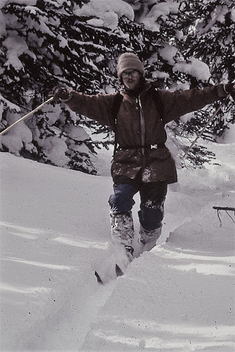
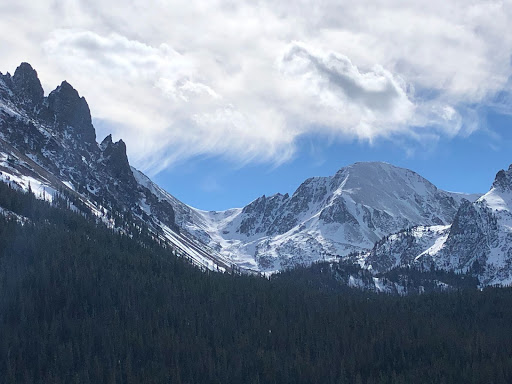
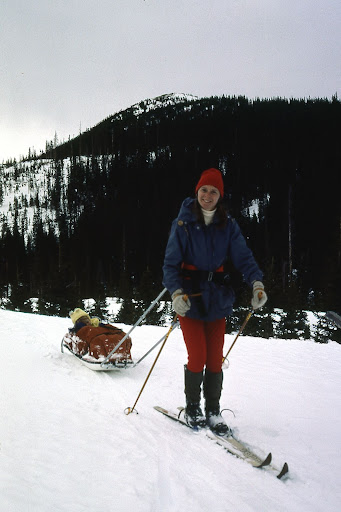
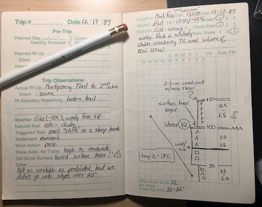
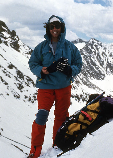
Circa 1974, sporting a genuine Scottish blaclava and the ubituitous 60:40 parka, I pose dramatically in the newly rediscovered Telemark turn position.The Lake Agnes cirque with Nokhu Crags on the left, Mount Mahler on the right. November 2021.Approaching Paradise Bowl on the east side of Nokhu Crags-circa 1985.Jana Ley and one-year-old Samuel sled tour on Cameron Pass. Winter of 1982.A page from my 1989 Snow Journal that I kept for six years on Cameron Pass. Being an early member of the CAIC development was key to my development as an outdoor leader.Rodney Ley at the top of Fourth of July Bowl above Lake Agnes, circa 1990. Note the knee-pads–still rocking the telly turn back then!
Wild and remote, Cameron Pass drew me back year after year. Although the road was not paved until 1976 and was closed in winter until 1979, the drive was always worth the effort. One attribute we Nordic skiers noticed right away was how much snow fell every year! In 1976, shortly after the road was plowed and opened for the year, I drove up and skied South Diamond Peak—perhaps the first full descent!
On the west side of Cameron Pass is the Colorado State Forest, and by 1971 the Colorado Parks and Wildlife agency had secured a lease to manage recreation. This resulted in the unusual name of State Forest State Park. With Highway 14 now open year-round the winter use of Cameron Pass began to explode—simultaneously the growth of backcountry skiing, avalanche education, and telemark ski equipment added to the excitement.
Along with many others, I began to explore as many nooks and crannies as possible in this giant winter basin. Compared to other locations along the Front Range, Cameron Pass was virtually unknown. For many years the only ski tracks I would see were those I had made the week before. Every trip was pure adventure!
Slowly the backcountry skiing scene began to solidify—South Diamond Peak became the undisputed monarch over the pass. Runs were named, faces and gullies skied. Where once only a few folks might be seen now tracks laced the slopes. By the early 1980’s it wasn’t always possible to get first tracks in the powder, so I and several hardy souls began to push into the farther reaches of Cameron Pass and the State Forest State Park. It was a time of huge growth.
In 1985 I had decided to leave the outdoor retail business and develop a backcountry ski yurt system in the State Forest State Park. Never Summer Nordic Yurts was the culmination of a10-year passion to immerse myself in backcountry skiing and guiding. We opened the first three yurts just before Christmas 1986. For a guy with two kids and a wife, it was a huge step. I also expanded my avalanche education and became one of the first avalanche observers for the Colorado Avalanche Information Center. I added avalanche education courses to my backcountry yurt business in 1987 and continued to teach those until 1992.
All good things must end, but in this case the good thing got better! I accepted a job to direct the newly founded Outdoor Adventure Program (now Outdoor Program) for Colorado State University. Over the next thirty years (1990-2020) I trained student outdoor leaders, taught academic wilderness leadership courses, and continued my personal passion for exploring Cameron Pass.
Although retired from Colorado State University, I continue to educate, inform, and inspire others to share in the beauty of Cameron Pass. With the help of the awesome crew at Beacon Guidebooks, I’m excited to be sharing that love of Cameron Pass with the publication of the ski atlas Backcountry Skiing Cameron Pass.
Le Grand Morne est la fameuse paroi mystérieuse de la Beauce. Communément appelé le Morne par les locaux, on peut considérer ce site comme le joyau de la région. L’escalade au Morne est unique. C’est une falaise du terroir vertical qu’on ne retrouve nulle part ailleurs. Le Morne c’est un rocher volcanique surprenant avec plein de formes et de prises cachées. Grimper au Morne, c’est accepter de se perdre dans une lecture d’itinéraires déroutantes. On y trouve des voies multi longueurs avec de l’ambiance et une gestuelle variée et complexe. En plus, il vous faudra savoir trouver les placements de protection dans cette escalade majoritairement traditionnelle. Vous voilà avec un grand cru d’escalade bien épicé qui demande temps et patience avant d’en apprécier toute la subtilité. Le Morne est une montagne à approcher avec respect et qui permet de développer le sens de l’itinéraire et de l’engagement. Prenez le temps de découvrir le Morne grâce à ce topo qui contient plus de 250 photos et une description complète de toute les voies (plus de 280 voies, 375 longueurs) d’escalade qui sillonnent la paroi. Les bénévoles du CEMA sont toujours au travail, attendez-vous à des mises à jour de façon régulière.
Nicolas Rodrigue on Incognito 5.10a photo credit Quentin Orain.Nicolas Rodrigue on La Piquette 5.8+photo credit Quentain Orain.Olivier Plante on Piles Non incluses 5.12+ photo crédit Nicolas Rodrigue.Nicolas Rodrigue at the office drilling new anchor Grand Morne photo credit Matéo Arnaldi.
Québec: Grand Morne Rock Climbing by Nicolas Rodrigue was last modified: June 20th, 2023 by nicomorne
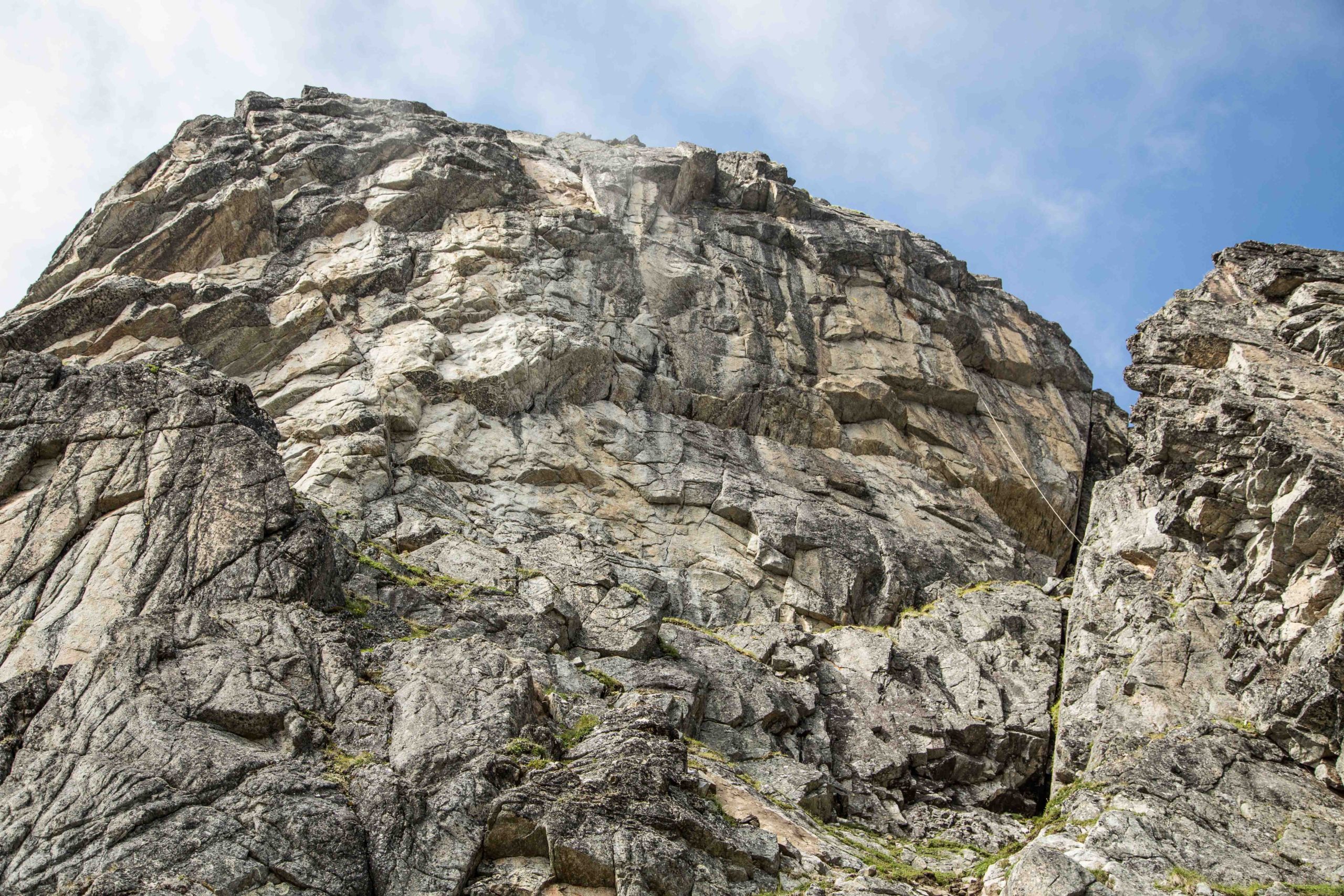
The San Juan Mountains of Colorado rising to over 14,000’ are probably the prettiest in the state. A variety of exposed colorful rock layers contrast with the pines and aspens that grace their lower ramparts. Far from any major metropolitan areas, the air is fresh, and you can take a moment to take in your surroundings. Glacier carved valleys and cascading waterfalls surround you. Rock outcroppings protrude from the trees in almost every direction exciting the climber’s mind.
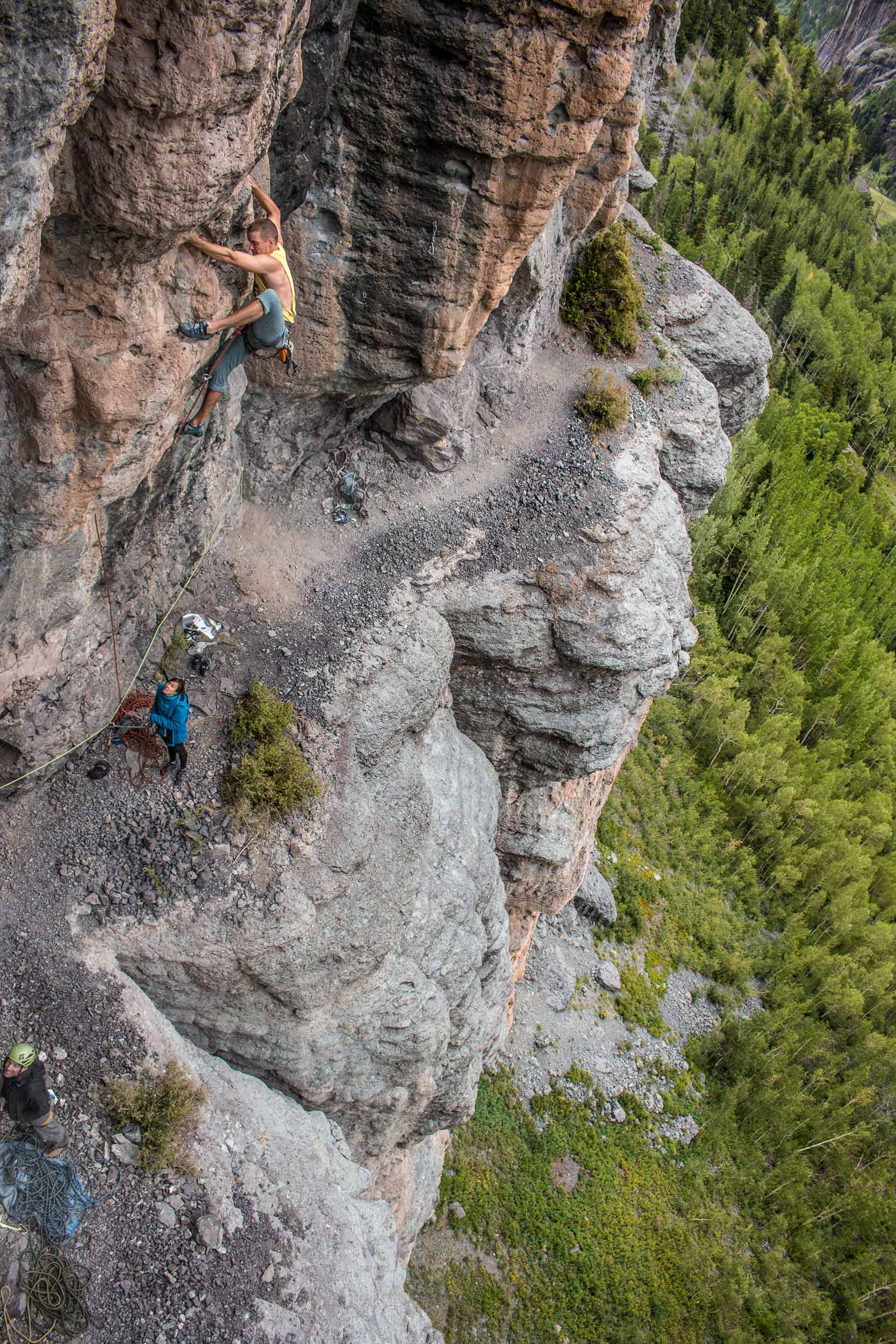
Heather Swallow on Hard to Kill (10d) at the Hall of Justice
The geologic variety is as wide as the colors of rock in the San Juan Mountains. 1,400’ walls of quartzite and slate dating back 1.7 billion years have been uplifted and exposed in the mountain canyons and eroded calderas. Crags such as The Trough, Techno Crag, The RV Wall, and the Wicked Crag line the precipitous sides of Highway 550. You may see them, but the windy and exposed highway devoid of guard rails will keep your eyes from staring too long. The San Juans host some 20 calderas and some of the most significant volcanic events on the history of the planet. Like icing on a cake, the San Juan formation has left giant walls of volcanic ash at the tops of most of the peaks. While most of this layer is fractured to the point of being unappealing to climb on when it’s not froze in place, there are some dramatic exceptions to this rule. Most notably, the Hall of Justice is one of the more memorable sport crags you’ll find in the country. With routes up to six pitches in length, the dramatic exposure just walking the upper ledge will have your full attention. A host of long 35-meter pitches of steep pocked rock rise above and below this ledge.
Carley Ewert on Over the Monsoon, Overlook Crag
Located between the upper volcanic ash and quartzite basement layers are a series of sandstone, limestone, conglomerate, shale and mudstone layers interspersed with igneous intrusions. You may be climbing on several different rock types throughout the course of a pitch at some crags.
Audrey Sneizek on Seduction of Gravity (5.10a), Rotary Park
For the more faint of heart, there are some of the most friendly and convenient options imaginable. Ouray’s Rotary Park crag hosts a bathroom with running water, barbeque grills, and over 50 bolted climbs between 5.2 and 5.12d rising just a few feet from your car. The Stripe Crag in Silverton lacks the amenities of Rotary Park, but also hosts a variety of grades with a short approach just outside of town.
Mary Harlan on (5.11a) at the Jimmy Cliff
When the high peaks unleash their fury, fair weather can often be found on the high desert Dakota Sandstone escarpments west of Montrose. A series of long east to west canyons offer mountain biking, off-roading, rock climbing and bouldering. The most notable is Dry Creek which features about 70 climbs between 5.7 and 5.13 overlooking a vast dry western landscape sloping down to the fertile farmlands of Montrose.
Bryce Jones on Unnamed 5.10 (5.12c) at the Hall of Justice
With Moab and Indian Creek only a 3-3.5 hour drive and the big walls of the Black Canyon sitting on the hill above Montrose there is no lack of full value year round climbing in the immediate vicinity. Locals don’t really take rest days here; we just change sports. You can river surf, ski, mountain bike, run, 4×4, run one of several via-ferratas, hike, paddle lakes and rivers, and soak in hot springs if climbing doesn’t suit your fancy.
Bryce Jones on (5.12c) Wicked Crag
Mike Pennings on All Night Rave (5.12c), Techno Crag
Ouray isn’t just for Ice Climbing! was last modified: June 30th, 2022 by visualadventures
Synthia Laurin assuré par Jean Luc Vanakers dans la dalle centre (5.5)
Le CEMA et la FQME sommes fiers et heureux de vous présenter un premier site d’escalade dans la région de Saint-Léon-de-Standon surnommé «petite Suisse». Cette région offre des paysages montagneux magnifiques. La Montagne du Soleil Couchant orienté face nord sera un oasis de fraicheur dans nos étés québécois chauds et humides. Le topo contient une trentaine de voie de 5.5 à 5.12 + fraichement équipé sur scellement. Le rocher volcanique de Saint Léon est particulier avec plein des belles prises et de trous. L’escalade accessible majoritairement uniquement en premier de cordée est de type sportif avec quelques voies trad classiques. Ce topo contient toutes les informations pour profiter de ce nouveau site. Ce topo sera éventuellement bonifié par l’ajout de d’autre site et secteur selon l’avancement des négociations et travaux du CEMA. Merci de nous encourager.
Synthia Laurin dans Apporte tes gros chico (5.9)Yves Granger première ascension de Apporte tes gros chico (5.9)
Québec: Saint-Léon-de-Standon Rock Climbing by Nicolas Rodrigue was last modified: September 14th, 2022 by nicomorne
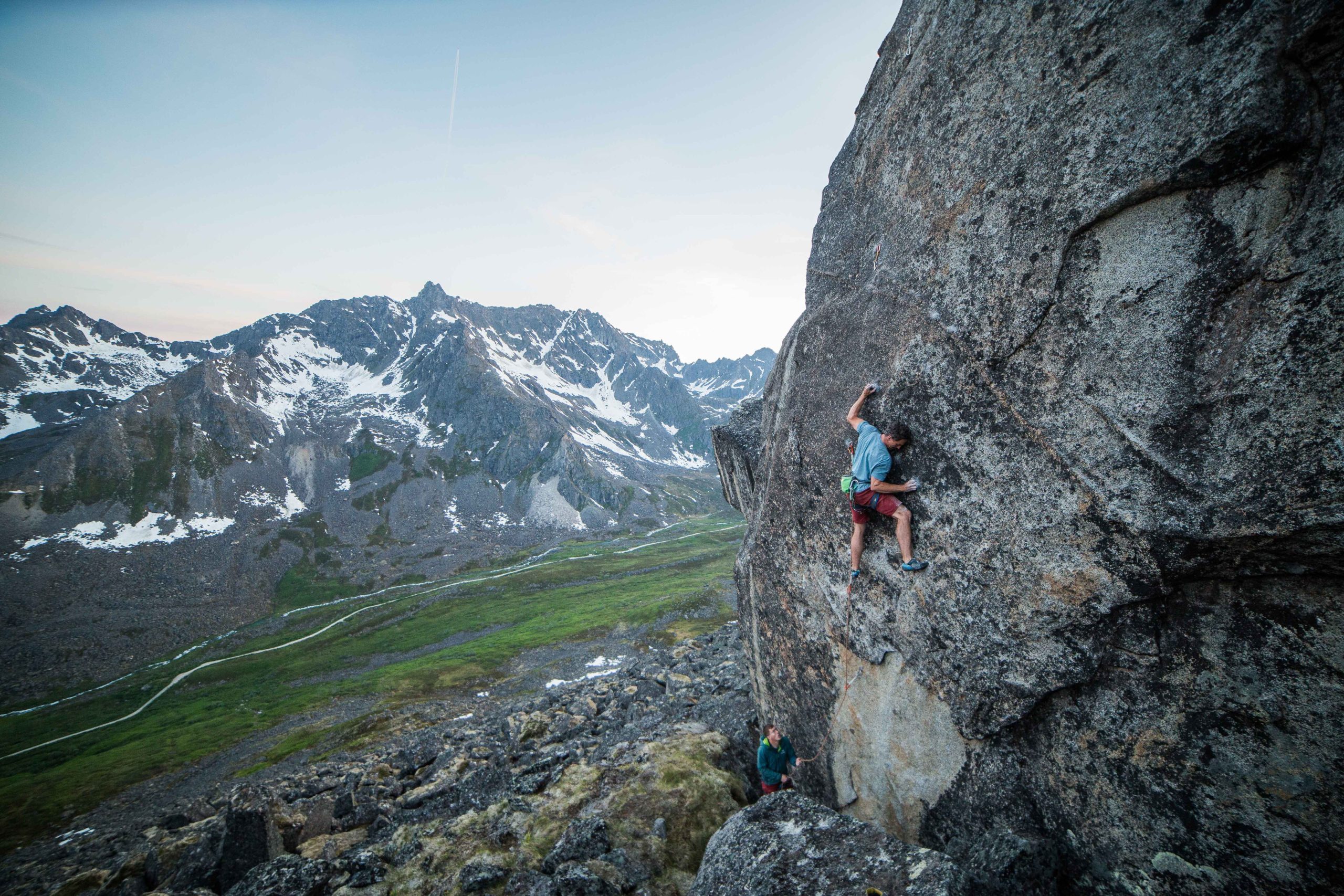
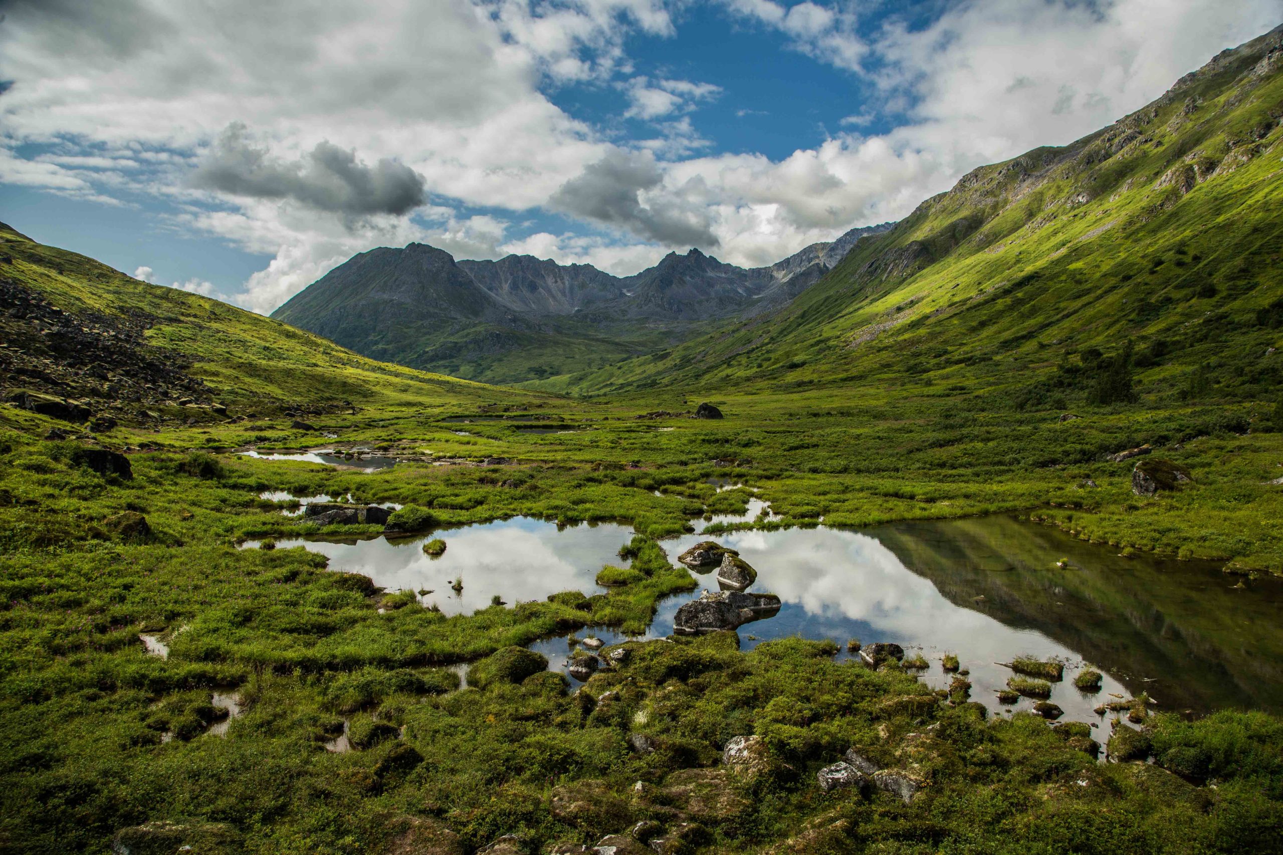
Located under two hours from Anchorage, the season for climbing in Hatcher Pass may be short but one not to be missed. One of the best crags in Alaska, it boasts over 500 routes in multiple valleys of granite in an alpine setting where rolling green tundra contrasts against the dark gray bands of rock.
Todd Helgeson on The Romanian Hi-Step (5.12d) on the Gargoyle, climbing at midnight.
Prior to the mid 2000’s, Hatcher Pass was primarily old buttonhead bolts, cracks filled with moss, and a decent amount of runouts. The last ten years a few dedicated individuals led by the rebolting efforts of Kelsey Gray and Chris Williams and with support from their own wallets as well as the American Safe Climbing Association, have drastically changed the landscape of climbing in Hatcher. Many of the old buttonhead bolts are gone and replaced with stainless steel bolts and anchors. Old webbing that was once crusted with lichen, is now chain and rings. The return of larger numbers of climbers to Hatcher than ushered in a flurry of development across the valley with new crags and routes appearing every season. What was once an obscure area frequented by the experienced or those who already had knowledge of the area, is now a place where climbers of all levels can enjoy and learn.
Looking down Reed Valley from the Nugget Boulder.
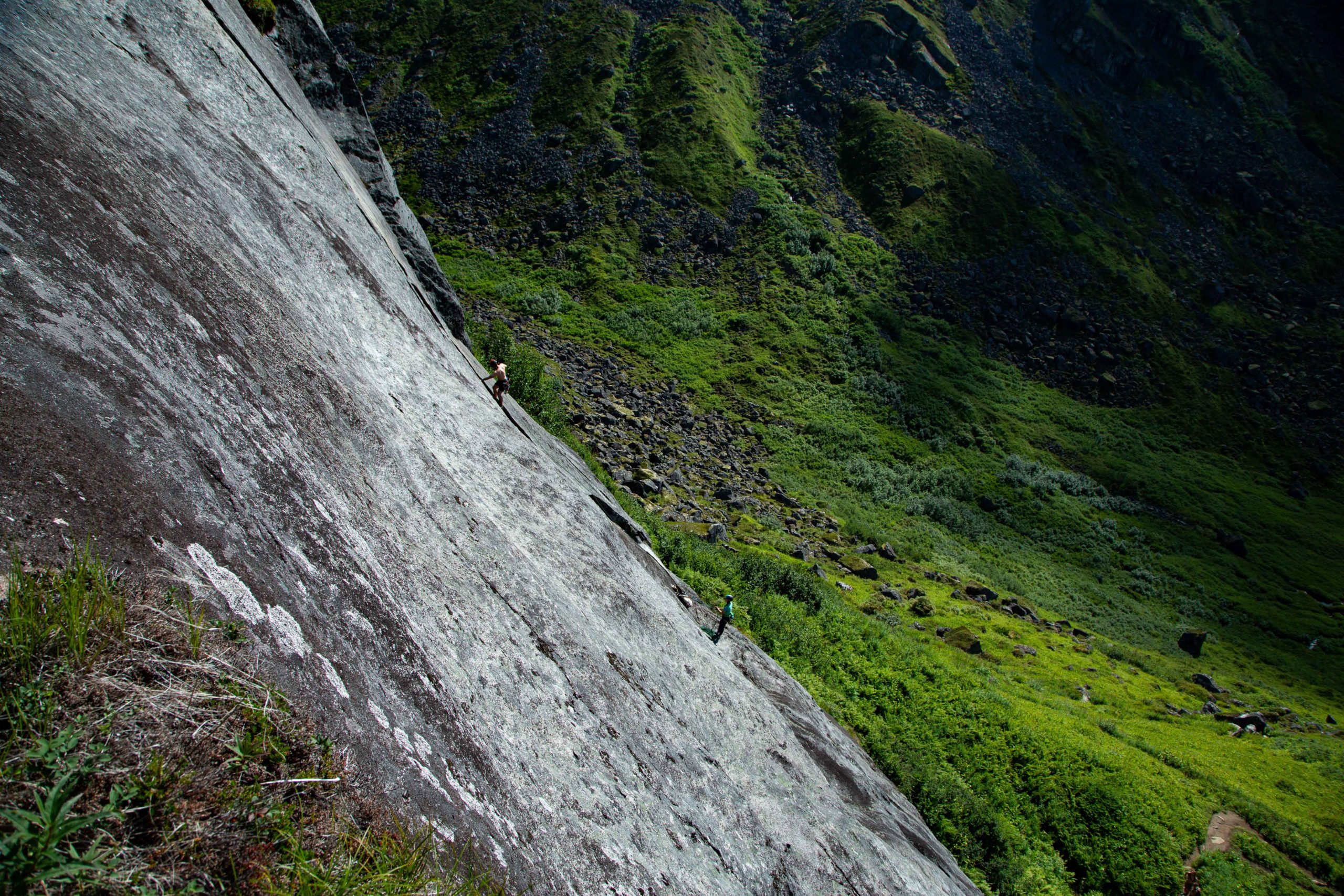
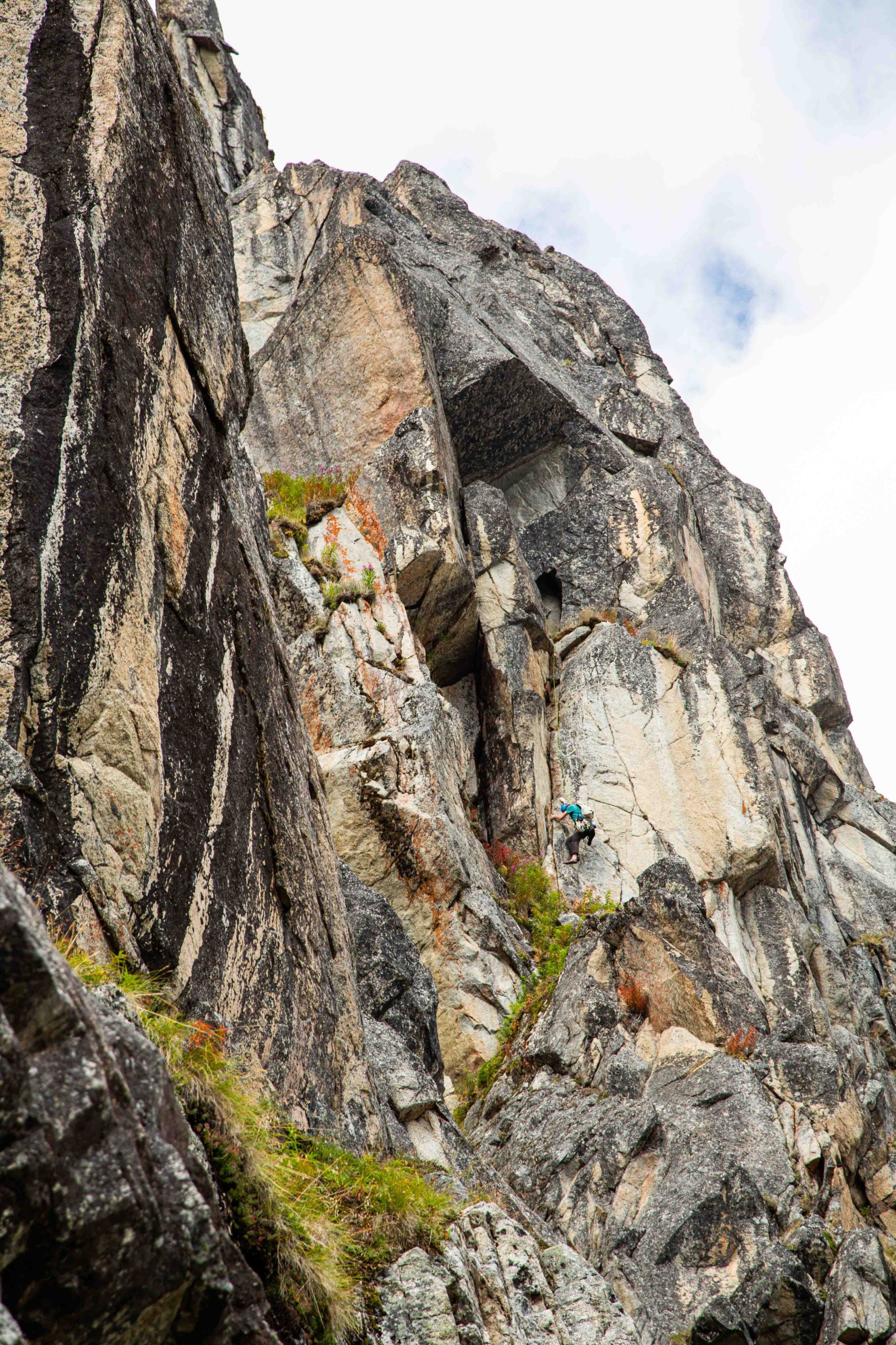
Some of the highlights of the valley are areas such as Snowbird Slab, which includes routes from one to three pitches but has the greatest concentration of lines in the valley. 28 routes with grades from 5.6-5.10d make it a perfect day crag for getting lots of moderate lines. Other crags such as the Lost Wall or Renaissance Wall will test many climbers’ strength and abilities and the strongest may visit the Gargoyle for the full test. Don’t forget to bring your rack as well as quickdraws, while there are an increasing number of sport routes most of the lines will need at least one piece of gear and there are a lot of excellent trad climbs. A 70m rope is ideal but a 60m will work for many climbs.
Regan Marin leading Snowflake (5.8) on Snowbird Slab. A route that has been climbed since the late 70’s.
The best season to visit is from Mid-June when the gate to Archangel Valley opens, and Mid-September when you can expect colder temperatures and the occasional snow. Boulderers will find the seasons to be longer as the snow landings can provide some excellent landings on taller problems. July is usually when the weather is best and the most climbers can be found.
Ben Olwell climbing Shelter in Place (5.9) at The Ramparts.
Don’t let a trip to Alaska go by without at least a visit to this beautiful area.
The imposing face of the Renaissance Wall in Independence Valley, Hatcher Pass.
Hatcher Pass Alaska Rock Climbing by Kelsey Gray was last modified: March 9th, 2022 by Prezwoodz
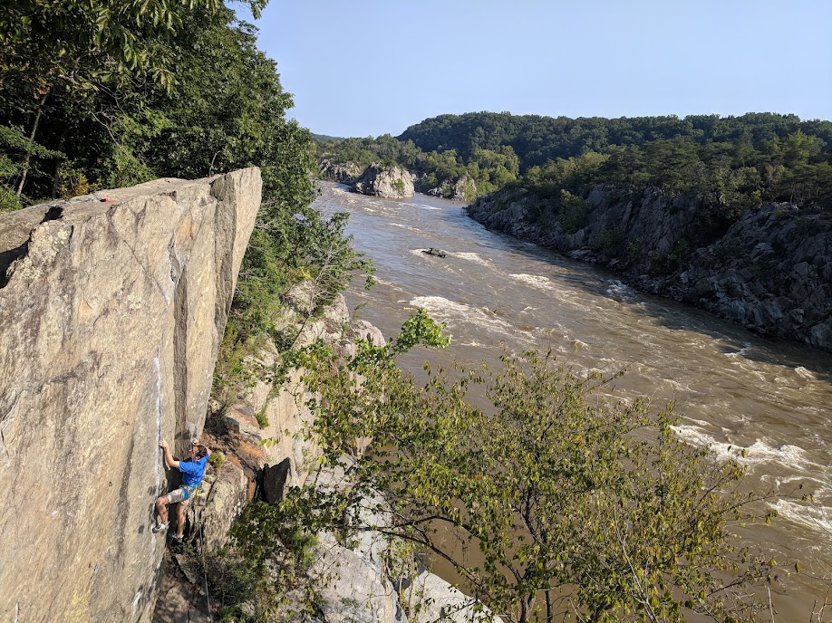
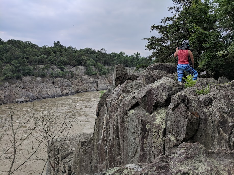
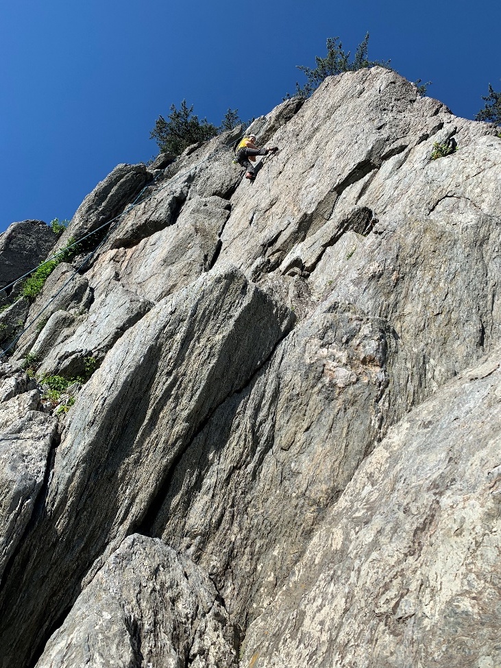
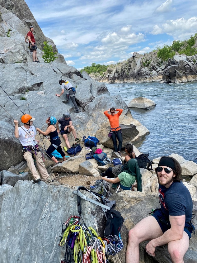
The gorge formed by the mighty Potomac River, carved a climbing area later to be a National Park just about a ba-zillion years ago. Great Falls National Park has a visitor’s center and several magnificent overlooks from which to view the spectacle of the great falls of the Potomac; even bigger during the spring runoff. Climbers and white-water kayakers alike are drawn to this beautifully secluded national park, one of many, just minutes from our Nation’s Capitol.
The rock climbing at the park is mostly on the Virginia side but there are a number of routes on the Maryland side as well. Most folks come for the top-roping since ropes are easily setup and the views are tremendous. Trad climbing and to a lesser degree aid climbing is not normally done since the shiest rock is brittle and easily flakes and breaks.
Ally on top of Diagonal (5.9-) at Aid Box.
A modest fee is collected at the ranger’s booth but those who frequent the park purchase seasonal or yearly passes. The comprehensive but expensive Annual National Parks is valid; however, a cheaper annual C&O Canal Parks pass is also available.
Since most climbers’ top rope here you will mostly need gear for building anchors at the cliff tops. Warning: rock along the river generally does not hold trad gear, and it is recommended that climbers sling trees and rocks instead!
Marc climbing Snowflake (5.6) at Seclusion.
Although the Park Service has decided to not allow the placement of permanent hardware in this part of the country, i.e. bolted anchors, adequate protection is achieved using the natural protection found in trees, blocks, and rock. Many routes have adequate rock for placing pro as backup.
Be gentle on the trees please! They see lots of use. This means don’t saw the bark off by pulling webbing and ropes around them. Try not to compact root soil, stand on rock if possible. Soil erosion and the health of these trees is one area that the park is intensely focused on and, rightly or wrongly, much of the stress these cliff top trees are seeing is being attributed to us climbers.
Note: The park service is reviewing the impact of climbing and climbers throughout the gorge. PLEASE minimize your impact when moving around on top of and on the climbs. Observe all fencing and restrictions. The park has been very responsive to climber concerns over closures and has in all but a very few cases provided opening in fences to access the cliff tops for us. Consider being a good custodian and packing out an extra bag of trash from the cliff bases.
Great Falls National Park Rock Climbing was last modified: February 18th, 2022 by Marc Grunberg
If you’re reading this you’re probably either an international climber contemplating their first visit to the Sultanate of Oman, or you’re lucky enough to already live in Oman and are excited to get out and explore some new rock. If you’re in the second group, you won’t need convincing as to how wonderful Oman is, and if this is your first trip, welcome!
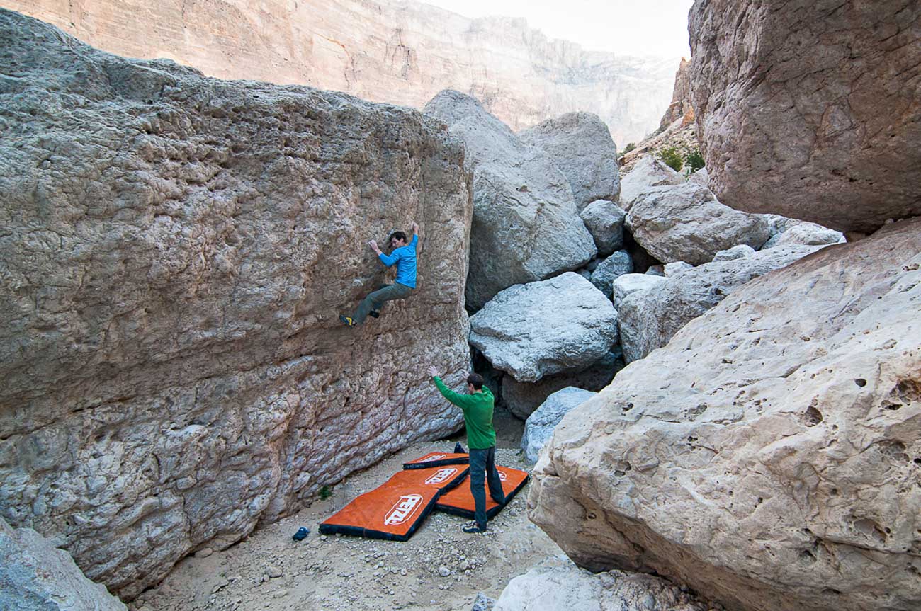
Dan Bates on Dan_s Arete V4. Photo Credit: Read Macadam
The Sultanate of Oman is an exceptional destination for all kinds of adventure tourism. You may primarily be a boulderer, but in Oman you can also find top-notch sport climbing (see our sport guides here and here), some of the most accessible deep-water soloing in the world (see here), and even Alpine-style rock routes. Besides climbing, there are stunning oasis-like canyons to explore and vast sandy deserts to venture into. The stable climate and vast open spaces make Oman an absolute dream for camping trips. The Omani locals are incredibly friendly and English is widely spoken.
Anisa Al Raissi on Corner Crack V1. Photo Credit: Jamie Moss
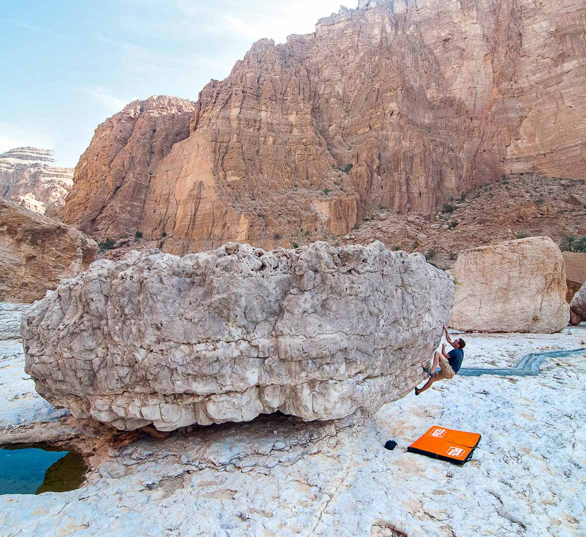
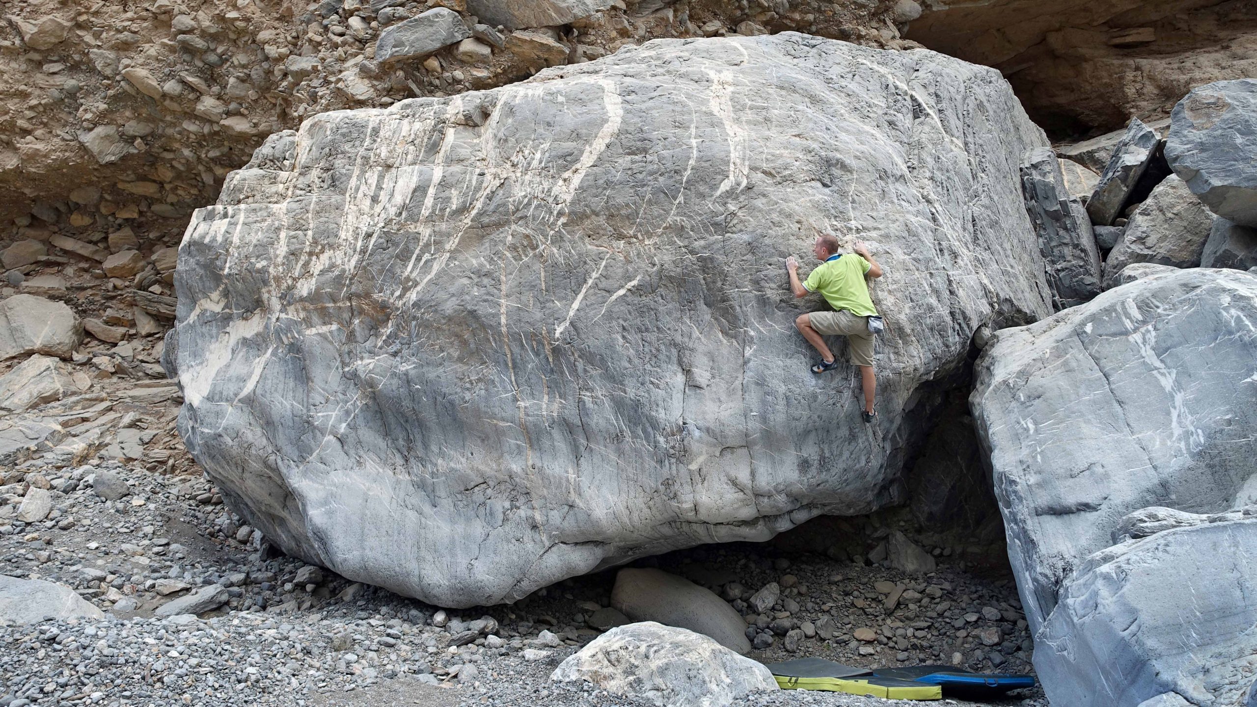
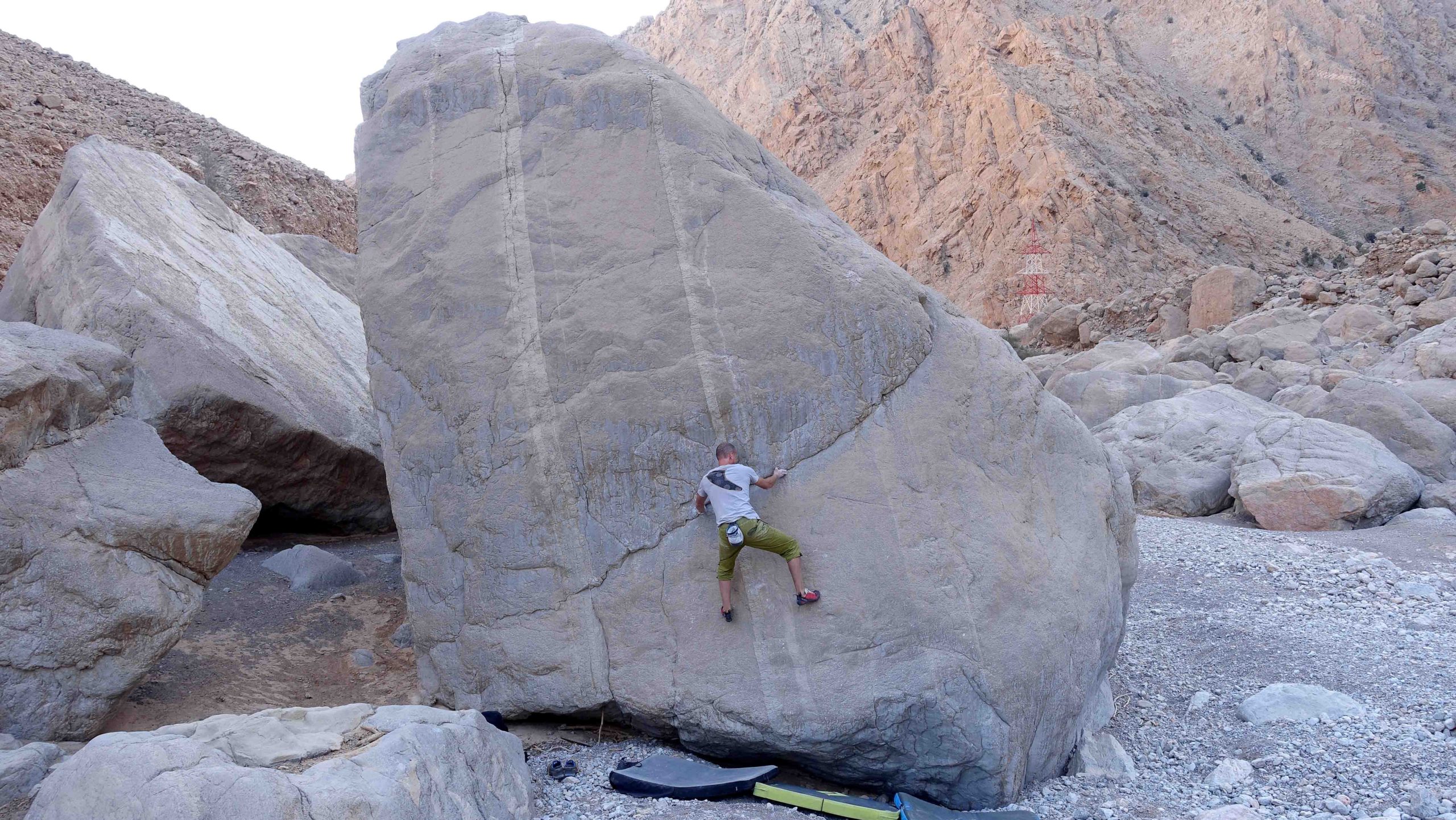
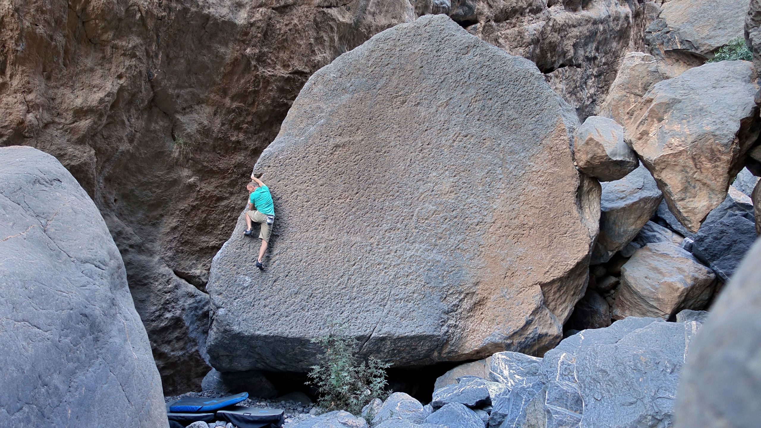
Oman is blessed with an abundance of rock. Almost the entire coastline from the Musandam Peninsula in the far north to Salalah in the south is backed by bare limestone hills and mountains. As spectacular as this is, it can also be somewhat overwhelming for the visiting climber! However, closer inspection reveals that much of the rock is too weathered and fragile for good climbing. In general, only cliffs that are regularly swept by rain, floodwater or ocean waves have that perfect blend of well-featured yet solid rock. Decades of exploration by dozens of individuals, often during the sweltering summer off-season, has created a long list of venues for all styles of climbing. For bouldering, this is generally within the dry river canyons – wadis – that criss-cross the country.
Larry Michienzi on Hidden Prow V4. Photo Credit: Jamie Moss
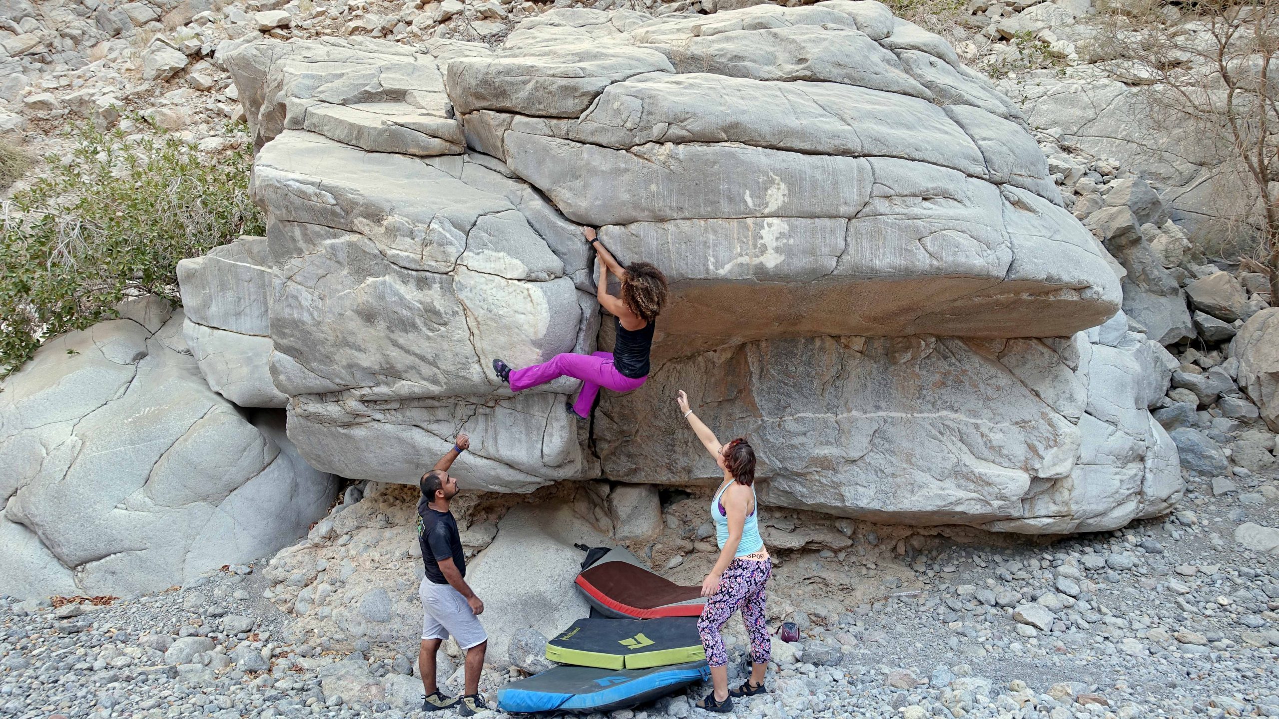
Whether you’re a visitor, a resident or an Omani local, our new guide will provide you with hundreds of boulder problems in spectacular and often isolated locations. Those who live in Muscat have five different after-work venues to choose from, all within the city limits. There are harder lines to project, easy circuit problems and even super-long traverses for those who wish to get fit. Jaded sport climbers will be pleased to learn that Oman’s three main bolted crags – Khubrah, Daykah and Hadash – all offer quality boulder problems as an alternative to bolt-clipping.
Read Macadam on Long Arm of the Law V6. Photo Credit: Philippe Ribière
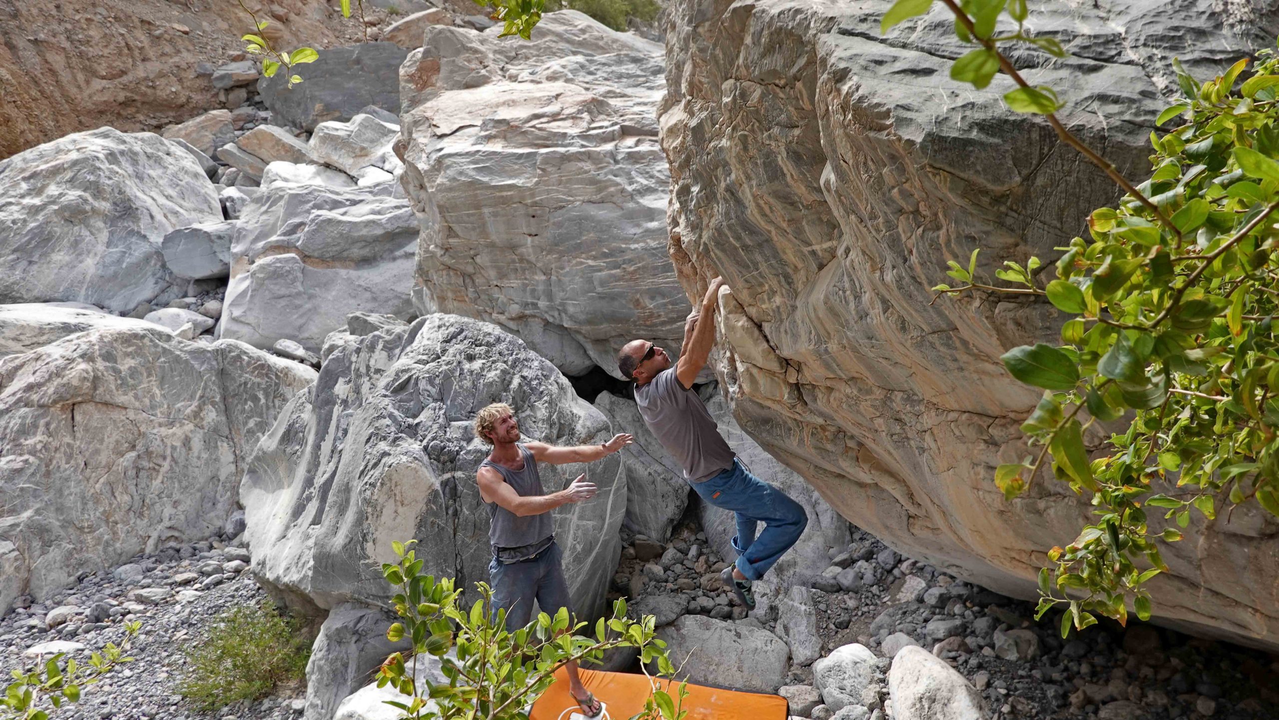
Weekend warriors can choose from any of five canyons located along the highway to Oman’s main interior city, Nizwa. All have been developed in the last few years and are documented for the first time in our latest guide. If you’re driving to the United Arab Emirates (UAE) and fancy a spot of bouldering followed by a dip in clear blue spring water, then you can use the guide to locate Wadi Damm.
Jamie Moss on Beast V7. Photo Credit: Jamie Moss
Those with enough time for a proper road trip can reach either of Oman’s world class bouldering venues. A half-day drive north from Muscat, via the UAE, will take you to Damian’s Boulders in Wadi Khab Al Shamsi on the Musandam Peninsula. Alternatively, a few hours driving southeast along the coast road from Muscat, followed by a few hours of hair-raising off-roading, will get you to the incredible Valley of Giants at Umq Bir, above Wadi Tiwi. A superb film by Read Macadam and Miguel Willis documented the bouldering at Umq Bir (see here). A one-day drive south from Muscat will take you to Oman’s tropical second city, Salalah, where recent exploration for boulders has yielded some impressive finds.
Jamie Moss on Wingwalker V5. Photo Credit: Jamie Moss
So, if you like to mix your bouldering with adventuring in roughly equal parts, you will not be disappointed with a visit to the Sultanate of Oman!
Jamie Moss on Levitation V5. Photo Credit: Jamie Moss
Oman Bouldering by Jamie Moss & Gary Goldfinger was last modified: January 17th, 2022 by Jamie Moss
Le Parc des Grands-Jardins et la Zec des Martres est un terrain d’aventure dépaysant à 15 minutes de St-Urbain. Venez grimper des voies mémorables dans un environnement grandiose! La nouvelle version du topo sur rakkup contient 125 voies (+ de 300 longueurs de corde), 160 photos et des informations détaillées sur les différentes voies, dont 23 nouvelles. Cette App nous permettra de faire des mises à jour régulières sans avoir à tout renuméroter et refaire la mise en page du texte et des photos. Impossible de se perdre grâce aux cartes GPS, vous pourrez accéder sans tarder aux classiques!
Benoit Dubois dans la 1è du Bras Canadien, 5.12a
Dane Duplessis dans Temps de cure, 5.10+
Tom Canac dans Le Dôme Deluxe, 5.7
Mélissa Tremblay dans Harmonie intérieure, 5.10+
Christophe Coulombe dans Tressaillements externes, 5.11d 1
Québec: Parc National des Grands-Jardins Rock Climbing by Benoit Dubois was last modified: March 25th, 2021 by Benoit Dubois
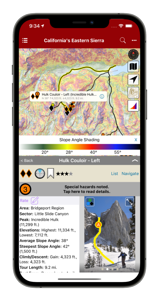
We’re now in our fourth year of offering backcountry ski guidebooks in rakkup, and we are really excited about our latest feature! Slope angle shading is now available for all our US backcountry skiing guidebooks on both iOS and Android devices. Simply be sure you have our latest app release, go to the Bookshelf tab, and tap the cloud icon to update your guidebook.
Avalanche safety educators have been telling us that Slope Angle Shading is one of the best tools for visualizing areas of high avalanche hazard and selecting safer routes in avalanche terrain. This transparent overlay immediately highlights areas with slope angles yielding the highest avalanche risk along and above your route, as well as terrain convexities, terrain traps, terrain that might be too steep to ski (such as cliffs), and even very flat areas where splitboarders like us might need poles or plan on walking.
According to the American Avalanche Institute, most avalanches occur on slopes between 30° and 45°, with peak risk at 37-38°. (Watch AAI’s short video about recognizing avalanche terrain. We’re proud to partner with the AAI this season and offer rakkup guidebooks to their instructors and students.) We’ve used color gradients to show slope angle information with a high degree of precision. We applied a lot of computing power and our best programming tricks to bring you beautiful maps that are easy to download, display quickly, and keep working long after you’ve left cellular service behind.
In the past, many snow professionals used the premium versions of generic mapping apps to view slope angle shading. We think it’s even better to have this feature integrated into your guidebooks – not to mention that these apps have yearly subscription fees several times higher than our guidebook prices! Integrating all our route data with topo maps and slope angle shading helps you choose which zone and which line to ski based on today’s conditions without flipping back and forth between different sources of information.
Of course, no app can take the place of quality avalanche safety training, observation of your surroundings including terrain and snow pack, and proper decision making. But the most effective part of avalanche safety is staying out of avalanches, not digging out of them, and better information can lead to better decision-making. If rakkup can help you select a quality descent, stay alive and safe without getting lost, and have more fun away from the crowds, then we’ve accomplished what we set out to do!
We hope you’ll check out a rakkup skiing guidebook and tell us what you think. Many of our digital guidebooks are also available with a companion printed ski atlas or folding map from our friends at Beacon Guidebooks as a backup and additional reference.
Many thanks to our friend Jamie at Teton Splitboarder for encouragement and technical advice that helped us execute and improve our work.
Finally, a reminder to make sure you know how to turn off the cellular, bluetooth, and Wi-Fi radios on your phone in the backcountry and keep it at least 30 cm away from your avalanche beacon. GPS reception is a passive operation that won’t interfere with your beacon’s signal so you can still pinpoint your location with the radios off.
Happy skiing and splitboarding to everyone!
Available now for Android devices too!
Slope Angle Shading released! was last modified: December 24th, 2020 by rob
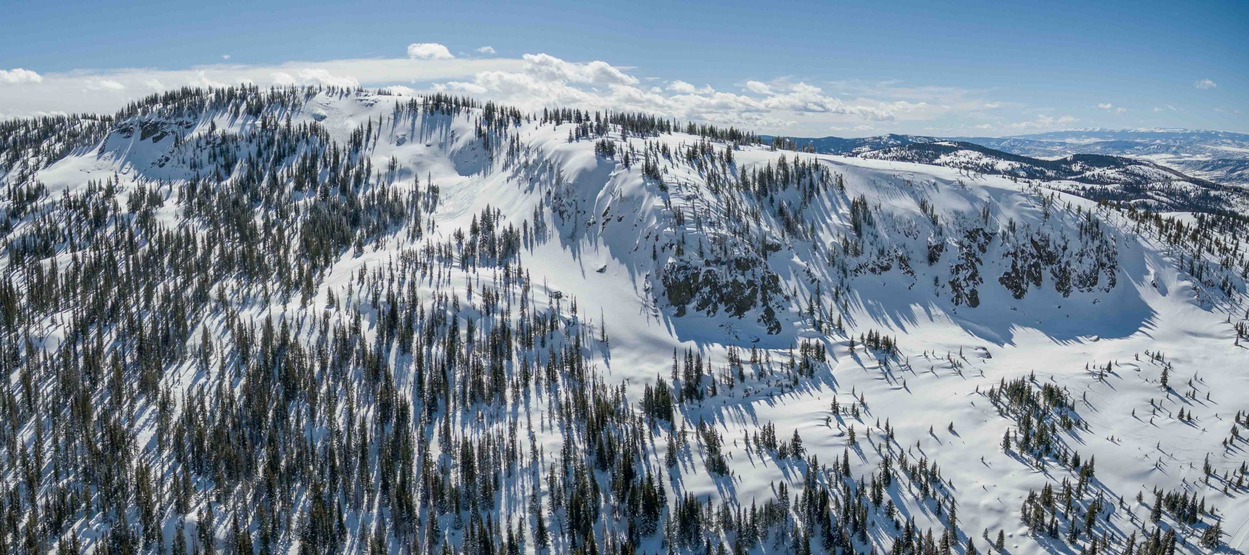
The smell of 2-stroke and the stoke of fresh powder on Buffalo Pass runs rampant throughout Dry Lake Campground as slednecks and hybrid skiers alike go over their gear checklists and read the updated avalanche bulletin from CAIC. The snowcam at Steamboat resort shows 8 inches of blower overnight, but the locals know of the “Fluffalo Pass” effect and expect a foot of fresh once they get to the top of Soda Mountain. Stu finally emerges from the USFS outhouse and Randy finishes scarfing his breakfast burrito from Creekside Cafe as I yell at everyone to remember why we woke up at 5am. We were the first to get our sleds off the trailer and now we are rewarded with fresh tracks on the snow road from Dry Lake all the way to our first stop at the Galaxy Drop.
Aerial view of north Soda Mountain and the Carnival zone. Photo Alex Neuschaefer.
We shuttle a sled down to the bottom of the Galaxy Trees and ride Canadian back to the top. The buzzing of idling engines from Dry Lake is no more and all that remains is the sound of a crisp breeze amongst the quaking aspens we are about to ski. Randy comments that these are the largest aspens he’s ever seen and Stu is still wrapping his head around how the entire stand has perfect spacing between each trunk. The untouched canvas in our field of view has us channeling our inner Da Vinci and our inner Billy Kid, minus the Stetson headgear. We roll over the top and drop into our line; the silence amongst the trees is met with hoots and hollers as we revert to our childlike selves giddy with the excitement and adrenaline of feeling alive and free. As we prepare to ride Caveman back to the top, we catch our breath and gaze at our lines meandering through the trees; It may not be the Mona Lisa but it is the closest we will ever get to creating a masterpiece.
Butter for Breakfast. Photo Madie Bass.
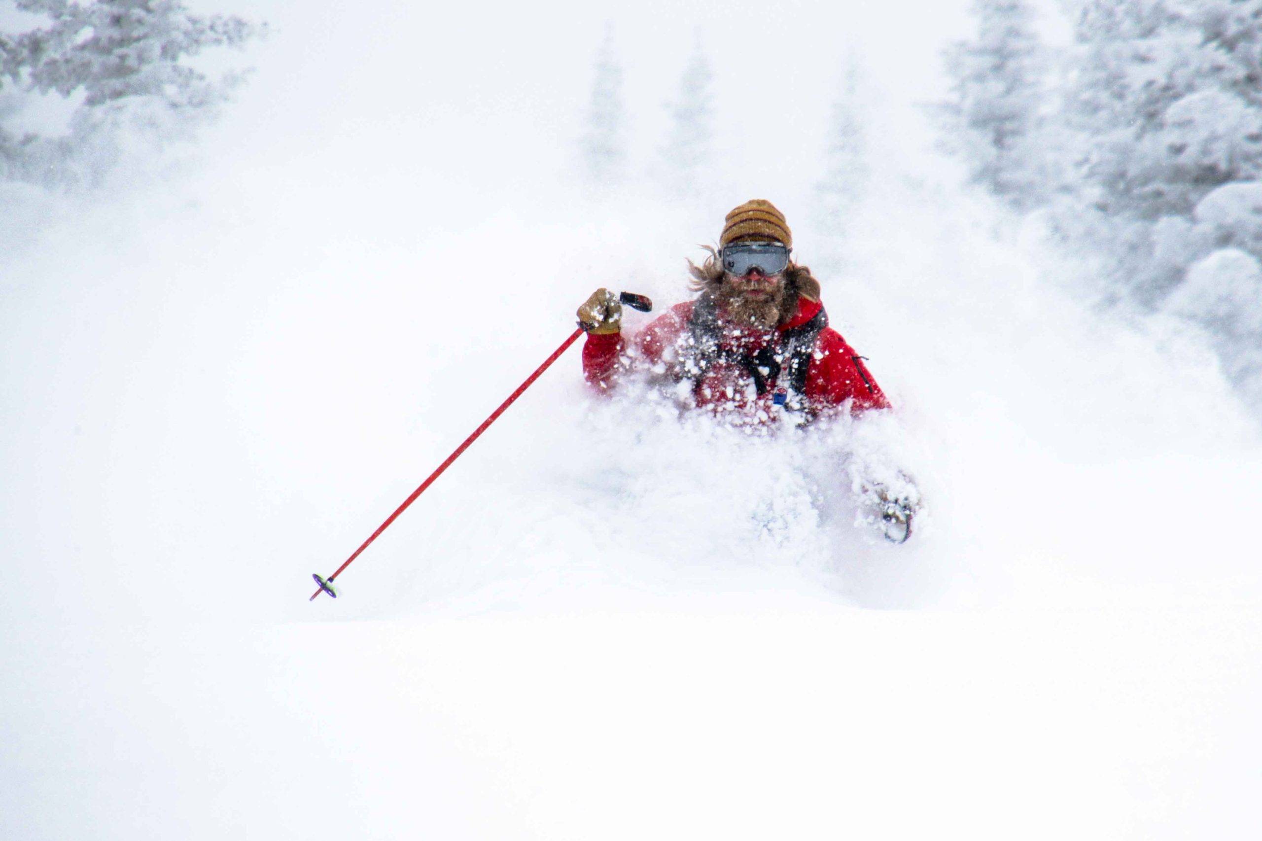
Stu was itching to get into steeper terrain and we decided to spend the next couple of hours shredding In the Frey and South Park Ridge to our heart’s content. Eight laps later and our legs are screaming at us to take a break for just 5 minutes. In that same moment the skies rip to blue and we get our first glimpses of the day at the summit of Soda Mountain. We decide there’s no better place for a picnic on the Pass and we head uphill to take in the best views in Routt County. As we come to Zohan Point, we see a snow stake measuring 15 inches and Randy’s mouth broadcasts a shit eating grin- it looks like Buff Pass wringed out every bit of precip in northwest flow overnight. We waste no time and dedicate the rest of our day to the Carnival. After scouting from below we head back to the summit to ski our most technical terrain of the day. Steep skiing, tight chutes, and big airs summarize the second half of our amazing day on Buff Pass.
Author, Stephen Bass, looking in vain for the bottom of Buffalo Pass. Photo Ben Saheb.
We head back towards Dry Lake after a full day of skiing, but we cannot resist the urge to ski one last fun run at Fiesta. We can see the congregation at the bottom of the run of other sled skiers reminiscing about all of the face shots had on this day. We ski one more line and make sure to put on a show for the locals and tourists alike watching from Lila’s Corner as we all three throw a Daffy on the booter some guys built towards the bottom. The excitement at Dry Lake as we load our trailer back up is intoxicating. Within earshot you can hear multiple proclamations of “Best. Day. Ever.” in some iteration or another. Randy, Stu, and I rally down to Slopeside for dinner and drinks as it starts to pound snow yet again. The forecast is calling for another foot of blower overnight and our sleds are already refueled.
Backcountry Skiing Buffalo Pass Colorado by Stephen Bass was last modified: November 20th, 2023 by Bassomatic86