by todd | Oct 24, 2014
Joshua Tree Rock Climbs
Wolverine Publishing
by Robert Miramontes
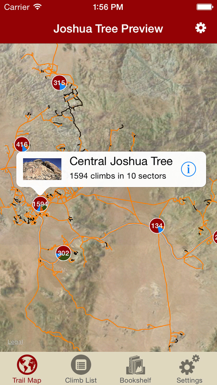
Welcome to one of Earth’s great playgrounds of stone—Joshua Tree National Park. World renowned for its bold and pure trad climbing, its monumental volume and variety of easy and moderate routes, and the other-worldly ambiance of its landscape. This digital rock-climbing guide presents the entire park, describing 3000 of the finest climbs, including several of the better bouldering circuits. The entire trail map to Joshua tree has been meticulously mapped to enable rakkup’s turn-by-turn directions from car to crag. Imagine never getting lost at Joshua Tree again. Is that even possible? It is with Robert’s Joshua Tree rakkup guidebook. The Joshua Tree trail map by itself is worth this price, let alone 3000 route descriptions with beautiful color topo images.
-

-
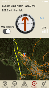
Imagine never being lost at Joshua Tree again. Robert’s Joshua Tree trail map will blow you away. You have to experience this trail map to understand how groundbreaking this is.
-
-
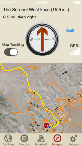
Navigate to over 3000 climbs, like Robert Miramontes was showing you the way to every crag at Joshua Tree.
-
-
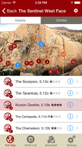
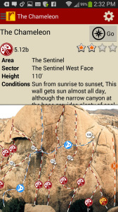
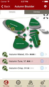
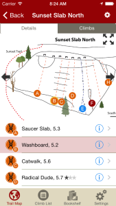
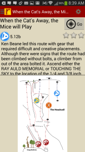
Tap on a climb to see where it’s located in the image, or tap on a route bubble in the image to see what climb it is.
-
-
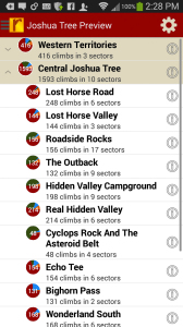
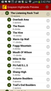
Explore Joshua Tree Rock Climbs from a hierarchical list that can be filtered and searched.
-

-
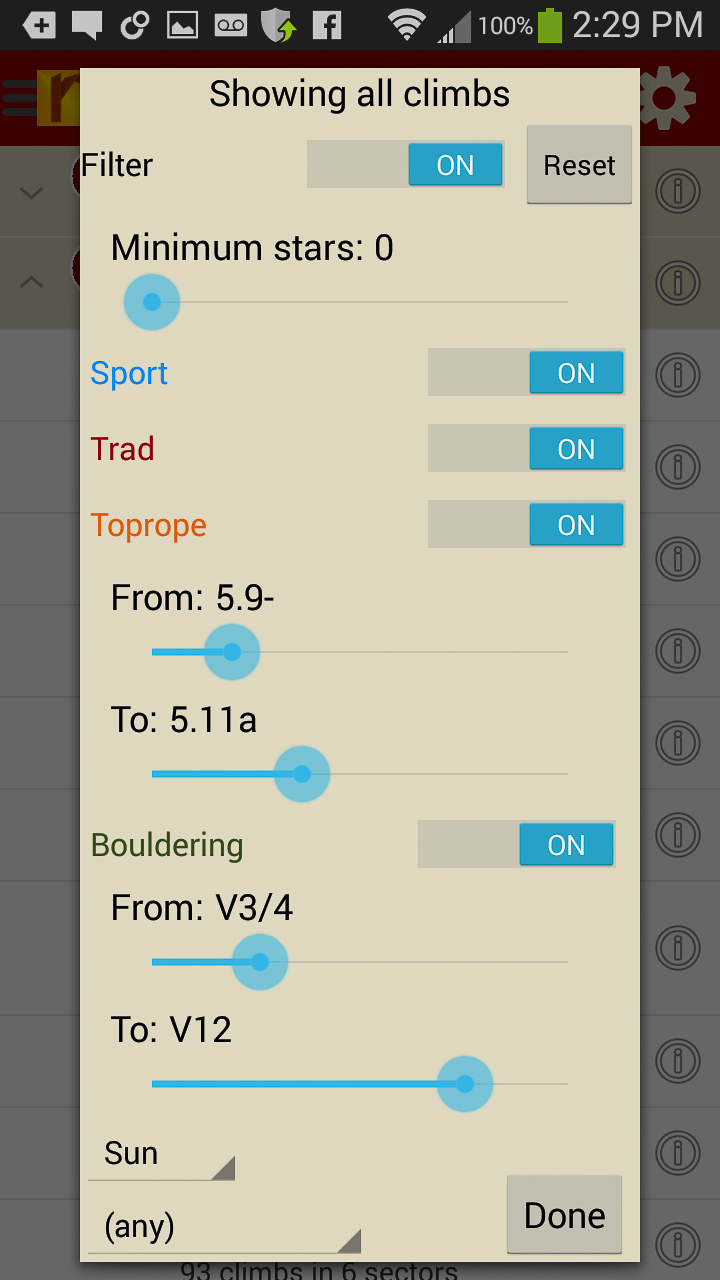
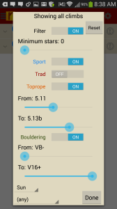
Filter the 3000+ climbing route list or trail map by grade, climb type, quality and sun/shade times. How cool is this?
-
-
Tired of bad beta? Use local expert, Robert Miramontes beta to send your next Joshua Tree climbing project.
Digital + print edition pricing includes $6.00 for shipping.
by todd | Aug 27, 2014
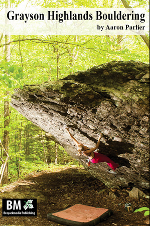
Grayson Highlands Bouldering
Brayackmedia Publishing
by Aaron Parlier
Grayson Highlands Bouldering Blog
Grayson Highlands Bouldering Facebook
Grayson Highlands State Park (GHSP) is the uncontested crown jewel of Virginia in terms of scenery, hiking, and nearly all facets of outdoor recreation. Grayson is the best bouldering area in the Southeast. Don’t believe us? Learn why here. In GHSP there are problems ranging from easy going to V-insane. This digital guide for Android, iPhone & iPad devices has 349 of the the best problems and Aaron will be adding more problems in updates.
Print + digital bundle pricing includes $6.00 for shipping. The print guidebook sold with the “Digital + Print edition” bundle is the 2013 edition.
-

-
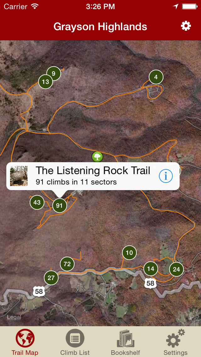
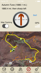
Explore Grayson like it was meant to be explored via our interactive trail map.
-
-
Then just like Aaron Parlier was showing you how to get to his latest secret problem, rakkup guides you turn by turn to your boulder then shows you a picture when you arrive. Awesome.
-
-
Beautiful hand drawn topos. Tap on a problem name, see where it’s located on the topo. Tap on a problem bubble in the topo, discover what problem it is. So nice…
-
-
Over 400 of the best problems at Grayson right at your finger tips.
-

-
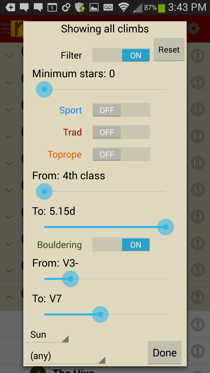
Too much to handle? Sort all those problems to only the grades you want to see. Too hot? No prob, filter by in shade only.
-

-
Tired of bad beta? Use local expert, Aaron Parlier’s beta to send your next proj!
by todd | Aug 27, 2014
Rockin’ on the Rock: A Guide to Mt. Erie Climbing
by Dallas Kloke with Jim Thompson & Aaron Bryant
Mt. Erie is a diverse destination for rock climbers in Northwest Washington. From beginning top ropes, to multi-pitch trad and 5.13 sport routes, Mt. Erie has it all. This digital guide for Android & iOS devices features the best climbs on Mt. Erie. All author royalties go to the Dallas Kloke Foundation.
Buy both versions of the guidebook (print and digital) for only $40.99! That price includes $6.00 for shipping, meaning that you get the book for only $20 more! A good deal on a beautiful guidebook!
-
-
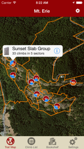
Think you can find your way around Mt. Erie without getting lost? Have you seen this trail map?
-
-
With rakkup it’s like having a local guide take you right to the base without getting lost.
-
-
Beautiful and accurate hand drawn topos. Tapping on a route bubble, identifies the climb. Tapping on a route name, identifies which topo line you want.
-
-
Filter your route list or trail map by grade, climb type, quality and sun/shade times. How cool is this?
-
-
Tired of bad beta? Our Mt. Erie beta is from Dallas Kloke, the Mt. Erie legend and pioneer that put up most of these routes.
-
-
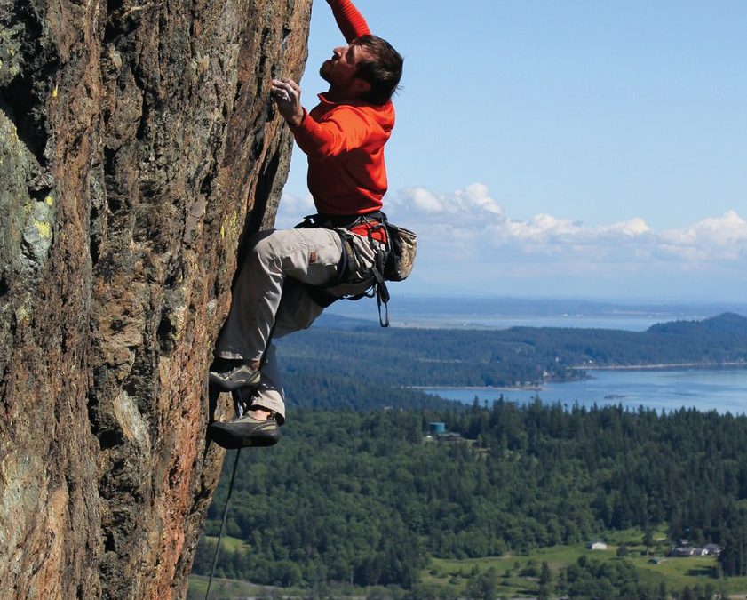
Still not enough? Well, get stoked to send the coolest routes at Erie with tons of awesome action shots!
by todd | Mar 17, 2014
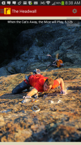
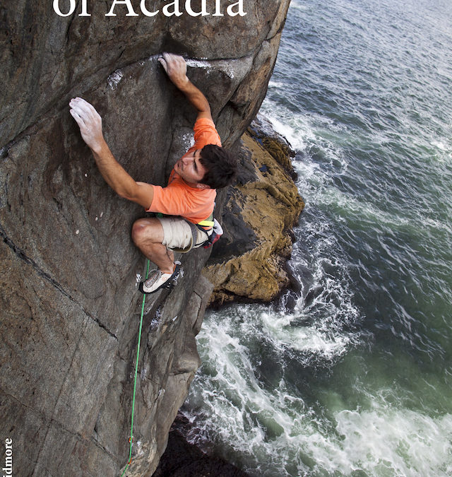
Rock Climbs of Acadia
by Grant Simmons
Rock Climbs of Acadia Facebook
Grant’s Rock Climbs of Acadia website
One of the East Coast’s premier summer destinations. Acadia National Park offers high quality granite climbing in a spectacular setting. It is a Downeast island paradise replete with classic routes both on the coast and inland. Rock Climbs of Acadia, more up to date than the print guidebook, covers over 280 climbs in all the classic climbing areas, plus many of the island’s more obscure haunts.
Learn why Acadia Rock Climbing is truly an island paradise here. Check out Grant’s Rock Climbs of Acadia site here.
-
-
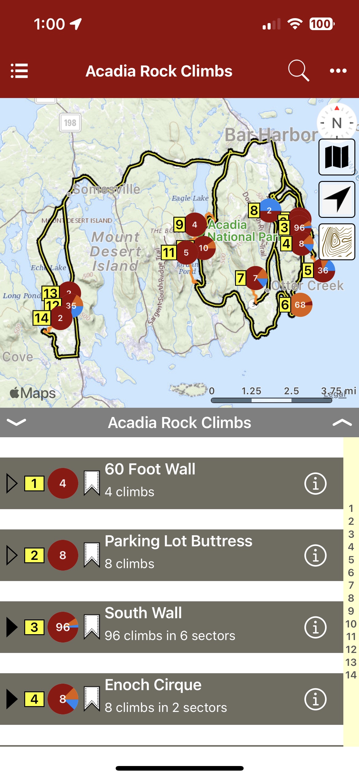
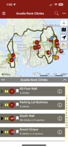
Map view
-
-
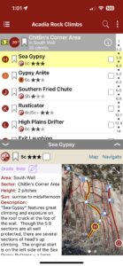
List view
-

-
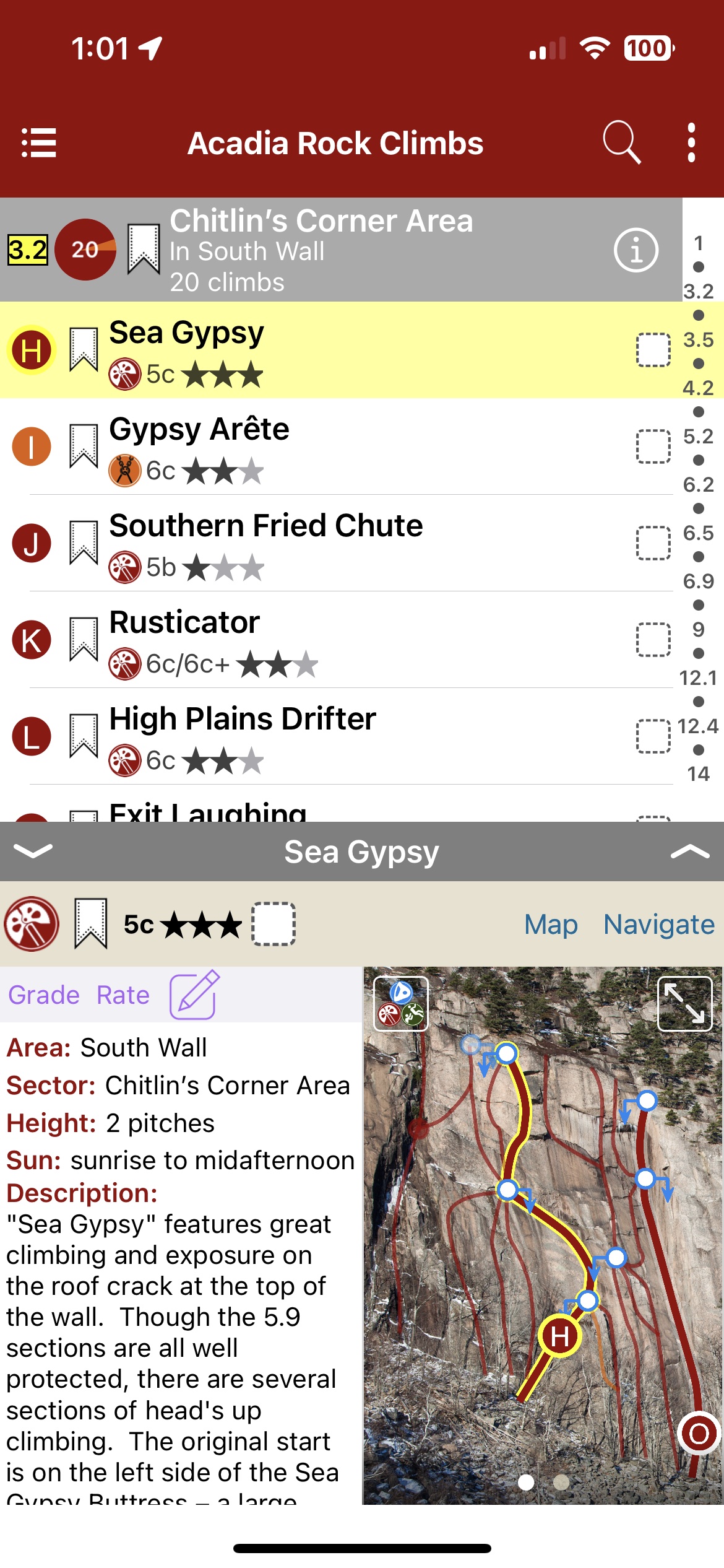
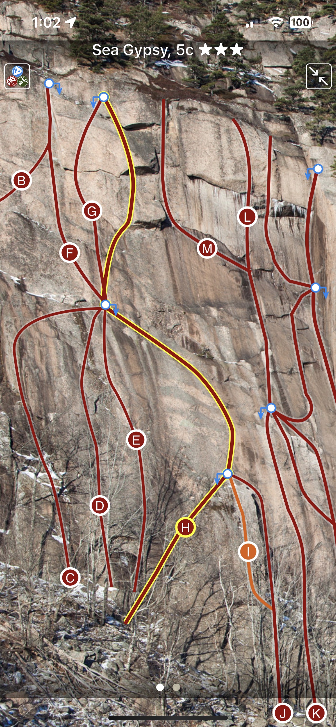
Full screen topos
by todd | Mar 17, 2014
Devil’s Head Colorado Digital Climbing Guide
by Tod Anderson
Devil’s Head Facebook
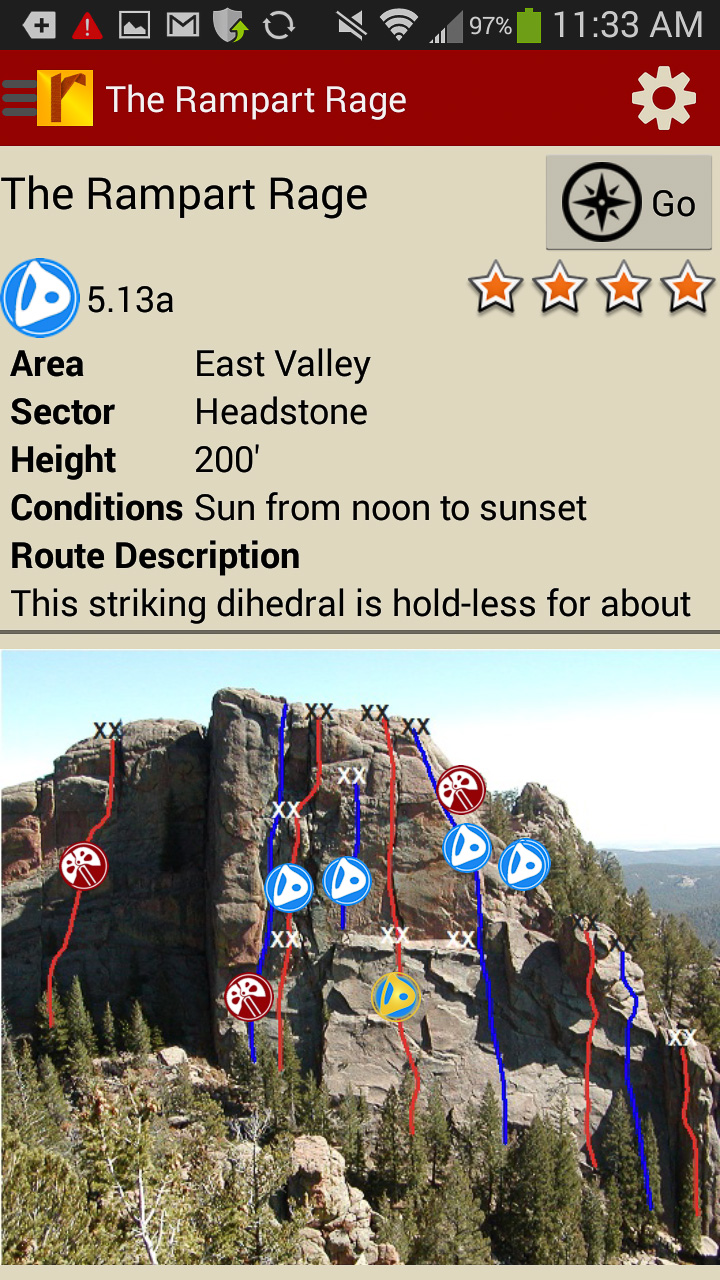
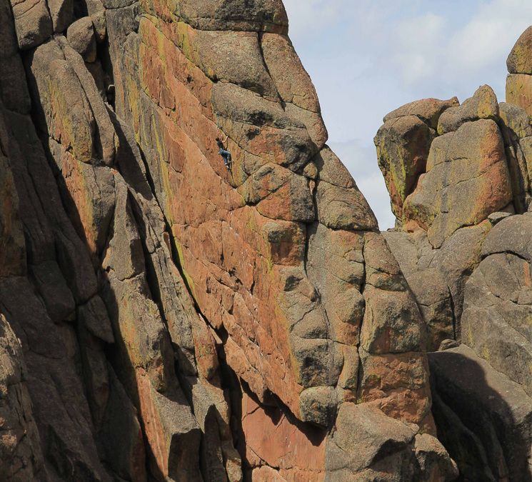
Overlooked or ignored for many years, Devil’s Head rock climbing has become one of Colorado’s premier sport climbing destinations. Over 100 crags, spires and walls contain some of the best granite in the western U.S., and there are now over 1000 climbs at Devil’s Head and Tod is updating this guidebook with new routes regularly.
Devil’s Head features great views and a feeling of remoteness, despite being only an hour from downtown Denver. Most crags require some walking to access, but the hikes are generally over moderate terrain and elevation gains are reasonable. It’s easy to find sun or shade as needed, depending on the daily temperatures. Each crag has its own unique character and a wide variety of types of climbing are found at the always expanding collection of crags at Devil’s Head.
Both free and pay camping are available in the vicinity and some sites even feature walk from camp climbing access. Pay camping exists at the main trailhead in a small campground that has about 15 sites. Those often fill up on weekends, so early weekend arrival is advised. Free dispersed camping is allowed along Rampart Range Road and in Jackson Creek valley. The best sites are located past the turnoff to the main trailhead and beyond Mile Marker 10.
-
-
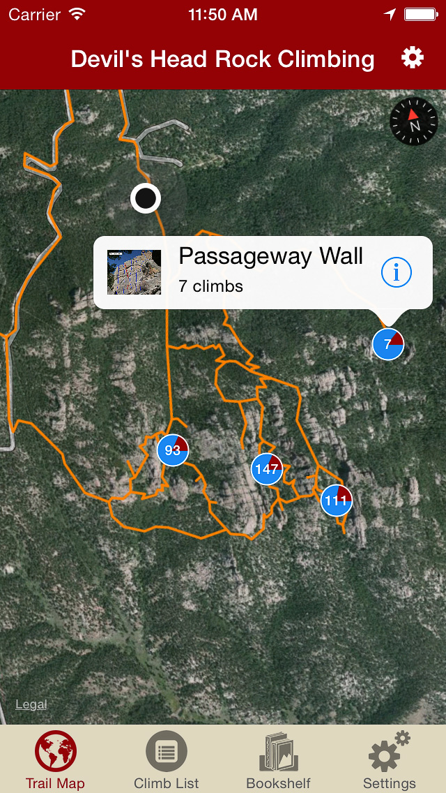
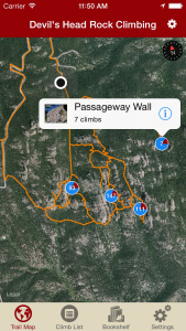
Explore Devil’s Head rock climbing like it was meant to be explored, via our interactive trail map.
-
-
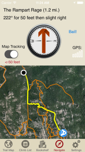
Navigate to all Devil’s Head climbs and walls like Tod was personally guiding you.
-
-
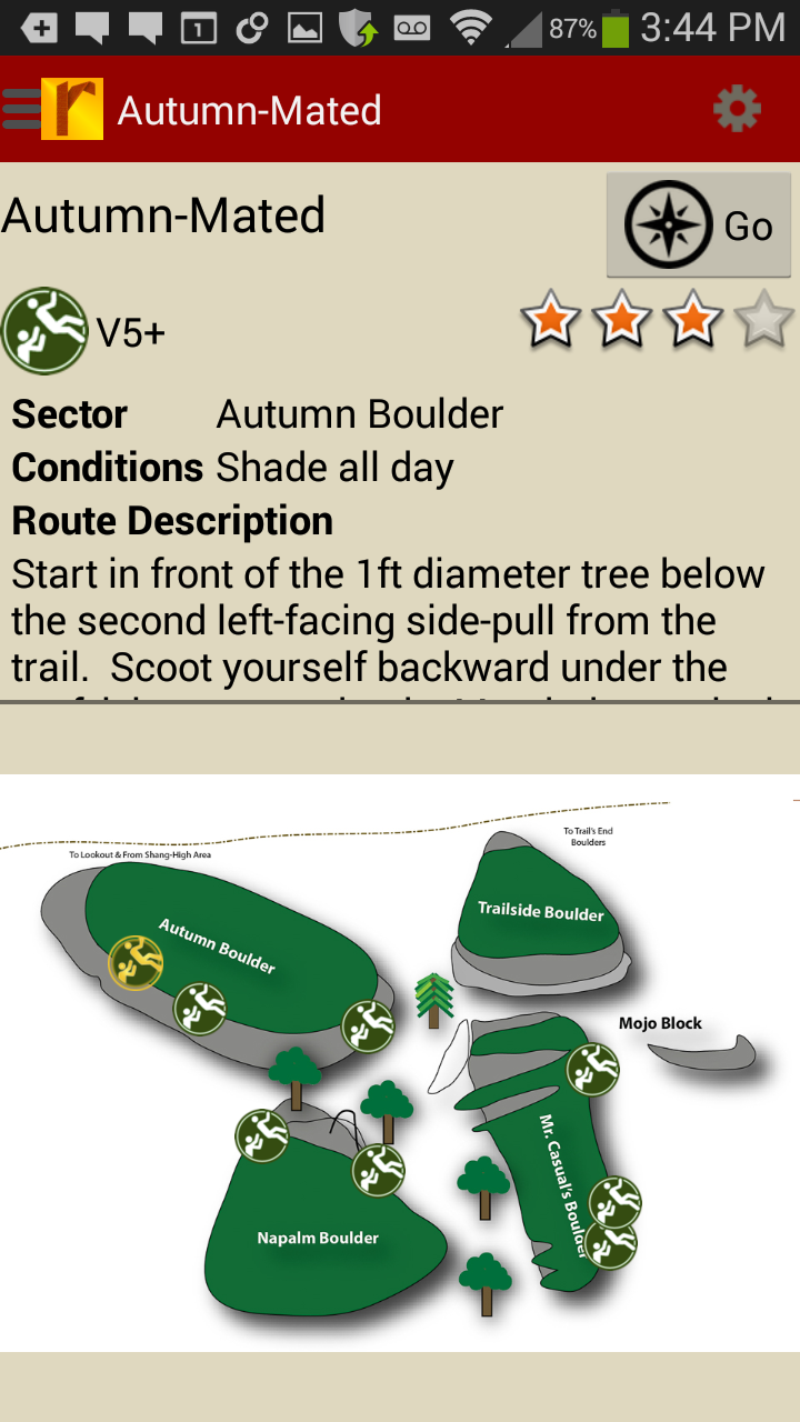
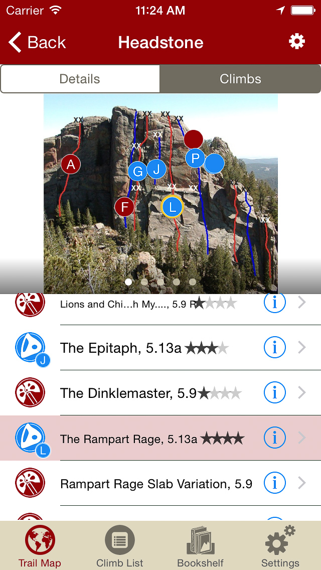
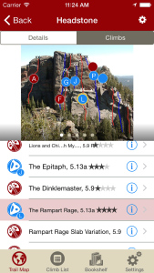
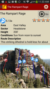
Tap on a climb to see where it’s located in the image, or tap on a route bubble in the image to see what climb it is.
-
-
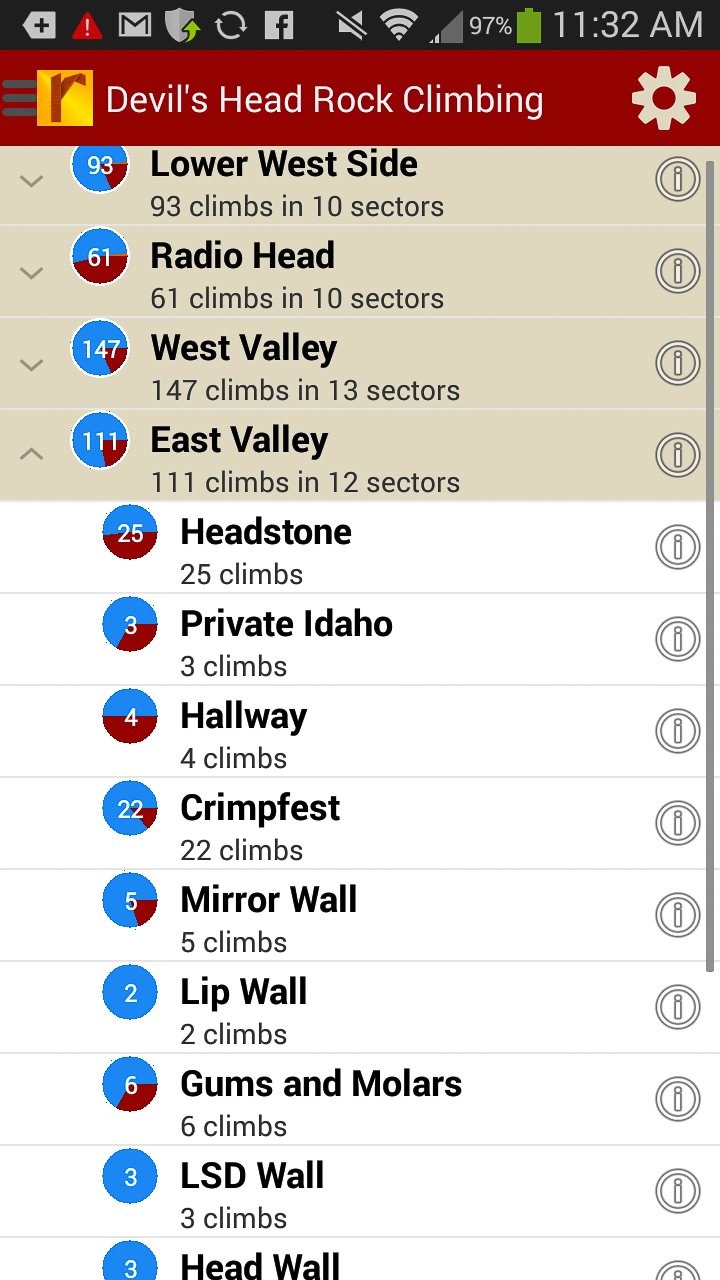
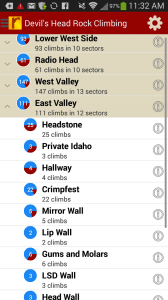
Explore Devil’s Head rock climbs & walls from a hierarchical list that can be filtered and searched.
-
-
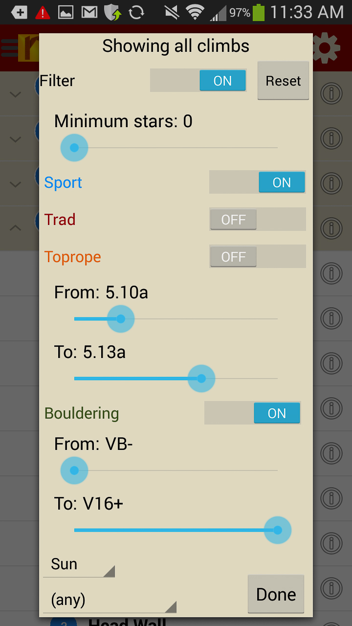
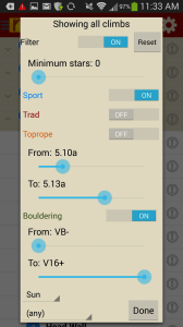
Filter the Devil’s Head climbing route list or trail map by grade, climb type, quality and sun/shade times. How cool is this?
-
-
Tired of bad beta? Use local expert, Tod Anderson’s beta to send your next Devil’s Head climbing project.
Print + digital bundle pricing includes $7.00 for shipping.