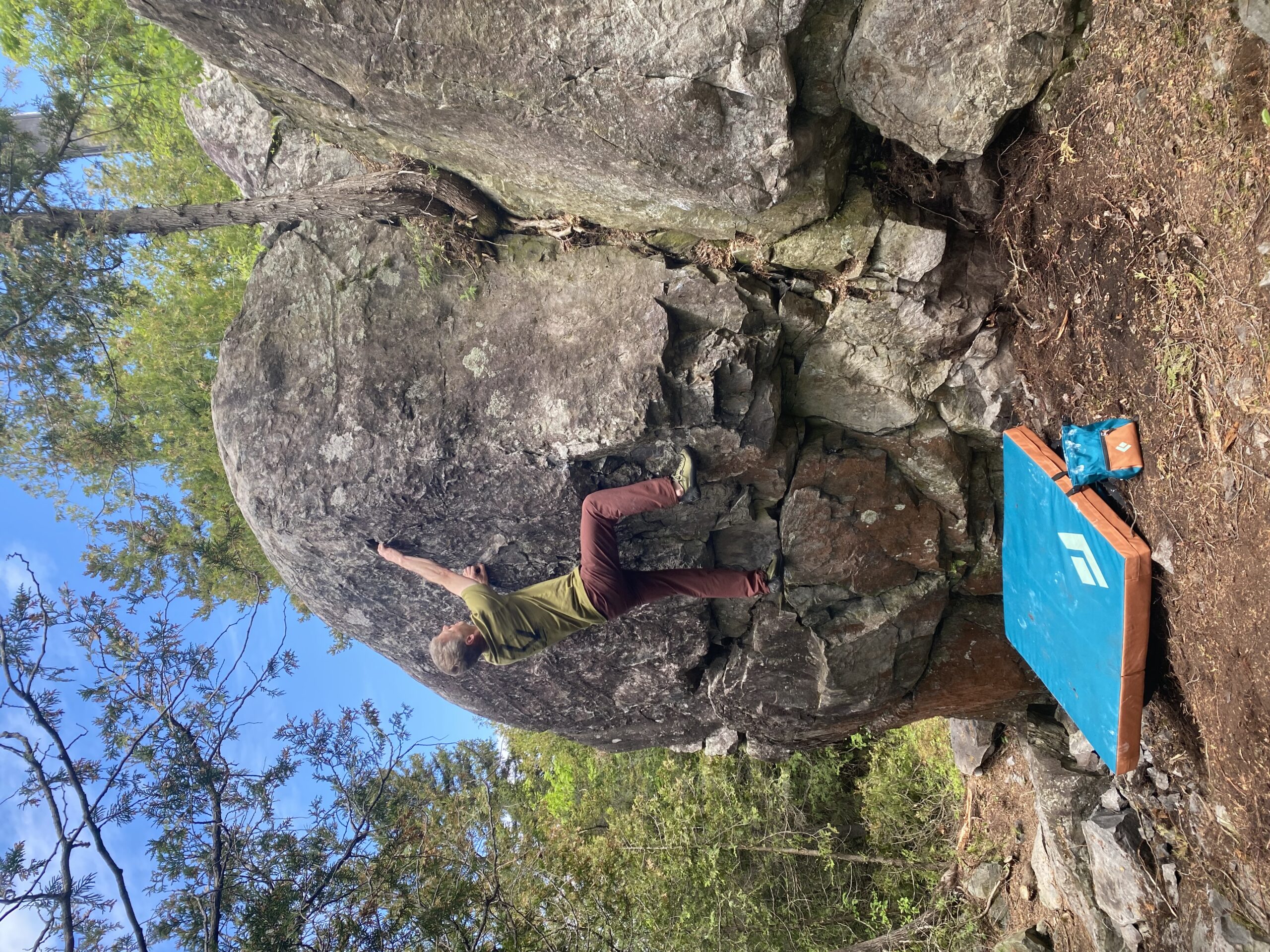
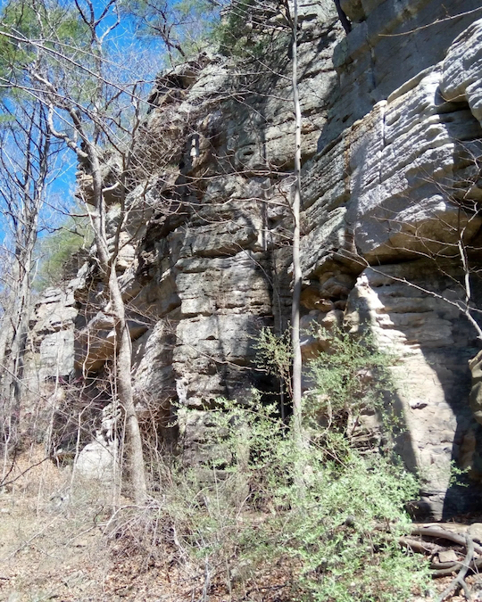
La région de Montmagny-L’islet possède un excellent potentiel pour le développement de site de voies et de blocs. La région est bien située pour une grimpe rapide de la rive sud de Québec ou pour une pause escalade lors d’un long déplacement sur l’autoroute 20.
Le CEMA est fier de vous présenter le premier site officiel de la région. Le parc du rocher de la Chapelle situé au cœur du magnifique paysage rurale de Momtmagny est intéressant par sa proximité d’accès et d’approche. Le site est un beau laboratoire de mouvement de blocs et de voies. Il y a au rocher de la Chapelle, un peu de tout. On y trouve un beau mélange de problèmes de blocs, d’option pour faire de la moulinette et quelques belles voies sportives. Ce premier site dans la région pourra plaire à tous, de la petite famille aux grimpeurs d’expériences.
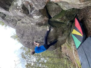
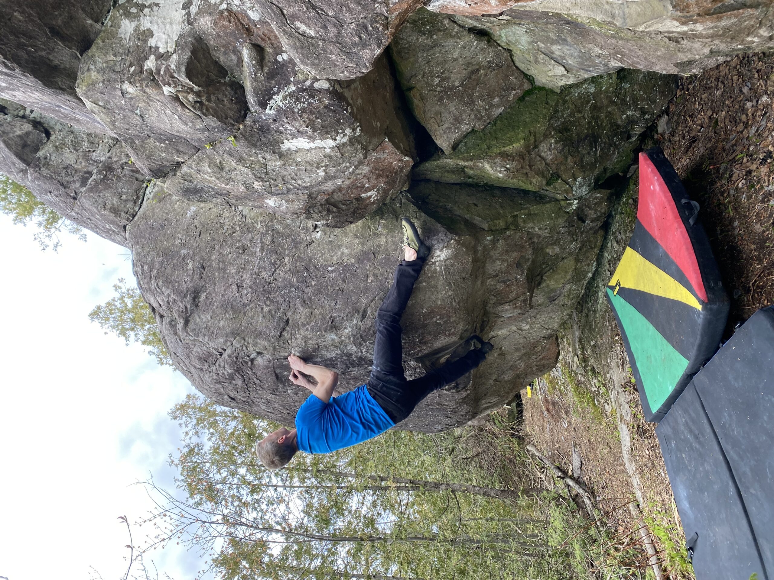
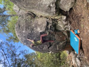
Nicolas Rodrigue on Retour aux Sources V3
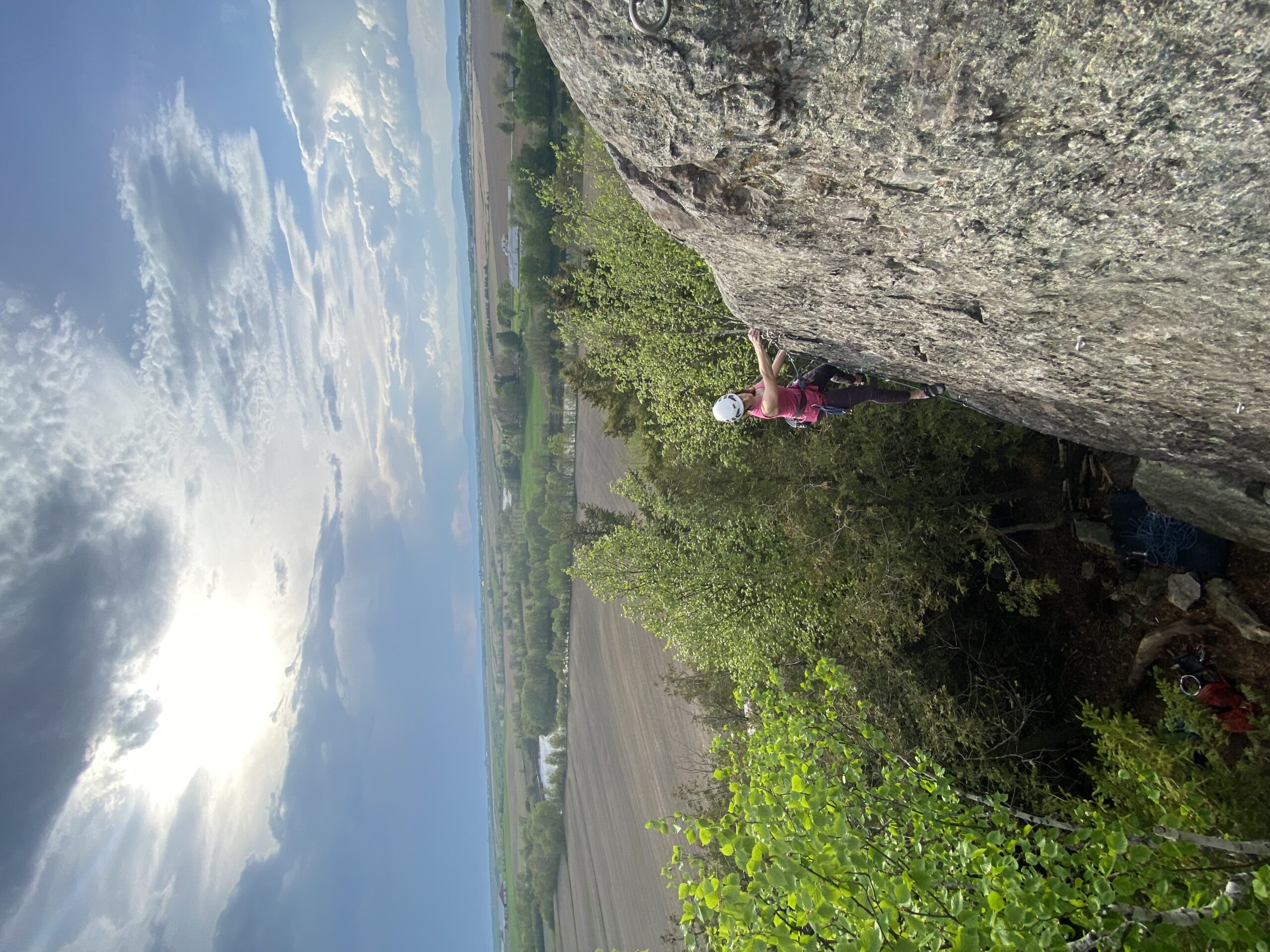
Synthia Laurin on Pointe Lacaille 5.8
Nicolas Rodrigue on Ganesha V1
Synthia Laurin on Étole 5.9+
Québec: Montmagny-L’Islet Rock Climbing by Nicolas Rodrigue was last modified: June 3rd, 2024 by todd
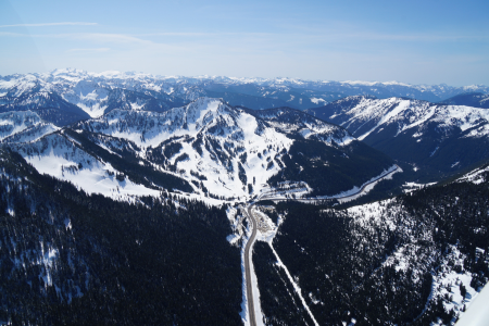
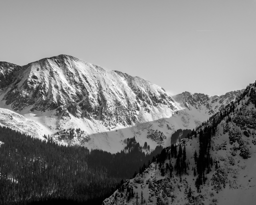
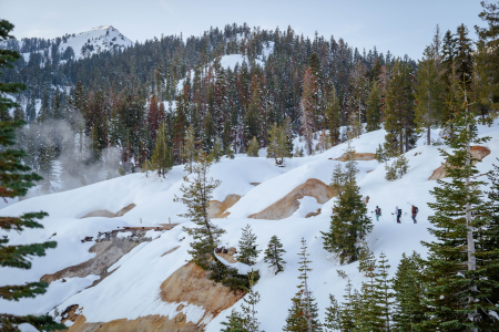
Stevens Pass is located at an elevation of 4,061’ in the Cascade Mountains in Washington. The climate on the Pass is a maritime-influenced alpine subarctic climate that experiences short and mild summers and winters with extremely heavy snowfall. The Stevens Pass Ski Area is on Cowboy and Big Chief Mountains. The pass was named after John Frank Stevens, the first non-indigenous guy to discover it. In 1890, Stevens began a survey for the Great Northern Railway. He found the pass and decided that it would be a great place for the railway crossing and today, the BNSF’s Cascade Tunnel sits 1,180 feet below the summit of the pass.
On February 23, 1910 two Great Northern Railway trains were stalled on the tracks at the tunnel station due to big storms and avalanches. Six days later, on March 1, another avalanche came and swept both trains from the track, pushing them 150 feet down into the Tye River Valley and burying the train cars in a heap of snow and other debris. This catastrophic event, known as the Wellington Disaster, killed ninety-six people. Thirty-five of those deaths were passengers and the other sixty-one were railroad employees. This is considered the most deadly avalanche and one of the worst train accidents in the history of the United States.
Colchuck Lake descents from Beacon’s Washington’s East Side Stevens to Snoqualmie Pass Guidebook.
Mount Stuart
Probing
Testing
Stevens Pass Resort
Unfortunately, this is not the only deadly avalanche to have occurred on Stevens Pass. This area is prone to avalanches and is a zone that requires attention and caution. Over a century later in February of 2012, after three feet of fresh snow had fallen, a group of 16 experienced skiers were out in the backcountry in the Tunnel Creek area when an avalanche occurred and killed three of the men that were there that day.
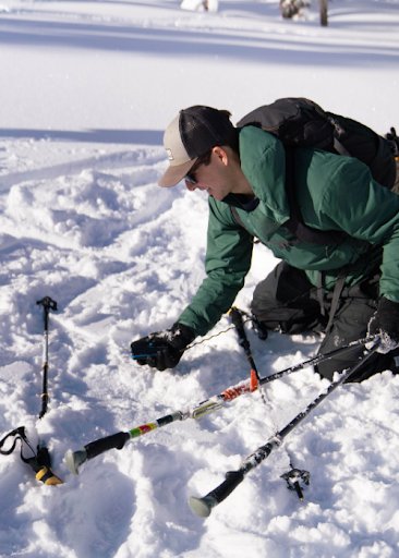
Due to the dry snow and the high avalanche risk in this zone, we wanted to remind everyone how essential avalanche training is when you’re going to be in the backcountry.
The ski resort on Stevens Pass was started by two passionate skiers on Big Chief Mountain in the winter of 1937-1938. These two men had hauled an old V8 engine, some ropes and pulleys up the mountain to build their first rope tow. Aspiring skiers had to hike six miles in if coming from the west side or take a bus if coming from the east side. Skiers from Seattle to Wenatchee and even further came to ski the mountain. Popularity increased, and by 1963 the ski area had expanded to include twelve rope tows, the lodge, a shop, and three chairlifts. Eventually, they expanded into Mill Valley, which opened up terrain on three sides of both Big Chief and Cowboy Mountain.
Ownership of the resort has passed through many hands, and has finally landed on Vail Resorts as the current owners.
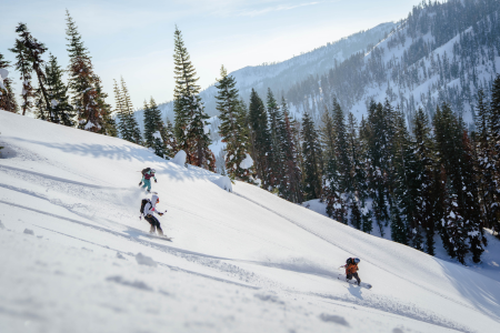
Parking on Hwy. 2 is an endangered species; it requires careful choices and planning to spot. Tunnel Creek is a no parking zone—and also an incredibly large terrain trap with a long history of accidents, as we’ve mentioned above. Parking at Stevens Pass is legal, but challenging due to its popularity and management’s lack of interest in supporting backcountry access as of this writing. Other parking on Hwy. 2 is variable and inconsistent. The Smithbrook parking lot is the only official spot to park, and even there, you may get plowed in. Follow the parking recommendations in the guidebook to decrease your chances of getting towed or plowed in.
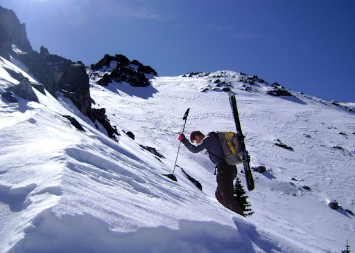
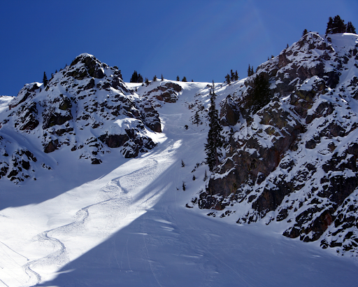
There are some dangers and logistics to navigate in accessing this zone safely, but if done so, you’re in for a heck of a good time in some deep, fresh pow.
Being so far south in latitude and with nearly 300 sunny days a year, there’s a good chance you’ll be skiing in the sunshine in New Mexico. The snow here is unique because it is dry, cold, and powdery throughout the winter with great corn skiing in the spring. The snowpack also tends to be more consistent due to more minor temperature fluctuations than you are likely to see further north.
The Taos + Santa Fe guidebook can be divided into three geographical regions. The first is the Taos range that includes Wheeler Peak and the ski area there. The second region is the area around the Truchas Range, a lesser explored mountain. And lastly, Santa Fe and the mountain and sidecountry skiing there.
Ascending
Fresh turns, blue skies
Historical Wheeler Peak photo
The skiing history in New Mexico is rich and dates back to the late 1800s and early 1900s with prospectors trying out their skis for both practical uses and for casual fun. New Mexico is also home to what is likely the oldest-known photo of a Native American on skis. The image from around 1900, shows a man from Taos Pueblo on skis in Hondo Valley (just a few miles from Taos Ski Valley), holding one long wooden pole in lieu of the preferred two short ski poles of today.
With the advent of backcountry skiing technology, access has exploded and NM offers vast opportunities for the enthusiastic adventurer. This guidebook serves as a primer for what all is out there. There are even several abandoned ski resorts that serve as good places to ski. Generally, there is good freedom for backcountry access, but Taos Ski Valley is the exception. They don’t let you venture from the resort boundaries to out of bound terrain during the season. But, fun tip, you can ski inbounds once the resort is closed for the season because it is national forest land. The Taos Ski Valley can be found to the northwest of Wheeler Peak. Wheeler Peak (13,167’) is the highest peak in the state of New Mexico. In the 1870s, U.S. Army Major George Montague Wheeler began to make a topographic map of the southwestern United States, and this included New Mexico. After climbing the peak, he named it after himself. In fact, at least six mountains in the southwestern US are named after him. He was likely not the first to summit Wheeler Peak, but it is believed that the people of the Taos Pueblo had likely climbed it for many years before a white man came to stand on top.
In northern New Mexico lies a brilliant turquoise body of water known as Blue Lake, or Ba Whyea, which is a sacred land to the native Taos Pueblos. This is because it is believed that they were born from the waters of the lake. The settling of Taos began in 1200- 1250 A.D. and it has been a place of worship and spiritual significance since that time.
In 1906, the US Congress grabbed that land from the native people and made it part of a national forest. For 64 years, protesting ensued. These people fought to get their land back, and finally, in 1970, around 48,000 acres of land, including the Blue Lake, was returned to the pueblo. Hurray!
From the Wheeler Peak East Fork Bowl, on top of Simpson Peak, you can see Blue Lake. Admire it from afar but don’t ski off the south side of Simpson towards it; it is a sensitive area that deserves respect. For more information, look in our guidebook.
Truchas Range
Truchas Peak, in the Sangre de Cristo Mountains is a north-south running massif with four discernible summits, North Truchas Peak, Middle Truchas Peak, “Medio Truchas Peak”, and South Truchas Peak. South Truchas is the highest of the four and it is considered to be the second highest peak in the state of New Mexico at 13,108’. It is also the most southerly peak in the continental United States to rise higher than 13,000’.
Truchas Range is one of the biggest backcountry ski endeavors in New Mexico because of the unpredictability and intrinsic remoteness in every direction. Skiing in this zone should not be underestimated; it is a high commitment zone that takes serious planning and preparation. SAR is far away, there is no avalanche forecast, no ski patrol, no cell phone coverage, no paved roads, no huts. You’re out there, and you get to experience a very real sense of wilderness.
It’s a big adventure with massive payoff because of the overall reward of being in such a pristine, massive wilderness area. You likely won’t see anyone else out there or even their tracks; it is relatively untouched.
One of the first developed ski areas in NM came in the 1930s at Hyde Park near Santa Fe.
In 1949, the Sierras de Santa Fe group founded the Santa Fe Ski Basin and raised funds to build its first chairlift. The 50s and 60s saw huge changes and major developments for resort skiing in the region and it has only continued to grow in popularity since.
Ski Santa Fe is located in the Sangre de Cristo Mountains in northern New Mexico. It’s located in a beautiful alpine forest between 10,350’ (base) and 12,075’ (summit), which makes it one of the highest, and furthest south, ski resorts in the US.
Accessibility to Santa Fe is excellent during the winter season because you can take the lift at Ski Sante Fe to venture off into the backcountry and when you return, you can go back down through the resort. Check the Ski Santa Fe website for any updated rules and information. Backcountry skiing at Santa Fe is a bit more of a trek than in Taos, but not nearly as committing as the Truchas Range.
Whether you’re looking for an entirely remote destination like the Truchas Range, something full of other skiers like the Taos Range, or something in the middle like the Santa Fe Range, there’s a beautiful sunny slope waiting for you in New Mexico.
During the 1960s and early 70s, developers obtained hundreds of acres of land with the intent of building a ski resort. They planned big, including 12 chairlifts, hotels, shops and restaurants. The plan bothered many of the local residents, so in an effort to keep Marble wild and secluded, they got together and in 1972 formed the Crystal Valley Environmental Protection Association. They had a goal of preventing the development of the Marble Ski Area and protecting the local environment as a whole. They had large hurdles to overcome, like the wealthy and powerful developers and bureaucrats who were more interested in profits than planet.
The project ran into issues; the land they had obtained was mostly south-facing and would get baked in the sun all day, there were hazards that prevented home sales, questions about the adequacy of water and sewage services, and a group of citizens that voiced their concerns whenever possible. The development plans never launched due to all of these troubles and allegations of illegal land sales. In the end, only one chairlift was ever built and it only operated for one season. The developers went bankrupt after two years, and the citizens’ group won that battle and has continued to fight for the environment and protect the Crystal River ever since. They are currently working on issues like the Coal Basin methane mitigation and helping find solutions to the overuse issues occurring from the off-road vehicles on the Lead King Loop.
Historic Colorado mine
Quarry Road approach
Marble Colorado
Quarry Road
Marble is known for its beauty in more ways than one. The Yule Marble Quarry is one of the biggest marble deposits known globally. It was founded in the 1870s and was the main source of profit for the town and it is still open today. Unlike most quarries, it is not an open pit mine; the marble deposits are found underground at 9,500’ of elevation, which means carving into steep mountainsides.
In 1941, operations stopped as there was no need for marble during the war, and since steel was in short supply, the mining equipment was stripped and sold off. The quarry reopened after 50 years, in 1990. Since then, ownership has changed hands many times. In 2010, Enrico Luciani bought the mine and began shipping marble to Italy, and to other countries in Europe and Asia. Today, it’s run by Colorado Stone Quarries.
Notably, the Lincoln Memorial in Washington D.C. was built out of marble from this quarry in 1914. In 1931, Yule Quarry marble was used to construct the Tomb of the Unknown Soldier in Arlington National Cemetery. A special type of marble called Calacatta Lincoln was first discovered in this quarry and is often considered to be the finest, in terms of both quality and purity, white marble on the planet.
To help keep Marble wild and with a heavy degree of solitude, we need to follow the rules in place that keep the businesses happy and keep everyone safe.
Let’s talk logistics. Parking and road access are important components to understand before booting up.
4WD or AWD is mandatory for driving the Quarry Road (County Road 3). Note that the road is narrow and mostly one lane, it is steep and can be slick from the snow and ice. Passing a quarry truck hauling marble is very difficult. To avoid this, stop at the quarry office at the beginning of the road to find out where the truck is. A pilot car precedes the truck on each run, if you see the car, they’ll ask you to pull over to let the truck pass, please do so.
The road crosses several avalanche paths, do not drive when the risk is high. There is zero opportunity for snowmobiling from Quarry Road. All terrain accessible from the road is considered advanced and has challenging avalanche terrain, there is nothing available here for beginners.
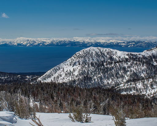
Lake Tahoe is the largest alpine lake in all of North America, sitting at an elevation of 6,225’. It is 22 miles long, has 75 miles of shoreline, and is 1,645 feet deep. It’s the second deepest lake in America, just after Crater Lake in Oregon which is 1,949 feet deep, and it is the 11th deepest lake in the world. The amount of water in the lake (39 trillion gallons) is enough to supply every person in the US with 50 gallons of water every day for five years.
The vibrant, turquoise blue waters of the lake get their color from the amount of algae present. The water is so clear that in some areas, objects can be seen at over 70 feet deep. One reason for the clarity, is that 40 percent of the precipitation falling on the Tahoe Lake Basin, falls directly onto the water. The rest of the precipitation is filtered through marshes and meadows before draining into the lake. Lake Tahoe is 99.994% pure water, making it one of the most pure bodies of water in the world.
Lake Tahoe
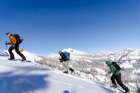
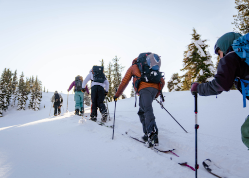
Skinning up
and up!
The lake gets its name from the Washoe Tribe of Native Americans that inhabited the lake for over 10,000 years. Tahoe means “big water” in Washo. Native Americans lived a somewhat secluded existence here until the lake was “found” by white men in 1844. The discovery went mostly unnoticed for years until Comstock Lode was found in Virginia City, Nevada. In the 1860s, Tahoe became a commercial hub because of the silver mines and railroads that were spreading out west. Because of the mining at Comstock, large-scale deforestation took place in the Tahoe Basin. The estimations of how much forest the Basin lost during this time are as high as 80%.
Over the next century, conservationists worked hard to protect Lake Tahoe. From 1912-1918, they tried to designate the Tahoe Basin as a national park, but they did not succeed. As pressures to develop the beautiful area increased in the 40s and 50s, a group was created called the League to Save Lake Tahoe in 1957. The League has been influential and imperative to the protection of the lake. They formed the Tahoe Regional Planning Agency (TRPA) which is a congressionally- approved agreement between California and Nevada to create environmental goals and take necessary actions to achieve and maintain those goals.
Granite patches on the approach.
Riding deep Tahoe pow!
We’ve talked a little about the history of the lake, but the story wouldn’t be complete without a discussion of the epic skiing that has taken place near the shores. It is said that the first people in the world to race competitively on skis were California gold miners. Miners started racing on skis during the Gold Rush in the early 1850s. The Lake Tahoe and Auburn ski clubs were early supporters and promoters of competition skiing. On Donner Summit, the Sugar Bowl was one of the first destination ski resorts in the country.
A man named Charles Nelson taught his friends how to ski in order to get around and have fun in the deep pow. He taught them how to make 7-12 foot long wooden boards that they shaped into skis and then sold for $6 in gold. The first legit, organized ski race championship in the world took place on February 15, 1867 in La Porte. The winner claimed a massive prize of $600.
In 1928, just a mile from the Tahoe Tavern at Lake Tahoe, an Olympic- size ski hill was built by a hired Norwegian man named Lars Haugen. Tryouts for the 1932 Winter Olympics were held here. The jump was named Granlibakken and was used and managed by the Lake Tahoe Ski Club.
The 30s brought huge changes as more and more people in the area began skiing and downhill or cross country racing competitively. The Southern Pacific Railway developed the Sugar Bowl, one of the first ski areas in the West. The 50s saw a dramatic increase in infrastructure that supported skiing and increased the number of people coming to the area. Today, people still flock to Tahoe to enjoy the sun and awesome pow. With crazy tours available around the state, it’s nice for there to be an option when the day calls for a light tour for one reason or another, that’s one thing that makes this book such a winner. The Light Tours of Lake Tahoe make for an incredible opportunity to explore some of the majestic wonder that this area has to offer.
For the Light Tours of Tahoe ski atlas, we identified many of the prime routes in this region that meet these criteria. For the places in our book where the skier might encounter a small, limited amount of avalanche terrain, we make a point to draw attention to it and describe it for the reader. Choosing to ski light tours doesn’t mean that you should venture out unprepared. It’s still paramount that you and your ski partners have avalanche training and are well equipped and knowledgeable.
Watching mounds of snow pile up on the ground can be exciting and intimidating for many backcountry enthusiasts. Many are eager to enjoy these spoils while they’re fresh, but the serious reality of avalanche risk can steer many away from journeying into the backcountry. The beauty of light tours is that they provide an alternative to your more challenging routes while still delivering delightful turns to those that are willing to sacrifice a greater rush of adrenaline for a lower risk option. Let’s say you’re looking to test out some of your new AT gear, or you’re heading out with a new ski partner, or a ton of fresh powder just fell and avalanche risk is high where you often ski; light tours serve as the perfect option for accomplishing any of these tasks. They may not suit the prototypical “instagram-worthy” experience that garners social media attention, but at the end of the day, no amount of likes is as valuable as one’s life.
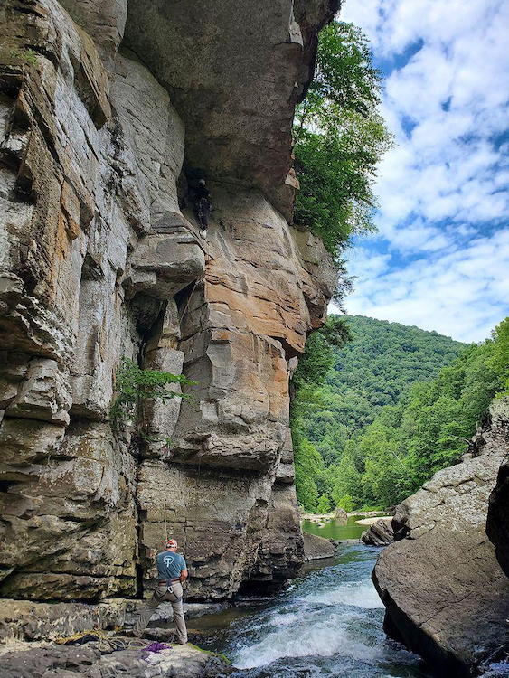
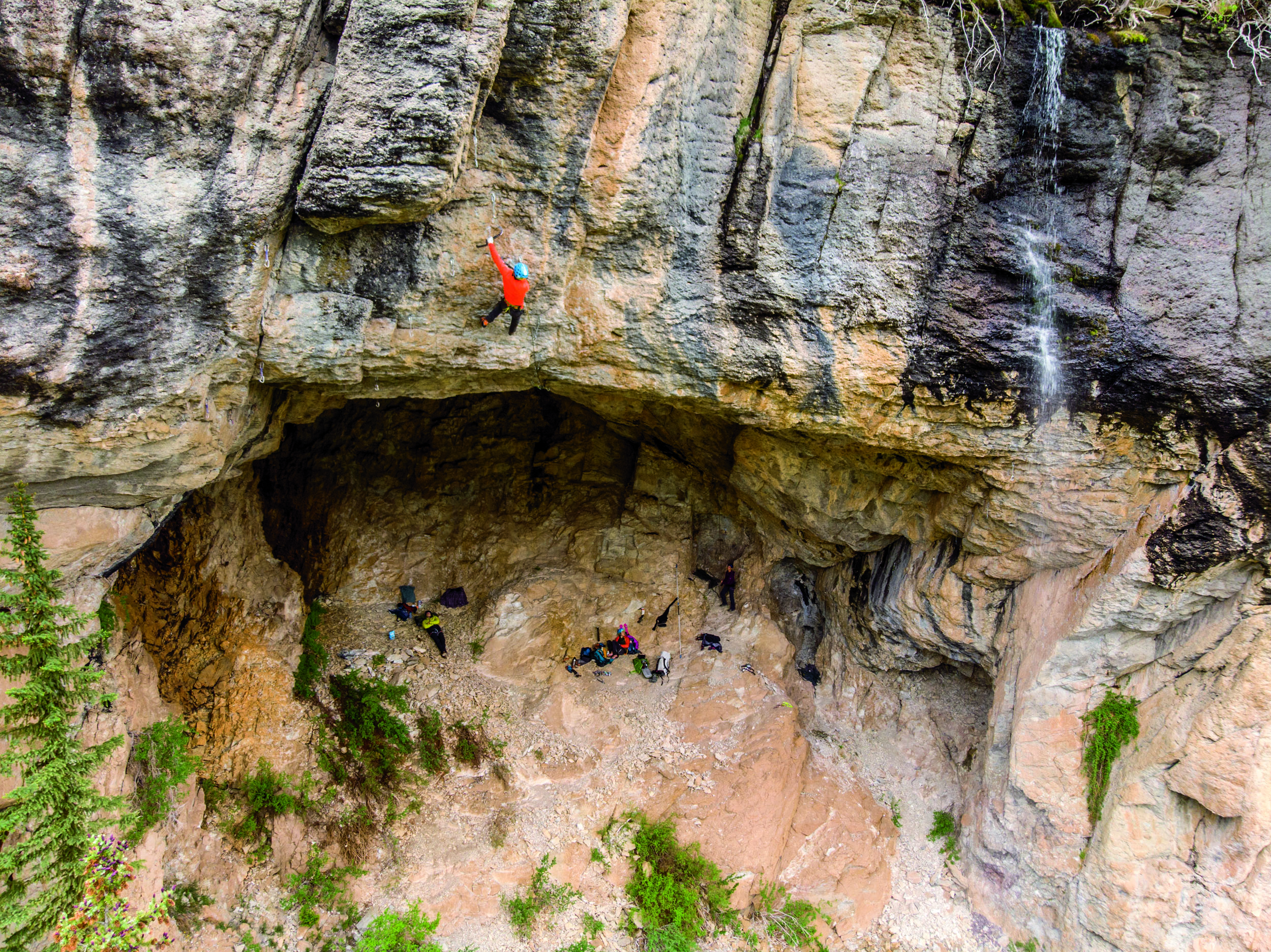
Voici un guide complet de l’escalade qu’on trouve dans le Parc régional du Poisson Blanc. Il y a longtemps que la grimpe se pratique sur le territoire, mais en 2016, suite à la demande des gestionnaires du Parc, ceux-ci ont établi une collaboration avec la FQME et à l’aide de plusieurs bénévoles ont procédé au développement de l’escalade sur les falaises du réservoir. Le résultat est ce qui se retrouve dans ce guide: cinq secteurs avec plus de 130 voies.
L’approche à l’escalade se fait uniquement par bateau et peut nécessiter jusqu’à 4 heures en canot pour se rendre. Il est donc commun de faire du canot-camping sur les îles aux sites désignés. Pour toute réservation ou information pour le camping vous devez vous référer au site du Poisson Blanc: www.poissonblanc.ca
Il est essentiel de respecter la réglementation en vigueur dans le Parc. Y avoir accès et y grimper est un privilège, aidez-nous à conserver l’accès à ce site unique.
Bonne aventure!
DWS at Paroi Écho
Araine Nguyen on Vent du Nord 5.9 Paroi Amiral (Credit Caleb Gingras)
?? on the second pitch of Virginie 5.10c at Paroi Éch0 (Credit: )
?? on Oeil de Lynx 5.10- Paroi Éléphant (Credit:)
Here is the complet guide to rock-climbing in the Parc Régional du Poison Blanc. Climbing on the various cliffs in the parc has been occasionally practiced by adventurous enthusiasts. But, in 2016 development stepped up. The Parc administrators collaborated with the FQME to organise and structure the development on the cliffs of the Parc. So, with the help of many volunteers there a been a huge boost to the number of climbs and cliffs accessible to climbing. The result is that there are now over 5 areas with over 130climbs.
Approaching the climbs can only be done by boat. A canoe approach can be up to 4 hours. It is therefore common practice for climbers to camp on one of the many islands at the designated camping spots. For all information on access to the Parc and camping reservations please consult the parc’s webpage at: www.poissonblanc.ca
Climbing in the parc is a unique experience, and it is a privilege to have access to such a magnificent and natural place. Therefore, please respect all parc policies concerning reservations and access.
Have a great adventure!
Québec: Escalade Parc Régional du Poisson Blanc Guidebook by Socrate Badeau was last modified: November 1st, 2023 by todd
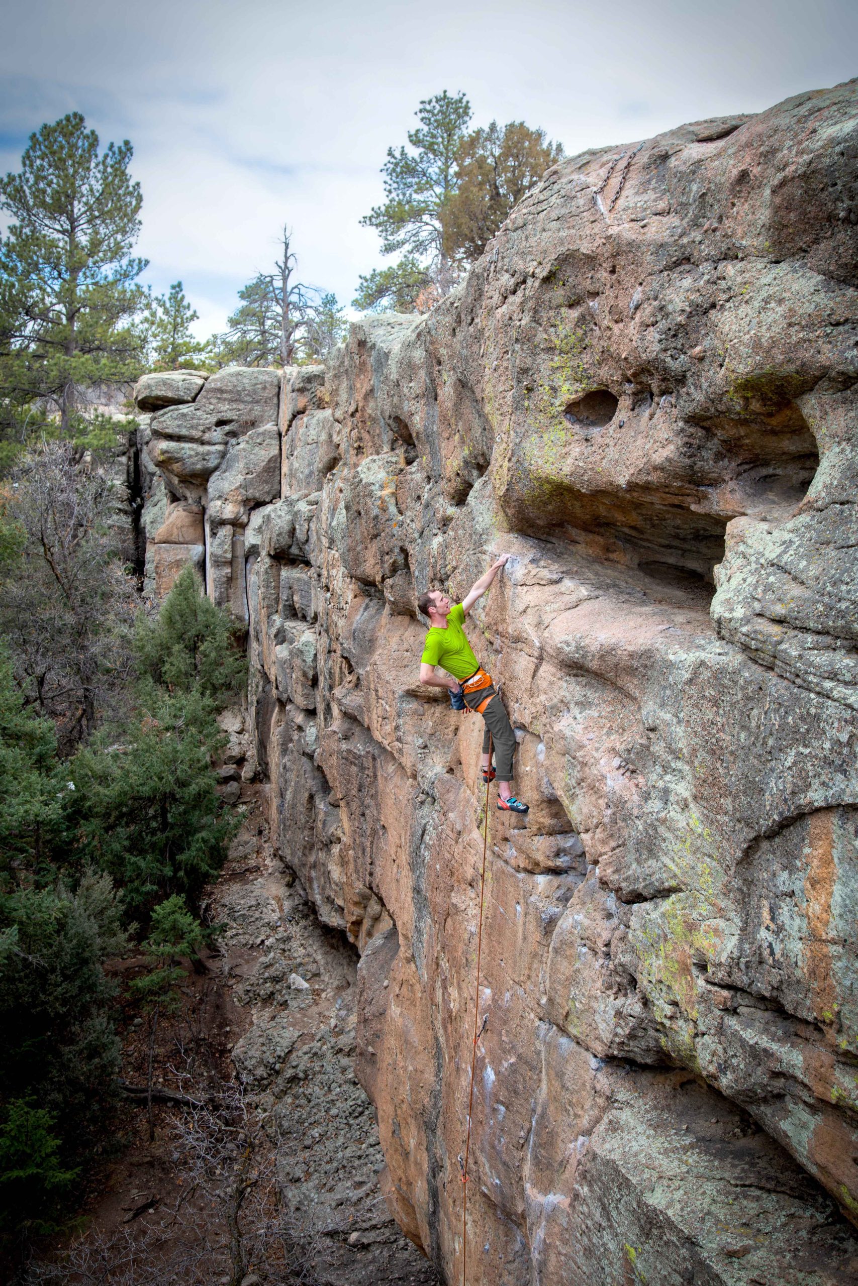
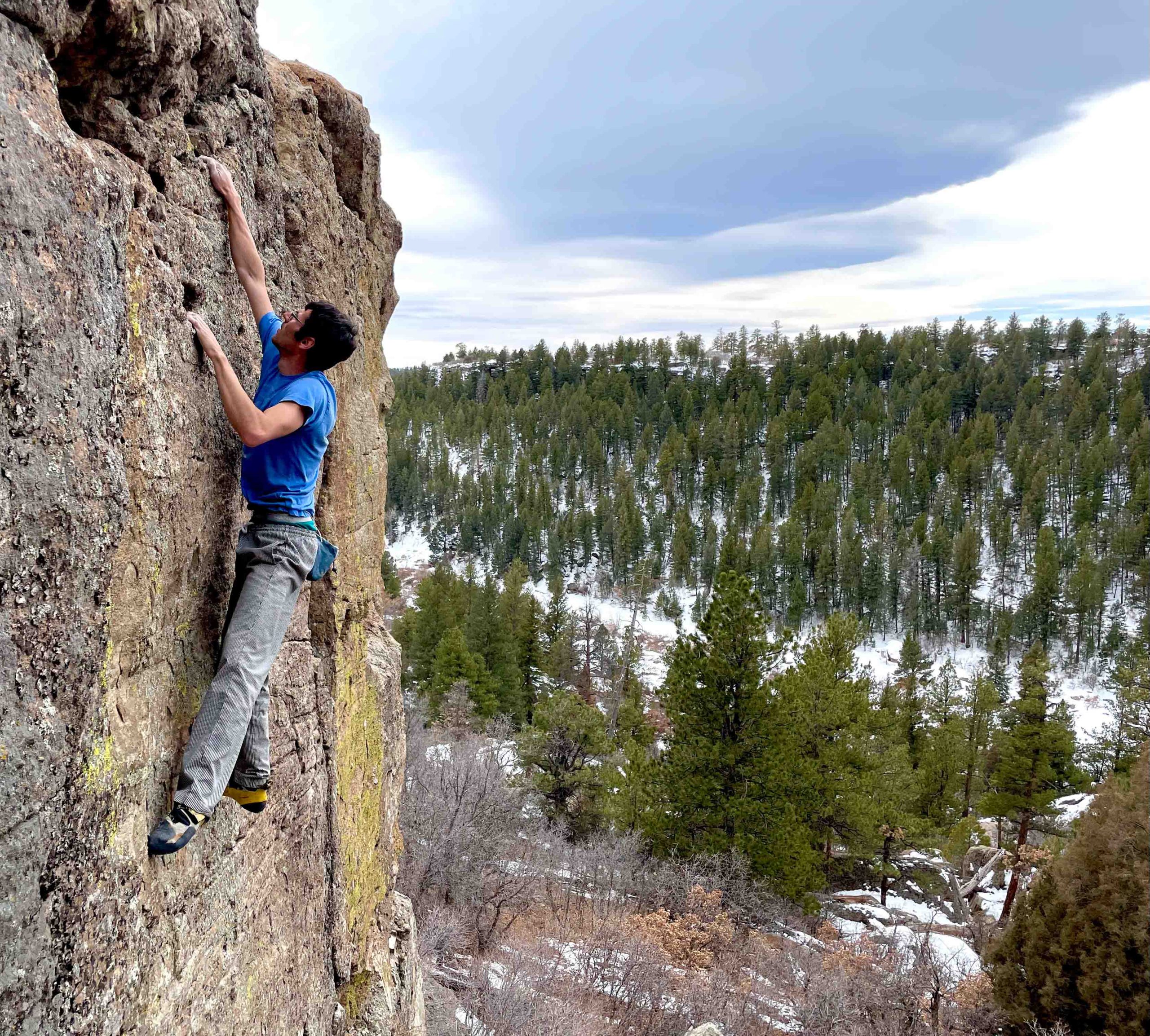
There’s a lot of places to climb in the Front Range of Colorado, but Castlewood Canyon State Park is unique among them all. The first reason is its location; Castlewood is one of the few climbing areas in the front range, that is not actually in the mountains. It sits out in the plains to the east of Castle Rock, about 45 minutes from Denver.
Mike Burdon running it out above some gear on Another World (5.11a PG13).Photo by Joe Lovin
Jacob Peyton on Bozo No No (5.11b)
Joe Lovin sending The Travesty (5.12d). Photo by Mike Burdon.jpeg
Mike Burdon highballing on Daddy Cool (V2 X). Photo by Aleks Grocic
Chris Lopez on Phalloid Void (5.10c). Photo by Mike Burdon
Megan Lee on Outer Mongolia (5.10b). Photo. by Mike Burdon
Castlewood is also unique in its rock type. While a variety of sandstones, granite, gneiss and basalt can all be found in the Front Range, this is one of the only places to climb on conglomerate. This style can be tricky at first, but super fun and rewarding for those who have spent some time with it. It involves cranking on cobbles, sinker pockets, crisp edges, beautiful alligator skin and some wild looking features!
Castlewood has long been known for its bouldering, which is fantastic in both quality and quantity. As a previous guidebook author once marveled, the bouldering here is “inexhaustible!”
The more one seeks, the more one finds! But Castlewood is not only a bouldering area! There are over 130 sport routes, more than 200 trad climbs and still tons of potential for new routes of every style.
Due to its proximity to Denver, Castlewood has been a popular recreation spot for families and beginner climbers. On any given Saturday you’ll see a bunch of families toproping at the Grocery Store Wall, or the Boy Scouts out learning to rappel. Recently, however, there has also been a resurgence of more serious climbers, realizing the park’s untapped potential for new sport climbs, hard boulders and serious trad climbs. In the last year there have been many new routes developed; trad climbs as hard as 12a R, sport climbs up to 13a and boulders in the double digits! Castlewood is not just for kids.
The Wood also provides an opportunity to get off the beaten path. As crags like Canal Zone and the Graveyard are becoming increasingly overrun with the ever-growing number of Denver climbers, Castlewood Canyon remains a place of scenic solitude, where one can enjoy a quiet climbing experience away from the crowds and highways.
So whether you’re looking for some adventure and exploring, bolt protected pocket-pulling, cranking on cobbles, or a chill day in the forest, Castlewood has what you’re looking for and I hope this guidebook helps you find it.
The Wood: Climbing in Castlewood Canyon by Mike Burdon was last modified: April 20th, 2023 by makb
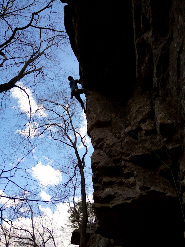
Back in 93, when Troy Johnson and I made our first pilgrimage to Smoke Hole Canyon, there was a ragged piece of white tat hanging from a rusted piton up in the deep green Entrance Arch dihedral that would eventually become the start of Hunting Unicorns. Climbing, long slumbering in the shadows, had returned to Smoke Hole Canyon.
Connor Pace turning the roof on Hunting Unicorns, Entrance ArchA Drop in the Ocean, Copperhead CoveJake Hill in Spring Colors
The first bolted lines would go up in Copperhead Cove soon thereafter, including Faces in Stone and the start of Bad Drugs. Then other routes at other canyon crags called us away, and the challenges of access between floods kept us away. We scattered to the four corners in 1995, and I spent six years exploring the Four Corners region.
In 2009, Cindy Bender and I put up our first route together on a tall, roof stacked corner in the Cove, and called it Going on a Bender. In 2011, we moved to Arizona, and the Cove went back undercover.
Flash forward to 2017; I returned to cleaning and drilling lines at the Cove and Jake Hill with Michael Holmes, J. and Ben Feher. More recently, Virginia activist Mitchell Goldman joined the fun, adding the mixed lines Flagman and ADrop in the Ocean.
Today, three decades after Troy and I first drove into the Canyon, the Entrance Arch has 30 routes of its own, with 16 more lines waiting at Copperhead Cove, and 9 instant classics at Jake Hill.
If you are a new Smoke Hole climber or have not previously downloaded the guides, grab them today to get the best tools for exploring Smoke Hole’s crags, old and new. Your purchases help support trail work and other stewardship efforts in the canyon and at nearby Reed’s Creek, while giving you all the best beta on route development, camping, parking and access issues.
Come explore the best of the old, and the new, at the Entrance Walls of Smoke Hole Canyon.
Smoke Hole Canyon: Entrance Walls, Copperhead Cove and Jake Hill was last modified: March 18th, 2023 by Mike Gray
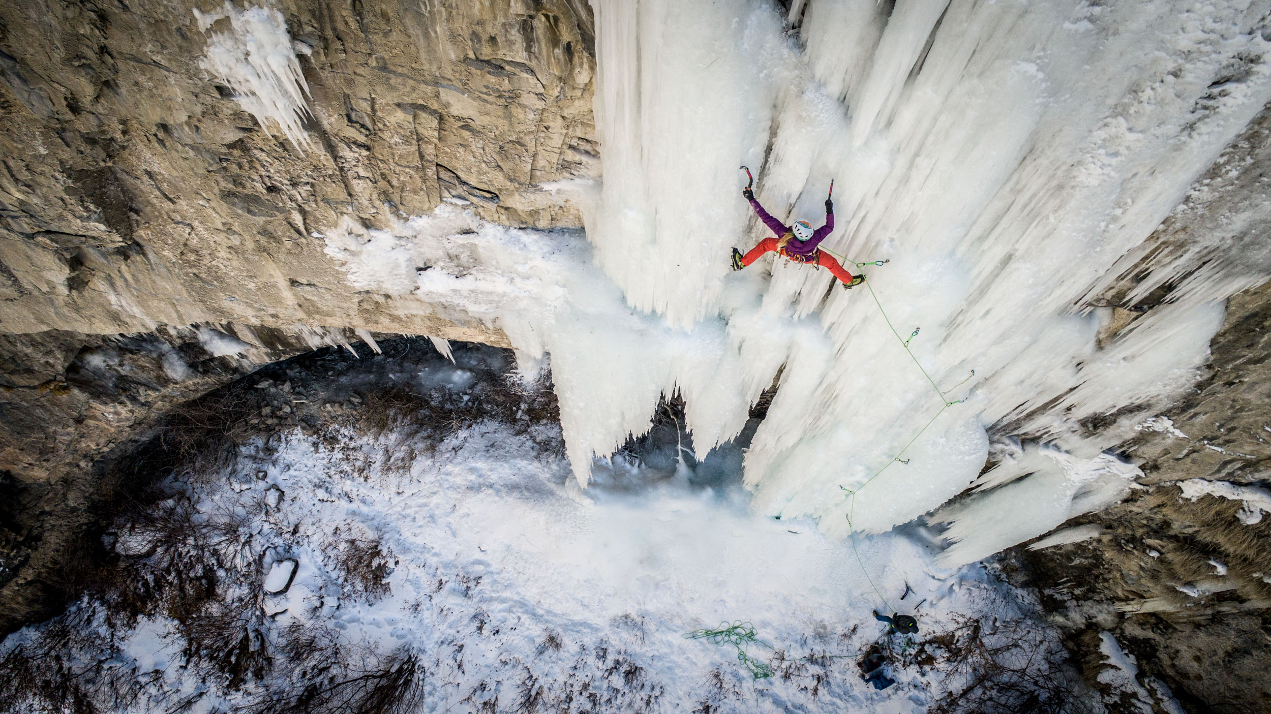
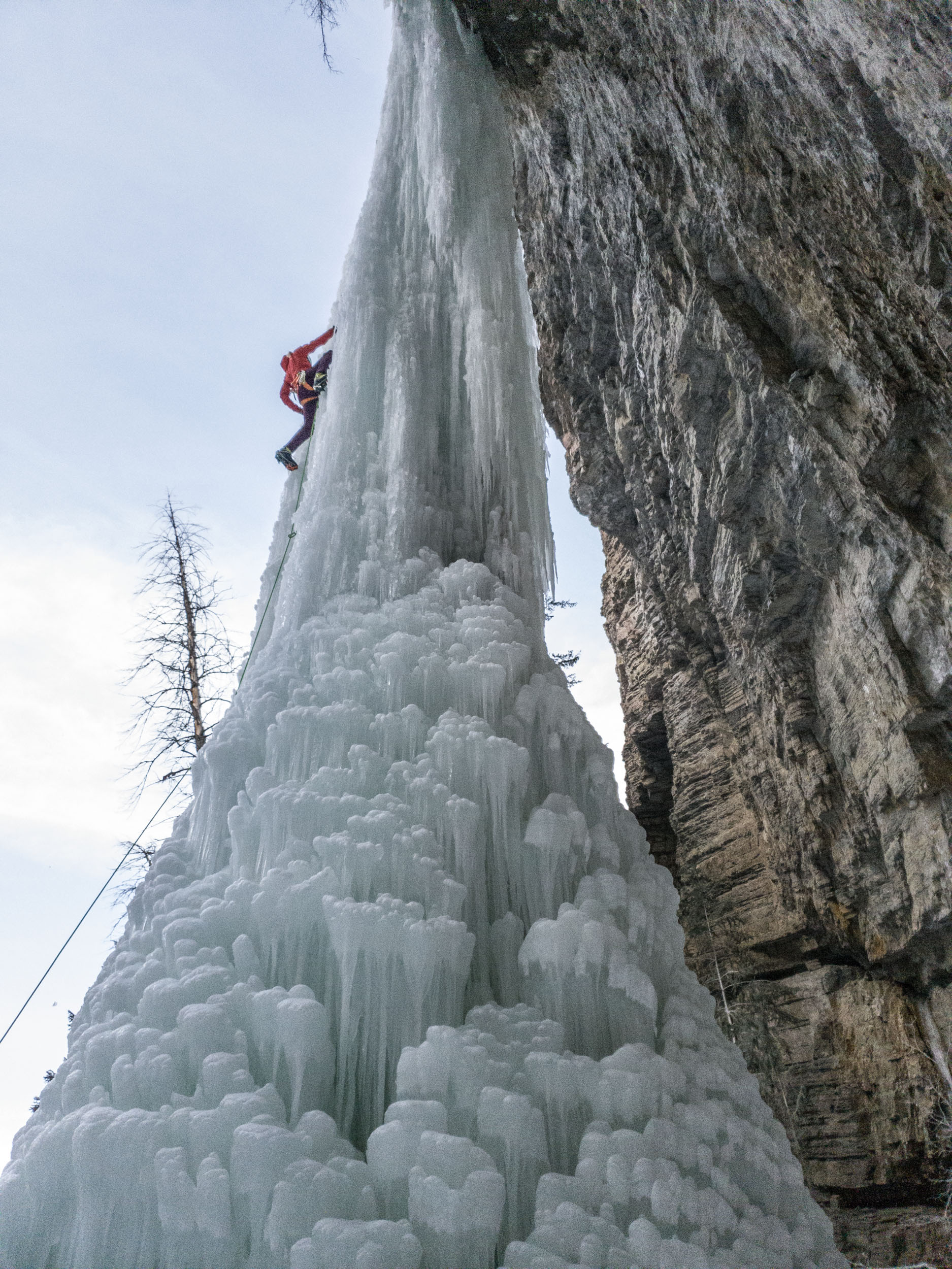
Ice climbing in Colorado is about more than just the Ouray Ice Park. The entire western slope is full of frozen gems. Suffer Candy Volume 2 picks up where Volume 1 left off with the surrounding areas to the east and north. Covering ice in the areas of Ridgway, Montrose, Unaweep Canyon, Grand Junction, Parachute, Rifle, Glenwood Springs, Aspen, Redstone, Paonia, Gunnison, Crested Butte, and Lake City, Suffer Candy Volume 2 dishes out a large swath of ice climbing. There are many undocumented and perhaps still previously unclimbed routes in this guide. I can pretty much guarantee that there are routes you have not known existed in this guide.
While there is plenty of roadside and convenient to get to climbs such as Glenwood Canyon, Rifle, and Lake City, I’ve uncovered many adventure-worthy climbs farther from the trailhead. Check out Curecanti Monster, a climb not quite as fearful as its name might suggest but hidden in the depths of the upper Black Canyon in an amazing location. There are different ways to approach “the monster”. I would consider a hike down into the canyon, followed by a pack raft paddle across the reservoir, and then four pitches of ice climbing to top off the day. Oh, then you get to reverse the sequence.
Another highlighted adventure would be the Cimarrons. Some committing 4×4 travel on snowy national forest roads (or skiing, or snowmobiling) leads you deep into one of Colorado’s most beautiful ranges. You’ll be surrounded by peaks and crazy spires of conglomerate and basalt intrusions. The landscape is incredible. Pouring out from the gullies between the spires are dreamy and steep pillars of ice. I hope you packed some sharp ice tools and strong biceps.
The development of this information has taken years. From decoding the mysteries of the Roberts and Burns guides to repeated trips to many of these areas to catch conditions where ice climbing could be a reality, the work has been endless. I’ve spent hours studying satellite imagery, consulting with fellow climbers, and cross-checking location accuracy. Existing internet information is spotty at best for these areas. I know because I’ve had to reference it.
As with Suffer Candy Vol 1, you’ll enjoy a variety of essays, inspiring full-page images, and lots of my wacky sense of humor to keep things from getting too serious. Let’s get suffering!
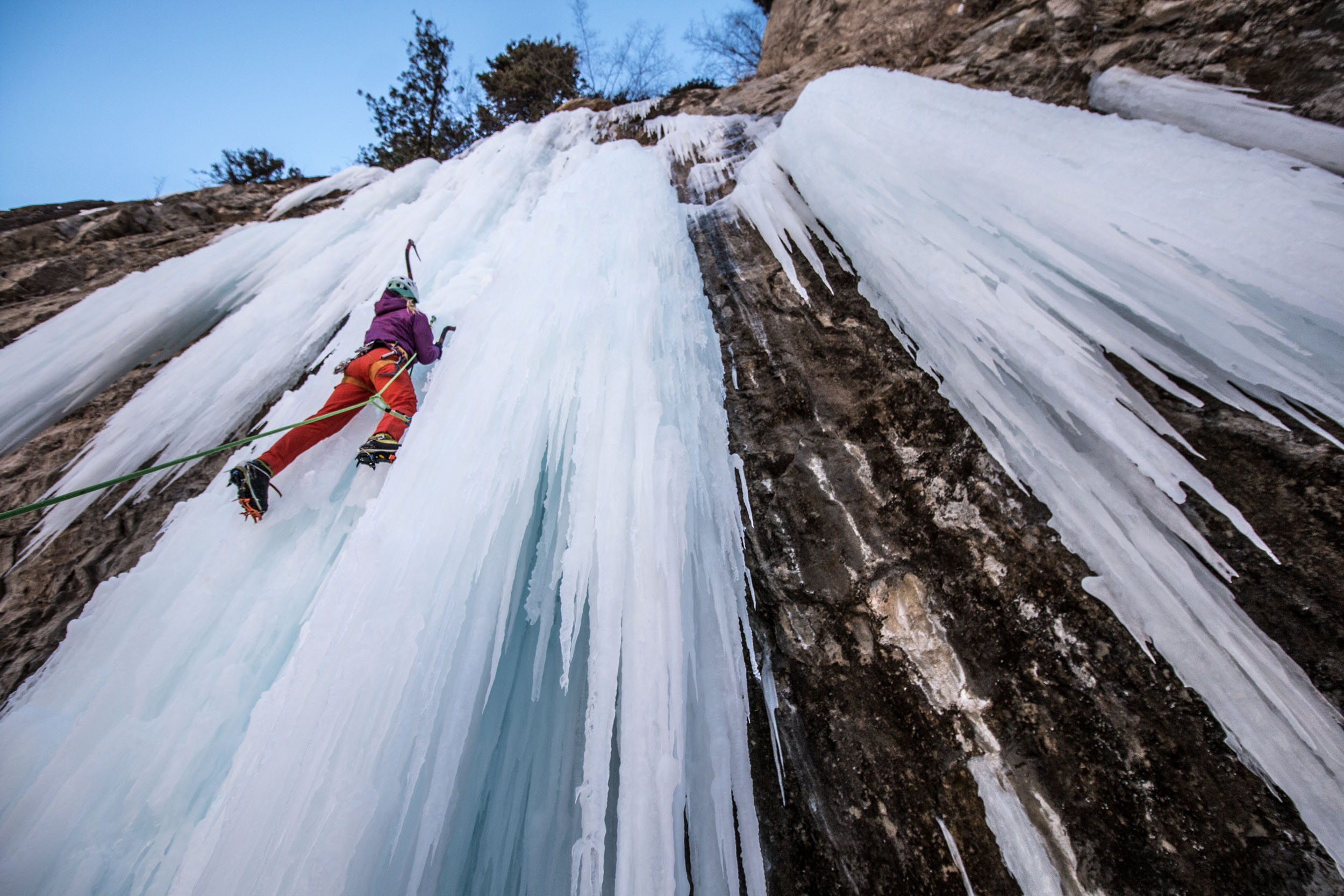
Liam Foster on Jedi Mind Tricks (M13), God’s Crag in Lake City, CO
Beth Goralski on Soul on Ice (WI5) Rifle Mountain Park, CO
Beth Goralski on Grizzly Creek Pillar (WI5), Glenwood Canyon
Beth Goralski also on Soul on Ice (WI5) Rifle Mountain Park, CO
Suffer Candy Volume 2: Ice Climbing in West Central Colorado by Jason Nelson was last modified: January 11th, 2023 by visualadventures
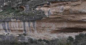
Last Chance Canyon is a true gem of New Mexico climbing. Located deep in the Lincoln National Forest and with the closest “town” being the very small community of Queen (population 50 and formally classified as a ghost town) the feel of the area is remote, isolated and very peaceful. The canyon’s limestones walls hold over 100 routes, in the range of 5.3-5.13+ from thin vertical face routes to jaw dropping jug hauls out monstrous caves the place has something for everyone of all abilities. The limestone within the canyon varies in quality from average to bullet hard top tier seemingly belonging in Spain, the majority of established routes are on fantastic stone. All of these goods are spread out over 16 crags amongst the beautiful winding canyon floor and relatively close together, once in the canyon (10-15min walk) it’s never very far from one crag to the next.
Last Chance Canyon Sits at 5,706ft altitude, In the summers it can be much too hot for climbing but in the fall, winter and spring it is prime time, because of the nature of the twist and turns of the canyon there is always a wall you can go to for sun or shade no matter the time of day depending on your preference. These attributes coupled with the remoteness of the area make this a fantastic stop for the winter climbing road tripper, ample sun, good rock and no crowds what more could one ask for.
If planning on staying at the canyon for longer than a day a few things to keep in mind. There is no water or toilets so come prepared. The nearest larger town is Carlsbad 1 hours’ drive away which has all the supplies you could need. The dirt road leading to the parking/camping area is rocky but generally passable by all vehicle types with proper driving, I witnessed a very new very low BMW creep its way into the park lot one morning. Don’t miss checking out this beautiful and unique area, you will not be disappointed.
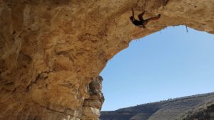
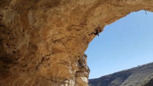
The gaping maw of “The Hueco Cave”Stu Smith on It puts The Buff On 5.13Nicole Deuchar on Solstice 5.12
Last Chance Canyon New Mexico Rock Climbing by Stu Smith was last modified: November 22nd, 2022 by squamishstu