
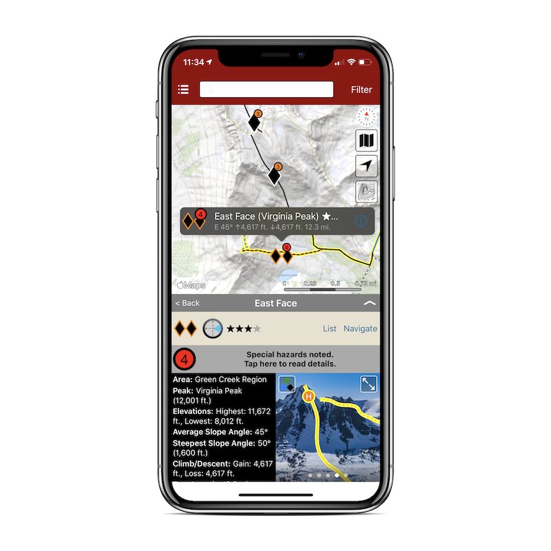
Matt Kaso & Trevor Klein boot the last bit of the East Face of Virginia Peak. Photo by: Nate Greenberg

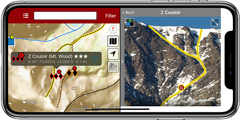
Backcountry Skiing California's Eastern Sierra author, Nate Greenberg looking past the complex terrain in the crux of the Z Couloir. Photo by Brett Lotz.
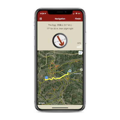
Approach to The Egg, Yangshuo, China, Photo by Ursa Kenk.
Exit 32 & 38 guidebook co-author, Rob Price, finding his adventure in Chugach, AK.

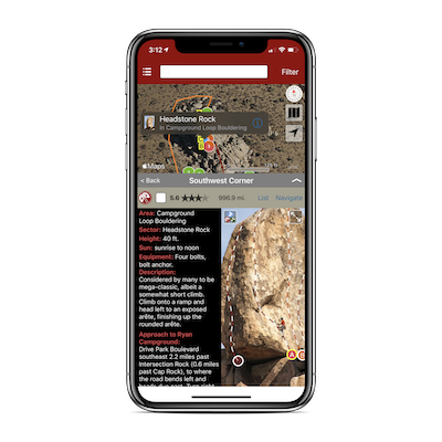
Headstone Rock, Ryan Campground, Joshua Tree, CA. Photo by Robert Miramontes.
The best guidebook content
We’ve partnered with the best area authors and publishers. Get trustworthy beta, beautiful photos and topos, and frequent updates from local experts.
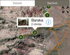
Zoom in
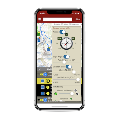
Explore the crag with rakkup’s area maps, topos, and belay-view photos. Powerful search and filtering lets you personalize your climbing area. Want to see all the 5.10b sport routes and V5 problems in the sun right now? Plan a week’s climbing, or just the afternoon.
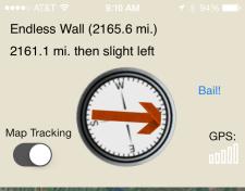
Turn-by-turn GPS navigation
rakkup uses GPS and detailed trail info to choose the fastest route to your climb, from wherever you are. No cellular signal? No problem!
Publish a rakkup guidebook
Thinking about creating a guidebook for your area? Find out about rakkup’s authoring tools. We handle the technology so you can bring great content to the marketplace.