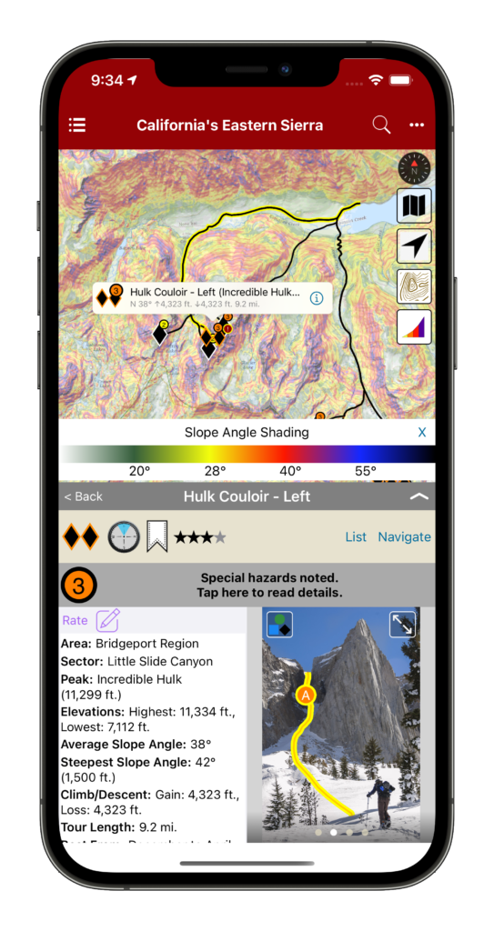
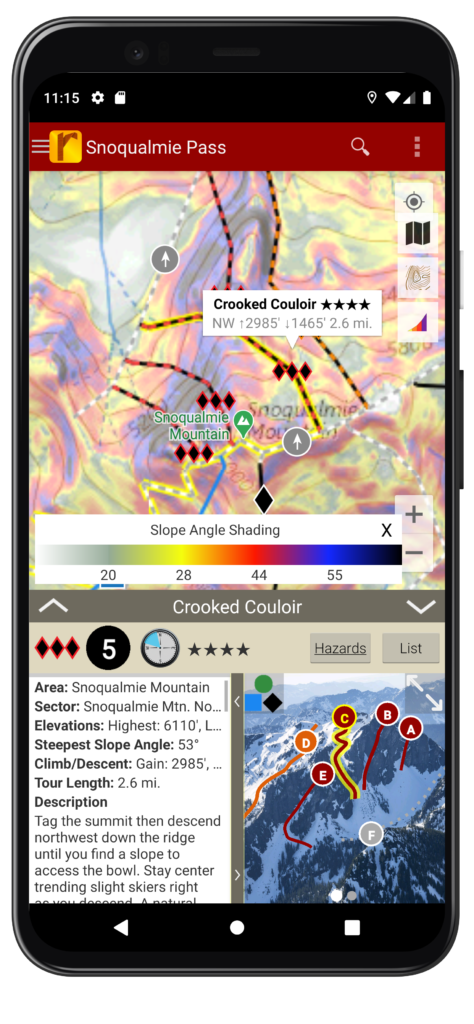
Slope Angle Shading released!
We’re now in our fourth year of offering backcountry ski guidebooks in rakkup, and we are really excited about our latest feature! Slope angle shading is now available for all our US backcountry skiing guidebooks on both iOS and Android devices. Simply be sure you have our latest app release, go to the Bookshelf tab, and tap the cloud icon to update your guidebook.
Avalanche safety educators have been telling us that Slope Angle Shading is one of the best tools for visualizing areas of high avalanche hazard and selecting safer routes in avalanche terrain. This transparent overlay immediately highlights areas with slope angles yielding the highest avalanche risk along and above your route, as well as terrain convexities, terrain traps, terrain that might be too steep to ski (such as cliffs), and even very flat areas where splitboarders like us might need poles or plan on walking.
According to the American Avalanche Institute, most avalanches occur on slopes between 30° and 45°, with peak risk at 37-38°. (Watch AAI’s short video about recognizing avalanche terrain. We’re proud to partner with the AAI this season and offer rakkup guidebooks to their instructors and students.) We’ve used color gradients to show slope angle information with a high degree of precision. We applied a lot of computing power and our best programming tricks to bring you beautiful maps that are easy to download, display quickly, and keep working long after you’ve left cellular service behind.
In the past, many snow professionals used the premium versions of generic mapping apps to view slope angle shading. We think it’s even better to have this feature integrated into your guidebooks – not to mention that these apps have yearly subscription fees several times higher than our guidebook prices! Integrating all our route data with topo maps and slope angle shading helps you choose which zone and which line to ski based on today’s conditions without flipping back and forth between different sources of information.
Of course, no app can take the place of quality avalanche safety training, observation of your surroundings including terrain and snow pack, and proper decision making. But the most effective part of avalanche safety is staying out of avalanches, not digging out of them, and better information can lead to better decision-making. If rakkup can help you select a quality descent, stay alive and safe without getting lost, and have more fun away from the crowds, then we’ve accomplished what we set out to do!
We hope you’ll check out a rakkup skiing guidebook and tell us what you think. Many of our digital guidebooks are also available with a companion printed ski atlas or folding map from our friends at Beacon Guidebooks as a backup and additional reference.
Many thanks to our friend Jamie at Teton Splitboarder for encouragement and technical advice that helped us execute and improve our work.
Finally, a reminder to make sure you know how to turn off the cellular, bluetooth, and Wi-Fi radios on your phone in the backcountry and keep it at least 30 cm away from your avalanche beacon. GPS reception is a passive operation that won’t interfere with your beacon’s signal so you can still pinpoint your location with the radios off.
Happy skiing and splitboarding to everyone!


