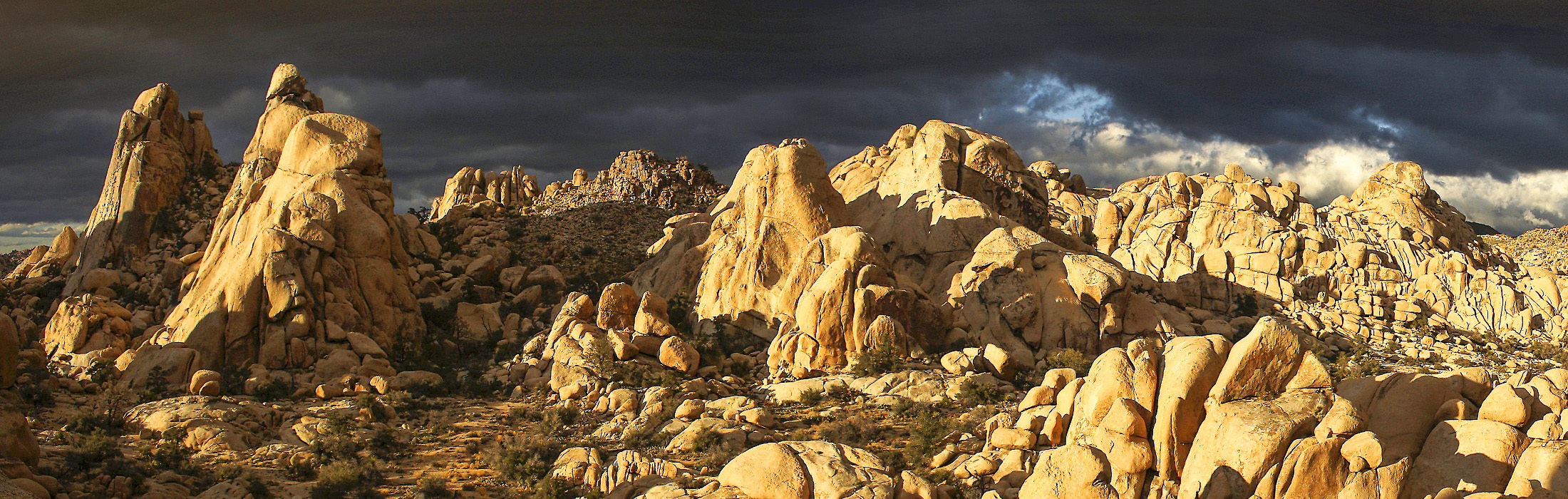
Joshua Tree NP, photo by Robert Miramontes
This week we are launching the rakkup digital version of Joshua Tree Rock Climbs by Robert Miramontes, from our partners Wolverine Publishing. This release is an emotional one for us on several levels and we thought it might be interesting to share the story of how it came to be. With a sense of great pride and accomplishment, gratitude for partners who helped us and believed in us, and sadness at a recent loss, we bring you this book and hope it is your companion for some great climbing days this Winter.
The good folks at Wolverine have been our most important partners for the last couple of years, and it all started with a visit to the Western Slope. We admired Wolverine as an early leader in smartphone versions of digital guidebooks, and we had recently seen the news that they were discontinuing the first generation of apps they had released because they proved to be difficult to update. Excitedly, we drove from Boulder to the Rifle area to pitch our platform. There we not only received the warm hospitality of Dave Pegg and his wife Fiona, but also the gift of their faith in us. After our meeting and a super home-cooked meal, they decided to entrust us to release digital versions of their books at a time when our catalog consisted of about two titles.
Some of you may have heard of the tragic loss of Dave Pegg last weekend. He was a great business partner but more than that. We counted him as a friend and admired his energy, business smarts, integrity, and pure love for the people and places of climbing. Several other authors told us his books set the standard in North America for detail, readability, and appearance, and we agree. Our last email from Dave was the “green light” to release the Joshua Tree guidebook we built together, and after we conferred with Robert Miramontes (its meticulous author), we agreed that Dave would want to see this go forward. Therefore we see this as something of a tribute to the beautiful books he made and the community of people he brought together to do it.
When you pick up the book, you are immediately struck by its beauty. The layout is clean and readable, the depth of the descriptions is amazing, the photos are simply among the most stunning of any guidebook (but also perfectly framed to help find your route), and the heft and thoroughness is mind-blowing. Turning this into a digital guidebook was a daunting task, but from the very first day that we prototyped rakkup’s turn-by-turn navigation we talked about Joshua Tree as “nirvana”, the ultimate place where it was really needed. We had already checked that GPS signal was accurate way out in the park beyond cell phone service.
It turns out, it took a team of four people and nearly six months from the time we started to pull it all together, and this book pushed our platform and our technologies to new heights. Todd was responsible for processing the original book files and using our automated import tool to parse all the sector, wall, boulder, and route descriptions and data. We structure the text and put it in a database so that climbers can quickly, sort, filter, and find routes. Our friend Tom Moulin helped with the enormous task of processing all the photos, preparing and labeling them to look great on mobile displays. (Tom is also a professional photographer, and author of the superb Southern Nevada Bouldering guidebook in his own right.) Robert, the author, used our web-based map building tool to draw a map of all the roads and trails that connect the 3,057 climbs and boulder problems with 201 miles of roads and trails. It boggles our minds to think of the time and knowledge required to put this together, and we feel sure every rakkup user is going to appreciate Robert’s setting this all down in a way we can benefit from when we climb. Watching Robert work forced us to make our tools better. I regret that some of the improvements will come too late to help this Herculean task, but I know all future map builders will benefit.
For my part, I found this guidebook was on such a daunting scale that I had to rewrite both the iPhone and Android versions of rakkup to give a better experience with it. First, we added smart downloads that let you open the guidebook and use it within about 15 seconds of your purchase, and seamlessly download nearly 600 photos in the background and as you need them. Once they are cached the entire guidebook works offline so you can use it anywhere in the park. Next up, I did a rewrite of the map drawing code to handle the complexity of the map, which includes over 5,300 sections of road and trail, 3 or 4 times as much as our next most complicated map. Both iOS and Android offer a way to break the drawing up into small units of work so you can zoom, pan, and tap and feel a responsive app even as we show you where all the climbs are. This requires us to do all the math of converting GPS coordinates into pixels, so it was a fun challenge.
Finally, I had to address the speed of route calculation. In our other guidebooks it felt nearly instantaneous to calculate the route from where you are to the route you seek, but it took a few seconds at J Tree on the iPhone app, and the Android app was just overwhelmed. Our algorithm was already pretty good, but I added a caching strategy to pre-calculate some things, and now we are back to instant response and reliable routing on both platforms. Along the way we used some new quality-control tools to validate the map and fix a few errors that crept into the map data, too.
This book was really what we had in mind three years ago when we labored to create rakkup. I love ability to filter a huge database of routes and see just the ones you want in a list or laid out on the map (by morning shade or afternoon sun, 3 or 4 stars, trad or sport or bouldering, just the right range of grades, and more). I can’t even imagine visiting Josh again without relying on rakkup navigation, as one who has been lost plenty and seen the labyrinth of stone in the park. And Robert’s beta, opinions, and ratings clearly seem to reflect more climbing experience there than I and my friends could ever hope to amass.
We loved being part of a team that came together to make a piece of work cooler than any of us could have done on our own. We got Wolverine’s permission to bring it to you at an amazing price. And we think that since we all rallied together around an effort started by Dave Pegg, it is a fitting tribute to how much he gave to the climbing community. You’ll be missed, Dave, and we will work hard to keep the level of quality you would have wanted, and to get out and climb as often as we can, as you certainly did.
-Rob, November 2014