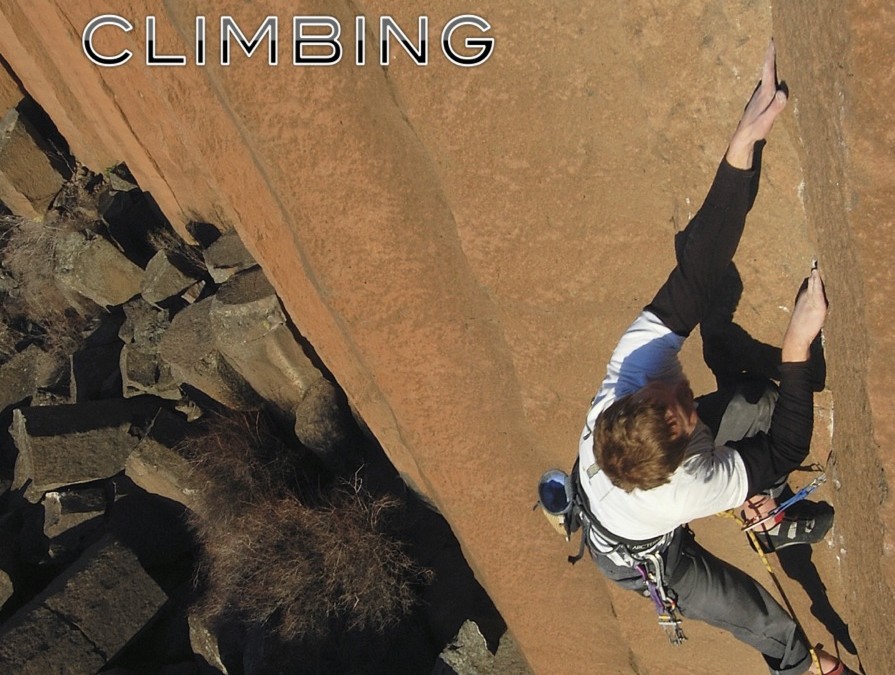
by todd | Dec 1, 2014
Kotečnik Rock Climbing
by Boštjan Božič
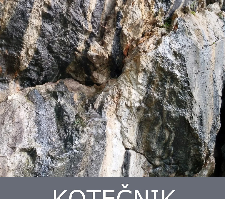
Kotečnik is Slovenia’s largest climbing area with 300+ single and multi-pitch climbs. With most of the walls hidden in the beech forest near the 3rd largest town Celje it offers a great spring to autumn nature refuge from the crowds. The crag is widely known and visited also by foreign climbers coming from all over the world to climb routes with difficulties ranging from 4b to 8c+.
The rock in Kotečnik is limestone in all shapes and forms, so visiting Kotečnik is a must for all-round climbers, even more because the walls come in variety of inclinations: slopes, smooth face vertical walls, overhangs and even roofs.
Kotečnik became of considerable importance to the international climbing community probably because the safety equipment has always been exceptionally well maintained throughout the years thanks to great efforts being invested from generations of local climbers. The vast majority of the climbs are equipped with glued bolts and anchors, so it is a sport climbers’ paradise.
The Kotečnik rakkup digital guide is made and published by local Boštjan Božič, who has been climbing the Kotečnik walls for almost two decades.
-

-
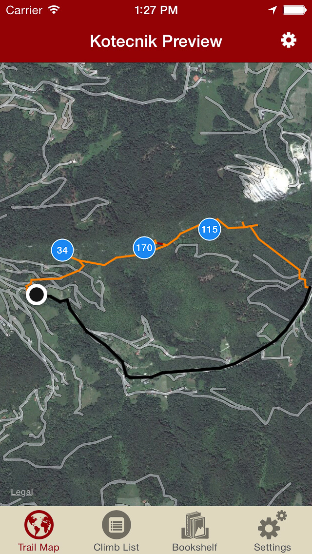
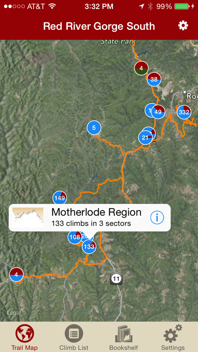
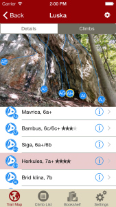
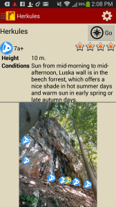
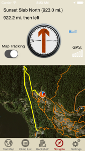
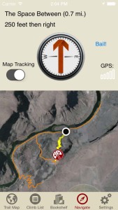
Explore Kotečnik rock climbs like they are meant to be explored via our interactive trail map.
-

-
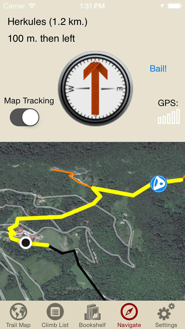
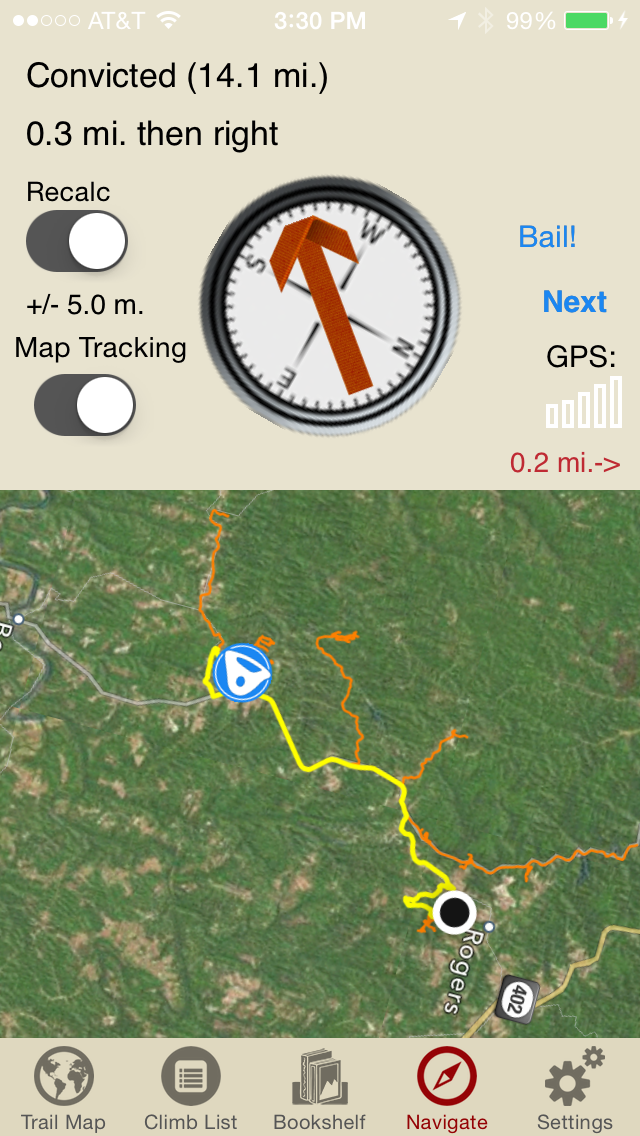
Like a local who’s been there and done that, rakkup guides you turn by turn to your rock climb.
-
-
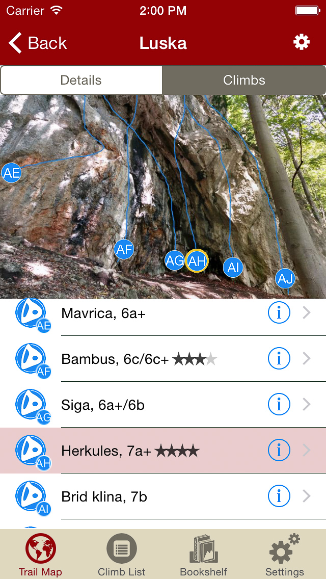
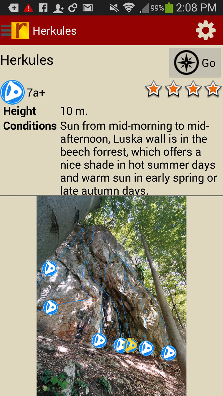
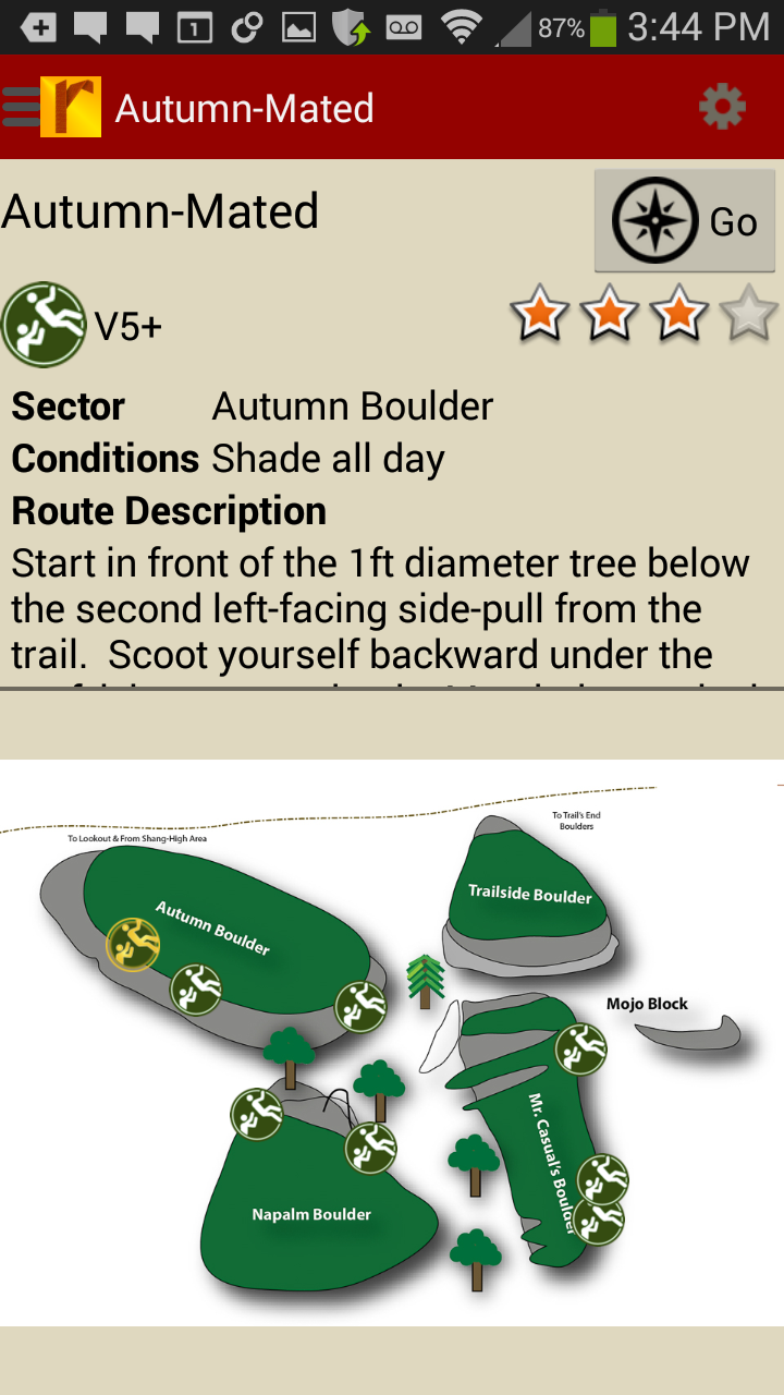
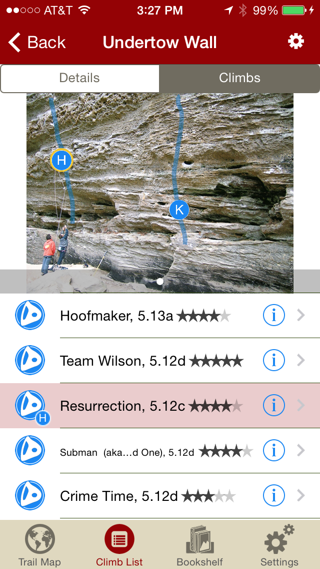
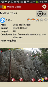
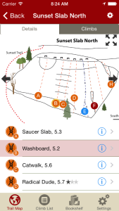
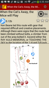
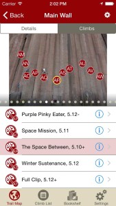
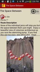
Tap on a climb to see where it’s located in the image, or tap on a bubble in the image to see what climb it is.
-

-
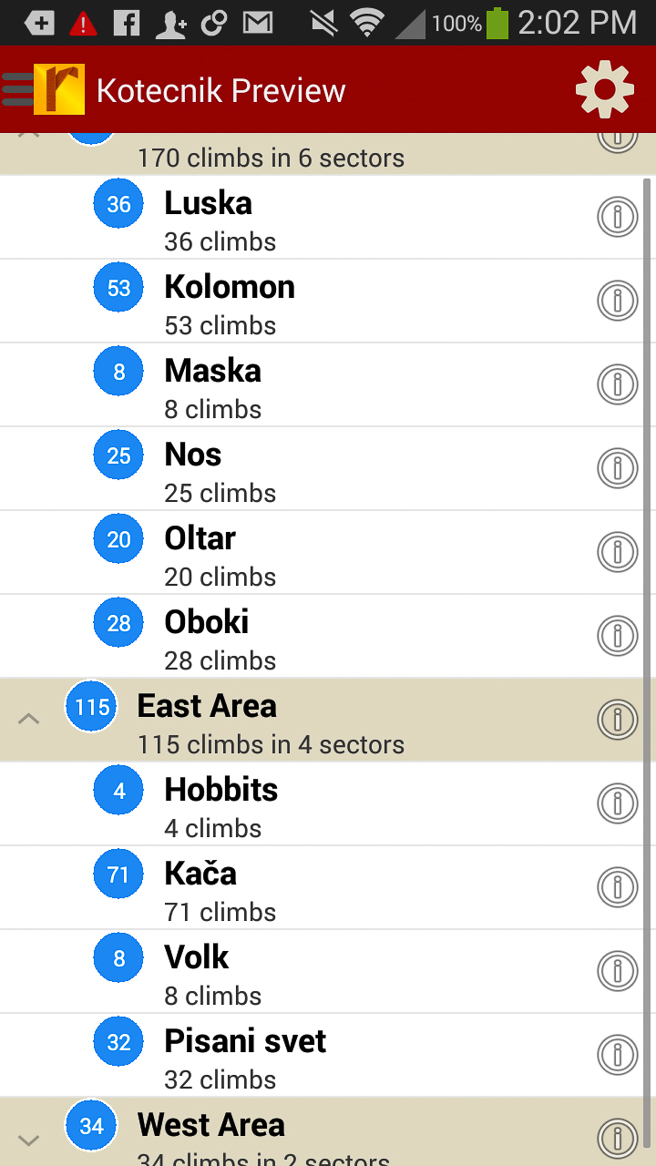
Explore Kotečnik rock climbs from a hierarchical list that can be filtered.
-

-
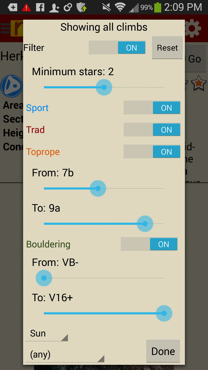
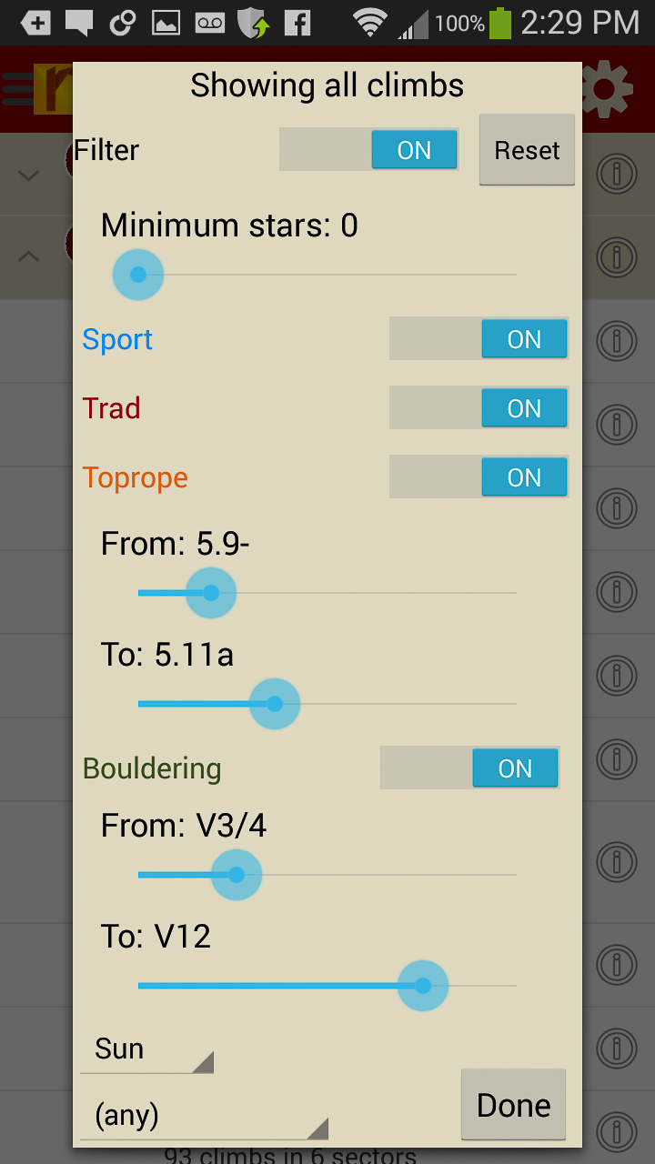
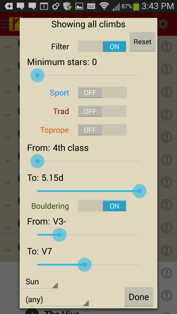
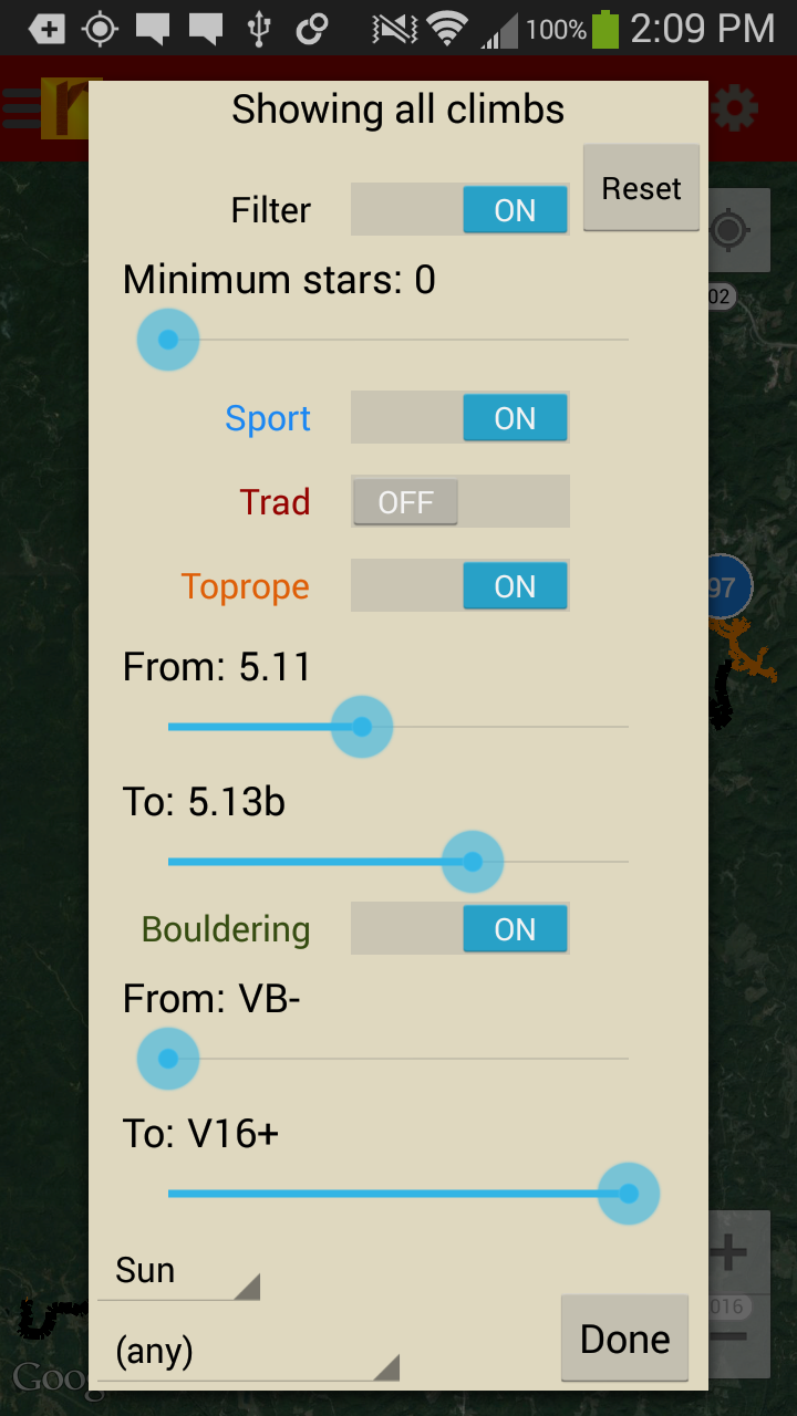
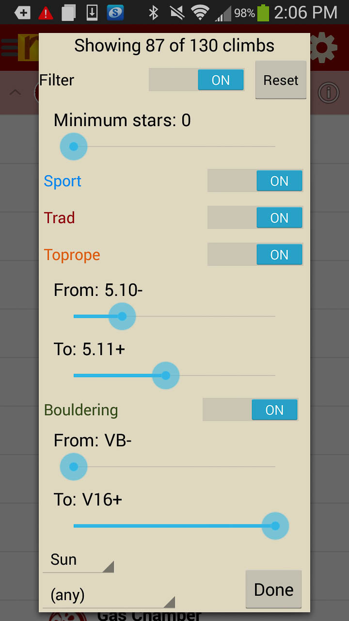
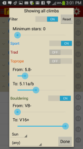
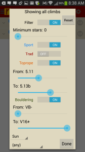
Filter your climb list or trail map by grade, quality and sun/shade times. How cool is this?
-
-
Tired of bad beta? Use local expert Boštjan Božič’s beta to get to and send your next Kotecnik project.
by todd | Oct 24, 2014
Joshua Tree Rock Climbs
Wolverine Publishing
by Robert Miramontes
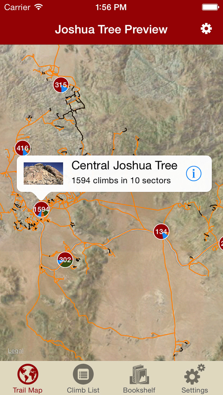
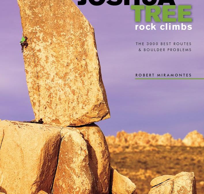
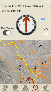
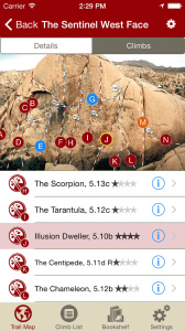
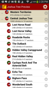
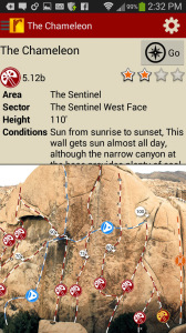
Welcome to one of Earth’s great playgrounds of stone—Joshua Tree National Park. World renowned for its bold and pure trad climbing, its monumental volume and variety of easy and moderate routes, and the other-worldly ambiance of its landscape. This digital rock-climbing guide presents the entire park, describing 3000 of the finest climbs, including several of the better bouldering circuits. The entire trail map to Joshua tree has been meticulously mapped to enable rakkup’s turn-by-turn directions from car to crag. Imagine never getting lost at Joshua Tree again. Is that even possible? It is with Robert’s Joshua Tree rakkup guidebook. The Joshua Tree trail map by itself is worth this price, let alone 3000 route descriptions with beautiful color topo images.
-

-
Imagine never being lost at Joshua Tree again. Robert’s Joshua Tree trail map will blow you away. You have to experience this trail map to understand how groundbreaking this is.
-
-
Navigate to over 3000 climbs, like Robert Miramontes was showing you the way to every crag at Joshua Tree.
-
-
Tap on a climb to see where it’s located in the image, or tap on a route bubble in the image to see what climb it is.
-
-
Explore Joshua Tree Rock Climbs from a hierarchical list that can be filtered and searched.
-

-
Filter the 3000+ climbing route list or trail map by grade, climb type, quality and sun/shade times. How cool is this?
-
-
Tired of bad beta? Use local expert, Robert Miramontes beta to send your next Joshua Tree climbing project.
Digital + print edition pricing includes $6.00 for shipping.
by todd | Oct 23, 2014
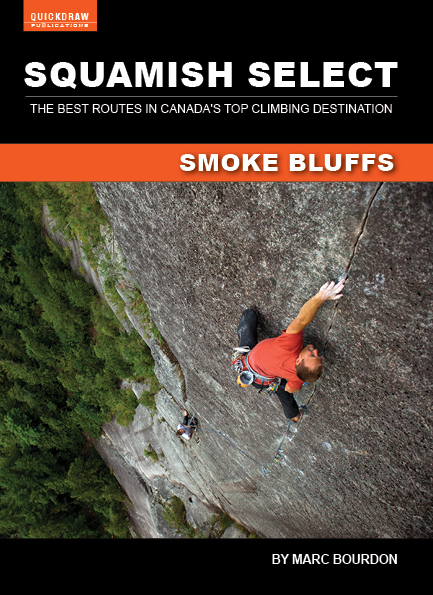
Squamish Select Smoke Bluffs
Quickdraw Publications
by Marc Bourdon
Squamish is one of Canada’s most important climbing areas and the Smoke Bluffs rock climbing lies at the centre of this spectacular region. Over 600 single pitch climbs are scattered throughout the Bluffs, all within walking distance of the city’s downtown core. The crystalline granite is perfectly suited for rock climbing and the crags boast plenty of smooth face climbs and all sizes of cracks, an ideal venue in which to broaden your repertoire. This app guide is based on our popular print book, Squamish Select, but contains more current route information. Inside you’ll find all the popular cliffs along with many new and less-travelled areas. Learn more about Smoke Bluffs rock climbing here.
-
-
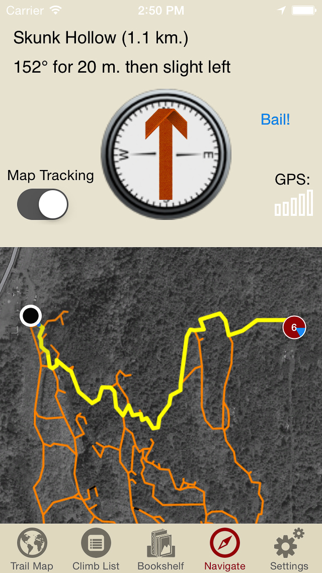
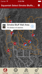
Explore Squamish Smoke Bluffs rock climbs like they are meant to be explored via our interactive trail map.
-

-
Like a local who’s been there and done that, rakkup guides you turn by turn to your rock climb.
-
-
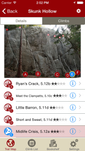
Tap on a climb to see where it’s located in the image, or tap on a bubble in the image to see what climb it is.
-
-
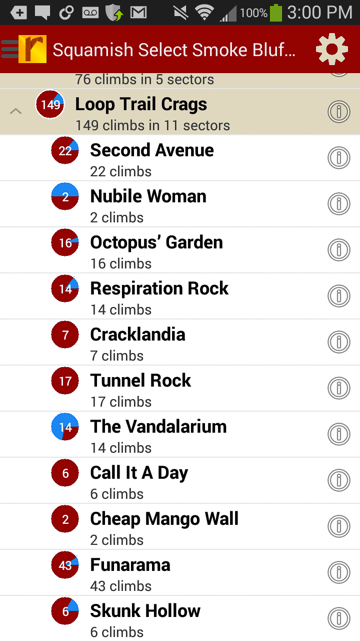
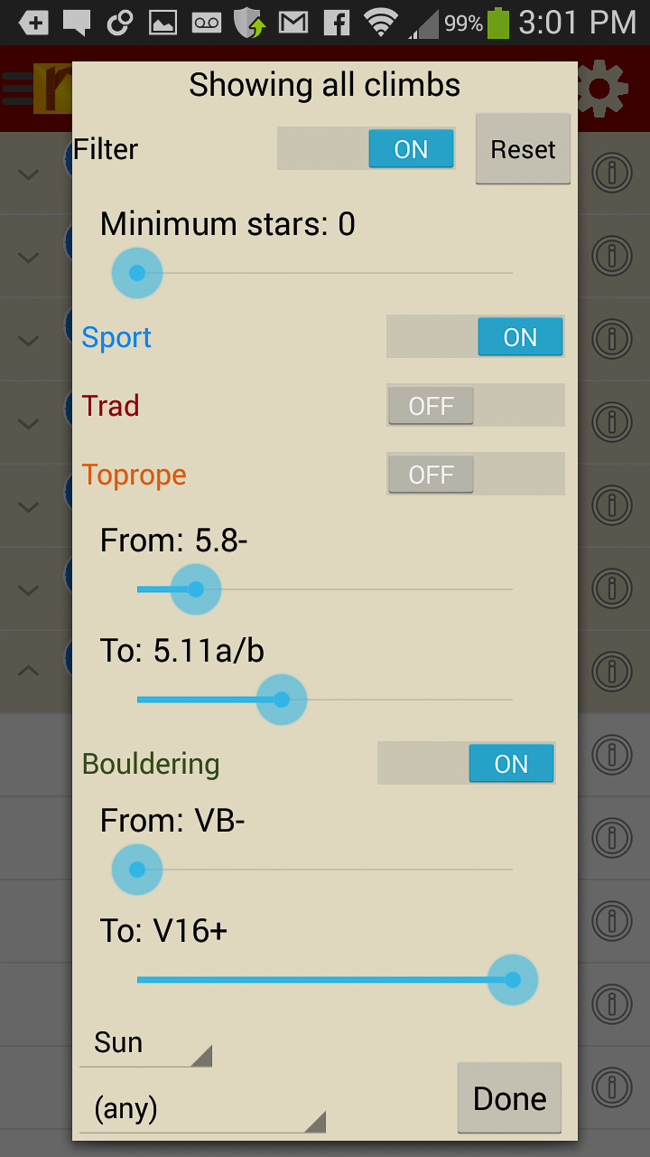
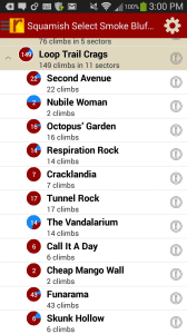
Explore Squamish Smoke Bluffs rock climbs from a hierarchical list that can be filtered.
-
-
Filter your climb list or trail map by grade, quality and sun/shade times. How cool is this?
-
-
Tired of bad beta? Use local expert Marc Bourdon’s beta to get to and send your next Squamish project.
by todd | Aug 27, 2014
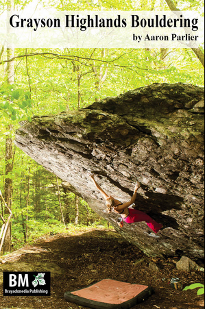
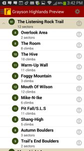
Grayson Highlands Bouldering
Brayackmedia Publishing
by Aaron Parlier
Grayson Highlands Bouldering Blog
Grayson Highlands Bouldering Facebook
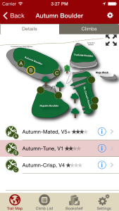
Grayson Highlands State Park (GHSP) is the uncontested crown jewel of Virginia in terms of scenery, hiking, and nearly all facets of outdoor recreation. Grayson is the best bouldering area in the Southeast. Don’t believe us? Learn why here. In GHSP there are problems ranging from easy going to V-insane. This digital guide for Android, iPhone & iPad devices has 349 of the the best problems and Aaron will be adding more problems in updates.
Print + digital bundle pricing includes $6.00 for shipping. The print guidebook sold with the “Digital + Print edition” bundle is the 2013 edition.
-

-
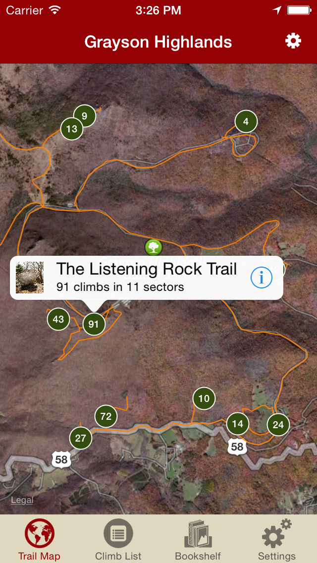
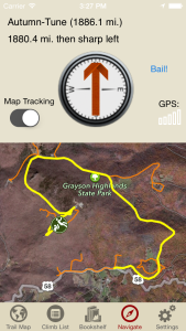
Explore Grayson like it was meant to be explored via our interactive trail map.
-
-
Then just like Aaron Parlier was showing you how to get to his latest secret problem, rakkup guides you turn by turn to your boulder then shows you a picture when you arrive. Awesome.
-
-
Beautiful hand drawn topos. Tap on a problem name, see where it’s located on the topo. Tap on a problem bubble in the topo, discover what problem it is. So nice…
-
-
Over 400 of the best problems at Grayson right at your finger tips.
-

-
Too much to handle? Sort all those problems to only the grades you want to see. Too hot? No prob, filter by in shade only.
-

-
Tired of bad beta? Use local expert, Aaron Parlier’s beta to send your next proj!
by todd | Aug 27, 2014
Rockin’ on the Rock: A Guide to Mt. Erie Climbing
by Dallas Kloke with Jim Thompson & Aaron Bryant
Mt. Erie is a diverse destination for rock climbers in Northwest Washington. From beginning top ropes, to multi-pitch trad and 5.13 sport routes, Mt. Erie has it all. This digital guide for Android & iOS devices features the best climbs on Mt. Erie. All author royalties go to the Dallas Kloke Foundation.
Buy both versions of the guidebook (print and digital) for only $40.99! That price includes $6.00 for shipping, meaning that you get the book for only $20 more! A good deal on a beautiful guidebook!
-
-
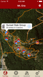
Think you can find your way around Mt. Erie without getting lost? Have you seen this trail map?
-
-
With rakkup it’s like having a local guide take you right to the base without getting lost.
-
-
Beautiful and accurate hand drawn topos. Tapping on a route bubble, identifies the climb. Tapping on a route name, identifies which topo line you want.
-
-
Filter your route list or trail map by grade, climb type, quality and sun/shade times. How cool is this?
-
-
Tired of bad beta? Our Mt. Erie beta is from Dallas Kloke, the Mt. Erie legend and pioneer that put up most of these routes.
-
-
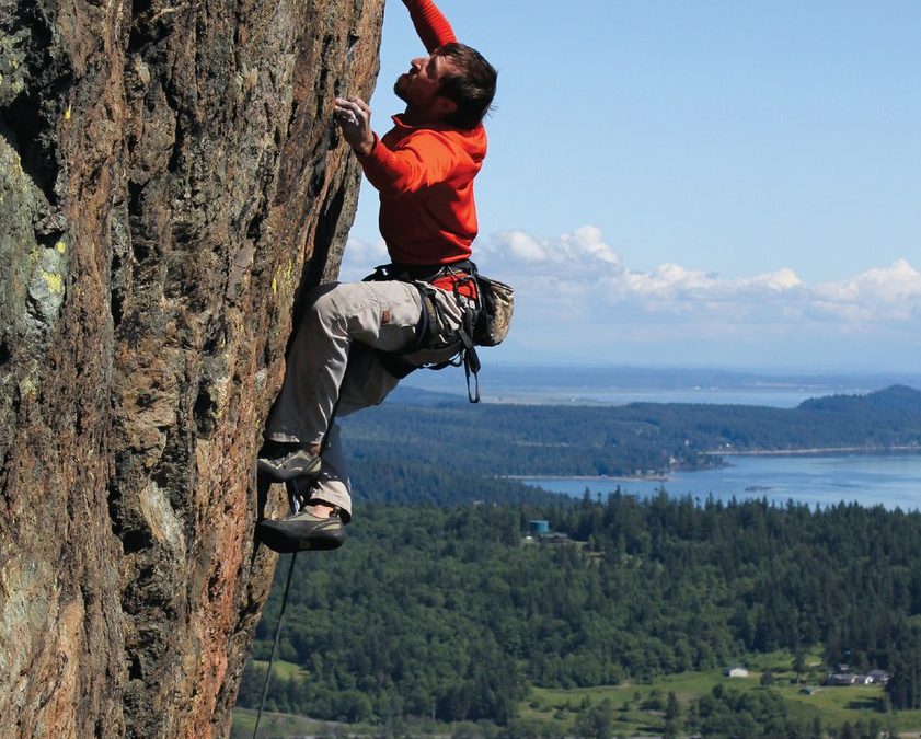
Still not enough? Well, get stoked to send the coolest routes at Erie with tons of awesome action shots!
by todd | Aug 21, 2014
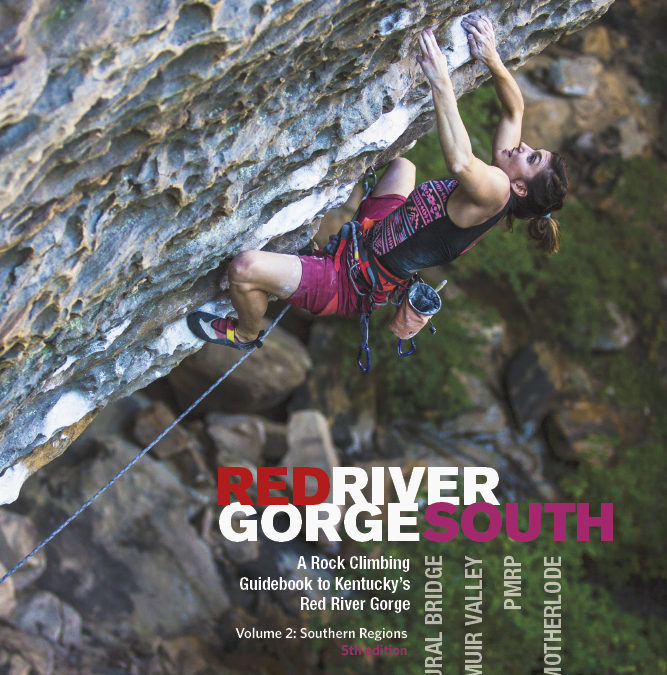
Red River Gorge South
Wolverine Publishing
by Ray Ellington & Blake Bowling
Ray’s Red River Climbing website
Red River Gorge North Guidebook
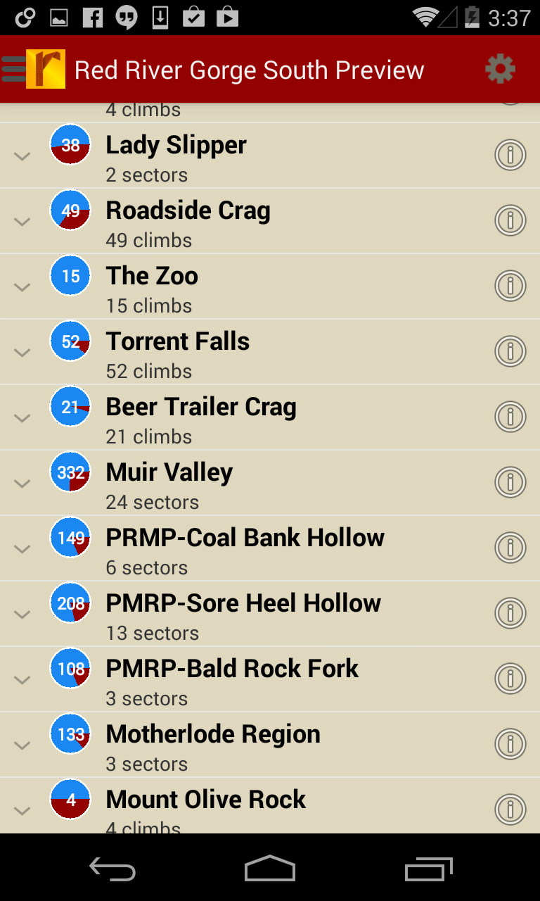
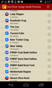
The Red River Gorge in eastern Kentucky is one of the best rock-climbing areas in the world. Its solid, well-featured sandstone makes for steep, spectacular climbing, from traditionally protected cracks to some of the hardest sport climbs in America. This digital guide for iOS or Android devices covers over 1500 of the best climbs in the southern half of the Red River Gorge, i.e those cliffs that lie south of Miguel’s Pizza and the Mountain Parkway, including those in Roadside, Torrent Falls, Lady Slipper, Muir Valley, The PMRP, and The Motherlode. The Southern Region includes most of the popular sport crags and has some of the hardest climbs in the country.
Digital + print bundle pricing includes $6.00 for shipping.
-
-
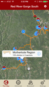
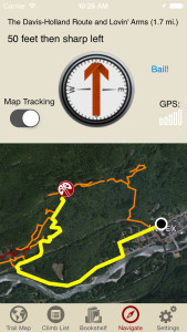
Explore the Red River Gorge like it was meant to be explored via our interactive trail map.
-

-
Like a local who’s been there and done that, rakkup guides you turn by turn to your desired climb at the Red River Gorge.
-
-
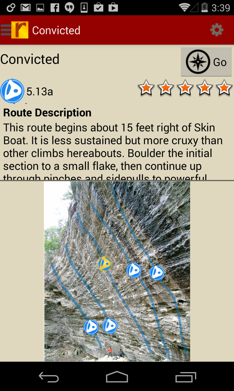
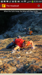
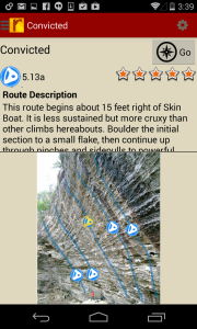
Tap on a climb to see where it’s located in the image, or tap on a route bubble in the image to see what climb it is.
-
-
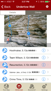
Explore the Red River Gorge climbs from a hierarchical list that can be filtered and searched.
-
-
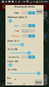
Filter your Red River Gorge climbing routes or trail map by grade, climb type, quality and sun/shade times. How cool is this?
-
-
Tired of bad beta? Use local expert, Ray Ellington’s beta to send your next Red River Gorge climbing project.
by | Jul 8, 2014
Index Town Walls
by Chris Kalman and Matt Van Biene
Most consider Index the best crag in the state of Washington, many believe it is the best crag in the country, and some even swear that Index is the best crag in the world. Now you can decide for yourself, with Index Town Walls: A Select Guide to Washington State’s Best Crag.
The Index Town Walls are a beautiful collection of granite walls in the Skykomish Valley, just outside of Seattle. The rock quality is superb, and features an incredible array of climbing types. Everything from well-protected splitters, to multi-pitch sport and trad routes, to Grade IV aid climbs, to modern-style sport clip ups can be found here nestled in among the scenic forest, river, and alpine peaks. Index Town Walls covers over 250+ of the best routes on all of the walls at Index. From old routes that have cleaned up into new-age classics, to new ground-breaking 4-star lines, this guide provides current and up to date information on a staggering selection of world-class lines.
Is Index the best crag in the world? Learn why it just might be here.
-

-
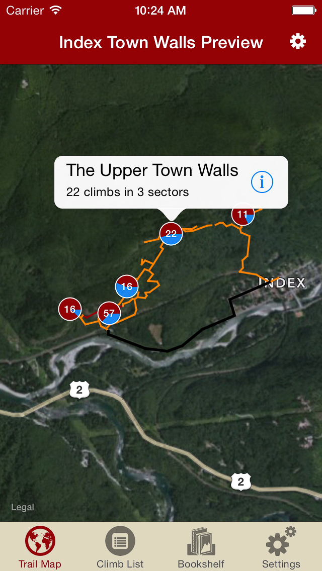
Explore Index Town Walls via our interactive trail map.
-
-
rakkup guides you car to crag then shows you a picture when you arrive. Awesome.
-
-
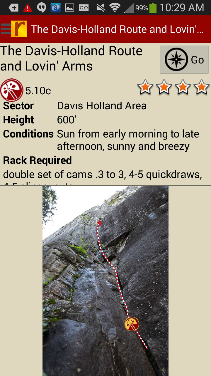
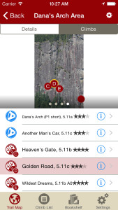
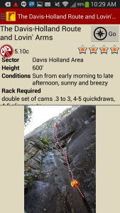
Tap on a climb name, see where it’s located on the image. Tap on a climb bubble in the image, discover what climb it is. So nice…
-
-
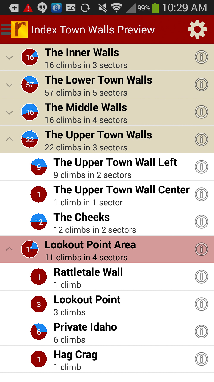
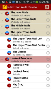
All of the Index Town Walls rock climbs at your fingertips.
-
-
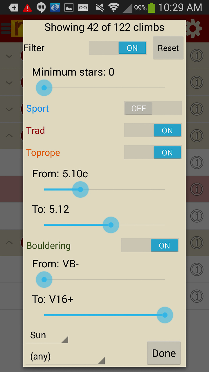
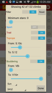
Sort climbs to only the grades you want to see.
-
-
Detailed beta to send your next proj!
by todd | Mar 17, 2014
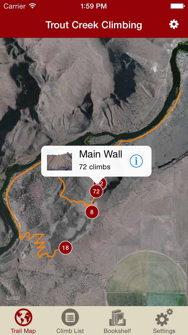
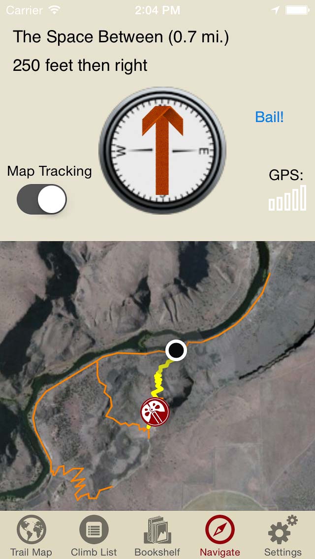
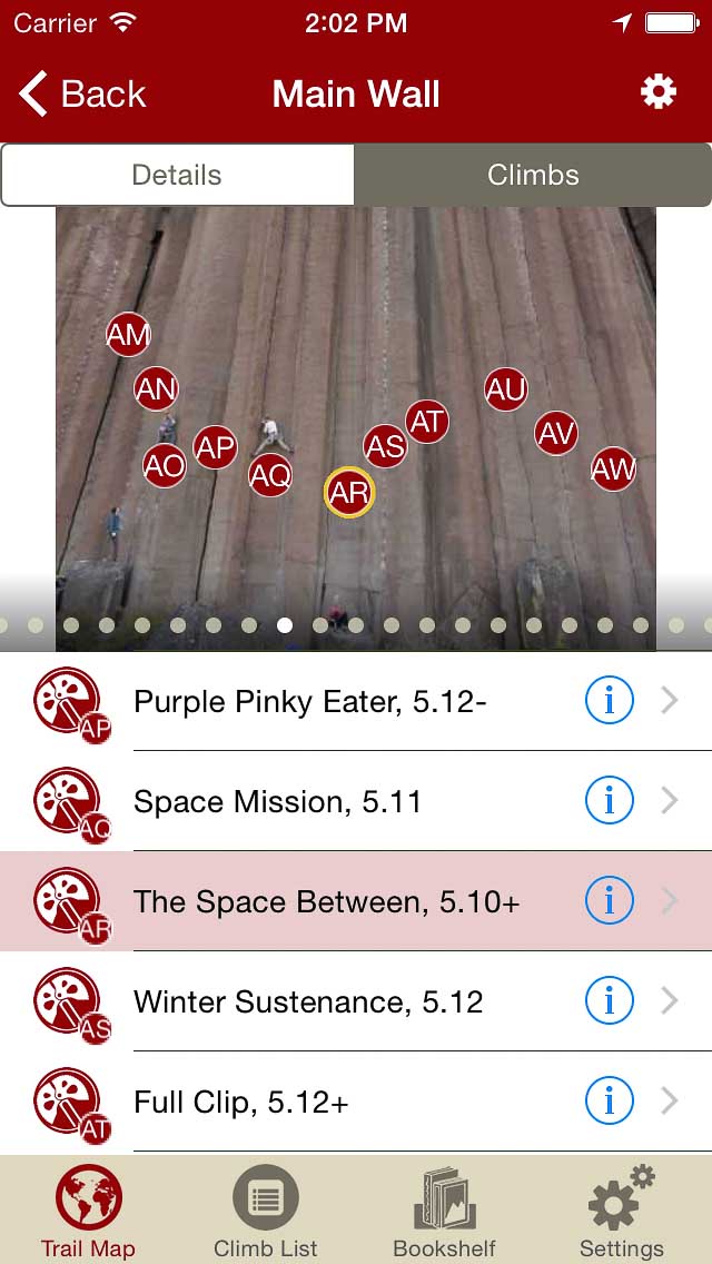
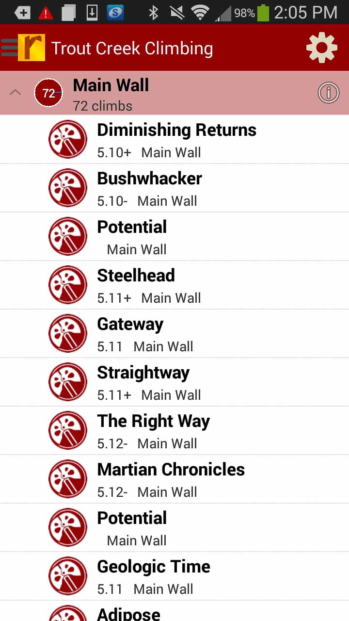
Trout Creek Climbing
by Jeff Wenger
Friends of Trout Creek Facebook
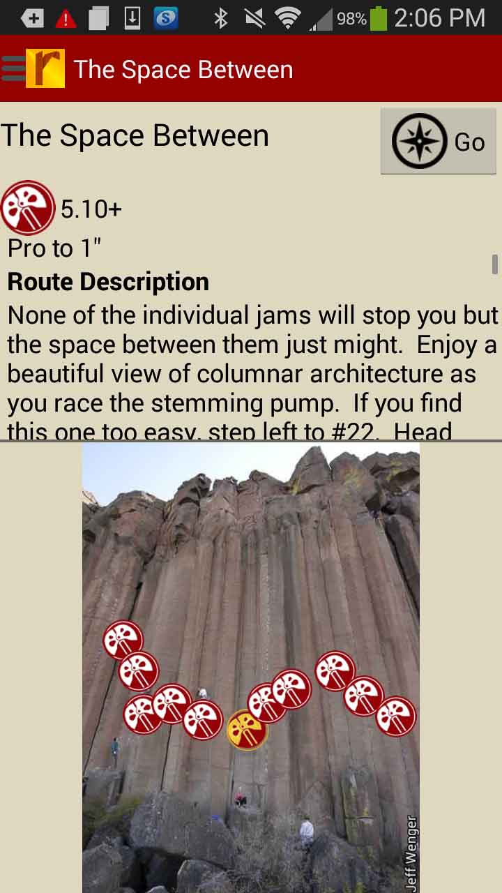
Welcome to Trout Creek, Oregon’s answer to desert crack climbing. Trout Creek is not a large area but the concentration of high quality natural lines is immense and the setting alone is well worth the hike. Positioned high above the Deschutes River the crag provides a sweeping panorama of the Central Oregon landscape and gorge framed viewing Mt. Jefferson. The highest percentage of classics come in at 5.10 and above but the spaces between the lower angle columns produce many quality 5.7-5.9 routes. With 130 routes to choose from, there’s plenty to suit every crack fans strength or weakness. The Norther End, Main, Castle & Cool Walls are included in this guidebook. Learn more about Trout’s creeks history here.
IMPORTANT: Trout Creek has a seasonal closure from Jan. 15th to Aug 15th to protect Golden Eagle habitat. During years that eagles do not nest the climbing area will open May 15th. Please observe all closures or the area could be in jeopardy of closing permanently.
2016 UPDATE: Trout Creek North & South Main Wall access is open for climbing as of May 11th, 2016, Cool Wall access is still closed.
-

-
Explore Trout Creek like it was meant to be explored via our interactive trail map.
-
-
Then just like Jeff was showing you how to get to his latest secret project, rakkup guides you car to crag then shows you a picture when you arrive. Awesome.
-
-
Tap on a climb name, see where it’s located on the image. Tap on a climb bubble in the image, discover what climb it is. So nice…
-

-
130 Trout Creek climbs at your fingertips.
-

-
Too much to handle? Sort all those climbs to only the grades you want to see. Too hot? No prob, filter by in shade only.
-
-
Tired of bad beta? Use local expert, Jeff Wenger’s beta to send your next proj!
by todd | Mar 17, 2014
Castle Rock Bouldering
by Clay Breitweiser
Castle Rock State Park and Sanborn County Park contain some of the finest sandstone bouldering and climbing in California. Just over an hour away from San Francisco, this world class bouldering area is often compared to Fontainebleau, the legendary bouldering destination in France, and its only getting better!
This guide contains over 200 boulder problems including many previously unpublished gems in little known areas, alongside many of the classics. Turn by turn, gps guided navigation lead you right to your chosen sector, where interactive overview maps and photographs assist with orientation.
Areas included: Castle Rock Boulders, Magoos, Hueco Wall, Graveyard, Parking Lot Rock, Waterfall Trail Boulders, Indian Rock Boulders, Indian Cracks, Down Under, Lost Keys, Nature Nazis, Biddles, Tree In The Wall, Road Kill Rock Boulders, X-mas Tree Farm Boulders, Trapper Boulders, The Office, and more!

by todd | Mar 17, 2014
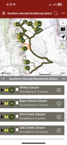
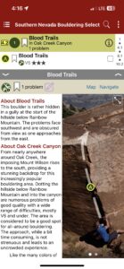
Souther Nevada Bouldering Select
Snell Press
by Tom Moulin
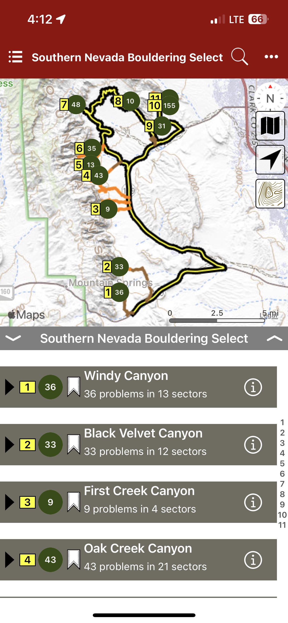
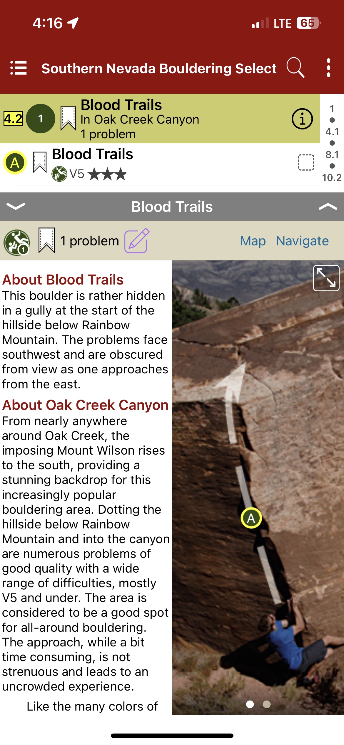
Southern Nevada & Red Rocks, long known for outstanding sport and trad climbing, boasts an impressive array of world-class boulder problems at all difficulty levels. Set amidst beautiful surroundings, the boulders offer everything from steep gymnastic problems and long pumpy traverses to under-vertical balance affairs and the crimpy lines that Red Rocks is famous for. No longer confined to the Kraft Boulders, climbers now have a wealth of problems to choose from in the Calico Hills and vast canyons of Red Rocks. This digital guidebook with car to crag navigation to every boulder is a select guidebook to the best southern nevada red rocks bouldering with 468 problems.
-
-
Map view
-
-
List view
-
-
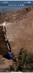
Full screen photos