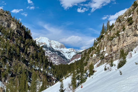
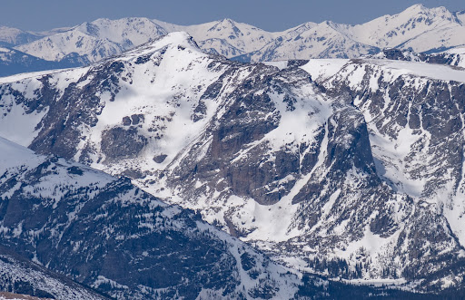
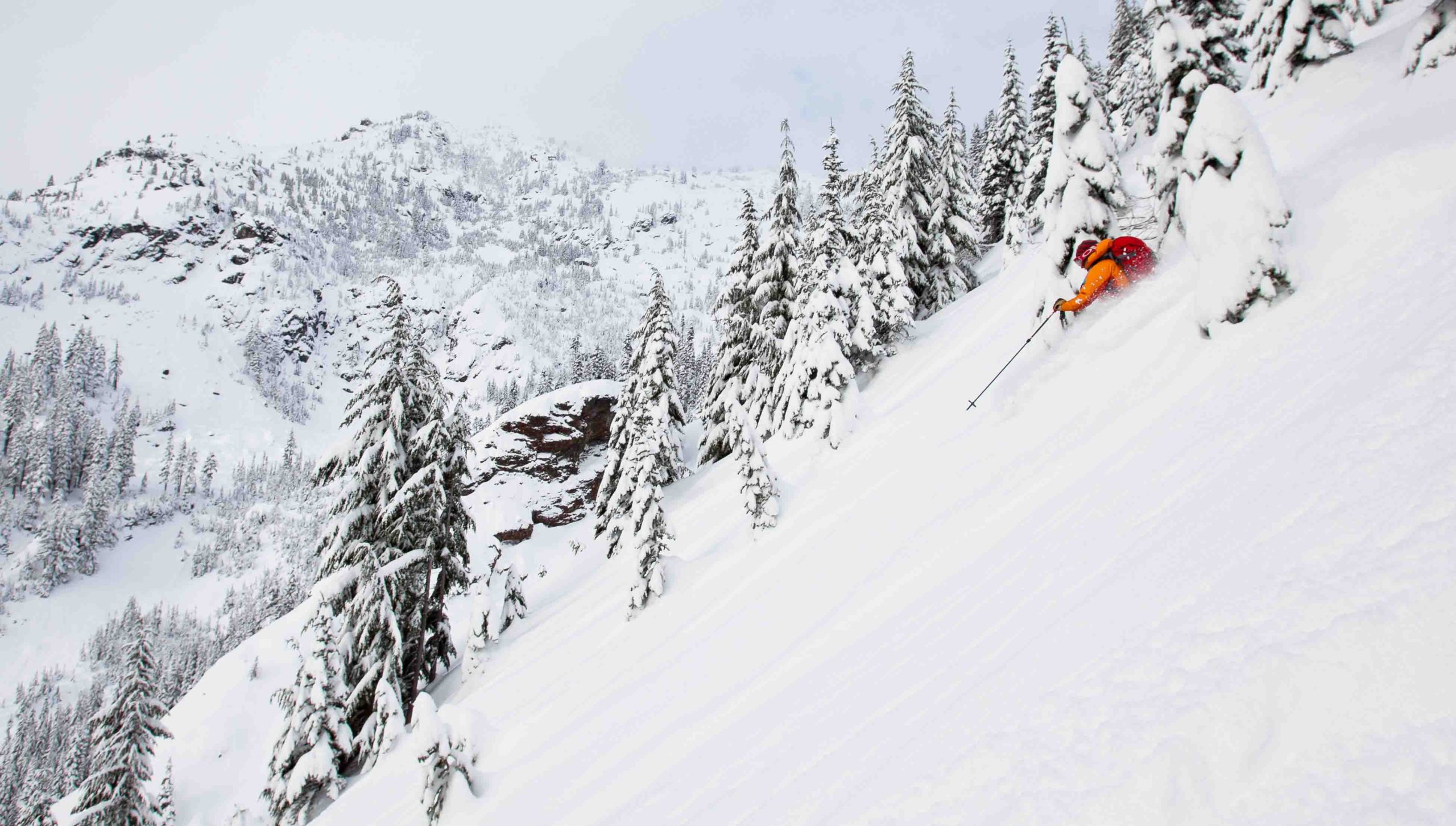
Stevens Pass is located at an elevation of 4,061’ in the Cascade Mountains in Washington. The climate on the Pass is a maritime-influenced alpine subarctic climate that experiences short and mild summers and winters with extremely heavy snowfall. The Stevens Pass Ski Area is on Cowboy and Big Chief Mountains. The pass was named after John Frank Stevens, the first non-indigenous guy to discover it. In 1890, Stevens began a survey for the Great Northern Railway. He found the pass and decided that it would be a great place for the railway crossing and today, the BNSF’s Cascade Tunnel sits 1,180 feet below the summit of the pass.
On February 23, 1910 two Great Northern Railway trains were stalled on the tracks at the tunnel station due to big storms and avalanches. Six days later, on March 1, another avalanche came and swept both trains from the track, pushing them 150 feet down into the Tye River Valley and burying the train cars in a heap of snow and other debris. This catastrophic event, known as the Wellington Disaster, killed ninety-six people. Thirty-five of those deaths were passengers and the other sixty-one were railroad employees. This is considered the most deadly avalanche and one of the worst train accidents in the history of the United States.
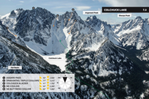
Colchuck Lake descents from Beacon’s Washington’s East Side Stevens to Snoqualmie Pass Guidebook.
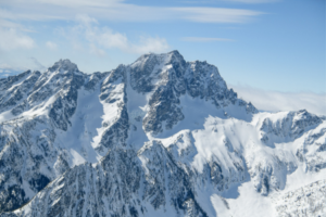
Mount Stuart
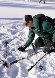
Probing
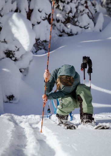
Testing
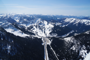
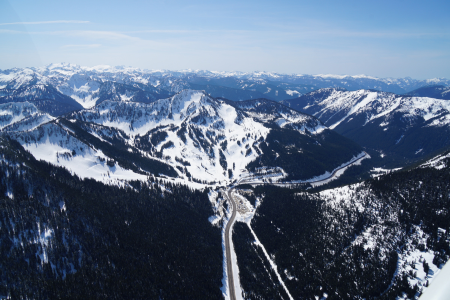
Stevens Pass Resort
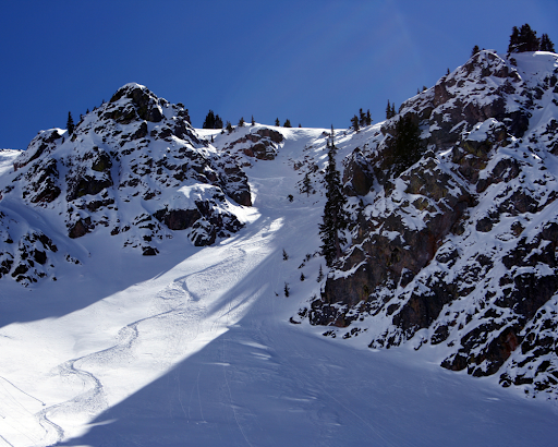
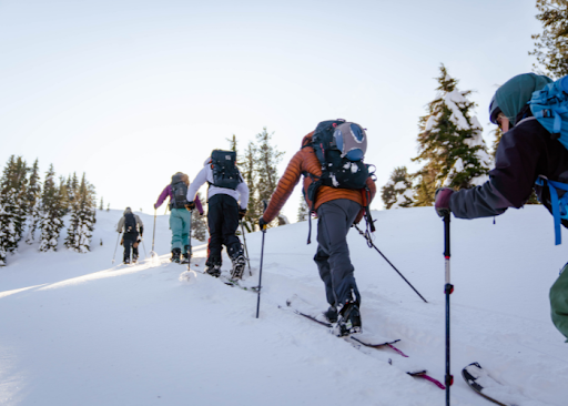
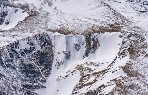
Unfortunately, this is not the only deadly avalanche to have occurred on Stevens Pass. This area is prone to avalanches and is a zone that requires attention and caution. Over a century later in February of 2012, after three feet of fresh snow had fallen, a group of 16 experienced skiers were out in the backcountry in the Tunnel Creek area when an avalanche occurred and killed three of the men that were there that day.
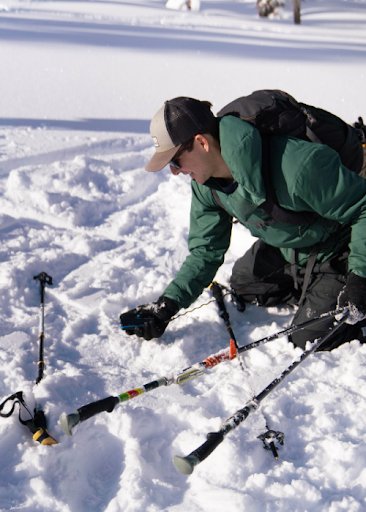
Due to the dry snow and the high avalanche risk in this zone, we wanted to remind everyone how essential avalanche training is when you’re going to be in the backcountry.
The ski resort on Stevens Pass was started by two passionate skiers on Big Chief Mountain in the winter of 1937-1938. These two men had hauled an old V8 engine, some ropes and pulleys up the mountain to build their first rope tow. Aspiring skiers had to hike six miles in if coming from the west side or take a bus if coming from the east side. Skiers from Seattle to Wenatchee and even further came to ski the mountain. Popularity increased, and by 1963 the ski area had expanded to include twelve rope tows, the lodge, a shop, and three chairlifts. Eventually, they expanded into Mill Valley, which opened up terrain on three sides of both Big Chief and Cowboy Mountain.
Ownership of the resort has passed through many hands, and has finally landed on Vail Resorts as the current owners.
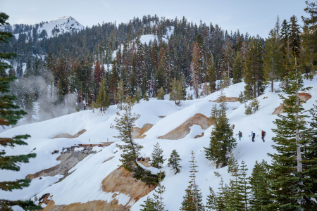
Parking on Hwy. 2 is an endangered species; it requires careful choices and planning to spot. Tunnel Creek is a no parking zone—and also an incredibly large terrain trap with a long history of accidents, as we’ve mentioned above. Parking at Stevens Pass is legal, but challenging due to its popularity and management’s lack of interest in supporting backcountry access as of this writing. Other parking on Hwy. 2 is variable and inconsistent. The Smithbrook parking lot is the only official spot to park, and even there, you may get plowed in. Follow the parking recommendations in the guidebook to decrease your chances of getting towed or plowed in.
There are some dangers and logistics to navigate in accessing this zone safely, but if done so, you’re in for a heck of a good time in some deep, fresh pow.
Being so far south in latitude and with nearly 300 sunny days a year, there’s a good chance you’ll be skiing in the sunshine in New Mexico. The snow here is unique because it is dry, cold, and powdery throughout the winter with great corn skiing in the spring. The snowpack also tends to be more consistent due to more minor temperature fluctuations than you are likely to see further north.
The Taos + Santa Fe guidebook can be divided into three geographical regions. The first is the Taos range that includes Wheeler Peak and the ski area there. The second region is the area around the Truchas Range, a lesser explored mountain. And lastly, Santa Fe and the mountain and sidecountry skiing there.
Ascending
Fresh turns, blue skies
Historical Wheeler Peak photo
The skiing history in New Mexico is rich and dates back to the late 1800s and early 1900s with prospectors trying out their skis for both practical uses and for casual fun. New Mexico is also home to what is likely the oldest-known photo of a Native American on skis. The image from around 1900, shows a man from Taos Pueblo on skis in Hondo Valley (just a few miles from Taos Ski Valley), holding one long wooden pole in lieu of the preferred two short ski poles of today.
With the advent of backcountry skiing technology, access has exploded and NM offers vast opportunities for the enthusiastic adventurer. This guidebook serves as a primer for what all is out there. There are even several abandoned ski resorts that serve as good places to ski. Generally, there is good freedom for backcountry access, but Taos Ski Valley is the exception. They don’t let you venture from the resort boundaries to out of bound terrain during the season. But, fun tip, you can ski inbounds once the resort is closed for the season because it is national forest land. The Taos Ski Valley can be found to the northwest of Wheeler Peak. Wheeler Peak (13,167’) is the highest peak in the state of New Mexico. In the 1870s, U.S. Army Major George Montague Wheeler began to make a topographic map of the southwestern United States, and this included New Mexico. After climbing the peak, he named it after himself. In fact, at least six mountains in the southwestern US are named after him. He was likely not the first to summit Wheeler Peak, but it is believed that the people of the Taos Pueblo had likely climbed it for many years before a white man came to stand on top.
In northern New Mexico lies a brilliant turquoise body of water known as Blue Lake, or Ba Whyea, which is a sacred land to the native Taos Pueblos. This is because it is believed that they were born from the waters of the lake. The settling of Taos began in 1200- 1250 A.D. and it has been a place of worship and spiritual significance since that time.
In 1906, the US Congress grabbed that land from the native people and made it part of a national forest. For 64 years, protesting ensued. These people fought to get their land back, and finally, in 1970, around 48,000 acres of land, including the Blue Lake, was returned to the pueblo. Hurray!
From the Wheeler Peak East Fork Bowl, on top of Simpson Peak, you can see Blue Lake. Admire it from afar but don’t ski off the south side of Simpson towards it; it is a sensitive area that deserves respect. For more information, look in our guidebook.
Truchas Range
Truchas Peak, in the Sangre de Cristo Mountains is a north-south running massif with four discernible summits, North Truchas Peak, Middle Truchas Peak, “Medio Truchas Peak”, and South Truchas Peak. South Truchas is the highest of the four and it is considered to be the second highest peak in the state of New Mexico at 13,108’. It is also the most southerly peak in the continental United States to rise higher than 13,000’.
Truchas Range is one of the biggest backcountry ski endeavors in New Mexico because of the unpredictability and intrinsic remoteness in every direction. Skiing in this zone should not be underestimated; it is a high commitment zone that takes serious planning and preparation. SAR is far away, there is no avalanche forecast, no ski patrol, no cell phone coverage, no paved roads, no huts. You’re out there, and you get to experience a very real sense of wilderness.
It’s a big adventure with massive payoff because of the overall reward of being in such a pristine, massive wilderness area. You likely won’t see anyone else out there or even their tracks; it is relatively untouched.
One of the first developed ski areas in NM came in the 1930s at Hyde Park near Santa Fe.
In 1949, the Sierras de Santa Fe group founded the Santa Fe Ski Basin and raised funds to build its first chairlift. The 50s and 60s saw huge changes and major developments for resort skiing in the region and it has only continued to grow in popularity since.
Ski Santa Fe is located in the Sangre de Cristo Mountains in northern New Mexico. It’s located in a beautiful alpine forest between 10,350’ (base) and 12,075’ (summit), which makes it one of the highest, and furthest south, ski resorts in the US.
Accessibility to Santa Fe is excellent during the winter season because you can take the lift at Ski Sante Fe to venture off into the backcountry and when you return, you can go back down through the resort. Check the Ski Santa Fe website for any updated rules and information. Backcountry skiing at Santa Fe is a bit more of a trek than in Taos, but not nearly as committing as the Truchas Range.
Whether you’re looking for an entirely remote destination like the Truchas Range, something full of other skiers like the Taos Range, or something in the middle like the Santa Fe Range, there’s a beautiful sunny slope waiting for you in New Mexico.
During the 1960s and early 70s, developers obtained hundreds of acres of land with the intent of building a ski resort. They planned big, including 12 chairlifts, hotels, shops and restaurants. The plan bothered many of the local residents, so in an effort to keep Marble wild and secluded, they got together and in 1972 formed the Crystal Valley Environmental Protection Association. They had a goal of preventing the development of the Marble Ski Area and protecting the local environment as a whole. They had large hurdles to overcome, like the wealthy and powerful developers and bureaucrats who were more interested in profits than planet.
The project ran into issues; the land they had obtained was mostly south-facing and would get baked in the sun all day, there were hazards that prevented home sales, questions about the adequacy of water and sewage services, and a group of citizens that voiced their concerns whenever possible. The development plans never launched due to all of these troubles and allegations of illegal land sales. In the end, only one chairlift was ever built and it only operated for one season. The developers went bankrupt after two years, and the citizens’ group won that battle and has continued to fight for the environment and protect the Crystal River ever since. They are currently working on issues like the Coal Basin methane mitigation and helping find solutions to the overuse issues occurring from the off-road vehicles on the Lead King Loop.
Historic Colorado mine
Quarry Road approach
Marble Colorado
Quarry Road
Marble is known for its beauty in more ways than one. The Yule Marble Quarry is one of the biggest marble deposits known globally. It was founded in the 1870s and was the main source of profit for the town and it is still open today. Unlike most quarries, it is not an open pit mine; the marble deposits are found underground at 9,500’ of elevation, which means carving into steep mountainsides.
In 1941, operations stopped as there was no need for marble during the war, and since steel was in short supply, the mining equipment was stripped and sold off. The quarry reopened after 50 years, in 1990. Since then, ownership has changed hands many times. In 2010, Enrico Luciani bought the mine and began shipping marble to Italy, and to other countries in Europe and Asia. Today, it’s run by Colorado Stone Quarries.
Notably, the Lincoln Memorial in Washington D.C. was built out of marble from this quarry in 1914. In 1931, Yule Quarry marble was used to construct the Tomb of the Unknown Soldier in Arlington National Cemetery. A special type of marble called Calacatta Lincoln was first discovered in this quarry and is often considered to be the finest, in terms of both quality and purity, white marble on the planet.
To help keep Marble wild and with a heavy degree of solitude, we need to follow the rules in place that keep the businesses happy and keep everyone safe.
Let’s talk logistics. Parking and road access are important components to understand before booting up.
4WD or AWD is mandatory for driving the Quarry Road (County Road 3). Note that the road is narrow and mostly one lane, it is steep and can be slick from the snow and ice. Passing a quarry truck hauling marble is very difficult. To avoid this, stop at the quarry office at the beginning of the road to find out where the truck is. A pilot car precedes the truck on each run, if you see the car, they’ll ask you to pull over to let the truck pass, please do so.
The road crosses several avalanche paths, do not drive when the risk is high. There is zero opportunity for snowmobiling from Quarry Road. All terrain accessible from the road is considered advanced and has challenging avalanche terrain, there is nothing available here for beginners.
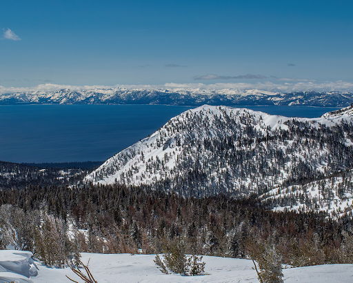
Lake Tahoe is the largest alpine lake in all of North America, sitting at an elevation of 6,225’. It is 22 miles long, has 75 miles of shoreline, and is 1,645 feet deep. It’s the second deepest lake in America, just after Crater Lake in Oregon which is 1,949 feet deep, and it is the 11th deepest lake in the world. The amount of water in the lake (39 trillion gallons) is enough to supply every person in the US with 50 gallons of water every day for five years.
The vibrant, turquoise blue waters of the lake get their color from the amount of algae present. The water is so clear that in some areas, objects can be seen at over 70 feet deep. One reason for the clarity, is that 40 percent of the precipitation falling on the Tahoe Lake Basin, falls directly onto the water. The rest of the precipitation is filtered through marshes and meadows before draining into the lake. Lake Tahoe is 99.994% pure water, making it one of the most pure bodies of water in the world.
Lake Tahoe
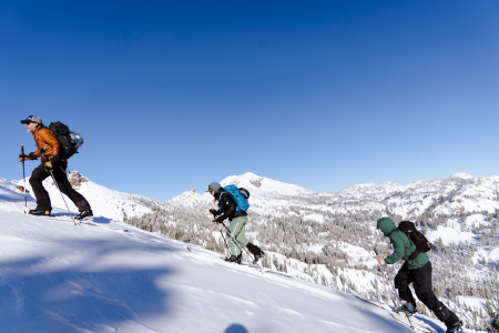
Skinning up
and up!
The lake gets its name from the Washoe Tribe of Native Americans that inhabited the lake for over 10,000 years. Tahoe means “big water” in Washo. Native Americans lived a somewhat secluded existence here until the lake was “found” by white men in 1844. The discovery went mostly unnoticed for years until Comstock Lode was found in Virginia City, Nevada. In the 1860s, Tahoe became a commercial hub because of the silver mines and railroads that were spreading out west. Because of the mining at Comstock, large-scale deforestation took place in the Tahoe Basin. The estimations of how much forest the Basin lost during this time are as high as 80%.
Over the next century, conservationists worked hard to protect Lake Tahoe. From 1912-1918, they tried to designate the Tahoe Basin as a national park, but they did not succeed. As pressures to develop the beautiful area increased in the 40s and 50s, a group was created called the League to Save Lake Tahoe in 1957. The League has been influential and imperative to the protection of the lake. They formed the Tahoe Regional Planning Agency (TRPA) which is a congressionally- approved agreement between California and Nevada to create environmental goals and take necessary actions to achieve and maintain those goals.
Granite patches on the approach.
Riding deep Tahoe pow!
We’ve talked a little about the history of the lake, but the story wouldn’t be complete without a discussion of the epic skiing that has taken place near the shores. It is said that the first people in the world to race competitively on skis were California gold miners. Miners started racing on skis during the Gold Rush in the early 1850s. The Lake Tahoe and Auburn ski clubs were early supporters and promoters of competition skiing. On Donner Summit, the Sugar Bowl was one of the first destination ski resorts in the country.
A man named Charles Nelson taught his friends how to ski in order to get around and have fun in the deep pow. He taught them how to make 7-12 foot long wooden boards that they shaped into skis and then sold for $6 in gold. The first legit, organized ski race championship in the world took place on February 15, 1867 in La Porte. The winner claimed a massive prize of $600.
In 1928, just a mile from the Tahoe Tavern at Lake Tahoe, an Olympic- size ski hill was built by a hired Norwegian man named Lars Haugen. Tryouts for the 1932 Winter Olympics were held here. The jump was named Granlibakken and was used and managed by the Lake Tahoe Ski Club.
The 30s brought huge changes as more and more people in the area began skiing and downhill or cross country racing competitively. The Southern Pacific Railway developed the Sugar Bowl, one of the first ski areas in the West. The 50s saw a dramatic increase in infrastructure that supported skiing and increased the number of people coming to the area. Today, people still flock to Tahoe to enjoy the sun and awesome pow. With crazy tours available around the state, it’s nice for there to be an option when the day calls for a light tour for one reason or another, that’s one thing that makes this book such a winner. The Light Tours of Lake Tahoe make for an incredible opportunity to explore some of the majestic wonder that this area has to offer.
For the Light Tours of Tahoe ski atlas, we identified many of the prime routes in this region that meet these criteria. For the places in our book where the skier might encounter a small, limited amount of avalanche terrain, we make a point to draw attention to it and describe it for the reader. Choosing to ski light tours doesn’t mean that you should venture out unprepared. It’s still paramount that you and your ski partners have avalanche training and are well equipped and knowledgeable.
Watching mounds of snow pile up on the ground can be exciting and intimidating for many backcountry enthusiasts. Many are eager to enjoy these spoils while they’re fresh, but the serious reality of avalanche risk can steer many away from journeying into the backcountry. The beauty of light tours is that they provide an alternative to your more challenging routes while still delivering delightful turns to those that are willing to sacrifice a greater rush of adrenaline for a lower risk option. Let’s say you’re looking to test out some of your new AT gear, or you’re heading out with a new ski partner, or a ton of fresh powder just fell and avalanche risk is high where you often ski; light tours serve as the perfect option for accomplishing any of these tasks. They may not suit the prototypical “instagram-worthy” experience that garners social media attention, but at the end of the day, no amount of likes is as valuable as one’s life.
Massive glaciers carved out the landscape that is now the third most popular National Park in the United States based on visitation. What today is known as Rocky Mountain National Park(RMNP) was first visited by humans 11,000 years ago. Spearheads and scrapers along with other artifacts shed light into this land’s past. Up until the 1700’s RMNP was a summer get-away for the Ute tribe who enjoyed the vast alpine tundras, green valleys, and turquoise lakes. Early Spanish explorers, French fur traders, and the United States Military steered clear of the intimidating mountain range up until 1843 when Rufus Sage wrote down the first accounts of the park. (NPS 2015)
Longs Peak, the guardian of the park and its highest peak reaching 14,255’ catches anyone’s eye whether they be a “ski-bum” or not as they are pulling out of Denver International Airport. The prolific diamond face and flat summit comparable to a football field make Longs one of the most well known peaks in Colorado and Rocky Mountain National Park a go-to destination for many mountain-oriented travelers. Due to its popularity and extreme terrain, more than 70 people made Longs their last climb due to hypothermia, past medical conditions, altitude related injuries, or falling.
The Diamond-Longs Peak Photo by Alex Buisse
The Elevator Shaft-Chaos Canyon
Ptarmigan Fingers-Odesea Gorge
The new RMNP ski atlas, map, and digital guidebook boasts thirteen distinct areas with a total of fifty-five runs. Of the thirteen areas, nine of them are classified as complex terrain that include high angle open terrain, intricate cliffy terrain containing steep couloirs, and/or spines that may have significant overhead hazard.
RMNP contains many classic Colorado ski lines that are outlined in the guidebook. Some of the lines that are outlined in the book are the Y couloir on Ypsilon peak (55 degrees), the Dragontail couloir in the Tyndall Gorge (55 degrees), the Elevator Shaft in Chaos Canyon (55 degrees), the Sky couloir in the Loch Vale (55 degrees), and McHenrys Notch in the Upper Glacier Gorge (55 degrees). If these grades worry you then they should! However, RMNP also contains mellower tours for those who wish to enjoy the view and keep their risk tolerance low such as Fall River South, Upper Hidden Valley, Lower Hidden Valley, and Chaos Canyon.
This past summer of 2022 a change to the Beacon Guidebook products and to the park itself happened at Hallett Peak in Chaos Canyon. A very large debris slide came free off the southside of Hallett Peak. Apartment complex size boulders slid as well as other varying size boulders and the existing snowfield. In some areas the debris ripped all the way down to the bedrock. No injuries or deaths occurred due to the slide. One of the unexpected by-products of the slide is the change in color of Lake Haiyaha from its typical clear alpine lake look to a sea-green from the “rock-flour” transported into the lake after the slide. Chaos Canyon past Lake Haiyaha is closed until further notice because there are still many active slide areas.
What is one part of the avalanche recipe that never changes? Terrain. Terrain is the only constant. With Backcountry Skiing Rocky Mountain National Park and Rakkup’s powerful planning and execution tools, you can read your run the night, week, or month before. Refer to it as you travel through the field, assess your conditions, and adjust your plan as necessary.
In December of 1972 I made my first trip up Colorado Highway 14, a winding two-lane road up from Fort Collins to cross-country ski on Cameron Pass. My old Bonna 600 edgeless wooden skis with Tempo cable bindings (borrowed from the university outing club) stuck awkwardly across the backseat of my ‘63 Ford Falcon.
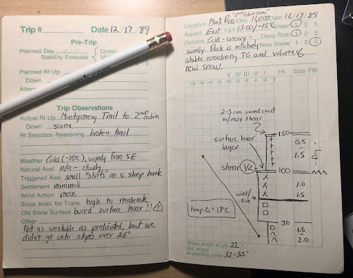
Circa 1974, sporting a genuine Scottish blaclava and the ubituitous 60:40 parka, I pose dramatically in the newly rediscovered Telemark turn position.The Lake Agnes cirque with Nokhu Crags on the left, Mount Mahler on the right. November 2021.Approaching Paradise Bowl on the east side of Nokhu Crags-circa 1985.Jana Ley and one-year-old Samuel sled tour on Cameron Pass. Winter of 1982.A page from my 1989 Snow Journal that I kept for six years on Cameron Pass. Being an early member of the CAIC development was key to my development as an outdoor leader.Rodney Ley at the top of Fourth of July Bowl above Lake Agnes, circa 1990. Note the knee-pads–still rocking the telly turn back then!
Wild and remote, Cameron Pass drew me back year after year. Although the road was not paved until 1976 and was closed in winter until 1979, the drive was always worth the effort. One attribute we Nordic skiers noticed right away was how much snow fell every year! In 1976, shortly after the road was plowed and opened for the year, I drove up and skied South Diamond Peak—perhaps the first full descent!
On the west side of Cameron Pass is the Colorado State Forest, and by 1971 the Colorado Parks and Wildlife agency had secured a lease to manage recreation. This resulted in the unusual name of State Forest State Park. With Highway 14 now open year-round the winter use of Cameron Pass began to explode—simultaneously the growth of backcountry skiing, avalanche education, and telemark ski equipment added to the excitement.
Along with many others, I began to explore as many nooks and crannies as possible in this giant winter basin. Compared to other locations along the Front Range, Cameron Pass was virtually unknown. For many years the only ski tracks I would see were those I had made the week before. Every trip was pure adventure!
Slowly the backcountry skiing scene began to solidify—South Diamond Peak became the undisputed monarch over the pass. Runs were named, faces and gullies skied. Where once only a few folks might be seen now tracks laced the slopes. By the early 1980’s it wasn’t always possible to get first tracks in the powder, so I and several hardy souls began to push into the farther reaches of Cameron Pass and the State Forest State Park. It was a time of huge growth.
In 1985 I had decided to leave the outdoor retail business and develop a backcountry ski yurt system in the State Forest State Park. Never Summer Nordic Yurts was the culmination of a10-year passion to immerse myself in backcountry skiing and guiding. We opened the first three yurts just before Christmas 1986. For a guy with two kids and a wife, it was a huge step. I also expanded my avalanche education and became one of the first avalanche observers for the Colorado Avalanche Information Center. I added avalanche education courses to my backcountry yurt business in 1987 and continued to teach those until 1992.
All good things must end, but in this case the good thing got better! I accepted a job to direct the newly founded Outdoor Adventure Program (now Outdoor Program) for Colorado State University. Over the next thirty years (1990-2020) I trained student outdoor leaders, taught academic wilderness leadership courses, and continued my personal passion for exploring Cameron Pass.
Although retired from Colorado State University, I continue to educate, inform, and inspire others to share in the beauty of Cameron Pass. With the help of the awesome crew at Beacon Guidebooks, I’m excited to be sharing that love of Cameron Pass with the publication of the ski atlas Backcountry Skiing Cameron Pass.
The smell of 2-stroke and the stoke of fresh powder on Buffalo Pass runs rampant throughout Dry Lake Campground as slednecks and hybrid skiers alike go over their gear checklists and read the updated avalanche bulletin from CAIC. The snowcam at Steamboat resort shows 8 inches of blower overnight, but the locals know of the “Fluffalo Pass” effect and expect a foot of fresh once they get to the top of Soda Mountain. Stu finally emerges from the USFS outhouse and Randy finishes scarfing his breakfast burrito from Creekside Cafe as I yell at everyone to remember why we woke up at 5am. We were the first to get our sleds off the trailer and now we are rewarded with fresh tracks on the snow road from Dry Lake all the way to our first stop at the Galaxy Drop.
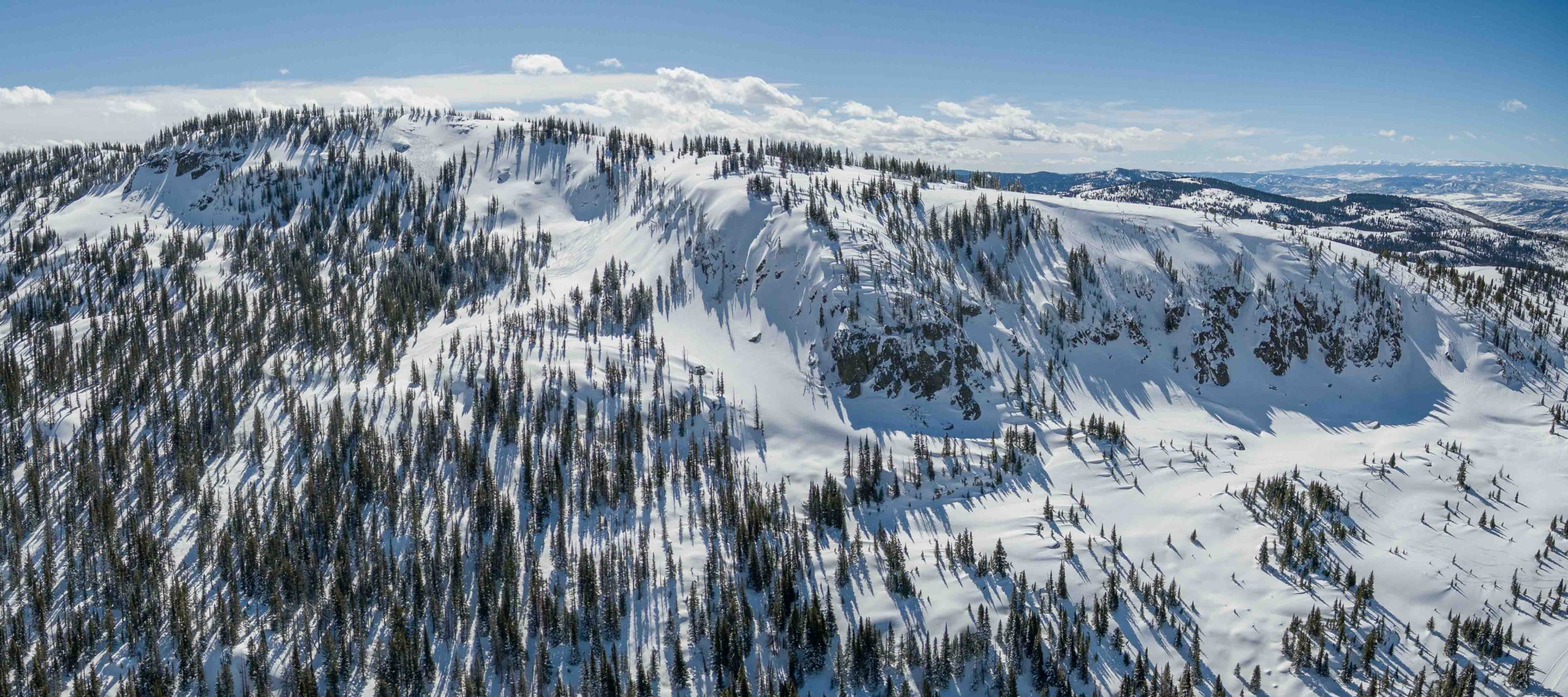
Aerial view of north Soda Mountain and the Carnival zone. Photo Alex Neuschaefer.
We shuttle a sled down to the bottom of the Galaxy Trees and ride Canadian back to the top. The buzzing of idling engines from Dry Lake is no more and all that remains is the sound of a crisp breeze amongst the quaking aspens we are about to ski. Randy comments that these are the largest aspens he’s ever seen and Stu is still wrapping his head around how the entire stand has perfect spacing between each trunk. The untouched canvas in our field of view has us channeling our inner Da Vinci and our inner Billy Kid, minus the Stetson headgear. We roll over the top and drop into our line; the silence amongst the trees is met with hoots and hollers as we revert to our childlike selves giddy with the excitement and adrenaline of feeling alive and free. As we prepare to ride Caveman back to the top, we catch our breath and gaze at our lines meandering through the trees; It may not be the Mona Lisa but it is the closest we will ever get to creating a masterpiece.
Butter for Breakfast. Photo Madie Bass.
Stu was itching to get into steeper terrain and we decided to spend the next couple of hours shredding In the Frey and South Park Ridge to our heart’s content. Eight laps later and our legs are screaming at us to take a break for just 5 minutes. In that same moment the skies rip to blue and we get our first glimpses of the day at the summit of Soda Mountain. We decide there’s no better place for a picnic on the Pass and we head uphill to take in the best views in Routt County. As we come to Zohan Point, we see a snow stake measuring 15 inches and Randy’s mouth broadcasts a shit eating grin- it looks like Buff Pass wringed out every bit of precip in northwest flow overnight. We waste no time and dedicate the rest of our day to the Carnival. After scouting from below we head back to the summit to ski our most technical terrain of the day. Steep skiing, tight chutes, and big airs summarize the second half of our amazing day on Buff Pass.
Author, Stephen Bass, looking in vain for the bottom of Buffalo Pass. Photo Ben Saheb.
We head back towards Dry Lake after a full day of skiing, but we cannot resist the urge to ski one last fun run at Fiesta. We can see the congregation at the bottom of the run of other sled skiers reminiscing about all of the face shots had on this day. We ski one more line and make sure to put on a show for the locals and tourists alike watching from Lila’s Corner as we all three throw a Daffy on the booter some guys built towards the bottom. The excitement at Dry Lake as we load our trailer back up is intoxicating. Within earshot you can hear multiple proclamations of “Best. Day. Ever.” in some iteration or another. Randy, Stu, and I rally down to Slopeside for dinner and drinks as it starts to pound snow yet again. The forecast is calling for another foot of blower overnight and our sleds are already refueled.
Backcountry Skiing Buffalo Pass Colorado by Stephen Bass was last modified: November 20th, 2023 by Bassomatic86
It’s my first time in the Cascade Mountains on skis, and the forecast is for rain. Or more specifically, the forecast was for the morning’s snowfall to turn into rain mid-day. As we skin past Source Lake, the group of locals keeps nervously talking about how the snow may turn into rain any minute. Their anxiety is contagious and I start to look up for any sign of rain too. Unlike these guys, I’m not used to this ritual of watching the thermometer dance around the “zero celcius line” like a roulette ball bouncing around your chosen number.
Anticipation on the skintrack. Photo by Scott Schell.
I’m from the mountains of Colorado, where during the winter, we have two types of winter weather: sunny, or snowy. More specifically, I’m from Gunnison, where we have two types of winter temperatures: cold, or really really cold. So, even in the era of climate change, we still don’t look nervously up to a snowstorm for signs of rain.
Climbing Snoqualmie on a clear day. Photo by Scott Schell.
But as we strip skins and debate between the Cache Couloir, Middle Child, or a simple Snow Lake descent, a cold wind picks up and kisses our faces. The snow intensifies and we all look up at each other. Matt Schonwald slowly grinning, says: “there won’t be any rain today my friends” and then he laughs a deep triumphant laugh. Schonwald and I became friends a year before this day when our mutual friend Tom Murphy, co-founder of AIARE, introduced us. I was launching a publishing company based on my ski atlas for the Crested Butte zone and Matt was looking for a publisher for the atlas he’d been dreaming of for the Snoqualmie Pass zone. Hundreds of hours and a dozen drafts later, we’d created a “first of it’s kind” atlas. And after a full year of drooling over the hundreds of aerial photos of thousands of ski lines, I took the first excuse I could muster up to fly out and ski with Schonwald and friends.
Storm skiing at its best. Photo by Matt Schonwald.
We begin crossing the aptly named Snow Lake in a total blizzard, and the snow intensifies to a rate I have never experienced in my life. The flip side of living in sunny, cold Colorado, is that we rarely see rates of more than one inch per hour, and even more rarely see a single storm produce more than twenty inches. Though Matt was not an official mountain guide for the day, I can tell his decision making and wisdom do not waiver from his hundreds of days as a guide. We begin to question our plans. What had started as a mission to maybe check out the Holy Diver or Oyster Couloir effortlessly morps into a tree mission. Though our group is big, the decision is swift: It’s dumping, conditions are changing rapidly, and the tree skiing will be all time deep! Enough said, we choose Moe Trees, and if the day would never end, I could do laps here for the rest of my life.
Snippet of the new topo map. Photo by Scott Schell.
When we finally admit that the light is fading, we head back across Snow Lake, wet, tired and delirious over what we just experienced. Our friend Truc knowingly asks me “So Andy, what do you think of the Cascades?” Laughing, I reply “well, the secret is out: your rain is incredibly white and fluffy!”
Getting submerged in Snoqualmie’s “cold white rain.”
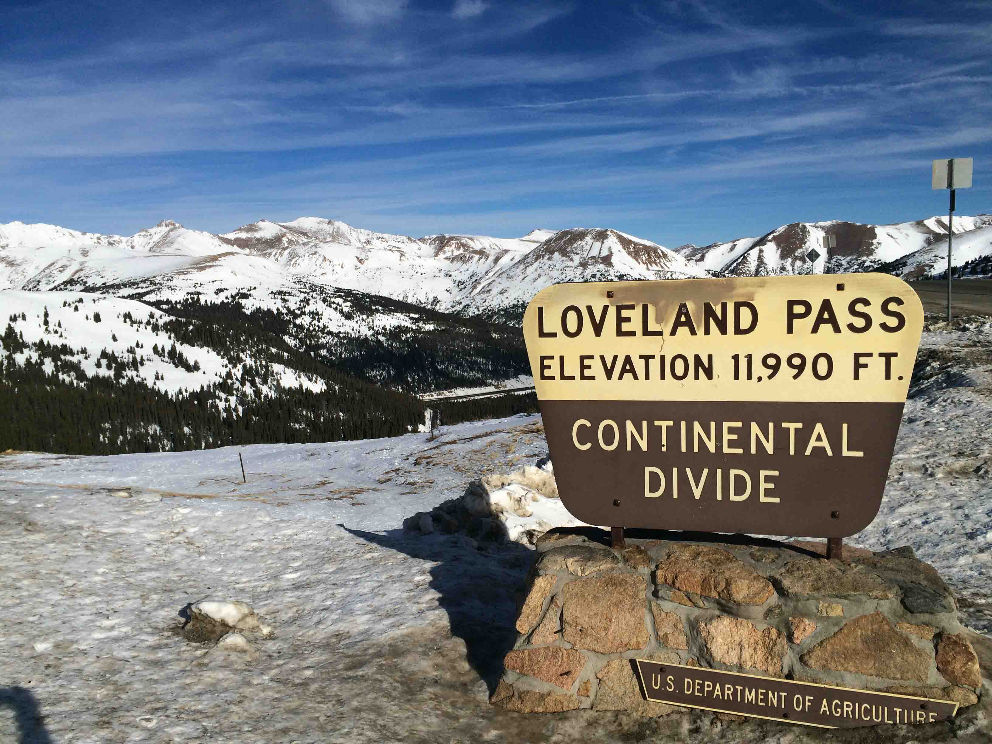
In a Denver Post Article, MacKenzie Ryan labelled Loveland Pass as “one of the best worst-kept secrets in backcountry skiing.” Skiers and snowboarders have cemented Loveland Pass’s reputation as a backcountry destination by driving up and skiing down for nearly one hundred years. Explorers went deeper into the basins surrounding the Pass, leading to mechanical rope tows in the 1930s. Loveland Ski Area opened on the north side of the pass in 1936, and Arapahoe Basin began operations on the south side in 1946. In the 1980s and 1990s, snowboarders pioneered jumps on descents like Main Line and Ironing Board long before terrain parks existed at ski resorts. Fast forward to today, and you can find a full terrain park here, including kickers and rails. Many Front Range and Summit County sliders had their first backcountry experience at Loveland Pass.
Cresting the Continental Divide at 11990 feet Loveland Pass is between Arapahoe Basin and Loveland Ski Areas
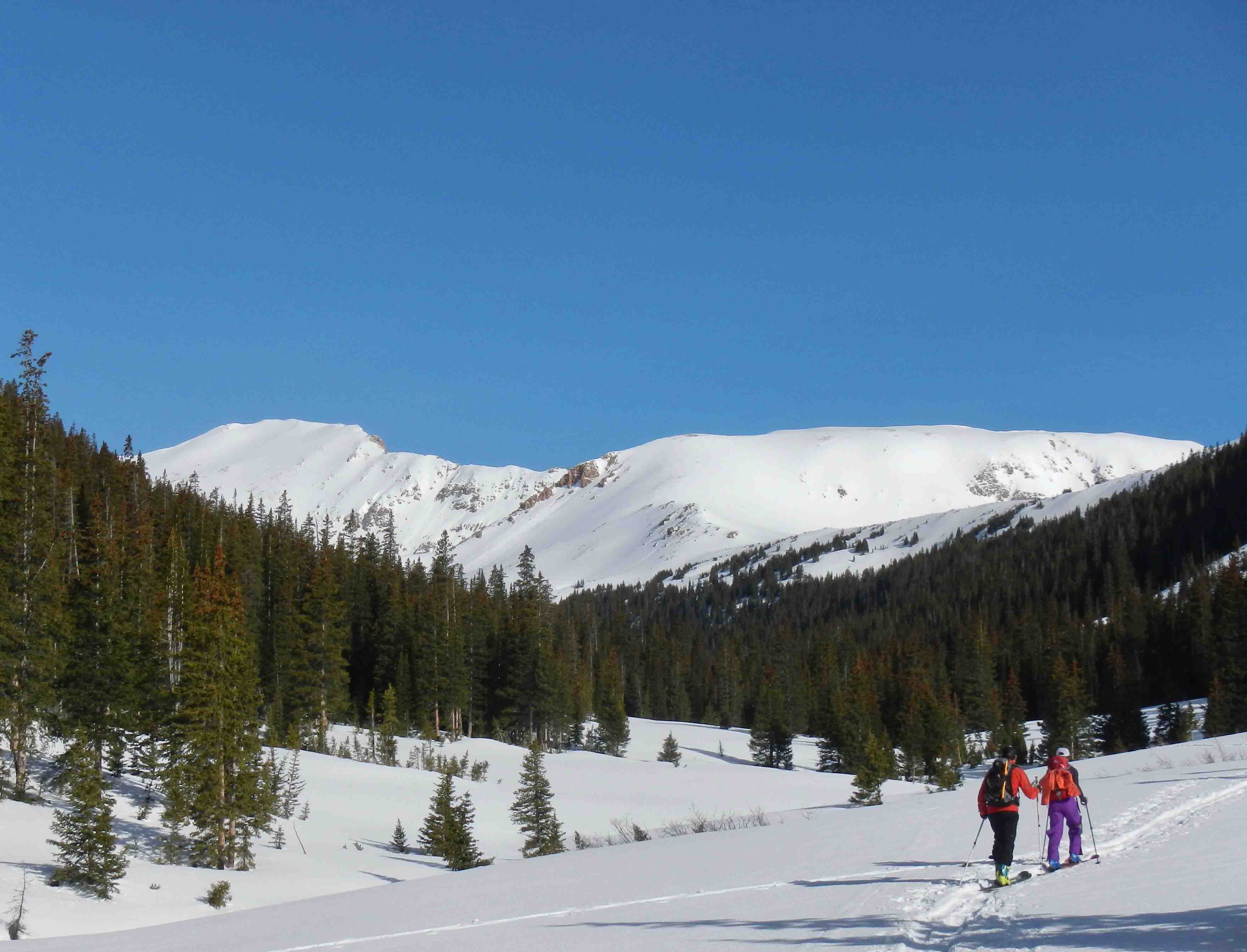
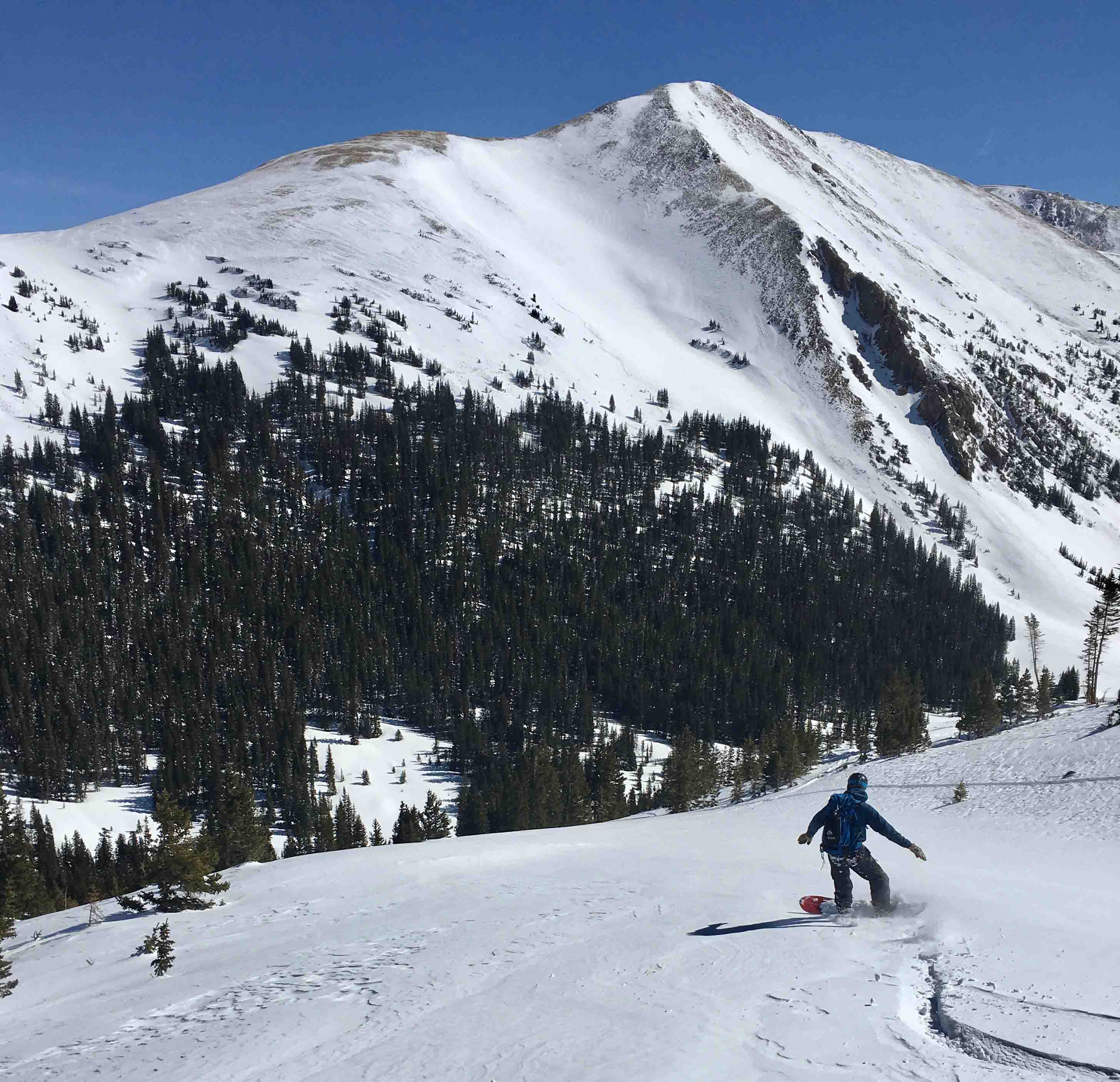
Most folks view the Loveland Pass backcountry as simply the drop-in terrain at the top of the Pass. This backcountry ski guidebook presents the opportunity to go beyond the hustle and bustle of Loveland Pass. From Watrous Gulch to Porcupine Gulch, we follow US Highway 6 as it climbs dramatically to 11,990 feet; providing trailhead access to glacial valleys holding a lifetime of winter backcountry exploration. The guidebook terrain ranges from all day ski adventures in Dry Gulch and Herman Gulch, to a new perspective on how to use the Pass’s hitchhiking resources to access valleys not visible from the Highway. Our focus is winter skiing, and we also include a sample of ski mountaineering on thirteen thousand foot peaks directly accessible from Highway 6. The onset of spring and a stabilizing snow pack lures skiers into the high alpine to seek famous descents such as Dave’s Wave and the notorious Shit for Brains couloir.
Ski touring up Herman Gulch
MacKenzie Ryan was right, Loveland Pass is one of the best worst-kept secrets in backcountry skiing. Embrace the craziness of the Pass, and become part of the history of Colorado backcountry skiing. Have fun, but keep it real in avalanche terrain. This zone is the target of online forum rants about reckless backcountry skiing, and even the subject of a study quantifying the lack of safety gear present in the Pass’s backcountry user population. You and your friends need to bring avalanche equipment, training, and the mentality for safety to ensure a great experience at Loveland Pass.
Every fall, skiers and snowboarders anxiously await the ritual of opening day at Bridger Bowl. The intricate lines incised into the mountain are a playground. As the season progresses and the snowfall begins to stack up, possibilities appear where previously only rock walls and scree fields existed. A blank canvas materializes and beckons riders to paint their own artistic vision upon it with the unique tracks they leave behind. Bridger is a special place that many people hold close to their hearts. It’s an area known for steep terrain, massive storm totals, dedicated locals and a distinct lack of commercial development in the base area. Over the generations, the lift infrastructure has changed and the ski area boundary has expanded, but the majesty and allure of The Ridge has remained the same. Although avalanche control is conducted by a professional patrol staff, a 457 khz avalanche transceiver is required to access the upper mountain. This area is the true gem of Bridger Bowl and completely devoid of grooming or trail markings. Founded in 1955, Bridger Bowl is a community institution that is managed by an association and run by a board of directors. The area itself is situated on the east side of the Bridger Mountains and benefits from orographic lift to create a micro-climate that produces legendary powder days. Buy the Bridger Ridge rakkup guidebook here: https://rakkup.com/guidebooks/backcountry-skiing-bridger-bowl/
Sam Cox in Never Never Land
Robb Gaffney gets deep in the Second Finger
Dave Sundnas soaks up some fresh snow on The Ridge
Backcountry Skiing Bridger Ridge by Sam Cox & Tavis Campbell was last modified: March 27th, 2019 by stepping_up