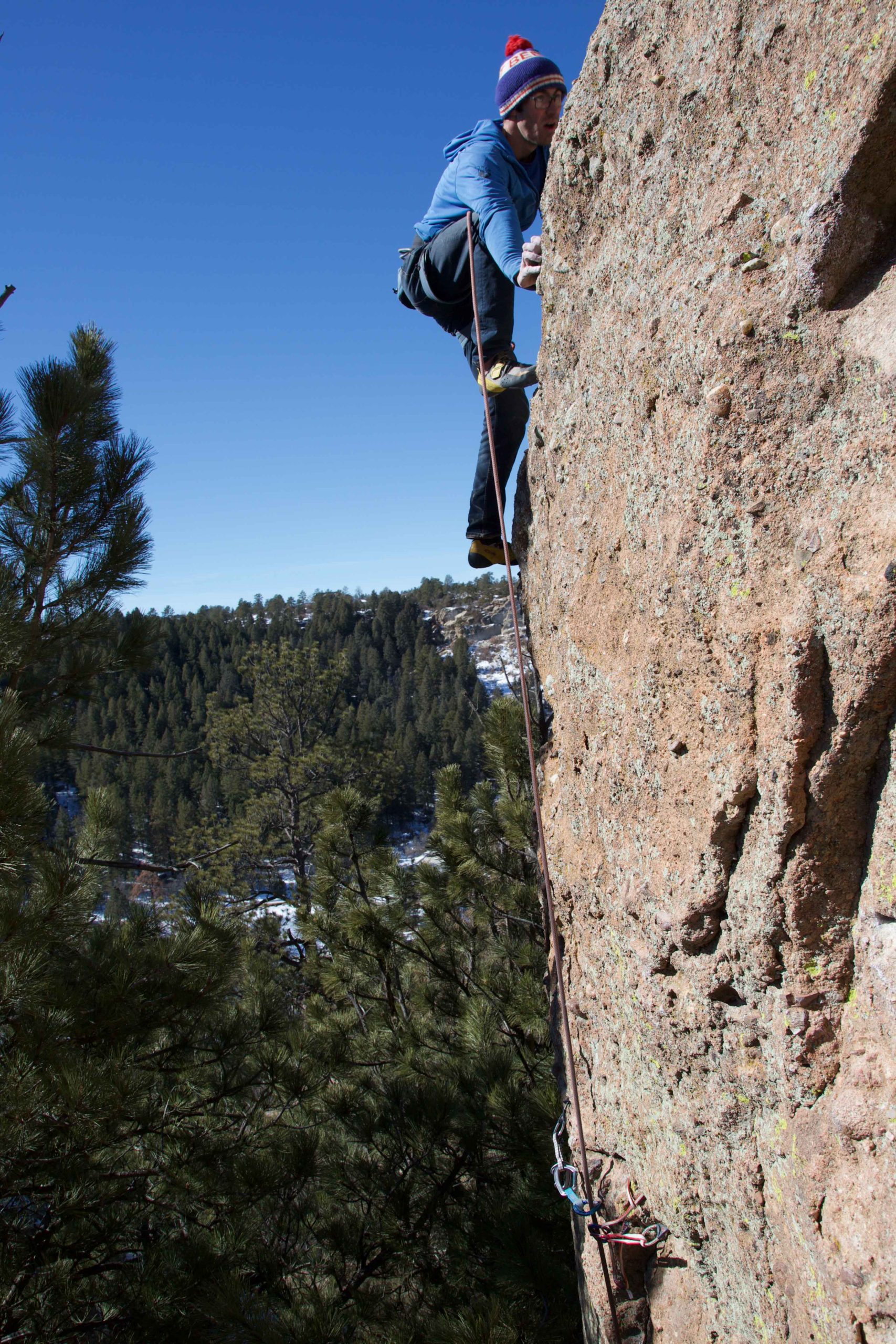
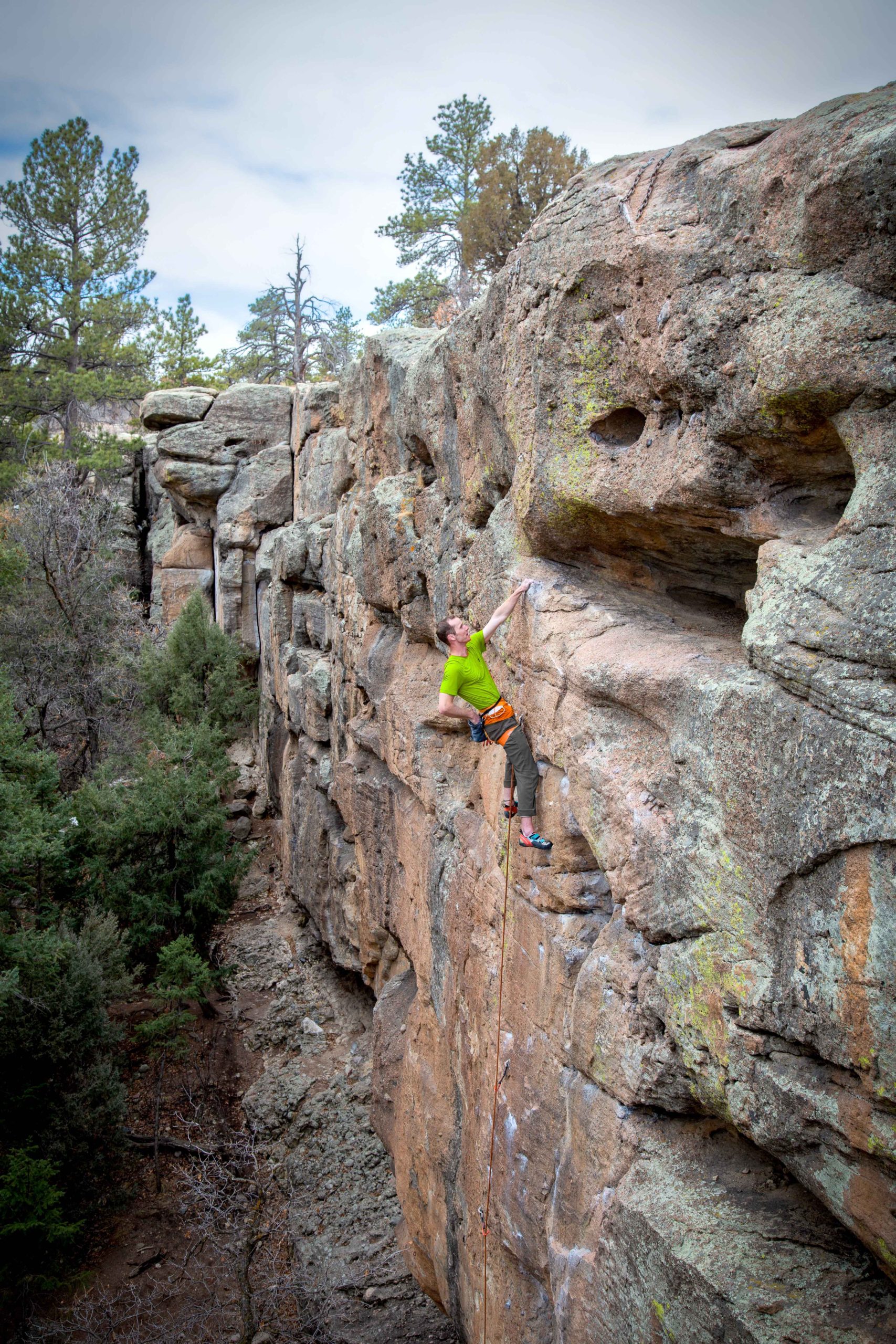
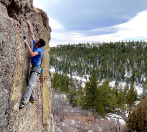
There’s a lot of places to climb in the Front Range of Colorado, but Castlewood Canyon State Park is unique among them all. The first reason is its location; Castlewood is one of the few climbing areas in the front range, that is not actually in the mountains. It sits out in the plains to the east of Castle Rock, about 45 minutes from Denver.
Mike Burdon running it out above some gear on Another World (5.11a PG13).Photo by Joe Lovin
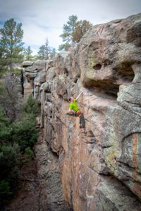
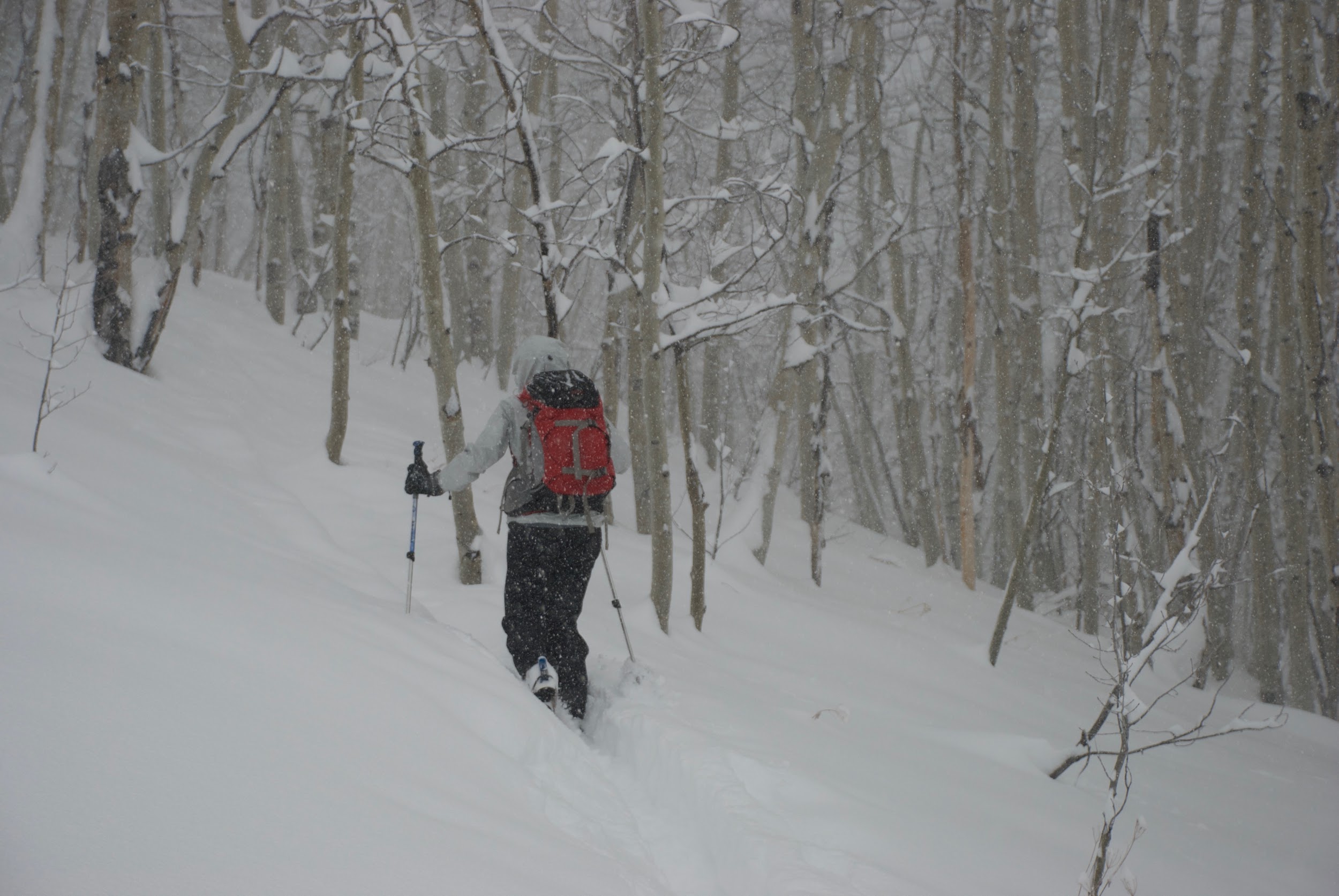
Jacob Peyton on Bozo No No (5.11b)
Joe Lovin sending The Travesty (5.12d). Photo by Mike Burdon.jpeg
Mike Burdon highballing on Daddy Cool (V2 X). Photo by Aleks Grocic
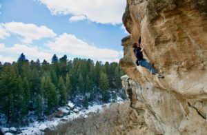
Chris Lopez on Phalloid Void (5.10c). Photo by Mike Burdon
Megan Lee on Outer Mongolia (5.10b). Photo. by Mike Burdon
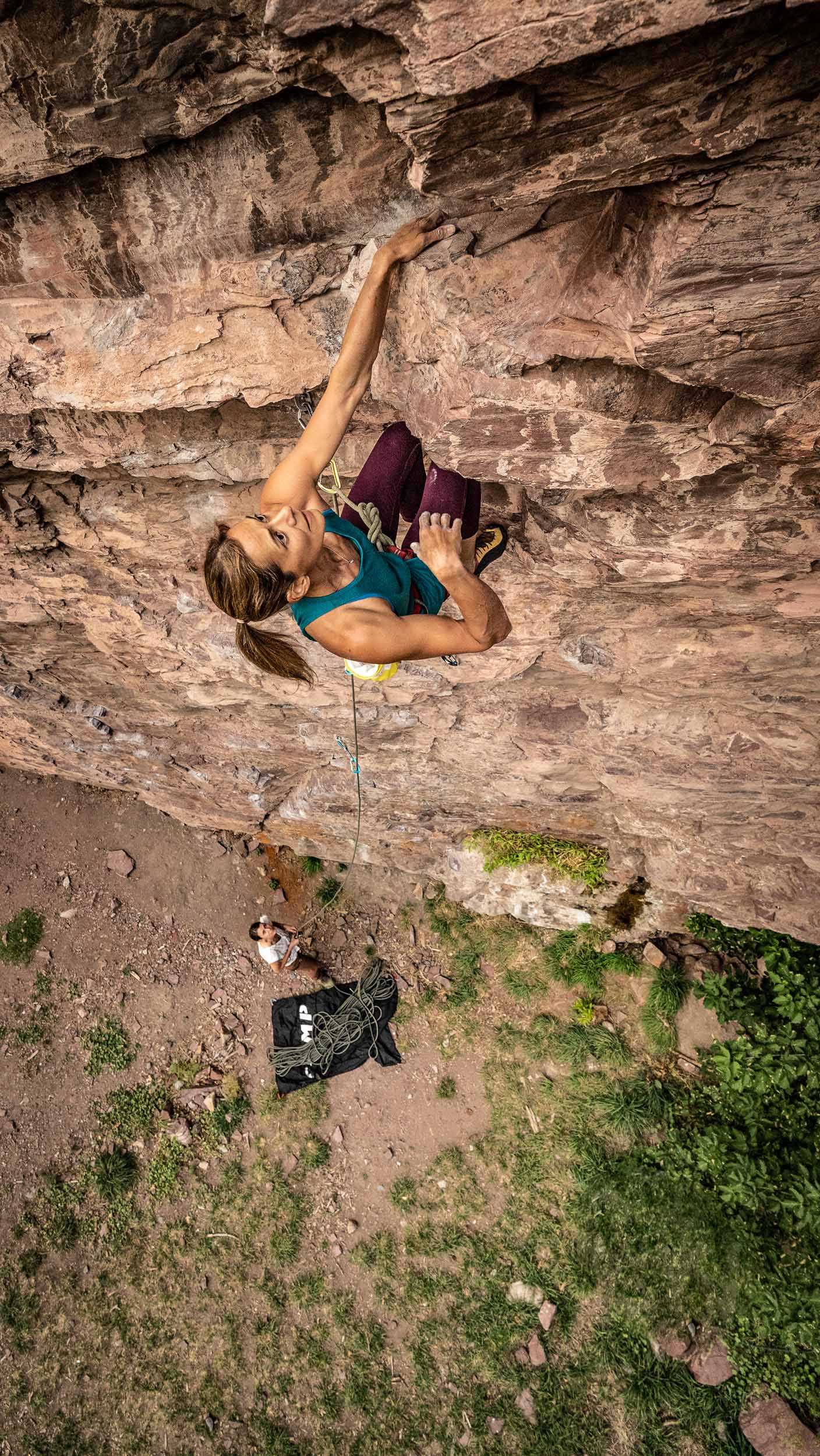
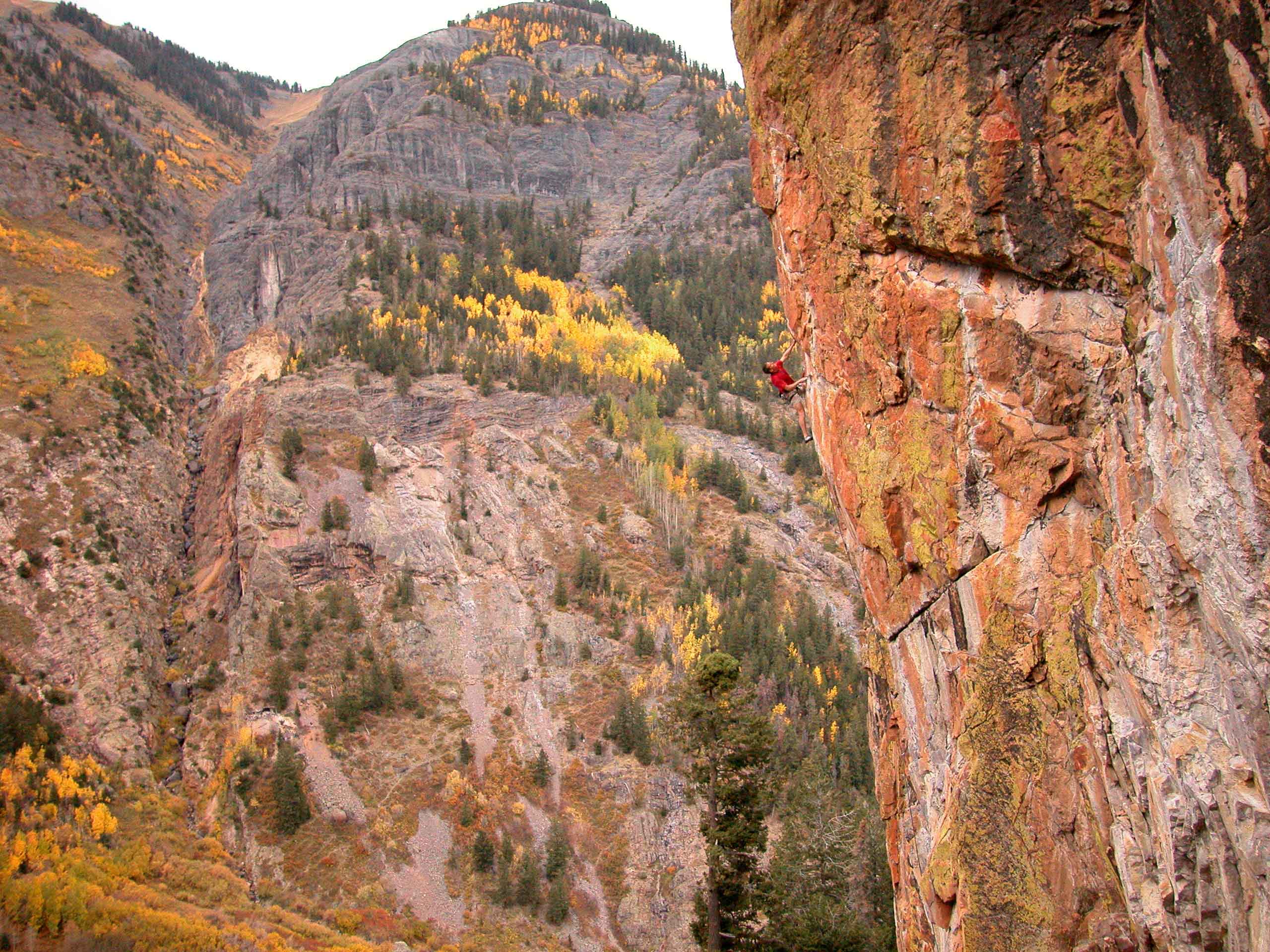
Castlewood is also unique in its rock type. While a variety of sandstones, granite, gneiss and basalt can all be found in the Front Range, this is one of the only places to climb on conglomerate. This style can be tricky at first, but super fun and rewarding for those who have spent some time with it. It involves cranking on cobbles, sinker pockets, crisp edges, beautiful alligator skin and some wild looking features!
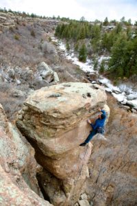
Castlewood has long been known for its bouldering, which is fantastic in both quality and quantity. As a previous guidebook author once marveled, the bouldering here is “inexhaustible!”
The more one seeks, the more one finds! But Castlewood is not only a bouldering area! There are over 130 sport routes, more than 200 trad climbs and still tons of potential for new routes of every style.
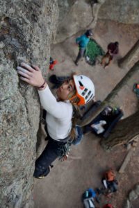
Due to its proximity to Denver, Castlewood has been a popular recreation spot for families and beginner climbers. On any given Saturday you’ll see a bunch of families toproping at the Grocery Store Wall, or the Boy Scouts out learning to rappel. Recently, however, there has also been a resurgence of more serious climbers, realizing the park’s untapped potential for new sport climbs, hard boulders and serious trad climbs. In the last year there have been many new routes developed; trad climbs as hard as 12a R, sport climbs up to 13a and boulders in the double digits! Castlewood is not just for kids.
The Wood also provides an opportunity to get off the beaten path. As crags like Canal Zone and the Graveyard are becoming increasingly overrun with the ever-growing number of Denver climbers, Castlewood Canyon remains a place of scenic solitude, where one can enjoy a quiet climbing experience away from the crowds and highways.
So whether you’re looking for some adventure and exploring, bolt protected pocket-pulling, cranking on cobbles, or a chill day in the forest, Castlewood has what you’re looking for and I hope this guidebook helps you find it.
The Wood: Climbing in Castlewood Canyon by Mike Burdon was last modified: April 20th, 2023 by makb
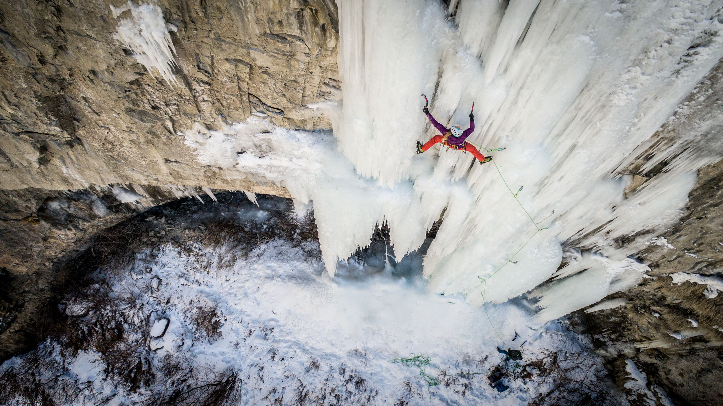
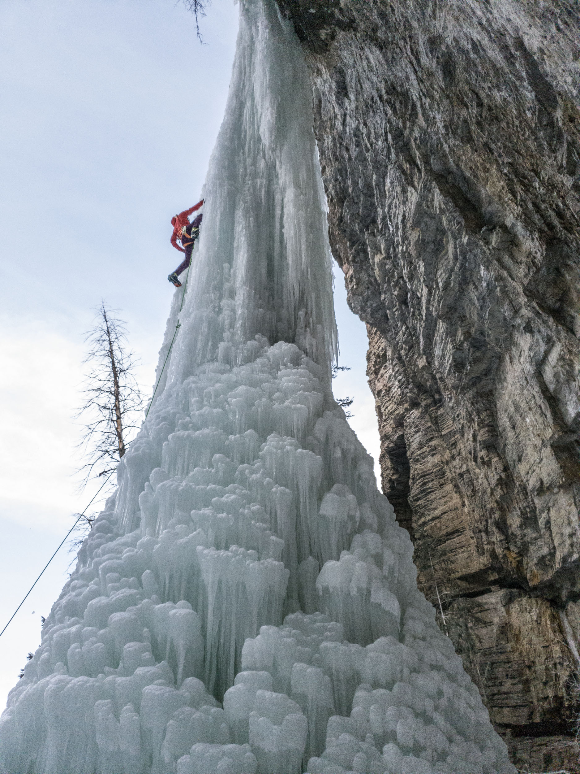
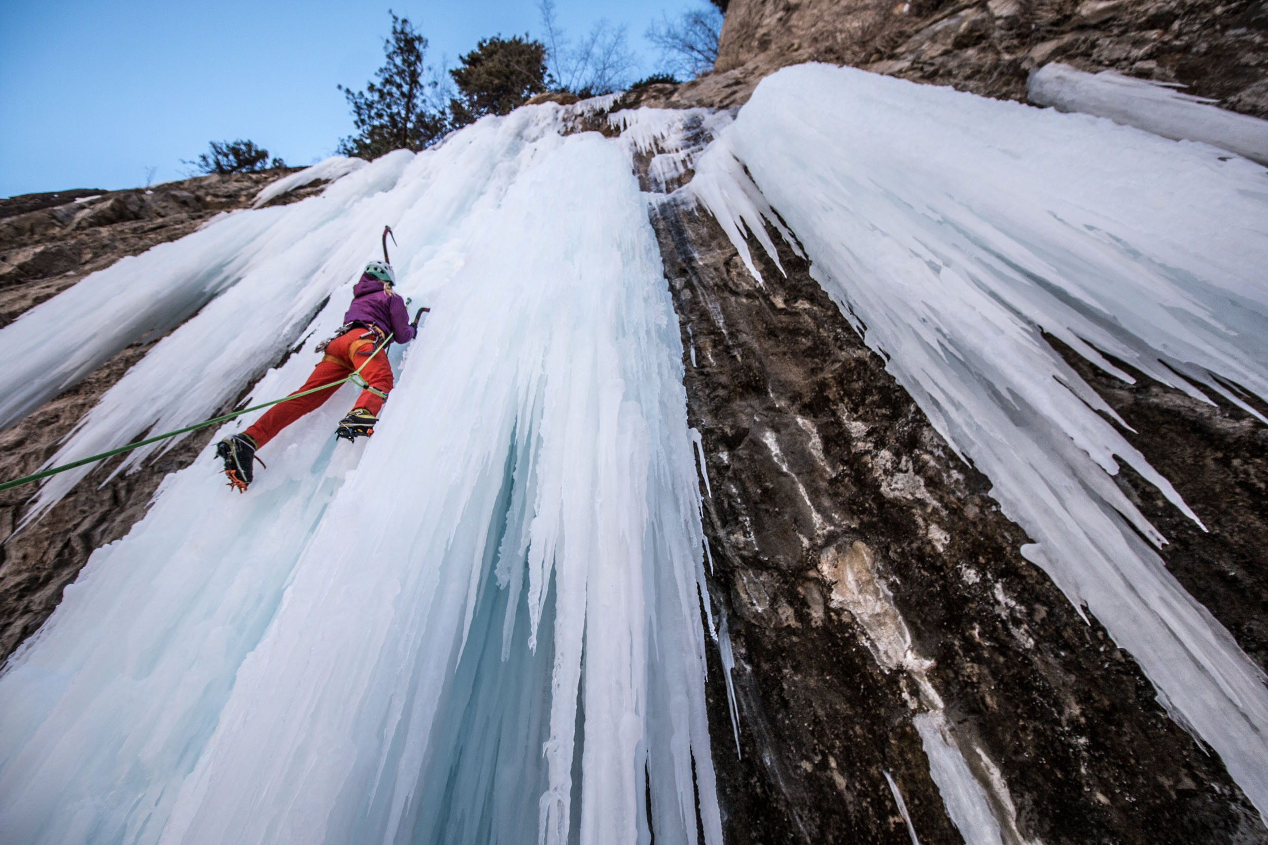
Ice climbing in Colorado is about more than just the Ouray Ice Park. The entire western slope is full of frozen gems. Suffer Candy Volume 2 picks up where Volume 1 left off with the surrounding areas to the east and north. Covering ice in the areas of Ridgway, Montrose, Unaweep Canyon, Grand Junction, Parachute, Rifle, Glenwood Springs, Aspen, Redstone, Paonia, Gunnison, Crested Butte, and Lake City, Suffer Candy Volume 2 dishes out a large swath of ice climbing. There are many undocumented and perhaps still previously unclimbed routes in this guide. I can pretty much guarantee that there are routes you have not known existed in this guide.
While there is plenty of roadside and convenient to get to climbs such as Glenwood Canyon, Rifle, and Lake City, I’ve uncovered many adventure-worthy climbs farther from the trailhead. Check out Curecanti Monster, a climb not quite as fearful as its name might suggest but hidden in the depths of the upper Black Canyon in an amazing location. There are different ways to approach “the monster”. I would consider a hike down into the canyon, followed by a pack raft paddle across the reservoir, and then four pitches of ice climbing to top off the day. Oh, then you get to reverse the sequence.
Another highlighted adventure would be the Cimarrons. Some committing 4×4 travel on snowy national forest roads (or skiing, or snowmobiling) leads you deep into one of Colorado’s most beautiful ranges. You’ll be surrounded by peaks and crazy spires of conglomerate and basalt intrusions. The landscape is incredible. Pouring out from the gullies between the spires are dreamy and steep pillars of ice. I hope you packed some sharp ice tools and strong biceps.
The development of this information has taken years. From decoding the mysteries of the Roberts and Burns guides to repeated trips to many of these areas to catch conditions where ice climbing could be a reality, the work has been endless. I’ve spent hours studying satellite imagery, consulting with fellow climbers, and cross-checking location accuracy. Existing internet information is spotty at best for these areas. I know because I’ve had to reference it.
As with Suffer Candy Vol 1, you’ll enjoy a variety of essays, inspiring full-page images, and lots of my wacky sense of humor to keep things from getting too serious. Let’s get suffering!
Liam Foster on Jedi Mind Tricks (M13), God’s Crag in Lake City, CO
Beth Goralski on Soul on Ice (WI5) Rifle Mountain Park, CO
Beth Goralski on Grizzly Creek Pillar (WI5), Glenwood Canyon
Beth Goralski also on Soul on Ice (WI5) Rifle Mountain Park, CO
Suffer Candy Volume 2: Ice Climbing in West Central Colorado by Jason Nelson was last modified: January 11th, 2023 by visualadventures
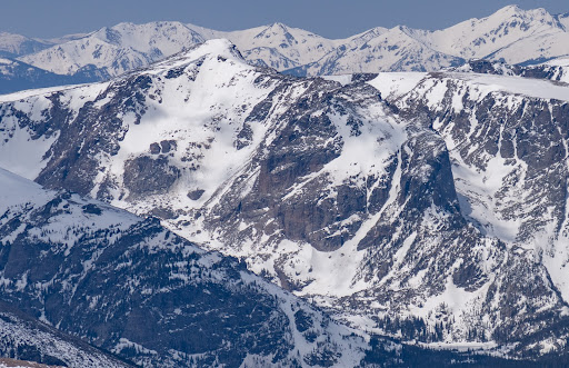
Massive glaciers carved out the landscape that is now the third most popular National Park in the United States based on visitation. What today is known as Rocky Mountain National Park(RMNP) was first visited by humans 11,000 years ago. Spearheads and scrapers along with other artifacts shed light into this land’s past. Up until the 1700’s RMNP was a summer get-away for the Ute tribe who enjoyed the vast alpine tundras, green valleys, and turquoise lakes. Early Spanish explorers, French fur traders, and the United States Military steered clear of the intimidating mountain range up until 1843 when Rufus Sage wrote down the first accounts of the park. (NPS 2015)
Longs Peak, the guardian of the park and its highest peak reaching 14,255’ catches anyone’s eye whether they be a “ski-bum” or not as they are pulling out of Denver International Airport. The prolific diamond face and flat summit comparable to a football field make Longs one of the most well known peaks in Colorado and Rocky Mountain National Park a go-to destination for many mountain-oriented travelers. Due to its popularity and extreme terrain, more than 70 people made Longs their last climb due to hypothermia, past medical conditions, altitude related injuries, or falling.
The Diamond-Longs Peak Photo by Alex Buisse
The Elevator Shaft-Chaos Canyon
Ptarmigan Fingers-Odesea Gorge
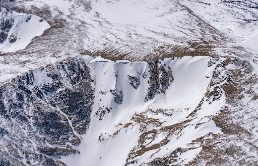
The new RMNP ski atlas, map, and digital guidebook boasts thirteen distinct areas with a total of fifty-five runs. Of the thirteen areas, nine of them are classified as complex terrain that include high angle open terrain, intricate cliffy terrain containing steep couloirs, and/or spines that may have significant overhead hazard.
RMNP contains many classic Colorado ski lines that are outlined in the guidebook. Some of the lines that are outlined in the book are the Y couloir on Ypsilon peak (55 degrees), the Dragontail couloir in the Tyndall Gorge (55 degrees), the Elevator Shaft in Chaos Canyon (55 degrees), the Sky couloir in the Loch Vale (55 degrees), and McHenrys Notch in the Upper Glacier Gorge (55 degrees). If these grades worry you then they should! However, RMNP also contains mellower tours for those who wish to enjoy the view and keep their risk tolerance low such as Fall River South, Upper Hidden Valley, Lower Hidden Valley, and Chaos Canyon.
This past summer of 2022 a change to the Beacon Guidebook products and to the park itself happened at Hallett Peak in Chaos Canyon. A very large debris slide came free off the southside of Hallett Peak. Apartment complex size boulders slid as well as other varying size boulders and the existing snowfield. In some areas the debris ripped all the way down to the bedrock. No injuries or deaths occurred due to the slide. One of the unexpected by-products of the slide is the change in color of Lake Haiyaha from its typical clear alpine lake look to a sea-green from the “rock-flour” transported into the lake after the slide. Chaos Canyon past Lake Haiyaha is closed until further notice because there are still many active slide areas.
What is one part of the avalanche recipe that never changes? Terrain. Terrain is the only constant. With Backcountry Skiing Rocky Mountain National Park and Rakkup’s powerful planning and execution tools, you can read your run the night, week, or month before. Refer to it as you travel through the field, assess your conditions, and adjust your plan as necessary.
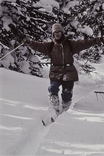
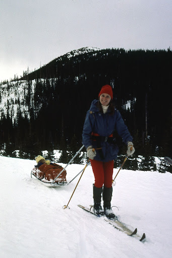
In December of 1972 I made my first trip up Colorado Highway 14, a winding two-lane road up from Fort Collins to cross-country ski on Cameron Pass. My old Bonna 600 edgeless wooden skis with Tempo cable bindings (borrowed from the university outing club) stuck awkwardly across the backseat of my ‘63 Ford Falcon.
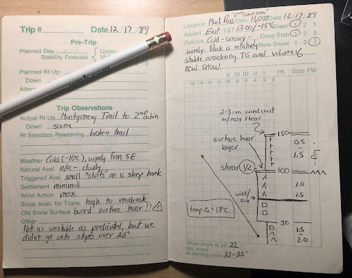
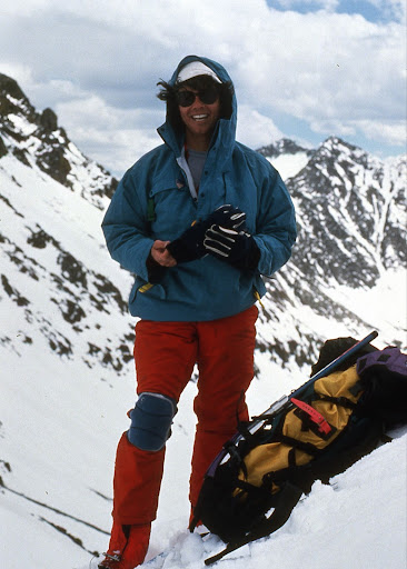
Circa 1974, sporting a genuine Scottish blaclava and the ubituitous 60:40 parka, I pose dramatically in the newly rediscovered Telemark turn position.The Lake Agnes cirque with Nokhu Crags on the left, Mount Mahler on the right. November 2021.Approaching Paradise Bowl on the east side of Nokhu Crags-circa 1985.Jana Ley and one-year-old Samuel sled tour on Cameron Pass. Winter of 1982.A page from my 1989 Snow Journal that I kept for six years on Cameron Pass. Being an early member of the CAIC development was key to my development as an outdoor leader.Rodney Ley at the top of Fourth of July Bowl above Lake Agnes, circa 1990. Note the knee-pads–still rocking the telly turn back then!
Wild and remote, Cameron Pass drew me back year after year. Although the road was not paved until 1976 and was closed in winter until 1979, the drive was always worth the effort. One attribute we Nordic skiers noticed right away was how much snow fell every year! In 1976, shortly after the road was plowed and opened for the year, I drove up and skied South Diamond Peak—perhaps the first full descent!
On the west side of Cameron Pass is the Colorado State Forest, and by 1971 the Colorado Parks and Wildlife agency had secured a lease to manage recreation. This resulted in the unusual name of State Forest State Park. With Highway 14 now open year-round the winter use of Cameron Pass began to explode—simultaneously the growth of backcountry skiing, avalanche education, and telemark ski equipment added to the excitement.
Along with many others, I began to explore as many nooks and crannies as possible in this giant winter basin. Compared to other locations along the Front Range, Cameron Pass was virtually unknown. For many years the only ski tracks I would see were those I had made the week before. Every trip was pure adventure!
Slowly the backcountry skiing scene began to solidify—South Diamond Peak became the undisputed monarch over the pass. Runs were named, faces and gullies skied. Where once only a few folks might be seen now tracks laced the slopes. By the early 1980’s it wasn’t always possible to get first tracks in the powder, so I and several hardy souls began to push into the farther reaches of Cameron Pass and the State Forest State Park. It was a time of huge growth.
In 1985 I had decided to leave the outdoor retail business and develop a backcountry ski yurt system in the State Forest State Park. Never Summer Nordic Yurts was the culmination of a10-year passion to immerse myself in backcountry skiing and guiding. We opened the first three yurts just before Christmas 1986. For a guy with two kids and a wife, it was a huge step. I also expanded my avalanche education and became one of the first avalanche observers for the Colorado Avalanche Information Center. I added avalanche education courses to my backcountry yurt business in 1987 and continued to teach those until 1992.
All good things must end, but in this case the good thing got better! I accepted a job to direct the newly founded Outdoor Adventure Program (now Outdoor Program) for Colorado State University. Over the next thirty years (1990-2020) I trained student outdoor leaders, taught academic wilderness leadership courses, and continued my personal passion for exploring Cameron Pass.
Although retired from Colorado State University, I continue to educate, inform, and inspire others to share in the beauty of Cameron Pass. With the help of the awesome crew at Beacon Guidebooks, I’m excited to be sharing that love of Cameron Pass with the publication of the ski atlas Backcountry Skiing Cameron Pass.
The San Juan Mountains of Colorado rising to over 14,000’ are probably the prettiest in the state. A variety of exposed colorful rock layers contrast with the pines and aspens that grace their lower ramparts. Far from any major metropolitan areas, the air is fresh, and you can take a moment to take in your surroundings. Glacier carved valleys and cascading waterfalls surround you. Rock outcroppings protrude from the trees in almost every direction exciting the climber’s mind.
Heather Swallow on Hard to Kill (10d) at the Hall of Justice
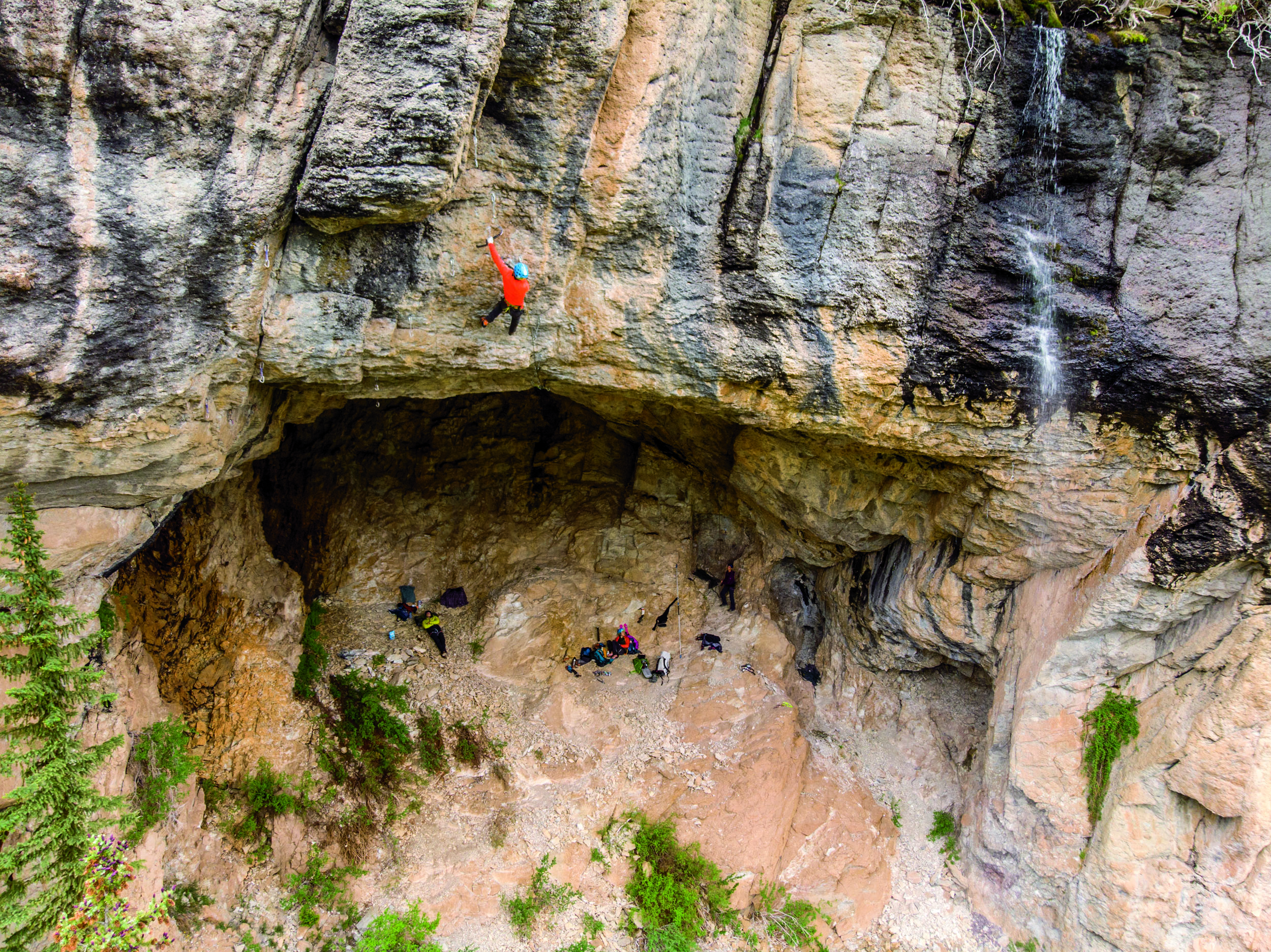
The geologic variety is as wide as the colors of rock in the San Juan Mountains. 1,400’ walls of quartzite and slate dating back 1.7 billion years have been uplifted and exposed in the mountain canyons and eroded calderas. Crags such as The Trough, Techno Crag, The RV Wall, and the Wicked Crag line the precipitous sides of Highway 550. You may see them, but the windy and exposed highway devoid of guard rails will keep your eyes from staring too long. The San Juans host some 20 calderas and some of the most significant volcanic events on the history of the planet. Like icing on a cake, the San Juan formation has left giant walls of volcanic ash at the tops of most of the peaks. While most of this layer is fractured to the point of being unappealing to climb on when it’s not froze in place, there are some dramatic exceptions to this rule. Most notably, the Hall of Justice is one of the more memorable sport crags you’ll find in the country. With routes up to six pitches in length, the dramatic exposure just walking the upper ledge will have your full attention. A host of long 35-meter pitches of steep pocked rock rise above and below this ledge.
Carley Ewert on Over the Monsoon, Overlook Crag
Located between the upper volcanic ash and quartzite basement layers are a series of sandstone, limestone, conglomerate, shale and mudstone layers interspersed with igneous intrusions. You may be climbing on several different rock types throughout the course of a pitch at some crags.
Audrey Sneizek on Seduction of Gravity (5.10a), Rotary Park
For the more faint of heart, there are some of the most friendly and convenient options imaginable. Ouray’s Rotary Park crag hosts a bathroom with running water, barbeque grills, and over 50 bolted climbs between 5.2 and 5.12d rising just a few feet from your car. The Stripe Crag in Silverton lacks the amenities of Rotary Park, but also hosts a variety of grades with a short approach just outside of town.
Mary Harlan on (5.11a) at the Jimmy Cliff
When the high peaks unleash their fury, fair weather can often be found on the high desert Dakota Sandstone escarpments west of Montrose. A series of long east to west canyons offer mountain biking, off-roading, rock climbing and bouldering. The most notable is Dry Creek which features about 70 climbs between 5.7 and 5.13 overlooking a vast dry western landscape sloping down to the fertile farmlands of Montrose.
Bryce Jones on Unnamed 5.10 (5.12c) at the Hall of Justice
With Moab and Indian Creek only a 3-3.5 hour drive and the big walls of the Black Canyon sitting on the hill above Montrose there is no lack of full value year round climbing in the immediate vicinity. Locals don’t really take rest days here; we just change sports. You can river surf, ski, mountain bike, run, 4×4, run one of several via-ferratas, hike, paddle lakes and rivers, and soak in hot springs if climbing doesn’t suit your fancy.
Bryce Jones on (5.12c) Wicked Crag
Mike Pennings on All Night Rave (5.12c), Techno Crag
Ouray isn’t just for Ice Climbing! was last modified: June 30th, 2022 by visualadventures
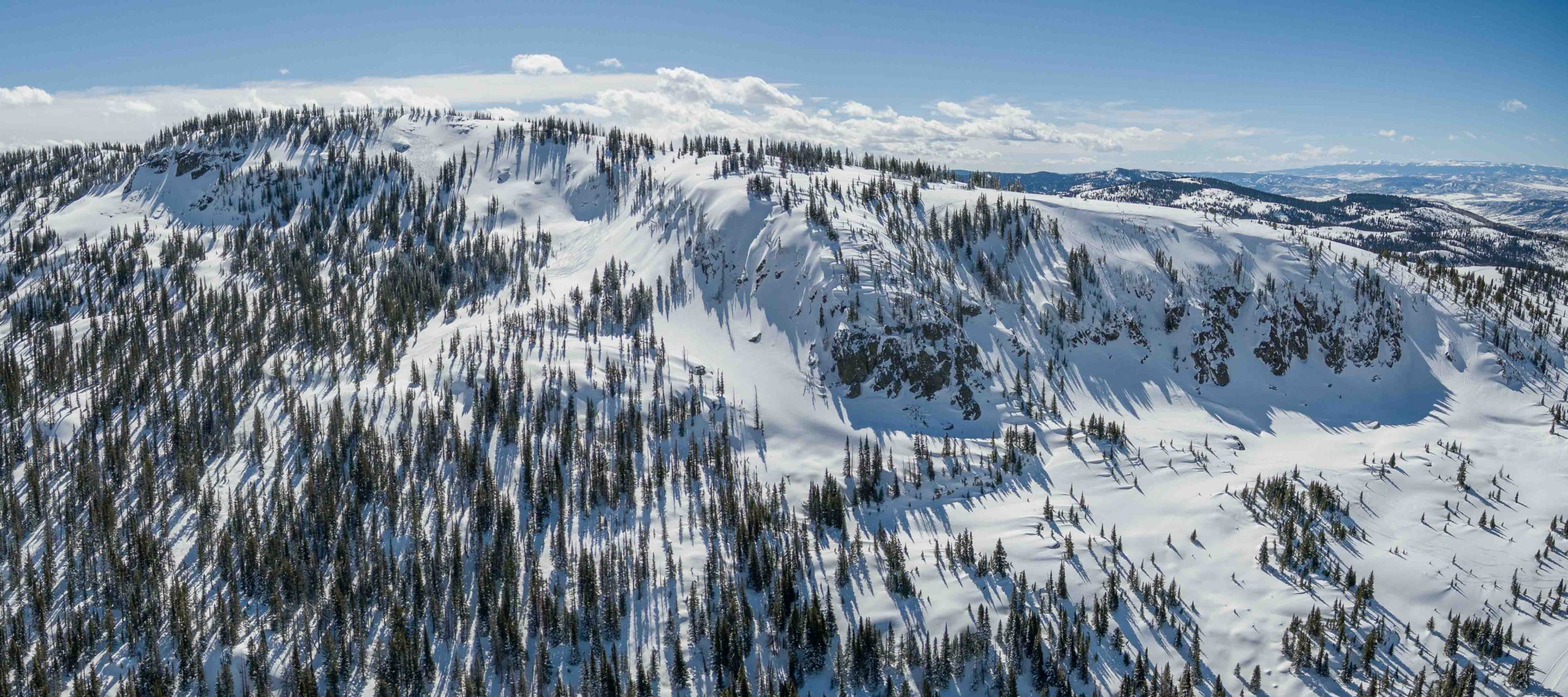
The smell of 2-stroke and the stoke of fresh powder on Buffalo Pass runs rampant throughout Dry Lake Campground as slednecks and hybrid skiers alike go over their gear checklists and read the updated avalanche bulletin from CAIC. The snowcam at Steamboat resort shows 8 inches of blower overnight, but the locals know of the “Fluffalo Pass” effect and expect a foot of fresh once they get to the top of Soda Mountain. Stu finally emerges from the USFS outhouse and Randy finishes scarfing his breakfast burrito from Creekside Cafe as I yell at everyone to remember why we woke up at 5am. We were the first to get our sleds off the trailer and now we are rewarded with fresh tracks on the snow road from Dry Lake all the way to our first stop at the Galaxy Drop.
Aerial view of north Soda Mountain and the Carnival zone. Photo Alex Neuschaefer.
We shuttle a sled down to the bottom of the Galaxy Trees and ride Canadian back to the top. The buzzing of idling engines from Dry Lake is no more and all that remains is the sound of a crisp breeze amongst the quaking aspens we are about to ski. Randy comments that these are the largest aspens he’s ever seen and Stu is still wrapping his head around how the entire stand has perfect spacing between each trunk. The untouched canvas in our field of view has us channeling our inner Da Vinci and our inner Billy Kid, minus the Stetson headgear. We roll over the top and drop into our line; the silence amongst the trees is met with hoots and hollers as we revert to our childlike selves giddy with the excitement and adrenaline of feeling alive and free. As we prepare to ride Caveman back to the top, we catch our breath and gaze at our lines meandering through the trees; It may not be the Mona Lisa but it is the closest we will ever get to creating a masterpiece.
Butter for Breakfast. Photo Madie Bass.
Stu was itching to get into steeper terrain and we decided to spend the next couple of hours shredding In the Frey and South Park Ridge to our heart’s content. Eight laps later and our legs are screaming at us to take a break for just 5 minutes. In that same moment the skies rip to blue and we get our first glimpses of the day at the summit of Soda Mountain. We decide there’s no better place for a picnic on the Pass and we head uphill to take in the best views in Routt County. As we come to Zohan Point, we see a snow stake measuring 15 inches and Randy’s mouth broadcasts a shit eating grin- it looks like Buff Pass wringed out every bit of precip in northwest flow overnight. We waste no time and dedicate the rest of our day to the Carnival. After scouting from below we head back to the summit to ski our most technical terrain of the day. Steep skiing, tight chutes, and big airs summarize the second half of our amazing day on Buff Pass.
Author, Stephen Bass, looking in vain for the bottom of Buffalo Pass. Photo Ben Saheb.
We head back towards Dry Lake after a full day of skiing, but we cannot resist the urge to ski one last fun run at Fiesta. We can see the congregation at the bottom of the run of other sled skiers reminiscing about all of the face shots had on this day. We ski one more line and make sure to put on a show for the locals and tourists alike watching from Lila’s Corner as we all three throw a Daffy on the booter some guys built towards the bottom. The excitement at Dry Lake as we load our trailer back up is intoxicating. Within earshot you can hear multiple proclamations of “Best. Day. Ever.” in some iteration or another. Randy, Stu, and I rally down to Slopeside for dinner and drinks as it starts to pound snow yet again. The forecast is calling for another foot of blower overnight and our sleds are already refueled.
Backcountry Skiing Buffalo Pass Colorado by Stephen Bass was last modified: November 20th, 2023 by Bassomatic86
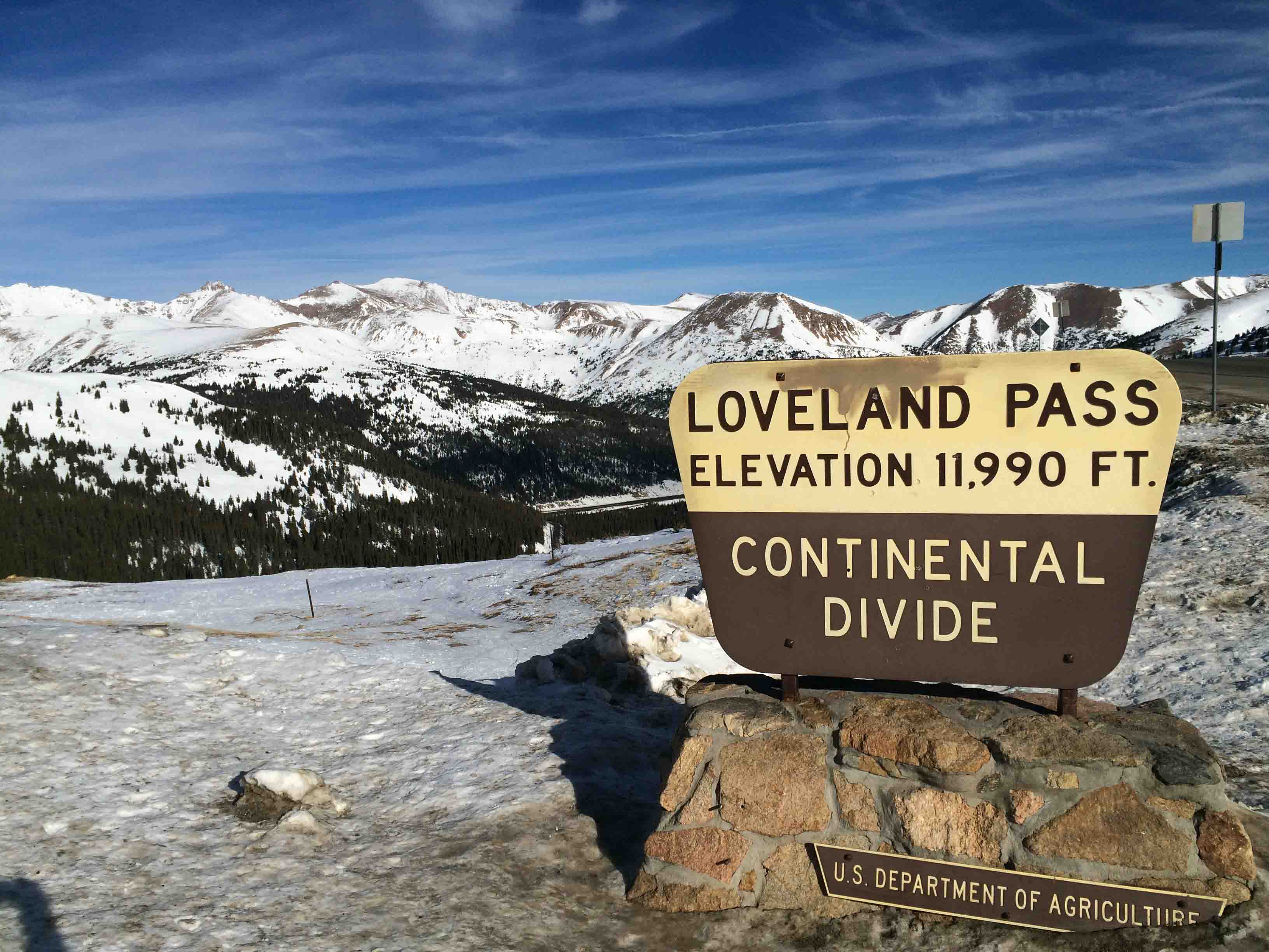
In a Denver Post Article, MacKenzie Ryan labelled Loveland Pass as “one of the best worst-kept secrets in backcountry skiing.” Skiers and snowboarders have cemented Loveland Pass’s reputation as a backcountry destination by driving up and skiing down for nearly one hundred years. Explorers went deeper into the basins surrounding the Pass, leading to mechanical rope tows in the 1930s. Loveland Ski Area opened on the north side of the pass in 1936, and Arapahoe Basin began operations on the south side in 1946. In the 1980s and 1990s, snowboarders pioneered jumps on descents like Main Line and Ironing Board long before terrain parks existed at ski resorts. Fast forward to today, and you can find a full terrain park here, including kickers and rails. Many Front Range and Summit County sliders had their first backcountry experience at Loveland Pass.
Cresting the Continental Divide at 11990 feet Loveland Pass is between Arapahoe Basin and Loveland Ski Areas
Most folks view the Loveland Pass backcountry as simply the drop-in terrain at the top of the Pass. This backcountry ski guidebook presents the opportunity to go beyond the hustle and bustle of Loveland Pass. From Watrous Gulch to Porcupine Gulch, we follow US Highway 6 as it climbs dramatically to 11,990 feet; providing trailhead access to glacial valleys holding a lifetime of winter backcountry exploration. The guidebook terrain ranges from all day ski adventures in Dry Gulch and Herman Gulch, to a new perspective on how to use the Pass’s hitchhiking resources to access valleys not visible from the Highway. Our focus is winter skiing, and we also include a sample of ski mountaineering on thirteen thousand foot peaks directly accessible from Highway 6. The onset of spring and a stabilizing snow pack lures skiers into the high alpine to seek famous descents such as Dave’s Wave and the notorious Shit for Brains couloir.
Ski touring up Herman Gulch
MacKenzie Ryan was right, Loveland Pass is one of the best worst-kept secrets in backcountry skiing. Embrace the craziness of the Pass, and become part of the history of Colorado backcountry skiing. Have fun, but keep it real in avalanche terrain. This zone is the target of online forum rants about reckless backcountry skiing, and even the subject of a study quantifying the lack of safety gear present in the Pass’s backcountry user population. You and your friends need to bring avalanche equipment, training, and the mentality for safety to ensure a great experience at Loveland Pass.
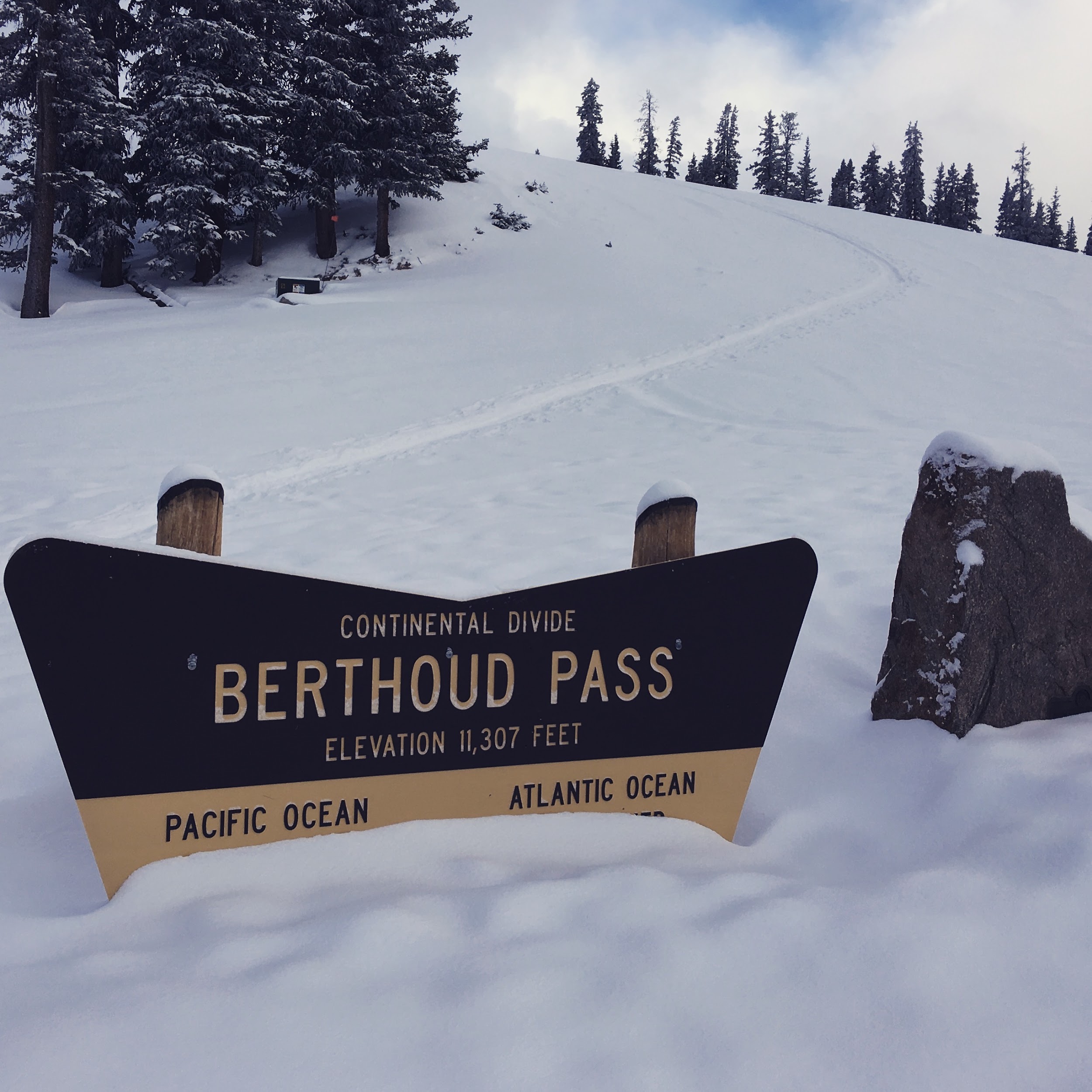
I have lost track of how many sunrises I have seen from Berthoud Pass. This means that I have also lost count of how many dawn patrols I have had at the Pass over the years. I don’t revel in the sub-zero and pitch black starts, but the day job and family schedule dictate these early mornings. When the sun rises over the Continental Divide it sheds just enough light on the surrounding terrain. From the top of the West Side you can see the Indian Peaks to the north, and the Mount Evans Wilderness to the south. The quick access and the deep snow of Berthoud Pass provide a solace from the harsh morning, and it is the camaraderie of the skiers in the parking lot that brings the warmth. Berthoud Pass is close enough to Denver to justify several laps and then a harrowing drive down I-70 to work. I often joke that after safely navigating the hazards of backcountry skiing, the most dangerous part may be the drive back.
Friends enjoying playful terrain after a classic Colorado storm.
Backcountry skiers have been exploring Berthoud Pass for nearly one hundred years. Cars would shuttle skiers to the top of the Pass, and the pick them up at the bottom. Fast-forward to today and you can find hitchhikers on any given day at a number of trailheads. Those who are generous enough to pull over and give a hitchhiking brother or sister a ride to the top are then blessed with good karma enshrined in the history and tradition of skiing the Pass.
Berthoud Pass also has a rich lift access history. Berthoud Pass Ski Area operated discontinuously from 1937 to 2003. It was the first ski area in Colorado with a rope tow, the first two-person chair lift, and the first to allow snowboarding. The ski area also pioneered big mountain competitions in the late 1990s and early 2000s.
Scott climbing Moonlight Bowl.
Quick access, a consistent snowpack, and endless discovery continue to draw backcountry skiers to Berthoud Pass. The east to west orientation of the Pass, located high above the Fraser River and Clear Creek valleys, attracts a deep snowpack benefiting from both northwest flow and upslope storms. In just over an hour drive from Denver, backcountry skiers have access to numerous trailheads leading into the high basins surrounding the Pass. From pre-work dawn patrols, to car shuttling, to all day epics, Berthoud Pass has an adventure for backcountry riders of all skill levels. This is why I love to ski here. I hope to see you in the Pass parking lot enjoying the dawn patrol as much as I do.
Just another two foot dump and the signs are gone.
Backcountry Skiing Berthoud Pass Colorado by Rob Writz was last modified: November 20th, 2023 by FRSKIMO
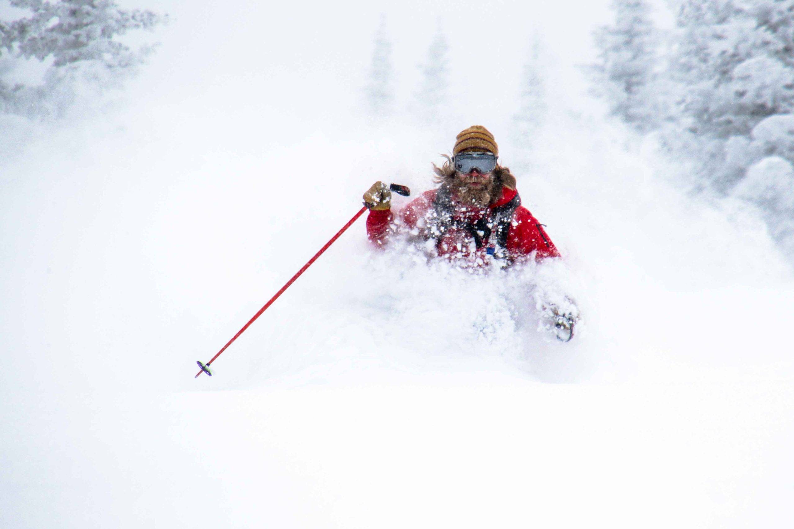
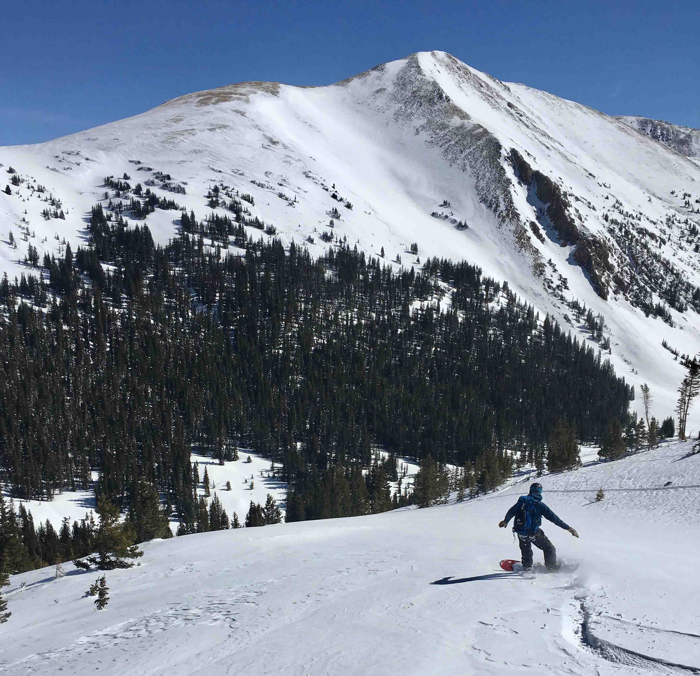
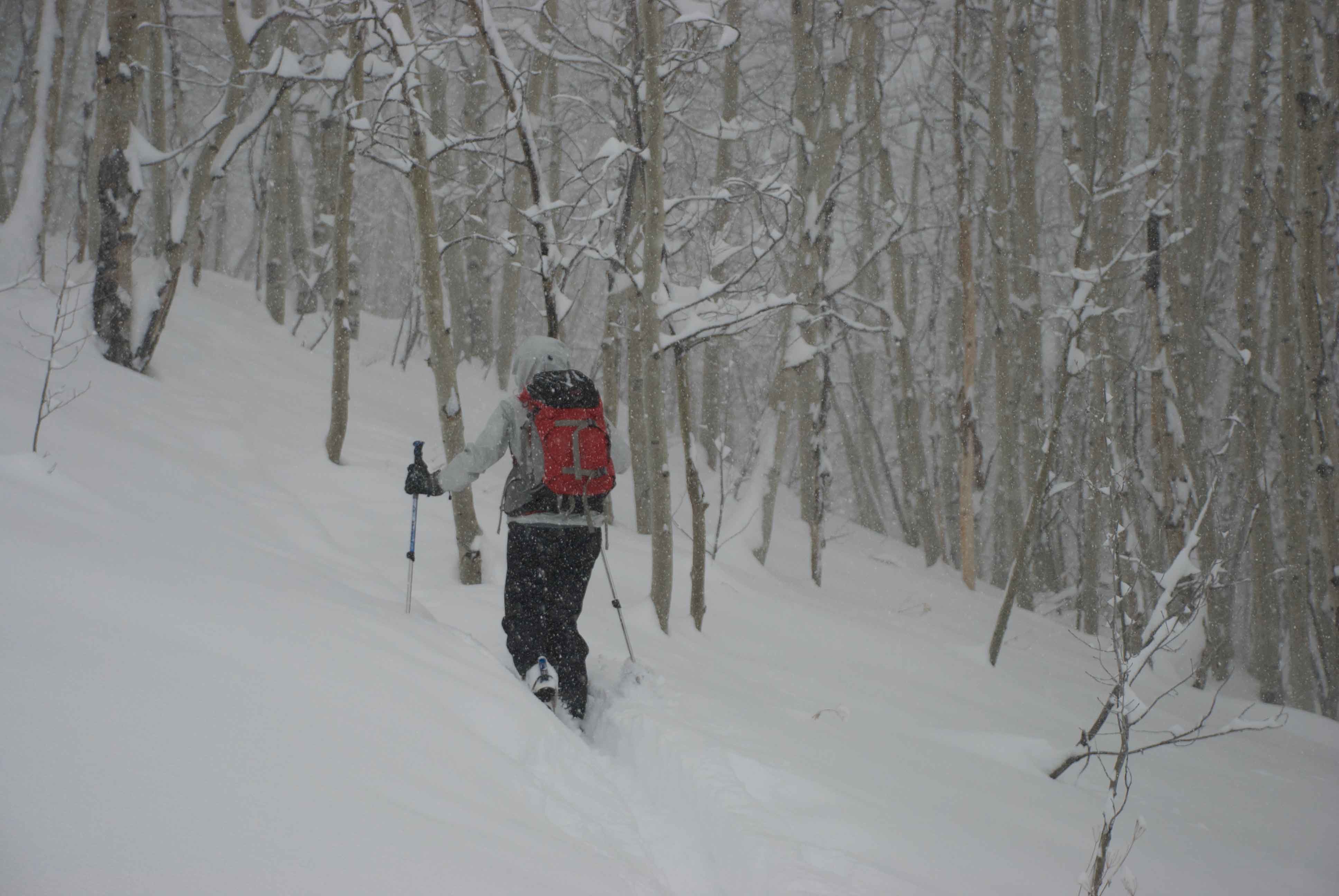
In January of 2017, it began snowing in the Elk Mountain. A month later, it felt like it had never stopped. A long sequence of storm cycles had deposited over 10 feet of snow at Irwin, just outside of Crested Butte.
Skier Gail Sovick heads-up the front side of Snodgrass mid storm.
For backcountry skiers, a massive amount of snow in a short amount of time awakes a mixed bag of emotions. On the one hand, a skier cannot help but get excited about deep, deep pow. Images start appearing in our heads (and on our social media) of skiers porpoising way down into the white room, gloves and poles barely exposed above the surface as if they are the only way to catch a breath of air on behalf of the submerged powderhound. On the other hand, a lot of snow in a short amount of time means that avalanche danger is likely to rise, thus keeping us from venturing out into the steep-and-deep to realize our dreams of flying through the subnivean zone.
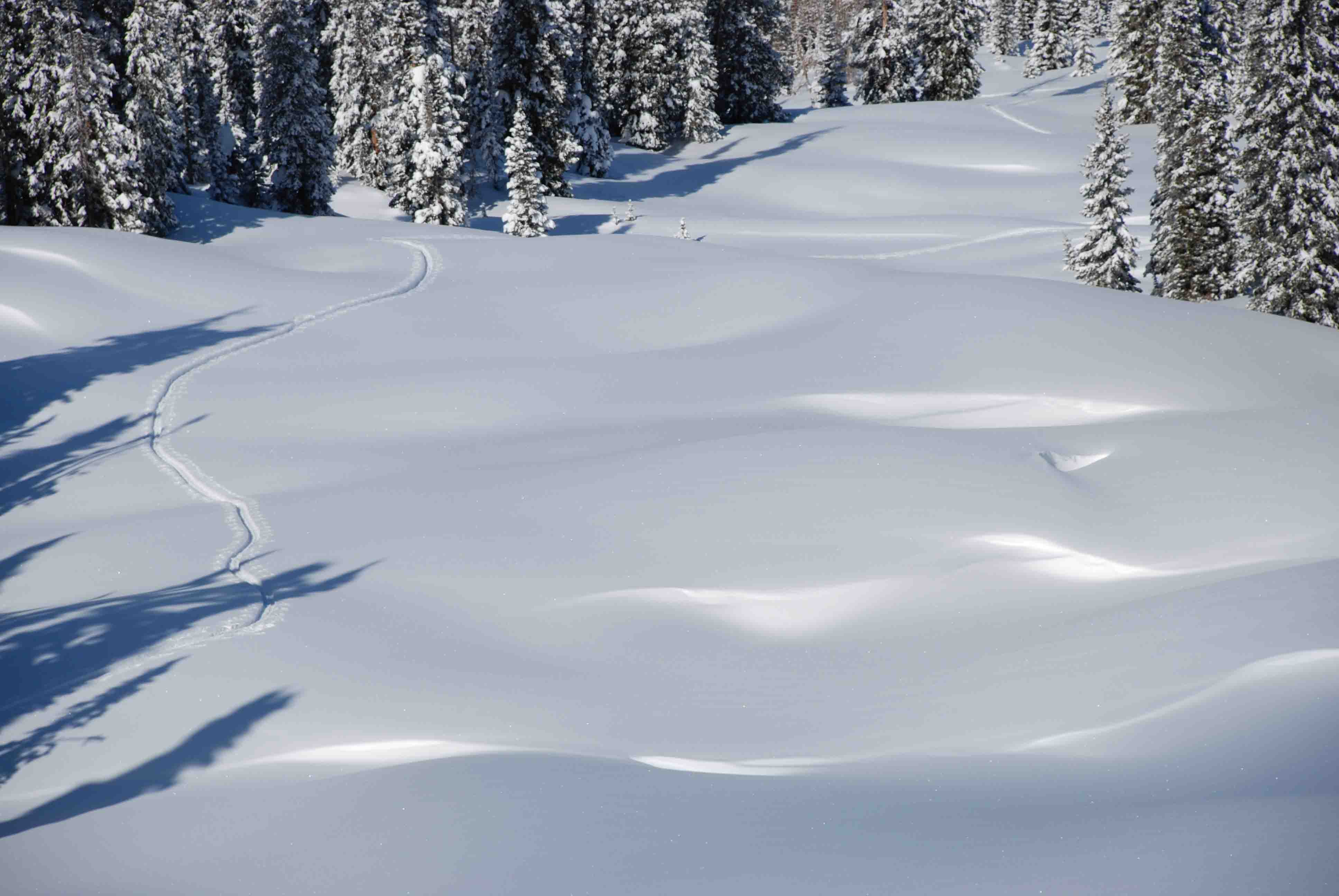
An impressive amount of snow blankets a “light tour” in the Anthracite Range
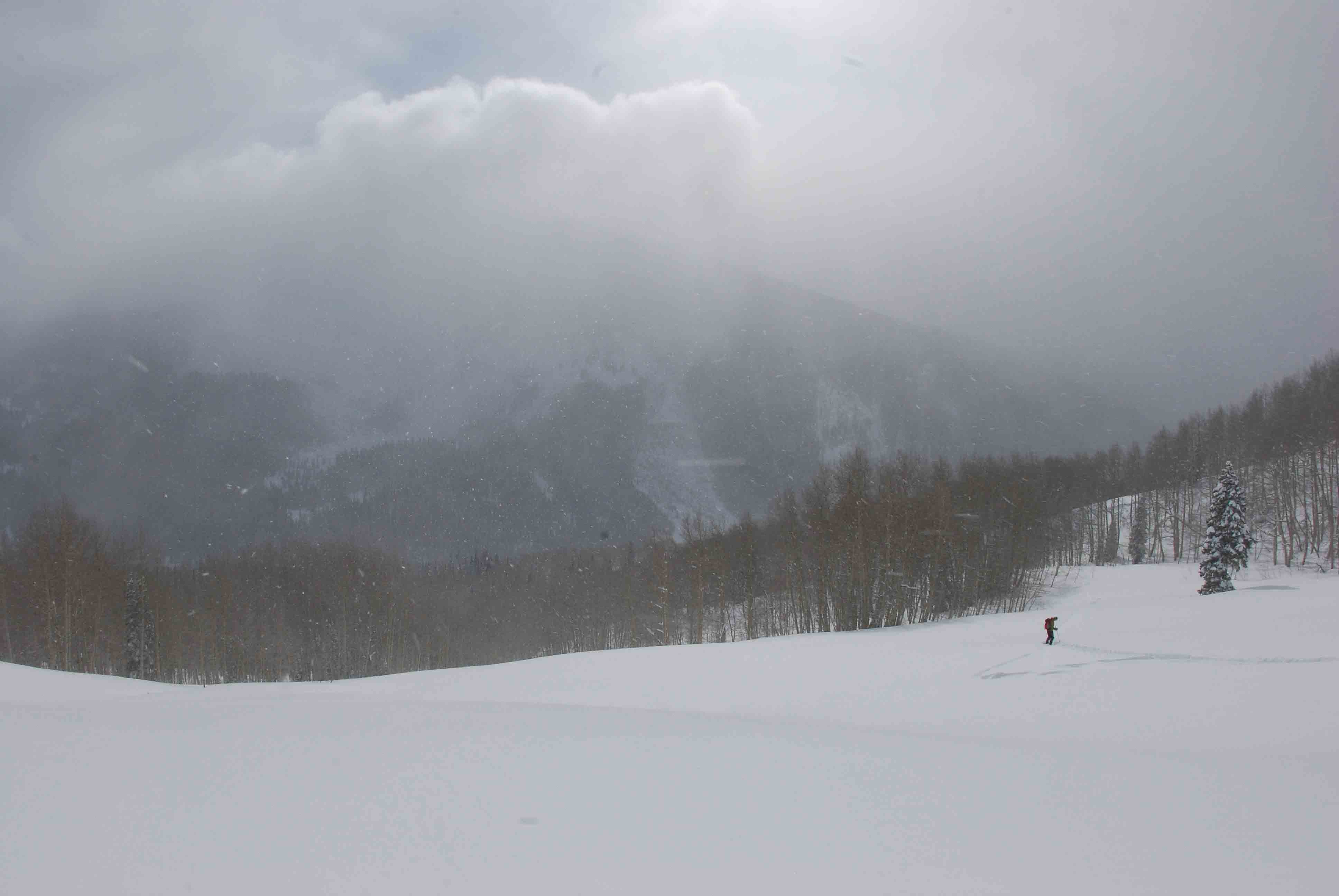
During this storm, I stopped into Wild Snow Headquarters to talk about a new book that my publishing company had just released for backcountry skiing Snoqualmie Pass in Washington. Lou Dawson runs wildsnow.com, which is one of the best online stops for quality and comprehensive backcountry ski news. Being the warm welcoming guy that he is, he invited me in for a cup of coffee, where we proceeded to talk about the storm that was surrounding our beloved mountains. We began talking about what we typically do during storms like this. Many people will read the avalanche forecast during storms like this, see that the danger is very elevated, and they will simply go to the ski area or just stay home. But backcountry skiers like Lou see things a little different. They begin to look for slopes in their area that are too low-angle to slide, but still steep enough to get some slow, yet oh-so enjoyable, turns on the way down.
Lou and I began talking about these tours and how wonderful they are, not only for high-danger days, but also for days with novice friends, or quick before-work tours, or days when you’re nursing a pulled muscle. In our conversation, we soon came to realize that we don’t even need an excuse to go hit the “light tours” of our area…we just plain like them. Our conclusion was that it’s really good to have a list of your local light tours in the back of your mind when the context presents itself.
Skier Gail Sovick takes a meadow break in Crested Butte’s Red Lady Glades.
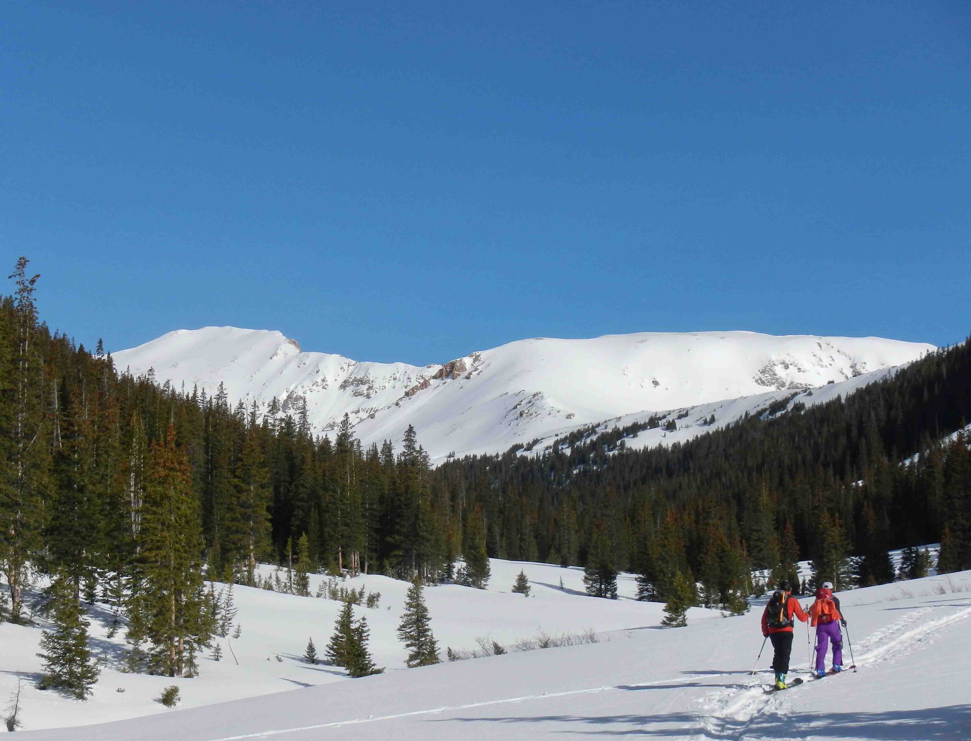
So was born, the idea of creating a book that showcases some of our state’s light tours. It is said Colorado has 300 sunny days a year. Combine that with several thousand mountains, and a winter climate that’s downright temperate. The result: one of the best places on the planet for ski touring. Of course nothing is perfect. Colorado challenges backcountry skiers with limited public access options, due in part to it being a mostly rural, relatively un-roaded western state. More importantly, due to various climatic factors the state’s mountains can be prone to dangerous avalanches for much of every winter. Yet options exist. Key with backcountry travel is picking routes with lower angle pitches and other avalanche-mitigating factors. While these “light tours” are surprisingly difficult to find, they do exist. We detail a selection of Colorado’s best under these covers. Further, a growing trend in ski touring is the use of ski resorts for “uphilling,” motivated by the need for a less committing experience — yet nonetheless an experience that can equal any other outdoor sport in enjoyment. Colorado lends itself to this as well, with most of the state’s more than twenty ski resorts allowing uphill skiing. Thus, we offer a special mix here, combining a variety of “easy” backcountry routes with recommended resort options. Pick one of our many days of Colorado sunshine, get out and enjoy.
December, 2000: I was a freshman at Fort Lewis College in Durango, sitting in a van full of other new students. The van was doggedly climbing up Coal Bank Pass towards Silverton, Colorado. I had applied to Fort Lewis for two reasons. 1) It had an excellent humanities department, and 2) it is at the foot of the San Juan Mountains, home of backcountry ski legends. Legendary backcountry pioneers like Dolores LaChappelle and Chris Landry made their homes in the San Juans. Legendary big steep mountains like Snowdon, Bear, Sultan and Kendall loom over the towns and highways like sentinels of a sacred place. Yes, I wanted to get a college education, but let’s be serious for a minute: I was a 19 year-old kid hungry for epic adventures and boundary-pushing weekends.
Skier Kevin Krill finds a natural terrain park
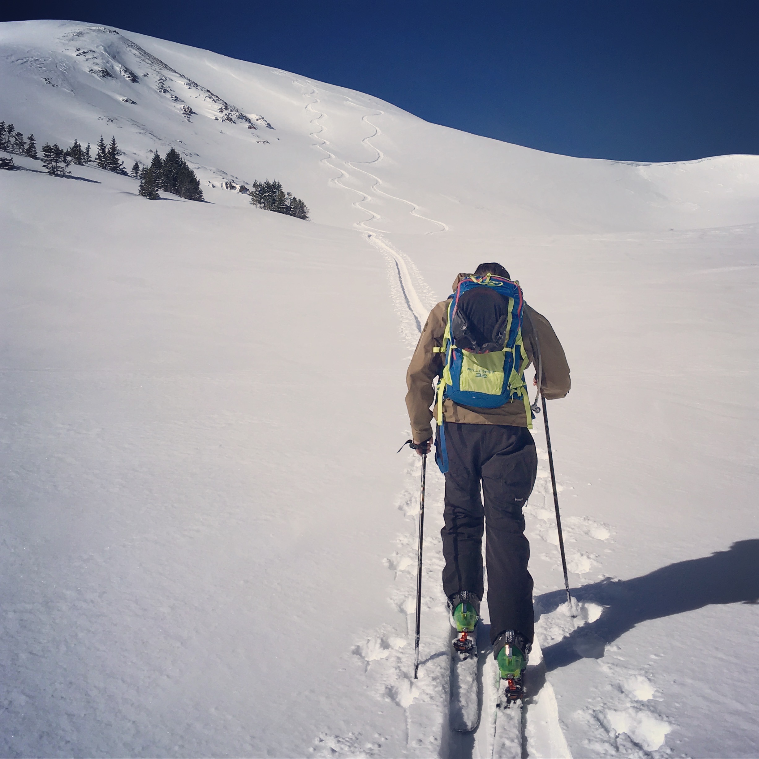
This was my place. The van full of students parked at the top of Molas Pass where we all stepped out, trying not to let our dropped jaws show too much as to make us look un-cool (we were 19 years old after all). We were on an Outdoor Pursuits day-trip, led by two very knowledgeable outdoorsmen. The class was titled “Terrain and Route Finding in Avalanche Country”. The instructors’ goal was to give us kids a primer on how to view avalanche terrain, how to notice avalanche prone features, how to understand the way an avalanche will move down different types of terrain. All day, we drove and hiked to dozens of locations to see classic ski zones like Anvil, Red 3, Kendall, and Prospect where the instructors emphasized how important it is to inspect avalanche terrain, plan your routes up and down. I’ll never forget the part of the day when our instructor said the following: “It would be so cool to have a folder full of photos of all the runs you want to ski, so that you can use them as you plan your next tour. From this moment, deep in the best ski terrain of the San Juans, the idea was born to create a terrain based photographic atlas of all backcountry runs.
I believe that just as a kayaker scouts his run and commits it to memory, a backcountry skier should too. Smack-dab in the center of an ancient volcanic caldera, Silverton is a true mountain town. Home to an extreme ski resort, famous mountaineers, miners and rich history, it is a fantastic place to visit and speaks for itself when it comes to remote and rugged towns. Many mountain ranges don’t have a year-round maintained road passing through them. The San Juan Range from Durango, through Silverton, to Ouray has three: Coal Bank, Molas, and the infamous Red Mountain. Highway 550 brings powder-hounds through some of Colorado’s most rugged and diverse ski terrain. Silverton Mountain ski resort, at the heart of the San Juans, boasts an annual snowfall of 400 inches. What is one part of the avalanche recipe that never changes? Terrain. Terrain is the only constant. With Backcountry Skiing Silverton and rakkup’s powerful planning and execution tools, you can read your run the night, week, or month before. You can refer to it as you travel through the field, assess your conditions, and adjust your plan as necessary.