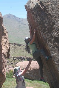
by todd | Jun 9, 2015 | World's Best Bouldering Areas
Buy
Pot Point Boulders here and save money versus purchasing from within our app via Apple or Google. It’s exactly the same guidebook, but offered at a lower price on
rakkup.com.
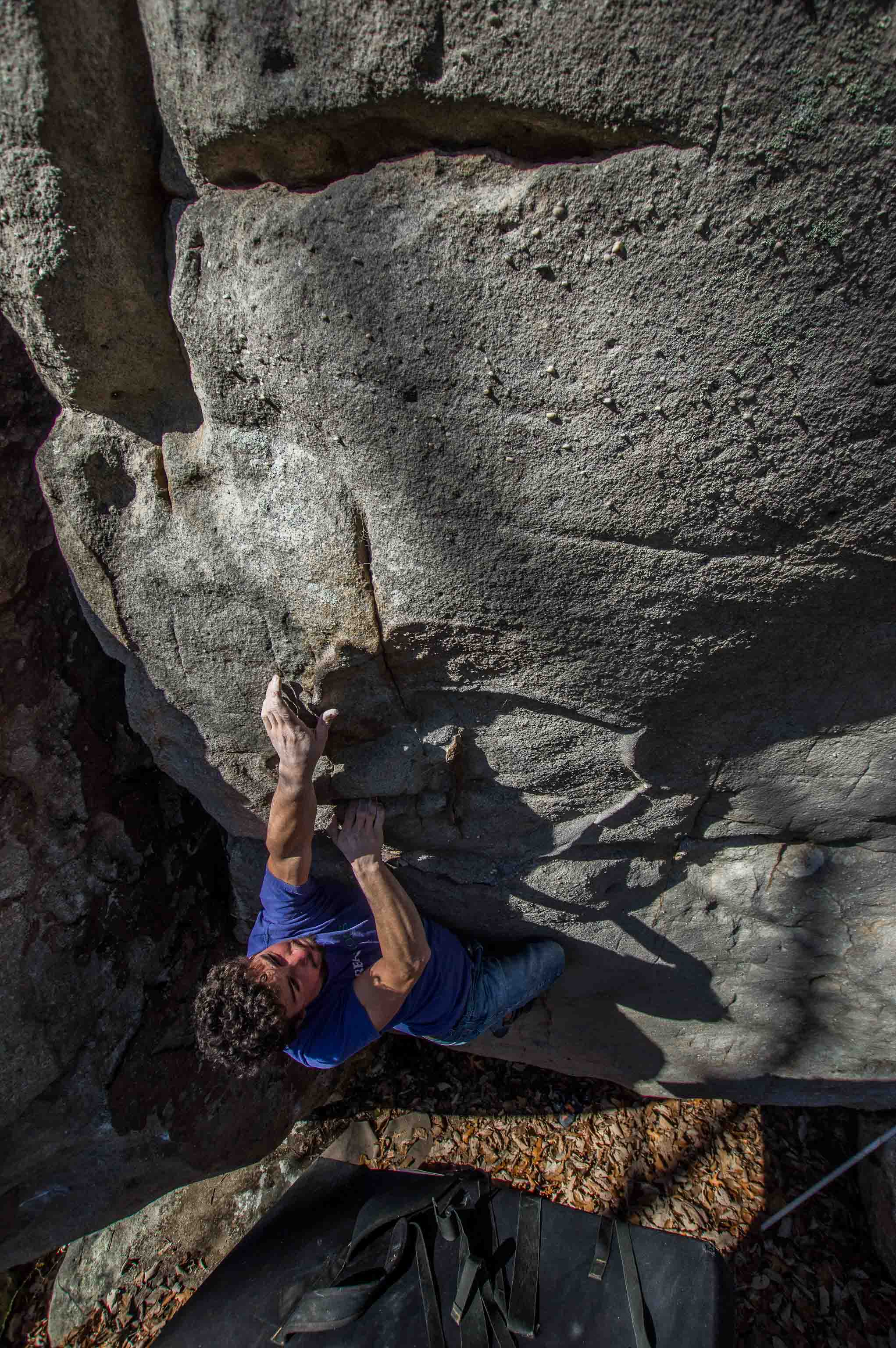
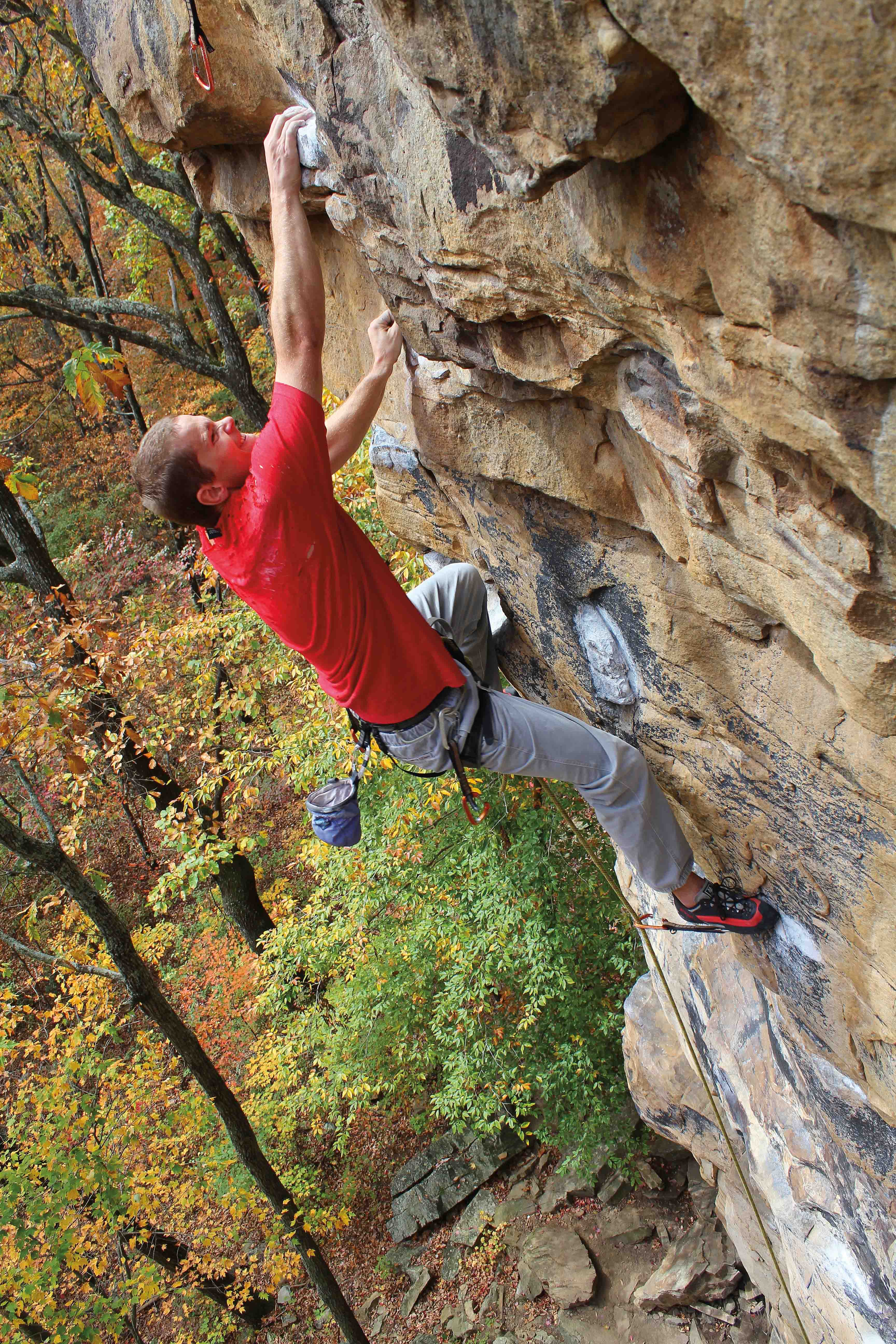
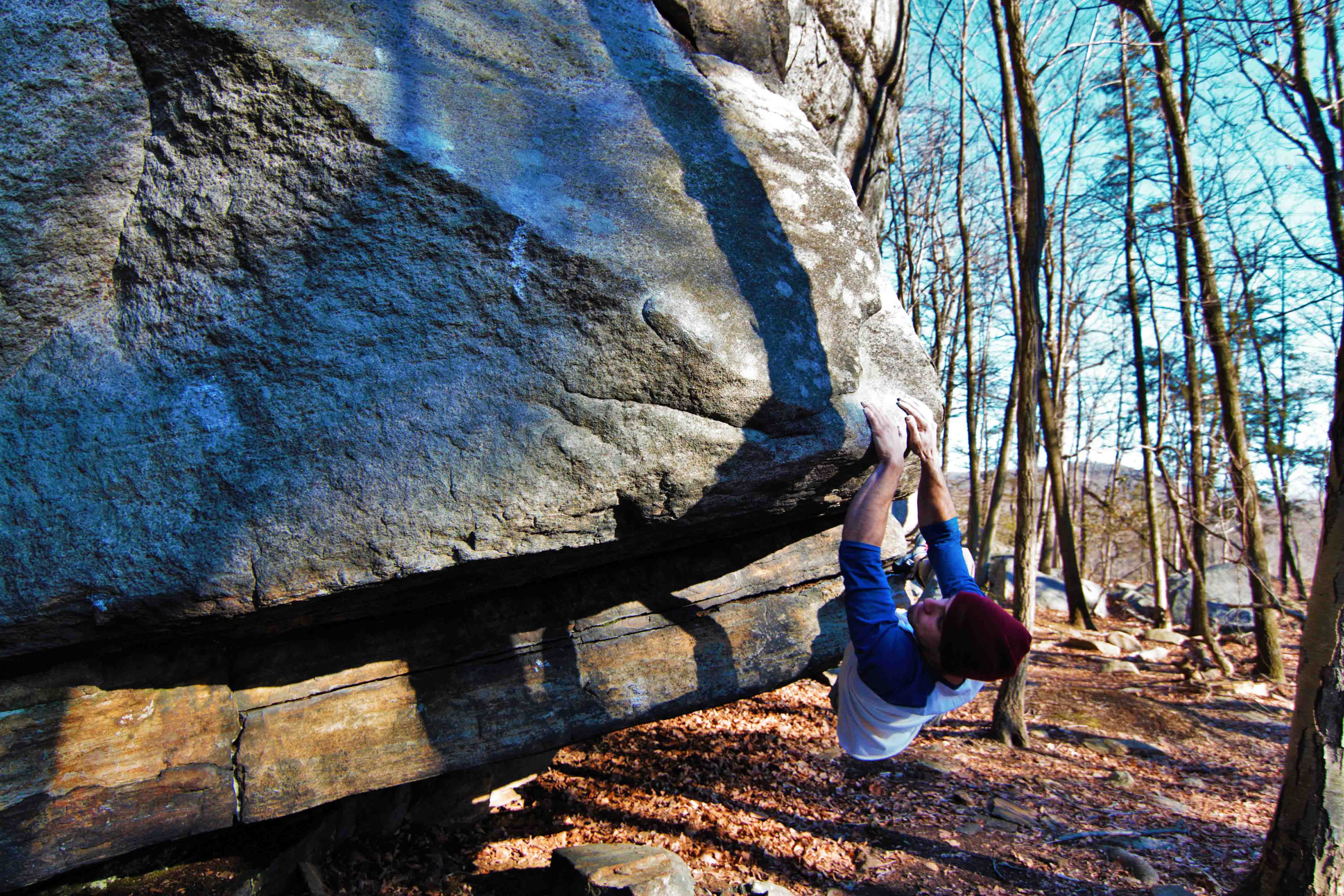
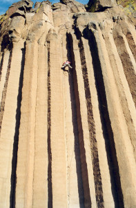
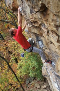
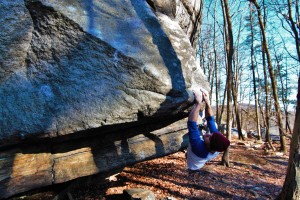
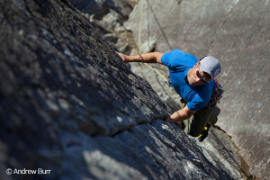
Corey Harris on Rite of Passage (V2)
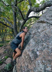
The Pot Point bouldering area is one of the best kept secrets of the Chattanooga bouldering scene. Potential for new lines and free camping all within a peaceful setting make this spot perfect for climbers looking for something new.
This area sits on the ridge overlooking the river gorge and Raccoon Mountain and is situated along the Pot Point hiking trail. While only the best select problems are included in this initial guidebook release the area has an abundance of unclimbed rock and well featured boulders. Divided into several mini areas the boulders are strewn about for almost a mile.
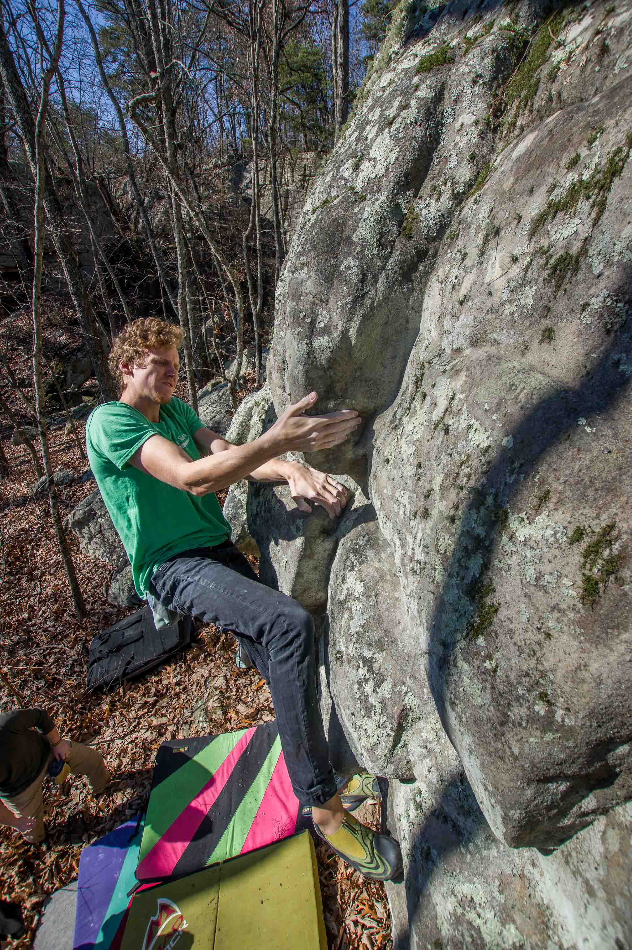
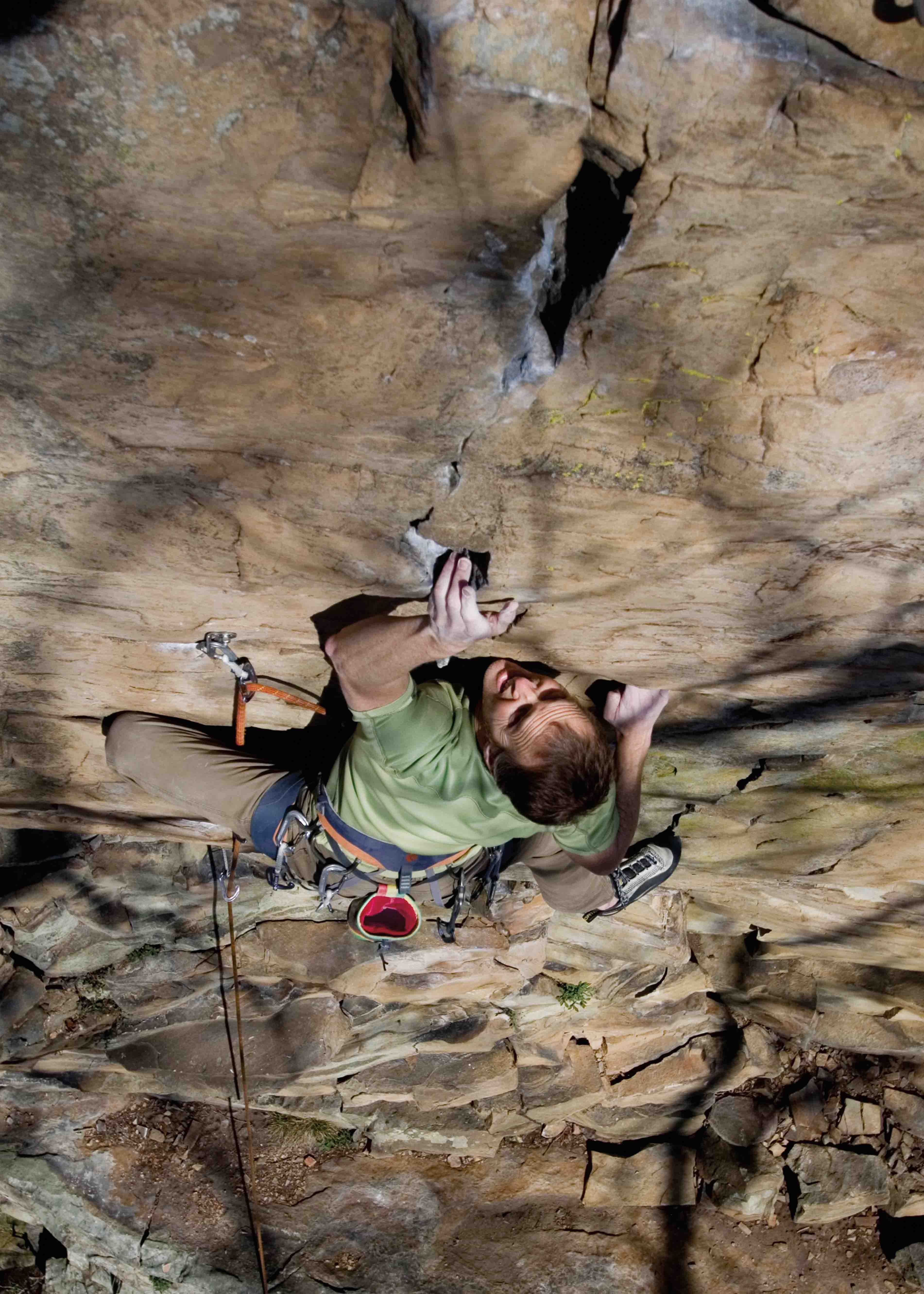
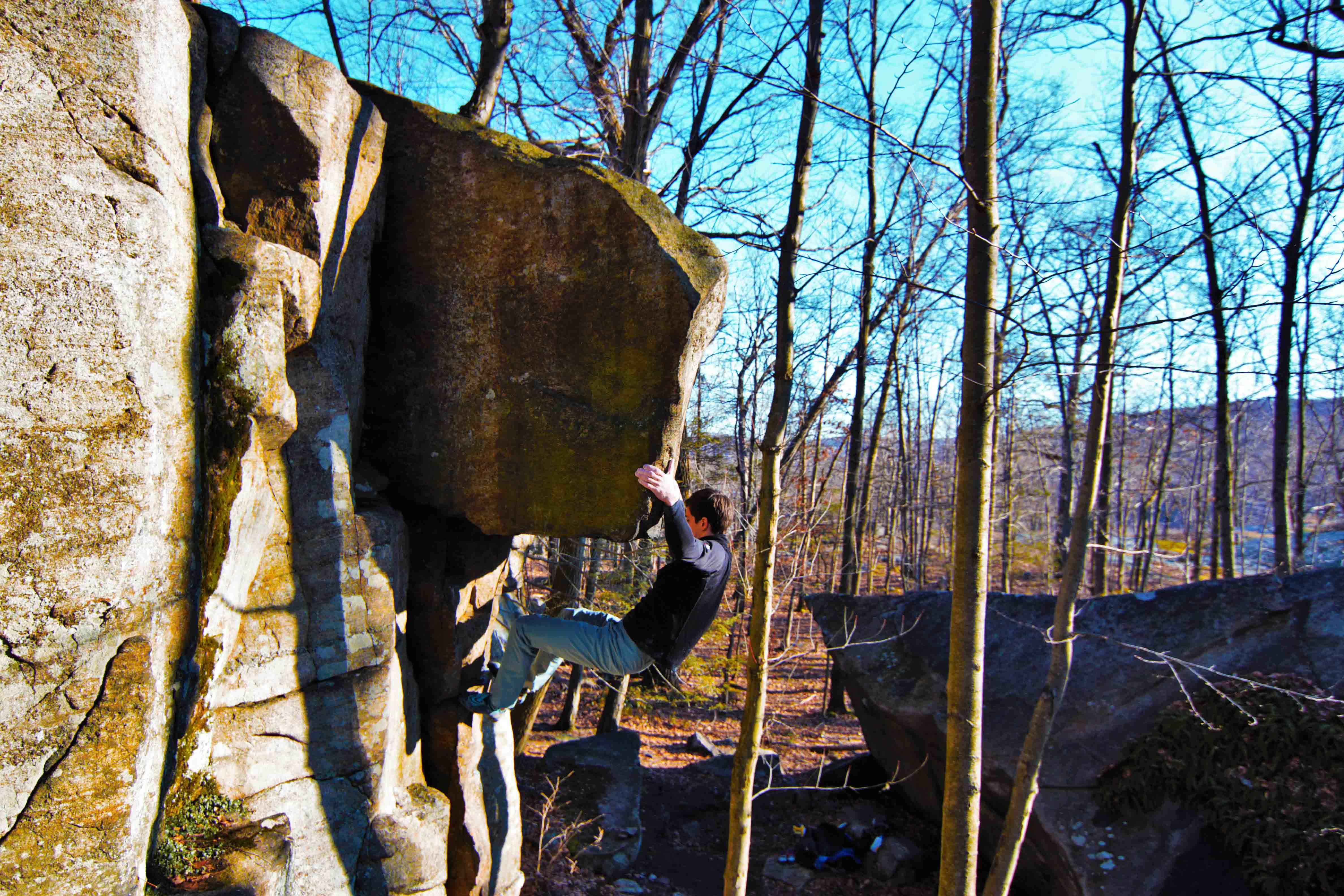
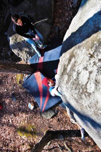
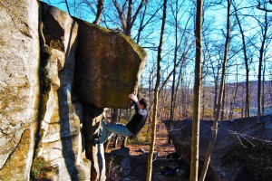
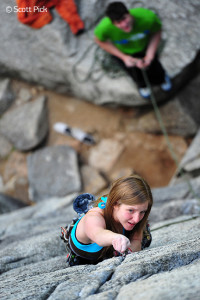
Drew Meyer on Love Handles (V4)
Each area has its classics and warmups with the furthest of all the areas being a large maze of rock, otherwise known as the Fortress. While most visitors to the area will hit the Fortress; the other areas hold enough quality problems to keep all but the strongest climbers busy. Keep in mind that since development in 2006 nature has reclaimed some boulders and problems can grow with lichen again and their approach trails become non-existent. This is part of the beauty of the area so embrace it.
Location:
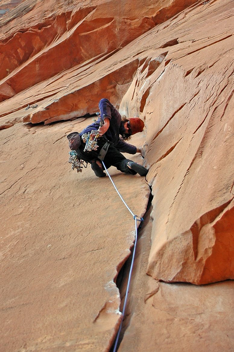
From the downtown Chattanooga area head north on Hwy 27 taking the Signal Mtn Rd Exit and head west (toward the mountain) taking a left onto TN-27 W/Suck Creek Rd. Drive 8 miles through the scenic Suck Creek area and turning left on to Choctaw Trail following signage for Prentice Cooper. A left turn onto Game Reserve Rd leads you to the entrance of the Prentice Cooper area. Drive 8 miles to the left turn to the Davis Pond Rd. and park here if the roads are closed.
The roads are closed from December to March or in exceptionally wet times. When the roads are open you can drive the loop just past the pond taking the right fork. You will be able to see the Alpha area from the road.

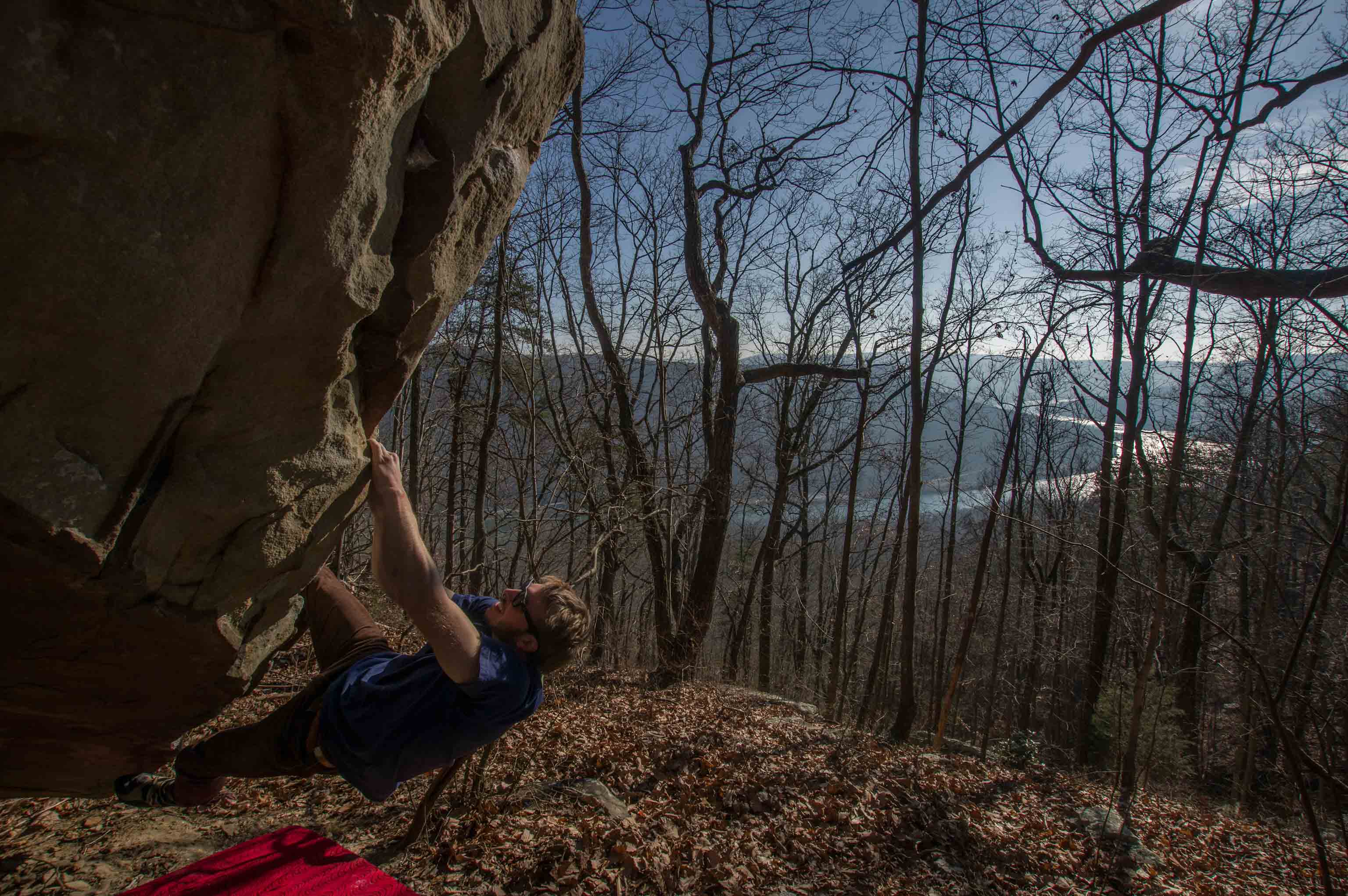
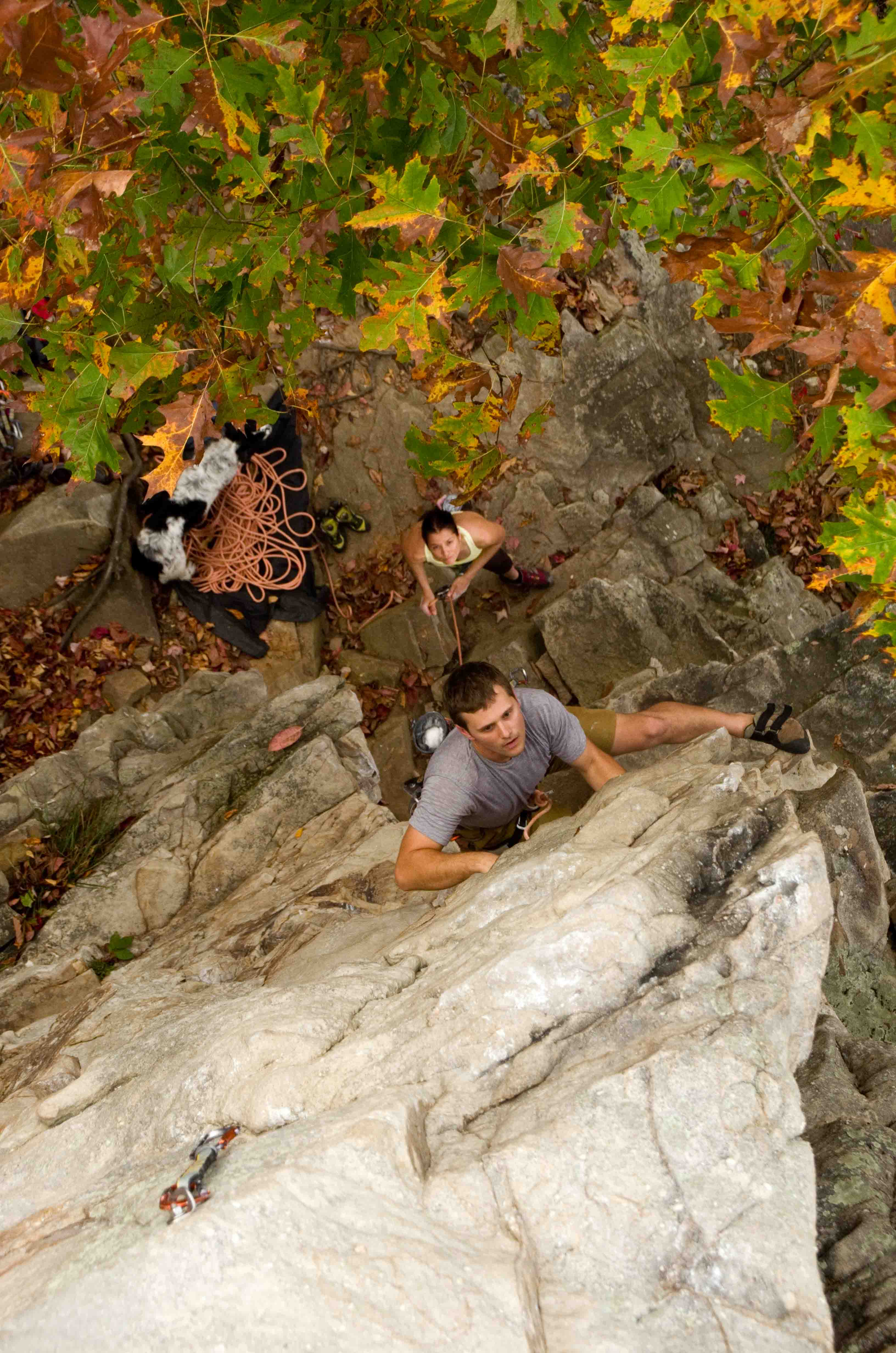
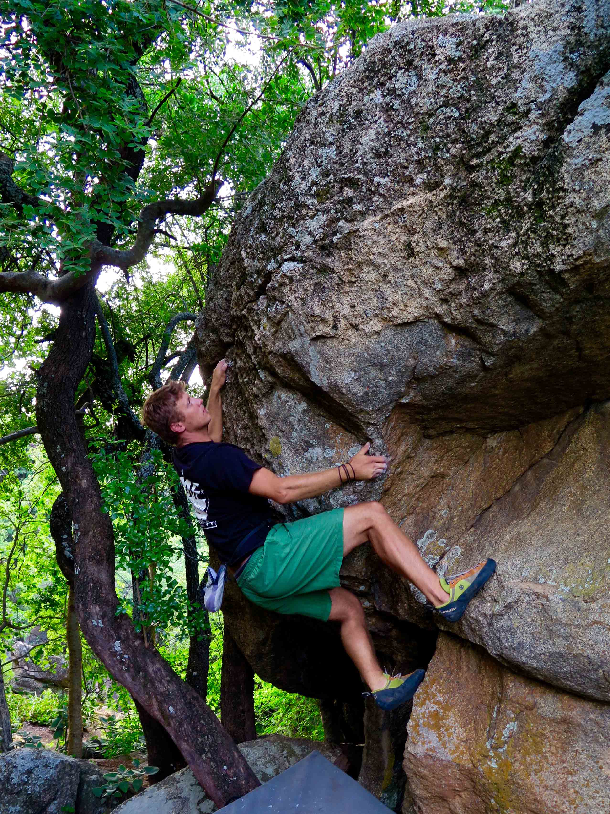
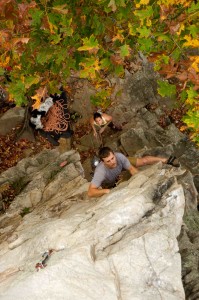
Graham Hodge on Napolean Dynamite (V2/3)
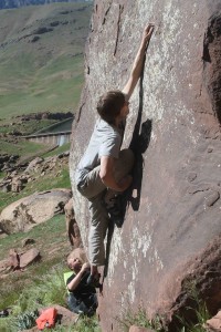
by todd | Jun 4, 2015 | World's Best Rock Climbing Areas
Buy
Trout Creek Climbing here and save money versus purchasing from within our app via Apple or Google. It’s exactly the same guidebook, but offered at a lower price on
rakkup.com.
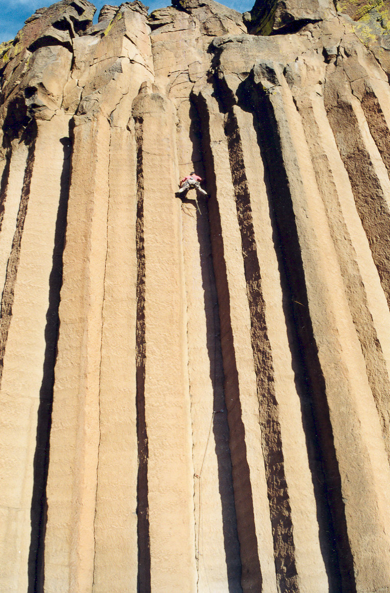
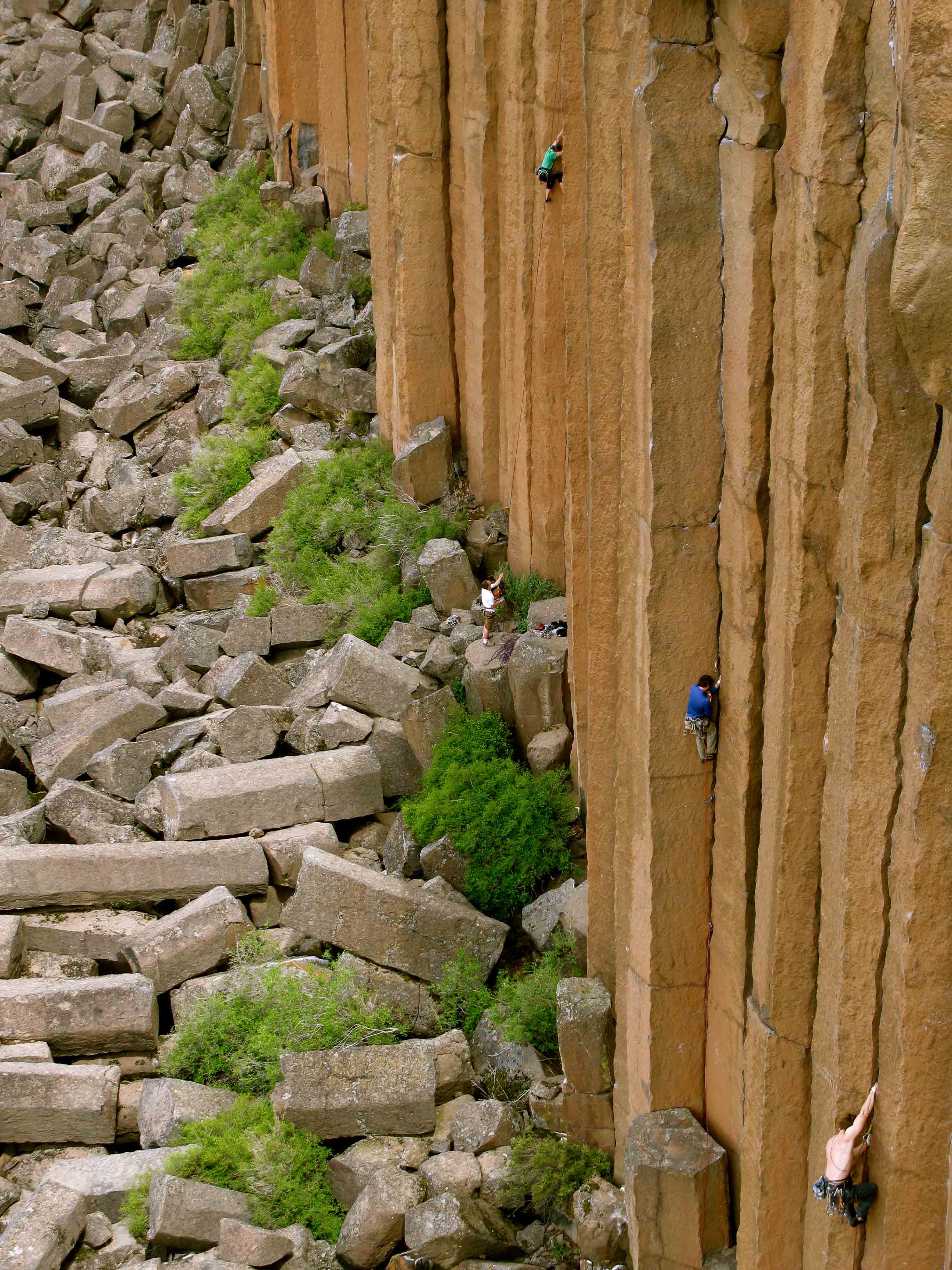
Trout Creek Main Wall as seen from the Deschutes.
In 2001, my dad and I were fishing a part of the Lower Deschutes we had never visited, the blue ribbon section of water from Warm Springs to Trout Creek. There were reports of record numbers of steelhead in the river and the uncharacteristically cloudy weather made chances better than normal for getting lucky. And I was feeling lucky, it was my birthday.
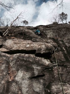
Jeff Wenger on The Space Between (5.10+)
About halfway through the day I landed my first steelhead on a fly rod. It was an awesome battle and after it ended I remember sitting back against the riverbank watching the low clouds swirl and recede upstream to the southwest. The scene changed dramatically as the skies started to clear. Suddenly everything was bright, the sun glaring of off the water almost blinding. I rifled through my pack and eventually located my sunglasses. When I looked back up the entire sky was blue and mirrored in the crystal waters, up the hillside in front of me, was a cliff line of golden columns glowing in the afternoon sun. A couple days later I hiked up to the cliff and climbed what later became known as The Space Between. That lucky birthday led to one steelhead dinner and, in the years since, countless servings of humble pie.

Climbers on the Main Wall.
A little fishing around Central Oregon revealed some knowledge of the place by Smith Rock’s old guard and limited activity on the obvious west-facing wall. After getting the go-ahead from the early visitors I could track down, I replaced the half a dozen or so aging ¼ inch bolts and faded webbing anchors left behind in the 80’s and started picking away at the obvious plums with my brother and a few friends. A year later there were 20 climbs added to the mix. Today Trout Creek offers visiting climbers over 130 routes with most classics ranging from 5.10 – 5.13. All popular routes are equipped with chain anchors and steel lowering carabineers for safety and convenience. Most of the climbing is straightforward with excellent protection and for many years, almost all of the development was done on-sight. In fact, classics were being sent first try even as late as 2008 when Will Stanhope casually dropped in and added Winter Sustenance and Full Clip one empty April afternoon.
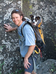
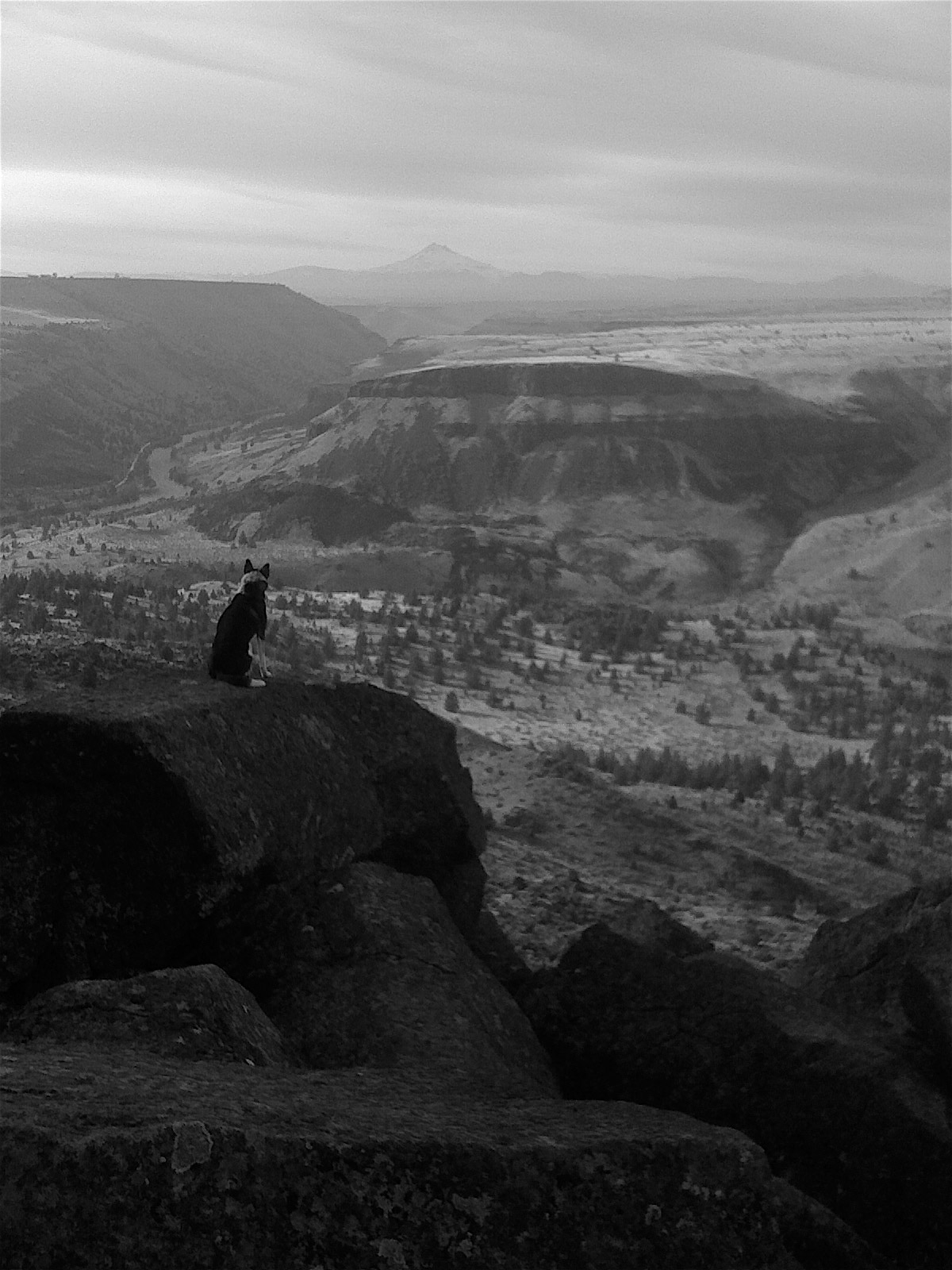
Muddy hitches a ride.
For the decade or so after first spotting the cliff, Trout Creek became my second home. I had my first date with Casey (now my wife) at the crag, we practically raised our dogs at the area. When the youngest, Muddy, was still too little to climb the hill, we carried him up in a pack. To this day Muddy is best behaved and seems most content hanging at one of his perches along the Main Wall.

Muddy taking in the view.
Over the years, the beautiful position of the crag seemed to have a similar effect on more and more people. A small community of climbers grew into a large family. We egged each other on at the crag and later during nighttime One Armed Weasel bouldering sessions, we maintained a community bucket filled with information and safety items, we spotted cougars on the way to the cliff and sometimes in the campground, we had icy swimming challenges, trundled giant chunks of columns, and rolled the ”cube” around the fire, we sketched across snow covered columns, organized trail building parties, had run-ins with snakes, poison oak, ticks, black widows in outhouses, even animal traps by the river. Along the way we developed working relationships with landowners, camp hosts, hunters, fishermen, boy scouts, cavers (yes, cavers), Fish and Game officers, local newspaper reporters, trail building specialists, Oregon Field Guide staff, the Madras police department and most critically to the area’s future, with wildlife biologists and policy makers at the BLM.
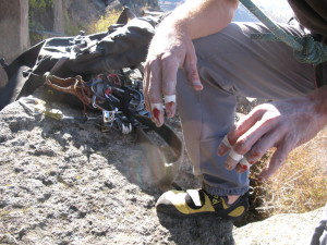
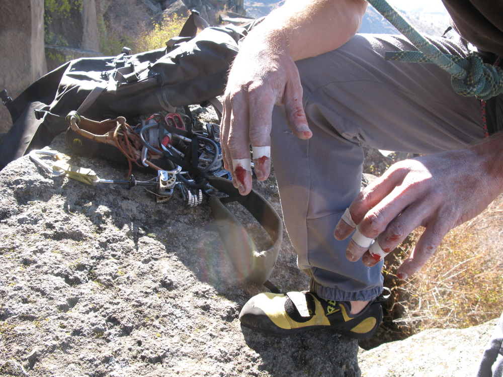
Trout Creek can be tough on the skin.
What could have resulted in a blanket closure of the area due to several Golden Eagle nests located between the SW corner of the Main Wall and Cool Wall evolved into a cooperative effort. Representing climbers at the table with the BLM, our mission was simple: To ensure the safety of the Golden Eagle while advocating for climbers’ rights as a responsible user group. In a show of good faith, and a test of community follow-through, the first seasonal closure in 2012 was voluntary. It was 100% successful in terms of climber compliance. This made a HUGE and positive difference for moving forward in talks with the BLM. Additionally, support from the Access Fund, The Crag Law Center, The American Alpine Club, and letters from many a climber led to a policy that should be sustainable so long as climbers continue to honor the following closure: January 15th – August 15th (This closure includes hiking on the hillsides) If the Golden Eagles do not have a viable nest in the area by May 14th, the area will open to user groups on May 15th.
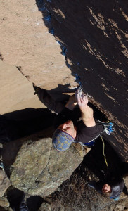
Jeff Wenger on Reservation Blues (5.12+)
So far, climbers have adhered to the seasonal closure but if that changes the area could face permanent closure. Bottom line: Follow the rules and protect future access. More importantly, follow the rules and protect Golden Eagles and the territories they staked out long before any of us came along to go rock climbing.
The impact of climbers, even when the area is empty for part of each year, can be significant. There are no facilities at the cliff. If you need to relieve yourself, please do so in minimally impactful ways and search out an area away from gathering points or the cliff. Also, left over tape, chalk, beer caps, cigarette butts, or other items not really considered garbage in many parts of the world are, in fact, garbage. Please do the right thing(s) in terms of impact and encourage others too also. Together we can all protect the experience and the environment out at Trout Creek.
See you up there,
Jeff Wenger
by todd | Apr 24, 2015 | Uncategorized, World's Best Rock Climbing Areas
Buy
Foster Falls here and save money versus purchasing from within our app via Apple or Google. It’s exactly the same guidebook, but offered at a lower price on
rakkup.com.

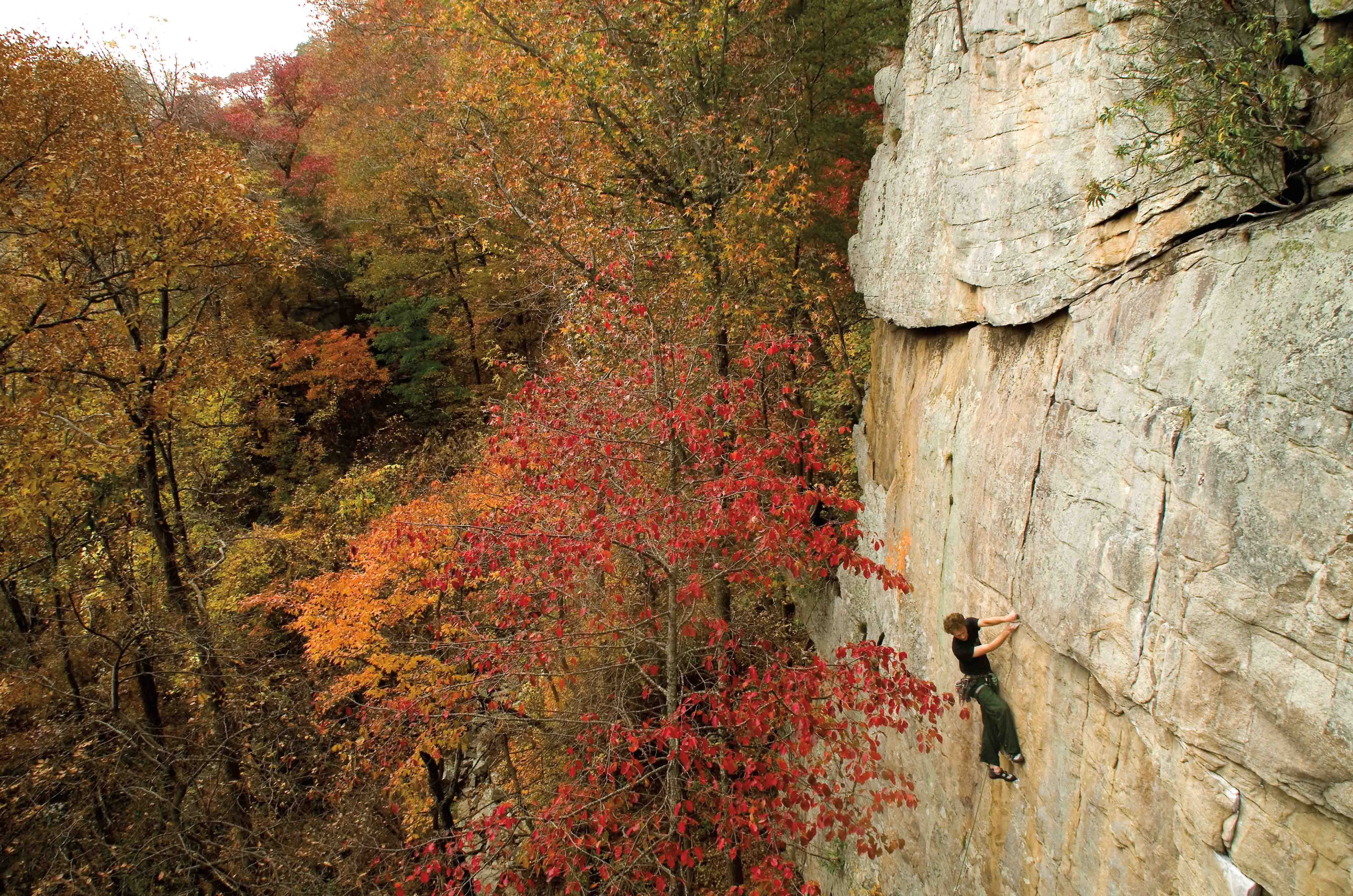
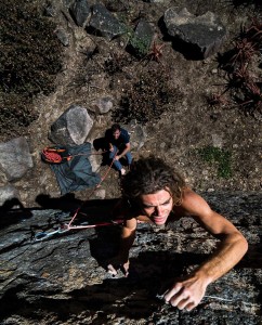
Jason Reynolds on Atrophy (5.11b)
Some of the earliest Foster Falls rock climbing activity dates back to the mid-80s to a handful of now forgotten or retrobolted routes established by a crew of traditional climbers including Chattanooga locals and visiting climbers like Rob Robinson, Steve Goins, and Hidetaka Suzuki. Limited by the amount of ground-up features and paths present within the largely overhung and blocky cliff, these climbers soon moved on to cliffs more palatable to their preferred style.
Jay Perry on Thieves (5.12a)
This fact left Foster Falls wide open for the wide-scale sport climbing development that was soon to follow in the early 90s. Led by the efforts of Eddie Whittemore, a bulk of the hardest and best routes at Fosters quickly fell to a committed group of climbers including Southern notables like Doug Reed, Porter Jarrard, and Chris Chestnutt. Other climbers like Paul Sloan, Steve Deweese, Louie Rumanes, and Chris Watford added to the route inventory throughout the mid-90s, while hardmen like Jerry Roberts established new high-end lines in the steep Bunkers.

Mike Moore on Super Saturated (5.10c)
Meanwhile, the largely unsung hero of Foster Falls moderates, Steve Jones, began bolting some of the most popular routes at Fosters dating back to the early days of development and continued to do so right up until the recent past. His efforts have led to the growing popularity of far-end moderate walls that are still being filled out by Nashville locals like Mike Moore and Darryl Bornhop. With the exception of a few obscure areas, the walls at Foster Falls are largely tapped out and are home to some of the most well-traveled and well-loved routes in the Chattanooga region. Of special note, with the help of the Southeastern Climbers Coalition, the cliff we climb on (once privately owned), has been secured and turned over to be managed by the South Cumberland State Park guaranteeing future access to this valuable climbing resource.
Richard Parks on Bear Mountain Picnic (5.8)
Foster Falls rock climbing is located in the hills of Jasper Tn, After leaving I-24, go north on 28 and get off at the Jasper exit (sign for Foster Falls), and head left off the exit ramp onto Main Street (West 72). After passing through the town of Jasper, take a right at signs reading TN150/US41 north toward Tracy City. Stay on TN150/ US41 North as it splits left and heads up the mountain. The entrance to Foster Falls (marked by a sign) is on your left 6.5 miles up the mountain from this split.
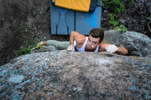
by todd | Apr 22, 2015 | World's Best Bouldering Areas
Buy Norm & Matt’s
Powerlinez guidebook here and save money versus purchasing from within our app via Apple or Google. It’s exactly the same guidebook, but offered at a lower price on
rakkup.com.

Jeep Trail – Trail Head Entrance
If you are one who is interested in history, then the Powerlinez might be just the place for you. Let me forewarn you – it’s not a place for solitude or escape from the influence of man. Hundreds of years ago, before power plants and landfills, the local Ramapough Indians roamed these hills and especially the Torne Valley region, which is the same valley we climb in today. Rumors of artifacts and old settlements have dated as far back as we remember.
Now, Powerlinez rock climbing is the beginning of a new history. It is the first area in Harriman State Park to be legally opened to climbing. Thanks to all the hard work of the Torne Valley Climbers’ Coalition (TVCC) in 2013; they worked together with the Palisades Interstate Parks Commission (PIPC) to work out a no fee, waiver agreement to get climbers into the area and doing what they love most!
The question is – how long have climbers been climbing here and what history are current climbers going to leave behind?
Krista on Goldilocks (5.6)
Over the last two years, development has exploded in the Powerlinez climbing area. There used to be a total of 100-200 boulder problems and roped routes, and now the first release of the rakkup guidebook “Powerlinez” is poised to have 100+ climbs alone. We’re barely exposing a quarter of the total current routes! When the hardest climbs used to top out at 5.10 or V4, local hard climbers are slaying 5.12s and V9s every month. This summer, during our two year anniversary, is only going to rein in more hard and bold climbing.
Matt on Indulge the Bulge (V7)
This development has spread as whispers around the local climbing gyms, and a couple local Gunks’ celebrities – Russ Klune and Al Diamond – showed us some hard boulder problems that they messed around on in the 90s. When we thought we were getting first ascents, we realized that we still live in the shadows of the true masters of their craft.
How can you not expect routes to be climbed in an area that’s only an hour away from New York City? With so many people, it’s no surprise that a climber or two have wandered through the boulder fields of the Powerlinez. After all, Storm King Mountain was one of the first rock climbing spots in the Northeast in the 1920s, and that’s still another half-hour north of the Powerlinez.
Matt on Indulge The Bulge (V7)
So here we stand, a group of local climbers fielding the interest of an even larger community further south in the metropolis of the city. They all want a taste of local climbing, but what can happen to an area with a new guidebook? Thanks to rakkup, we’re sure that amazing things will happen. With an interactive trail map to stay on the right trail, and waypoints so that you don’t get lost, rakkup is helping climber’s not only follow the rules, but make the most of their climbing experience.
Charlie on Ricochet (V4)
Here’s what we hope: We hope harder climbers will come out and project new stuff. We hope more 5 star problems will become uncovered from their mossy crags by all these climbers. We hope that there will be a responsible stewardship of the area; leaving a legacy of respect for the area, its history, and the locals.
We know that this is the beginning of a long and beautiful history between climbers and state lands. While we look forward to the next hand hold to climb on, may we all remember where we came from, and as more areas open up in New York State Parks, I hope we can remember the little area that started it all. The little yeast that leavened the whole dough: The Powerlinez.
by todd | Apr 13, 2015 | World's Best Bouldering Areas
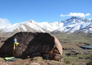
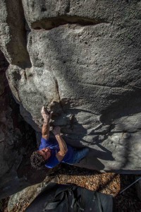
Tijl Smitz on Wind of Dawn (V4)
In the clouds of the High Atlas Mountains in Morocco rests a real bouldering treasure hidden from the climbing community for many years. Oukaimeden is the first bouldering destination in Morocco, and is just a one and a half hour drive from the cultural heart of Marrakech. Bouldering in Oukaimeden combines well with a road trip through Morocco or a city trip to Marrakech and is a cultural and exotic experience.
Odielvan Wijkon on Schwartz Walderkirch (V3)
If you thought pioneering was only something done by pioneers in the twentieth century, you are wrong. At 2000 meters above the imperial city of Marrakech you feel the fresh air of nature and splendid views when you get psyched about a new problem you’re working on. Thousands of potential problems are located in the hills surrounding the little village of Oukaimeden. A true pioneer’s experience of exploring new boulders and sending new problems no one has attempted before you.
Irene Pieper on Lost Hold (V3)
Oukaimeden is best visited in the spring months of March, through May and during the Autumn months of October and November. The summer months June, July and August can be hot and the mountains are, by then, covered with shepherds. The winter months December through February can be perfect for sending hard problems but at the same time can be frustrating with thick layers of snow. Nevertheless, the sun is strong enough to melt the snow from the boulders, even during the winter months, at a fast pace.
Leander Rutten balancing in The Bakery
Currently, Oukaimeden has three main areas where most of the problems are located. The lowest (2300m.) area, and probably the most flat one too, is called The Colony. A small area with a high density of documented boulders from balancy plates to high balls and seriously overhang cave problems. The Colony is a 7 km drive from the village and is located in a hairpin turn and provides spectacular views over the lush Ourika valley.
The most developed areas are The Bakery & Rivers of Babylon located near the small village of Oukaimeden. At the northwest side of the road The Bakery is covered with the most problems ranging from v0 to v6. There are also potential hard highball problems in this area. Rivers of Babylon is at the north east side of the river and is a long stretched area at Atlas crest line. Don’t wait, book your ticket to Marrakech today and go send these tasty problems.
by todd | Apr 8, 2015 | Rock Climbing App Reviews, Uncategorized
 Thank you Fringes Folly. We couldn’t agree more!
by todd | Mar 27, 2015 | World's Best Bouldering Areas

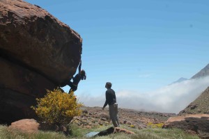
Martyn Oosthuizen on Aliance (V0)
The Hillside Dams, once the principle source of Bulawayo’s water supply, are in easy reach of the center of town. Our own climbing and bouldering oasis little more than a hop, skip and a jump away.
Although distinct from the Matopo Hills, this area of broken kopjes and sandy open plains resembles the much larger, better-known World Heritage Site. Yet it lies within the Bulawayo City boundary. Its natural vegetation is still largely intact and it includes a wide range of bird life. It has to be said that there are more species of plants in the park than the whole of England. There are also many small mammals including monkeys, squirrels, rock hyrax and duiker.
Tim Kluckow on Jungle Fresh (V3)
The area has attracted people since the earliest of times. It is not surprising that it was the location of one of King Lobengula Khumalo’s favorite royal villages to which he escaped when the stresses and strains of power at the nearby capital of Bulawayo were too great. In recent history it has catered to generations of Bulawayo residents seeking an accessible place of refuge and winding down. The newly renovated restaurant is becoming more popular and is a great place for a sundowner after a good session of sending.
Dom Stackler on Jungle Fresh (V3)
People have been climbing at Hillside Dams since the 90´s with the likes of Jeff Broome and Haedi Cunningham using the park regularly to keep in shape for the bigger rocks of the Matopo Hills and as a place to introduce those interested to the world of rock climbing. The bouldering potential was never really explored till after 2012. In 2014 Zimbabwe Rock Climbing (ZRC) was formed with the purpose of developing climbing and climbers in Zimbabwe. Hillside Dams with its position within the city and the potential for 300+ boulder problems (not bad for an area of 86 hectares/212 acres, a lot of which is the two dams) was chosen to be the focus of this development. Since the formation of ZRC there has been a frenzy of development including a dozen or so short sport routes and many dozen boulder problems. All of the climbing is easily accessible with most problems less than a 10 minute walk.
Tim Kluckow on Me Jane (5.10d)
The dominant rock is Syenite. This coarse igneous rock is about 2.172 billion years old and is very similar to granite but is deficient in quartz. As far as climbers are concerned it looks like and climbs the same as local granite and is often referred to as granite. Bulawayo´s cool dry winters are the best time for climbing at Hillside Dams, while early mornings and late afternoons/evenings are still great during the warmer months.
by todd | Mar 20, 2015 | World's Best Bouldering Areas
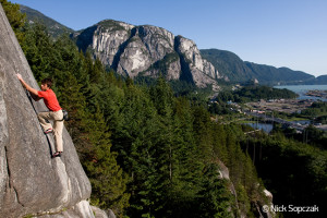
Squamish Smoke Bluffs Rock Climbing with The Chief & Howe Sound backdrop.
Smoke Bluffs Introduction
The Smoke Bluffs is likely one of the most popular and frequented climbing locations in all of Canada. This is primarily due to the hundreds of quality single-pitch climbs found scattered across the hillsides, all within walking distance of Squamish. The crags host an abundance of varied crack and slab climbs, and most of the cliff-tops are easy to access for setting up topropes. Rainstorms will prevent climbing on all the cliffs, but the Bluffs dry very quickly afterward due to afternoon sun exposure, minimal tree cover and frequent winds, which also provide welcome relief in the heat of summer.
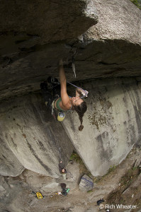
Jasmin Caton working on Zombie Roof. 5.12d. Smoke Bluffs, Squamish, British Columbia, Canada
If you’re new to the area, the Smoke Bluffs is a great place to test Squamish granite, get a quick session in after work, or hone your skills for bigger objectives on the Chief.
Location
From downtown Squamish, the Smoke Bluffs appear as a series of granite outcrops lining the hillsides directly to the east. To reach the parking area, follow Highway 99 toward downtown and turn east onto Logger’s Lane opposite the McDonald’s restaurant. Follow the paved road north past the Squamish Adventure Centre and a sign will direct you into the climbers’ parking area a little farther down the road on the right. All crags are approached from this location. The Smoke Bluffs is a municipal park that borders residential neighbourhoods and is frequented by non-climbing locals. Please be a considerate visitor in order to keep relations with the locals as positive as possible.
Roger Strong, Cold Comfort 5.9, Smoke Bluffs, Squamish, BC
Climbing Strategy
The quantity and quality of routes in the Bluffs causes the popular cliffs to get quite congested on most weekends throughout the climbing season. Walking from crag to crag looking for a free climb can be a frustrating experience, but if you consider the following recommendations, a good day with minimal waiting is likely. Try starting early or climbing late if you must join the onslaught of weekend warriors. The bulk of the climbing public will arrive mid-morning and will often quit before dinner, leaving many of the crags deserted in the evening, a wonderful time to get in a few classic pitches.
Placing gear in one of the Smoke Bluffs many sweet cracks.
If you’re having trouble finding open climbs midday, try the out-of-the-way cliffs. As a general rule, the farther you hike the better your odds of finding a quiet spot. Good examples are the crags around Lumberland, High Cliff and Island in the Sky below Burgers and Fries, and the outlying crags on the Loop Trail, such as Funarama, Tunnel Rock, Call it a Day and Skunk Hollow. Finally, don’t write off rain days. Many climbers from Vancouver get spooked if the forecast is threatening, and won’t make the one-hour drive from the city. But if you don’t mind taking a risk, you might luck into a great day in the fast-drying Bluffs. And if it does rain, you can always go hiking, biking or climbing at Chek.

Finding the sweet jams in the Squamish Smoke Bluffs Rock Climbing
by todd | Mar 19, 2015 | Uncategorized

Now you can follow us on our rakkup Pinterest page, a new visual way to hear rakkup content news. Browse our climbing guidebook catalogue, read about why our guidebook authors believe their local climbing areas are awesome, or stay updated whenever we publish guidebook content updates.
by todd | Mar 16, 2015 | World's Best Rock Climbing Areas
Moab is the name of a son, born of a young woman who tricked her father into having sex with her. It follows that it would become a wild child, run by a humpbacked flute player..the mythical Hopi symbol of fertility, replenishment, music, dance, and mischief. The place is a gypsy camp akin to “Burning Man”. Complete with the warm smell of colitas rising up through the air. Many of the town’s businesses are closed in the winter, when their owners move back to reality. A trip to this bustling recreational sprawl in the spring or fall is a “trip” with Kokopelli, indeed.

kokopelli-Moab Rock Climbing
Moab is a land of extremes. Such is life in a desert town born of a uranium mine. You can set up your tent in someone’s backyard in the middle of town for $10. Use the next door neighbor’s shower for another $5. And hit the cantina for tacos & beer 3 blocks down. You can check yourself into a “hostel” or “cabin commune” for a few bucks more and get a shower and microwave. Patchouli scent will be thrown in for free…whether you want it or not. $150/night is typical for a hotel room in April…if you book it by February. The same room will be available at a moments notice in July for $40/night. More traditional Forest Service campsites surround the town. Some are reservable…four months in advance. The rest are first come / first serve.

Ivan perevozov on Horizontal Mambo Photo By: Michael Loh – Moab Rock Climbing
Moab is a place people travel to for fun. The result is a gregarious party atmosphere of shared resources. Beer, campfires, coolers, drums, jeeps, bikes, ropes, boats, giant cams, bloody legs, bikini tops and cut-off jeans…all covered in a reddish-brown tint. Moab is four wheeling, dirt biking, river running, and rock climbing fun! Moab Rock Climbing is the most comprehensive guidebook to climbing on Wall Street, Moab’s most popular crag. But it also covers the most popular crags on Kane Creek Road and River Road with detailed route descriptions and color photo-topos. Over 150 routes are covered so far. All are within 15 miles of town.
Snake Slab (5.8) Moab Rock Climbing
Moab is Chinle, Cutler, Entrada, Kayenta, Moenave, Moenkopi, Navajo, Tuft, Vaqueros and Wingate. In the language of scientists and climbers alike. This “type locality” is the way we describe the ever-present sandstones in and around Moab, and that which covers the clothing, skin and hair of every person the moment they exit the vehicle that brought them here. Most cracks are parallel-sided, demanding mastery of jamming techniques. The surface of desert rock is like fine sandpaper. The dry air and porous rock will suck the sweat right out of your hands. If you’ve honed your friction skills on glacier-polished granite slabs you are in for some excitement on Navajo sandstone. Its a whole ‘nutherworld here. You may have heard horror stories about crazy old bolts and teetering loose blocks in the desert. They are all true. Ha! But this Moab Rock Climbing guidebook helps you navigate through the mix of good and bad protection and loose terrain with solid, up-to-date information and historic anecdotes.

Flakes of Wrath Photo By: Adam Winters – Moab Rock Climbing
Moab! The word makes the back of my hands tingle with the remembrance of pain, fear, and enthusiasm. Don’t worry if that’s not your kink. Its not all hand-jamming and teetering towers of mud here. This guidebook comes with equal parts crack, slab and vertical face. Nearly half the routes are actually sport climbs. And if you’re hankering for a road trip to a town with locals who actually welcome climbers, you might find a slice of heaven here.
Learn more about Tony here
here.