by todd | Jul 15, 2023
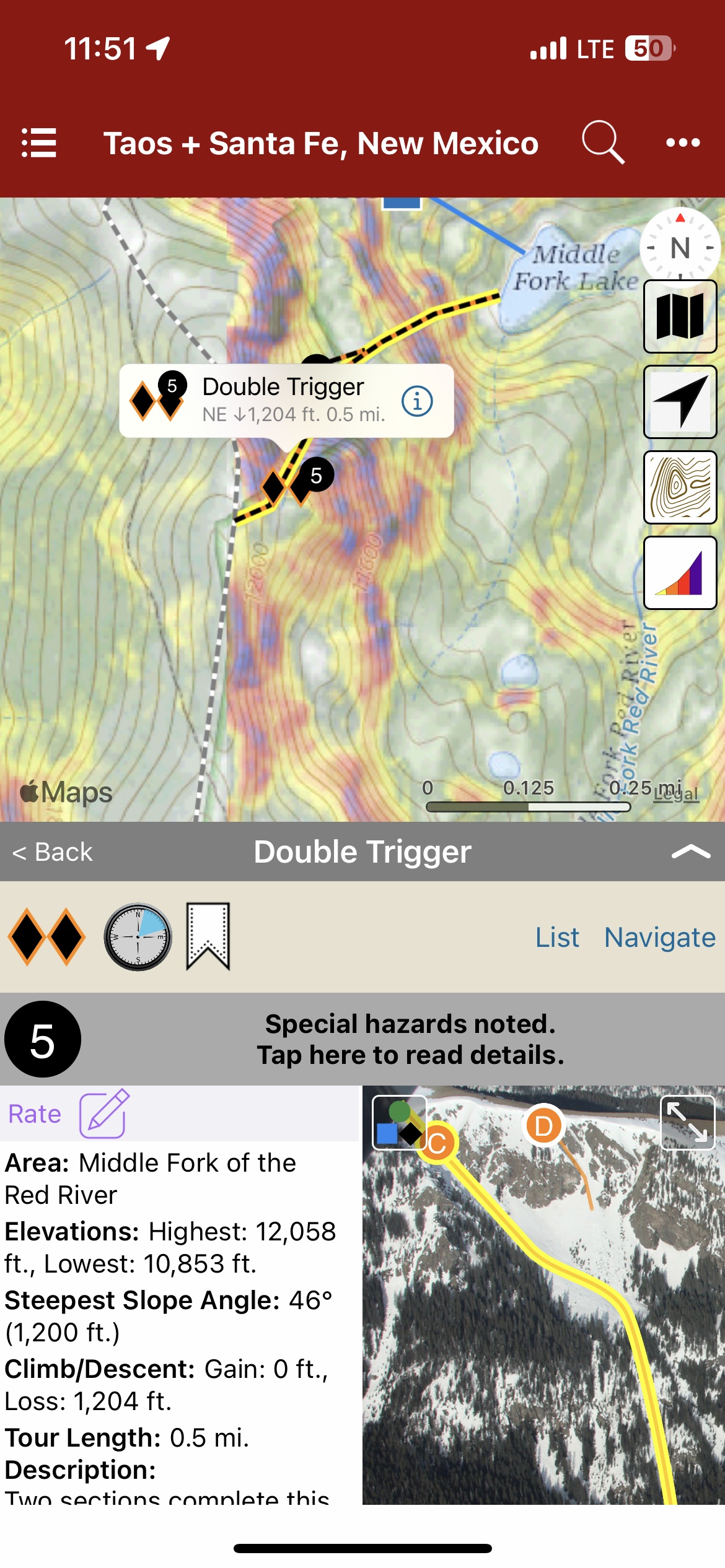
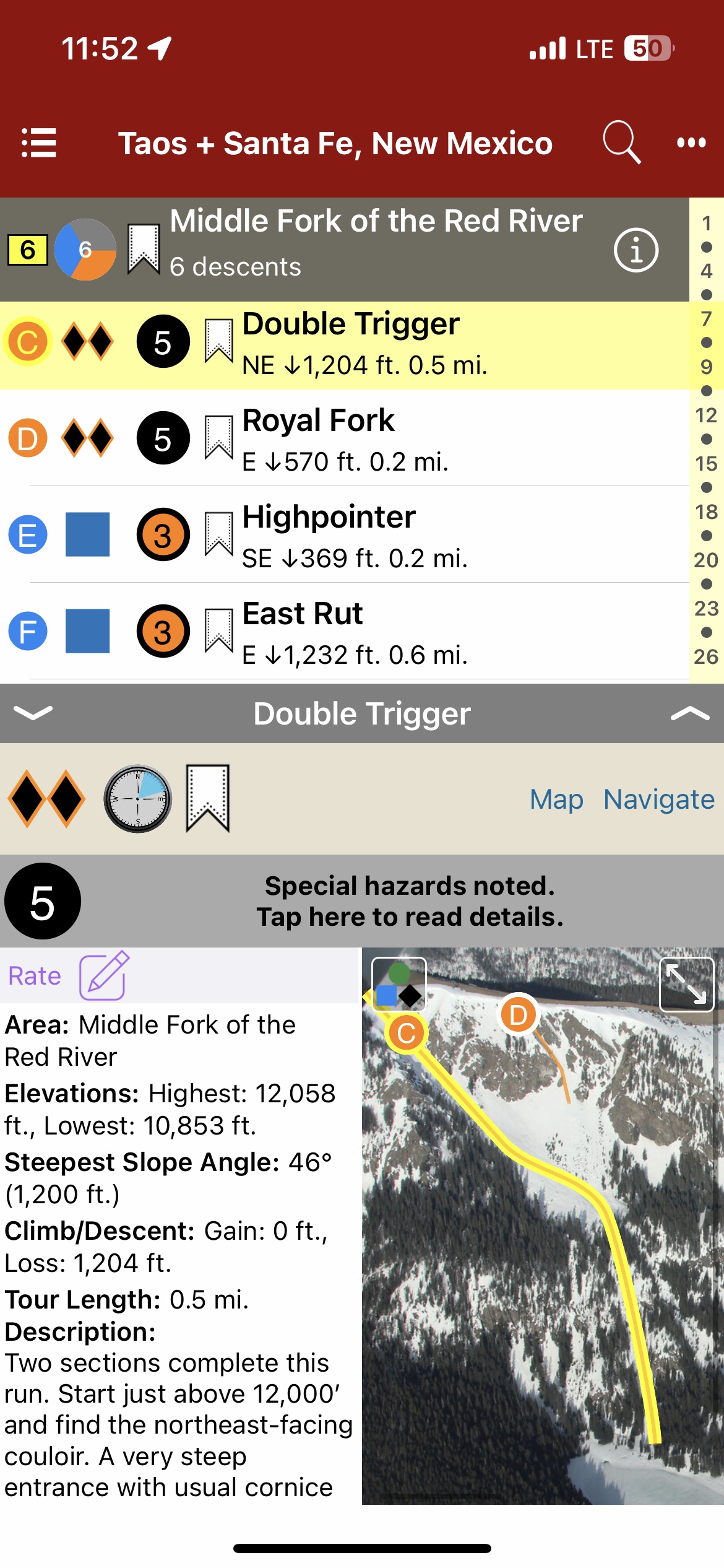
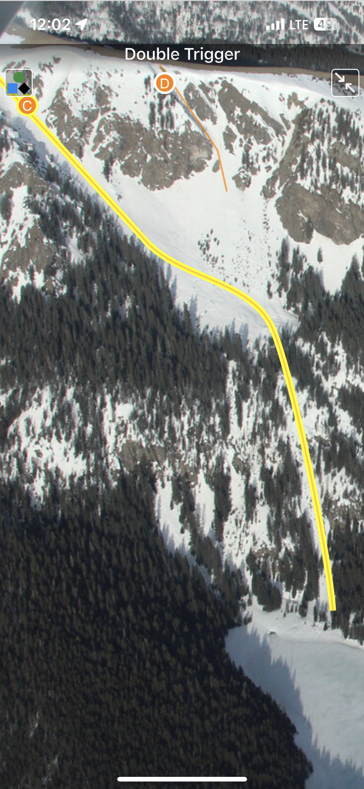
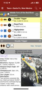
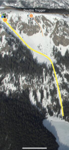
Backcountry Skiing: Taos and Santa Fe, New Mexico
by James Marc Beverly
Taos Avalanche Center
Beacon Guidebooks:
California: Light Tours of Tahoe Colorado: Light Tours of CO | Berthoud | Buffalo | Cameron | Crested Butte | Grand Traverse | Loveland | Marble | RMNP | Silverton Oregon: Mt. Hood Washington: Baker | Crystal | ONP | Snoqualmie | Stevens
New Mexico has been possessed by many peoples, tribes, countries, and government entities—and without fail, those who visit become possessed by its vastness and beauty. As centuries pass and new abodes are built on top of old, the peaks and valleys forged over geologic time remain. To experience their splendor, open your eyes, take a deep breath of the high desert air, and let the rapture of the place overtake you. At no time is the splendor wasted on those who hike to these summits during the winter and spring months as they are rewarded by the incomparable bliss of sliding down on snow. A truly magical experience.
Backcountry touring is a relatively new activity in New Mexico. The early days of the pandemic left many avid skiers and riders without a functioning ski area. For the cost of a lift ticket, backcountry travelers could buy a new pair of skins and open up the world outside the ski area boundaries.
I never saw tracks far beyond the ski area boundaries in the 80s; it wasn’t until the early 2000s that I started to see occasional tracks. Today, it’s rare that I don’t see someone else out having fun in the sidecountry—but the wilderness experience is still very much available to those willing to explore.
New Mexico offers many adventures in areas less traveled. The snow can be as deep as anywhere in the Rocky Mountains, and the spring skiing can make for quick descents. While the New Mexico snowpack shares commonalities to the snowpack at large within the Rocky Mountains, the lower latitude plus high elevation combine to form a special snowpack different from the surrounding states. The changing snowpack may be very different from the typical continental snowpack folks have come to expect in the San Juan or Elk Mountain ranges just to the north in Colorado.
I am fortunate to have had the opportunity to spend the majority of my youth, and to have made a successful guiding career, in these mountains. I share the common thread of the experience with those who have come before and those yet to make the discoveries.
—James Marc Beverly
-
-
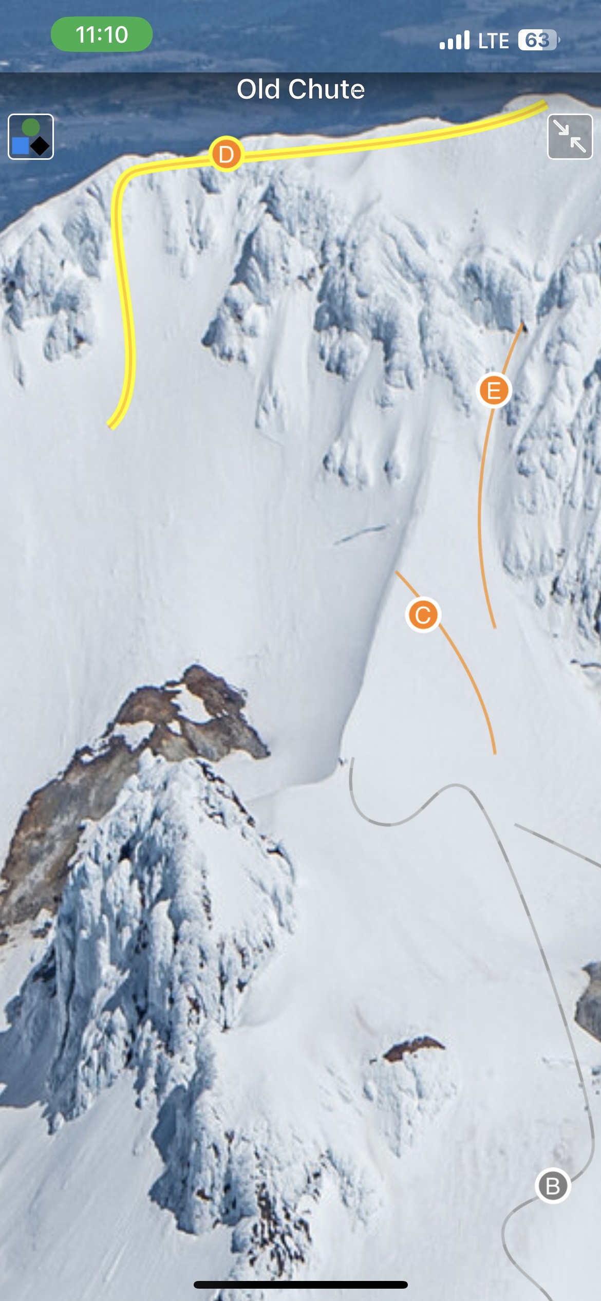
Map view
-
-
List view
-
-
Full screen photos
by todd | Jul 15, 2023
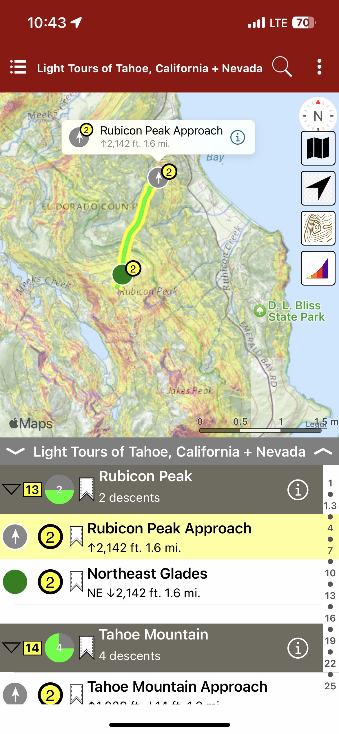
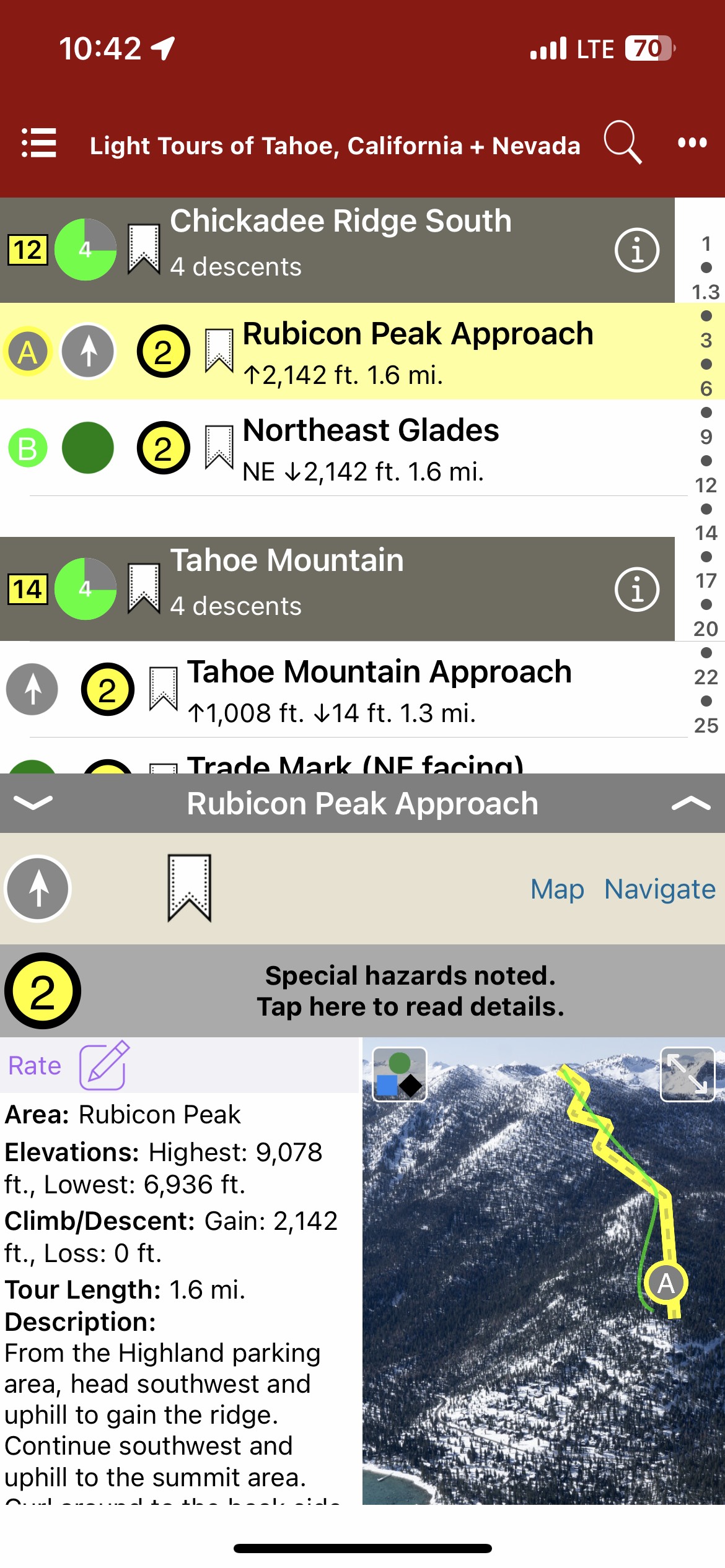
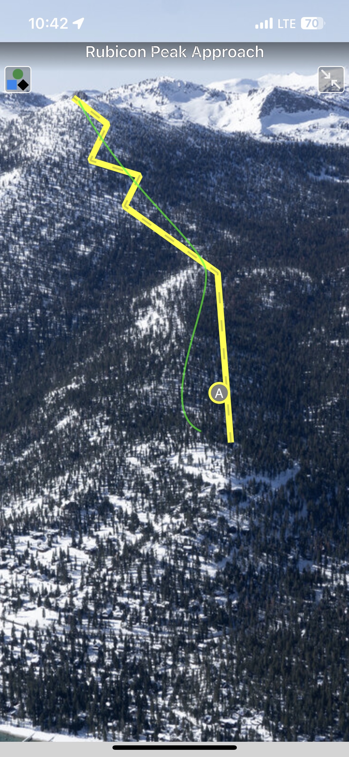
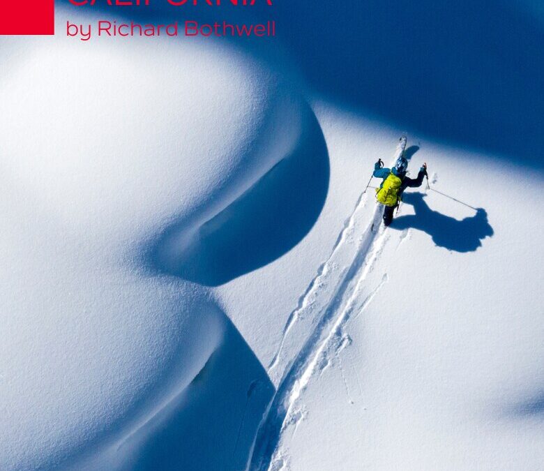
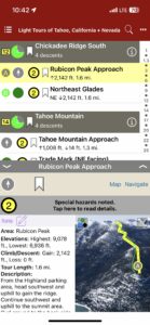
Backcountry Skiing: Light Tours of Tahoe California
by Richard Bothwell
Beacon Guidebooks:
For avalanche forecasts of this area: Sierra Avalanche Center
Colorado: Berthoud | Buffalo | Cameron | CO Light Tours | Crested Butte | Loveland | Marble | RMNP | Silverton New Mexico: Taos Oregon: Mt. Hood Washington: Baker | Crystal | ONP | Snoqualmie | Stevens
With its combination of playful terrain and plentiful snow, the Tahoe Sierra is reputed as one of the best ski touring regions in North America. While extreme skiing abounds in the Tahoe area, many people have an interest in finding enjoyable terrain for making turns while avoiding high-consequence avalanche slopes. Enter this first edition guidebook focused on the mellow side of ski touring by experienced guide and avalanche educator, Richard Bothwell.
With routes spanning the Lake Tahoe region from Interstate 80/Castle Peak in the north to Carson Pass in the south, there are enough tours to last you many seasons of exploration. Whether these mellower tours serve you as a way to get out on a higher-danger day, or as a way to introduce new friends to backcountry skiing, you’ll find that low-angle routes are a great arrow in your quiver.
Explore with a new ski partner, try something new, concentrate on the exercise and fresh air, and most of all, be proud you’ve chosen a sustainable style of ski touring you can enjoy for decades.
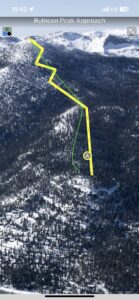
In this digital guidebook, you will find a sophisticated navigational mobile app, complete with aerial photos, marked runs, a zone descent list, ascent and skin track info, run descriptions and tour lengths, hazards, slope angles, elevations, Avalanche Terrain Exposure Scale ratings, and more. Additional app features include: offline GPS navigation, zoomable topo maps, map legends, slope angle shading, a searchable/filterable descent list and bookmarking. Designed to go along with you on your tours and accompany the Light Tours of Tahoe Ski Atlas.This digital book covers the following zones: Castle Peak, Johnson Canyon, Sunrise Bowl, Skislope, Boca Hill, Mount Judah, Bradley Hut, Brockway Summit, Incline Lake Peak, Tamarack Peak, Chickadee Ridge North, Chickadee Ridge South, Rubicon Peak, Tahoe Mountain, Mini Trimmer, Angora Ridge, Echo Lake + Becker, Ralston Peak, Waterhouse North, Waterhouse South, Meiss South, Meiss North, Elephant’s Hump, Round Top, Kirkwood + Caples
-

-
Map view
-
-
List view
-
-
Full screen photos
by rob | Jul 14, 2023
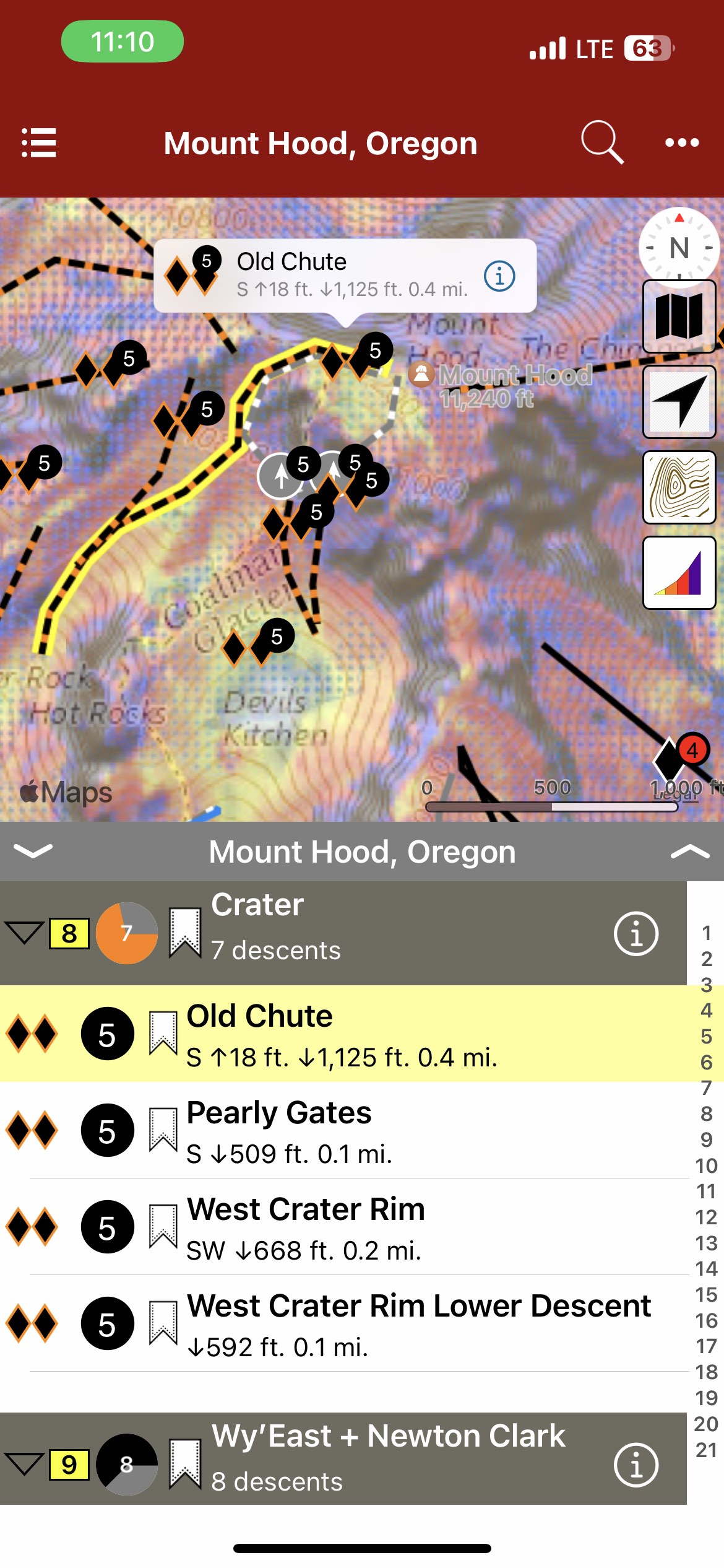
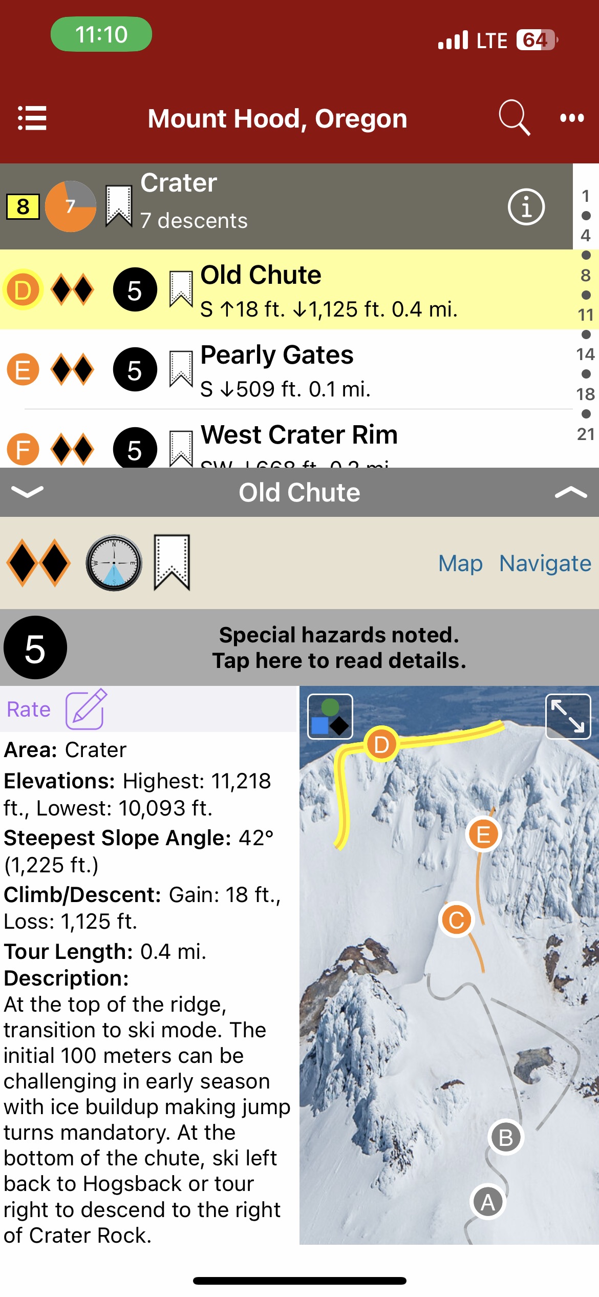
Backcountry Skiing: Mount Hood Oregon
by Eric Schmidgall
Northwest Avalanche Center
Beacon Guidebooks:
California: Light Tours of Tahoe Colorado: Light Tours of CO | Berthoud | Buffalo | Cameron | Crested Butte | Loveland | Marble | RMNP | Silverton New Mexico: Taos Washington: Baker | Crystal | ONP | Snoqualmie | Stevens
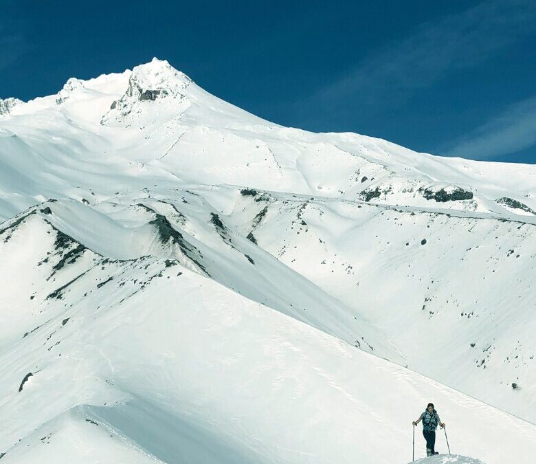
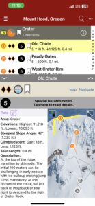
Mount Hood has captivated the imaginations of many in the Pacific Northwest for centuries. Named for a British admiral in the late 1700s, its native name has been lost to history. Lewis and Clark labeled Hood “stupendous” as they returned east on their epic journey, and that assessment rings true today. The first recorded ascent of Mt. Hood occurred in the 1850s, and the history of skiing on the mountain started with people on long wooden skis using them for transportation. The first recorded ski descent of the south side occurred in the 1920s, and skiing and mountaineering on Hood have been intertwined ever since. With the opening of Timberline Lodge in 1937, skiing on the mountain exploded in popularity. Mount Hood became renowned for backcountry skiing when Sylvain Saudan descended Newton-Clark Headwall on the east side of the mountain in 1971, a descent that heralded the arrival of “extreme skiing” in America. Backcountry skiing and riding has always been relatively popular on the mountain, as a stable snowpack and long season entice locals and tourists alike. As backcountry use has grown quickly in the past few years, Mount Hood remains a sought after destination for those looking for ski mountaineering descents, glaciers and hopefully – powder.
The author and publisher acknowledge that the land surrounding Mount Hood lies within the ancestral territories of several Native American tribes including the Multnomah, Wasco, Confederated Tribes of Warm Springs, Confederated Tribes of Grand Ronde, and the Confederated Tribes of the Yakama Nation, who have looked upon and lived on this mountain for thousands of years.
-

-
Map view
-
-
List view
-

-
Full screen photos
by rob | Feb 1, 2023
-
-
List views
-
-
Map views
-

-
Full screen topos
by todd | Nov 3, 2022
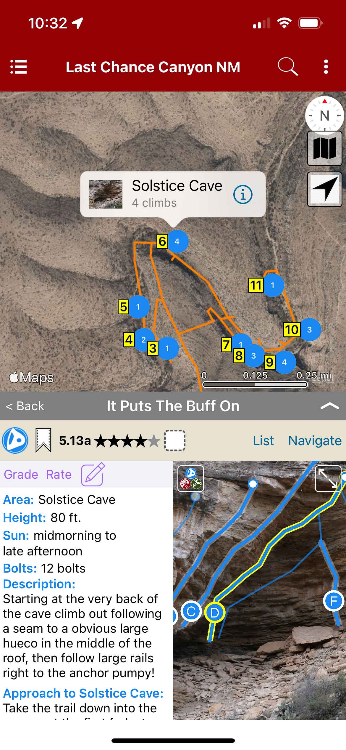
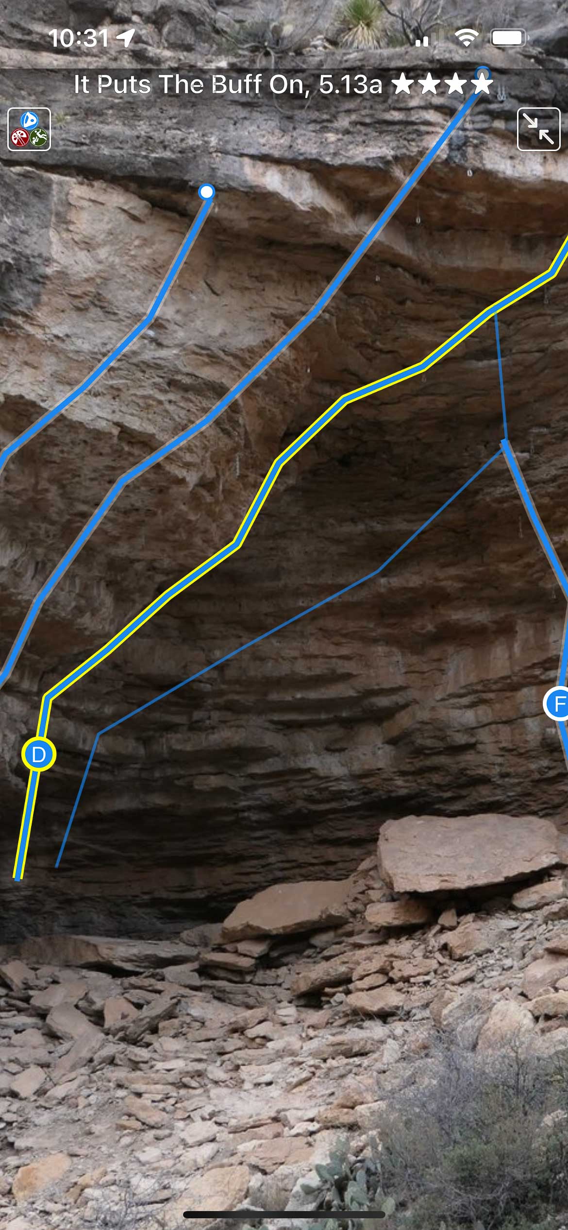
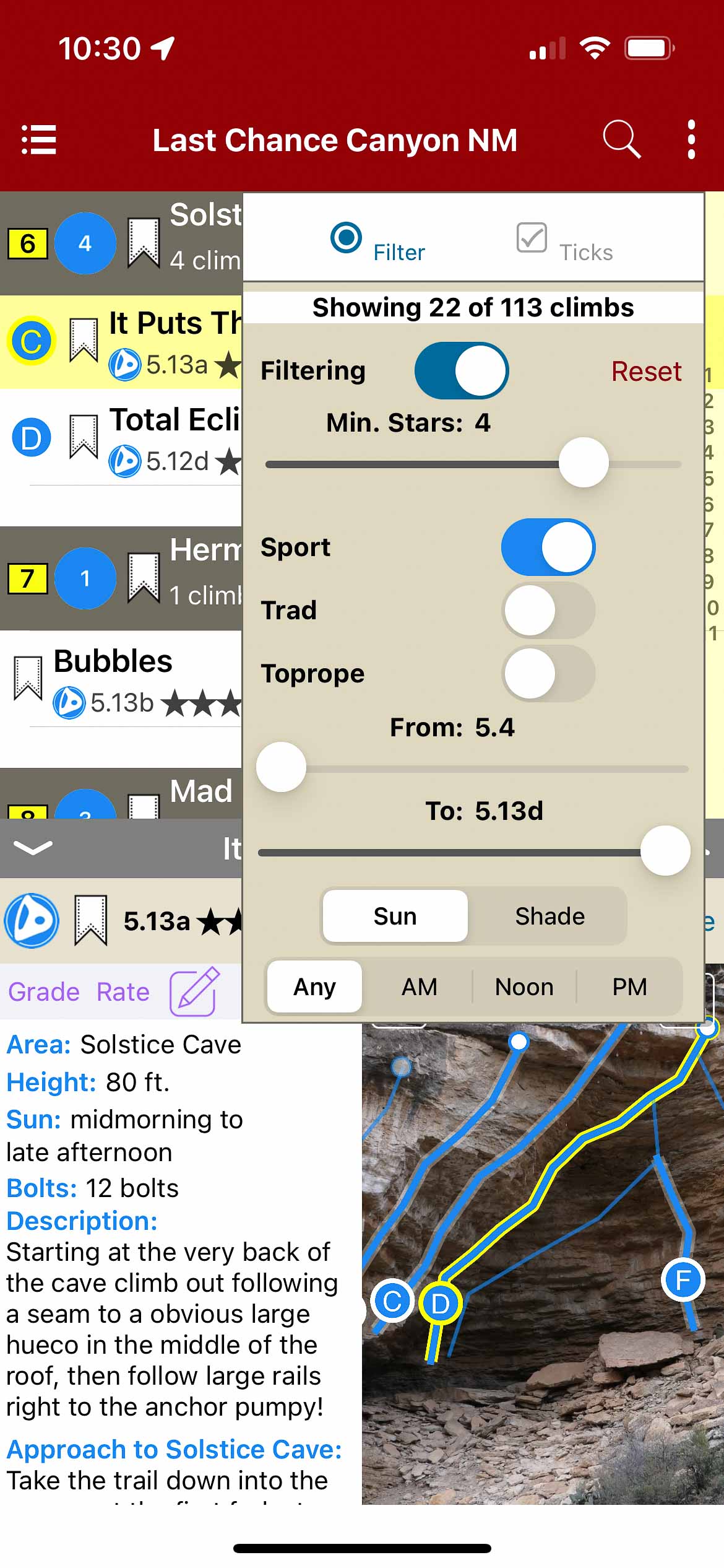
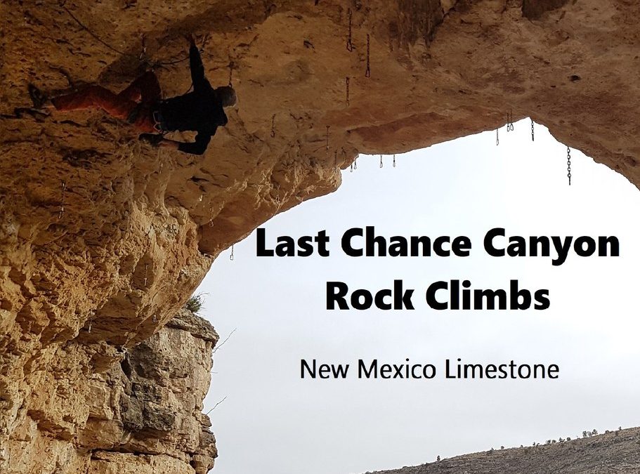
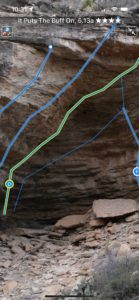
Last Chance Rock Climbs New Mexico Limestone
by Stu Smith
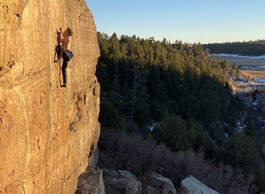
Last Chance Canyon is a year round climbing destination hosting some of the best sport climbing in New Mexico in a beautiful remote area. Located in the Lincoln national Forest just north of the tiny “town” of Queen NM. With around 120 routes ranging from 5.easy to 5.13+ on over 15 crags. Two styles dominate this limestone area, technical face climbing on thin edges/fantastic pockets and Steep jug hauls out inspiring sweeping roofs.
-

-
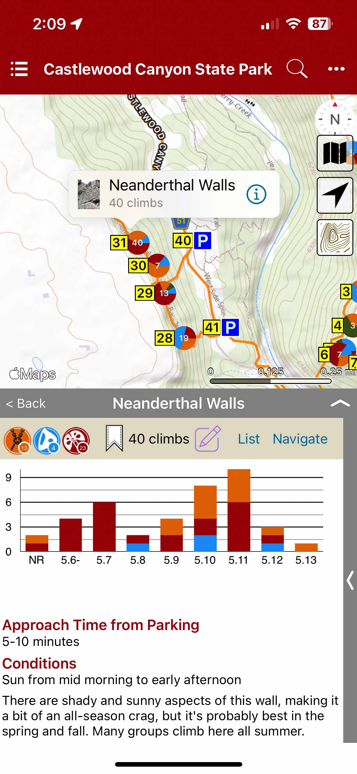
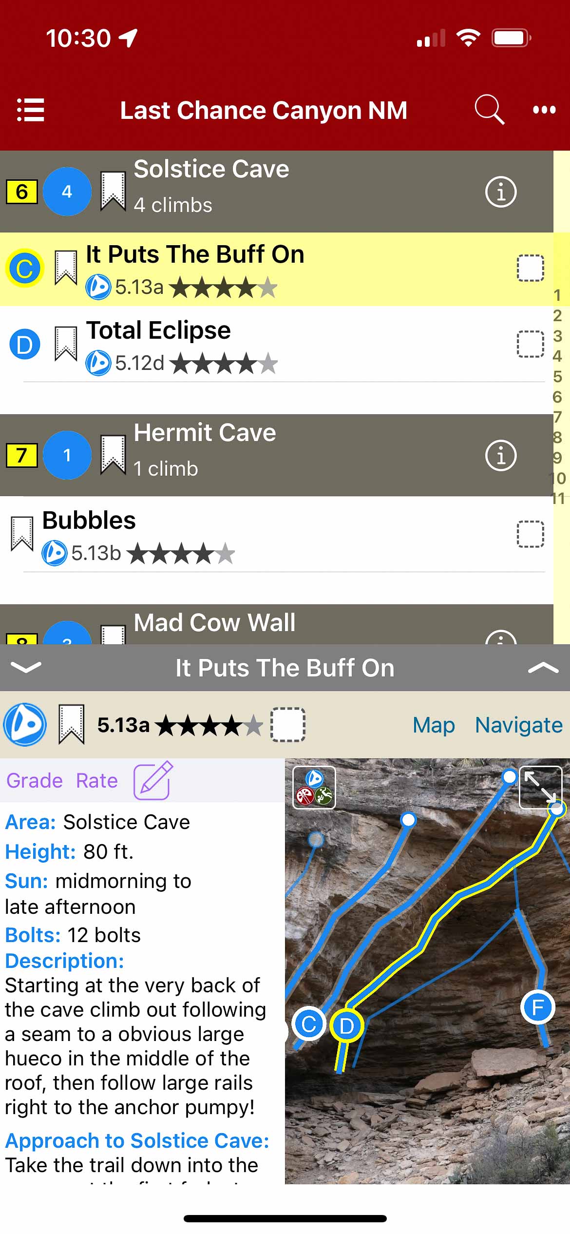
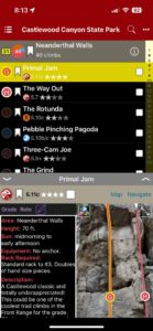
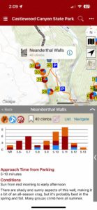
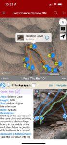
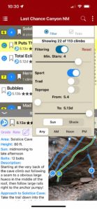
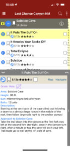
Climb List
-
-
Climb Map.
-
-
Full screen topos.
-
-
Climb filters.
-
-
Helpful beta.
-

-
Record ticks and notes
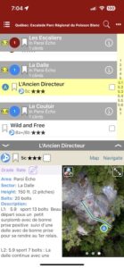
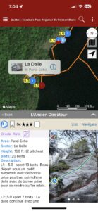
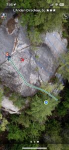
by todd | Sep 21, 2022
by Socrate Badeau & Francis Beauvais
Poisson Blanc
La Forêt Ouareau Guidebook | Escalade Sainte-Émélie (Proximus et Sérénité) Guidebook | Mont Rigaud Rock Guidebook | Mont Larose (Weir) Guidebook
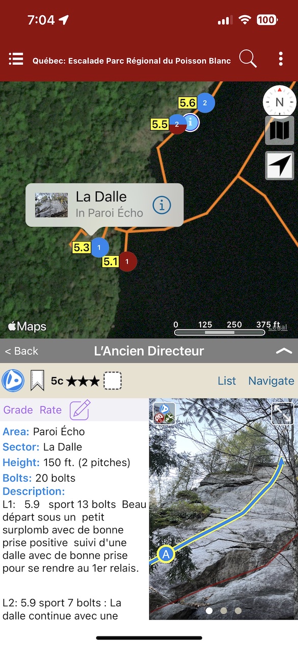
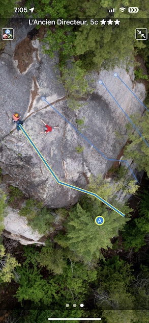
Voici un guide complet de l’escalade qu’on trouve dans le Parc régional du Poisson Blanc. Il y a longtemps que la grimpe se pratique sur le territoire, mais en 2016, suite à la demande des gestionnaires du Parc, ceux-ci ont établi une collaboration avec la FQME et à l’aide de plusieurs bénévoles ont procédé au développement de l’escalade sur les falaises du réservoir. Le résultat est ce qui se retrouve dans ce guide: cinq secteurs avec plus de 130 voies.
L’approche à l’escalade se fait uniquement par bateau et peut nécessiter jusqu’à 4 heures en canot pour se rendre. Il est donc commun de faire du canot-camping sur les îles aux sites désignés. Pour toute réservation ou information pour le camping vous devez vous référer au site du Poisson Blanc: www.poissonblanc.ca
Il est essentiel de respecter la réglementation en vigueur dans le Parc. Y avoir accès et y grimper est un privilège, aidez-nous à conserver l’accès à ce site unique.
Bonne aventure!
-
-
List View
-
-
Map View
-
-
Full Screen Photos
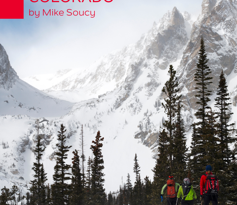
by todd | Aug 3, 2022
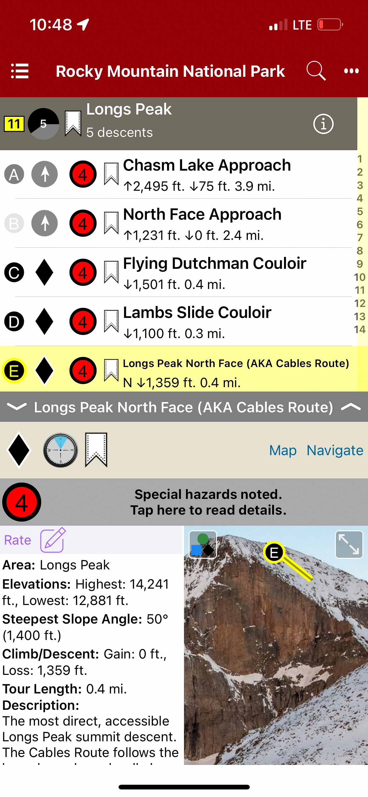
Backcountry Skiing: Rocky Mountain National Park Colorado
by Mike Soucy
Colorado Avalanche Information Center
Beacon Guidebooks:
California: Tahoe Light Tours Colorado: Berthoud Pass | Buffalo | Cameron | CO Light Tours | Crested Butte | Loveland | Marble | Silverton New Mexico: Taos Oregon: Hood Washington: Baker | Crystal | ONP | Snoqualmie | Stevens
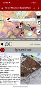
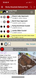
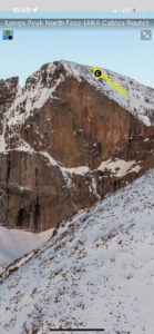
“The Park,” as locals know it, is home to some of the most diverse, accessible ski terrain on the Colorado Front Range. The Continental Divide creates a North-South backbone through the Park, and the glacier-carved east side offers long valleys of leeward terrain all the way to timberline. The Park holds the highest concentration of ski mountaineering terrain in the Front Range. Steep, dramatic scenery awaits as soon as you break into the alpine. Here, you will find options from entry-level to expert, from couloirs to alpine bowls. When the challenging midwinter weather or shallow early-season snowpack keeps you below the Continental Divide, fear not. Near- and below-timberline glades and gullies offer adventures in every valley, limited only by your curiosity for exploration. If you’re up for a more social affair, take a lap or two at Hidden Valley, a now-defunct ski area (1955–1991) which has become a gathering spot for everyone from new visitors and families to locals and skimo trainers. The spring months bring a deeper snowpack, more favorable weather, and the opening of Trail Ridge Road, which happens on Memorial Day Weekend in typical snow years. Topping out at over 12,000’, this is the highest paved road in Colorado and gives spring and early summer skiers great access to high alpine terrain. Mount Cumulus, Flattop Mountain, Hallett Peak, Longs Peak, McHenrys Peak, and many others offer classic high summit ski descents for a range of ability levels. April and May are often prime months for these objectives; you can still ski from the parking lot and often have the choice between cold snow or corn. In this first edition, we’ve compiled a list of the classic tours and descents the Park is known for, and included a few lesser-known objectives to spark the veterans’ curiosity. Routes and descriptions have been ground-truthed, vetted for accuracy, and supported by photography in order to provide a reliable planning and decision-making tool for your adventures. Enjoy!
The author and publisher acknowledge that the land described in this atlas is the ancestral home of the Hinono’eiteen (Arapaho) and Núutsi-u (Ute) peoples, who lived on these lands for thousands of years before the arrival of Europeans. The Arapaho traveled from the plains to and from what is now the east side of RMNP, while the Ute tribe lived along the west side and around what is now Grand Lake. They would also make seasonal trips back to the plains, traveling over the Continental Divide using what we now call the Ute Trail. Oliver Toll’s Arapaho Names and Trails is a great resource for learning more about the history of this land.
-
-
Map view
-
-
List view
-
-
Full screen photos
by todd | Jan 6, 2022
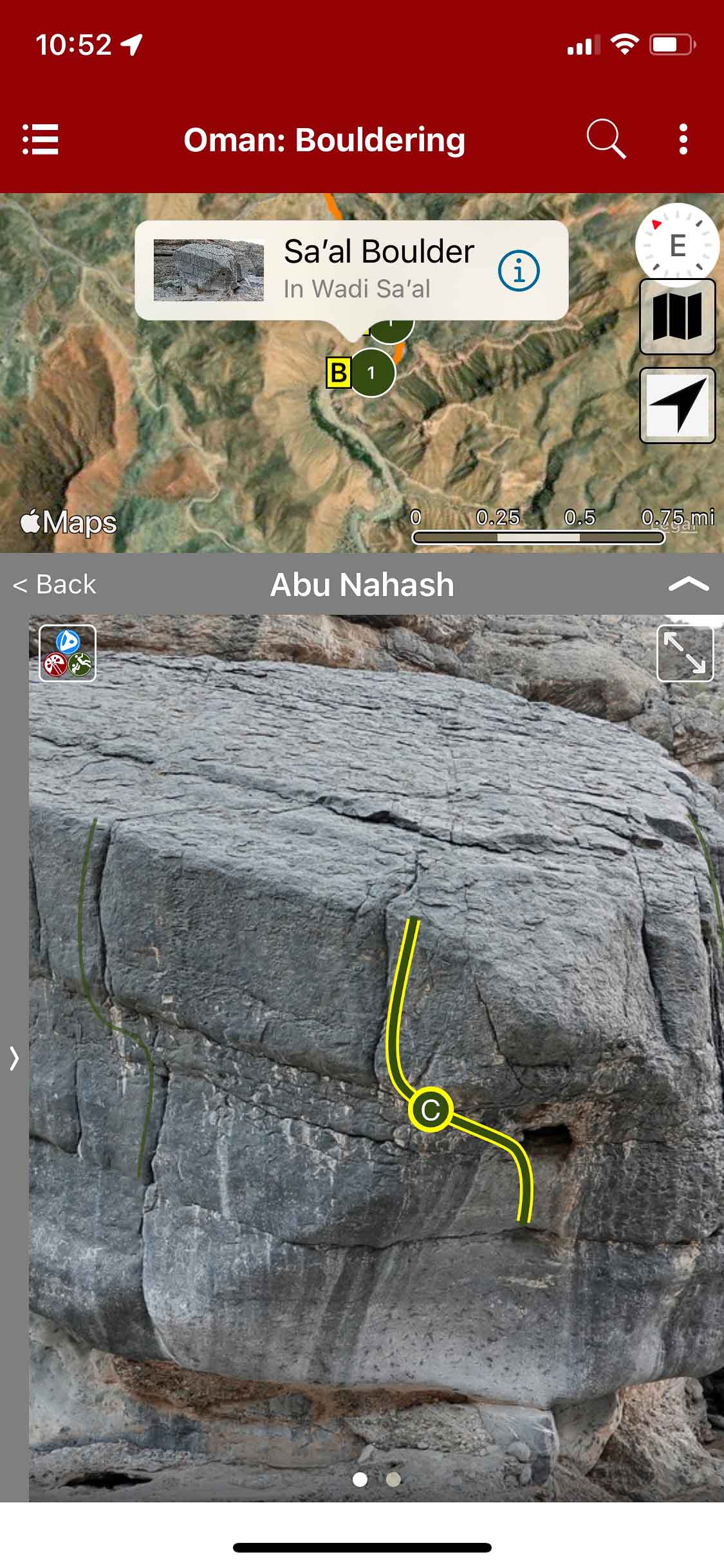
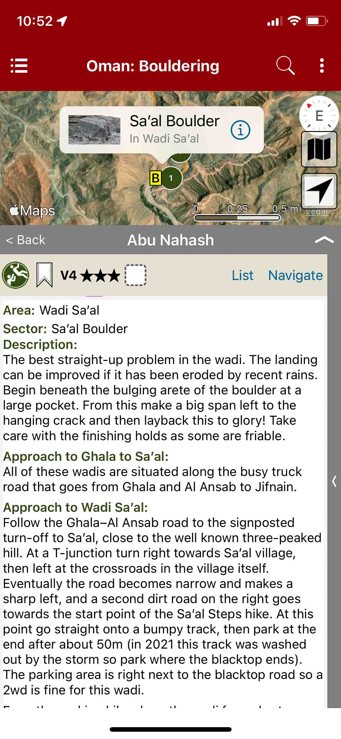
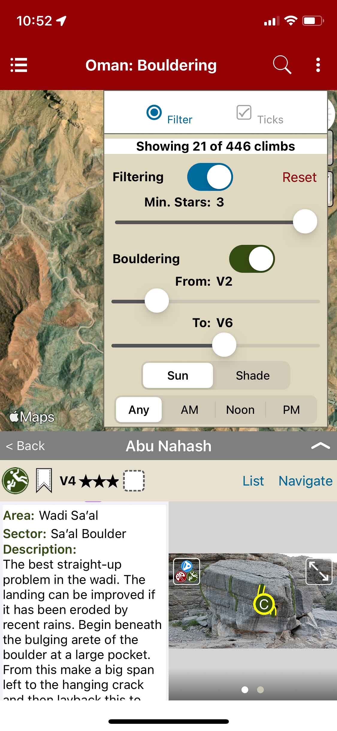
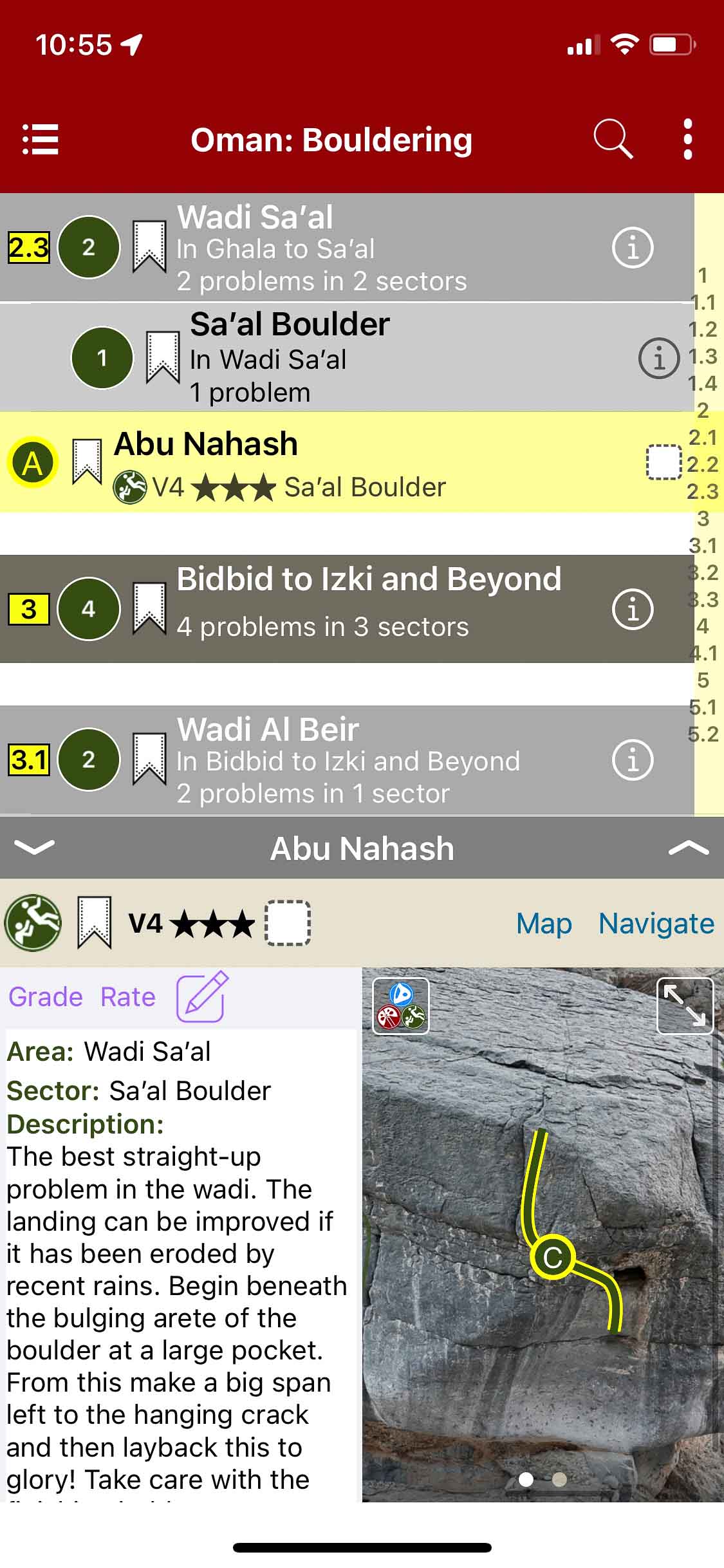
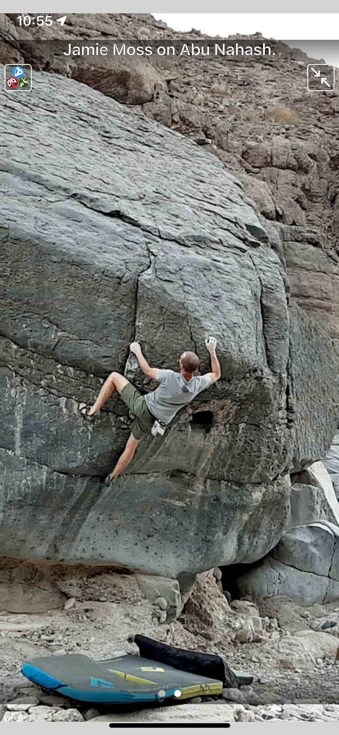
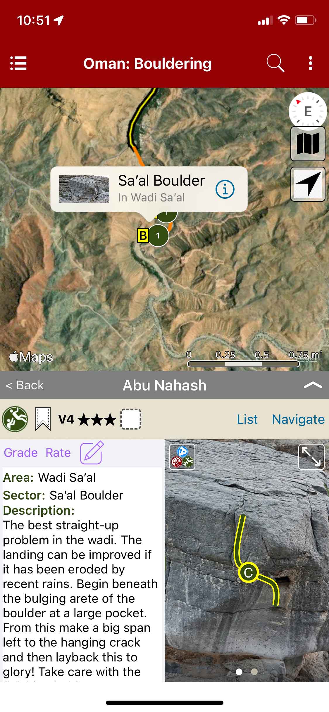
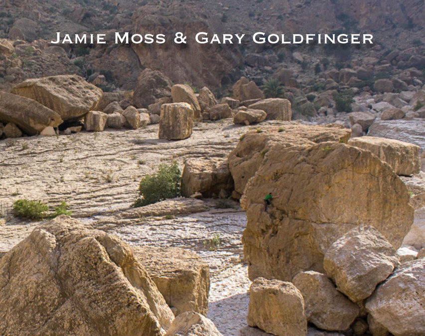
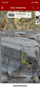
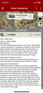
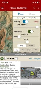
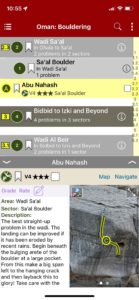
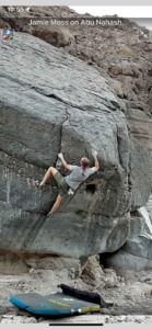
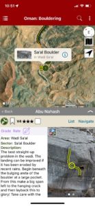
Oman: Bouldering
by Jamie Moss & Gary Goldfinger
Climbing in Oman Facebook
Muscat Sport Climbing Guidebook | Sharaf Al Alameyn Sport Climbing Guidebook | Oman: Deep Water Soloing Guidebook
Boulders are everywhere in Oman. Every range of hills is criss-crossed by dry river canyons – wadis – and every wadi is littered with blocks of all sizes. Not all of them are good for climbing on though – some are too weathered, some are smooth and hold-less, and some are just too plain big. In this guide we’ve done the hard work for you – hand-picking over 400 of the best problems from around 100 of the best blocks in more than 20 venues around the country.
There are a couple of world-class bouldering venues in Oman – Damian’s Boulders in the Musandam Peninsula and Umq Bir aka ‘Valley of Giants’ to the south of Muscat. These are covered in full detail. Most of the described bouldering is in the Musandam and Muscat areas, although the guide also includes some brand new developments from Salalah in the far south. A wide range of problems are available (V0-V12), although most of the development has been in the low to mid grades so far.
-
-
Easily navigate from car to problems with GPS.
-
-
Detailed approach and problem descriptions.
-
-
Filter problems based on grades and quality.
-
-
Searchable boulder and problem list.
-
-
Beautiful full screen photos.
-
-
Easily locate the best problems.
by todd | Nov 9, 2021
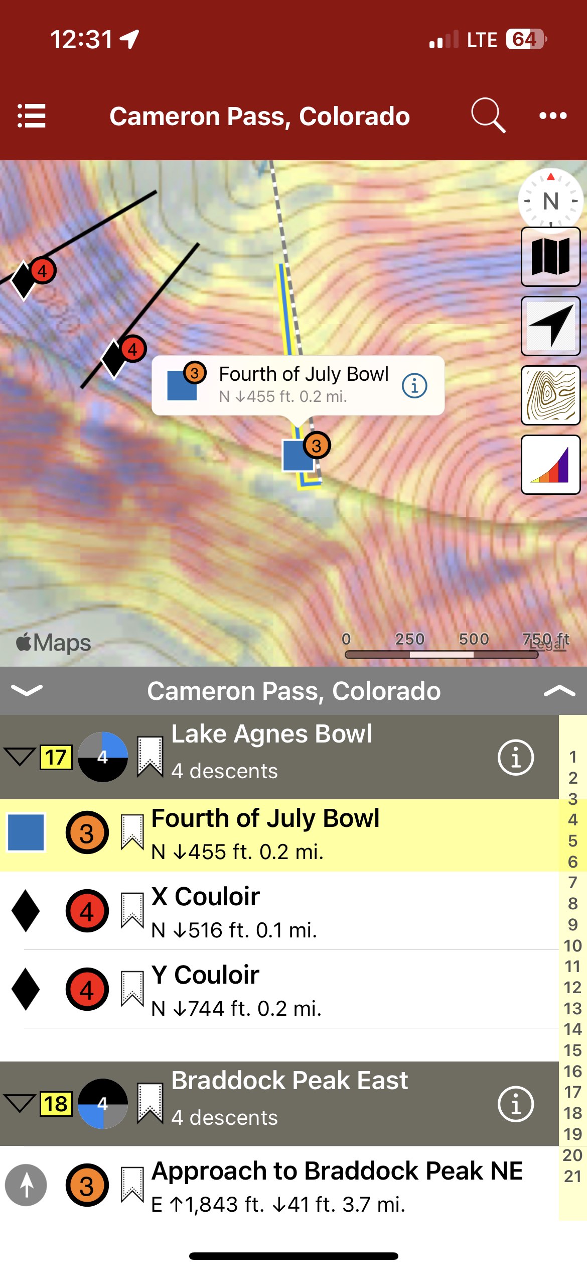
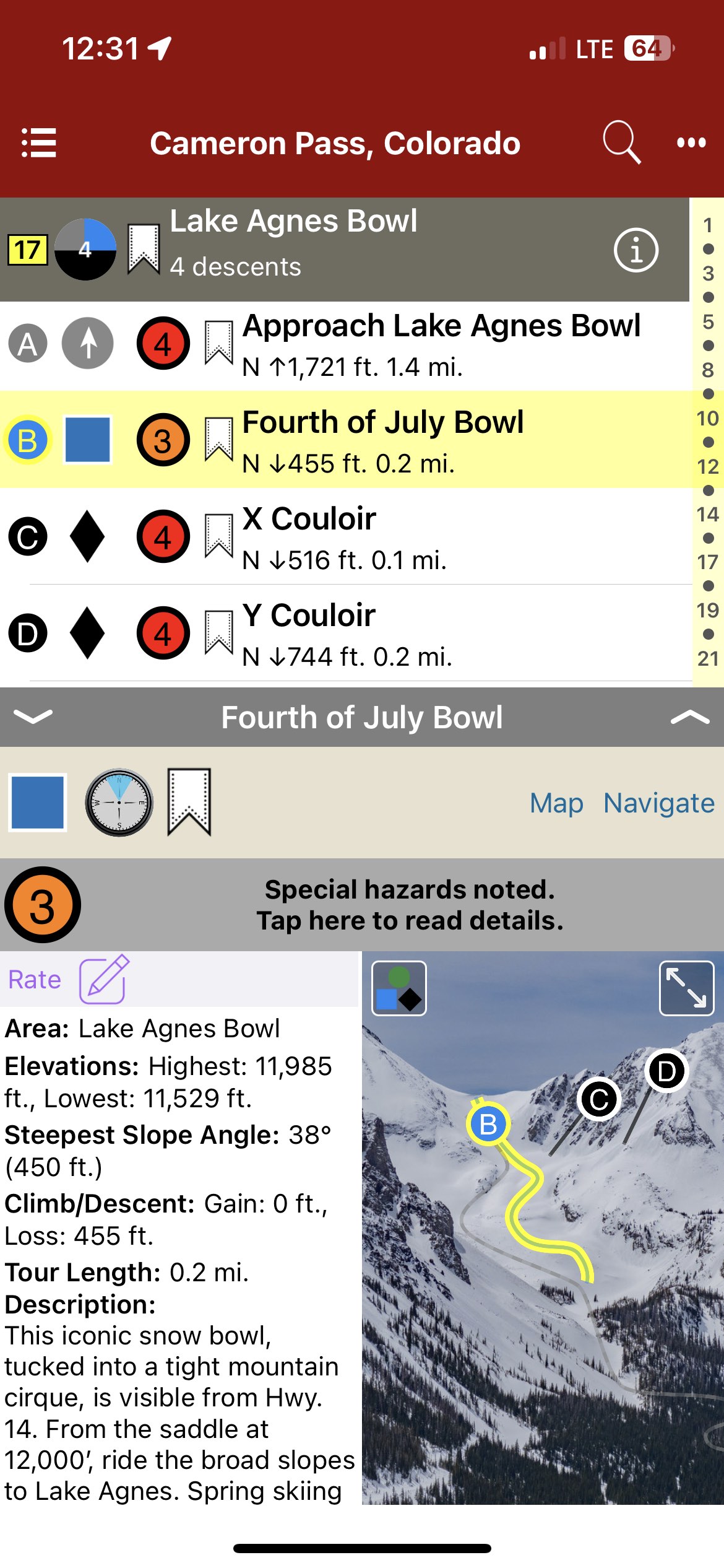
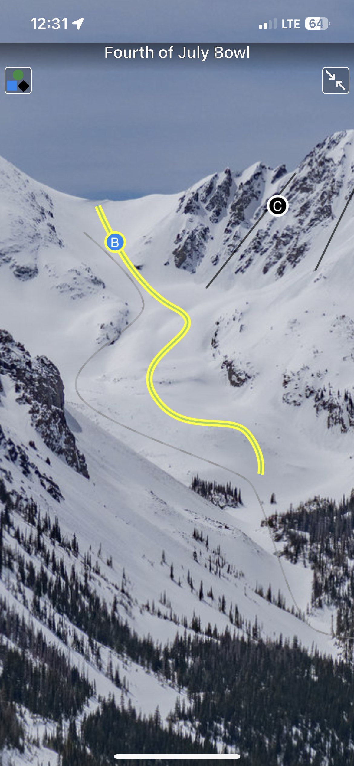
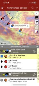
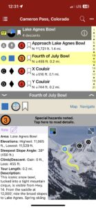
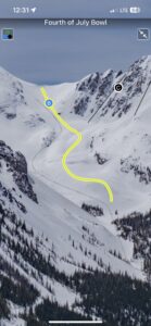
Backcountry Skiing: Cameron Pass, Colorado
by Rodney Ley
Colorado Avalanche Information Center
Beacon Guidebooks:
California: Tahoe Light Tours Colorado: Berthoud Pass | Buffalo | CO Light Tours | Crested Butte | Loveland | Marble | RMNP | Silverton Oregon: Hood Washington: Baker | Crystal | ONP | Snoqualmie | Stevens
Cameron Pass provides a unique Colorado backcountry skiing experience. Remote and undeveloped, “Cam Pass” also receives a generous amount of snow each winter; good skiing often extends into May. Colorado State Hwy.14, a well-maintained all-weather road over the pass, provides access from east and west. Although Cameron Pass does not cross the Continental Divide, it is the only year-round highway north of Berthoud Pass accessing the western slope. Just 65 miles from Fort Collins and 90 miles from Steamboat Springs, Cameron Pass is a straightforward day trip from many areas in Colorado. During the winter, facilities such as lodging, gas stations, and restaurants are scarce. Cell service on Cameron Pass is spotty to non-existent: only on higher ridges with good line of sight is cell service possible. The Moose Visitor Center, located 9 miles west of Cameron Pass, remains open year-round, providing restrooms and visitor services. At the time of publication, no wifi or cell service exists at this location. Administratively, the area is managed by Arapaho & Roosevelt National Forest east of Cameron Pass and by Colorado Parks and Wildlife (CPW) on the west side of the pass. Parking and access on the west side of the pass require a CPW Parks Permit. Currently, the National Forest does not require a daily use fee for the eastern side. The author and publisher acknowledge that the land described in this atlas is the ancestral home of the Hinono’eiteen (Arapaho) and Núutsi-u (Ute) peoples, who lived on these lands for thousands of years before the arrival of Europeans.
-
-
Map view
-
-
List view
-
-
Full screen topo photos
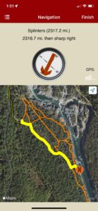
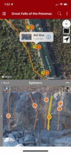
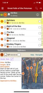
by todd | Aug 11, 2021
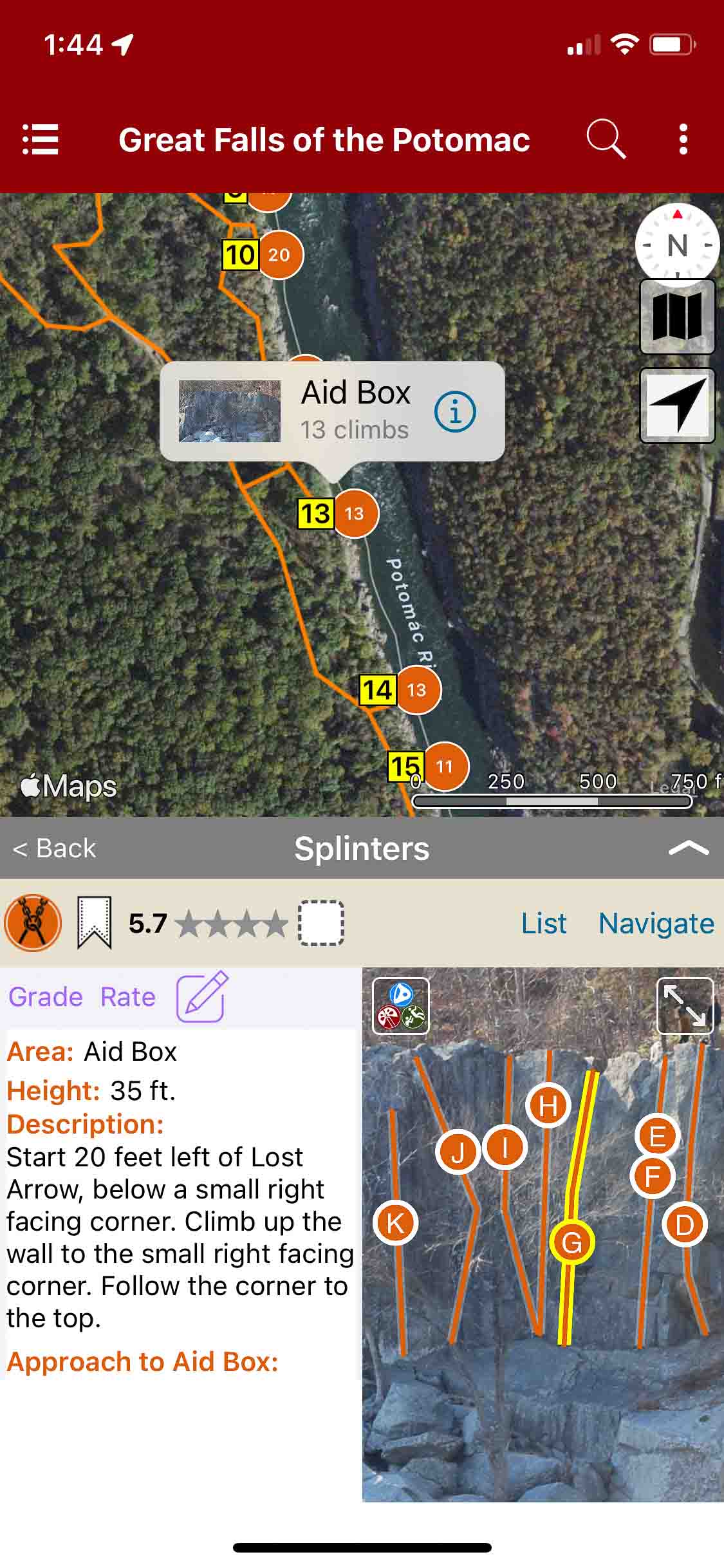
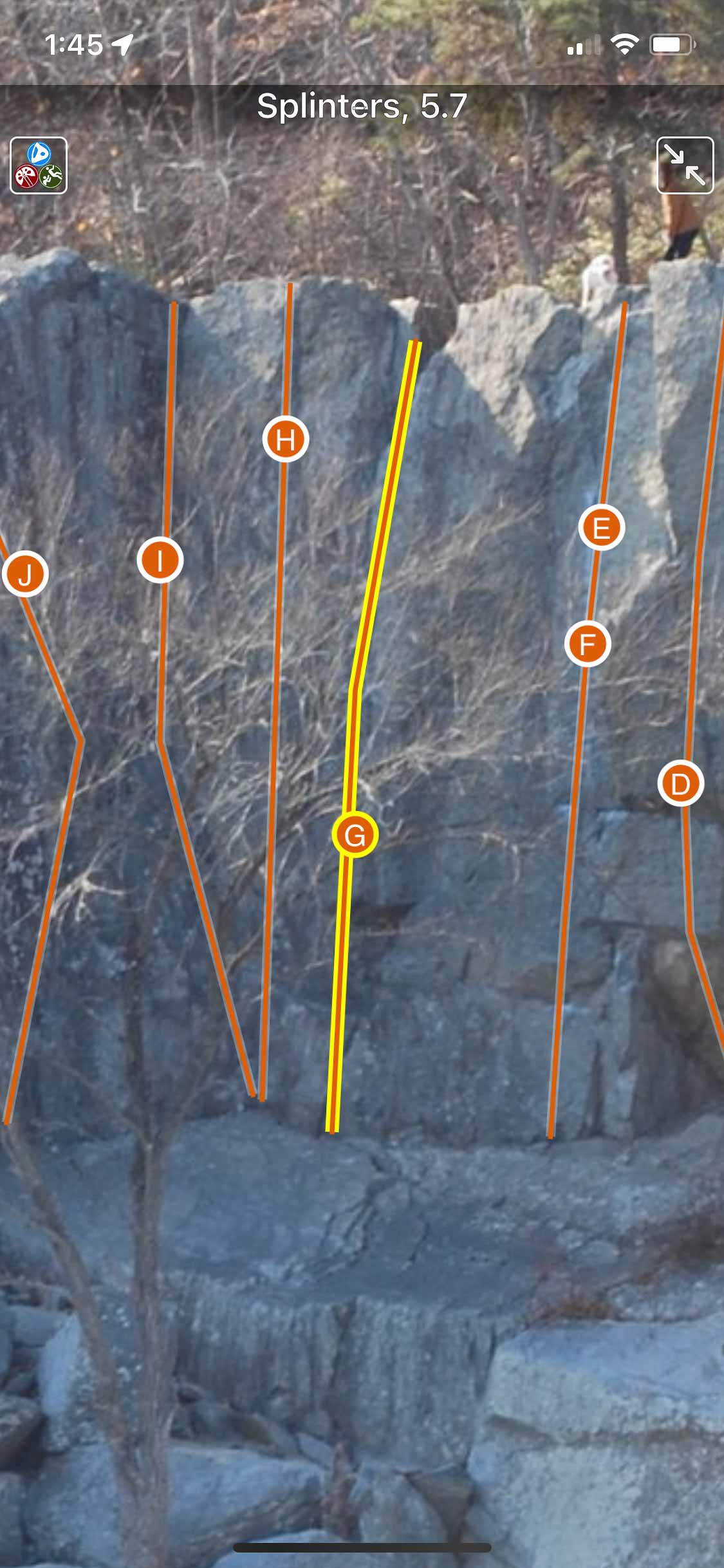
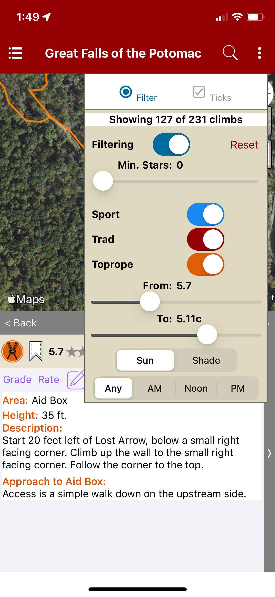
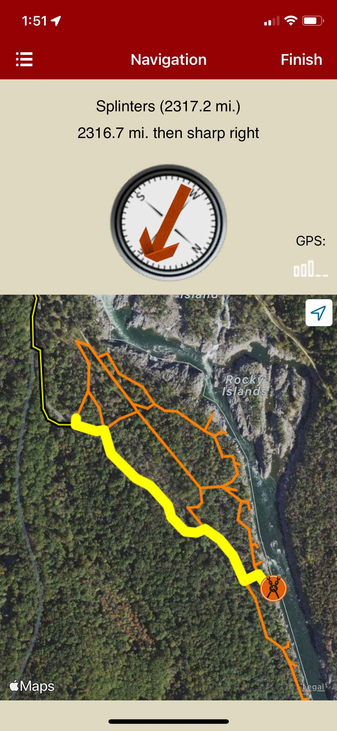
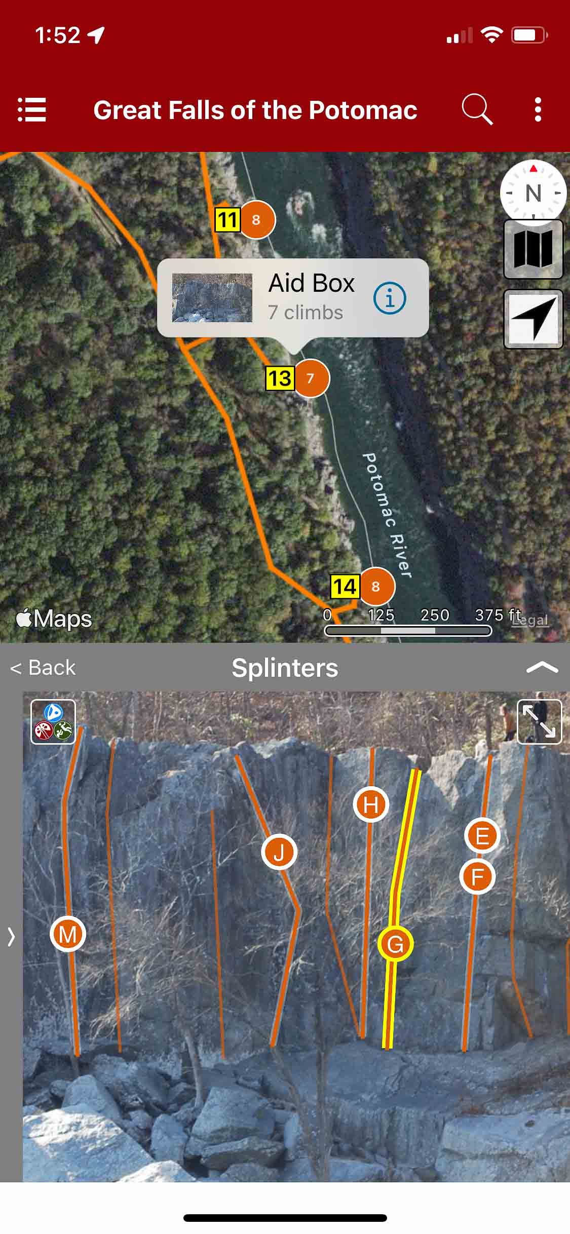
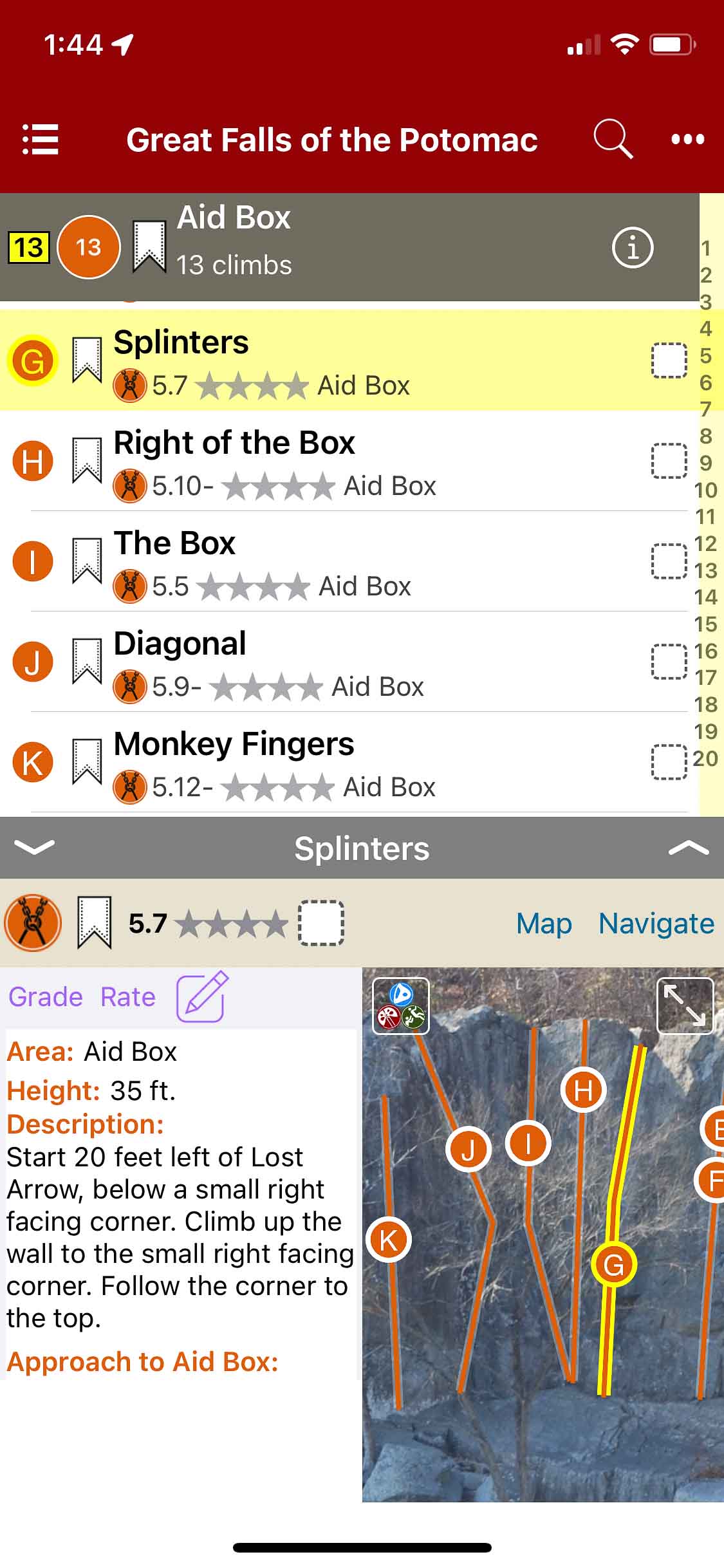
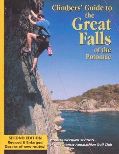
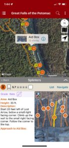
Great Falls of the Potomac
by Potomac Appalachian Trail Club – Mountaineering Section
Potomac Appalachian Trail Club Website
Located in the beautiful Potomac River Gorge, Great Falls provides a wide variety of climbing right along side the Potomac river. The cliffs are roughly 60 feet high made of hard, solid rock. The area is sunny and has lots of visitors, climbers and hikers alike.
This guide provides maps, descriptions, and ratings of technical climbing routes along the Potomac River; covering the Virginia shoreline. The paper edition contains Maryland shoreline climbs, which will be included in future editions of this Rakkup guide, as well as masterpoint locations for each sector. The Rakkup edition includes over 200 routes and updated images.
Should you have any comments, suggestions, or general inquiries regarding this guidebook, please reach out to the PATC-MS club directly at secretary@patcms.org.
-
-
Searchable climb map.
-

-
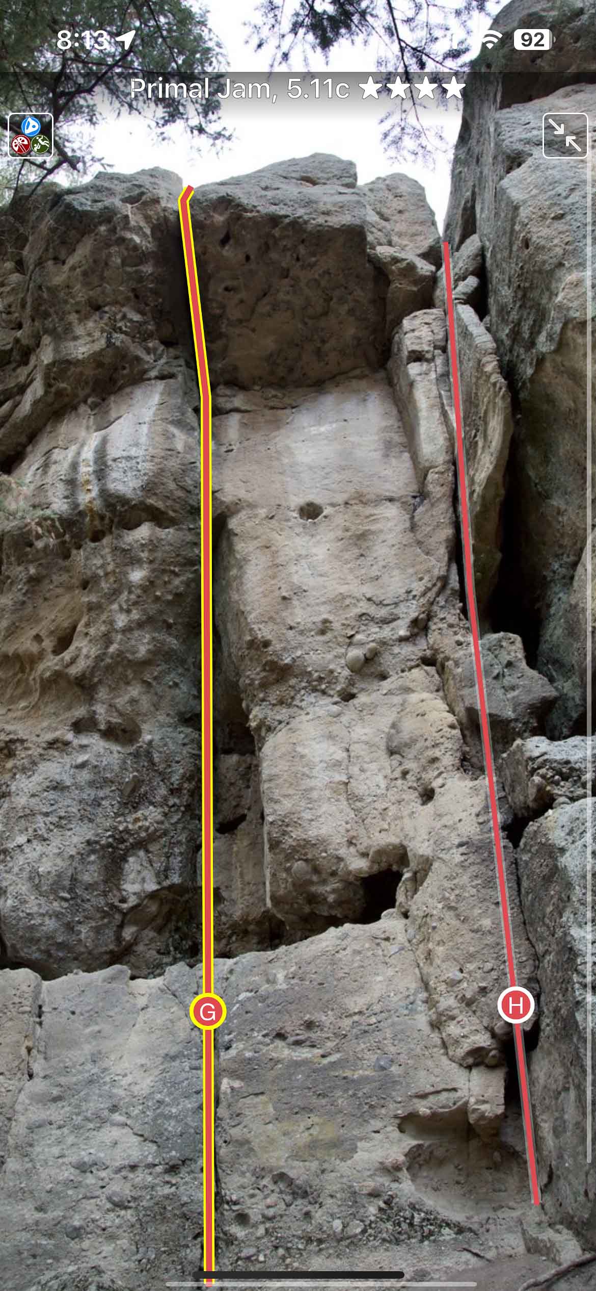
Beautiful full screen smart topos.
-

-
Filter climbs.
-
-
Navigate from car to crag.
-
-
Locate climbs on a map & photo.
-
-
Searchable climb list.