by todd | Mar 16, 2021
Backcountry Skiing: Washington’s East Side Stevens to Snoqualmie
by Matt Schonwald
Northwest Avalanche Center
Beacon Guidebooks:
California: Tahoe Light Tours Colorado: Berthoud | Buffalo | Cameron | CO Light Tours | Crested Butte | Loveland | Marble | RMNP | Silverton New Mexico: Taos Oregon: Hood Washington: Baker | Crystal | ONP | Snoqualmie
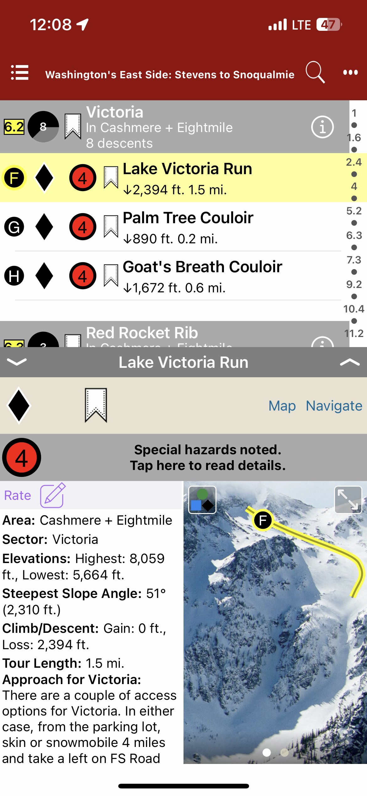
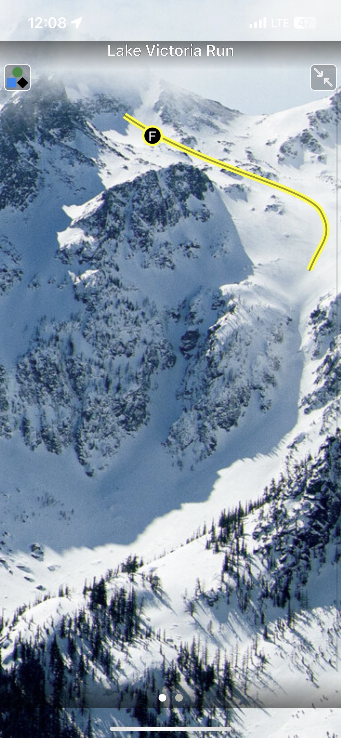
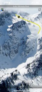
In 1897, John Stevens found the passage for the Great Northern Railroad across a 4,000’ pass in the Cascades. Since then, Stevens Pass place in history is thick with decades of travel, avalanches, ski areas, and so much more. Stevens Pass is one of the essential gateways to the extraordinary backcountry possibilities that exist between I-90, US Highway 97, and US Highway 2.
Over 300 tours, accessible via ski areas, roadside pullouts, and long snowmobile approaches make this region’s diverse opportunities seem infinite. The East Side also provides a drier, colder snowpack—bringing blower pow (and persistent slabs) to the Cascades.
The author and publisher acknowledge that the lands described in this atlas are the ancestral home of the Pisquouse and Si’apkat, members of the Yakama Nation. The Pisquouse (Yakama name: Winátshapam), or Wenatchi, lived in the area that spans present-day Leavenworth to Wenatchee. Wenatchee is a Sahaptian word for “river water which comes from canyons” or “robe of the rainbow.” The first inhabitants of the Kittitas Valley were the Psch-wan-wap-pams (stony ground people), also known as the Kittitas, Si’apkat, or Upper Yakama. They lived along the upper Yakima River (today called Cle Elum), which was a traditional gathering place for tribes east of the Cascades.
-
-
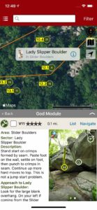
Map view
-
-
List view
-
-
Full screen photos
by todd | Nov 2, 2020
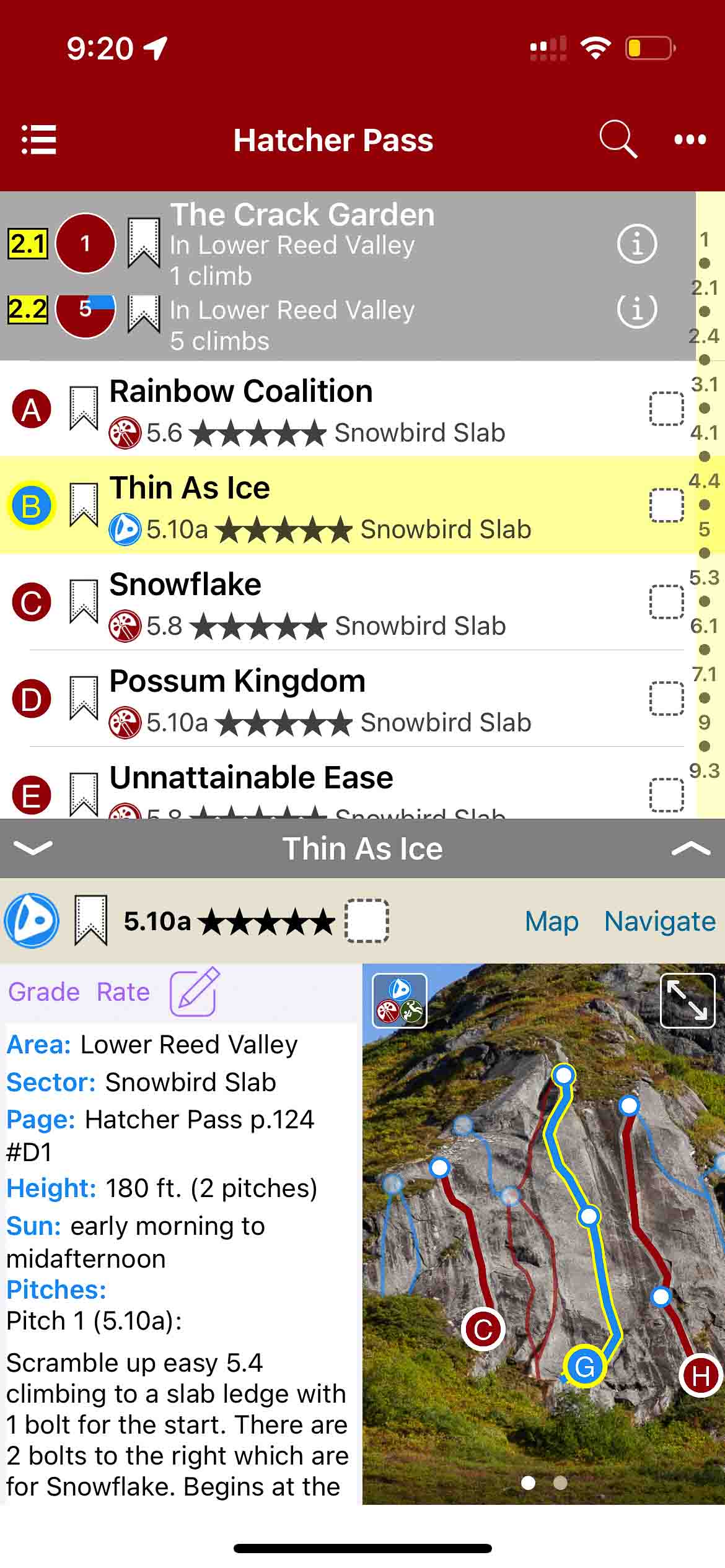
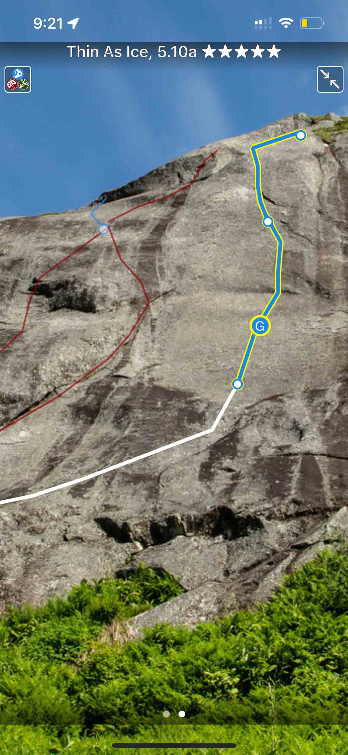
Hatcher Pass Rock Climbing
by Kelsey Gray
Koh Tao Rock Climbing
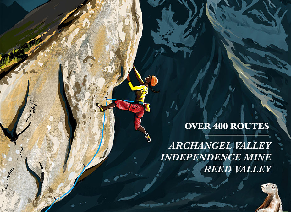
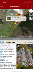
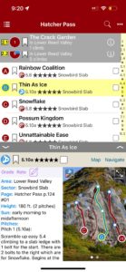
The best (and only) extensive guidebook for Hatcher Pass, Alaska. This new guidebook was published in paperback in 2021. The app includes over 400 climbs within one of the best climbing areas in Alaska.
Buy digital plus book and the price includes $7.00 for shipping, a screaming deal! When you buy a bundle, you can use your digital rakkup guidebook immediately.
-
-
Map view
-
-
List view
-

-
Full screen topos
by todd | Sep 23, 2020
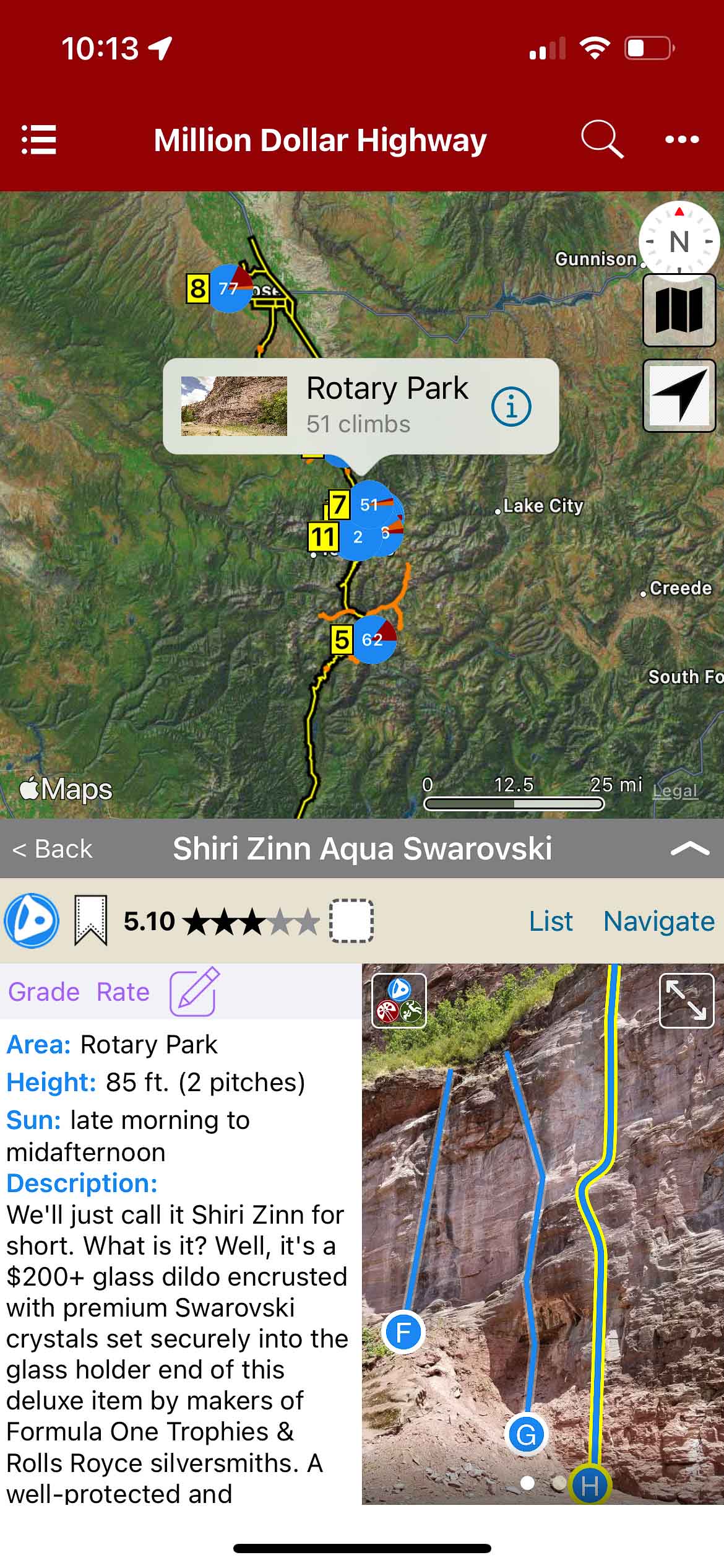
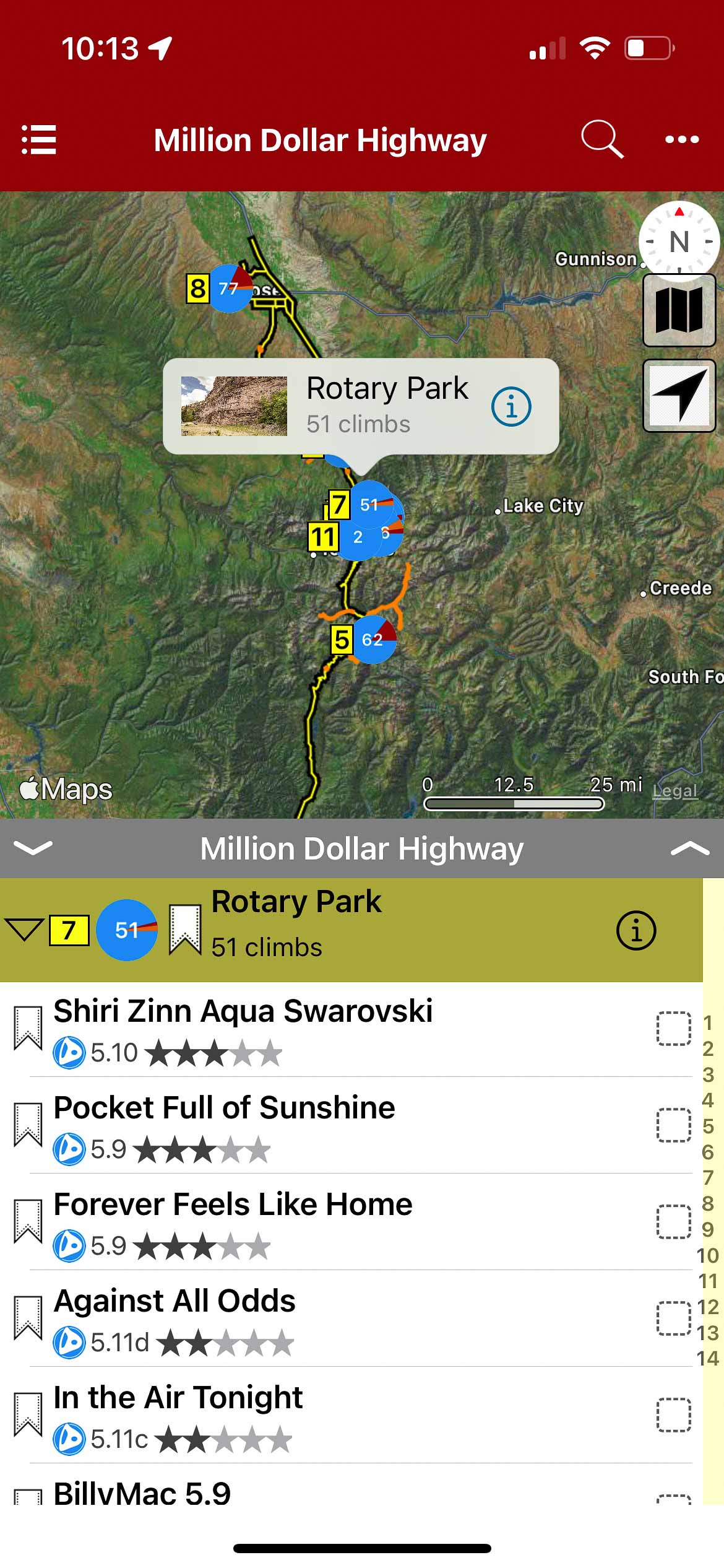
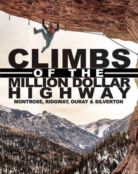
CLIMBS OF THE MILLION DOLLAR HIGHWAY Ridgway, Ouray and Silverton, Colorado
by Jason Nelson
Visual Adventures | Suffer Candy Volume 1 | Suffer Candy Volume 2
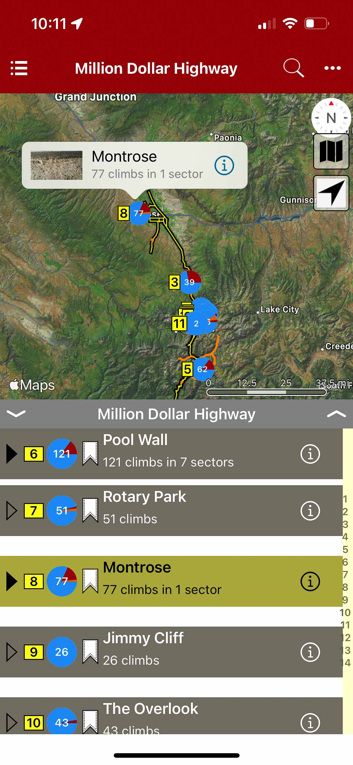
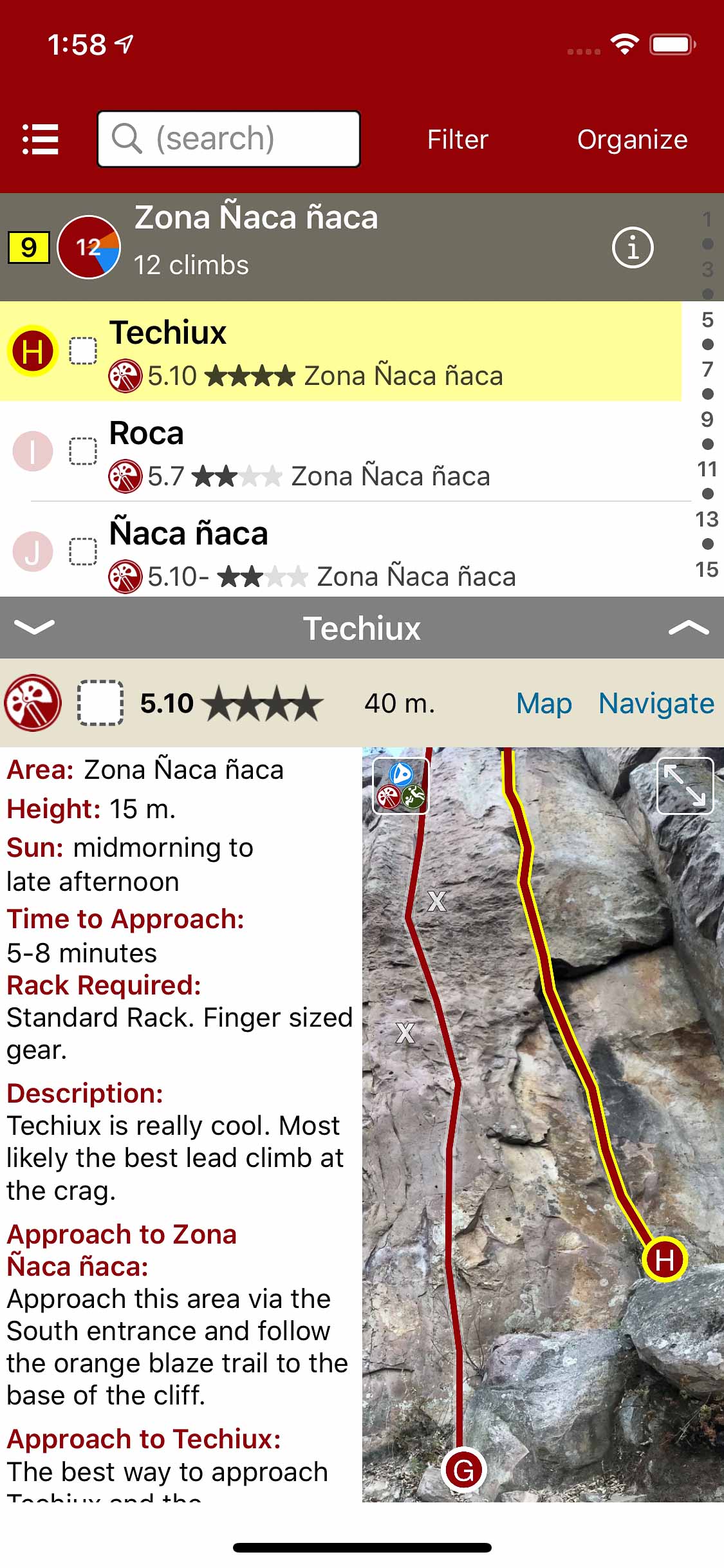
This guide covers the majority of rock climbing to be found in Montrose, Ridgway, Ouray and Silverton, Colorado. Most of the routes are sport climbs, but there is a little bit of everything and there is a wide variety of rock types to choose from. Route lengths are between 30′ and rise up to about 1,400′. We got sun. We got shade. Pretty much the only thing we don’t have is splitter granite. The scenery is top-notch, and the season never ends.
Current Routes included are:
Montrose: Dry Creek
Ridgway: Colby’s Corner, Dike Wall
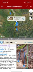
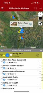
Ouray: Rotary Park, Pool Wall, Overlook, Jimmy Cliff, Techno Crag, Wicked Crag, The Hall of Justice, Roadside Attraction and Ice Park Crags.
Silverton: Master’s Wall, Snowden Peak
Routes soon to be added:
Ouray: Red Mountain Pass Crags including, Sandias, Other Canyon Creek Crags
Silverton: Eureka, Stripe, RV Wall, Ice Lake Crag.
-

-
Map overview with crags
-
-
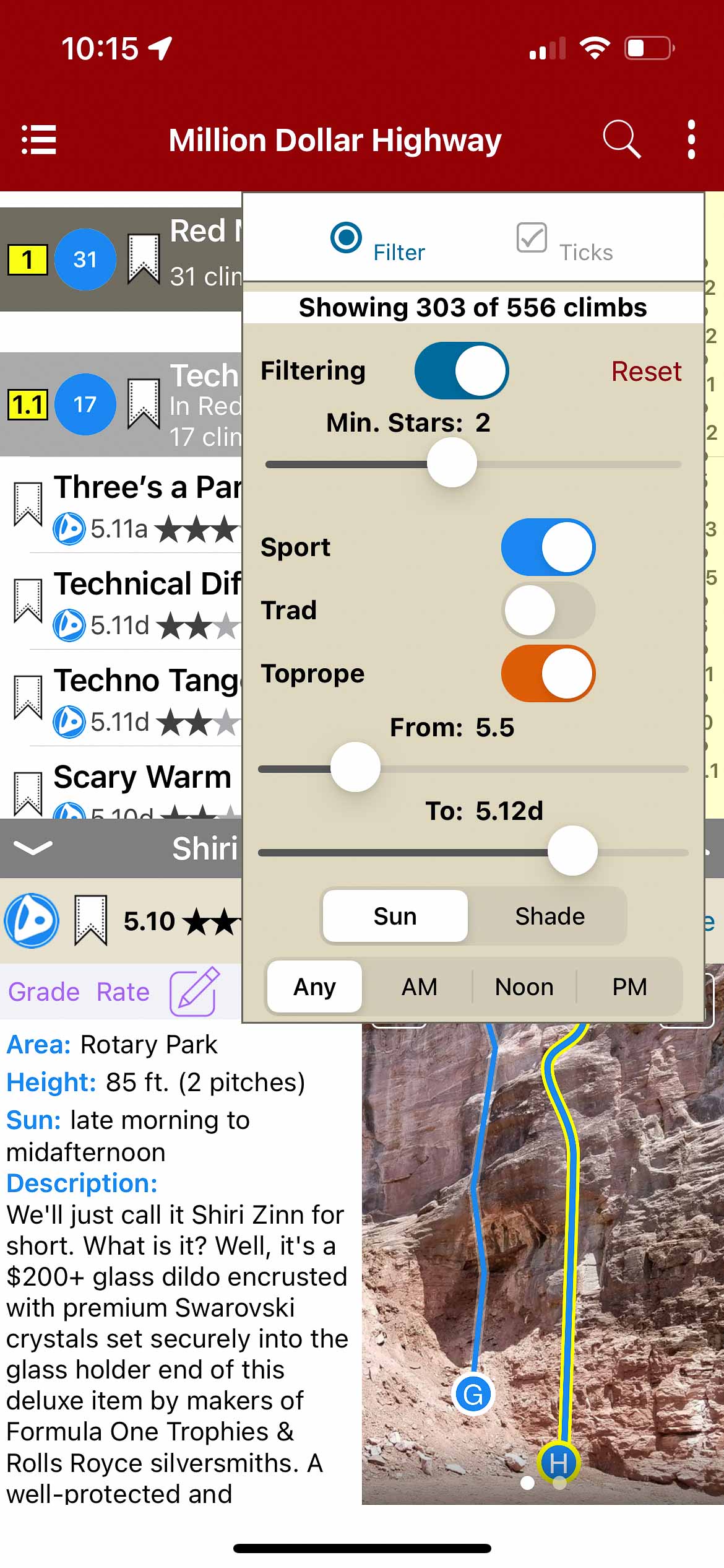
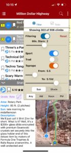
Filter climbs in list or map view by grade and type
-
-
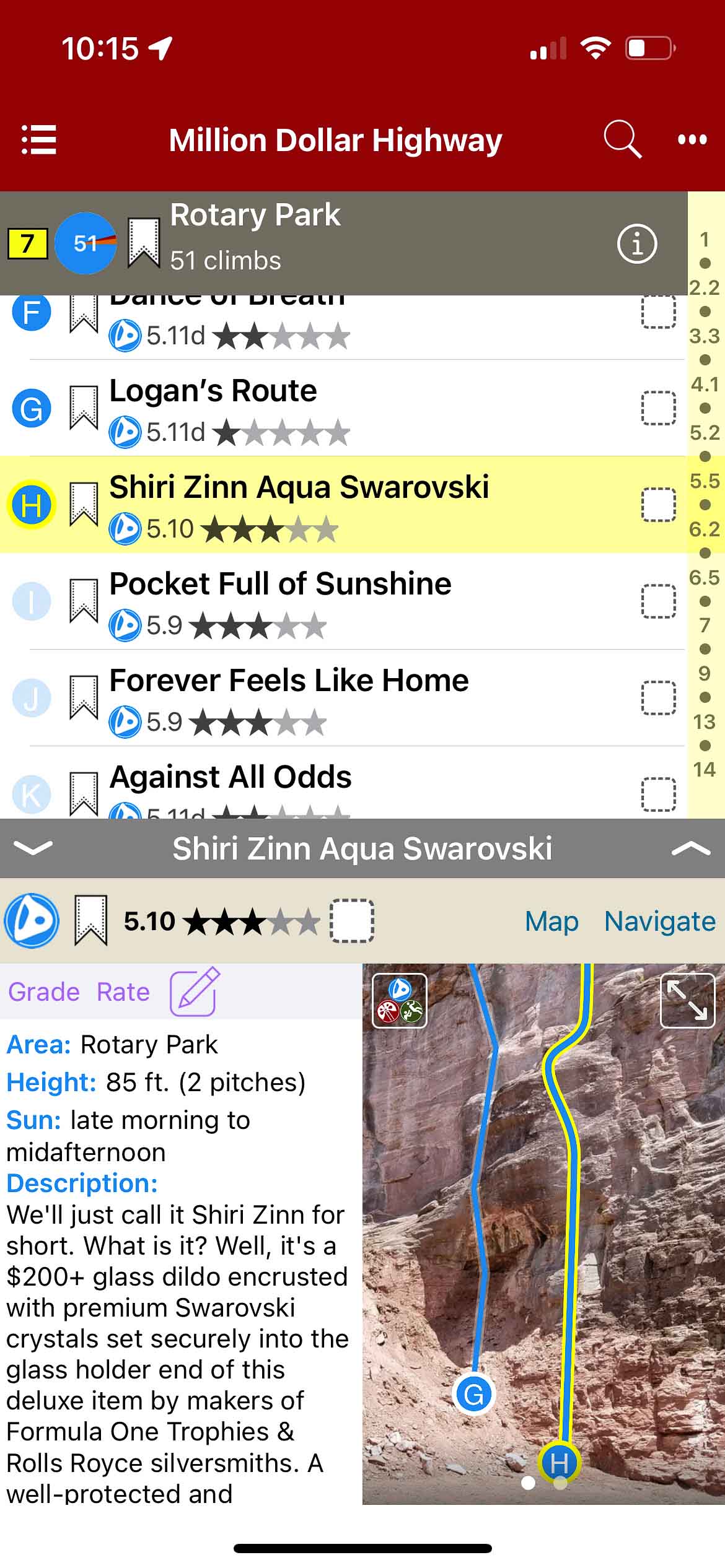
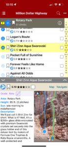
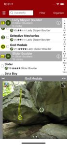
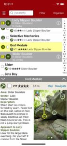
List view with climb details
-
-
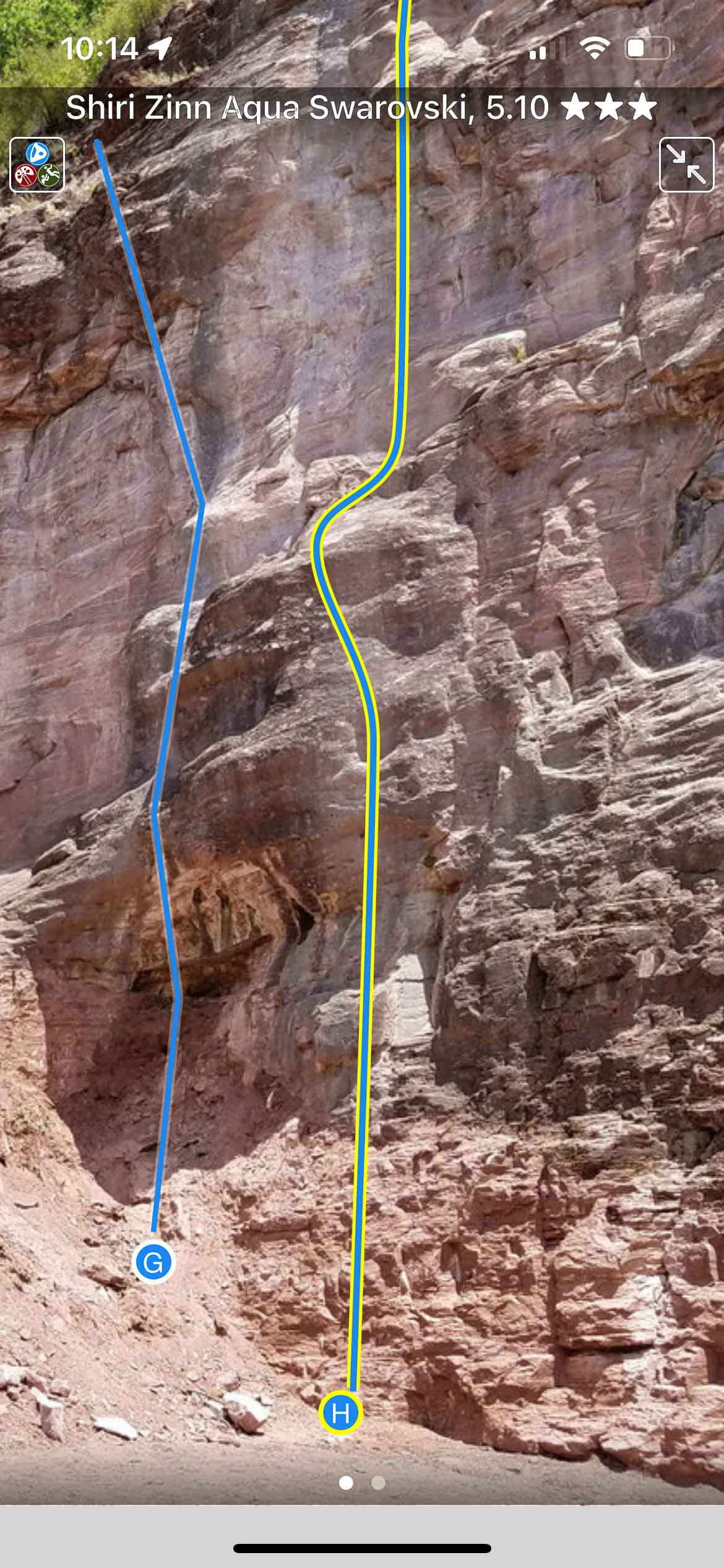
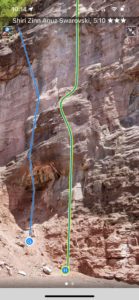
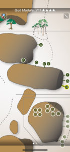
Full screen topos
-
-
Map view with climb details
-
-
Map view with climb list
by todd | Mar 21, 2020
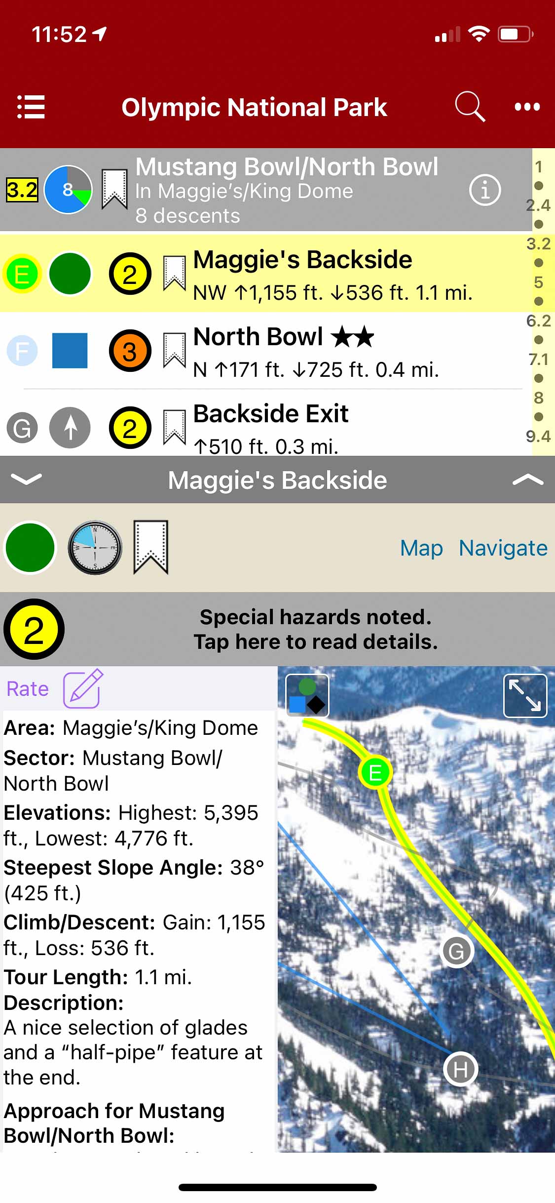
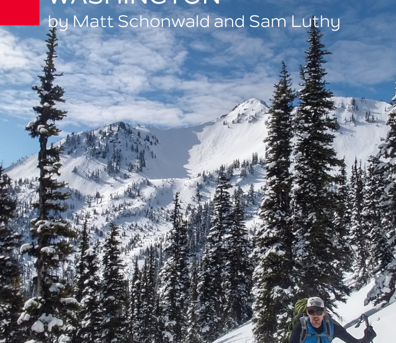
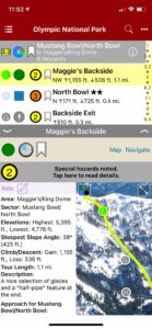
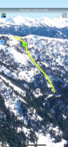
Backcountry Skiing Olympic National Park, Washington
by Matt Schonwald & Sam Luthy
Northwest Avalanche Center
Beacon Guidebooks:
California: Tahoe Light Tours Colorado: Berthoud | Buffalo | Cameron| CO Light Tours | Crested Butte | Loveland | Marble | RMNP | Silverton New Mexico: Taos Oregon: Hood Washington: Baker | Crystal | Snoqualmie | Stevens
For almost 8,000 years native people have lived around the Olympic Mountains. The Duwamish of the Salish sea call them ‘Sun-a-do’, and the ancestors of the Klallam have been living, hunting and gathering in the high mountains since time immemorial.The Spanish sailed along the coast in 1774 and named the highest peak, Cerro Nevado de Santa Rosalia. In 1788, the British Explorer Roger Meares renamed the highest peak, Mt Olympus because it looked like the ‘abode of the gods.’ and just like that the Olympic Mountains became part of the European map.The 1890s saw climbers begin ascending the summits of Mt. Olympus, with the main summit finally being climbed in 1907. Deer Park became Washington’s premier ski area in the mid 1930s. The Hurricane Ridge road was built in the early 50s and the ski area moved from Deer Park, establishing a new winter recreation center for the Olympic National Park. Ski touring began along the roads of Deer Park and Hurricane Ridge and shifted to the Bailey Range and the higher peaks in the 1990s.
Buy digital plus (book and/or map) and the price includes $4.00 for shipping, a screaming deal! When you buy a bundle, you can use your digital rakkup guidebook immediately.
-
-
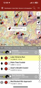
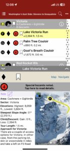
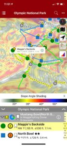
Map view
-
-
List view
-
-
Full screen photos
by todd | Mar 9, 2020
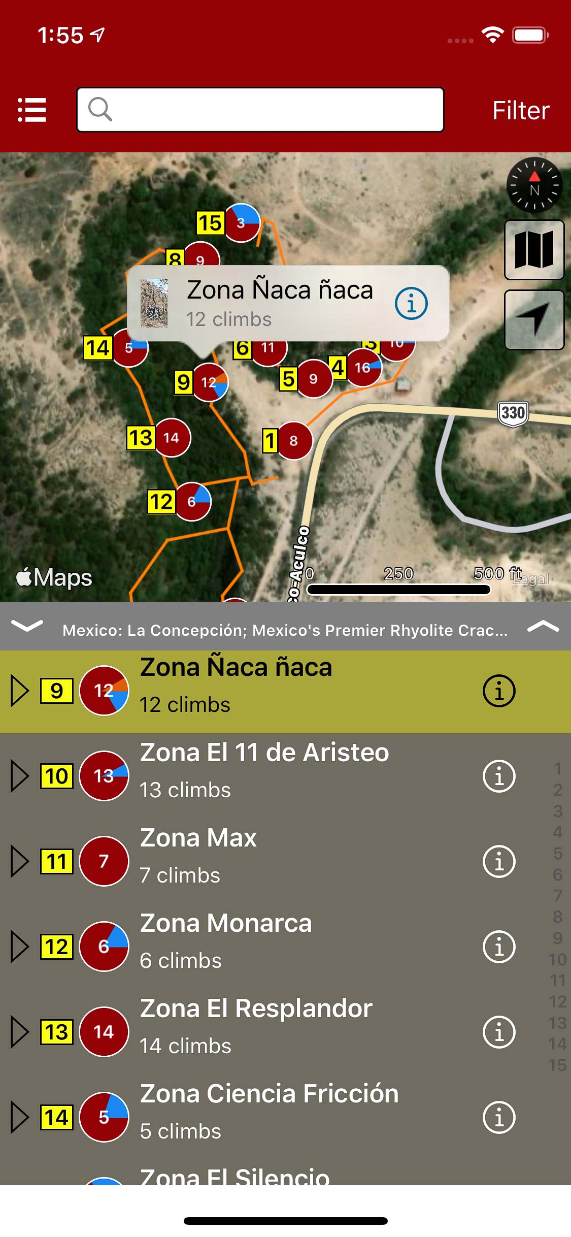
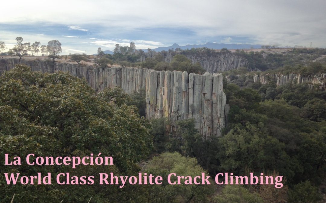
La Concepción; Mexico’s Premier Rhyolite Crack Climbing
by Simeon Heimowitz
Southern Exposure Professional Guide Service
This guidebook is the only fully comprehensive resource for La Concepción; Mexico’s premiere destination for Rhyolite crack climbing. In addition to the up to date route information on all the “must do” five star classics this guide also highlights lesser known high quality routes within this stunning river valley. This rakkup guide is the only up to date resource available for climbers visiting this world class climbing area. A total of 15 walls and 133 climbs are included in this stand alone resource. La Concepción is a stunning Rhyolite canyon located a short distance from Aculco de Espinoza; a truly beautiful town located high in the mountains of Central Mexico. At 8,000 feet in elevation and 1,300 miles North of the Equator the climbing season is continuous at La Concepción throughout the year. If crack climbing is your passion be prepared to fall in love with this hidden gem of a climbing area.
-
-
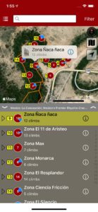
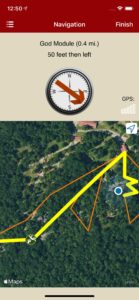
Explore La Concepcion climbing via an interactive trail map.
-
-
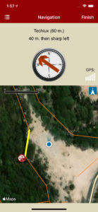
rakkup navigates car to crag then displays a picture when arriving at destination.
-
-
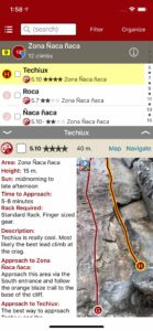
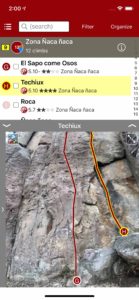
Quickly browse and search the climb list.
-
-
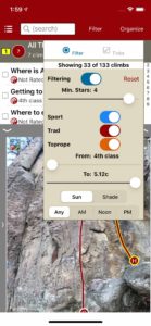
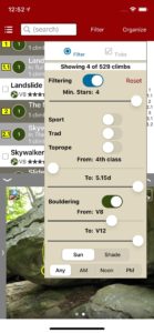
Filter climbs by quality, grade and type.
-
-
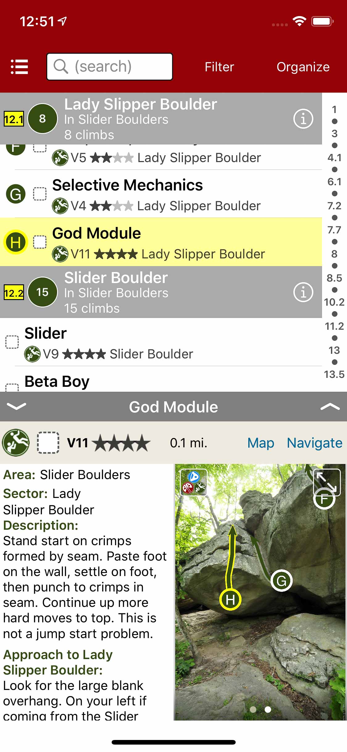
Smart topos help to locate your climb.
-
-
Beautiful full screen smart topos.
by todd | Jan 29, 2020
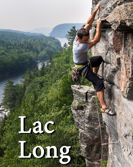
Lac Long
by Arian Manchego
Escalade Portneuf Facebook
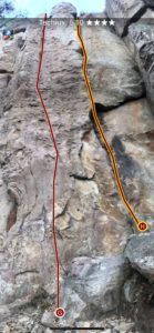
Un bijou caché dans le coeur de Portneuf, la falaise du lac Long offre une centaine de voies de different styles dans un milieu enchanteur. La majorité des parcours sont en trad ou en mixte mais on y retrouve assez de voies sportives pour meubler quelques visites. Les grimpeurs capables de leader du 5.10 en montant auront plus de choix car pour l’instant le nombre de voies faciles est limité. Dans ce guide nous proposons l’information nécessaire pour s’orienter mais pas plus, afin de préserver un sentiment de découverte et d’aventure. Un rocher excellent, une falaise ensoleillée et mystérieuse, de la baignade et du camping… qu’attendez-vous? ENGLISH : We hope to have an English-language version of the rakkup guidebook available soon.
-

-
Explore Lac Long climbing via our interactive trail map.
-

-
rakkup navigates car to crag then displays a picture when arriving at destination.
-

-
Action photos.
-

-
Filter climbs by grade and type.
-

-
Quickly browse climb details in the climb list.
-

-
Beautiful full screen smart topos.
by todd | Jan 10, 2020
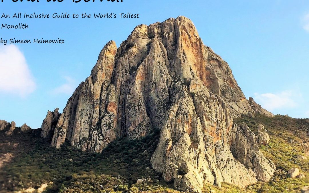
Peña de Bernal
by Simeon Heimowitz
Southern Exposure Professional Guide Service
Looking for stellar climbing, pristine weather, beautiful scenery, delicious food and an amazing town to relax in? Come and climb Peña de Bernal. At 7,000 feet in elevation and 1,300 miles North of the Equator the temperature in Central Mexico is perfect for climbing all year round.
This guidebook is the only fully comprehensive guide for La Peña available anywhere. Want to climb long multi pitch routes? Want to go cragging on single pitch routes in the shade all day? Anything and everything regarding Peña de Bernal. is included in this guide.
-

-
Explore Bernal climbing via an interactive trail map.
-

-
rakkup navigates car to crag then displays a picture when arriving at destination.
-

-
Quickly browse and search the climb list.
-

-
Filter climbs by quality, grade and type.
-

-
Smart topos help locate the right climb.
-

-
Beautiful full screen smart topos.
by todd | Oct 15, 2019
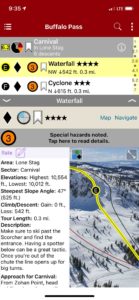
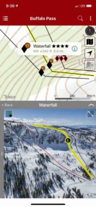
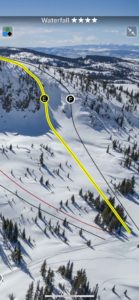
Backcountry Skiing: Buffalo Pass, Colorado
Colorado Avalanche Information Center
Beacon Guidebooks:
California: Tahoe Light Tours Colorado: Berthoud | Cameron | CO Light Tours | Crested Butte | Loveland | Marble | Silverton | Stevens New Mexico: Taos Oregon: Hood Washington: Baker | Crystal | ONP | Snoqualmie | Stevens
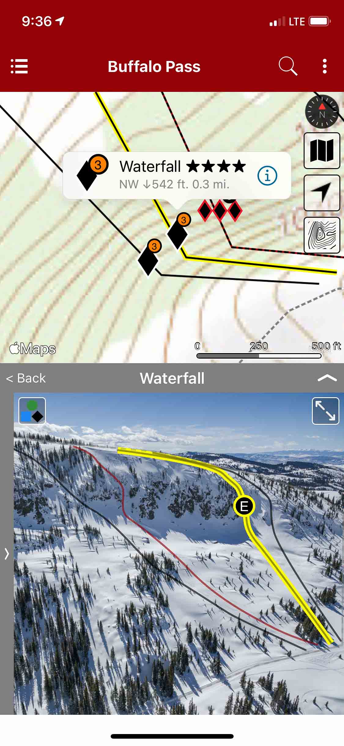
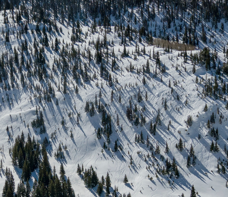
Buffalo Pass is the mecca for backcountry sled-skiers in the Rockies. Nestled in the Park Range of the Rocky Mountains near Steamboat Springs, it is one of the only places in the world where you can drive 15 minutes from a resort, unload a trailer full of snowmobiles, and have a 55-mile network of maintained snow roads on public lands dedicated to mechanized skiing from mid-December til Gaper Day.
The orientation of Buff Pass makes it favorable for significant orographic snowfall in zonal flow, particularly northwest flow patterns. The frigid air from northwest Colorado adds to the magic of “Fluffalo Pass” by providing consistent light and blower powder all winter long. To top it off, Buff Pass competes with Wolf Creek Pass every season for having the deepest snowpack in Colorado. Buffalo Pass also has access to some of the best tree skiing in the world, varying from widely spaced and naturally gladed aspens in mellow terrain to tight and technical aspens and evergreens guaranteed to test any skier.The area boasts some of the oldest and largest old growth aspens in Colorado.There are several stands on the pass that are renowned for their top to bottom skiing amongst quaking aspens such as Forester’s Aspens, Double A’s, GalaxyTrees, and Quaker Bowl. However, the gem of Buff Pass is Soda Mountain. When the skies rip to blue, locals and tourists alike flock to the highest point on the pass for steep chutes, big drops, and technical terrain in Buff Pass’s deep, world class powder.
Buy digital plus (book and/or map) and the price includes $4.00 for shipping, a screaming deal! When you buy a bundle, you can use your digital rakkup guidebook immediately.
-
-
List view
-
-
Map view
-
-
Full screen photos
by todd | Sep 24, 2019
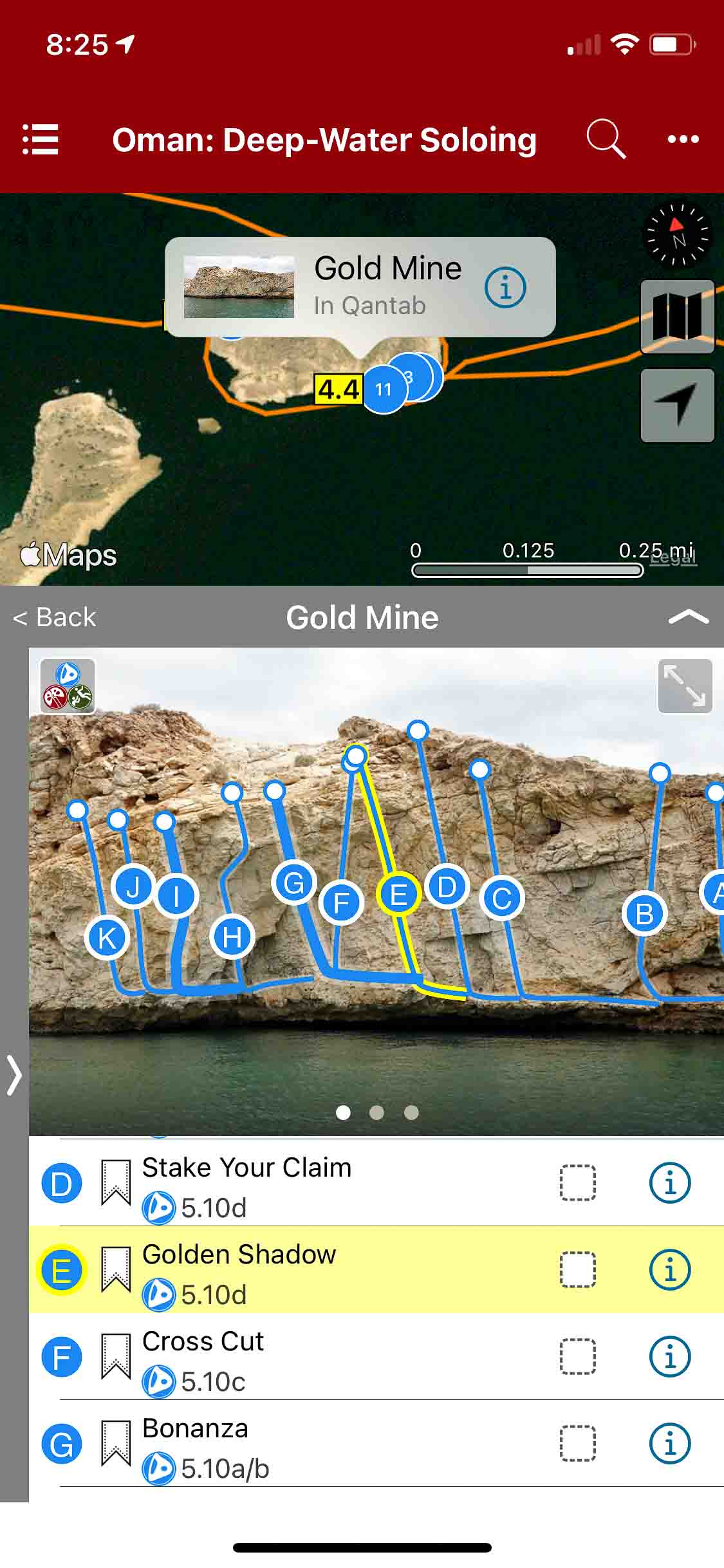
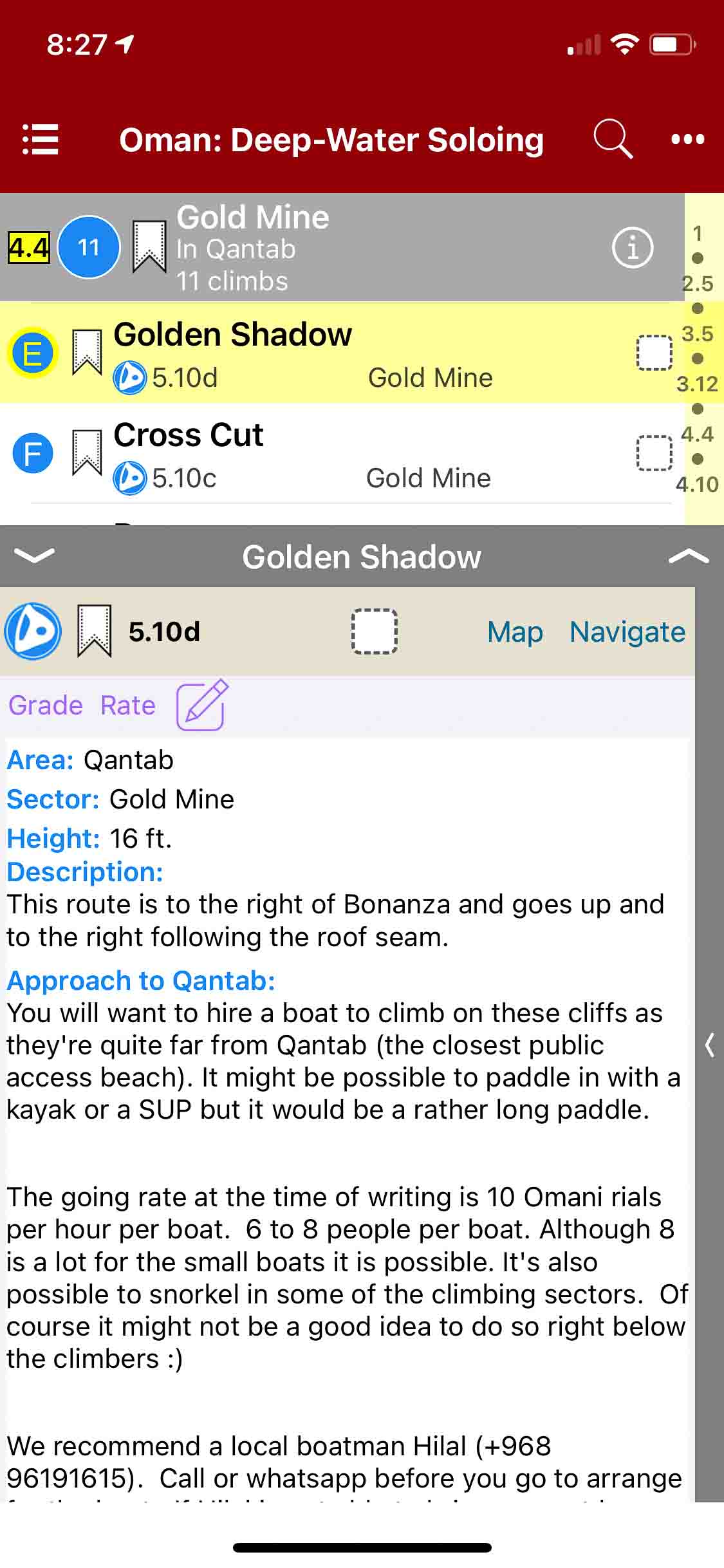
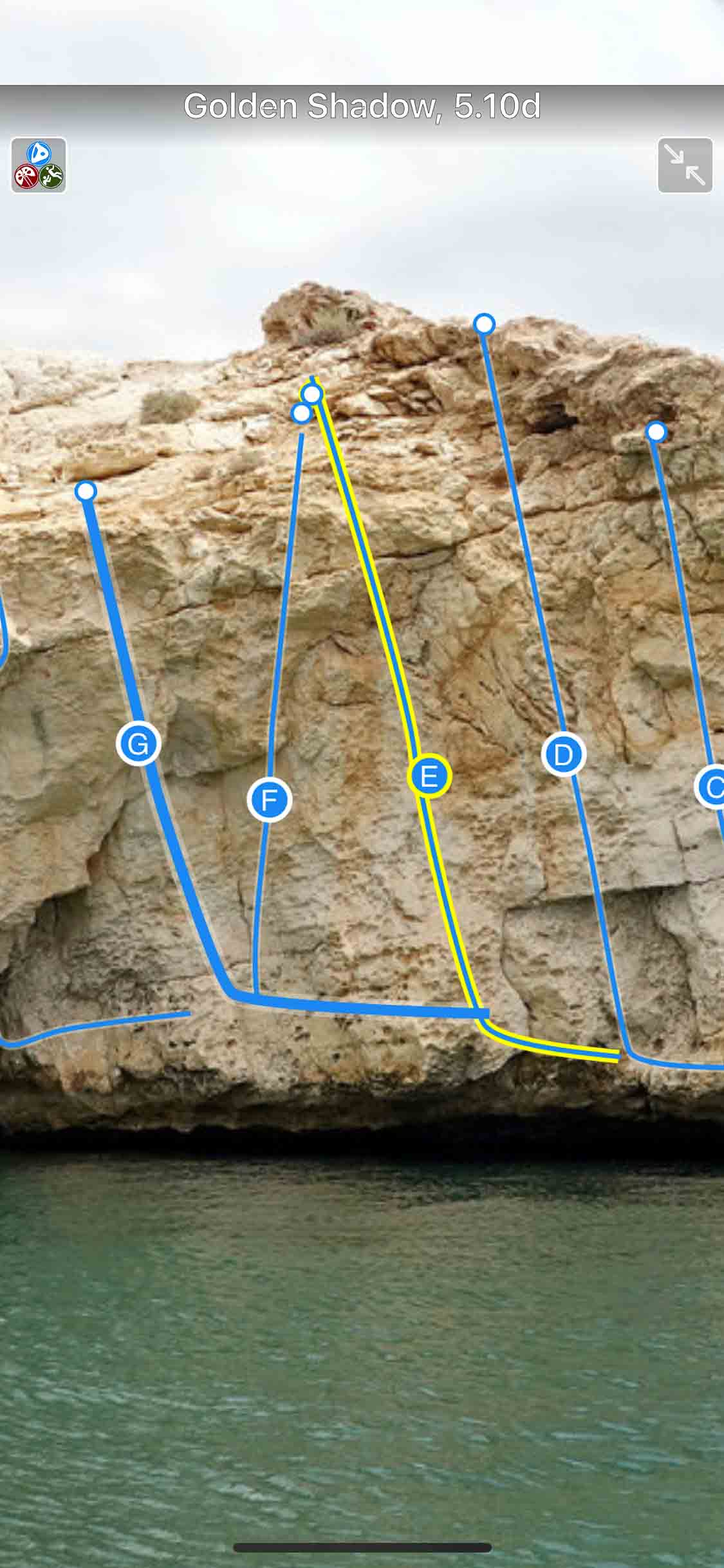
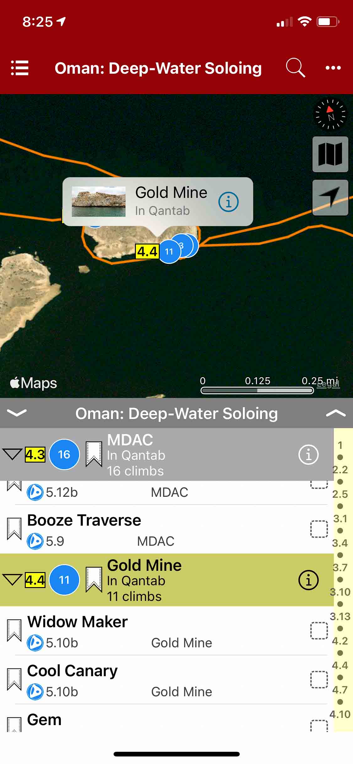
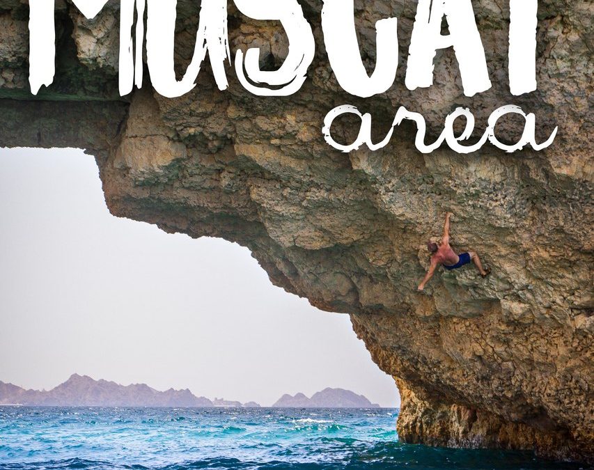
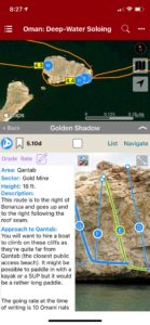
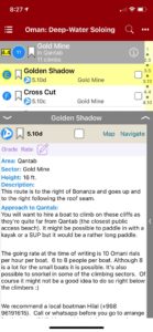
Oman: Deep Water Soloing
by Jamie Moss & Larry Michienzi
Climbing in Oman Facebook
Muscat Sport Climbing Guidebook | Sharaf Al Alameyn Sport Climbing Guidebook
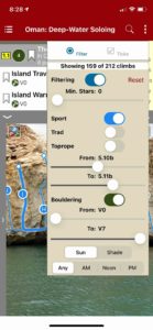
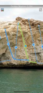
Muscat in the Sultanate of Oman might be the only capital city in the world with high quality deep-water soloing within the city limits. DWS makes perfect sense in Muscat with its complex rocky coastline surrounded by a warm calm Indian Ocean. Oman has an enviable climate making DWS a year-round pursuit. This guide details over 200 routes across the three most accessible cliffs developed so far. Some sectors are lowball and bouldery in nature and provide a great introduction to the sport (V0-V7), whereas other are taller and more committing (F5-F8a/5.7-5.13b).
-

-
Easily locate sectors and climbs.
-
-
Climb details, image and map.
-
-
Searchable climb list.
-
-
Filter based on grade.
-
-
Beautiful full screen smart topos.
-

-
Explore Oman: Deep Water Soloing with rakkkup’s trail map.
by | Aug 21, 2019
Horse Pens 40 Bouldering
by Adam Henry
Published by Rockery Press
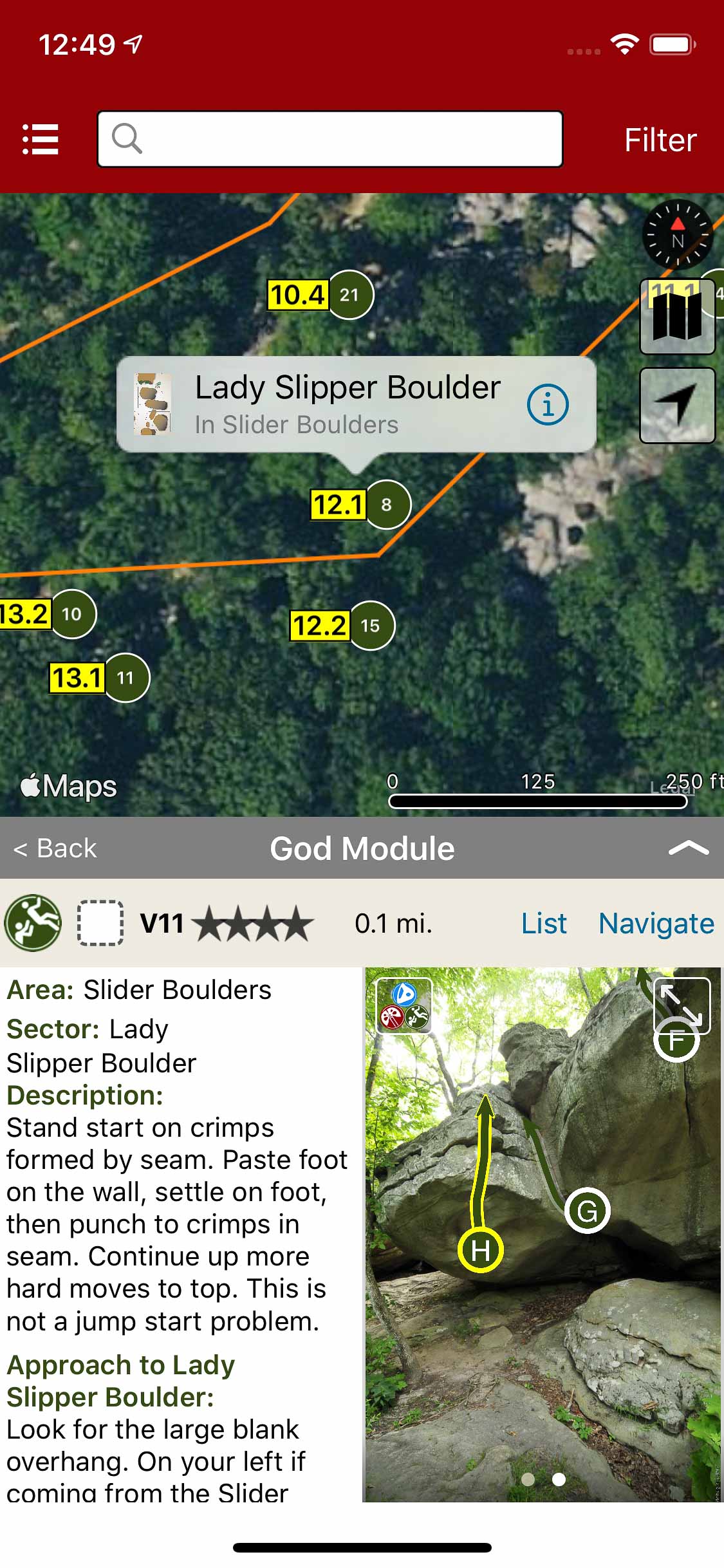
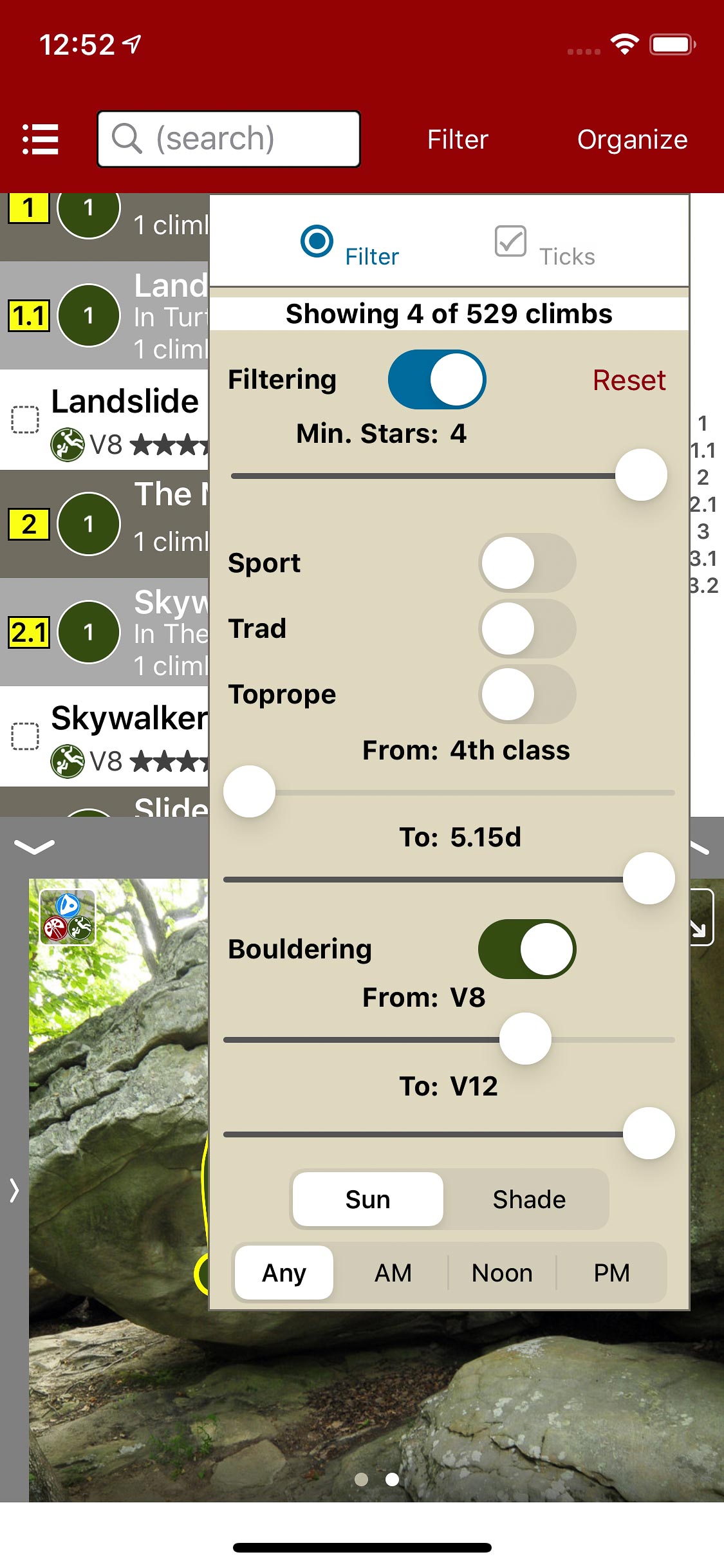
Sculpted by the ravages of time, Horse Pens 40 is home to acres of bulbous faces, blunt prows, delicate slabs, crimpy overhangs, and water grooves. The owners, Mike and Gina Schultz, are models for southern hospitality. Mike is one of the best storytellers you will ever meet, while Gina slings some of the meanest country cooking you will ever encounter. HP provides the maximum amount of problems for the least amount of effort. If you are in search of the double digit line, you might want to “go west young man,” because the area lacks the soft sends needed to pad the spraycard. With over 100+ lines from V3-V5 and the same amount from V6-V8, this is the moderate climbers dream come true. Horse Pens is the Fontainebleau of the South, without the arrogance and the stench. Either for a day, a week, or a season, your trip to HP will have you wanting of more. If the weather permits, this is as good as it gets.
-
-
Explore Horse Pens 40 bouldering via an interactive trail map.
-
-
rakkup navigates car to boulder then displays a picture when arriving at destination.
-
-
Smart topos help locate the correct problem.
-
-
Filter problems by quality and grade.
-
-
Quickly browse or search boulder problems in the problem list.
-
-
Beautiful full screen smart topos.