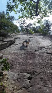
by todd | Feb 5, 2018 | Snow Sports, World's Best Backcountry Skiing Areas
When the sun goes down on Qurlutuarjuq camp
Vous y découvrirez un territoire et un peuple unique qui ne laisse personne indifférent. Tous les aventuriers et explorateurs qui y sont passés en reviennent marqués. Y aller c’est s’imprégner d’une culture millénaire, c’est découvrir un territoire infini, c’est de vivre l’agréable sentiment d’isolement, d’être seul au monde et d’avoir le privilège de vivre des moments uniques, intenses, des moments WOW. En entrant en communion avec la nature, les animaux sauvages, les aurores boréales et les montagnes, on a l’impression que le monde nous appartient.
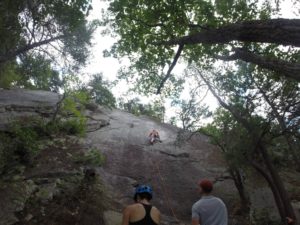
Mount Iberville south valley
Avec un peu plus de 40 lignes décrites, ce guide ne couvre qu’une infime partie de la cordillère arctique qui s’étend sur plus de 50 000 km² au nord du Labrador et du Québec, vous donnant ainsi l’opportunité de skier du terrain déjà connu et documenté, mais laissant aussi grandement place à votre imagination pour explorer l’infinité de possibilités encore intouchées. Cette chaîne de montagnes située à la frontière du Québec et du Labrador cache les plus hauts sommets du Nunavik, y compris le légendaire mont d’Iberville (Caubvick) qui se situe à cheval entre les 2 provinces. Avec son relief qui s’étend de la mer jusqu’aux pics rocheux d’où l’on peut voir la toundra s’étendre à perte de vue, ce territoire peu connu mérite le déplacement.

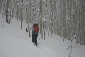
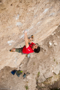
Jacob Laliberté bootpacking Sun In the Bucket
Il renferme une infinité d’options skiables pour tous les types de skieurs avec des dénivelés atteignant près de 1000m de vertical, des angles de pentes allant de 20º à 50º, des couloirs, des bols, des sommets et des faces de tous genres. Sans oublier les refuges (camps, dômes, tentes arctiques) situés un peu partout sur le territoire qui rendre l’expérience encore plus agréable et accessible.
Ce guide app vous donnera non seulement beaucoup d’information sur le terrain skiable. Il vous facilitera aussi la vie en vous donnant accès à toute l’information nécessaire sur; comment s’y rendre, comment économiser sur le transport, comment vous déplacer sur le territoire, où dormir et quel matériel apporter, vous permettant ainsi de vivre une expérience inoubliable sans trop vous casser le caillou. Le terrain skiable restant au cœur du guide, vous y trouverez le niveau de difficulté de chaque descente, leur niveau de risque, leur qualité (nombre d’étoiles), leur orientation, l’angle de pente, leur approche, leur description générale ainsi qu’une tonne de photos pour chacune des lignes skiables, vous donnant ainsi une bonne idée de la descente avant même de l’avoir skiée. Et pour ceux qui ont encore plus la fibre aventurière et qui ont envie de découvrir les dizaines de milliers de kilomètres carrés encore jamais explorés, alors ne vous en faites pas, il y a en masse de terrain pour combler tout le monde. Le seul conseil que nous avons à vous donner, c’est que peu importe que vous achetiez cette application ou non, ALLEZ-Y, foncez! Vous ne reviendrez pas déçu. Mais si vous n’avez pas envie de chercher de l’information à gauche et à droite, alors voici votre solution; «Backcountry skiing : NUNAVIK & LABRADOR » permet de contenir tout à la même place; autant pour la planification du voyage que pour l’auto-guidage une fois sur place.

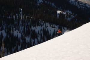
Jacob Laliberté charging on Jesus On the Edge aka J.O.E
Bref, skier au milieu des aurores boréales et des caribous n’aura jamais été aussi accessible. «Backcountry skiing : NUNAVIK & LABRADOR» est un nouveau souffle pour l’exploration en ski et une aventure qui changera votre vie.
———————————
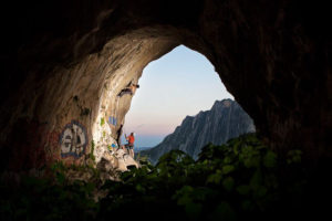
“Backcountry skiing: NUNAVIK & LABRADOR” is the first collection of ski runs covering the aera of Kuururjuaq Park and the Torngat Mountains Park located north of the 58th parallel.

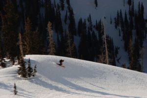
Jacob Laliberté enjoying the light on Mirador with the Butt Crack in the background
You will discover a territory and unique people that leaves no one indifferent. All the adventurers and explorers who went up north came back marked. Travelling there is immersing yourself in a thousand-year-old culture, discovering a limitless territory, it’s living the pleasant feeling of isolation, feeling the loneliness and having the privilege of living a unique and intense moment! You and nature will make one by rubbing wild animals, aurora borealis and mountains. You’ll have the impression that the world belongs to you.
With a little more than 40 lines described, this guide-app covers only a tiny part of the Arctic Cordillera stretching over more than 50,000 km² in northern Labrador and Quebec, giving you the opportunity to ski the land already known and documented, but also leaving room for your imagination to explore the incredible amount of possibilities still untouched. This mountain range on the border of Quebec and Labrador hides the highest peaks of Nunavik, including the legendary Mount Iberville (Caubvick) which straddles the two provinces, with its relief that stretches from the sea to the rocky peaks where you can see the tundra extend as far as the eye can see. This little-known territory deserves a trip.

Bruno-Pierre Couture et Jacob Laliberté the two authors of the guide-app
It contains endless ski options for all types of skiers with vertical elevation up to 1000m, slope angles from 20º to 50º, couloirs, bowls and faces of all kinds. And that’s without counting all the shelters (camps, domes, arctic tents) located throughout the area that makes the experience even more enjoyable and accessible.

Bruno-Pierre Couture au campement sur la rivière Koroc secteur In Your Face derrière – at the camp on the Koroc river sector In your face in the back
This guide-app will not only give you information on the ski terrain. It will also make your life easier by giving you access to all the necessary information about; how to get there, how to save money on transportation, how to get around the area, where to sleep and what equipment to bring, allowing you to live an unforgettable experience without any headache. The ski area remaining the guide’s heart, you will find the level of difficulty, level of risk, quality (number of stars), orientation, slope angle, approach, a general description and a ton of photos for each of the ski lines, giving you a good idea of the descent before skiing it. And for those of you who feels more adventurous, there is still thousand and thousand of square kilometers to explore. So don’t worry, there is plenty of terrain make everyone happy. The only advice we have to give you is that whether you buy this application or not, GO FOR IT! You will not be disappointed. But if you don’t want to lose energy gathering information everywhere, then here is your solution; “Backcountry skiing: NUNAVIK & LABRADOR” put everything in one place; from the planning of your trip to the self-guiding once you’re on the spot.
In short, skiing in the middle of the northern lights and caribous will have never been so accessible. “Backcountry skiing: NUNAVIK & LABRADOR” is a new breath for skiing exploration and an adventure that will change your life.
by todd | Oct 9, 2017 | Colorado, World's Best Backcountry Skiing Areas
Buy Silverton
Skier Gail Sovick braves the blizzard
Skier Kevin Krill Samples the Goods
December, 2000: I was a freshman at Fort Lewis College in Durango, sitting in a van full of other new students. The van was doggedly climbing up Coal Bank Pass towards Silverton, Colorado. I had applied to Fort Lewis for two reasons. 1) It had an excellent humanities department, and 2) it is at the foot of the San Juan Mountains, home of backcountry ski legends. Legendary backcountry pioneers like Dolores LaChappelle and Chris Landry made their homes in the San Juans. Legendary big steep mountains like Snowdon, Bear, Sultan and Kendall loom over the towns and highways like sentinels of a sacred place. Yes, I wanted to get a college education, but let’s be serious for a minute: I was a 19 year-old kid hungry for epic adventures and boundary-pushing weekends.
Skier Kevin Krill finds a natural terrain park
This was my place. The van full of students parked at the top of Molas Pass where we all stepped out, trying not to let our dropped jaws show too much as to make us look un-cool (we were 19 years old after all). We were on an Outdoor Pursuits day-trip, led by two very knowledgeable outdoorsmen. The class was titled “Terrain and Route Finding in Avalanche Country”. The instructors’ goal was to give us kids a primer on how to view avalanche terrain, how to notice avalanche prone features, how to understand the way an avalanche will move down different types of terrain. All day, we drove and hiked to dozens of locations to see classic ski zones like Anvil, Red 3, Kendall, and Prospect where the instructors emphasized how important it is to inspect avalanche terrain, plan your routes up and down. I’ll never forget the part of the day when our instructor said the following: “It would be so cool to have a folder full of photos of all the runs you want to ski, so that you can use them as you plan your next tour. From this moment, deep in the best ski terrain of the San Juans, the idea was born to create a terrain based photographic atlas of all backcountry runs.
I believe that just as a kayaker scouts his run and commits it to memory, a backcountry skier should too. Smack-dab in the center of an ancient volcanic caldera, Silverton is a true mountain town. Home to an extreme ski resort, famous mountaineers, miners and rich history, it is a fantastic place to visit and speaks for itself when it comes to remote and rugged towns. Many mountain ranges don’t have a year-round maintained road passing through them. The San Juan Range from Durango, through Silverton, to Ouray has three: Coal Bank, Molas, and the infamous Red Mountain. Highway 550 brings powder-hounds through some of Colorado’s most rugged and diverse ski terrain. Silverton Mountain ski resort, at the heart of the San Juans, boasts an annual snowfall of 400 inches. What is one part of the avalanche recipe that never changes? Terrain. Terrain is the only constant. With Backcountry Skiing Silverton and rakkup’s powerful planning and execution tools, you can read your run the night, week, or month before. You can refer to it as you travel through the field, assess your conditions, and adjust your plan as necessary.
Buy Silverton
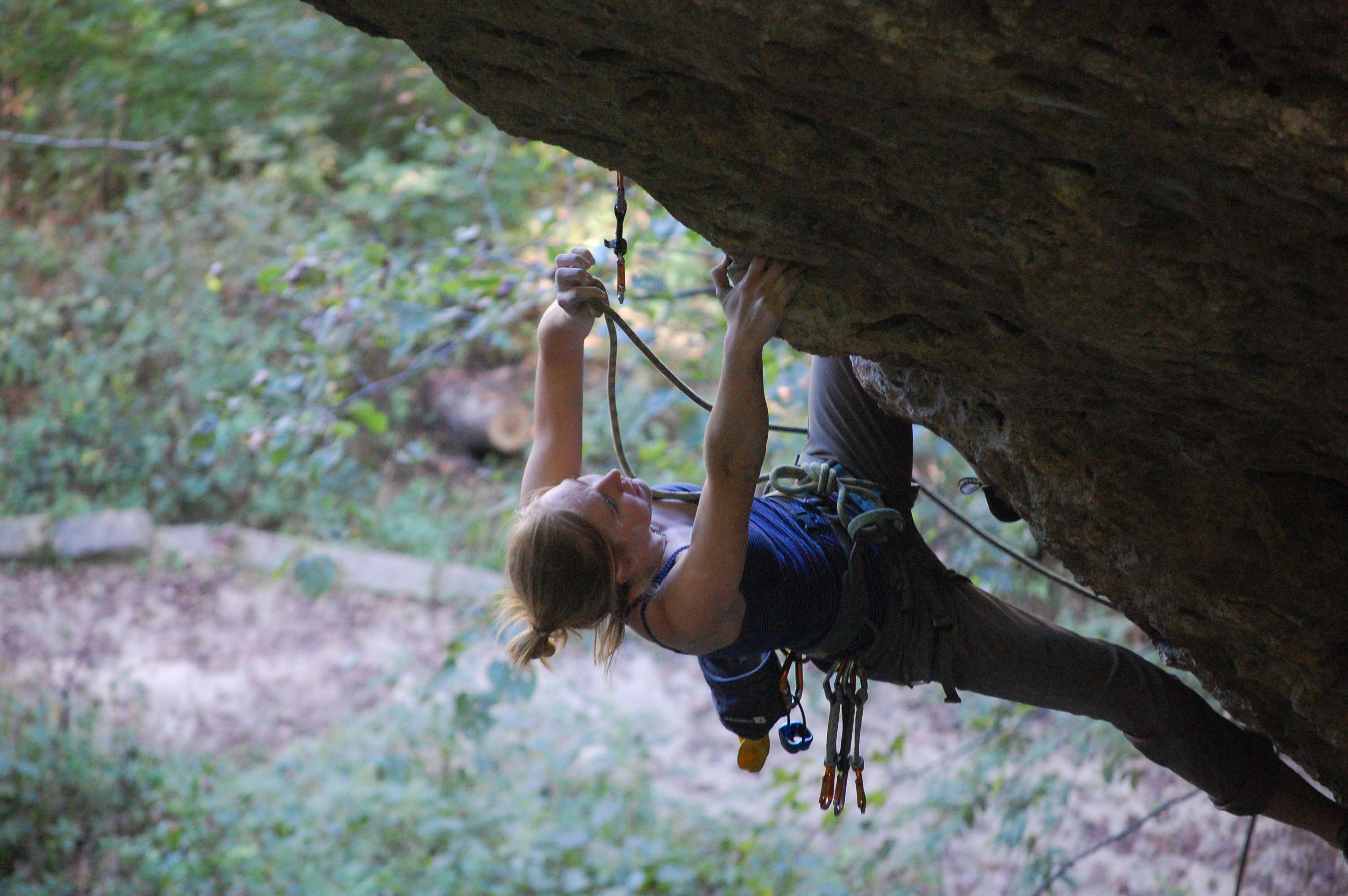
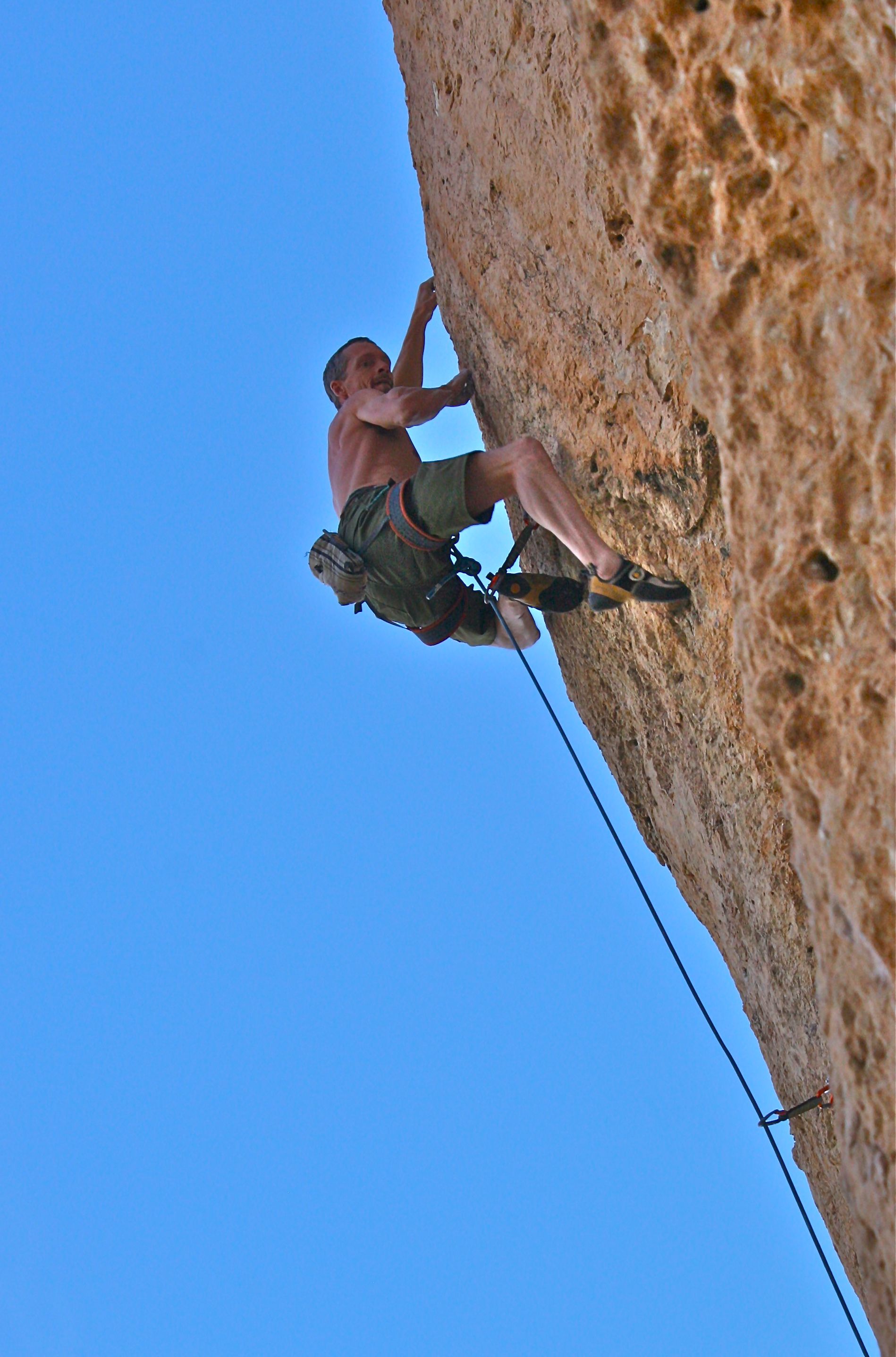
by todd | Apr 26, 2017 | World's Best Rock Climbing Areas
Buy
Elizabeth Furnace here and save money versus purchasing from within our app via Apple or Google. It’s exactly the same guidebook, but offered at a lower price on
rakkup.com.
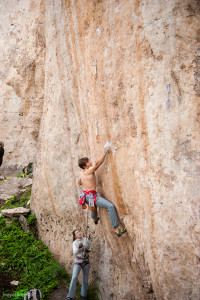
Francisco atop Raising Arizona 5.7
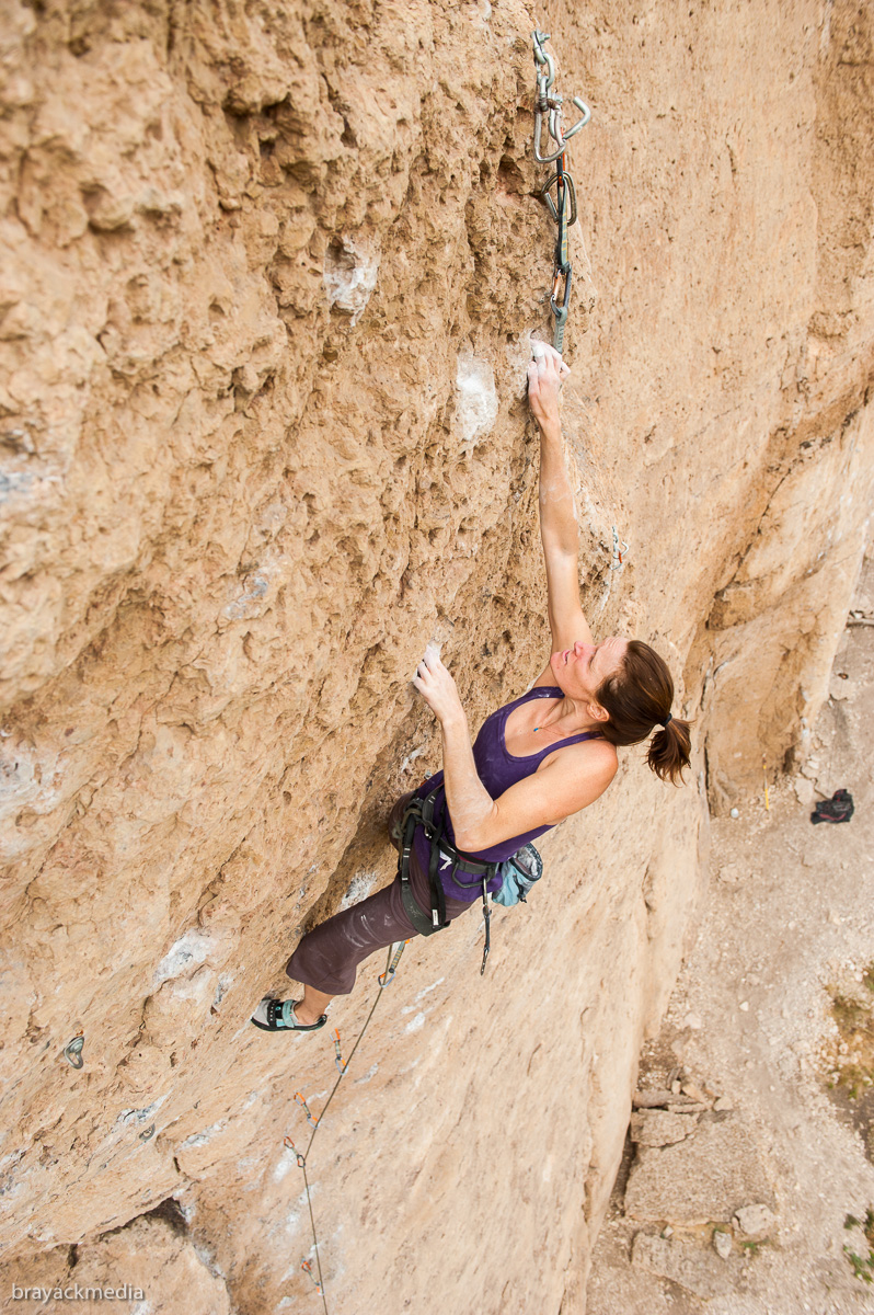
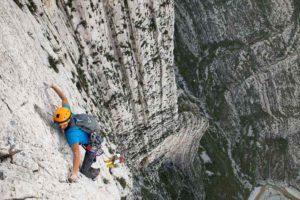
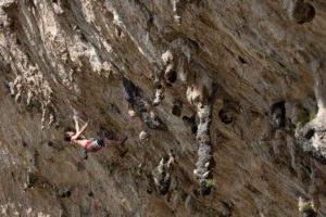
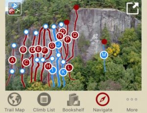
Elizabeth Furnace is a beautiful area located in the George Washington NF. Only a 1 hour drive from DC, it is the sport crag of choice for VA/MD/DC residents. Its name is derived from early 1800s history when a blast furnace located in the region was used to make pig iron using the currents of Passage Creek as a power source. Ore that was mined nearby and purified by the furnace was then transported to the South Fork of the Shenandoah River and taken downstream for forging in Harpers Ferry, WV. Today, the region is primarily a recreational area for families, with camping facilities that are readily accessible to those hiking the Massanutten & Tuscarora trails. Other activities to be enjoyed nearby, besides rock climbing, are camping, hiking, and mountain biking. The area offers two main crags; the roadside 5 minute approach Talking Headwall, and the mountain top 45 minute approach Buzzard Rock.
Melissa on Failure to Communicate 5.7
This guide is a comprehensive collection of the Elizabeth Furnace climbing region. It includes both Buzzard Rocks & Talking Headwall. Located in the north eastern outskirts of the George Washington National Forest, it is only a 1 hour drive from the DC region.
Talking Headwall is NoVa’s iconic roadside crag. Talking Headwall offers great sandstone features with overhangs and is the location of choice for new climbers to practice and hone their skills. Featured climbs are “Leading Should Feel This Way” (5.10), “I Love Big Jugs” (5.8), “Furnasty” (5.12), “Pure Energy” (5.10), and many others.
Mike – Suzzanne – Scott on Failure to Communiate 5.7
Buzzard Rock, with clean tuscarora sandstone and solid gear placements. Buzzard offers great features with mostly slab climbing and minimal overhangs. It is the location of choice for new climbers to practice and hone their trad skills. Featured climbs are the iconic “Anonymous Flake” (5.8 – 5.11), “Pulp Friction” (5.9), “Ass Cannibal” (5.8), and the new routes at the Adam Kopley Memorial Boulder.
Please email f.fuentes.ae@gmail.com for route updates & corrections. Contributions to this guidebook have been made by Francisco J Fuentes & Sean Tracy.
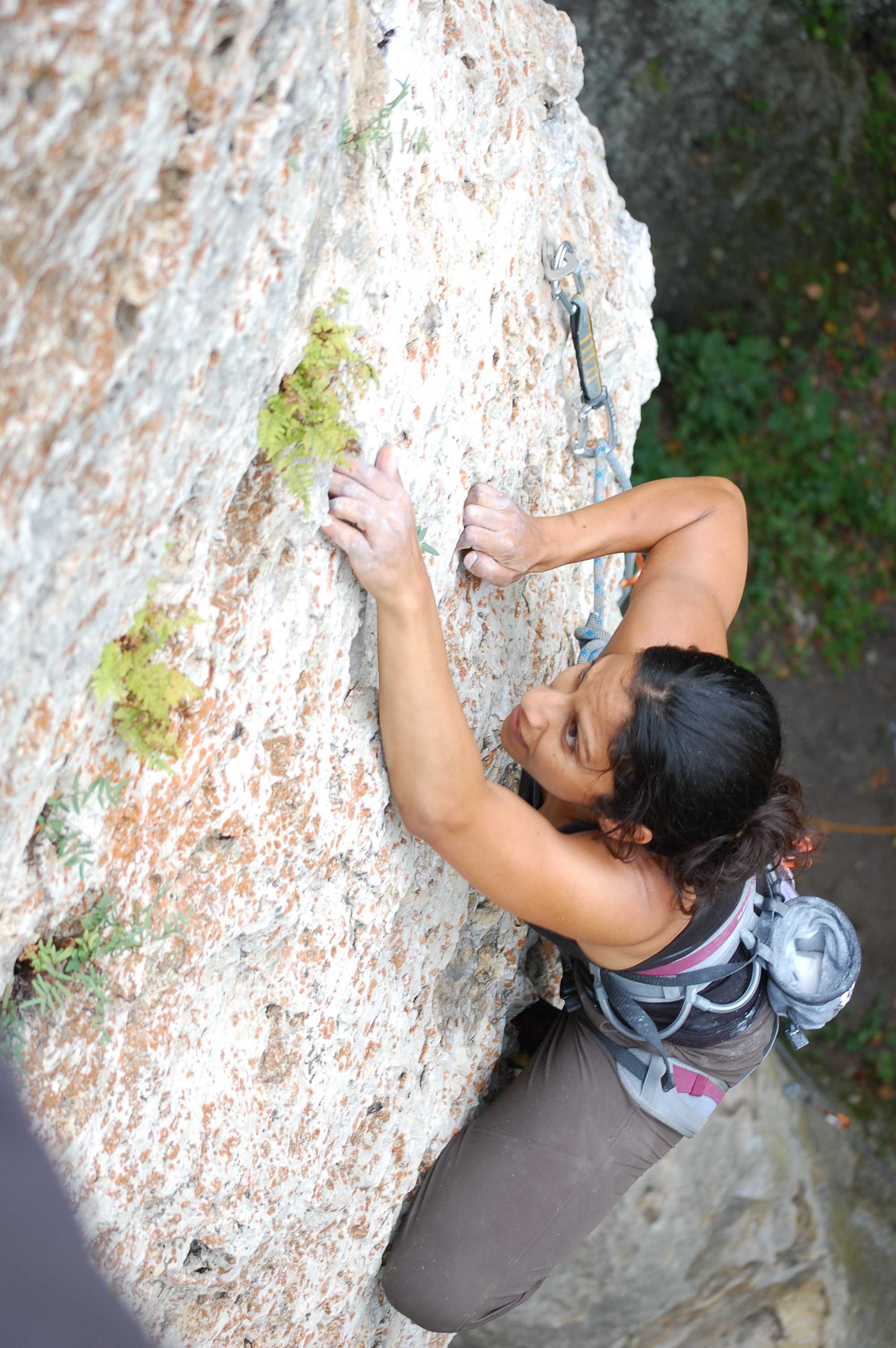
by todd | Mar 23, 2017 | World's Best Bouldering Areas
Buy
Boat Rock Bouldering here and save money versus purchasing from within our app via Apple or Google. It’s exactly the same guidebook, but offered at a lower price on
rakkup.com.
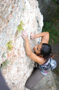
Athar Naseer, Gaping Crack (V3)
Boat Rock is a granite playground nestled in the heart of a bustling metropolis. It consists of monstrous boulders hidden within a beautiful southern forest. The contrast between this amazing paradise of sharp boulders and the fast-moving cement city that has enveloped this climbing Eden is stark and dramatic. Boat Rock is an amazing respite for the climber stranded in the city, and is the most extensive and varied bouldering park within a few hours of Atlanta.
Boat Rock boasts a variety of climbers that called the Boat their stomping grounds, including Robyn Erbesfield, Bob Cormany, Ron Kauk, Curtis Glass, Shannon Stegg, Jerry Roberts, and Rich Gottlieb who all have made Boat Rock a destination for those looking to develop technical skills in this slab filled area.
Alex Liu, on Easy Crack Traverse (V3)
Boat Rock is notorious for being saved from urban progress by advocacy groups, especially the Southeastern Climber’s Coalition. Today, the area is divided between being held for climbers, and still owned by others, so climbers have to be aware of where boundaries are. Future plans seem to incorporate the outlying areas that possess interesting problems into use for climbers of Boat Rock permanently.
The pinnacle of climbing season is late January, where it doesn’t usually get blistering cold in this area of Georgia. The closer to summer, the ever-present humidity makes its presence known to climbers. Spring and fall are beautiful times to enjoy this park, but as the foliage is beautiful on the trees, it does inhibit navigating the boulders for beginners and new-comers.
Boat Rock is a place for climbers of varying ability levels. This is a great place to develop great slab climbing skills, as well as crack climbing, edging and balance.
by todd | Jan 14, 2017 | World's Best Rock Climbing Areas
Buy
Denny Cove here and save money versus purchasing from within our app via Apple or Google. It’s exactly the same guidebook, but offered at a lower price on
rakkup.com.

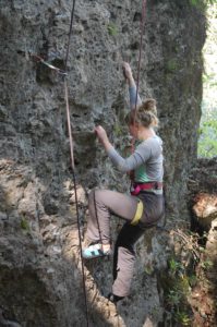
John Dorough on the classic, Magic Meat , 12a
Denny Cove is located down the street from Foster Falls and up the mountain from Castle Rock — putting it squarely in one of the most popular areas to rock climb in the South Cumberland region. Jason Reynolds (park ranger at the nearby Foster Falls) established the first routes at the cliff in 2011 and would later tell Steven Farmer and Cody Averbeck about the area. These two walked the cliff and were blown away by the variety of the different walls. Dubbing it a ‘Sandstone Buffet,’ the two recruited a core group of developers including John Dorough, Dave Wilson, Edward Yates, and Anthony Meeks. Over the next several years, the group would spend most weekends at the cliff knocking choss off of the buffet wall and making fun of each other.
Like Foster Falls, Denny Cove has a wall for everybody. Be it slabs, faces, to bunkers, Denny has it. Of special interest is the Buffet Wall which can really only be compared to the Lizard Wall in Little River Canyon, AL. Like Lizard Wall, the buffet wall is one of the driest walls in the region during wet weather. More importantly, the wall has a one of a kind climbing personality that blends limestone side pulling down low with classic pumpy Sandstone edges up high. This wall has nearly 50 5.12s with routes up to 100′ long — and is not to be missed!
In all, Denny Cove is a huge and highly valued addition to the Chattanooga climbing portfolio. It also represents a watershed acquisition project spearheaded by the Southeastern Climbers Coalition and the Access Fund. 10% of sales from this guidebook on rakkup will go the SCC to help preserve climbing access at Denny Cove.
by todd | Jan 12, 2017 | World's Best Rock Climbing Areas
Buy
Parque La Huasteca here and save money versus purchasing from within our app via Apple or Google. It’s exactly the same guidebook, but offered at a lower price on
rakkup.com.
Gaz Leah on Prudence Clasico 5.13c , Virgincita Cave.
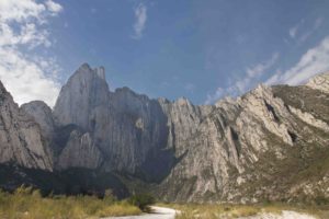
Hidden within the majestic valleys of the Sierra Madre Oriental, just outside the sprawling city of Monterrey, lies the wonderland that is Parque La Huasteca.
Gaz Leah on the first ascent of The Life You Can Save, 5.12+, Pico Independencia.
Gigantic spines of limestone cut the jagged landscape like knifes to the heavens and cascading canyons bestow hypnotizing vistas that reach as far as the eye can see. For decades, the park remained elusive to the outside world, an almost mythical place that few ventured into but the enigmatic Huichol people, whose annual pilgrimage to the pay tribute to Abuelo Fuego (Grandfather Fire) has been a tradition for millennia.
In recent years, the park has witnessed an awakening. The tales of it’s beauty have travelled far and wide, carried by images of it’s breathtaking scenery and signature views of Pico Independencia. Combined with it’s incredible selection of climbing routes ranging in grades from 5.7 to 5.14+, and boulders from V0 – V11, the park continues to attract visitors from across the globe and as far as the U.K., Germany and Sweden.
Clayton Reagan, Atodo Madre, 5.14a, La Bestia Cave.
Possessing a plethora of activities including sport climbing, bouldering, big walling, running, mountaineering, hiking, cycling, highlining, base jumping and camping, there is something to quiche the thirst of even the most ambitious adventurer!
Pargue La Huasteca Entrance.
by todd | Oct 19, 2016 | Rock Climbing App Reviews
Bone Mountain VT: A Hike with Rakkup | NY Ski Blog
The New York Ski Blog author “ml242” writes:
…As I continued on the steep switchbacks of a work road, I ran into some No Trespassing signs. It was at that moment I remembered that I had a guidebook in the Rakkup app on my iPhone. Embracing the new technology, I put the first edition print back in my pack and clicked through the trail guide. The GPS showed I was slightly off course, so I wandered back and hit the go button to navigate to the top with some turn-by-turn.
by todd | Aug 28, 2016 | World's Best Rock Climbing Areas
Buy
Iowa Limestone here and save money versus purchasing from within our app via Apple or Google. It’s exactly the same guidebook, but offered at a lower price on
rakkup.com.

Carolyn Coffey on the OS of Flash 5.11b
Finding rock climbing in the Midwest is not easy. Believe it or not a nice little area can be found in Eastern Iowa next to corn and hog farms near the town of Monticello. Three separate areas: Pictured Rocks, Indian Bluffs and Ozark Wildlife combine to form an area referred to by many as Wild Iowa. While unexpected, the climbing can be quite good and many leave satisfied that a stop wasn’t a waste of time.
Khadija Shahid at Windy Point 5.11a
Formed in ancient seas 2-300 million years ago, the Silurian Dolomite was revealed by erosion and contains some incredibly formed features. One might encounter pockets, crimps, combos, slopers, jugs and even fossils on route. While the Iowa climbing history predates the surge of bolting in the early 1990’s, it was the advent of the sport climbing revolution that was responsible for many of the rock climbs in Iowa. Over 100 bolted sport routes offer most styles of limestone climbing from technical slabs to steep jug hauls from 5.6 to 5.12. Trad climbing can be found as well near the pocketed faces but the Iowa Limestone guide will focus almost solely on sport climbs. Wild Iowa can provide a nice fix for regional climbers who can’t make longer drives to more popular/larger areas.
Emilie on Schoolio 5.9
Fall and Spring are the best seasons to climb at Wild Iowa, considering the cold winters and the humid summers. Occasionally, one can get a blue bird day in winter that is warm enough to enjoy South facing climbs. Also, many hard core climbers brave the humidity and insects to get some pitches in during the summer months. That said, the best days are found once the stifling heat abates in September -November or during the Spring season in late March – May. It should be mentioned accessing the areas in winter can be difficult. There is a gate that blocks car traffic to Pictured Rocks during the winter months, however foot traffic is still allowed.
The impetus for this guide came simply from meeting travelling climbers over the years,that had no idea how to find entire areas or what the climbs were rising before them. What better way to aid these climbers than to combine a GPS map to all climbs with the best descriptions of the climbs available. We sincerely hope you have fun climbing Iowa Limestone and that this guide aids your enjoyment!
by todd | Jun 24, 2016 | Rock Climbing App Reviews
Bouldering in the City: The Best Gear and Apps
Wall Street Journal’s Sanette Tanaka writes:
The Apps | Short of befriending an experienced urban boulderer, consulting an app is probably the easiest way to learn about climbing routes near you. “Mountain Project” and “Rakkup,” both available free on iOS and Android, catalogue thousands of climbing routes, and work offline once data is downloaded.
The key difference between the two is that the 100,000-plus climbs in Mountain Project are sourced from the app’s users, whereas Rakkup’s nearly 24,000 climbs (available through in-app purchases) are culled from the company’s digital guidebooks, which are written by local climbers.
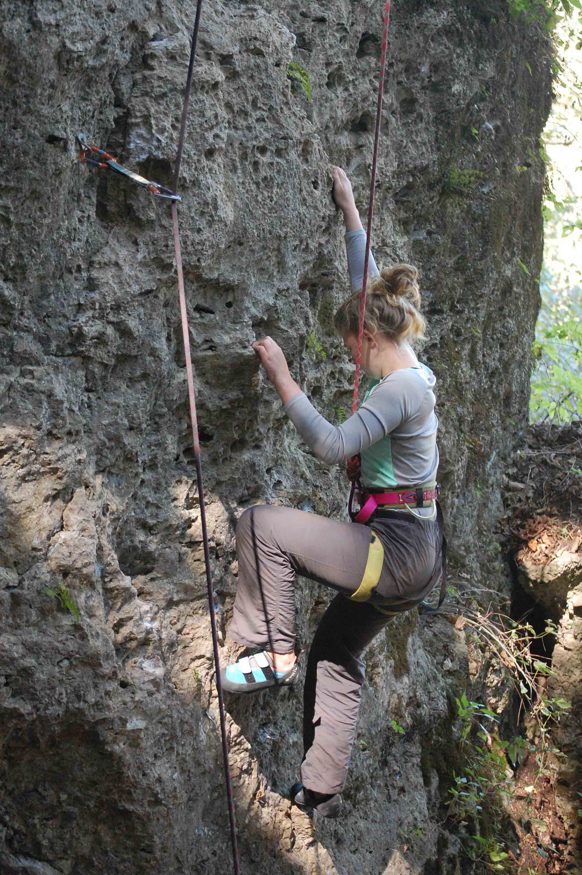
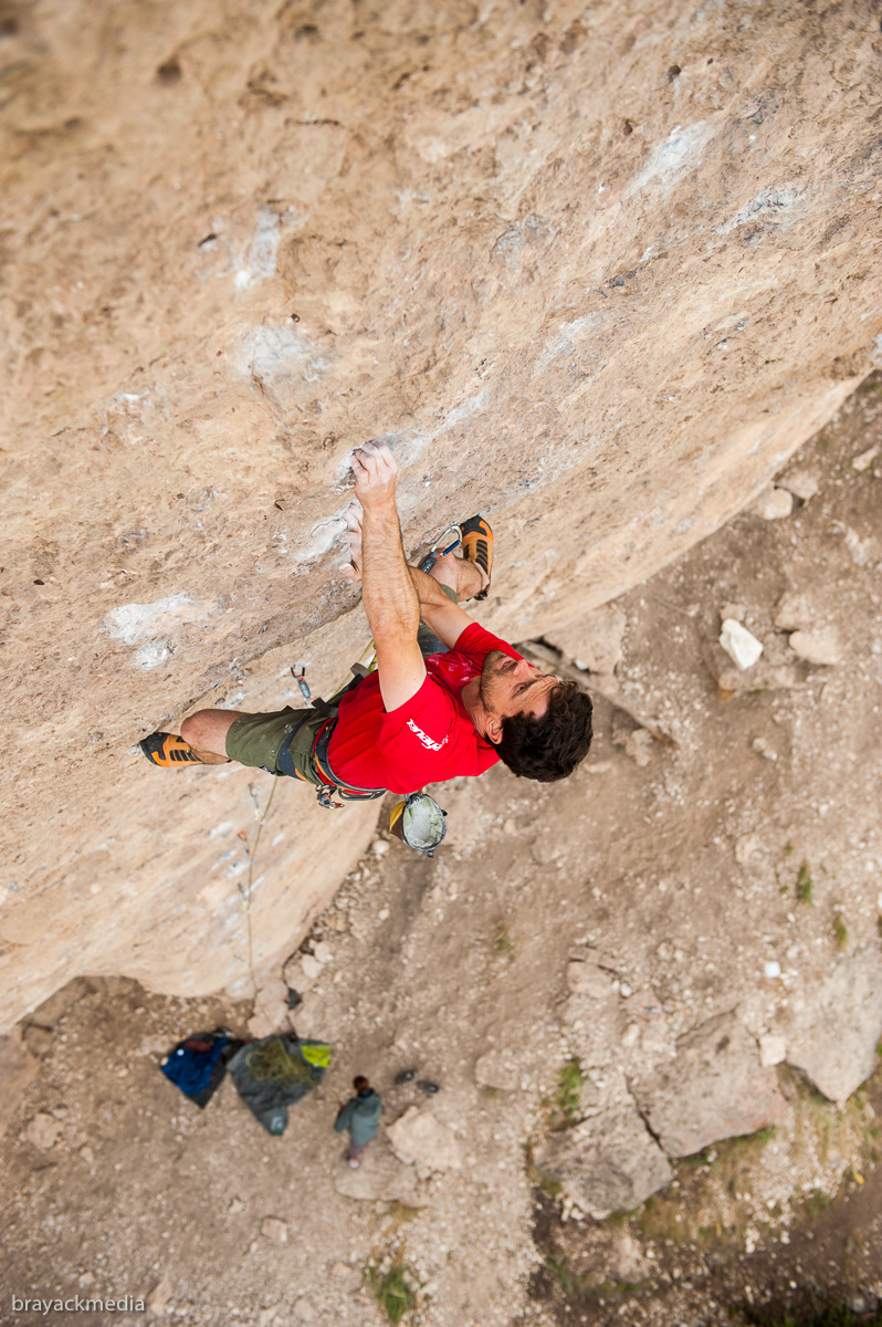
by todd | May 26, 2016 | World's Best Rock Climbing Areas
Buy or rent
Ten Sleep here and save money versus purchasing from within our app via Apple or Google. It’s exactly the same guidebook, but offered at a lower price on
rakkup.com.
The long and pumpy EKV .12c at Slavery Wall.
Tucked into the Western slope of the Big Horn Mountains Ten Sleep Canyon has miles of dolomite cliff line offering nearly 1000 rock climbing routes. You will find pockets of every shape and size along with edges, flakes and a perfect texture for sticking to climbing shoes no matter where you place them. The climbing in Ten Sleep often tends toward longer single pitch sport climbs requiring technique, endurance and a cool head. Highway 16 links this canyon from top to bottom providing access to dozens of individual crags and Old Road 18 parallels it on the other side of the river providing loads of free camping and more crags. The weather is typical of arid high desert and provides year round opportunities to get out cragging.

Mike Snyder grappling with the bouldery finish of Electric Jesus .13b at Downtown.
Author Mike Snyder’s initial Rakkup offering for Ten Sleep Canyon includes the main wall in the Upper Canyon stretching from Downtown all the way up to The French Cattle Ranch. In addition, Lake Point and the newest dope spot, Crag 6 are included as well. Other crags will be added periodically until the guide includes all crags and routes in the canyon.
Downtown, the lowest crag in the Upper Canyon has a gentle approach to 40 climbs. High quality and never crowded, you will find classics such as The Band is Just Fantastic .10a, Big Boy Pants .11a, Robot Steamroller .12b and Shaker .13b. Just up from Downtown are Metropolis and World Domination Sectors with long soaring routes like Crux Luthor .9/.12d, Jesus Christ Super Jew .11b, Bobby’s Got A Dirty Mouth .11c and Napoleon’s High Chair .12a/b.
The very first area in the Upper Canyon was the Mondo Beyondo which spawned tons of good routes and crags extending in both directions. Smack dab in the middle of the Mondo and directly up the trail from the main parking area is the Slavery Wall, hosting the oldest routes in the Upper Canyon and the inspiration to continue seeking out more and more walls/routes to develop. When you visit, try Beer Bong .10b, Wagon Wheel of Death .11c, Blackalicious .12a, EKV .12c and Gold Member .13d. There are also satellite crags extending off to the right and left providing different grades and angles of climbing for everyone in your posse.
Always on you from the word go, Esplanada .12d at French Cattle Ranch is a classic.
Up a little farther into the trees is Valhalla with areas like Vietnam, Munitions, the Oblivion Roof and Sex and Drugs. The 5.11’s and 5.12- routes in this beautiful part of the woods are superb. Bikini Girls with Machine Guns .11a, Hanoi Hilton .11c/d, Pump Me Like A Shotgun .11d and Cocaine Rodeo .12a. Wander high enough in the woods and you’ll find the Superratic pillar, this jaw dropping clean swath of bullet stone holds a high concentration of 5.13’s. The Great White Behemoth .12b , Hellion . 13c and F’d in the A .14a, will make you want to try everything there. Go ahead, you won’t be disappointed.
Hardman Ethan Pringle unlocks the bouldery start of He Biggum .13d at Superratic.
The French Cattle Ranch lies beyond all the rest at the highest elevation on the main wall. The Shinto wall has beautiful dark streaks defining its routes, while Sector D’or et Bleu and the Grashopper Wall look like multi-colored french limestone. The Matrix Pillar and the Back Forty host moderate Charlie Kardalef masterpieces. Many long vertical puzzles await including Euro Trash Girl .10b, I Just Do Eyes .11b, Center El Shinto .12b, Esplanada .12d and Galactic Emperor .13d.
The highest developed crag in the canyon is Lake Point. Its almost difficult to leave the parking area walking across the CCC constructed dam and gazing out across the lake, but rest assured supreme pocket tugging awaits. Ringed with horizontal pocket lines (HPL’s) found not often enough at other crags in the canyon, Lake Point has ’em in spades. At all different angles and facing in a multitude of directions, the climbs at Lake Point are a climbers dream. Check out Suits and Boots .8, Dirt Gator .10b, The Gooey Grasshopper .11d, Triple Double .12a and Bonnie and Clyde .12c.
Longtime developer of classic moderates Charlie Kardalef scored a home run with his first route Schools Out .10d at Slavery Wall.
Crag 6, so secret, we had to hide it way up on top, two miles South East of Ten Sleep Canyon. So far this concentrated climbing nugget has stayed off the radar, however all is revealed in the new Rakkup guide. Find the Mushroom Tip and the Rap Stars Wall jam packed with some of the best 5.13’s anywhere. There are some .10’s and .11’s too of equal quality. Warm up on The Buffalo has Landed .10b, Mr. Hyde .11b. Try Sniggity Nutz .12a, Swamp Thang .12b and Special Delivery .12c. Then throw yourself at any of 10 of the coolest 5.13’s out there.