Vous y découvrirez un territoire et un peuple unique qui ne laisse personne indifférent. Tous les aventuriers et explorateurs qui y sont passés en reviennent marqués. Y aller c’est s’imprégner d’une culture millénaire, c’est découvrir un territoire infini, c’est de vivre l’agréable sentiment d’isolement, d’être seul au monde et d’avoir le privilège de vivre des moments uniques, intenses, des moments WOW. En entrant en communion avec la nature, les animaux sauvages, les aurores boréales et les montagnes, on a l’impression que le monde nous appartient.
Mount Iberville south valley
Avec un peu plus de 40 lignes décrites, ce guide ne couvre qu’une infime partie de la cordillère arctique qui s’étend sur plus de 50 000 km² au nord du Labrador et du Québec, vous donnant ainsi l’opportunité de skier du terrain déjà connu et documenté, mais laissant aussi grandement place à votre imagination pour explorer l’infinité de possibilités encore intouchées. Cette chaîne de montagnes située à la frontière du Québec et du Labrador cache les plus hauts sommets du Nunavik, y compris le légendaire mont d’Iberville (Caubvick) qui se situe à cheval entre les 2 provinces. Avec son relief qui s’étend de la mer jusqu’aux pics rocheux d’où l’on peut voir la toundra s’étendre à perte de vue, ce territoire peu connu mérite le déplacement.
Jacob Laliberté bootpacking Sun In the Bucket
Il renferme une infinité d’options skiables pour tous les types de skieurs avec des dénivelés atteignant près de 1000m de vertical, des angles de pentes allant de 20º à 50º, des couloirs, des bols, des sommets et des faces de tous genres. Sans oublier les refuges (camps, dômes, tentes arctiques) situés un peu partout sur le territoire qui rendre l’expérience encore plus agréable et accessible.
Ce guide app vous donnera non seulement beaucoup d’information sur le terrain skiable. Il vous facilitera aussi la vie en vous donnant accès à toute l’information nécessaire sur; comment s’y rendre, comment économiser sur le transport, comment vous déplacer sur le territoire, où dormir et quel matériel apporter, vous permettant ainsi de vivre une expérience inoubliable sans trop vous casser le caillou. Le terrain skiable restant au cœur du guide, vous y trouverez le niveau de difficulté de chaque descente, leur niveau de risque, leur qualité (nombre d’étoiles), leur orientation, l’angle de pente, leur approche, leur description générale ainsi qu’une tonne de photos pour chacune des lignes skiables, vous donnant ainsi une bonne idée de la descente avant même de l’avoir skiée. Et pour ceux qui ont encore plus la fibre aventurière et qui ont envie de découvrir les dizaines de milliers de kilomètres carrés encore jamais explorés, alors ne vous en faites pas, il y a en masse de terrain pour combler tout le monde. Le seul conseil que nous avons à vous donner, c’est que peu importe que vous achetiez cette application ou non, ALLEZ-Y, foncez! Vous ne reviendrez pas déçu. Mais si vous n’avez pas envie de chercher de l’information à gauche et à droite, alors voici votre solution; «Backcountry skiing : NUNAVIK & LABRADOR » permet de contenir tout à la même place; autant pour la planification du voyage que pour l’auto-guidage une fois sur place.
Jacob Laliberté charging on Jesus On the Edge aka J.O.E
Bref, skier au milieu des aurores boréales et des caribous n’aura jamais été aussi accessible. «Backcountry skiing : NUNAVIK & LABRADOR» est un nouveau souffle pour l’exploration en ski et une aventure qui changera votre vie.
———————————
“Backcountry skiing: NUNAVIK & LABRADOR” is the first collection of ski runs covering the aera of Kuururjuaq Park and the Torngat Mountains Park located north of the 58th parallel.
Jacob Laliberté enjoying the light on Mirador with the Butt Crack in the background
You will discover a territory and unique people that leaves no one indifferent. All the adventurers and explorers who went up north came back marked. Travelling there is immersing yourself in a thousand-year-old culture, discovering a limitless territory, it’s living the pleasant feeling of isolation, feeling the loneliness and having the privilege of living a unique and intense moment! You and nature will make one by rubbing wild animals, aurora borealis and mountains. You’ll have the impression that the world belongs to you.
With a little more than 40 lines described, this guide-app covers only a tiny part of the Arctic Cordillera stretching over more than 50,000 km² in northern Labrador and Quebec, giving you the opportunity to ski the land already known and documented, but also leaving room for your imagination to explore the incredible amount of possibilities still untouched. This mountain range on the border of Quebec and Labrador hides the highest peaks of Nunavik, including the legendary Mount Iberville (Caubvick) which straddles the two provinces, with its relief that stretches from the sea to the rocky peaks where you can see the tundra extend as far as the eye can see. This little-known territory deserves a trip.
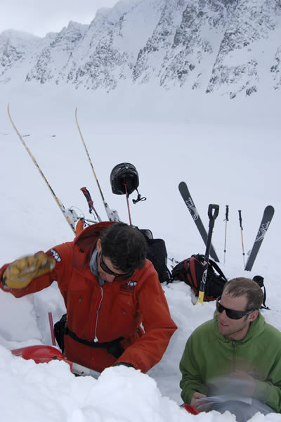
Bruno-Pierre Couture et Jacob Laliberté the two authors of the guide-app
It contains endless ski options for all types of skiers with vertical elevation up to 1000m, slope angles from 20º to 50º, couloirs, bowls and faces of all kinds. And that’s without counting all the shelters (camps, domes, arctic tents) located throughout the area that makes the experience even more enjoyable and accessible.
Bruno-Pierre Couture au campement sur la rivière Koroc secteur In Your Face derrière – at the camp on the Koroc river sector In your face in the back
This guide-app will not only give you information on the ski terrain. It will also make your life easier by giving you access to all the necessary information about; how to get there, how to save money on transportation, how to get around the area, where to sleep and what equipment to bring, allowing you to live an unforgettable experience without any headache. The ski area remaining the guide’s heart, you will find the level of difficulty, level of risk, quality (number of stars), orientation, slope angle, approach, a general description and a ton of photos for each of the ski lines, giving you a good idea of the descent before skiing it. And for those of you who feels more adventurous, there is still thousand and thousand of square kilometers to explore. So don’t worry, there is plenty of terrain make everyone happy. The only advice we have to give you is that whether you buy this application or not, GO FOR IT! You will not be disappointed. But if you don’t want to lose energy gathering information everywhere, then here is your solution; “Backcountry skiing: NUNAVIK & LABRADOR” put everything in one place; from the planning of your trip to the self-guiding once you’re on the spot.
In short, skiing in the middle of the northern lights and caribous will have never been so accessible. “Backcountry skiing: NUNAVIK & LABRADOR” is a new breath for skiing exploration and an adventure that will change your life.
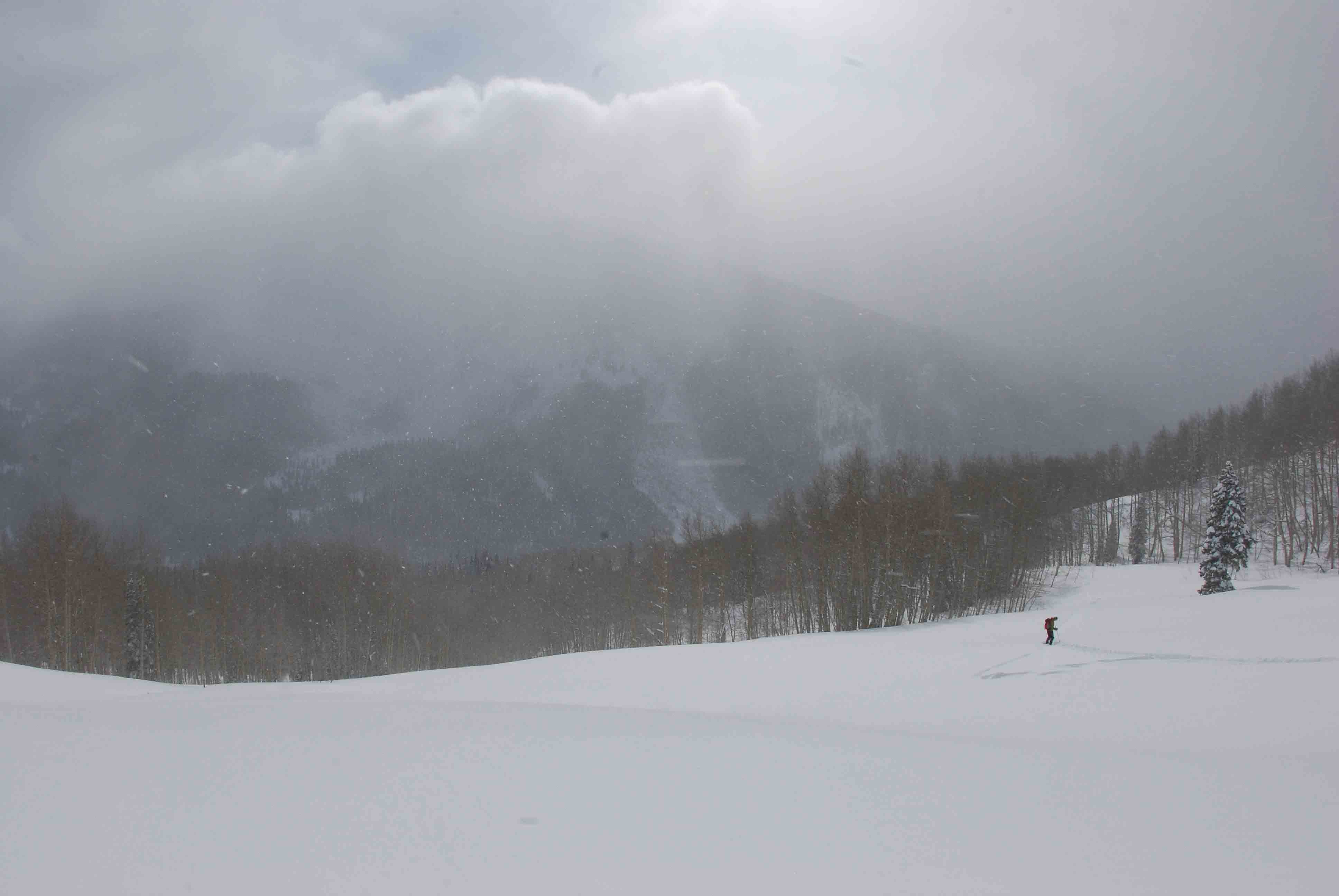
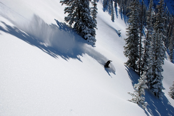
In January of 2017, it began snowing in the Elk Mountain. A month later, it felt like it had never stopped. A long sequence of storm cycles had deposited over 10 feet of snow at Irwin, just outside of Crested Butte.
Skier Gail Sovick heads-up the front side of Snodgrass mid storm.
For backcountry skiers, a massive amount of snow in a short amount of time awakes a mixed bag of emotions. On the one hand, a skier cannot help but get excited about deep, deep pow. Images start appearing in our heads (and on our social media) of skiers porpoising way down into the white room, gloves and poles barely exposed above the surface as if they are the only way to catch a breath of air on behalf of the submerged powderhound. On the other hand, a lot of snow in a short amount of time means that avalanche danger is likely to rise, thus keeping us from venturing out into the steep-and-deep to realize our dreams of flying through the subnivean zone.
An impressive amount of snow blankets a “light tour” in the Anthracite Range
During this storm, I stopped into Wild Snow Headquarters to talk about a new book that my publishing company had just released for backcountry skiing Snoqualmie Pass in Washington. Lou Dawson runs wildsnow.com, which is one of the best online stops for quality and comprehensive backcountry ski news. Being the warm welcoming guy that he is, he invited me in for a cup of coffee, where we proceeded to talk about the storm that was surrounding our beloved mountains. We began talking about what we typically do during storms like this. Many people will read the avalanche forecast during storms like this, see that the danger is very elevated, and they will simply go to the ski area or just stay home. But backcountry skiers like Lou see things a little different. They begin to look for slopes in their area that are too low-angle to slide, but still steep enough to get some slow, yet oh-so enjoyable, turns on the way down.
Lou and I began talking about these tours and how wonderful they are, not only for high-danger days, but also for days with novice friends, or quick before-work tours, or days when you’re nursing a pulled muscle. In our conversation, we soon came to realize that we don’t even need an excuse to go hit the “light tours” of our area…we just plain like them. Our conclusion was that it’s really good to have a list of your local light tours in the back of your mind when the context presents itself.
Skier Gail Sovick takes a meadow break in Crested Butte’s Red Lady Glades.
So was born, the idea of creating a book that showcases some of our state’s light tours. It is said Colorado has 300 sunny days a year. Combine that with several thousand mountains, and a winter climate that’s downright temperate. The result: one of the best places on the planet for ski touring. Of course nothing is perfect. Colorado challenges backcountry skiers with limited public access options, due in part to it being a mostly rural, relatively un-roaded western state. More importantly, due to various climatic factors the state’s mountains can be prone to dangerous avalanches for much of every winter. Yet options exist. Key with backcountry travel is picking routes with lower angle pitches and other avalanche-mitigating factors. While these “light tours” are surprisingly difficult to find, they do exist. We detail a selection of Colorado’s best under these covers. Further, a growing trend in ski touring is the use of ski resorts for “uphilling,” motivated by the need for a less committing experience — yet nonetheless an experience that can equal any other outdoor sport in enjoyment. Colorado lends itself to this as well, with most of the state’s more than twenty ski resorts allowing uphill skiing. Thus, we offer a special mix here, combining a variety of “easy” backcountry routes with recommended resort options. Pick one of our many days of Colorado sunshine, get out and enjoy.
How does a solid 7500 vertical foot ski descent from the top of a steaming volcano, with views of Canada, the San Juan Islands, and the heart of the North Cascades sound? If this sounds like your kind of thing, Mount Baker is your kind of mountain. Mount Baker, originally known to the Lummi as Komo Kulshan, aka the White Sentinel, was first sighted by the Spanish in 1790. 2 years later Captain George Vancouver discovered passage into the Salish Sea and the great renaming began with giving Kulshan the name: Mount Baker, after his lieutenant Joseph Baker who was the first of his crew to spot the volcano. Locals discovered powder skiing in 1927 and the ski area opened in 1929.
Climbers heading for Baker’s summit
Ptarmigan Ridge beckons those looking to reach a little farther
The terrain found on the north face of Shuksan certainly demands respect
The first uninterrupted climb and ski descent was achieved in 1933 by Hans Otto Giese and Don Fraser of the Seattle Ski Club. Apparently, they summited in 6.5 hours, and descended 6,750 feet in 30 minutes. Looking back on the particular gear they must have been climbing and skiing with, it is certainly humbling to think of the challenges men like these had to face in order to accomplish such high adventure with success. 90 years later passion to ride now is shared from Vancouver BC to Seattle driving up hwy 542 every weekend from November thru April to ride the biggest storms in the NW!
The Mt. Baker backcountry extends east to west from Mt. Shuksan to Mt. Baker connecting ridges of Shuksan Arm to Ptarmigan Ridge with expansive glaciers, powder bowls, technical couloirs, powder-filled glades and plenty of lower elevation trees. Many ski routes begin directly from the Mt. Baker Ski Area averaging the deepest snowpack in North America guaranteeing you can find fresh tracks somewhere.
What is one part of the avalanche recipe that never changes? Terrain. Terrain is the only constant. With Backcountry Skiing Mount Baker and Rakkup’s powerful planning and execution tools, you can read your run the night, week, or month before. Refer to it as you travel through the field, assess your conditions, and adjust your plan as necessary.
December, 2000: I was a freshman at Fort Lewis College in Durango, sitting in a van full of other new students. The van was doggedly climbing up Coal Bank Pass towards Silverton, Colorado. I had applied to Fort Lewis for two reasons. 1) It had an excellent humanities department, and 2) it is at the foot of the San Juan Mountains, home of backcountry ski legends. Legendary backcountry pioneers like Dolores LaChappelle and Chris Landry made their homes in the San Juans. Legendary big steep mountains like Snowdon, Bear, Sultan and Kendall loom over the towns and highways like sentinels of a sacred place. Yes, I wanted to get a college education, but let’s be serious for a minute: I was a 19 year-old kid hungry for epic adventures and boundary-pushing weekends.
Skier Kevin Krill finds a natural terrain park
This was my place. The van full of students parked at the top of Molas Pass where we all stepped out, trying not to let our dropped jaws show too much as to make us look un-cool (we were 19 years old after all). We were on an Outdoor Pursuits day-trip, led by two very knowledgeable outdoorsmen. The class was titled “Terrain and Route Finding in Avalanche Country”. The instructors’ goal was to give us kids a primer on how to view avalanche terrain, how to notice avalanche prone features, how to understand the way an avalanche will move down different types of terrain. All day, we drove and hiked to dozens of locations to see classic ski zones like Anvil, Red 3, Kendall, and Prospect where the instructors emphasized how important it is to inspect avalanche terrain, plan your routes up and down. I’ll never forget the part of the day when our instructor said the following: “It would be so cool to have a folder full of photos of all the runs you want to ski, so that you can use them as you plan your next tour. From this moment, deep in the best ski terrain of the San Juans, the idea was born to create a terrain based photographic atlas of all backcountry runs.
I believe that just as a kayaker scouts his run and commits it to memory, a backcountry skier should too. Smack-dab in the center of an ancient volcanic caldera, Silverton is a true mountain town. Home to an extreme ski resort, famous mountaineers, miners and rich history, it is a fantastic place to visit and speaks for itself when it comes to remote and rugged towns. Many mountain ranges don’t have a year-round maintained road passing through them. The San Juan Range from Durango, through Silverton, to Ouray has three: Coal Bank, Molas, and the infamous Red Mountain. Highway 550 brings powder-hounds through some of Colorado’s most rugged and diverse ski terrain. Silverton Mountain ski resort, at the heart of the San Juans, boasts an annual snowfall of 400 inches. What is one part of the avalanche recipe that never changes? Terrain. Terrain is the only constant. With Backcountry Skiing Silverton and rakkup’s powerful planning and execution tools, you can read your run the night, week, or month before. You can refer to it as you travel through the field, assess your conditions, and adjust your plan as necessary.
I moved to Mammoth Lakes, CA in 2000 right after finishing a degree in Nature & Culture with a GIS emphasis from UC Davis. As a kid growing up in Southern California, I spent a lot of time in Mammoth and the Eastern Sierra skiing and wandering around in the hills. Through my college years, we climbed our hearts out on Sierra alpine granite and sport routes in Owens Gorge. The goal: to run a GIS & technology consulting business out of some cheap housing and ski and climb my ass off. Sixteen years later, I am happy to say that I have been successful at achieving that goal, but the list of things that I want to accomplish has only gotten longer.
Nate Greenberg and Lorenzo Worster look at the snowpack.
As a new skier to the range, I was looking for mentorship and dismayed at the general lack of quality information that existed for this amazing mountain range. That is not to say that there were not resources, but in general, high quality avalanche forecasting and details on the lifetime of skiing opportunities throughout the Eastern Sierra was limited.
After several years of skiing and immersing myself in the community, I, along with a close friend, built a rudimentary online platform that was focused on sharing conditions information and trip reports to our growing community of backcountry skiers and riders. The appetite for what we were doing was surprisingly large, and we got a lot of encouragement to grow it. This ultimately led to the establishment of the Eastern Sierra Avalanche Center in 2006 which I helped form with a handful of committed local guides, snow professionals, and business folk. Now in its 11th year of operation, ESAC is growing and committed as ever to providing high quality information to help backcountry skiers and riders make good decisions in the Eastern Sierra.
In 2008, I set out to create a comprehensive and modern guidebook for California’s Eastern Sierra Nevada. After several years of skiing in the range, I was awestruck by the quality of skiing, and overall ease of getting into ‘real’ mountains – quickly. I, together with Dan Mingori, gathered combined years of first-hand experience to write Backcountry Skiing California’s Eastern Sierra. In 2013, after five years of successful sales, we released the 2nd Edition with two goals:
Increase the terrain covered in the book
Implement a classification and iconography system to help users quickly look at terrain and make Go/No-Go decisions
My interest in writing a ski guide was more than just publishing popular descents and promoting this region. Rather, I was, and still am keenly interested in helping people make better decisions and terrain choices in the backcountry. I hoped that by providing the community with a variety of descents, classified by relevant characteristics, it would afford people options that they may have previously overlooked. While the 2nd Edition made inroads in this area, I had always wanted to do something more.
Nate Greenberg skiing the Incredible Hulk Coulor. Photo: Christian Pondella.
With my background in Geographic Information Systems, today I serve as Director of Information Technology for Mono County & Town of Mammoth Lakes, CA. Through my daily work, I spend a lot of time thinking about the intersection of information and technology, particularly as it relates to open data and geography, and how we consume information and use it to make (hopefully) good decisions and improve the world around us. I have also always had a keen interest in the intersection between sports and technology, and especially considered how important technology and information were in pursuits such as backcountry skiing where timely decisions are critical and immediately relate to safety and quality.
The thing that has long baffled me, however, was how generally lacking the winter sports industry was with respect to technology. Surely there had to be a lot of other geeks out there like me who loved to ski – so where were all the apps? Today, even when there are more mobile devices in the world than personal computers, the avalanche industry is still struggling to figure out what it needs, where it should be headed, and how best to deliver that to users While there is an ever-growing landscape of digital tools pointed at improving information dissemination and decision making, for the most part we struggle to figure out the best (and unified) path forward. This is not to say that there aren’t promising approaches out there – MountainHub for real-time data sharing and trip planning, AvyLab for data collection, and a litany of industry-driven mobile-friendly utilities to help us access avalanche center data.
About a year ago I was introduced to the small, Seattle-based app start-up, Rakkup. With a passion for climbing, the two partners at Rakkup set out a few years ago to transform the guidebook industry, and send it kicking and screaming into the digital world. Over the past 12 months, we have set out to rebuild their digital guidebook platform to accommodate winter backcountry content. The result of that effort launched on December 1st, 2016 with Rakkup v20 for iOS and two guidebook titles – Backcountry Skiing California’s Eastern Sierra, and Teton Pass Descents. As of this writing, we are getting ready to release a third title: Backcountry Skiing: Crested Butte, Colorado by Andy Sovick.
The catalyst for this project and moment defining my path forward came to me while visiting my wife in Boulder, CO last year. Being a Sierra skier, I am naturally terrified of skiing in the Rockies, while simultaneously being drawn to the impressive steep terrain of places like Rocky Mountain National Park. As a trained and responsible backcountry skier, the natural thing to do was to pick up Mark Kelly’s guidebook and thumb through it, highlighting the obvious descents and making a short list for the weekend. The real challenge, however, came when I tried to apply the information coming out of the CAIC to the actual terrain that I wanted to go ski, and seeing if those nasty persistent weak layers lined up with my list.
Nate Greenberg navigating tricky terrain in the Notch Couloir on Split Mountain. Photo: Jim Barnes.
It turns out this is a challenging pursuit, even with all the resources and technology we have access to. Despite pins dropped on interactive maps showing recent observations, and some of the best avalanche forecasting in the US, relating information coming from avalanche professionals to the real-world terrain that we want to ski is a real chore. Especially as an outsider. Sure, the forecast says “avoid north facing terrain above 10,000,” but who in today’s world ventures out randomly to seek out non-north facing terrain below 10k? We want a list of objectives (with directions and definitions) of where we can, and should go. Furthermore, I wanted to know more about the descent that was being referred to in observations posted by Center staff or the general public. How steep were the Dream Shots? Was it a beginner or advanced ski? What kind of exposure was there? Oh, and how similar or different was it to the five other things I was looking at in the book?
All of these things drove my objectives and design philosophy for the initial product launch of Rakkup v20:
Establish a platform – that clearly displays content and provides users with interactivity – on which multiple guidebook titles could be authored
Leverage a business model that encourages and monetizes authoritative content development with easy to use authoring tools
Provide a set of search, sort, and filtering tools to help users quickly ‘Red Light’ terrain based on avalanche forecasts, and target terrain based on where the best skiing could be found
Work offline, on USGS topo maps and aerial imagery with approach/descent lines overlaid alongside your current GPS location
Display multiple photos with route lines, written descriptions, and other information that helps users find their way
Begin a conversation around developing standards for how we classify and categorize backcountry terrain features relative to difficulty and hazard
We hope, and honestly believe, this app will change the way terrain selection is taught, while simultaneously empowering users with the ability to quickly and easily apply everyday conditions to make solid terrain choices. We would also love to hear your feedback on how to make the product better and what kinds of things you would like to see added in the future. Feel free to contact me with any questions or thoughts at any time.
Spend even a short amount of time here, and you’ll quickly learn that Crested Butte, Colorado is the quintessential ski town. In my early twenties, I was a typical backcountry ski bum. I was looking for the perfect place for backcountry skiing. My guidelines: Lots of snow (preferably fluffy!), accessable terrain from by back door, safe routes and serious mountaineering objectives. I also required a ski culture, so that my employers would honor the “pow day” code. Backcountry skiing in Crested Butte meets each one of those qualities in spades! My girlfriend (now wife) and I were just a few of the countless powder seeking pilgrims who have come to this valley searching for the goods.
Author Andy Sovick way up the Slate River
In the winter, Crested Butte is literally at the end of the road, snuggled into the south end of the mighty Elk Mountains. Looking down on Crested Butte from an eagle’s view, the backcountry ski terrain spreads out like a fan. Coal Creek, Slate River, East River, Washington Gulch, Brush Creek, and Cement Creek. All of these drainages meet in the upper valley, and all of these drainages hold phenomenal backcountry ski terrain. The ski terrain varies over the entire spectrum. Steep and rocky fourteeners and thirteeners provide legitamate ski-mountaineering objectives, tight couloirs, big faces and ultimate adventure. The Anthracite Range, Schuylkill, Coney’s, and Snodgrass provide low angle glade skiing, classic steeper backcountry lines. The Majestic Mount Emmons watches over the town and is a 360 degree host of every type of terrain a backcountry skier can ever want.
Andy Sovick ripping around the Schuykill zone.
In the winter, unique orographic snowfall can put the western edge of the Crested Butte Zone at the top of the charts for the most snowfall in Colorado; famous cold temperatures can make newly fallen snow billow from your boots like fairy dust. In the spring, when the snowpack is deepest and generally gains stability, long gentle slopes and big skimo lines take form as small spring storms linger and refresh.
Lurking in the shadows of this backcountry paradise is Colorado’s infamous “continental” snowpack. Persistent slabs, buried surface hoar, rotten ground layers and extreme wind events only scratch the surface of the avalanche problems that plague Colorado’s snowpack. Crested Butte is no exception. As an avid student of avalanche snow science, I’m always amazed by the amount of variables that come along with avalanche forecasting. Conditions change, literally, every minute of every day. Forecasters and beginners alike are charged with doing their best to keep up on the information as it comes in, while remembering the past conditions, while predicting future conditions!
Matt shredding some quality Colorado fluff.
What is one part of the avalanche recipe that never changes? Terrain. Terrain is the only constant. One of the single greatest influences I ever had in my skiing carrer came from an instructor of a class I took when I was a teenager. The class was titled “Terrain and Route Finding in Avalanche Country”. From this class, the idea was born to create a terrain based photographic atlas of all backcountry runs. I believe that just as a kayaker scouts his run and commits it to memory, a backcountry sker should too. With Backcountry Skiing Crested Butte and Rakkup’s powerful planning tools, you can read your run the night, week, or month before. You can refer to it as you travel through the field assess your conditions and adjust your plan.