by todd | Nov 9, 2021
Backcountry Skiing: Cameron Pass, Colorado
by Rodney Ley
Colorado Avalanche Information Center
Beacon Guidebooks:
California: Tahoe Light Tours Colorado: Berthoud Pass | Buffalo | CO Light Tours | Crested Butte | Loveland | Marble | RMNP | Silverton Oregon: Hood Washington: Baker | Crystal | ONP | Snoqualmie | Stevens
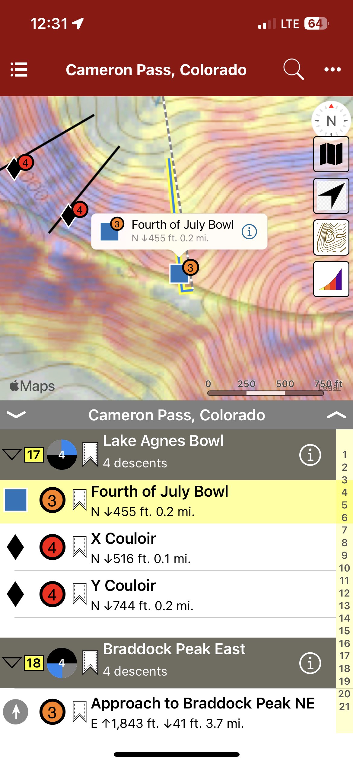
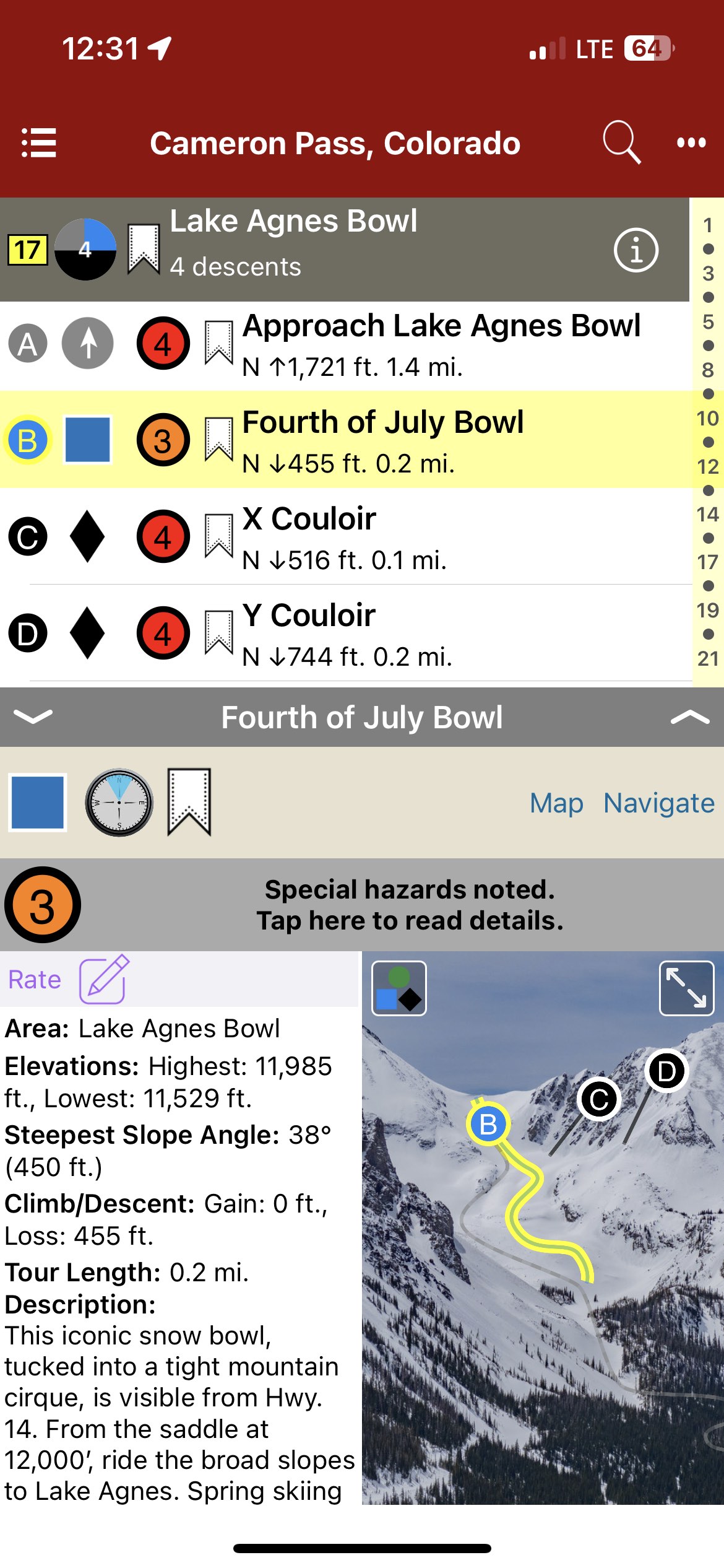
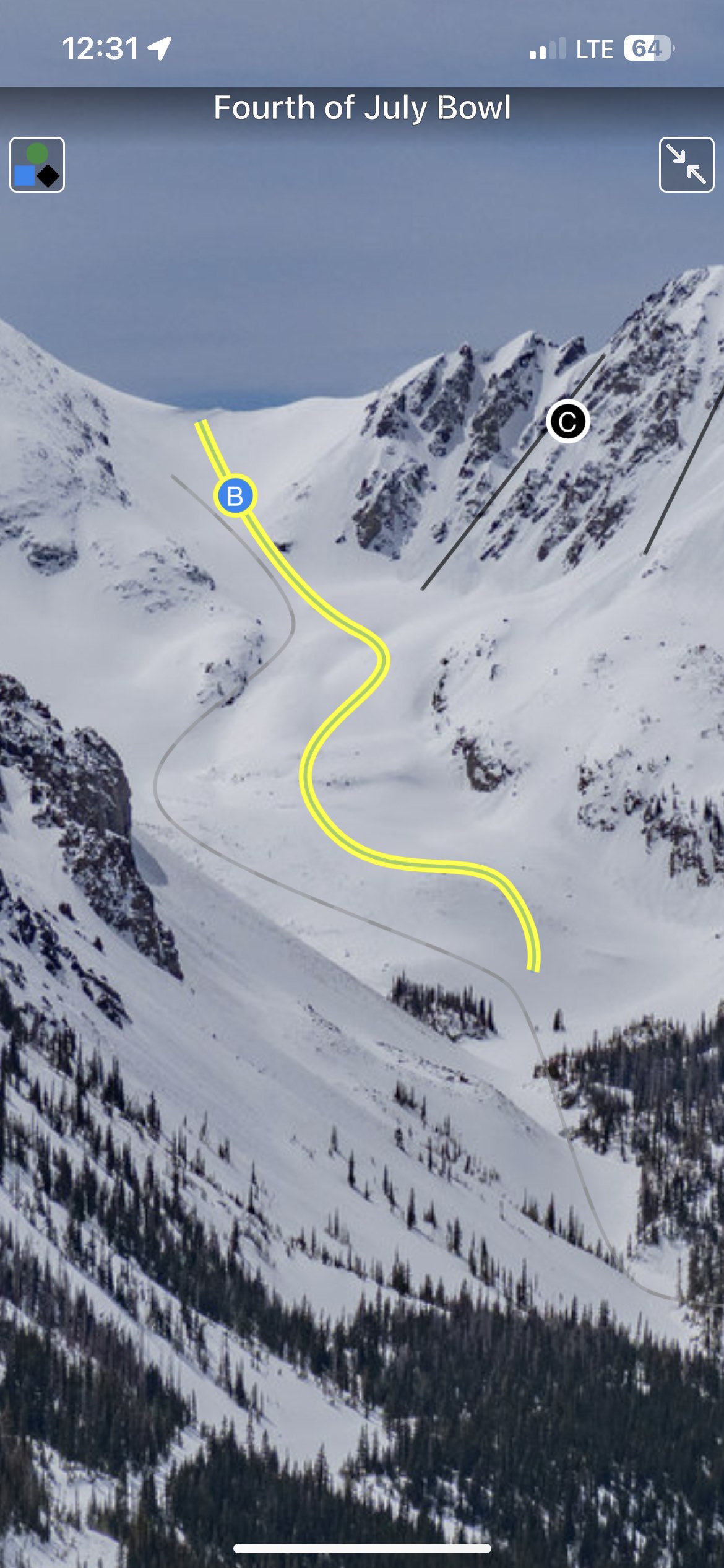
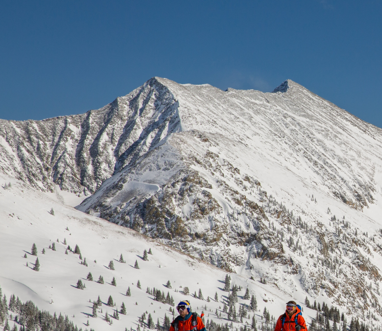
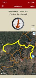
Cameron Pass provides a unique Colorado backcountry skiing experience. Remote and undeveloped, “Cam Pass” also receives a generous amount of snow each winter; good skiing often extends into May. Colorado State Hwy.14, a well-maintained all-weather road over the pass, provides access from east and west. Although Cameron Pass does not cross the Continental Divide, it is the only year-round highway north of Berthoud Pass accessing the western slope. Just 65 miles from Fort Collins and 90 miles from Steamboat Springs, Cameron Pass is a straightforward day trip from many areas in Colorado. During the winter, facilities such as lodging, gas stations, and restaurants are scarce. Cell service on Cameron Pass is spotty to non-existent: only on higher ridges with good line of sight is cell service possible. The Moose Visitor Center, located 9 miles west of Cameron Pass, remains open year-round, providing restrooms and visitor services. At the time of publication, no wifi or cell service exists at this location. Administratively, the area is managed by Arapaho & Roosevelt National Forest east of Cameron Pass and by Colorado Parks and Wildlife (CPW) on the west side of the pass. Parking and access on the west side of the pass require a CPW Parks Permit. Currently, the National Forest does not require a daily use fee for the eastern side. The author and publisher acknowledge that the land described in this atlas is the ancestral home of the Hinono’eiteen (Arapaho) and Núutsi-u (Ute) peoples, who lived on these lands for thousands of years before the arrival of Europeans.
-
-
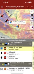
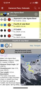
Map view
-
-
List view
-
-
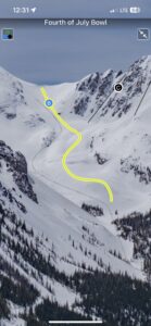
Full screen topo photos
by todd | Aug 11, 2021
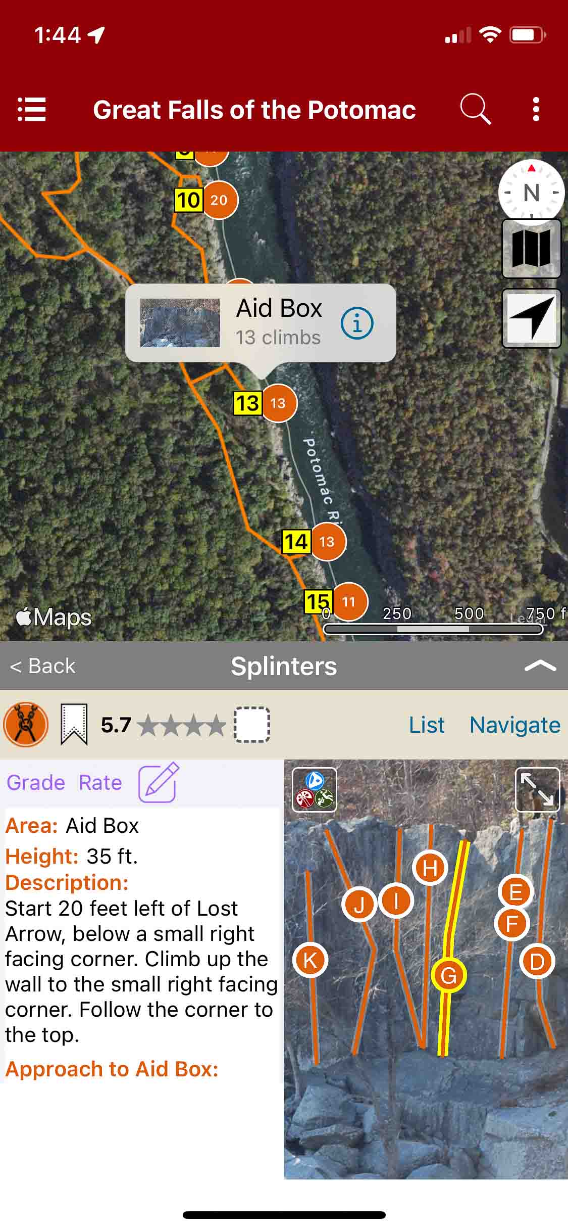
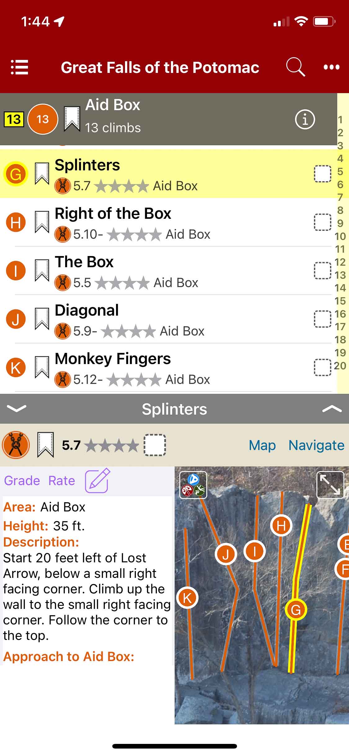
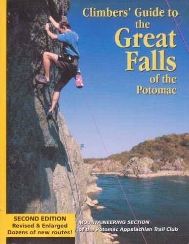
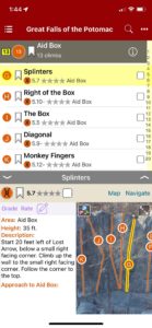
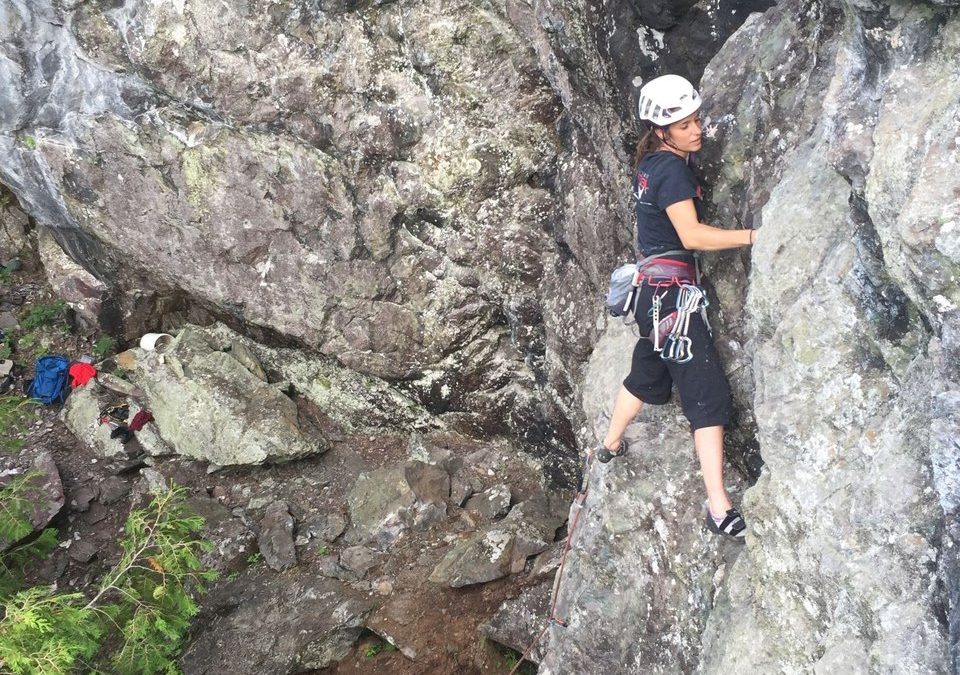
Great Falls of the Potomac
by Potomac Appalachian Trail Club – Mountaineering Section
Potomac Appalachian Trail Club Website
Located in the beautiful Potomac River Gorge, Great Falls provides a wide variety of climbing right along side the Potomac river. The cliffs are roughly 60 feet high made of hard, solid rock. The area is sunny and has lots of visitors, climbers and hikers alike.
This guide provides maps, descriptions, and ratings of technical climbing routes along the Potomac River; covering the Virginia shoreline. The paper edition contains Maryland shoreline climbs, which will be included in future editions of this Rakkup guide, as well as masterpoint locations for each sector. The Rakkup edition includes over 200 routes and updated images.
Should you have any comments, suggestions, or general inquiries regarding this guidebook, please reach out to the PATC-MS club directly at secretary@patcms.org.
-
-
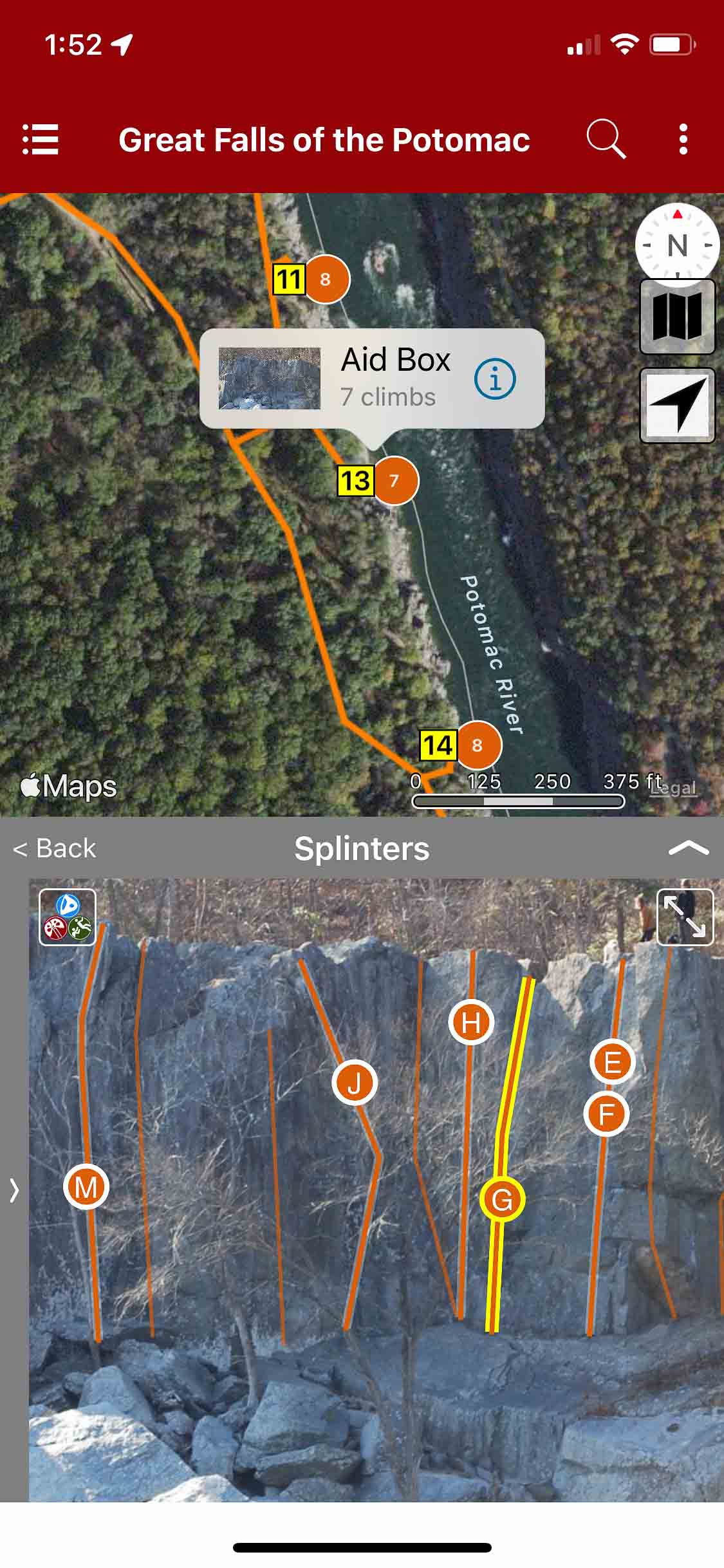
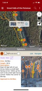
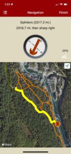
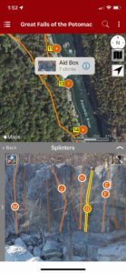
Searchable climb map.
-

-
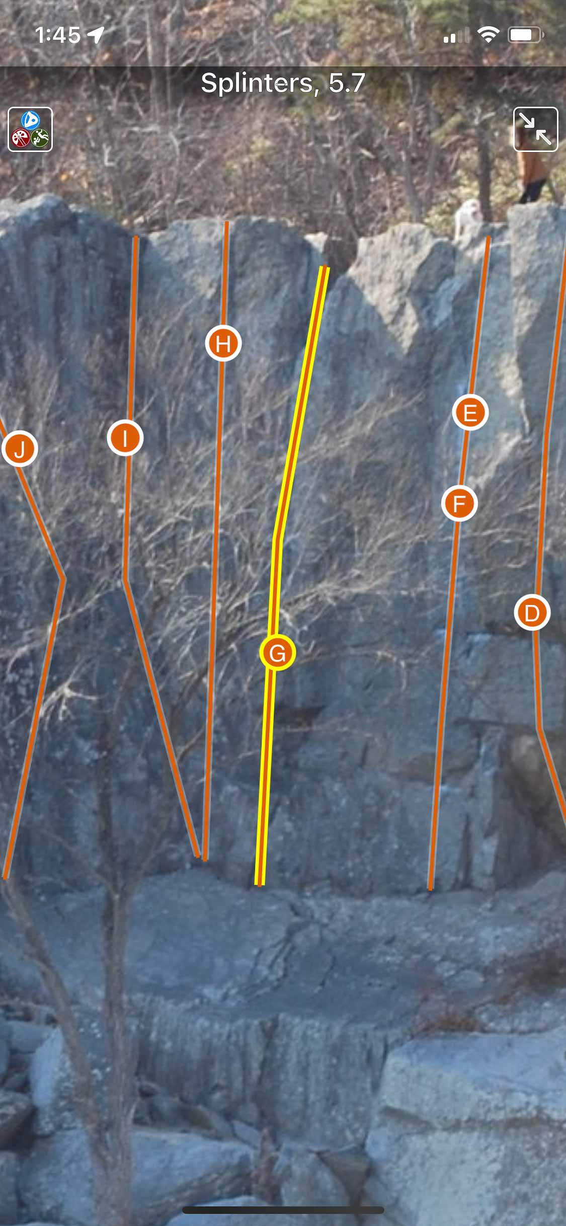
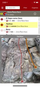
Beautiful full screen smart topos.
-

-
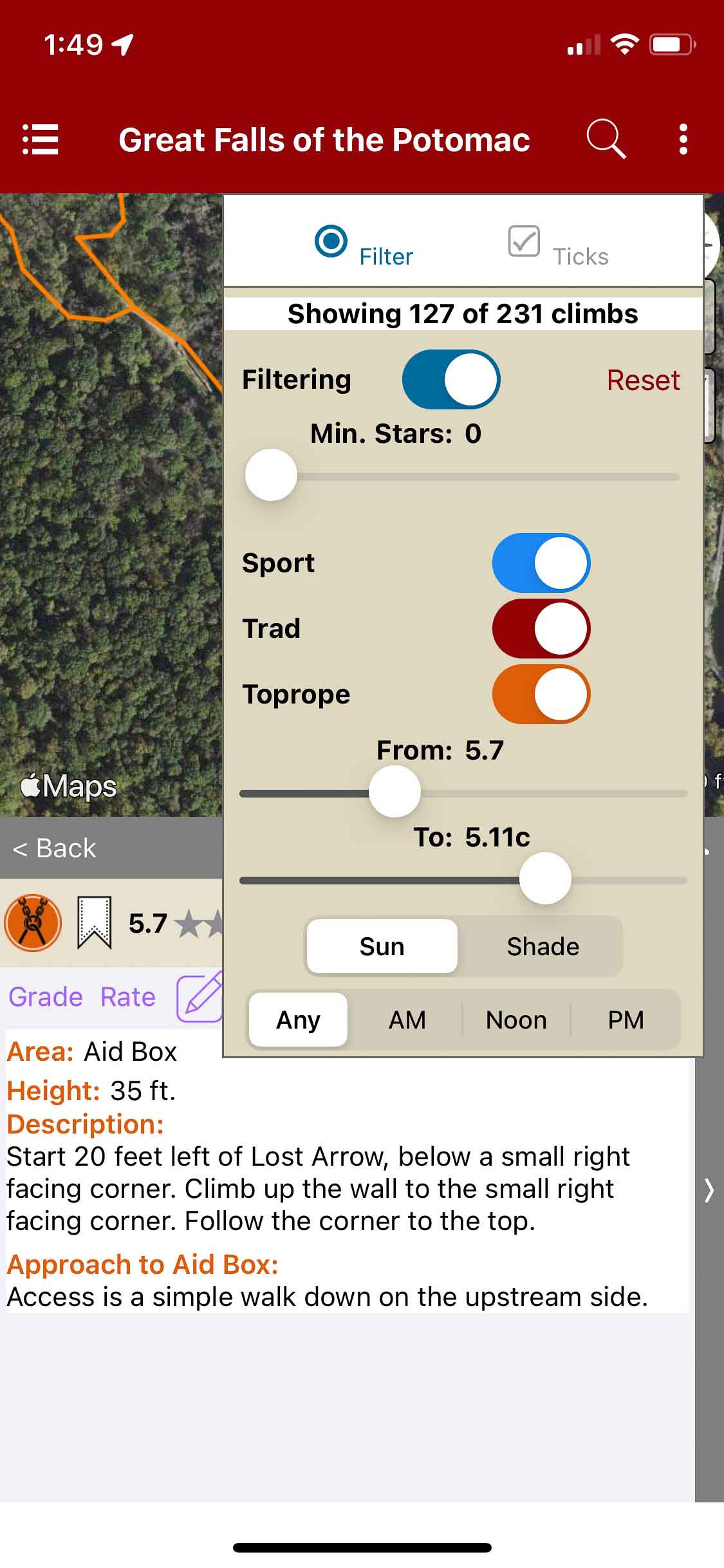
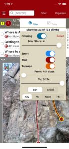
Filter climbs.
-
-
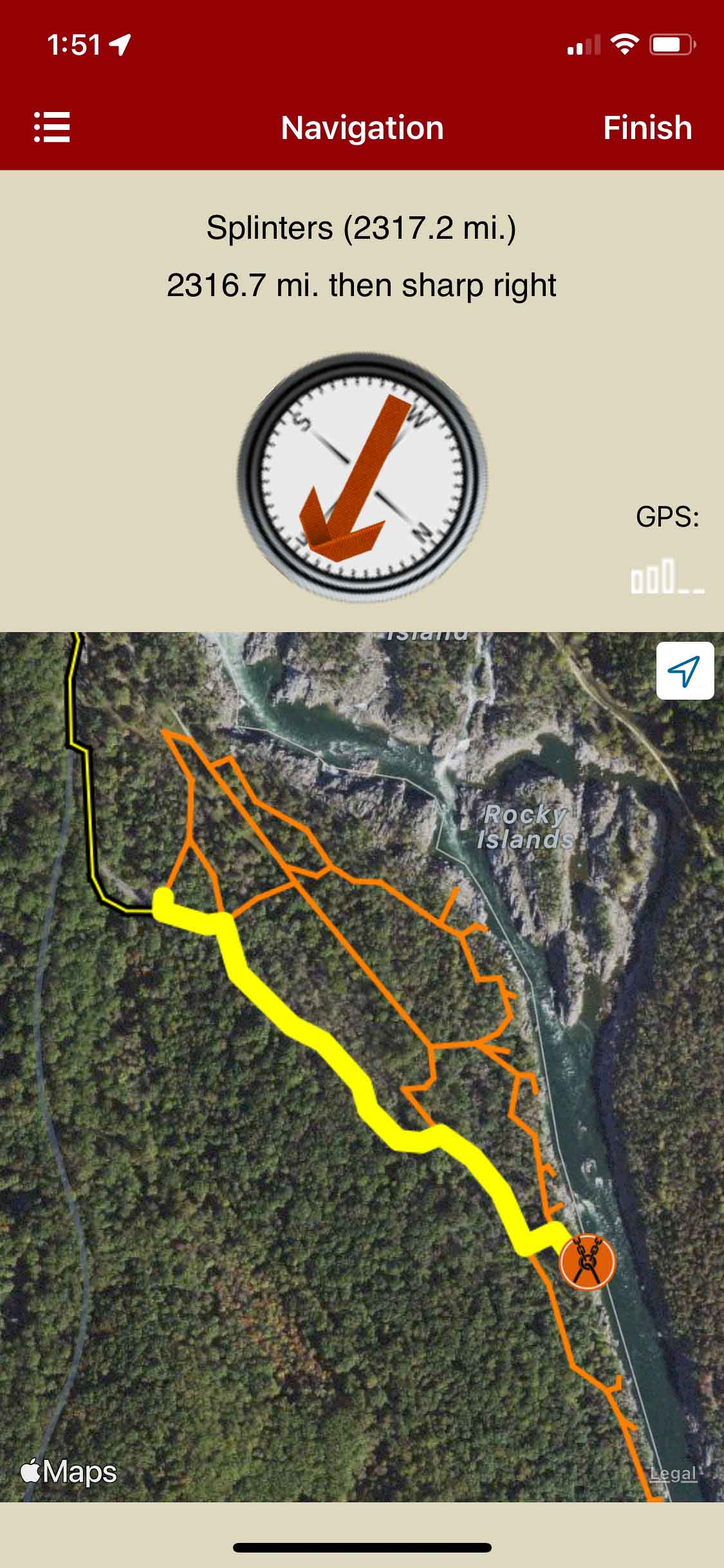
Navigate from car to crag.
-
-
Locate climbs on a map & photo.
-
-
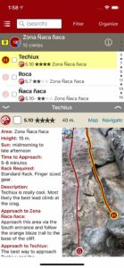
Searchable climb list.
by todd | Jul 2, 2021
Saint-Léon-de-Standon
by Nicolas Rodrigue & Club d’escalade et de montagne des Appalaches (CEMA)
Québec: Grand Morne | Montmagny-L’Islet
Le guide d’escalade Saint Léon de Standon contient une trentaine de voie de 5.5 à 5.12 + sur un rocher volcanique unique plein des belles prises. L’escalade est majoritairement de type sportif avec quelques voie trad classique. Ce guide complet vous donne toutes les informations pour profitez de ce site orienté nord et frais en été. D’autre projet bloc et voie sont en développement par le CEMA. Ce topo prendra de l’expansion au fil des années. Saint Léon deviendra un must comme destination estivale.
-

-
Area overview map
-

-
Climb list
-

-
Beautiful full screen smart topos.
by todd | Mar 16, 2021
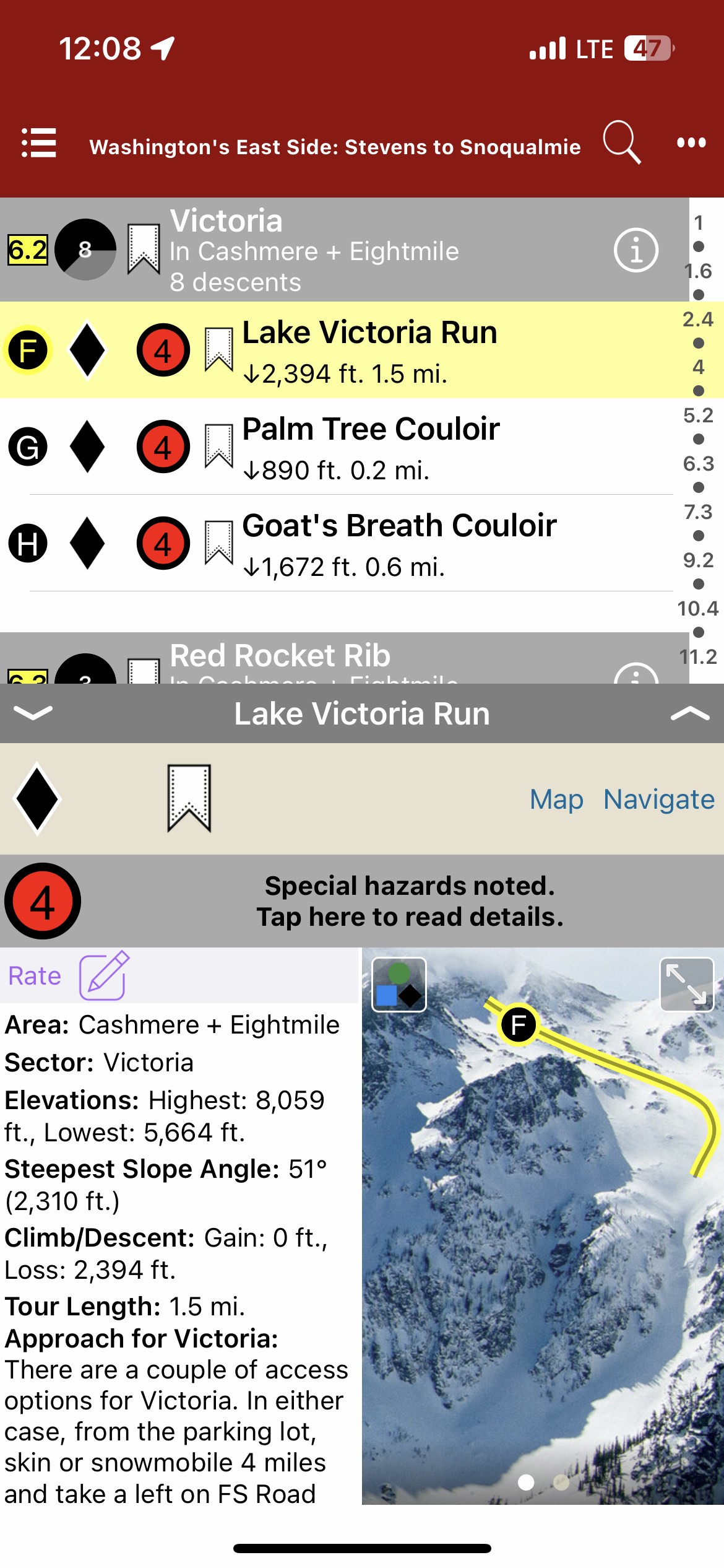
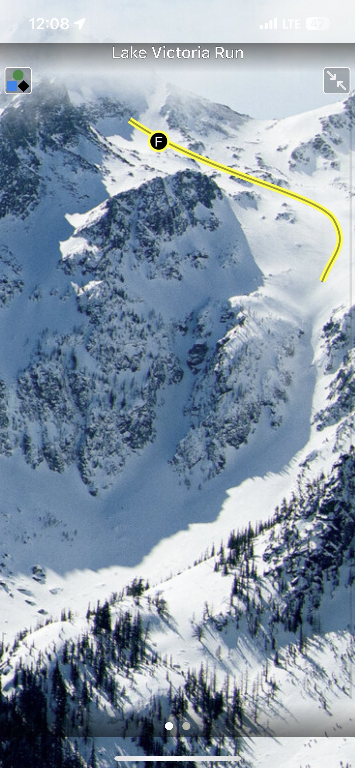
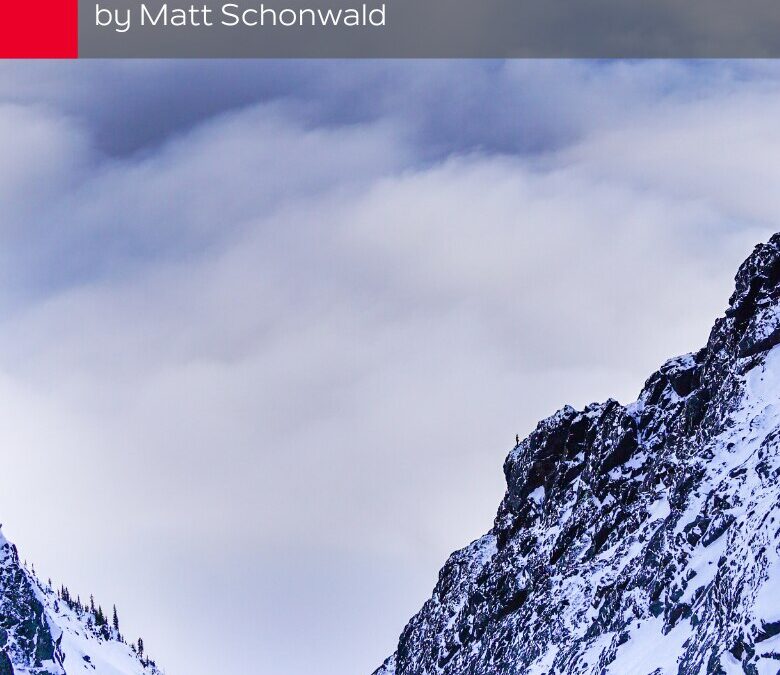
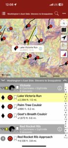
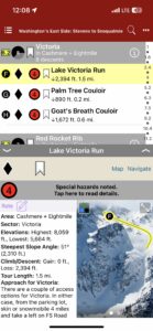
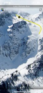
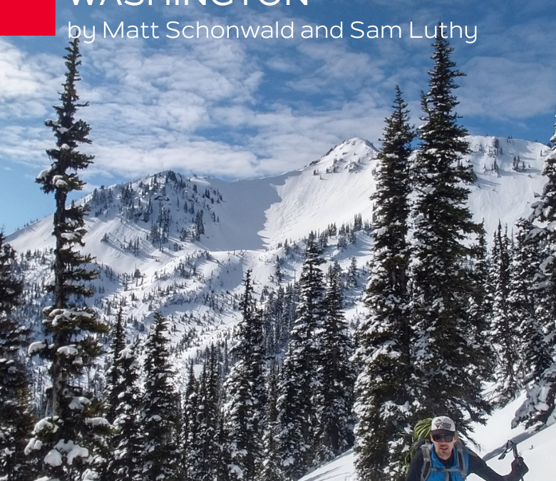
Backcountry Skiing: Washington’s East Side Stevens to Snoqualmie
by Matt Schonwald
Northwest Avalanche Center
Beacon Guidebooks:
California: Tahoe Light Tours Colorado: Berthoud | Buffalo | Cameron | CO Light Tours | Crested Butte | Loveland | Marble | RMNP | Silverton New Mexico: Taos Oregon: Hood Washington: Baker | Crystal | ONP | Snoqualmie
In 1897, John Stevens found the passage for the Great Northern Railroad across a 4,000’ pass in the Cascades. Since then, Stevens Pass place in history is thick with decades of travel, avalanches, ski areas, and so much more. Stevens Pass is one of the essential gateways to the extraordinary backcountry possibilities that exist between I-90, US Highway 97, and US Highway 2.
Over 300 tours, accessible via ski areas, roadside pullouts, and long snowmobile approaches make this region’s diverse opportunities seem infinite. The East Side also provides a drier, colder snowpack—bringing blower pow (and persistent slabs) to the Cascades.
The author and publisher acknowledge that the lands described in this atlas are the ancestral home of the Pisquouse and Si’apkat, members of the Yakama Nation. The Pisquouse (Yakama name: Winátshapam), or Wenatchi, lived in the area that spans present-day Leavenworth to Wenatchee. Wenatchee is a Sahaptian word for “river water which comes from canyons” or “robe of the rainbow.” The first inhabitants of the Kittitas Valley were the Psch-wan-wap-pams (stony ground people), also known as the Kittitas, Si’apkat, or Upper Yakama. They lived along the upper Yakima River (today called Cle Elum), which was a traditional gathering place for tribes east of the Cascades.
-
-
Map view
-
-
List view
-
-
Full screen photos
by todd | Mar 12, 2021
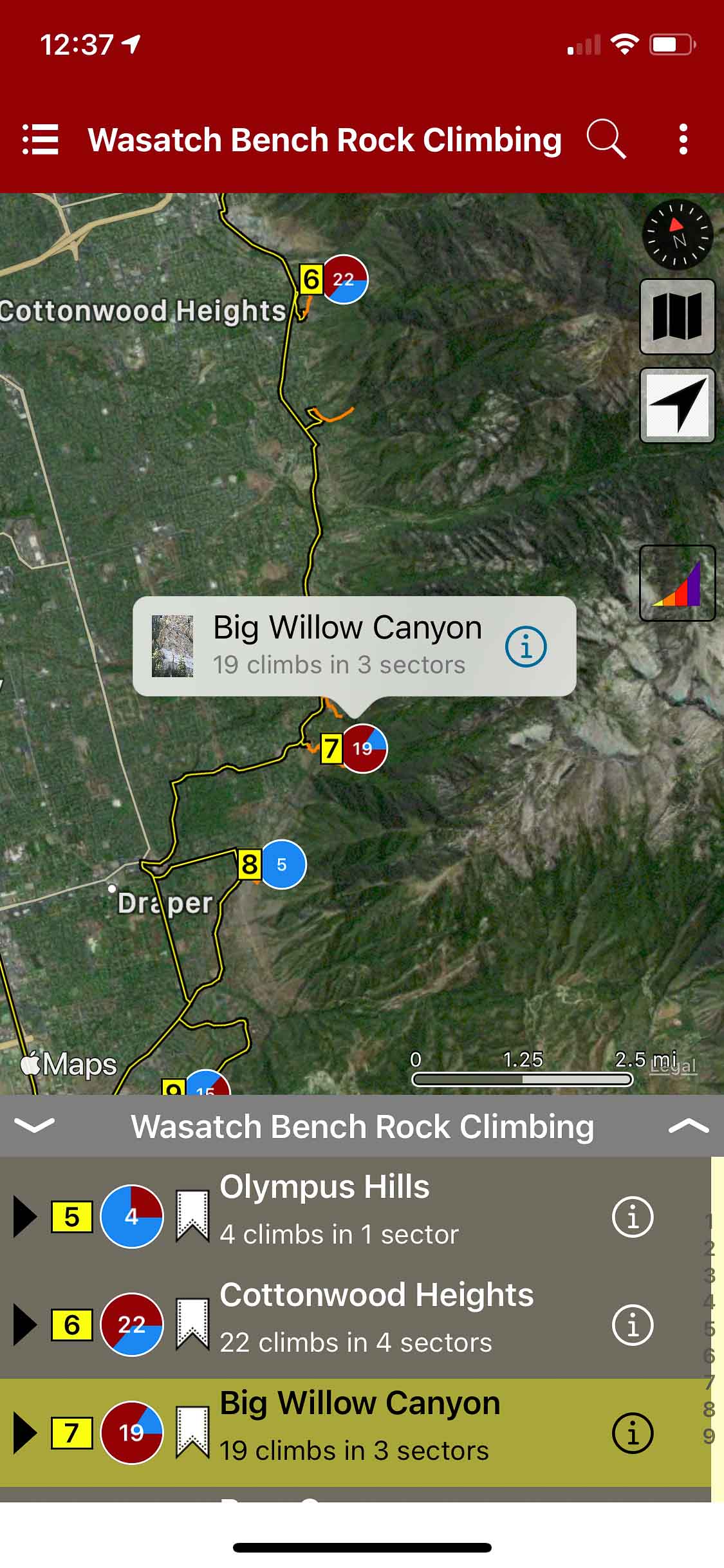
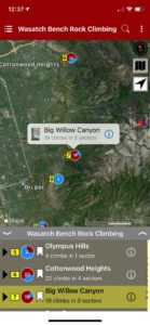
Wasatch Bench Rock Climbing
by Tony Calderone
Little Cottonwood Climbing | Big Cottonwood Climbing | Wasatch Front Bouldering | Wasatch Wilderness Climbing
Salt Lake Valley climbers have some of the most easily accessible rock climbs of any metropolitan area in the entire country. Big Cottonwood Canyon, Little Cottonwood Canyon and three wilderness areas immediately east of Salt Lake Valley have over 2,400 developed rock climbing routes that are described in other guidebooks in this series.
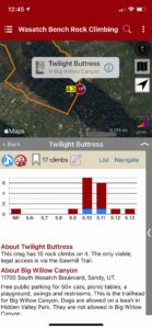
This is a guide to rock climbing in the hills and smaller canyons along the central Wasatch Bench, immediately east of Salt Lake Valley. The 175 routes described herein are typically short and have short approaches. Most can easily be climbed after work and before the sun sets. And most of these areas are conducive to bringing along small children and/or dogs.
-
-
Explore Wasatch Bench via our interactive trail map.
-
-
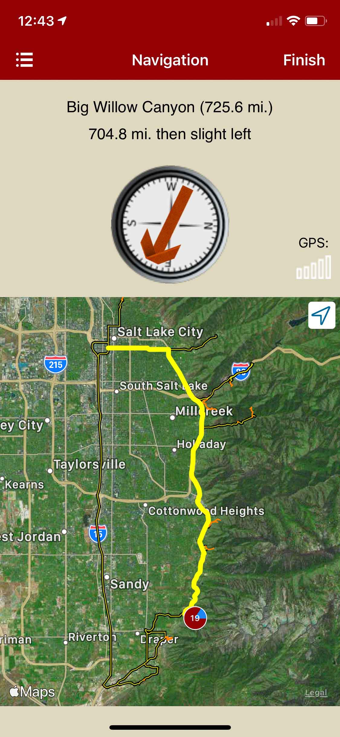
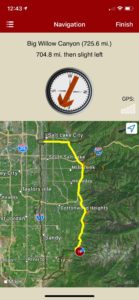
rakkup navigates car to crag.
-
-
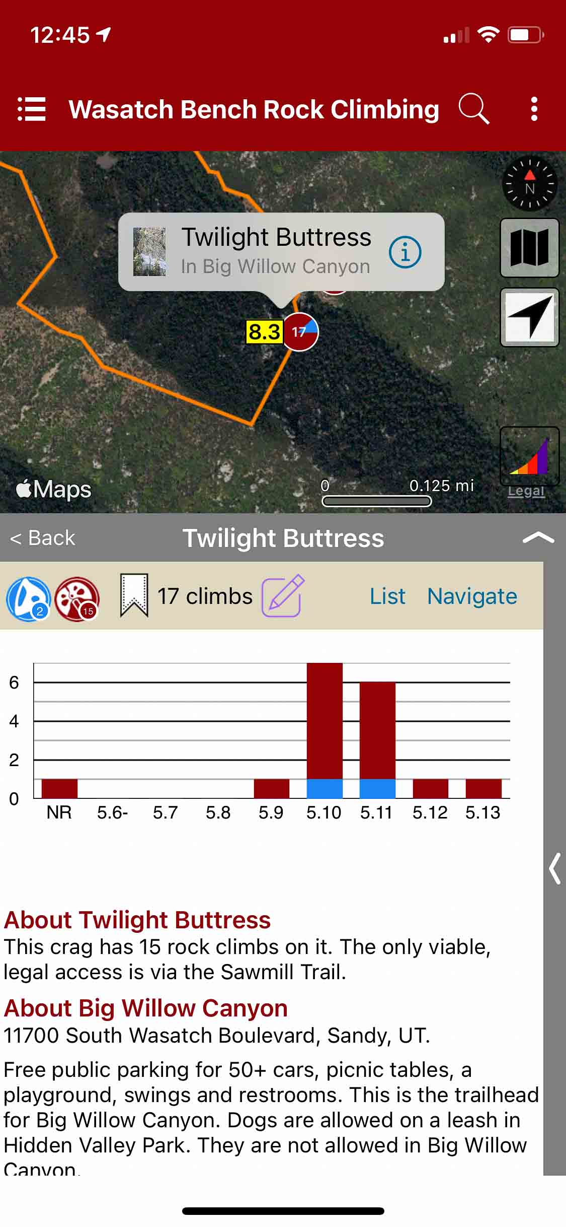
Crag overviews.
-
-
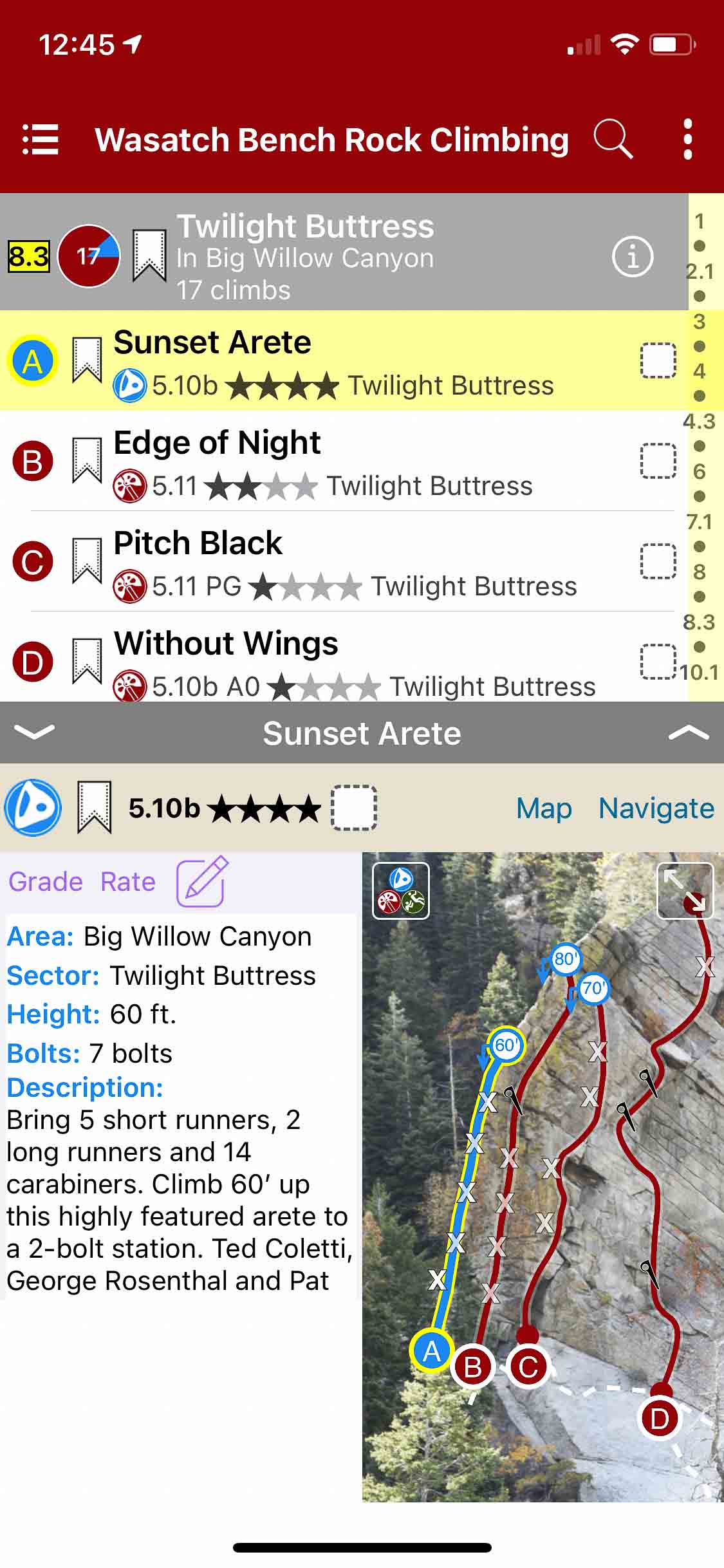
Quickly browse climb list details.
-
-
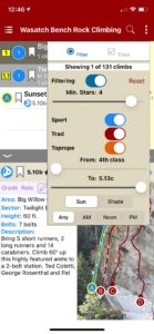
Filter climbs by grade and type.
-
-
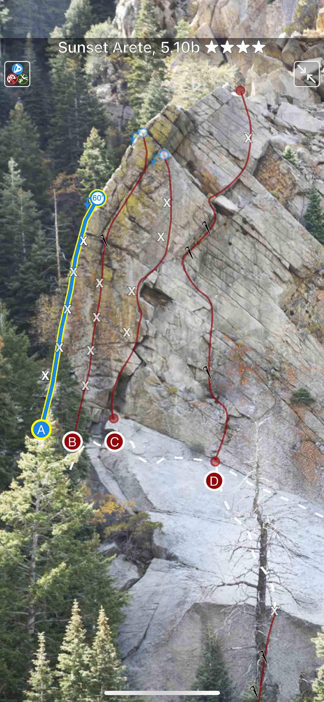
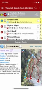
Beautiful full screen smart topos.
by todd | Nov 2, 2020
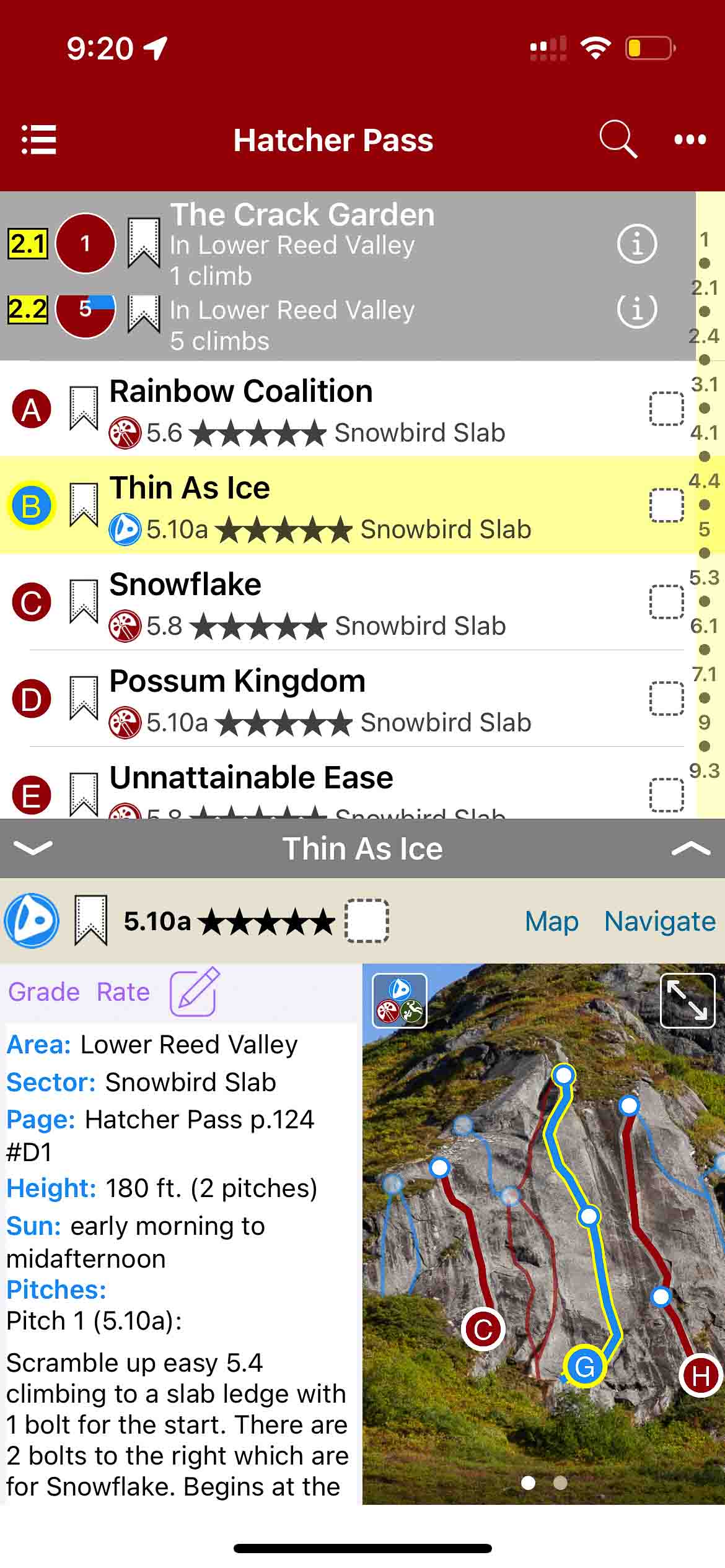
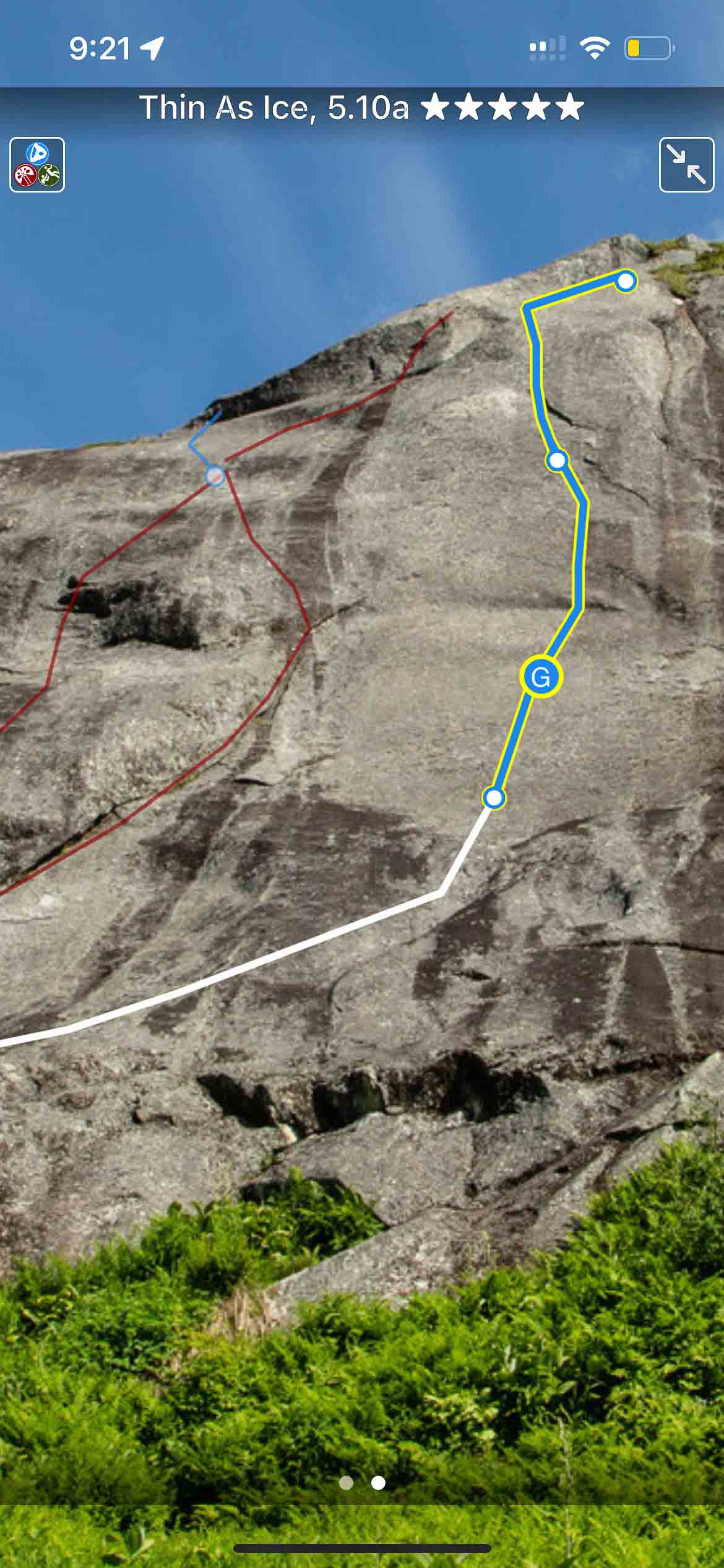
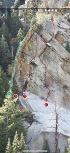
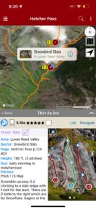
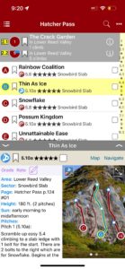
Hatcher Pass Rock Climbing
by Kelsey Gray
Koh Tao Rock Climbing
The best (and only) extensive guidebook for Hatcher Pass, Alaska. This new guidebook was published in paperback in 2021. The app includes over 400 climbs within one of the best climbing areas in Alaska.
Buy digital plus book and the price includes $7.00 for shipping, a screaming deal! When you buy a bundle, you can use your digital rakkup guidebook immediately.
-
-
Map view
-
-
List view
-

-
Full screen topos
by todd | Sep 23, 2020
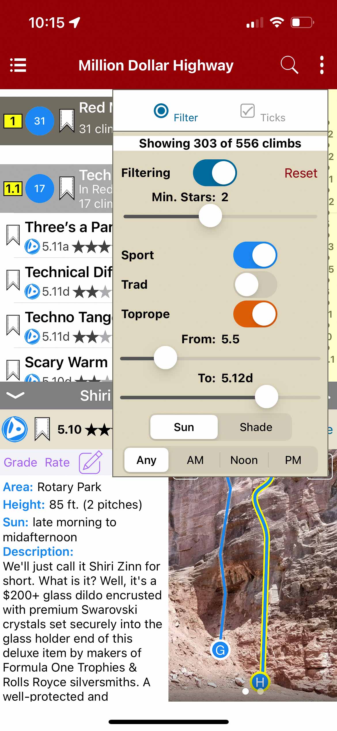
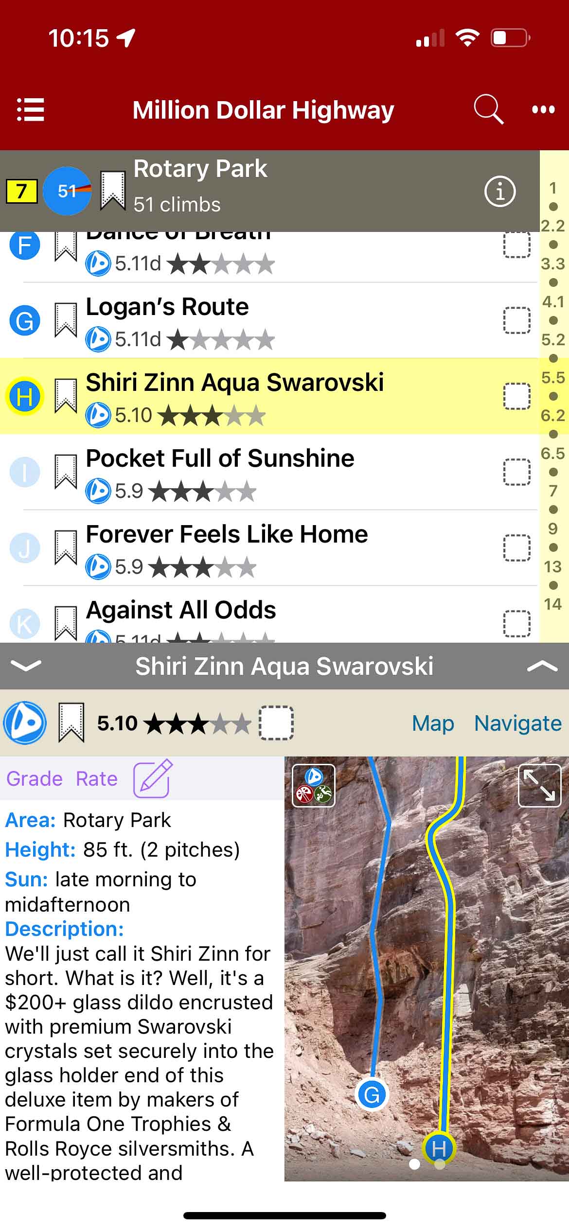
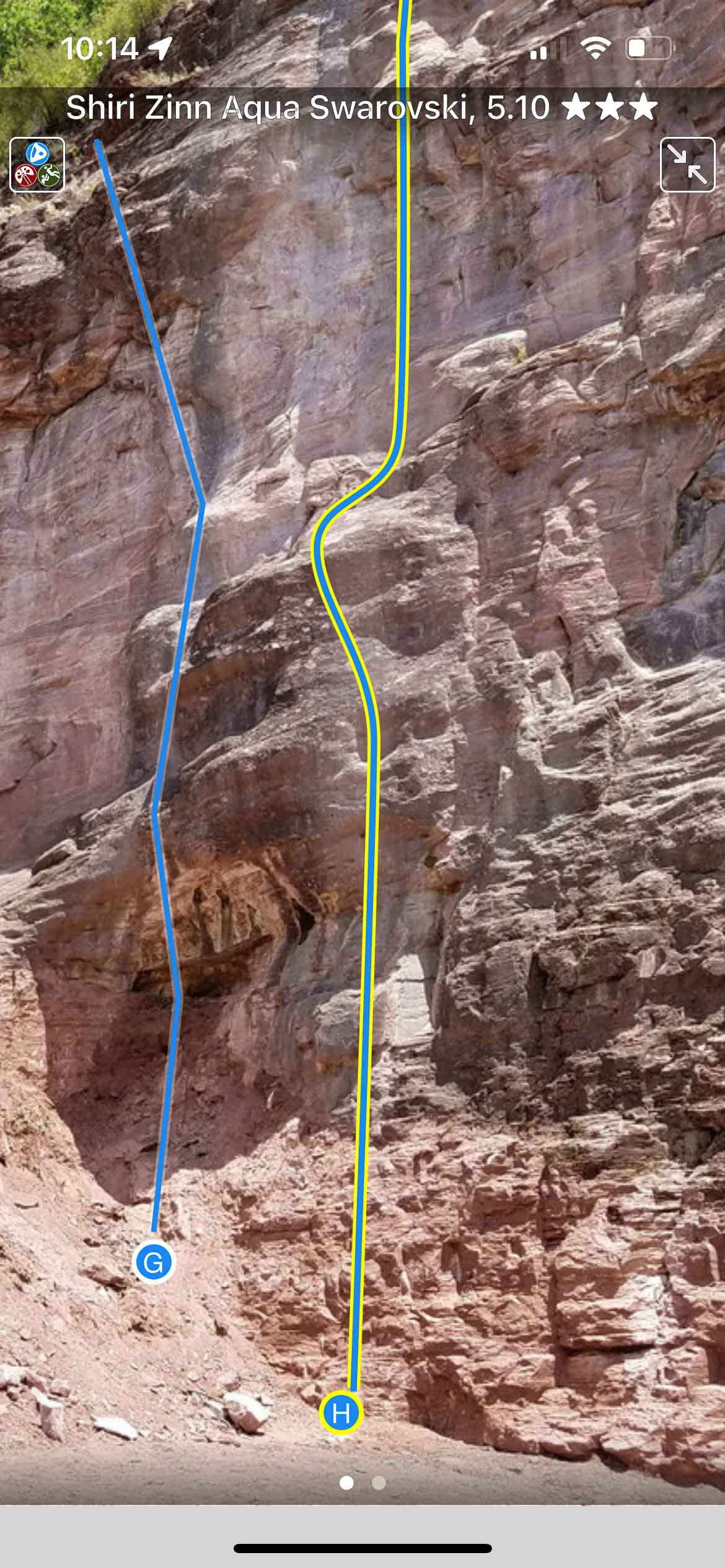
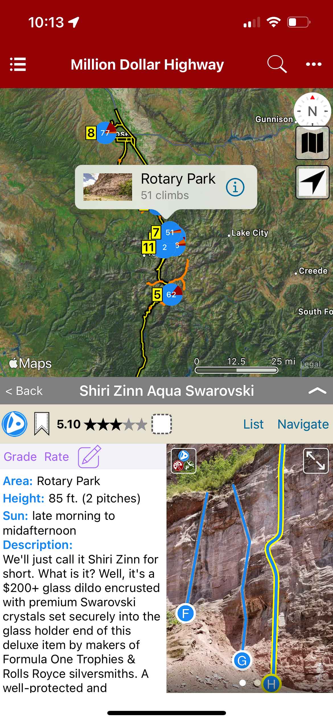
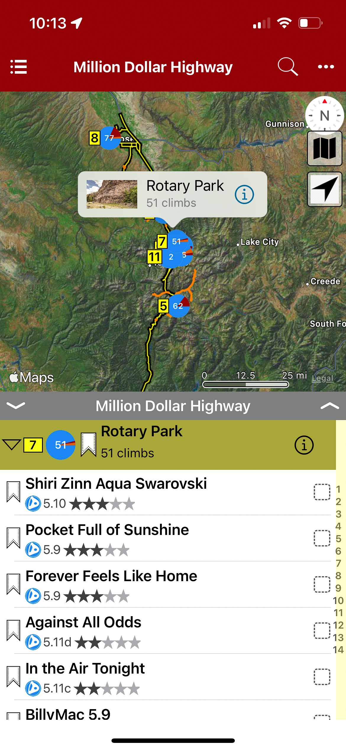
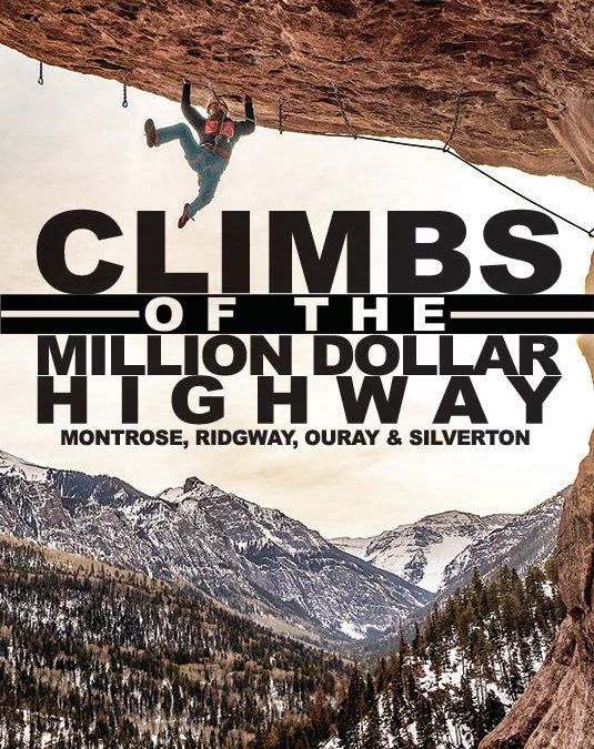
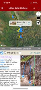
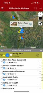
CLIMBS OF THE MILLION DOLLAR HIGHWAY Ridgway, Ouray and Silverton, Colorado
by Jason Nelson
Visual Adventures | Suffer Candy Volume 1 | Suffer Candy Volume 2
This guide covers the majority of rock climbing to be found in Montrose, Ridgway, Ouray and Silverton, Colorado. Most of the routes are sport climbs, but there is a little bit of everything and there is a wide variety of rock types to choose from. Route lengths are between 30′ and rise up to about 1,400′. We got sun. We got shade. Pretty much the only thing we don’t have is splitter granite. The scenery is top-notch, and the season never ends.
Current Routes included are:
Montrose: Dry Creek
Ridgway: Colby’s Corner, Dike Wall
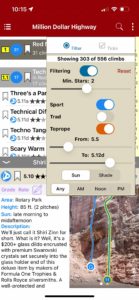
Ouray: Rotary Park, Pool Wall, Overlook, Jimmy Cliff, Techno Crag, Wicked Crag, The Hall of Justice, Roadside Attraction and Ice Park Crags.
Silverton: Master’s Wall, Snowden Peak
Routes soon to be added:
Ouray: Red Mountain Pass Crags including, Sandias, Other Canyon Creek Crags
Silverton: Eureka, Stripe, RV Wall, Ice Lake Crag.
-

-
Map overview with crags
-
-
Filter climbs in list or map view by grade and type
-
-
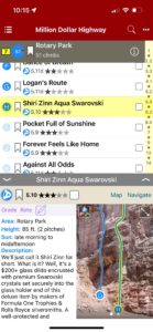
List view with climb details
-
-
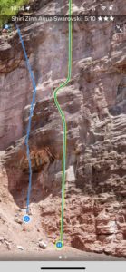
Full screen topos
-
-
Map view with climb details
-
-
Map view with climb list
by todd | Mar 21, 2020
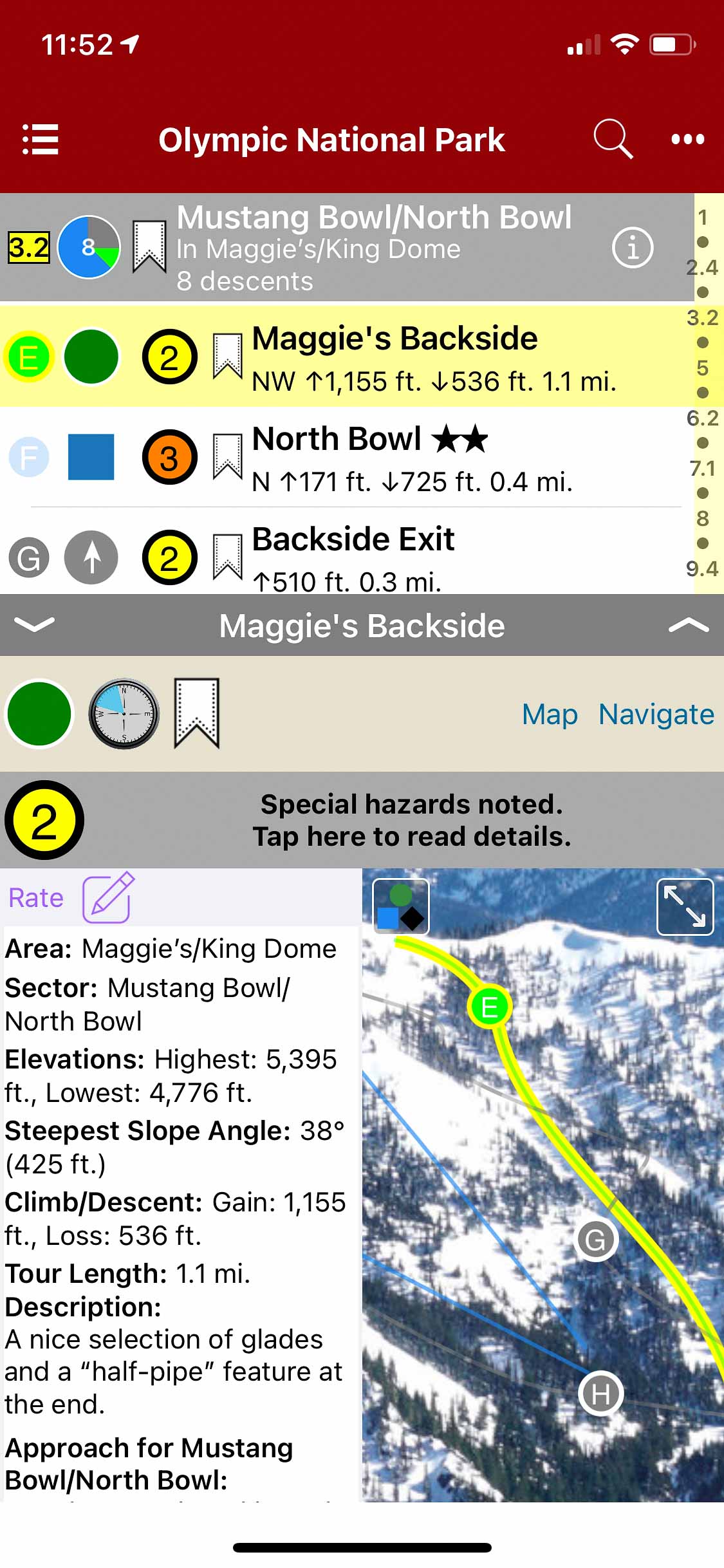
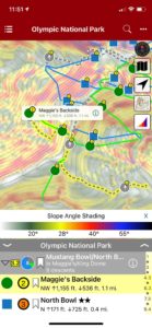
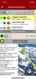
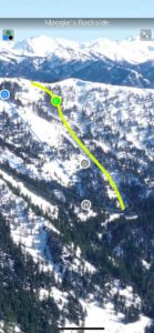
Backcountry Skiing Olympic National Park, Washington
by Matt Schonwald & Sam Luthy
Northwest Avalanche Center
Beacon Guidebooks:
California: Tahoe Light Tours Colorado: Berthoud | Buffalo | Cameron| CO Light Tours | Crested Butte | Loveland | Marble | RMNP | Silverton New Mexico: Taos Oregon: Hood Washington: Baker | Crystal | Snoqualmie | Stevens
For almost 8,000 years native people have lived around the Olympic Mountains. The Duwamish of the Salish sea call them ‘Sun-a-do’, and the ancestors of the Klallam have been living, hunting and gathering in the high mountains since time immemorial.The Spanish sailed along the coast in 1774 and named the highest peak, Cerro Nevado de Santa Rosalia. In 1788, the British Explorer Roger Meares renamed the highest peak, Mt Olympus because it looked like the ‘abode of the gods.’ and just like that the Olympic Mountains became part of the European map.The 1890s saw climbers begin ascending the summits of Mt. Olympus, with the main summit finally being climbed in 1907. Deer Park became Washington’s premier ski area in the mid 1930s. The Hurricane Ridge road was built in the early 50s and the ski area moved from Deer Park, establishing a new winter recreation center for the Olympic National Park. Ski touring began along the roads of Deer Park and Hurricane Ridge and shifted to the Bailey Range and the higher peaks in the 1990s.
Buy digital plus (book and/or map) and the price includes $4.00 for shipping, a screaming deal! When you buy a bundle, you can use your digital rakkup guidebook immediately.
-
-
Map view
-
-
List view
-
-
Full screen photos
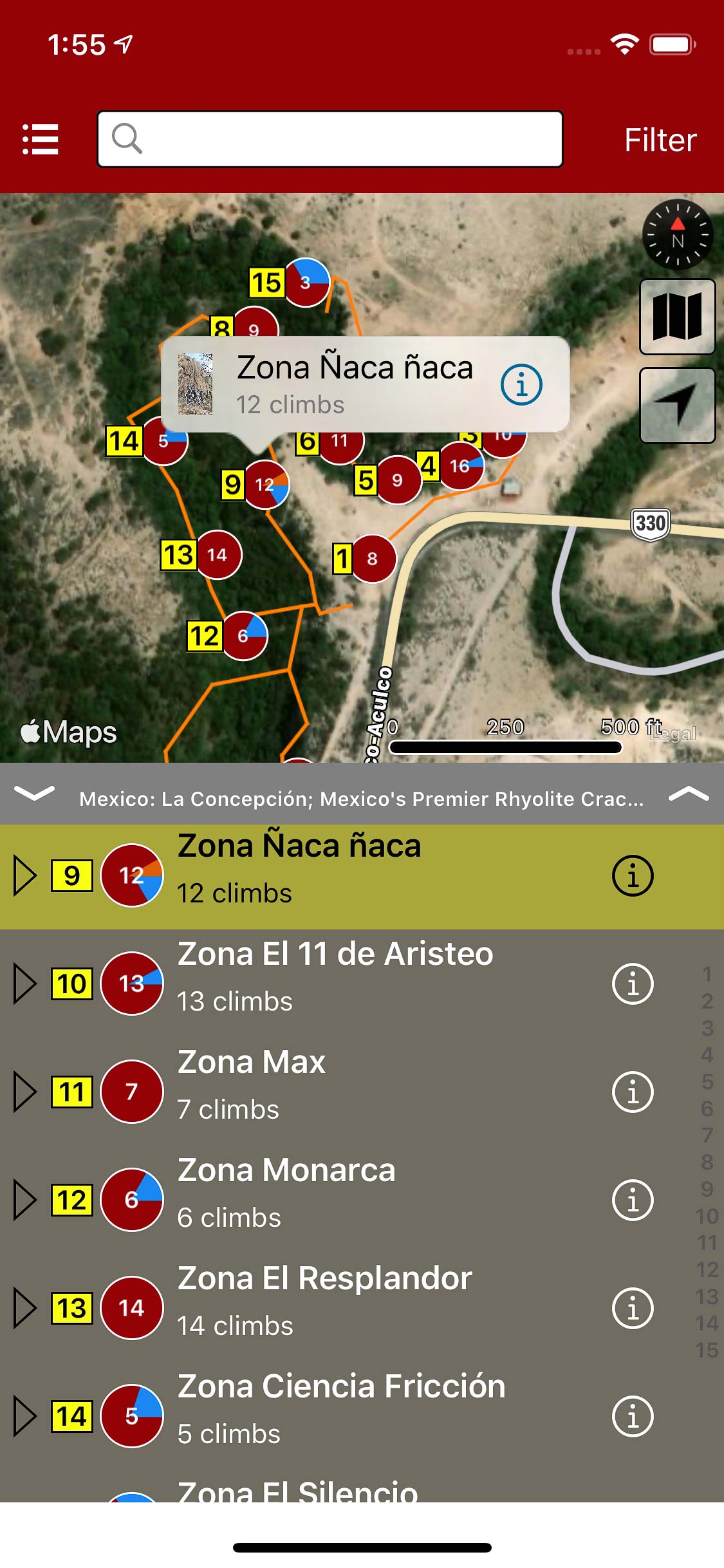
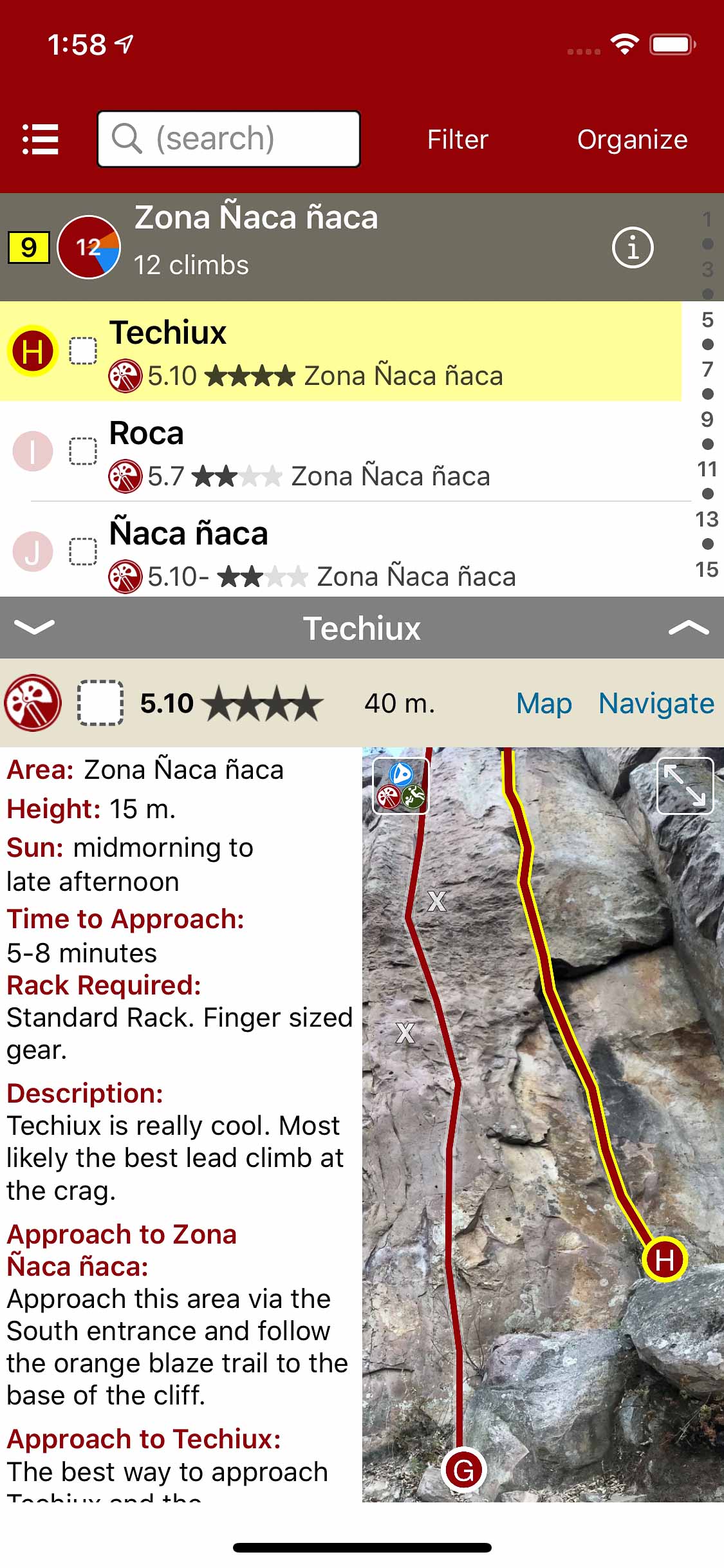
by todd | Mar 9, 2020
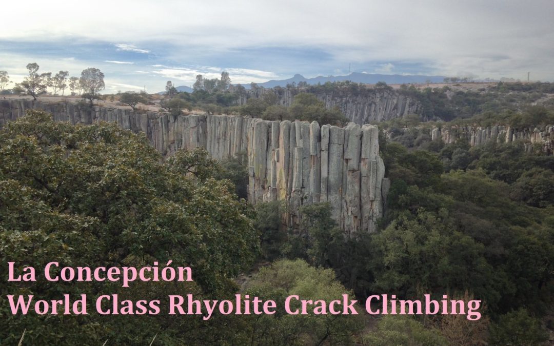
La Concepción; Mexico’s Premier Rhyolite Crack Climbing
by Simeon Heimowitz
Southern Exposure Professional Guide Service
This guidebook is the only fully comprehensive resource for La Concepción; Mexico’s premiere destination for Rhyolite crack climbing. In addition to the up to date route information on all the “must do” five star classics this guide also highlights lesser known high quality routes within this stunning river valley. This rakkup guide is the only up to date resource available for climbers visiting this world class climbing area. A total of 15 walls and 133 climbs are included in this stand alone resource. La Concepción is a stunning Rhyolite canyon located a short distance from Aculco de Espinoza; a truly beautiful town located high in the mountains of Central Mexico. At 8,000 feet in elevation and 1,300 miles North of the Equator the climbing season is continuous at La Concepción throughout the year. If crack climbing is your passion be prepared to fall in love with this hidden gem of a climbing area.
-
-
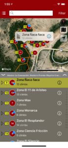
Explore La Concepcion climbing via an interactive trail map.
-
-
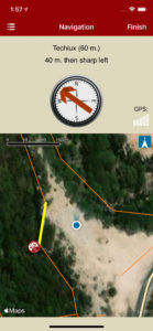
rakkup navigates car to crag then displays a picture when arriving at destination.
-
-
Quickly browse and search the climb list.
-
-
Filter climbs by quality, grade and type.
-
-
Smart topos help to locate your climb.
-
-
Beautiful full screen smart topos.
by todd | Mar 5, 2020
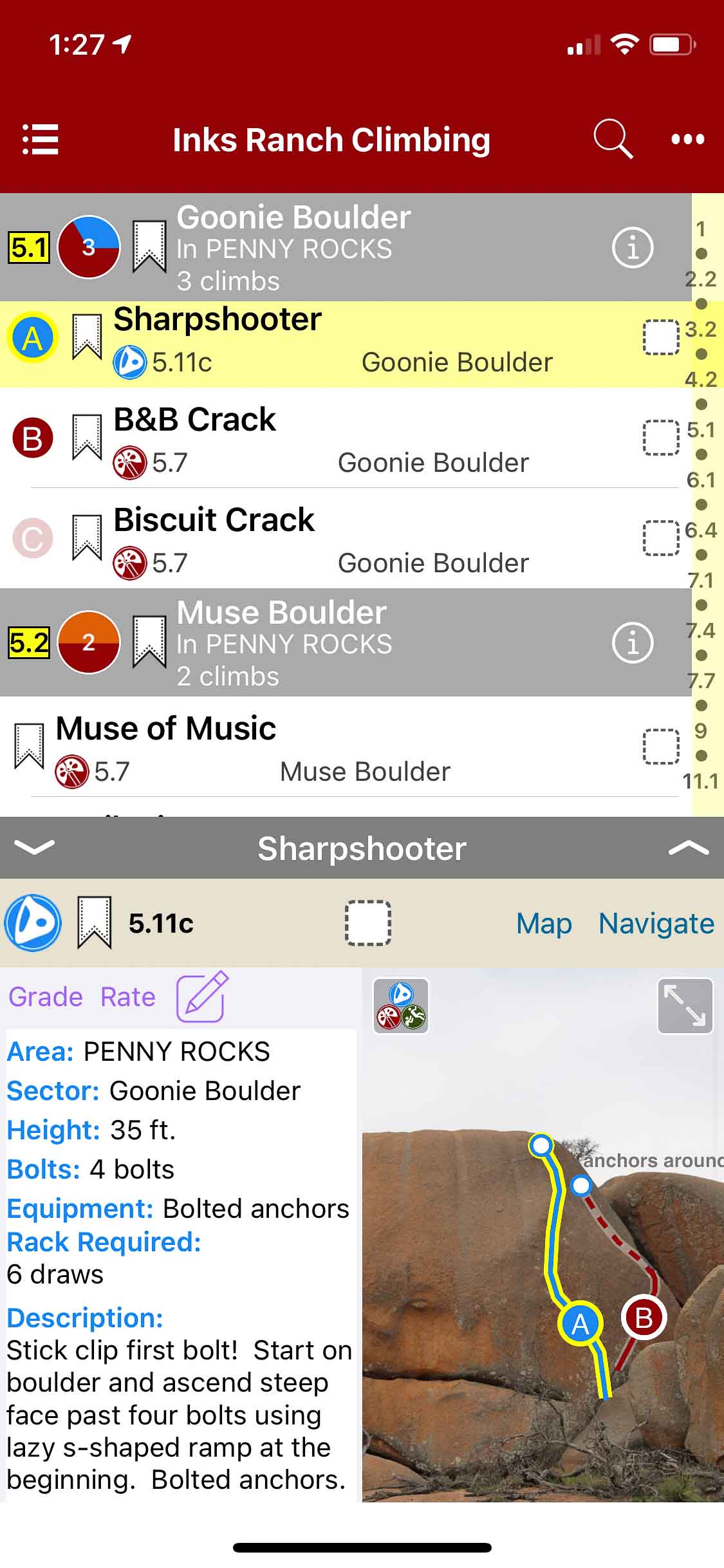
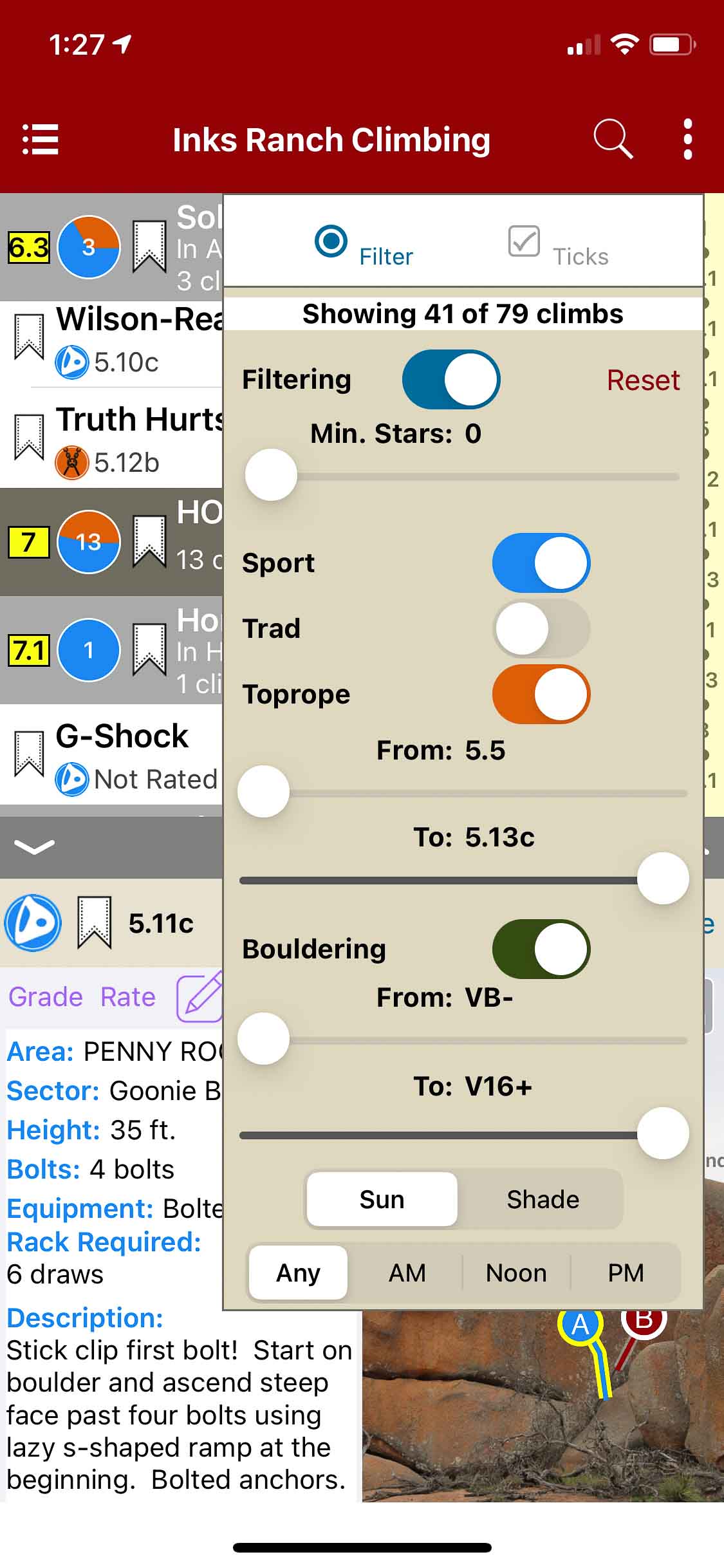
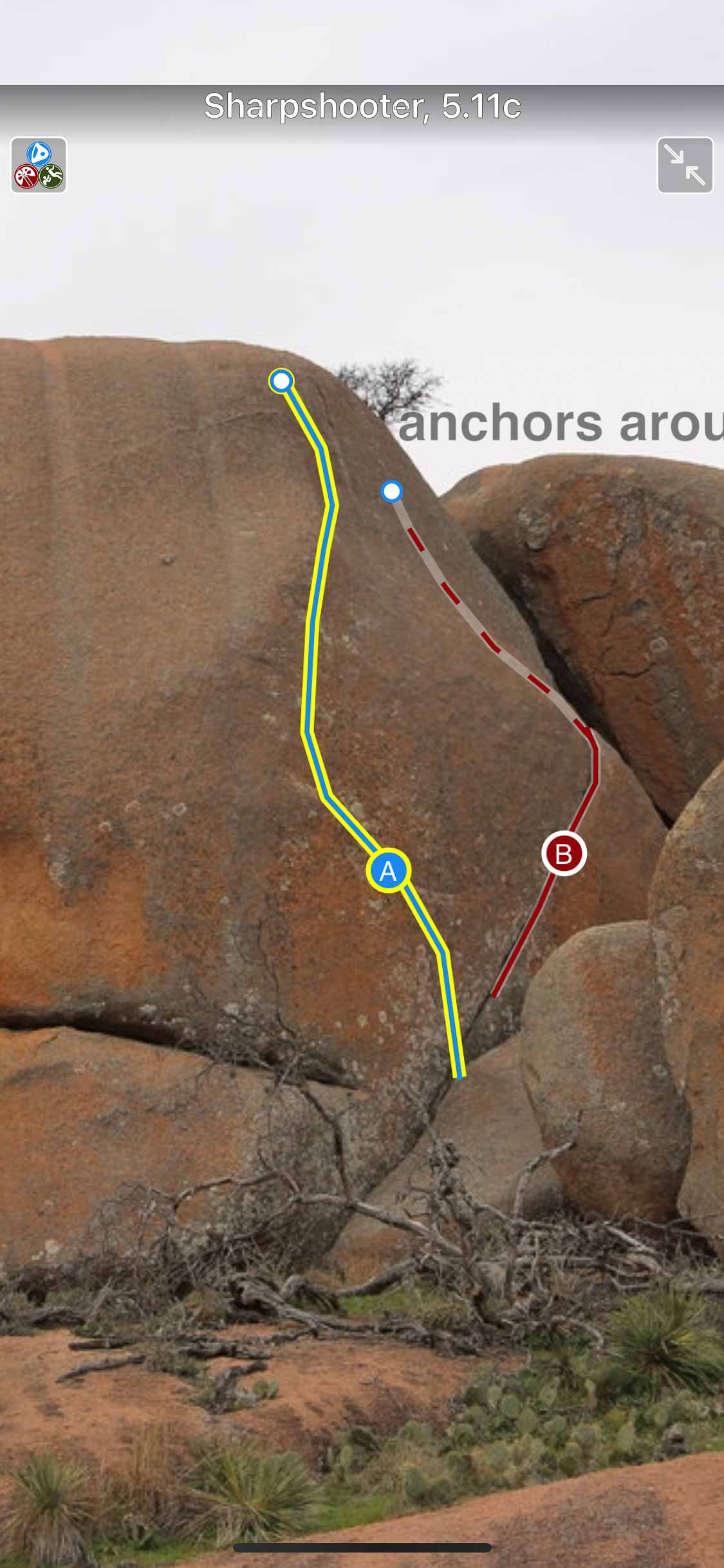
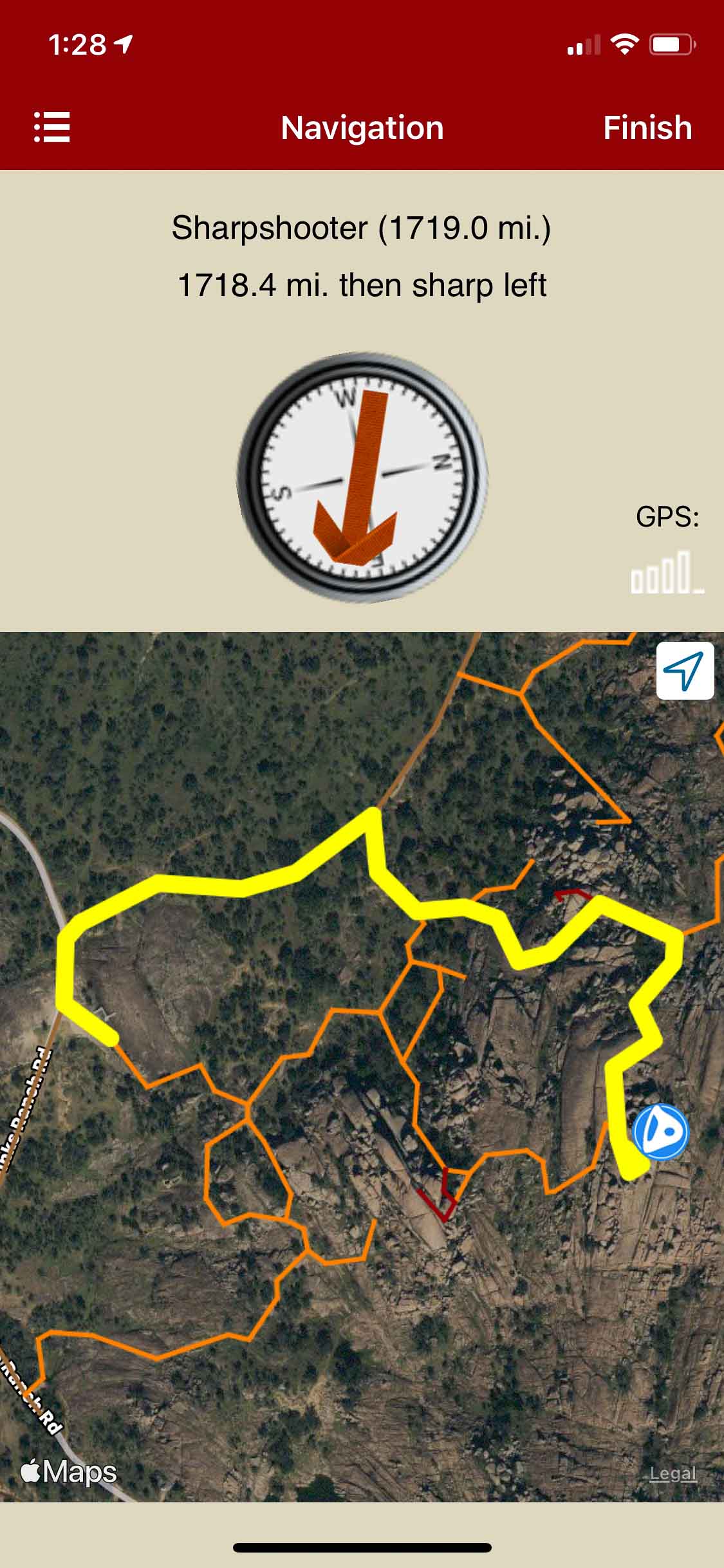
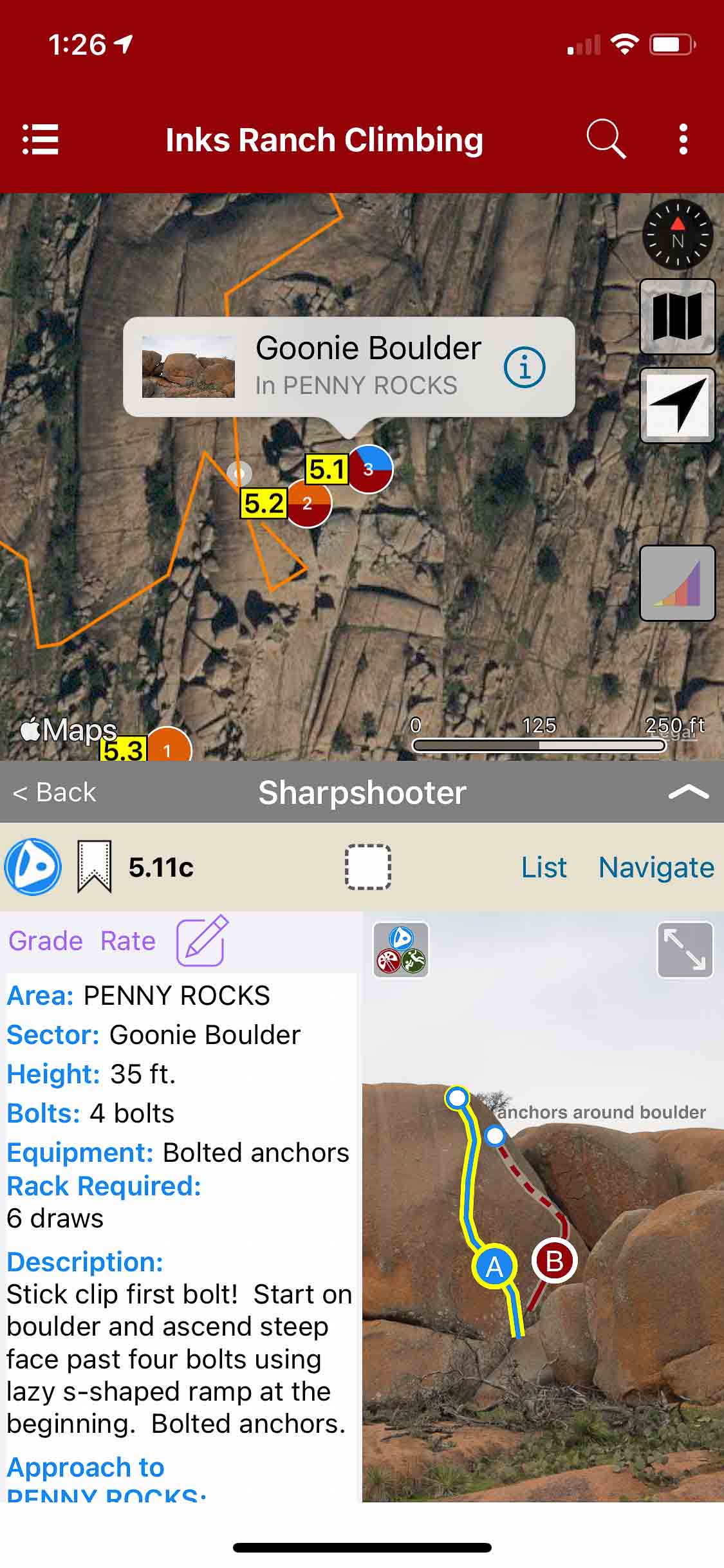
Inks Ranch Climbing
by Access Fund
Inks Ranch is a family-owned ranch in Texas that contains a trove of granite boulders, slabs, and cracks. Access Fund recently opened the ranch to provide climbers a unique opportunity to enjoy rock climbing, camping, and exploration during the “Inks Ranch Climbing Festival”. ACCESS NOTE: THE INKS RANCH IS NOT OPEN TO THE PUBLIC EXCEPT DURING THE INKS RANCH CLIMBING FESTIVAL.
-
-
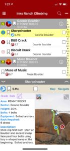
Quickly browse and search the climb list.
-

-
Filter climbs by grade & type.
-
-
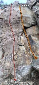
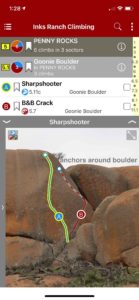
Smart topos help identify climbs.
-

-
Beautiful full screen smart topos.
-
-
rakkup navigates car to crag then displays a picture when arriving at destination.
-

-
Explore Inks Ranch climbing via an interactive trail map.