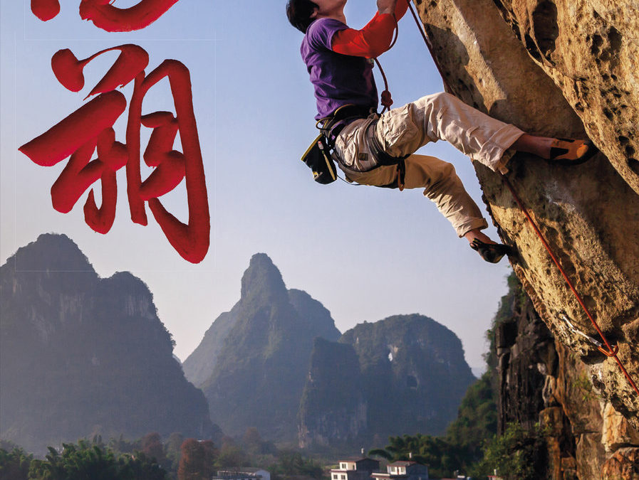
The Yangshuo Rock digital APP produced in conjunction between Andrew Hedesh and Rakkup.com incorporates the best rock climbing within 15km of Yangshuo, China. This APP is an extension of Andrew’s past four years in which he researched the nuances of navigating through the Yangshuo countryside and every detail of 750+ routes included in the recently released paperback book Yangshuo Rock – A China Climbing Guide.
The Yangshuo Rock Digital APP is a wonderful companion or stand-alone product for every climbers’ need while visiting Yangshuo. With exception to travel information and the historical timeline, the Yangshuo Rock Digital APP has everything else including plenty of local flair and personality. You won’t encounter any trouble while navigating the perils of law-breaking traffic, endless rice fields, nor the maze of similarly shaped karst towers to arrive at the climbing crags of your dreams. The Yangshuo Rock Digital APP will be continually updated with lesser known crags, new routes, and current development projects in an effort to create a complete guide totaling more than 60 crags and 1000+ routes. Buy both versions of the guidebook (print and digital) for only $56.99! That price includes $7.00 for U.S. domestic shipping, meaning that you get the print book for only $34 more! A great deal on a beautiful guidebook! Shipping outside the U.S. costs more and we will follow up after your purchase with shipping options and costs.
Please note a VPN is required to download guidebooks behind the Chinese firewall.
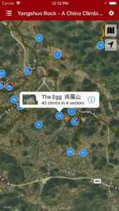
Explore Yangshuo’s climbing via our interactive trail map.
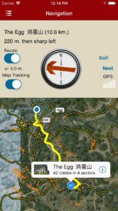
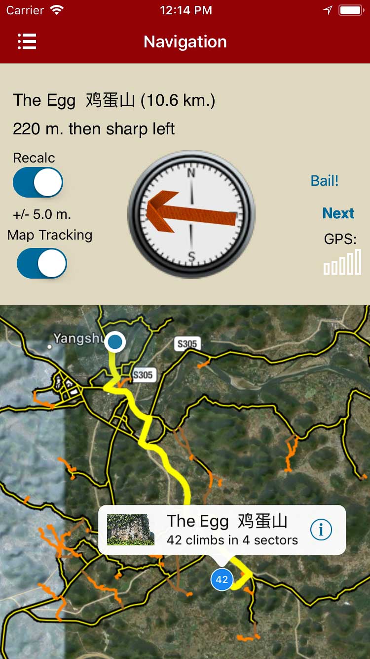
rakkup guides you car to crag then shows you a picture when you arrive.
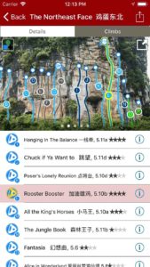
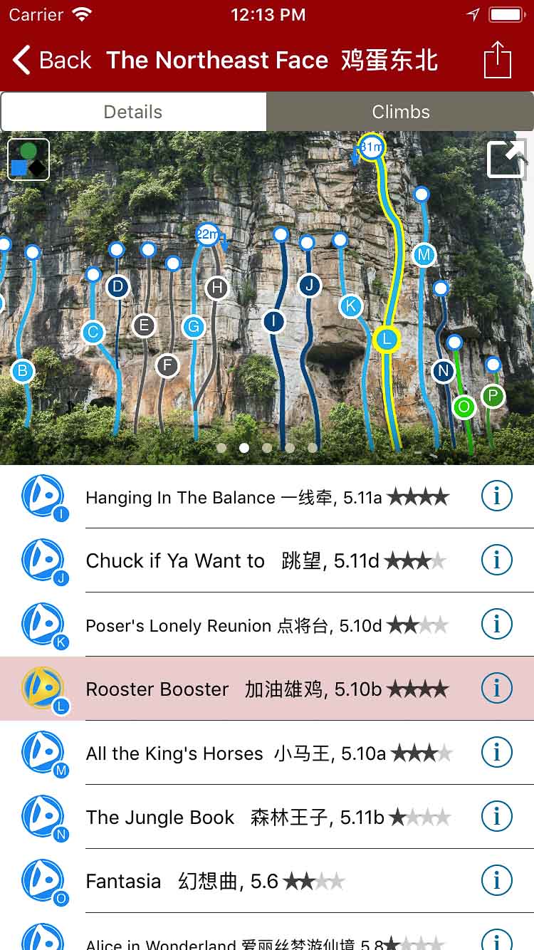
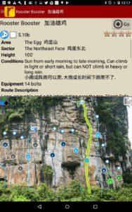
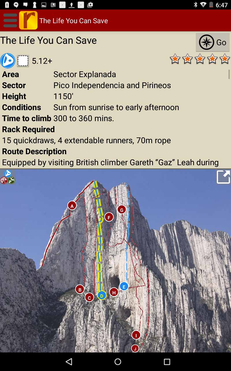
Smart topos find your line.
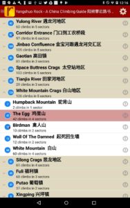
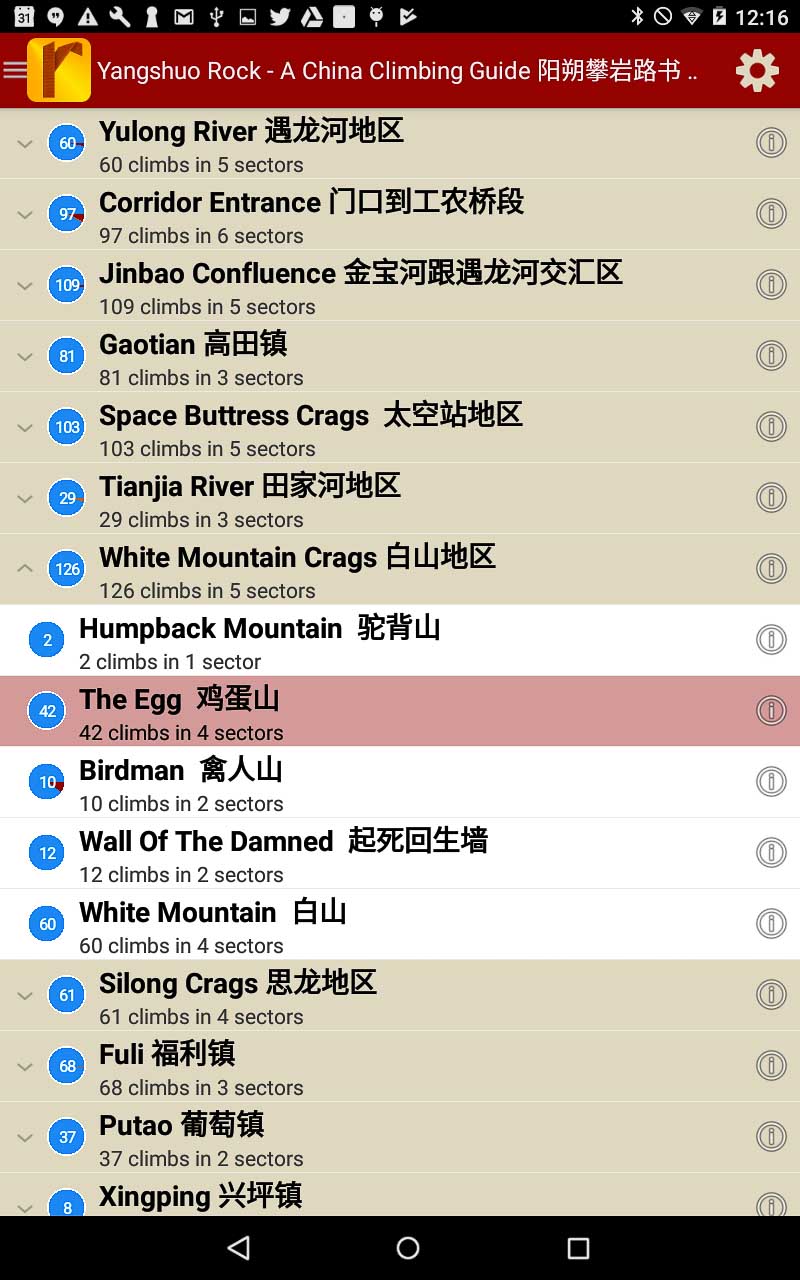
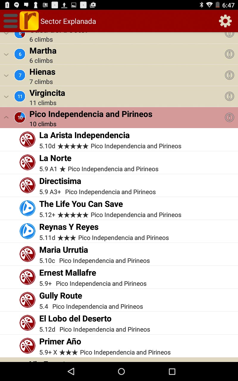
Searchable Yangshuo climb list.
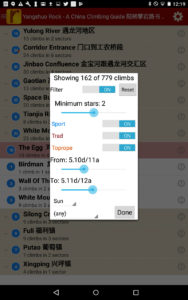
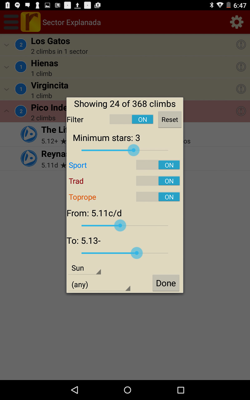
Filter climbs to show only the grades you want to see, or map where the highest quality climbs are located!
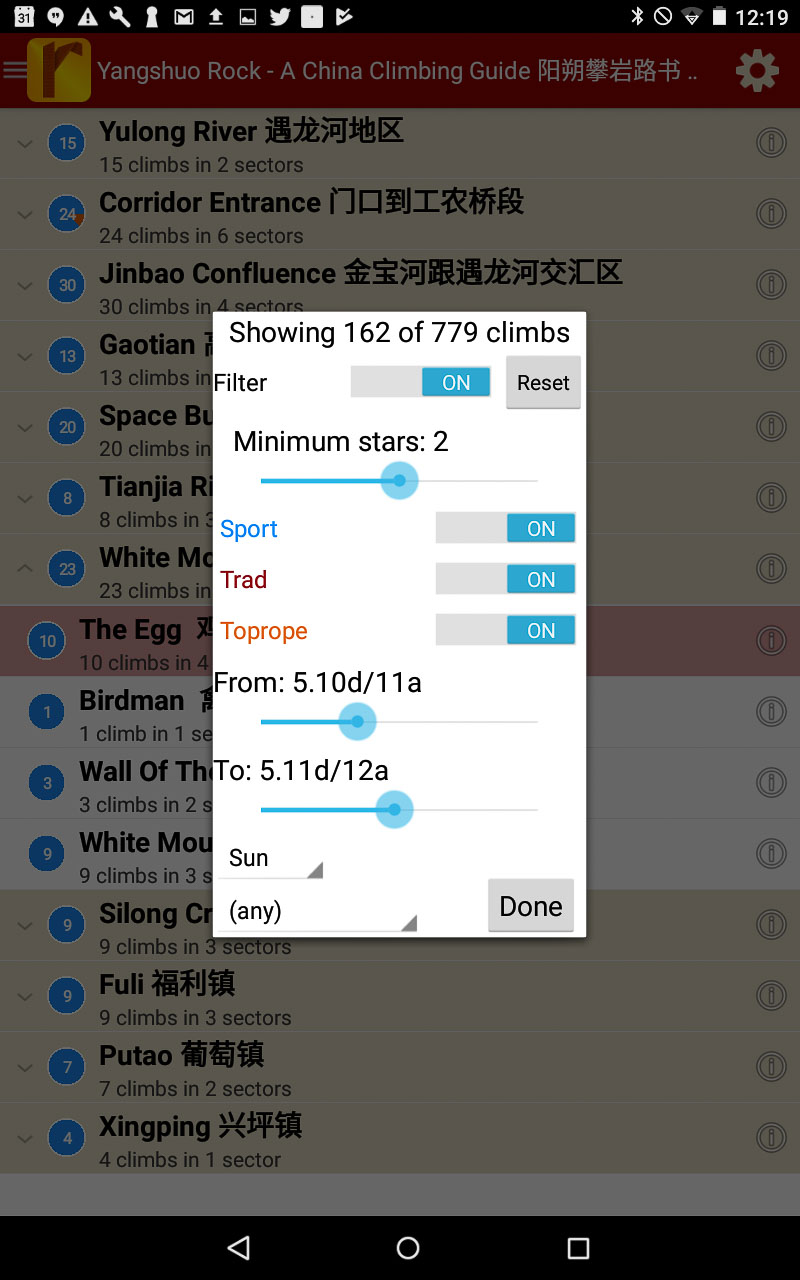
Detailed Yangshuo route descriptions.
China: Yangshuo Rock – Climbing Guidebook 阳朔攀岩路书 was last modified: October 6th, 2019 by
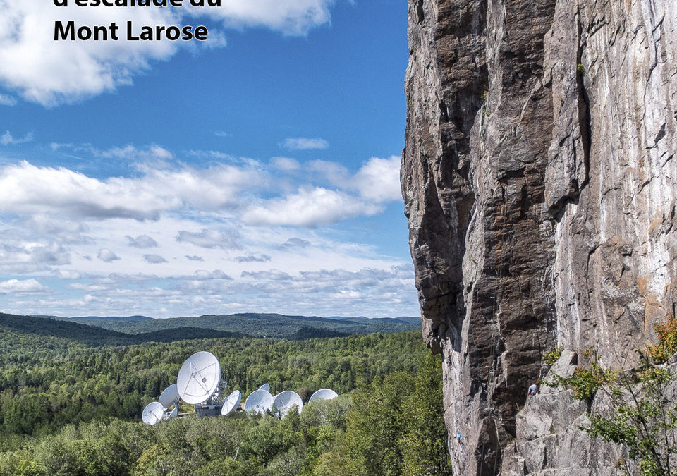
Le Mont Larose, situé au cœur des Laurentides, est un joyau de l’escalade du Québec. À Weir, comme il est appelé par les grimpeurs, on y retrouve un peu de tout, fissures, dièdres, voies sport, multi-longueurs, de l’artif, des devers, des toits et de la dalle. Vraiment de tout! L’ambiance y est irréelle avec les antennes paraboliques de TATA Communication, et l’escalade y est superbe. Souvent considéré comme un lieu où l’escalade était difficile. Dans les dernières années, un grand projet, chapeauté par la FQME, de mise à niveau des voies et d’ouverture de nouvelles voies, a aidé à rendre l’escalade plus variée à travers les cotations. Tous y trouveront du plaisir.
Mount Larose is situated in the heart of the Laurentians. Weir, as it is called by local climbers is one of the premiere climbing areas of the province. It towers 100m over the alien landscape caused by the communication dishes of TATA Communications. The climbing here is quite phenomenal. You can find a bit of everything, slabs, faces, overhangs, roofs, sport climbs, crack climbs, test-pieces, hardcore climbs, multi pitches, beautiful dihedrals and aretes, it really has it all! When people think of climbing at Weir, the first reaction is that there is not much easy stuff. But in the last few years thanks to the FQME and a governmental program to update, rebolt, and open up new climbs, Weir now has an amazing variety of climbs in all grades. There is something for everyone to enjoy.
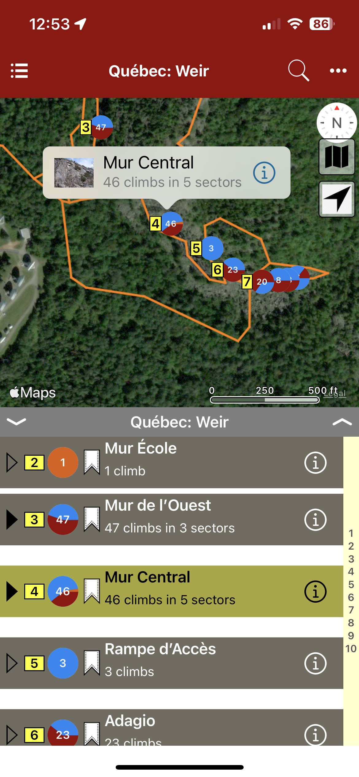
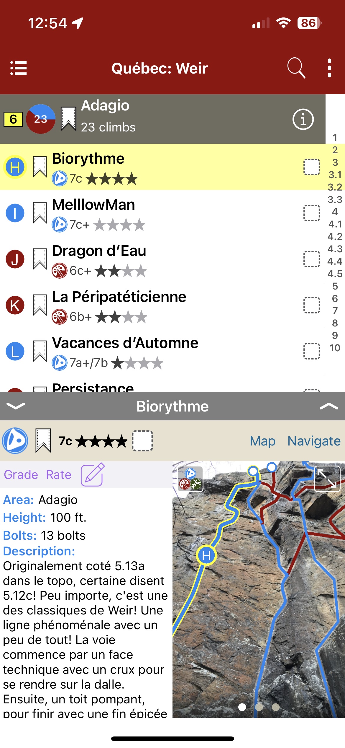
Map view
List view
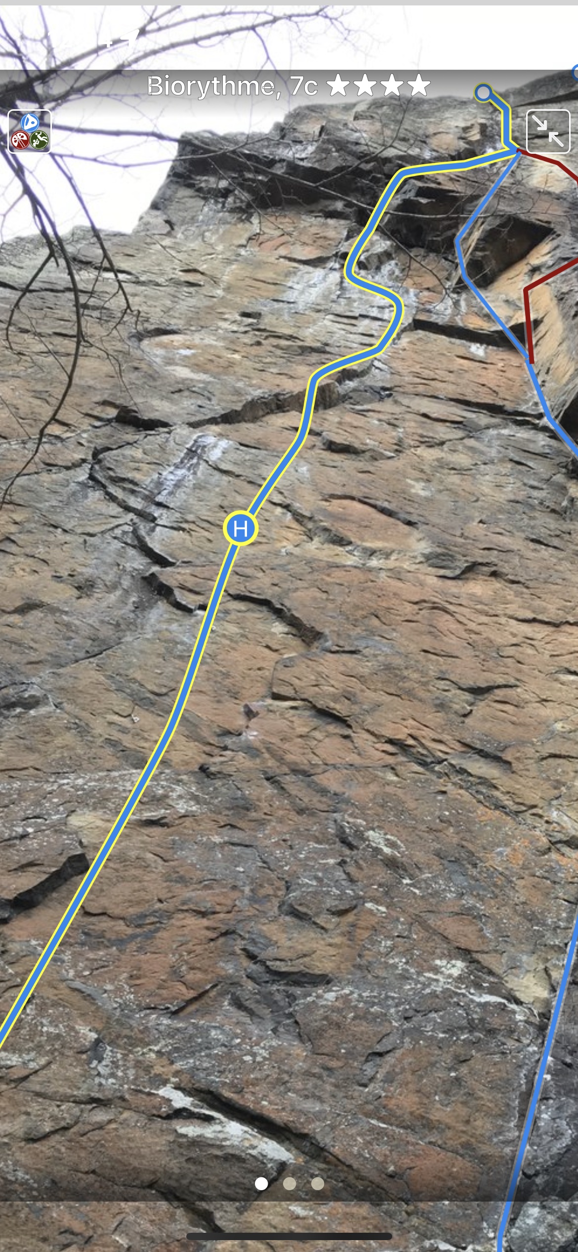
Full screen topos
Québec: Mont Larose (Weir) Rock Climbing was last modified: August 22nd, 2023 by todd
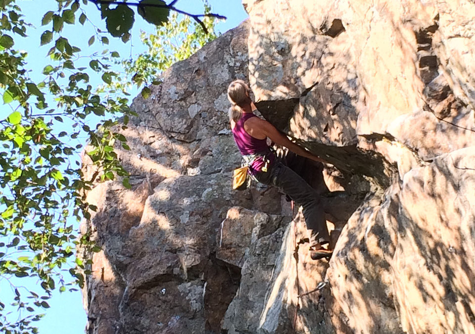
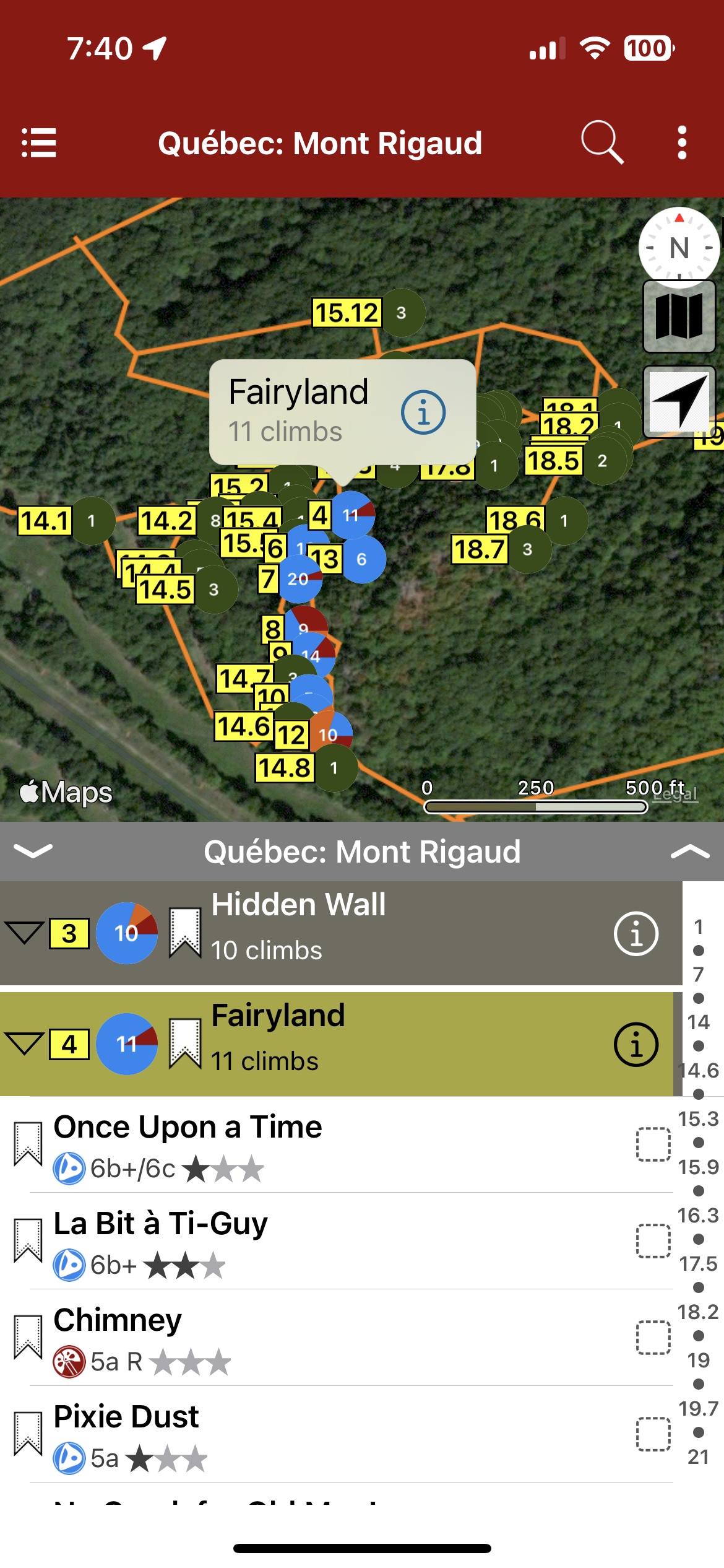
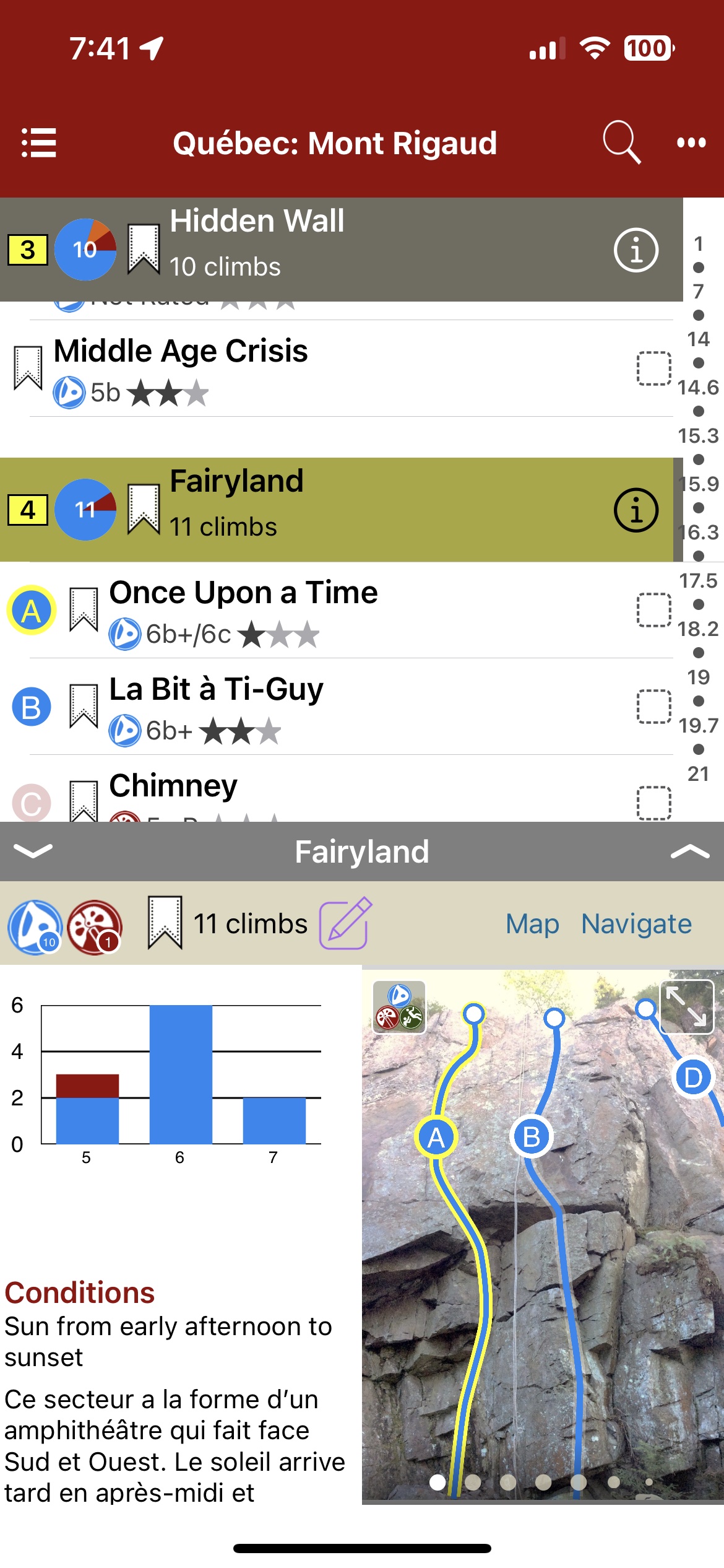
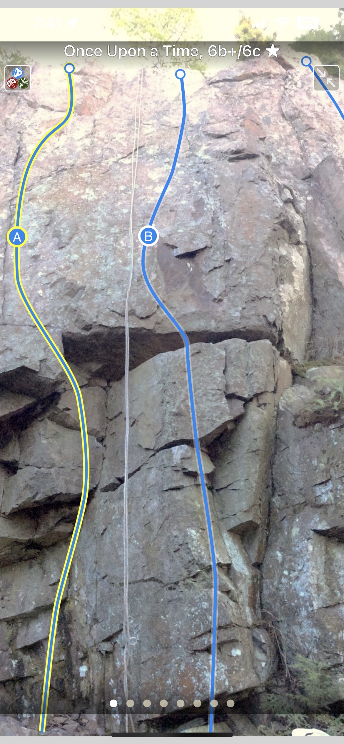
Mount Rigaud is a popular little crag about 45 min from Montreal and 80 min from Ottawa. Unfortunately, over the years access has been precarious and little to no formal information was available. Development however has been continuous and there are now close to 100 climbs. Most of these are short sport climbs, but there are a few nice trad lines. There has also always been some bouldering done on the obvious boulders along the trail. But in the past few years Nick Cowan has been exploring and has cleaned and climbed over 100 problems all over the mountain. With access now made easier, thanks to the implication of the ski center, the municipality and the FQME. It was judged time to get an accurate guide done. This guide, thanks to the help of the main developers, contains all of the correct information for all the climbs and boulders of Mount Rigaud.
Le Mont Rigaud est une destination très populaire pour l’escalade étant à 45 min de Montréal et 80 min d’Ottawa. Malheureusement, l’accès était précaire et peu d’informations étaient disponibles pour les voies. Malgré tout, le développement a continué et la falaise compte aujourd’hui près de 100 voies. Il y a toujours eu du bloc de fait sur les blocs le long du sentier. Mais dans les dernières années, Nick Cowan a nettoyé et grimpé plus de 100 problèmes sur la montagne. Heureusement, l’escalade est simplifiée grâce à la participation de la Station de Ski pour le stationnement. De plus, des discussions sont en cours entre la FQME, la municipalité et le propriétaire pour rendre l’accès officiel. Alors, avec la collaboration des ouvreurs le présent topo contient l’information exacte sur tous les voies et blocs.
Map View
List View
Full Screen Photos
Québec: Mont Rigaud Rock Climbing & Bouldering Guidebook was last modified: August 22nd, 2023 by todd
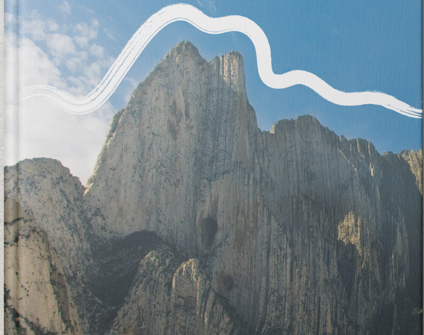
Hidden within the majestic valleys of the Sierra Madre Oriental, just outside the sprawling city of Monterrey, lies the wonderland that is Parque La Huasteca.
Gigantic spines of limestone cut the jagged landscape like knifes to the heavens and cascading canyons bestow hypnotizing vistas that reach as far as the eye can see. For decades, the park remained elusive to the outside world, an almost mythical place that few ventured into but the enigmatic Huichol people, whose annual pilgrimage to the pay tribute to Abuelo Fuego (Grandfather Fire) has been a tradition for millennia.
In recent years, the park has witnessed an awakening. The tales of it’s beauty have travelled far and wide, carried by images of it’s breathtaking scenery and signature views of Pico Independencia. Combined with it’s incredible selection of climbing routes ranging in grades from 5.7 to 5.14+, and boulders from V0 – V11 as well as numerous big walls, the park continues to attract visitors from across the globe and as far as the U.K., Germany and Sweden.
Possessing a plethora of activities including sport climbing, bouldering, big walling, running, mountaineering, hiking, cycling, highlining, base jumping and camping, there is something to quiche the thirst of even the most ambitious adventurer!
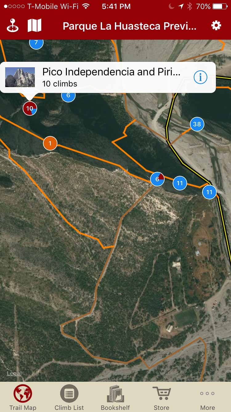
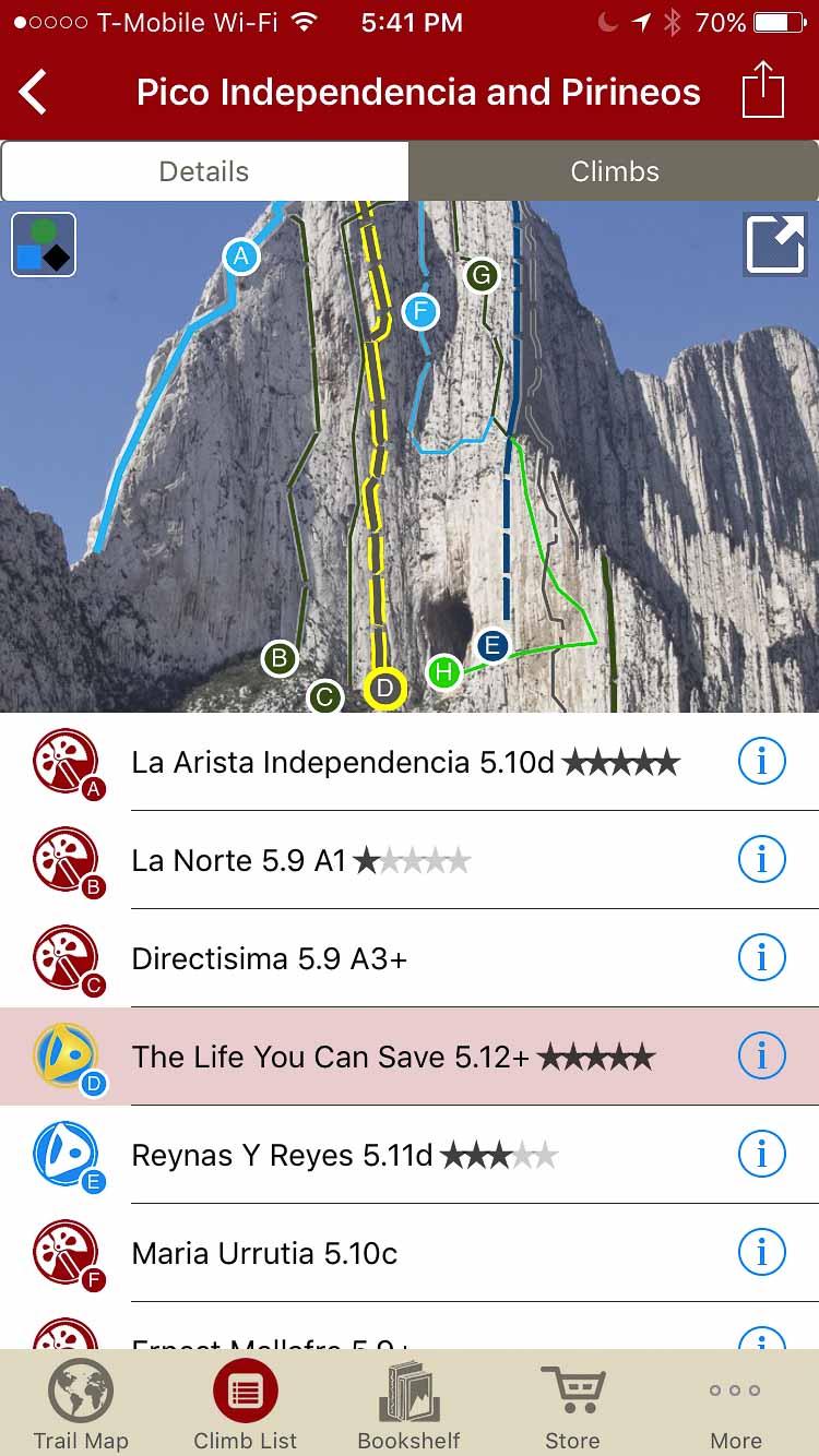
Explore Parque La Huasteca’s climbing via our interactive trail map.
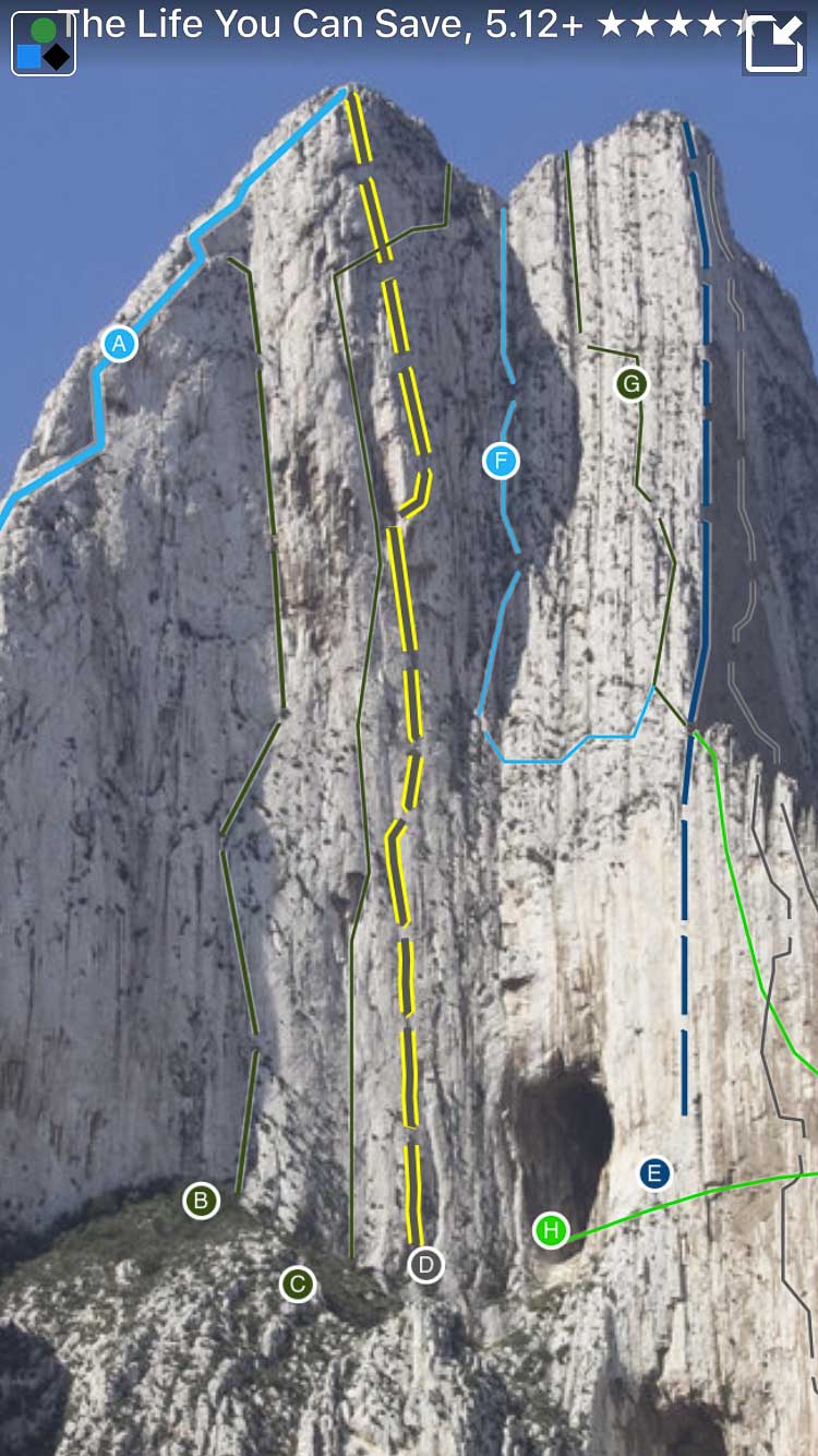
Smart Topos help you find your line.
Tap on a climb in the list to highlight the route.
All those Parque La Huasteca climbs in a searchable list.
Filter all those climbs to just the ones that are right for you.
Tired of bad beta? Use Gaz’s beta to send your next proj.
Parque La Huasteca Rock Climbing Guidebook was last modified: June 19th, 2018 by todd
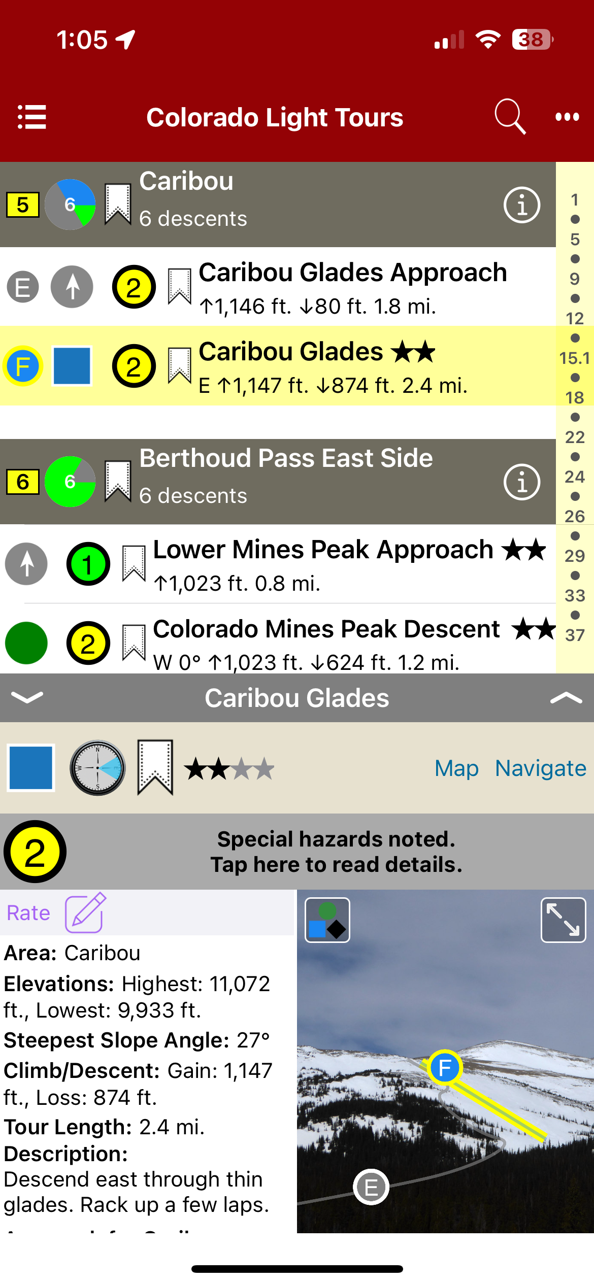
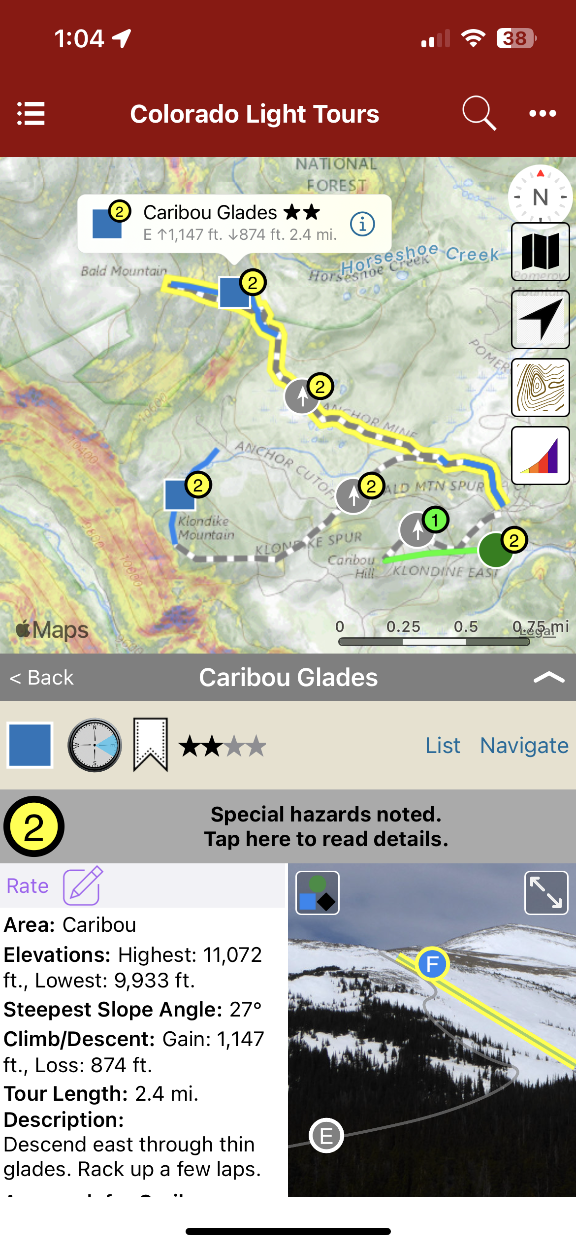
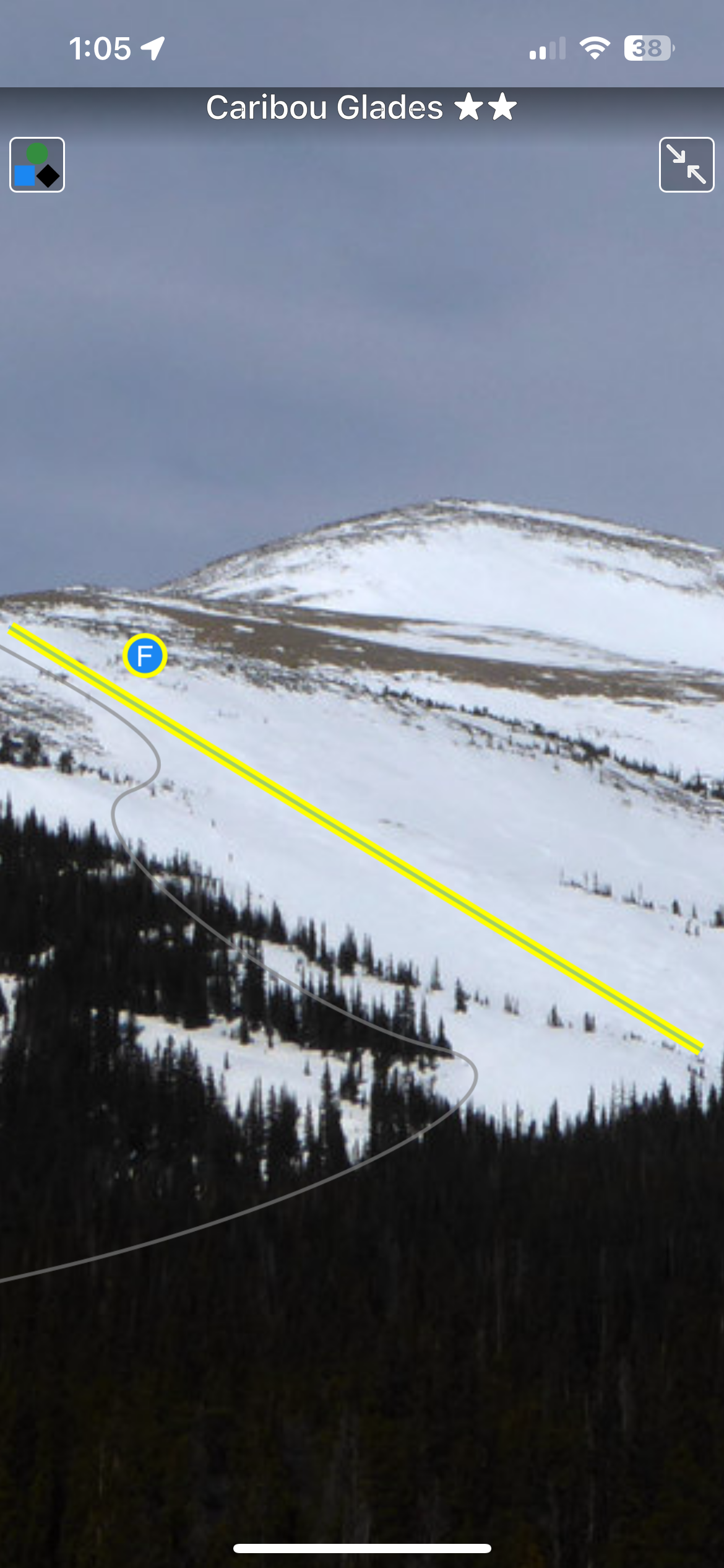
It is said Colorado has 300 sunny days a year. Combine that with several thousand mountains, and a winter climate that’s downright temperate. The result: one of the best places on the planet for ski touring. Of course nothing is perfect. Colorado challenges backcountry skiers with limited public access options, due in part to it being a mostly rural, relatively un-roaded western state. More importantly, due to various climatic factors the state’s mountains can be prone to dangerous avalanches for much of every winter. Yet options exist. Key with backcountry travel is picking routes with lower angle pitches and other avalanche-mitigating factors. While these “light tours” are surprisingly difficult to find, they do exist. We detail a selection of Colorado lends itself to this as well, with most of the state’s more than twenty ski resorts allowing uphill skiing. Thus, we offer a special mix here, combining a variety of “easy” backcountry routes with recommended resort options. Pick one of our many days of Colorado sunshine, get out and enjoy.
Buy digital plus book and the price includes $4.00 for shipping, a screaming deal! When you buy a bundle, you can use your digital rakkup guidebook immediately.
List view
Map view
Full screen photos
Backcountry Skiing: Colorado Light Tours Guidebook was last modified: November 21st, 2023 by todd
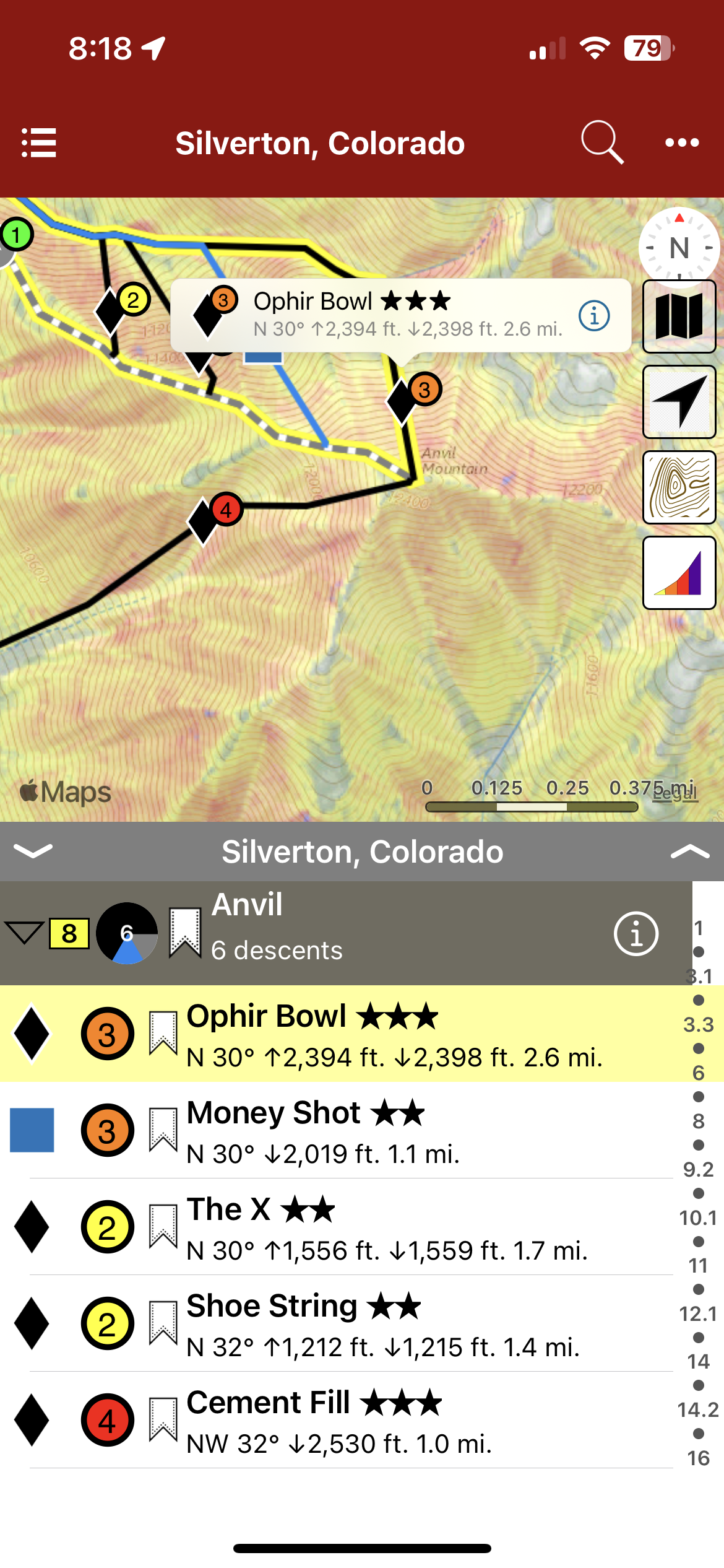
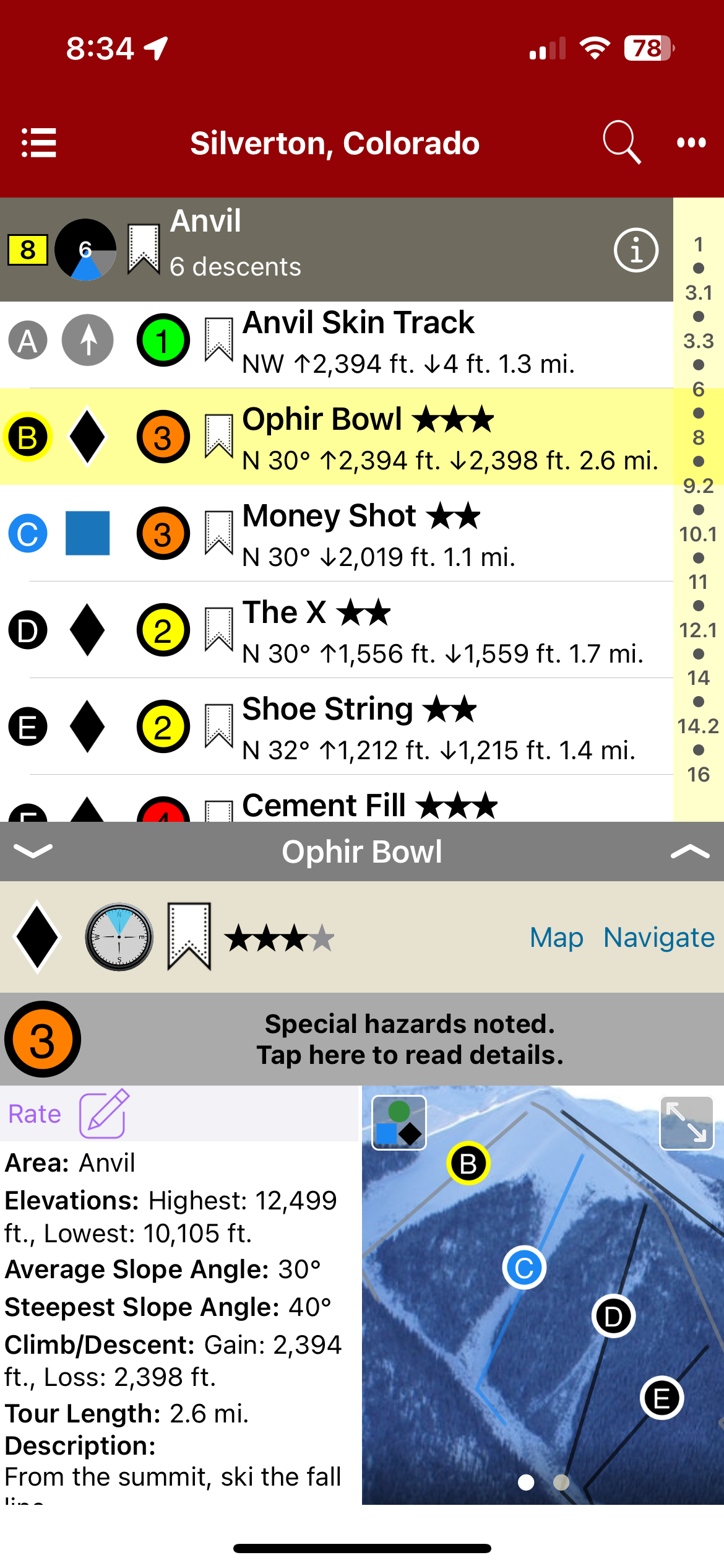
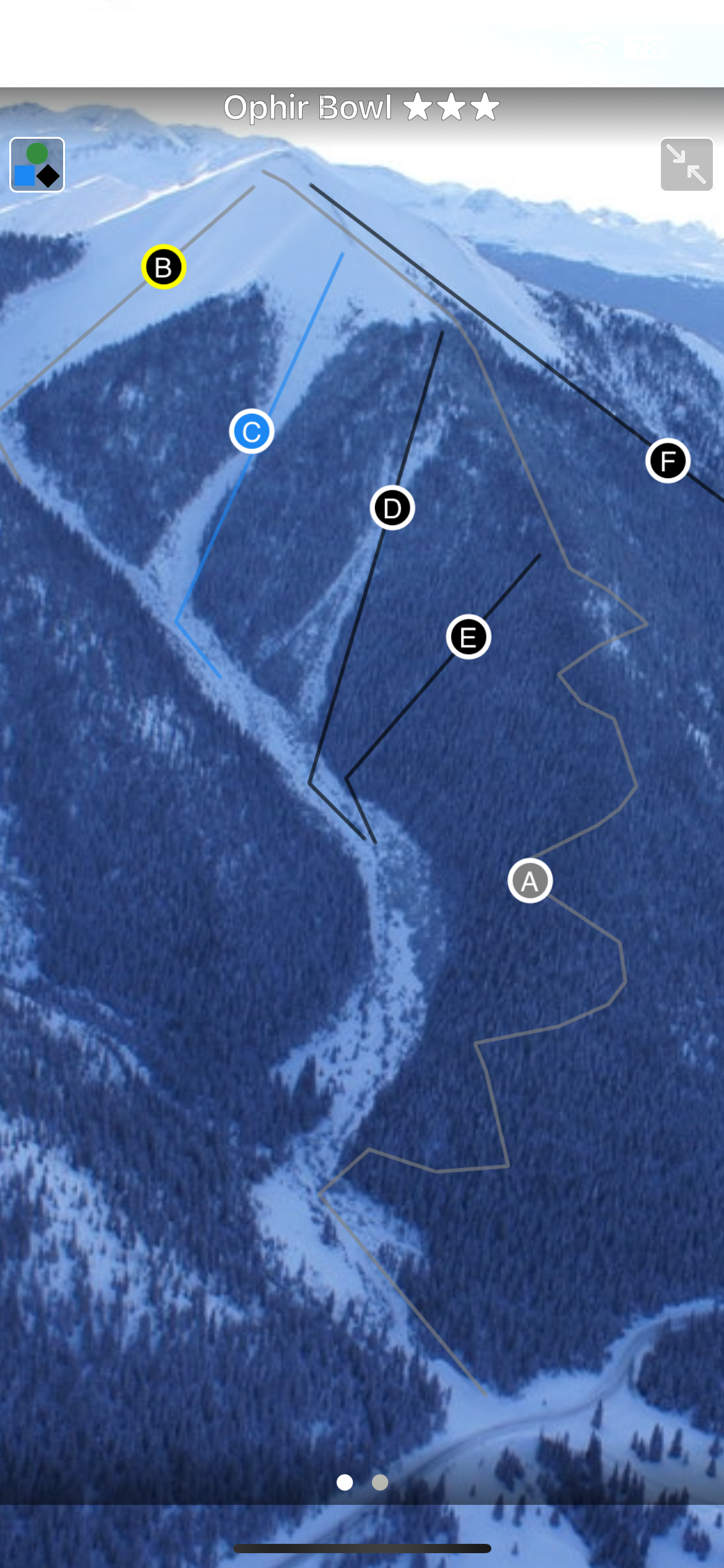
Home to multiple ski areas, extreme skiers and sledders, ski and mountain guides, and an incredibly rich mining history, the sleepy town of Silverton is a fantastic place to visit. It speaks for itself when it comes to remote and rugged mountain towns of the west. Many mountain ranges do not have a year round maintained road passing through them. The San Juan Mountain Range, from Durango through Silverton and on to Ouray has three: Coal Bank, Molas, and Red Mountain Passes. Highway 550 brings powder-hounds through some of Colorado’s most remote and diverse ski terrain. Basins adjacent to Highway 550, also known as the Million Dollar Highway, boast an annual snowfall of 400”. The mountains accessed from Silverton possess some of the largest ski descents in the lower 48, and some of the deepest snow in all of Colorado. The locations showcased in this atlas offer the entire spectrum of terrain and difficulty, from novice to extreme and everything in between. Provided you already have a small amount of experience as a backcountry skier and have completed a Level 1 avalanche course, there is something in this atlas for everyone. .
Buy digital plus (book and/or map ) and the price includes $4.00 for shipping, a screaming deal! When you buy a bundle, you can use your digital rakkup guidebook immediately.
Map view
List view
Full screen photos
Backcountry Skiing: Silverton, Colorado Guidebook was last modified: November 21st, 2023 by todd
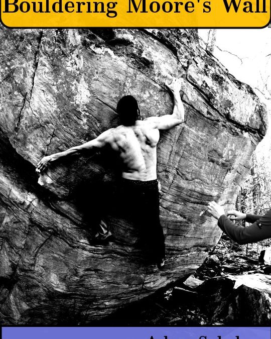
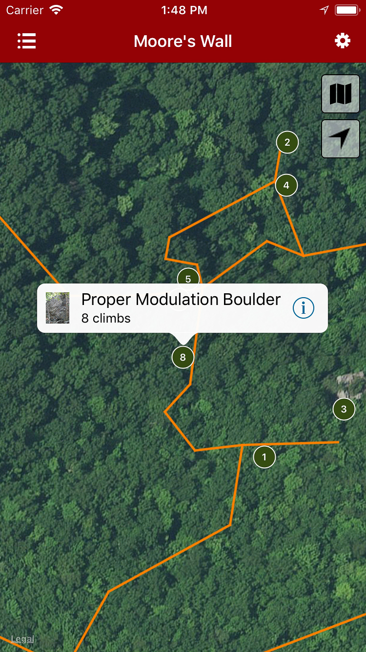
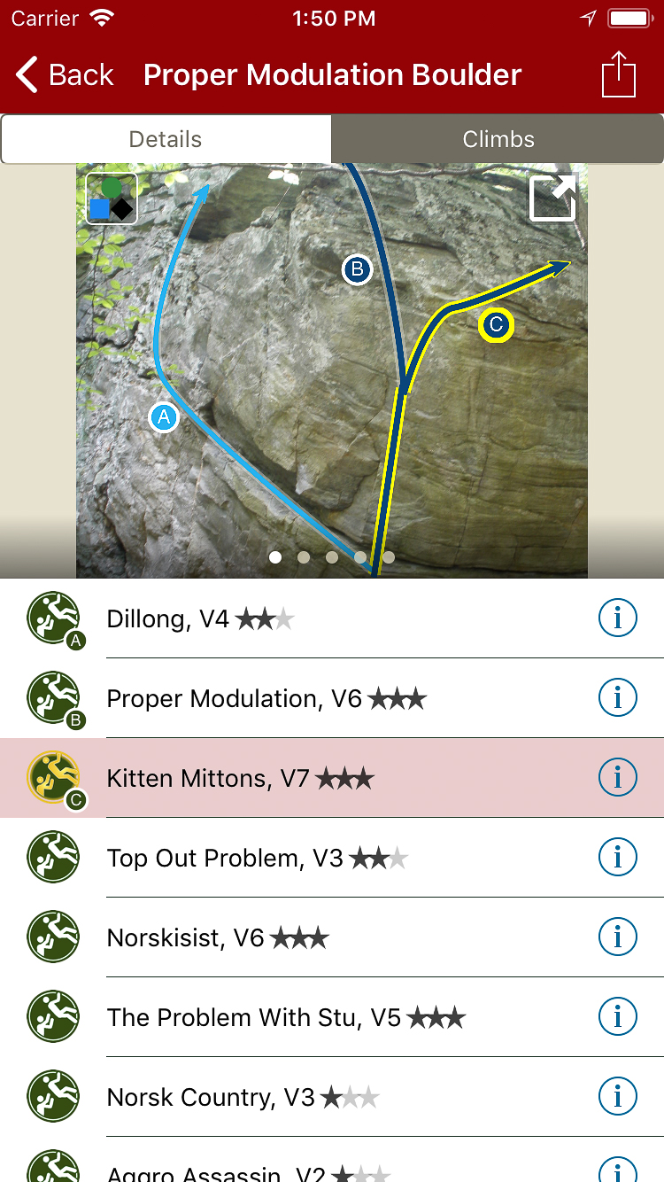
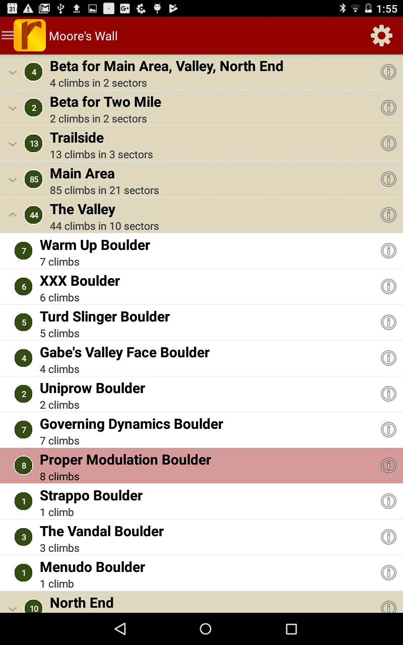
Moore’s Wall is arguably one of the greatest climbing areas in North Carolina. It’s jam packed with high-quality bouldering. We have taken great care to first bring you the classics. Currently there are over 200 problems in the rakkup guide, more than 80 of which are 3-Star problems including: Stu’s Roof, Stickman, The Nick, Hustler, Omega, Duck Soup, Zen Spasm, V3PO, R2V2, Titan Traverse, Tsunami, Gymrat Kevin, XXX, Turd Slinger, Proper Modulation, The Vandal, Orange Crush, Circus Roof, Stigmata, Mr. Robotto, and Eurowall. Each with photographs, complete descriptions, and GPS to get you where you want to go. Get in now at the introductory pricing rate and enjoy the steady inflow of dividends in the form of free upgrades. This guide is expanding and the introductory rate won’t last forever.
Explore Bouldering Moore’s Wall via our interactive trail map.
rakkup guides you car to boulder then displays your destination’s picture when you arrive.
Smart topos find your line!
Moore’s bouldering problems in a searchable list!
Filter problems to the grades you want.
Detailed problem descriptions and hand drawn overview maps.
Moore’s Wall Bouldering Guidebook was last modified: March 28th, 2018 by todd
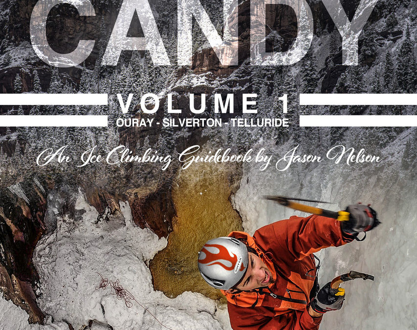
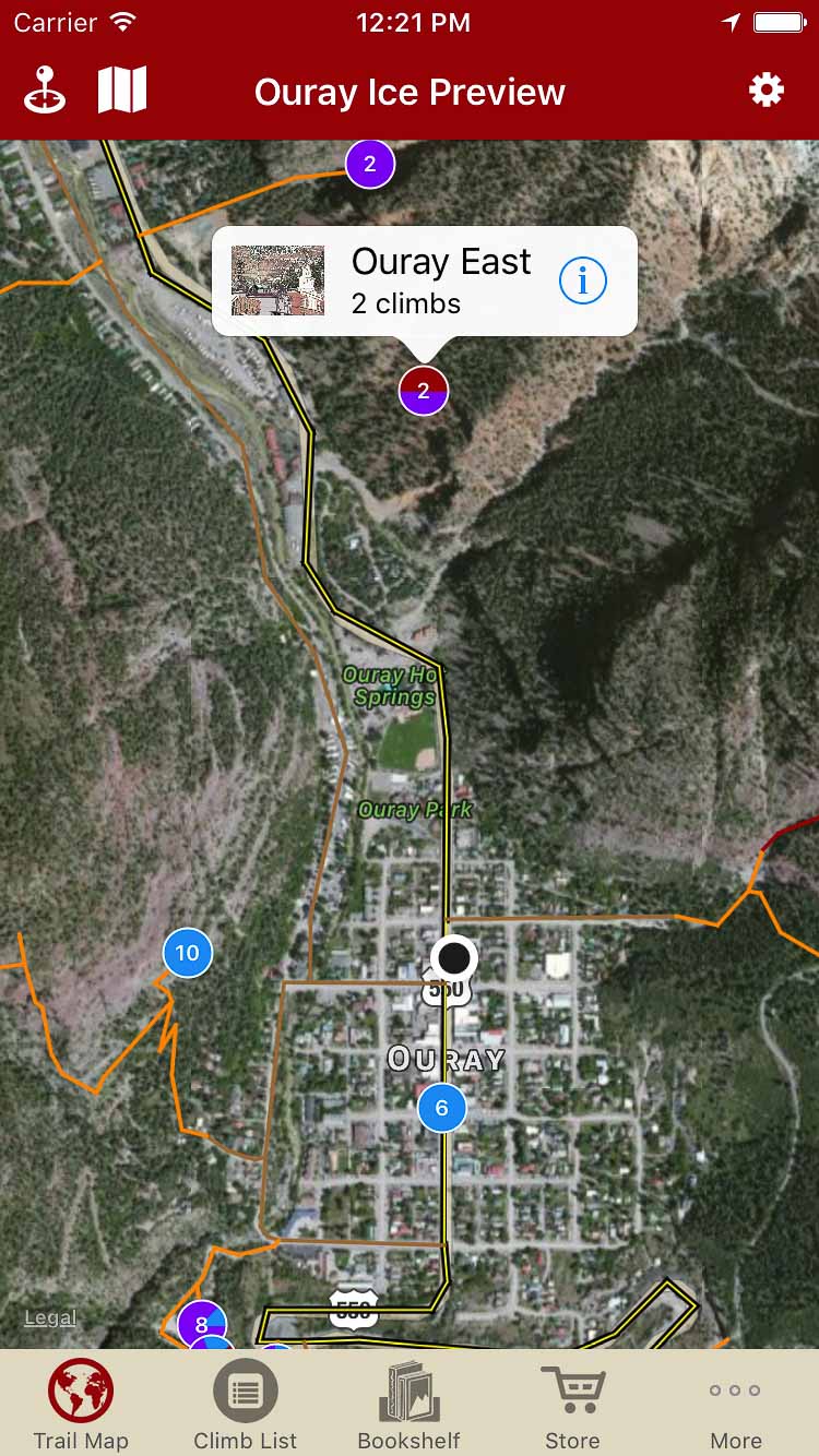
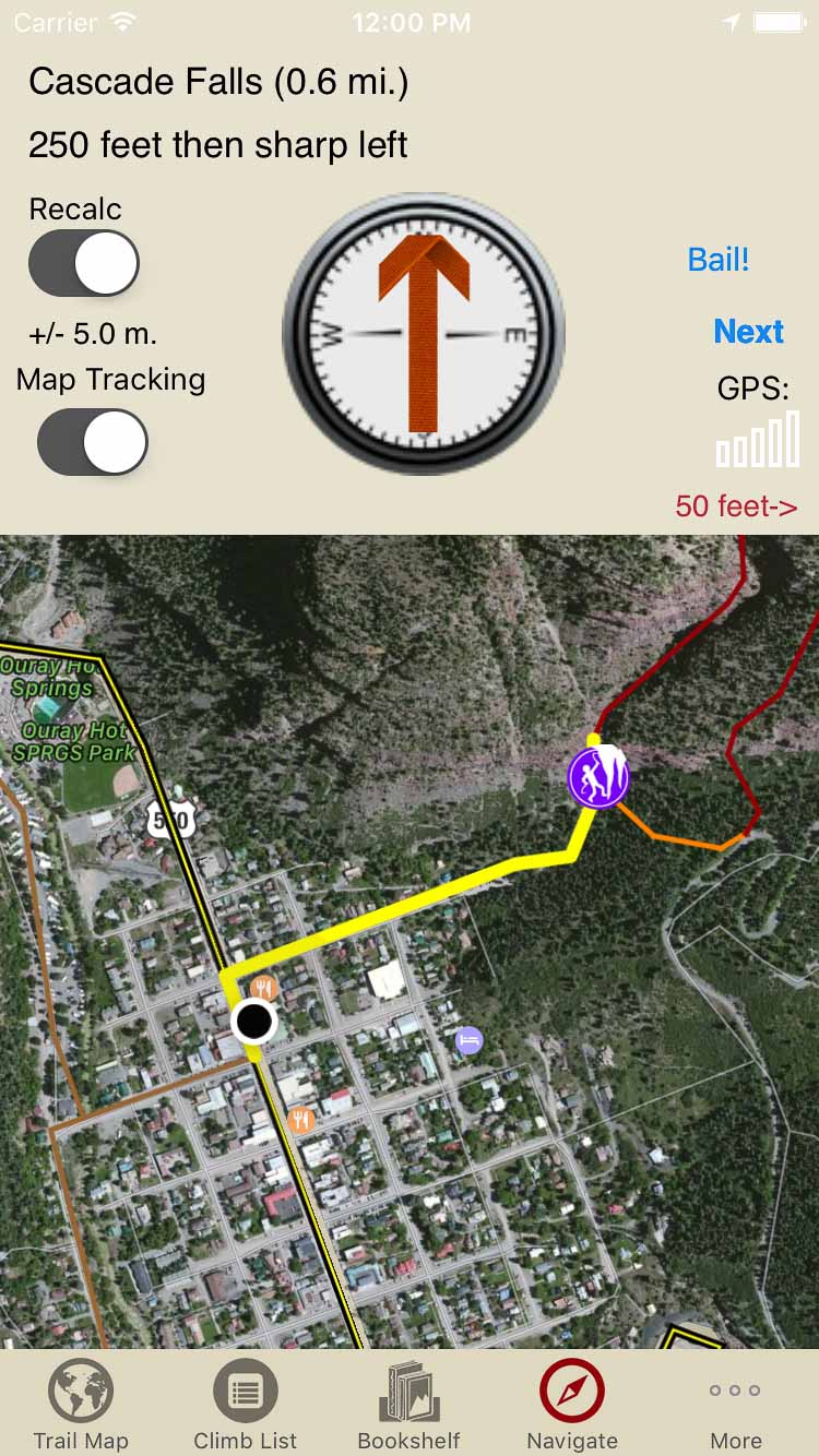
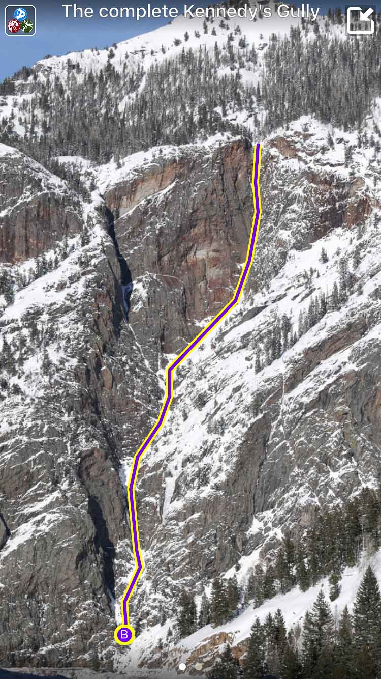
Formerly Ouray Ice, this guidebook covers ice, mixed and drytooling routes in Southwest Colorado. The book’s focus is on Ouray, Telluride, Silverton, West Fork of the Cimarrons, and Dunton.
:
Suffer Candy Volume 1: Ice Climbing in Ouray, Telluride, and Silverton Guidebook was last modified: January 11th, 2023 by todd
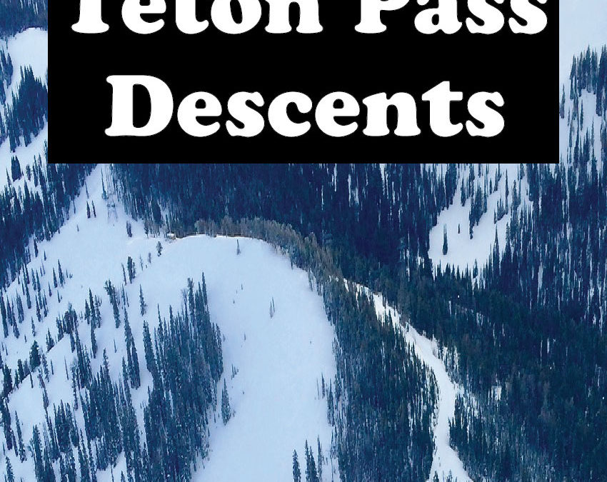
Teton Pass offers some of the best roadside-access skiing and snowboarding in North America.This guidebook includes descriptions, approaches, exits, and hazards for about 100 ski descents in the Teton Pass area written by Jamie Weeks, an AMGA-certified guide and American Avalanche Institute instructor with years of experience guiding in the Tetons and Alaska. The descents described in this book range from the fun, easy bowls of the Edelweiss area to the challenging extreme terrain on Mount Glory and Taylor Mountain. This guidebook will assist your decision making before your trip and continue to provide guidance while you are in the mountains.
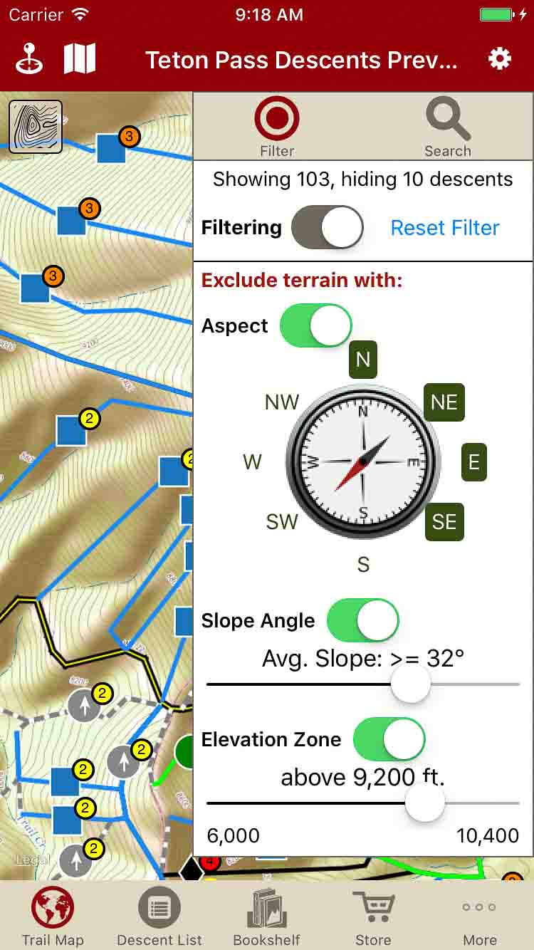
Check with your local avalanche center, then use rakkup’s unique filtering to remove descents based on slope, aspect, and elevation.
Descriptions, approach, exit and hazards for each of the 100+ runs written by AMGA Ski Guide Jamie Weeks using his years of intimate knowledge of the Teton Pass Area.
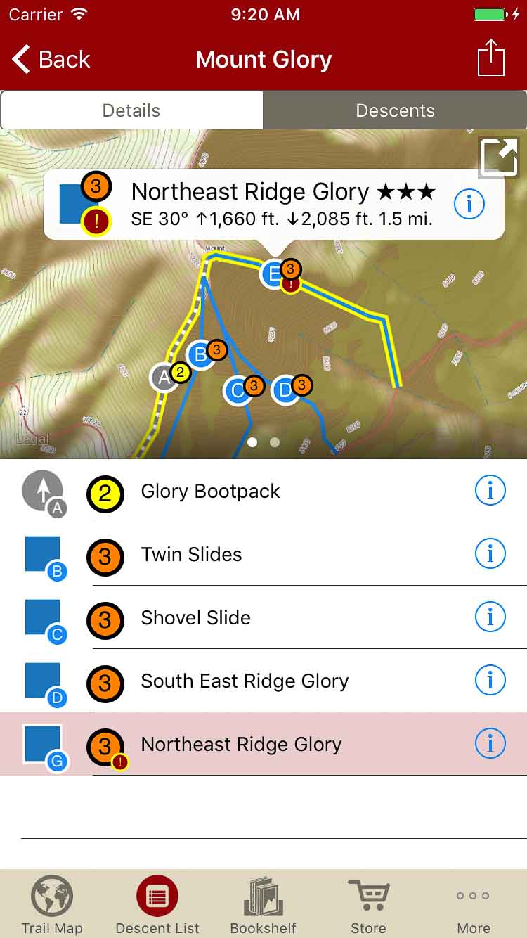
Interactive photos in the descent description give you tappable information about your ski run.
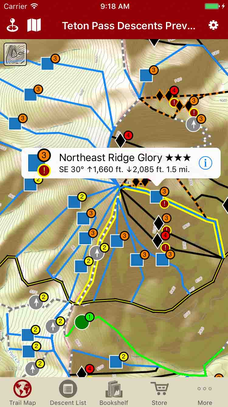
Our interactive map shows your current location, your selected descent and the surrounding descent options.
Tap on a descent name and see where it is located on the map. Tap a descent on the map to see detailed information or open a full-page description.
Over 100 ski descents in the Teton Pass area in the palm of your hand.
Backcountry Skiing: Teton Pass, Wyoming Descents Guidebook was last modified: November 13th, 2020 by rob
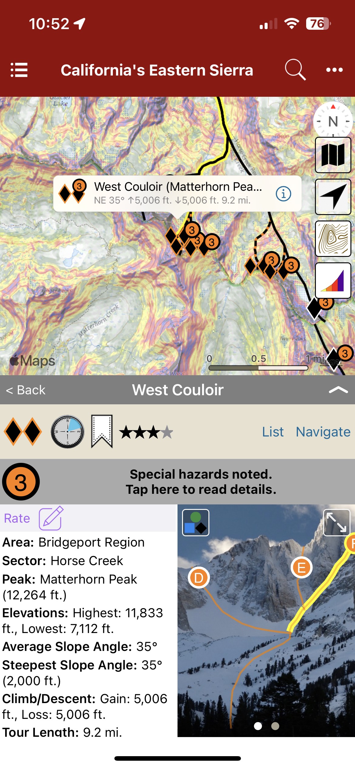
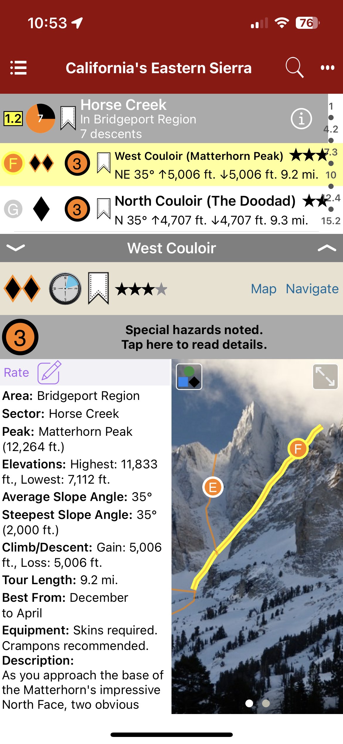
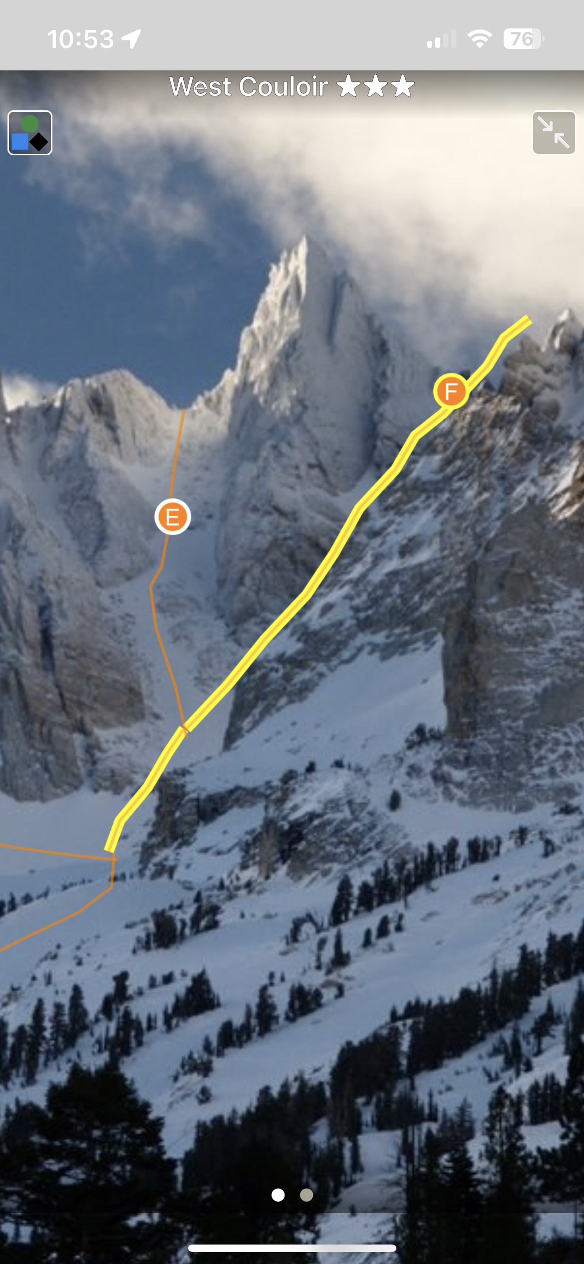
Blessed with a deep snowpack, sunny skies, and high-elevation peaks, the Eastern Sierra has some of the world’s best backcountry skiing and snowboarding. This digital guide covers the area between Bridgeport and Lone Pine, including all information included in the 3rd Edition, plus occasional updates and corrections to content which is not in the print guide. This digital app offers an improved experience for the user, with search and filtering functionality, the ability to quickly visualize and understand terrain, and interactive photos and maps.
Map view
List view
Full screen topo
Buy both versions of the guidebook (print and digital) for only $50.99! That price includes $6.00 for shipping, meaning that you get the bundle for only $10 more! A screaming deal! When you buy the bundle, you can use your digital rakkup guidebook immediately.
Backcountry Skiing: California’s Eastern Sierra Guidebook was last modified: September 13th, 2023 by todd