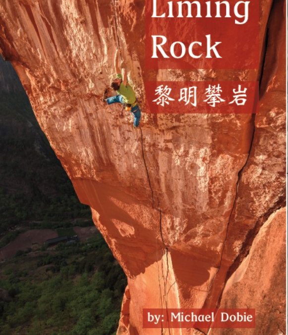
Liming is China’s premier destination for sandstone climbing and while it has gained notoriety with the trad routes, the most recent wave of development has focused on sport climbing. In addition to up to date beta on all the classic climbs the Rakkup guide is the only resource for the four new sport climbing areas plus new trad routes not in the print version. A total of 30 sectors and 260 routes (as long as 10 pitches) are included in this handy resource.
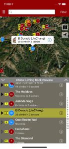
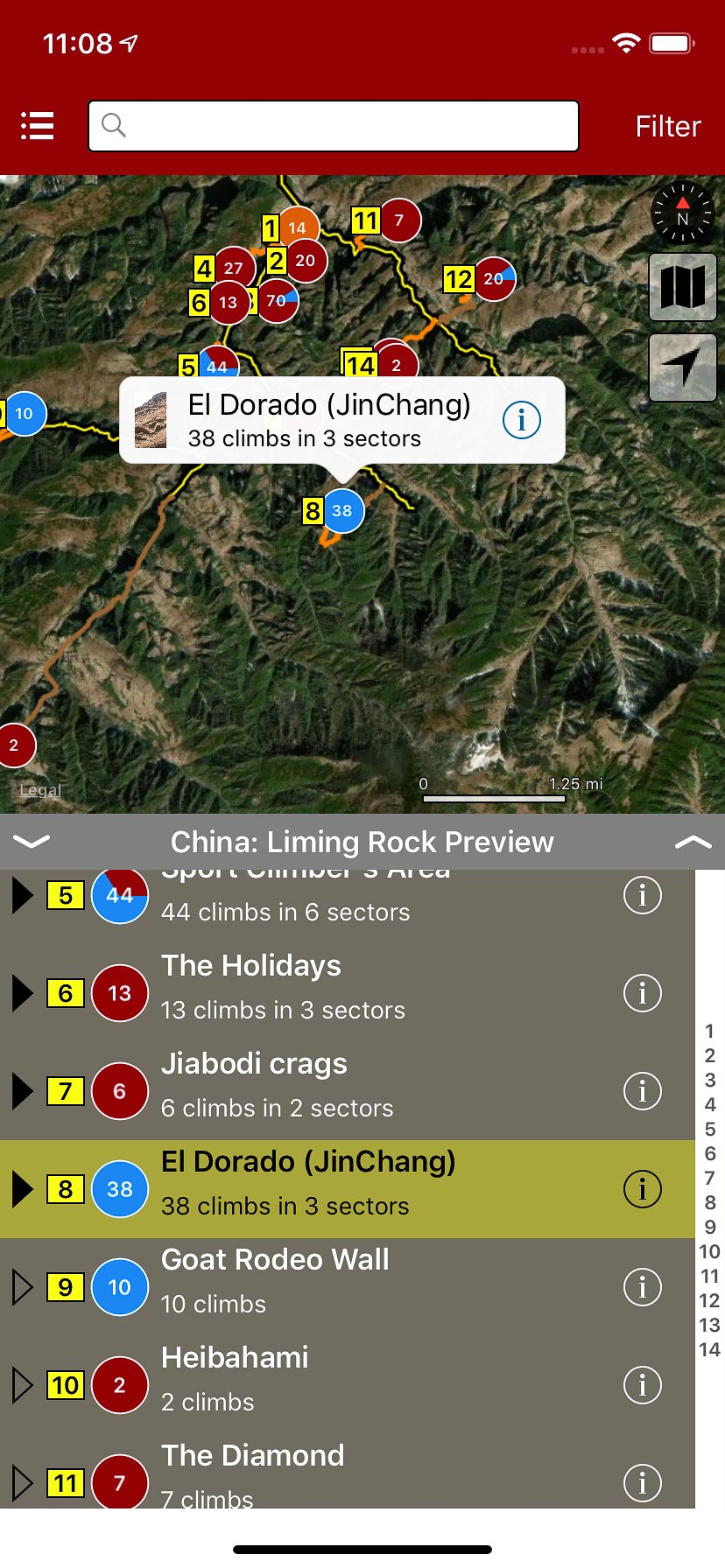
The Liming area is huge, yet centralized with a town that serves as a central hub for the local natives “the Lisu people” who inhabit the area. There are two main valleys that have seen climbing development spanning an area of about 7 km. The geological diversity is extreme. Tucked into these mountains is an ancient geological seabed that has been uplifted at a hard angle to expose three types of rock. One layer is a softer sandstone with cracks, splitters, and bouldery bolted face climbing, another is a harder type of yellow sandstone filled with pockets and jugs suitable for fun sport climbing, and hidden within these two are pockets of fine grained, vertical to steep granite with cracks. With such a large area and routes going up almost daily during the season, this convenient app will help you stay up to date with the current conditions and new routes.
A few of the main climbing areas are within walking distance from the guesthouses in town with approaches 30-45 minutes. With that said there are also areas that have roadside access using the transportation options detailed in the app. As with all rakkup guides, GPS navigation is featured and makes the approaches much easier. This is a welcomed addition as some areas remain quite wild and access via small trail systems used by local goat herders which can be confusing to navigate at times.
Included is travel beta to help navigate arrival and preparation. There is a particularly useful section for non-Chinese speakers with step by step directions on how to get to Liming. Also pronunciations and characters to show drivers and people where you want to go. China can be an intimidating place if you have never been, but these features make it much easier.
We’re sorry, but the author has informed us that printed version of this book is out of stock at this time. We hope you enjoy the digital guidebook until a reprint is available.
Buy both versions of the guidebook (print and digital) for only $46.99! That price includes $7.00 for U.S. domestic shipping, meaning that you get the print book for only $32 more! A great deal on a beautiful guidebook! Shipping outside the U.S. costs more and we will follow up after your purchase with shipping options and costs.
Please note a VPN is required to download guidebooks behind the Chinese firewall.
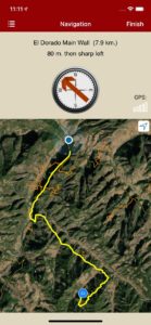
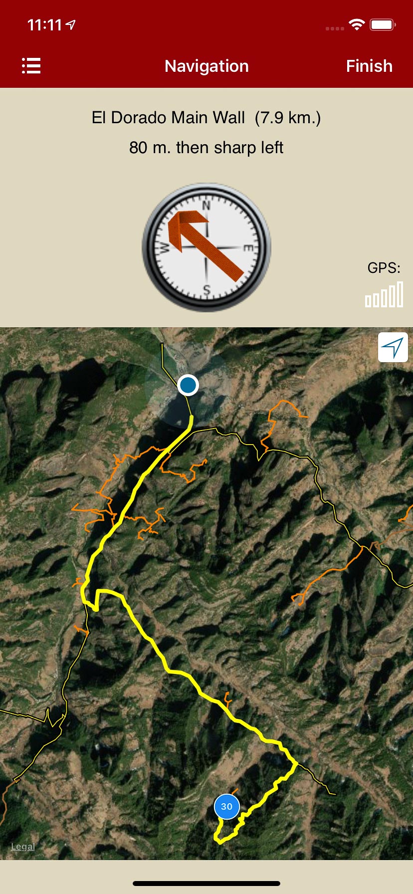
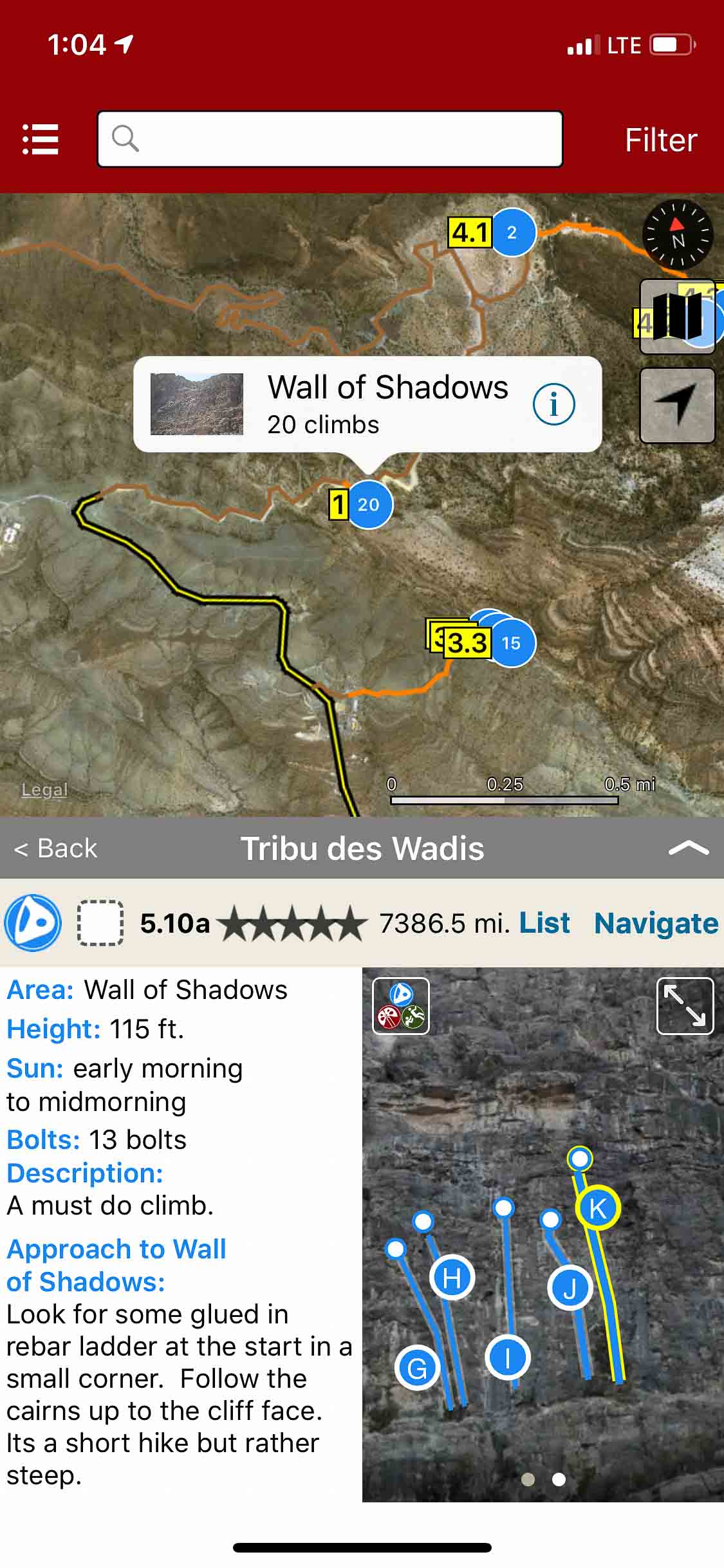
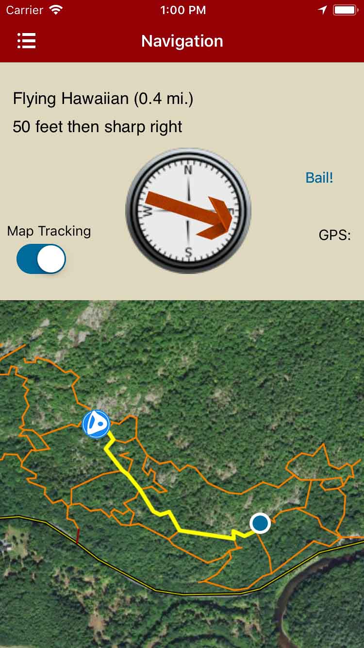
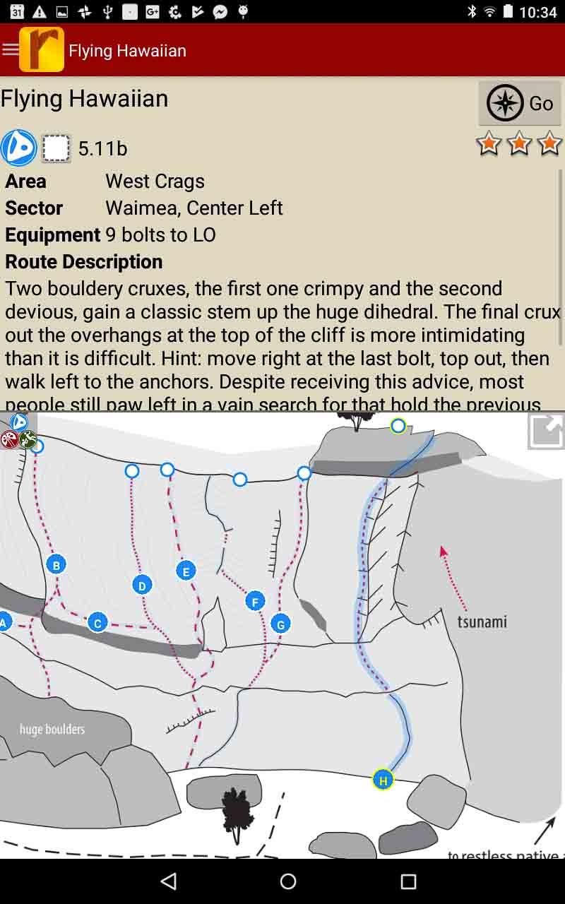
Explore Liming via rakkup’s trail map features.
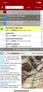
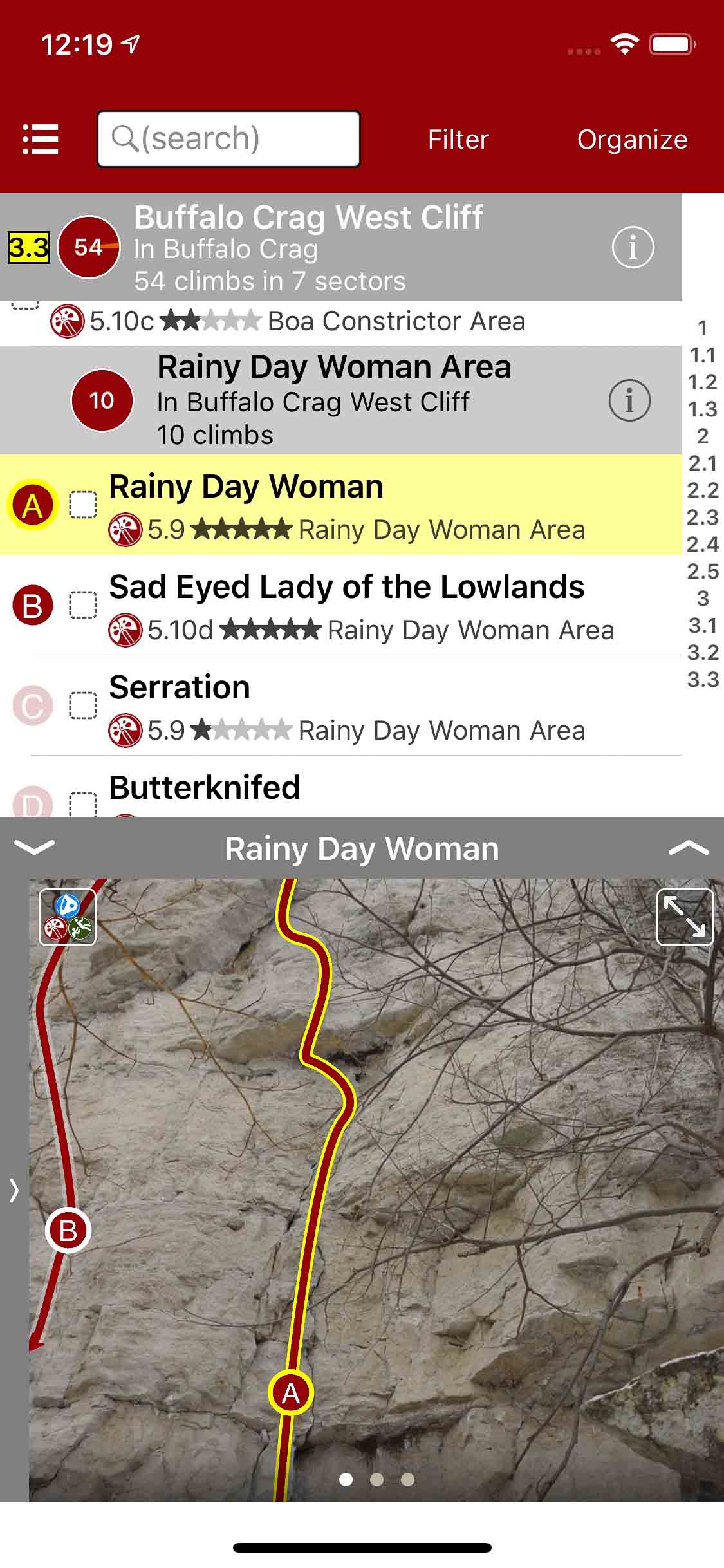
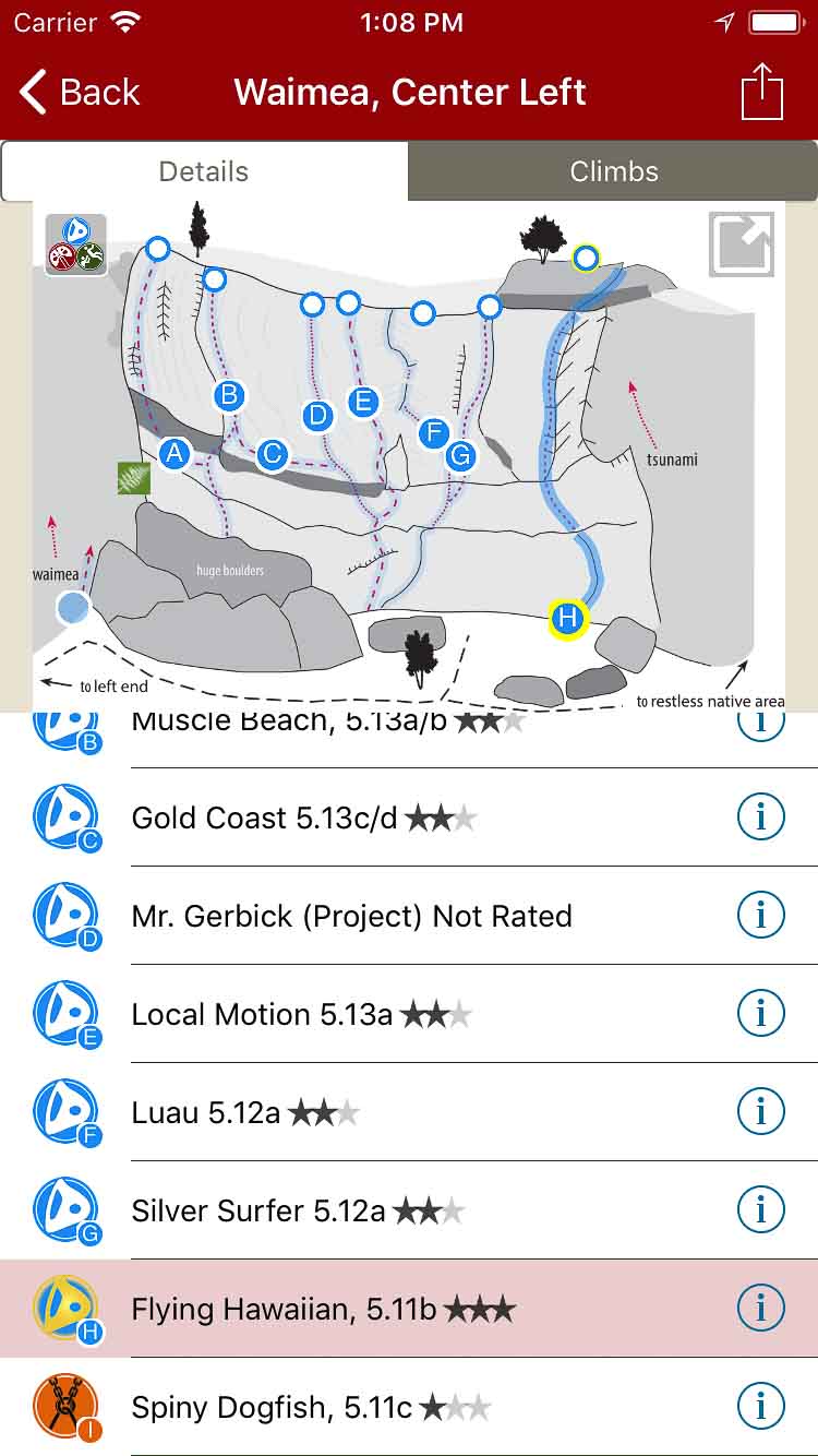
Browse sector details.
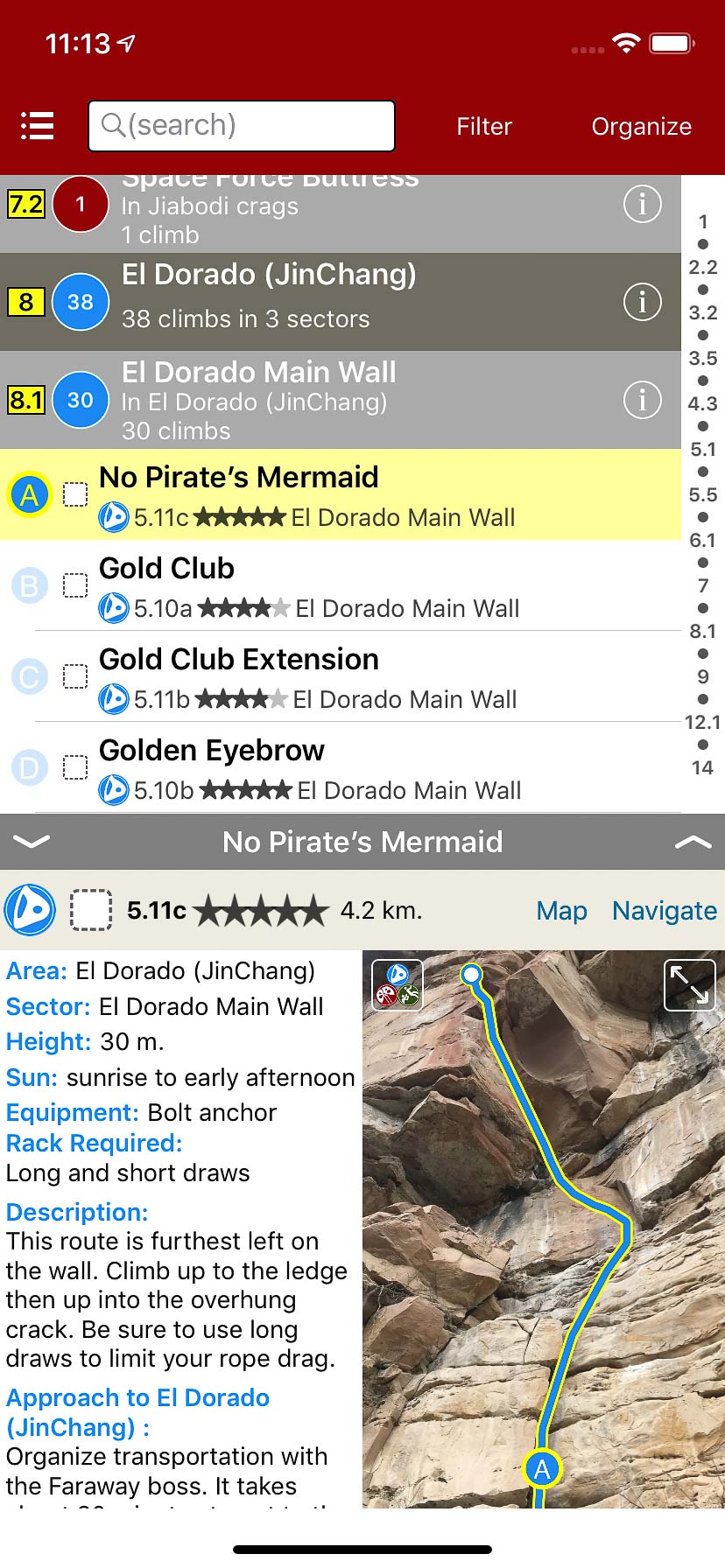
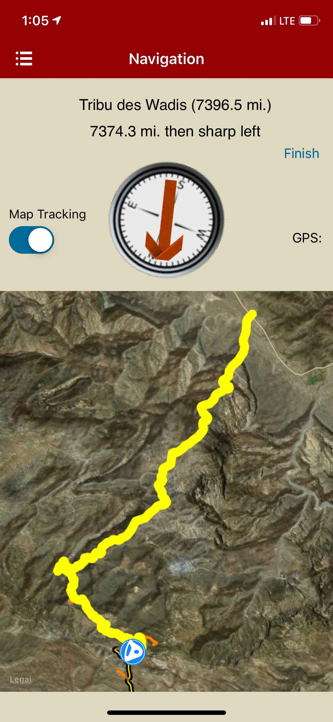
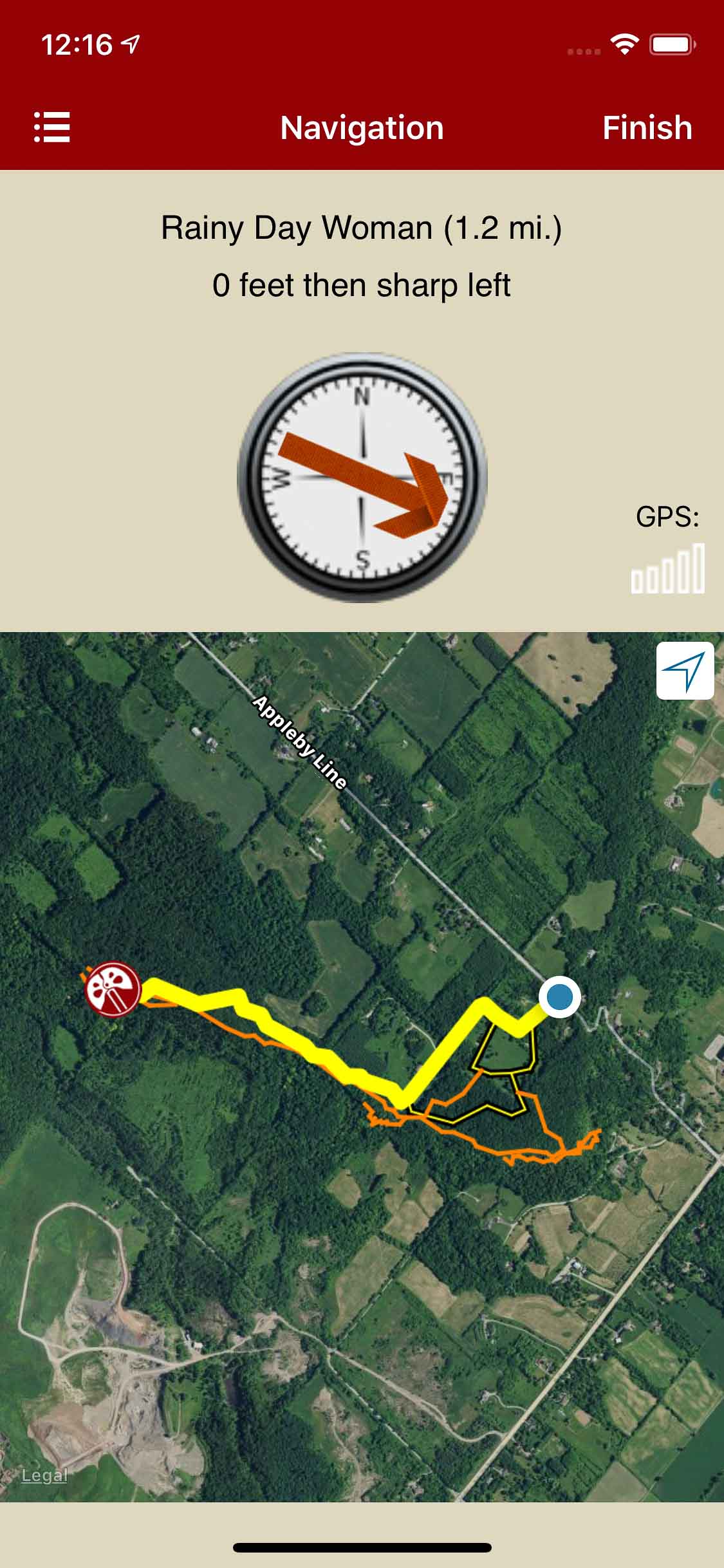
rakkup navigates car to crag.
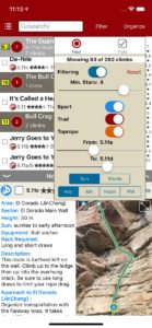
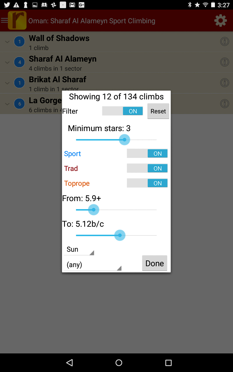
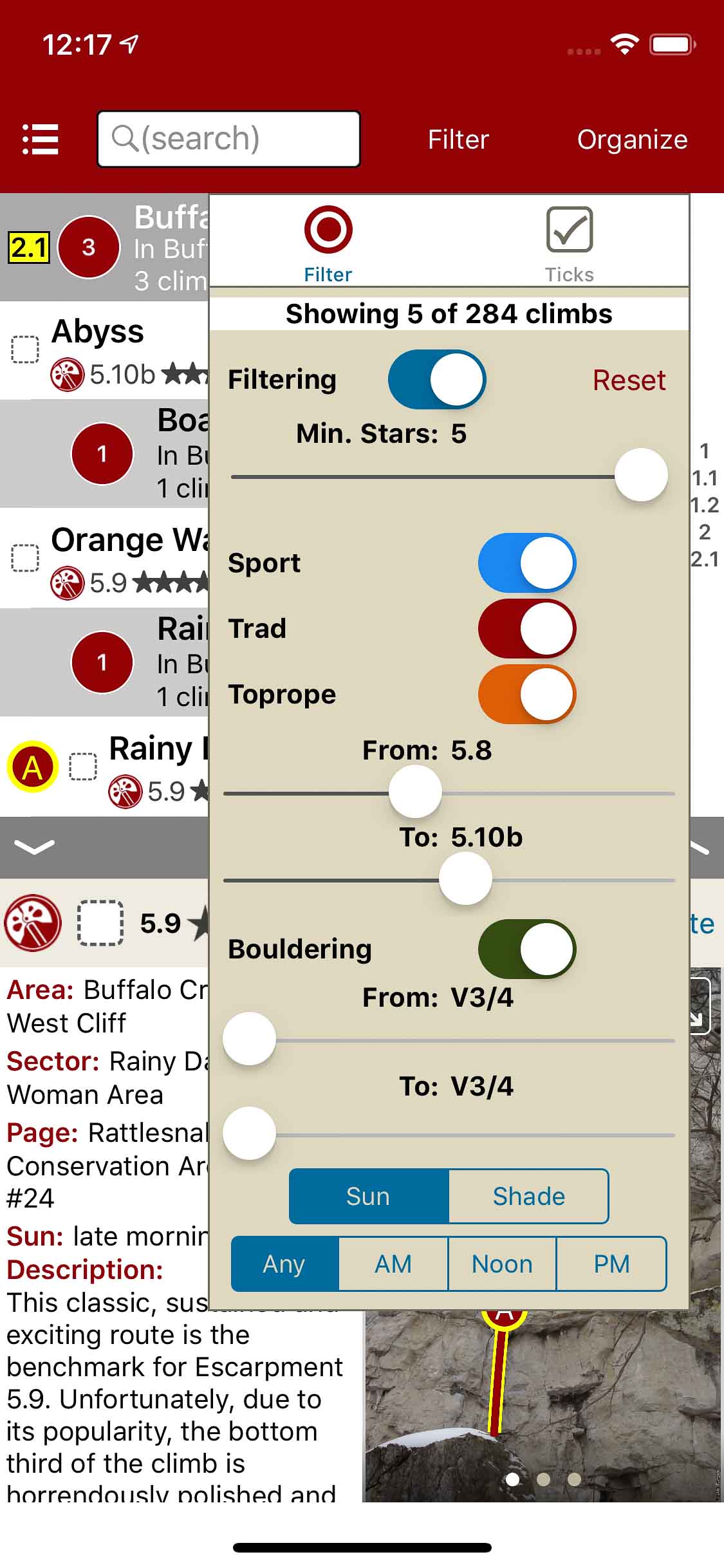
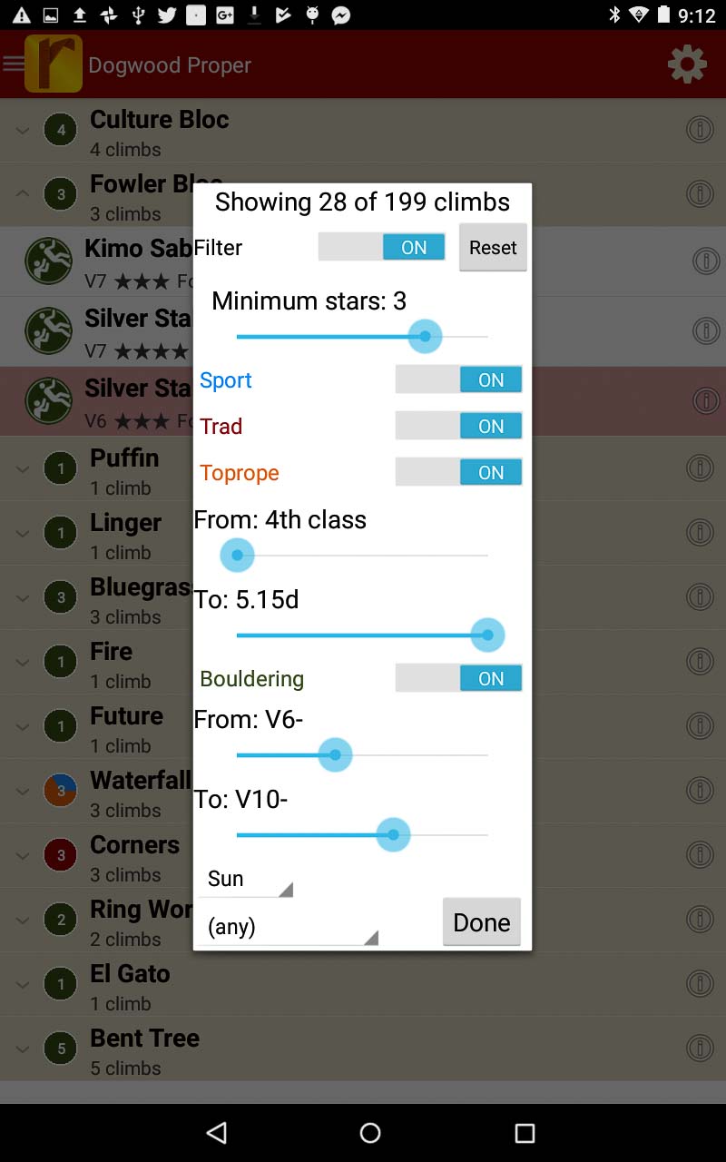
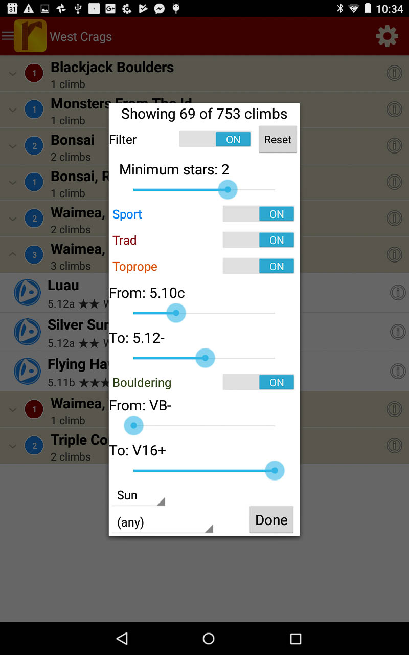
Filter by quality and grade.
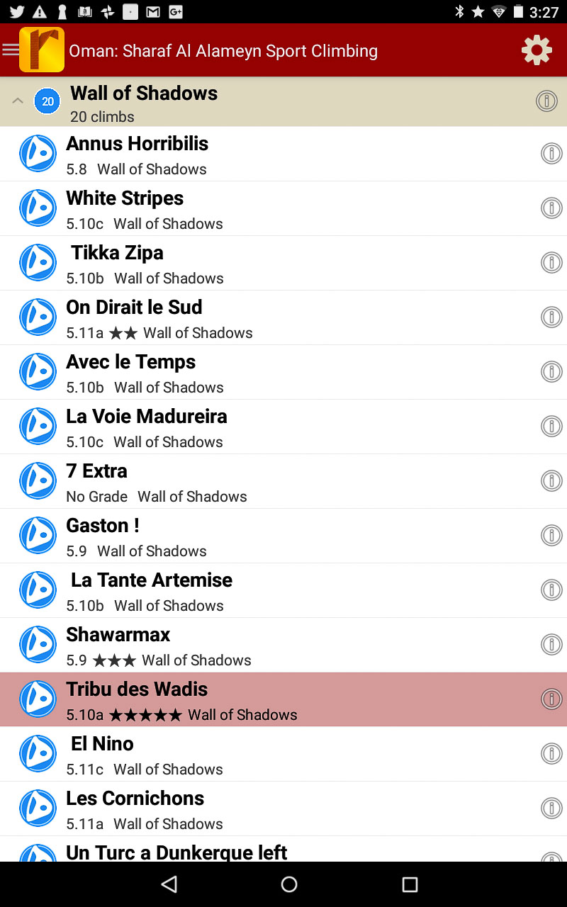
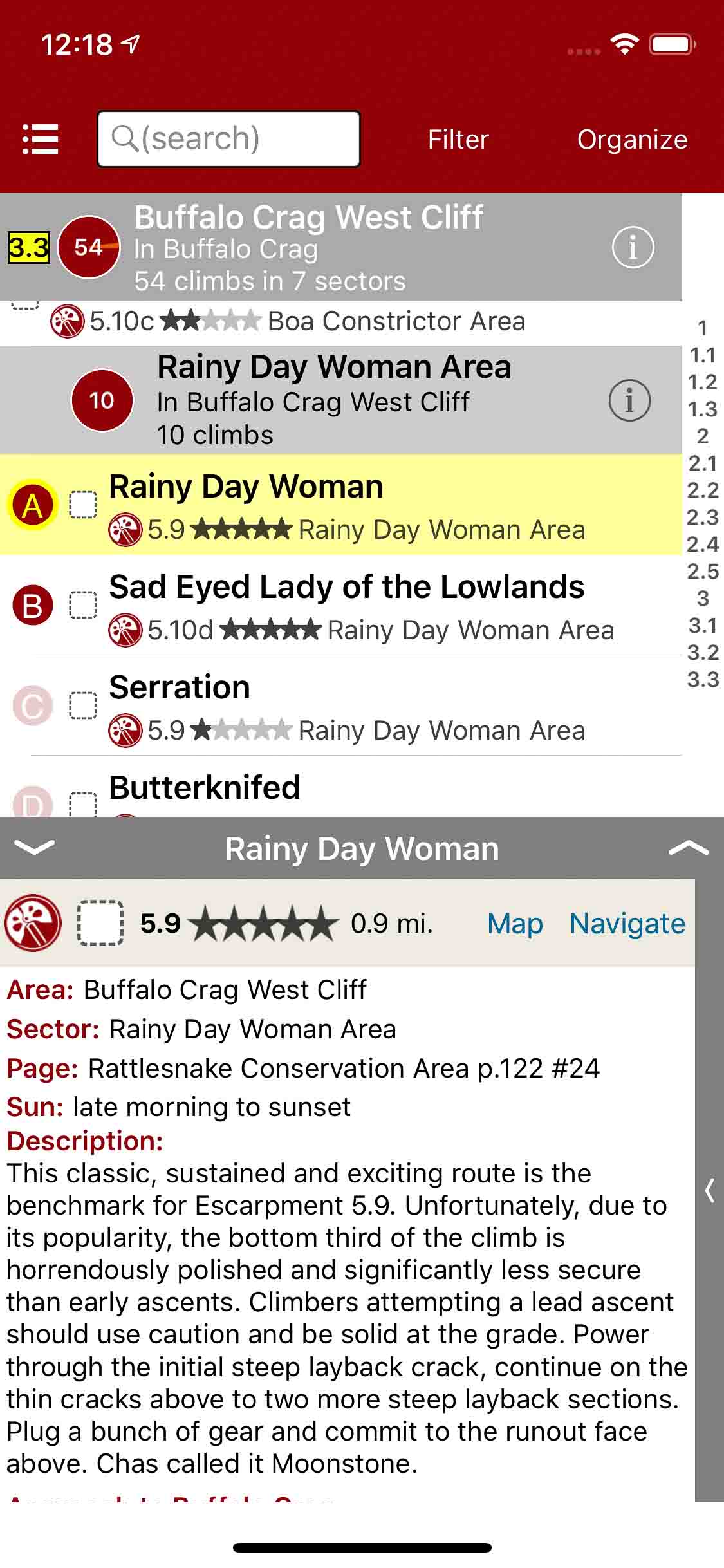
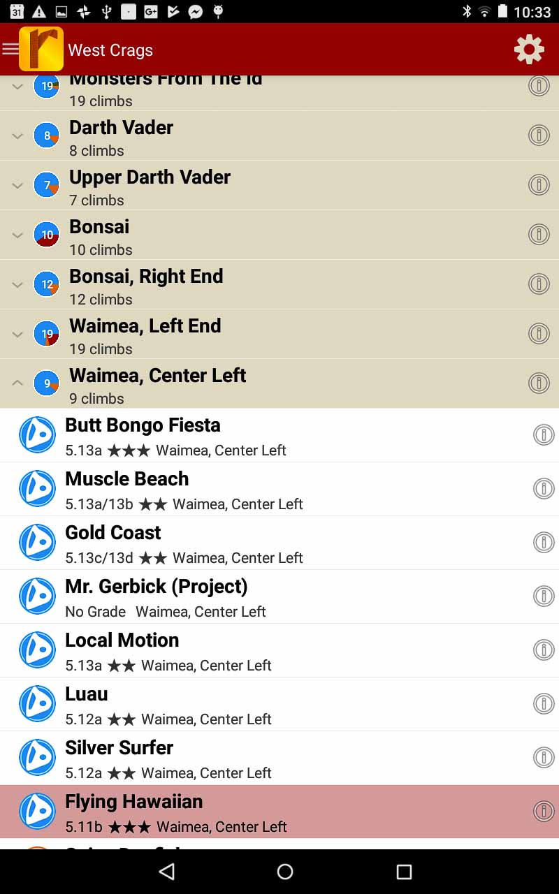
Easily searchable climb list.
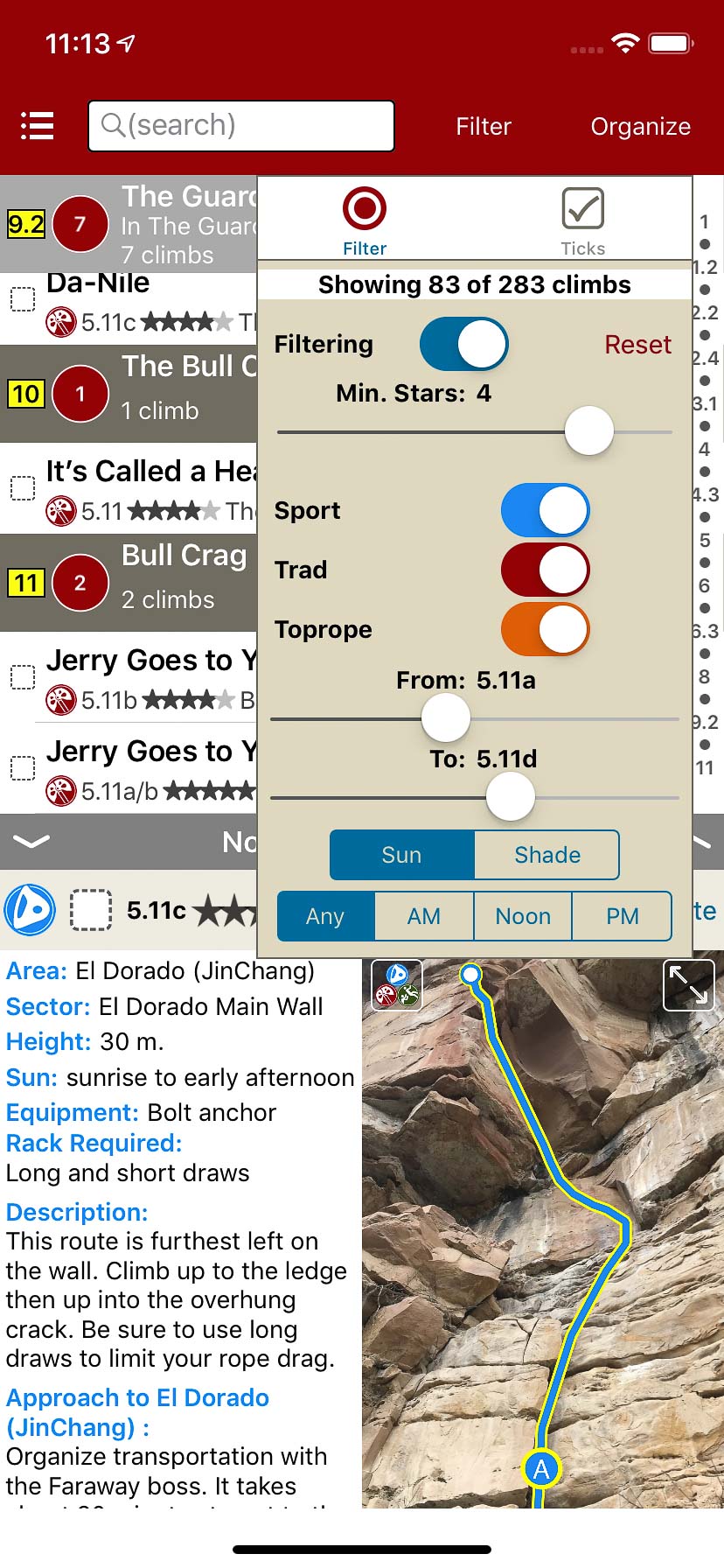
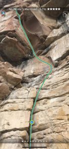
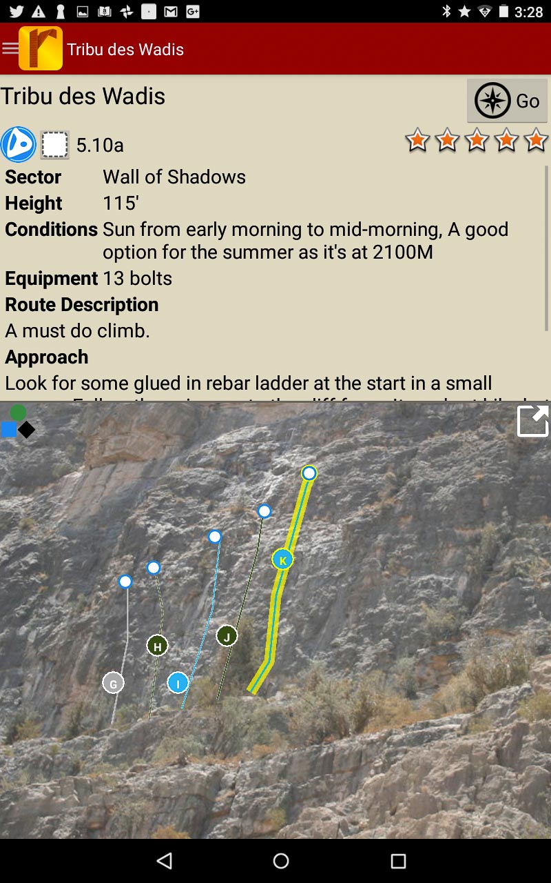
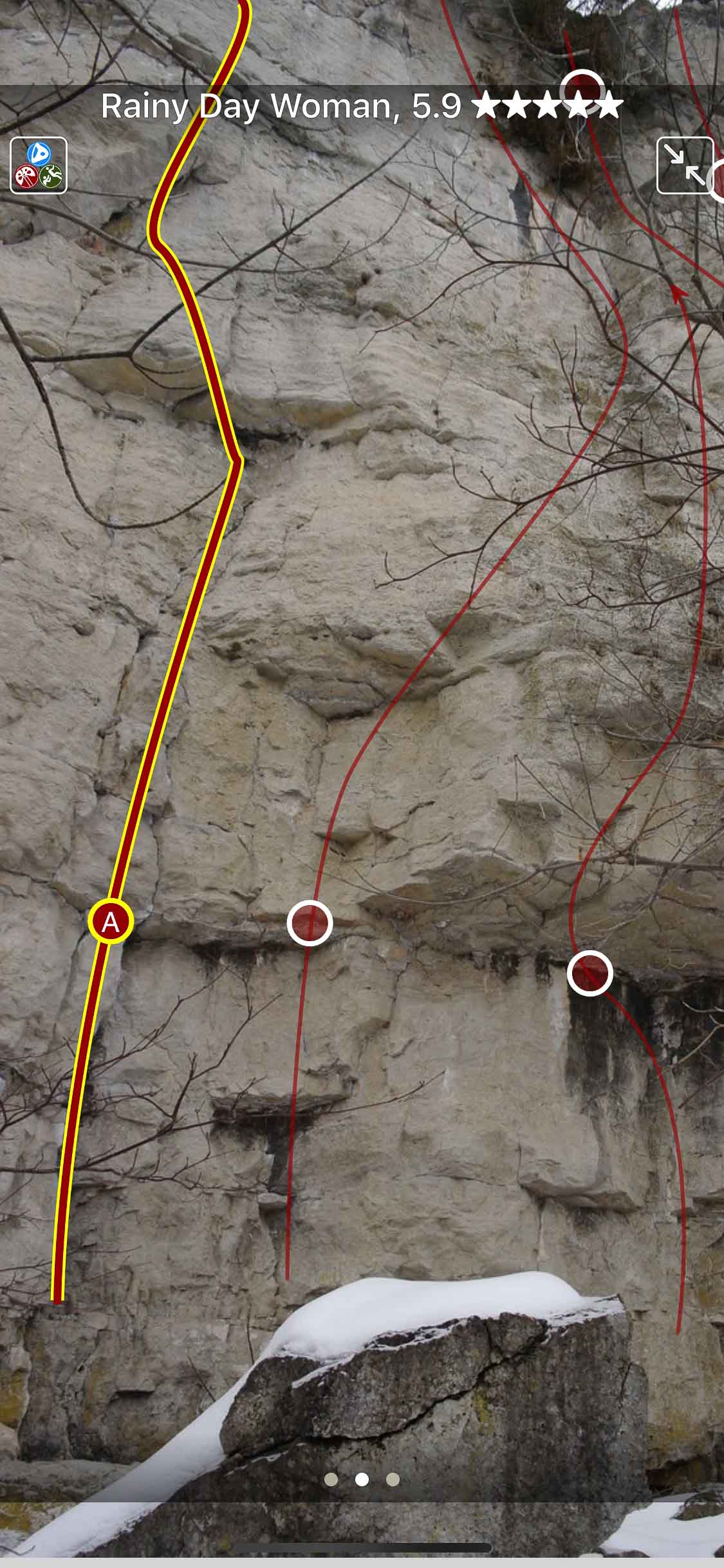
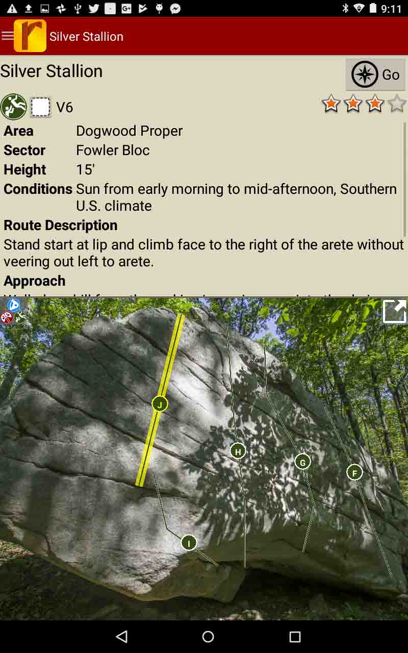
Smart topos find your line.
China: Liming Rock Climbing Guidebook was last modified: December 4th, 2025 by rob
Home to Rattlesnake Point, Bottle Glass Crag and Buffalo Crag, this is by far the best and most accessible area for any new climber looking for their first outdoor climbing experience. All three crags are approached from the top, which greatly simplifies setting up top-ropes, and the easy access to the base (Rattlesnake Point has a metal staircase) eliminates the need for rappelling and other more advanced climbing skills. These are primarily south facing cliffs with a relatively open base, so they dry quickly after rain and are ideal for early season climbing.
Explore Rattlesnake rock climbing via our interactive trail map.
rakkup navigates car to crag then displays a picture when arriving at destination.
Smart topos help locate the correct route.
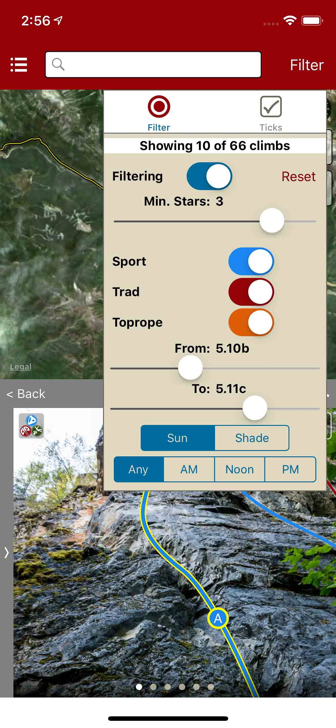
Filter climbs by quality, grade and type.
Quickly browse climb details in the climb list.
Beautiful full screen smart topos.
Ontario: Rattlesnake Conservation Area Rock Climbing was last modified: March 30th, 2019 by todd
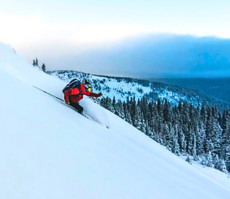
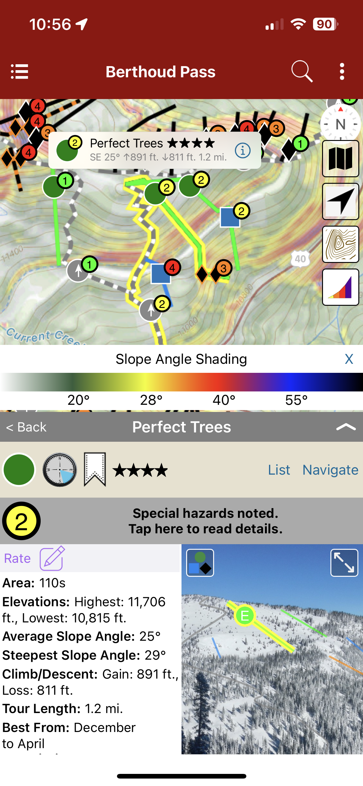
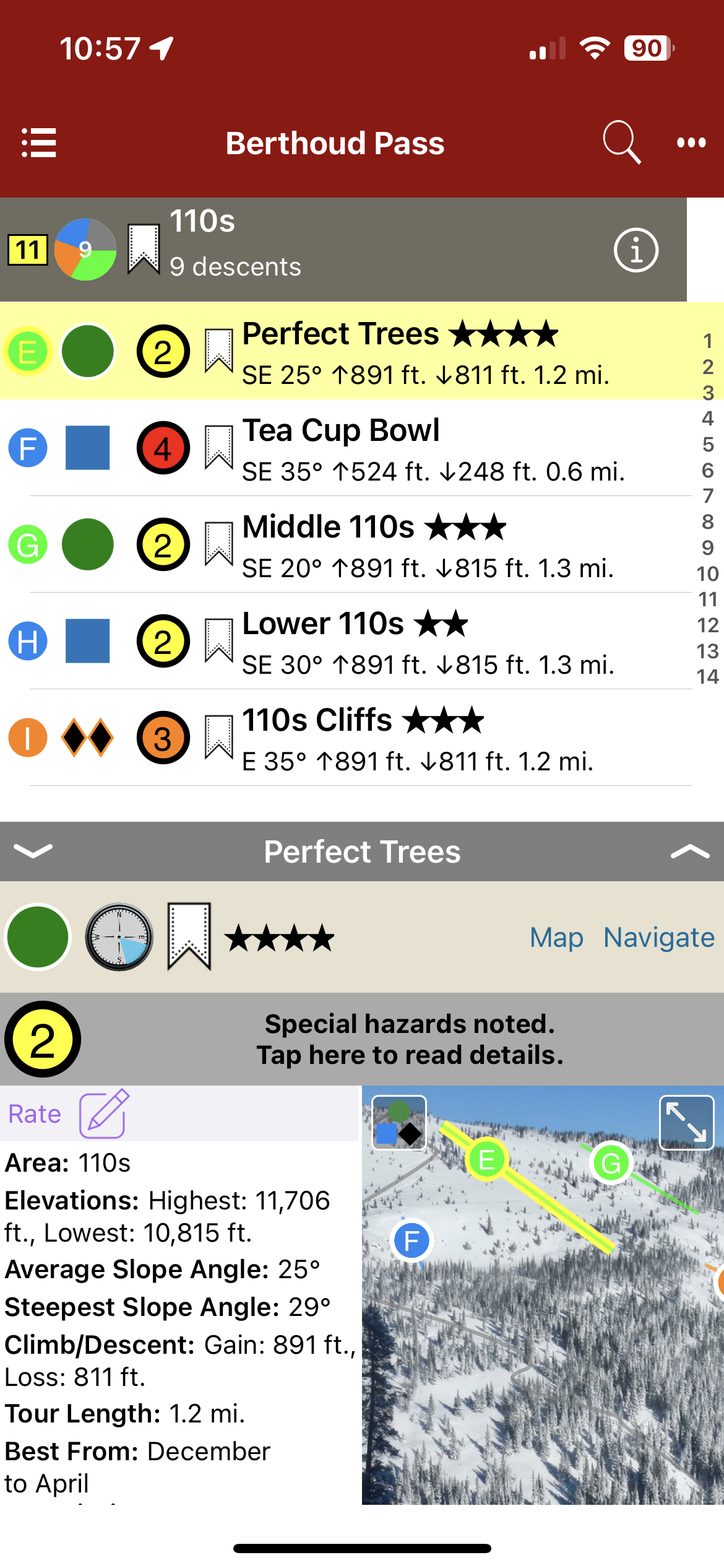
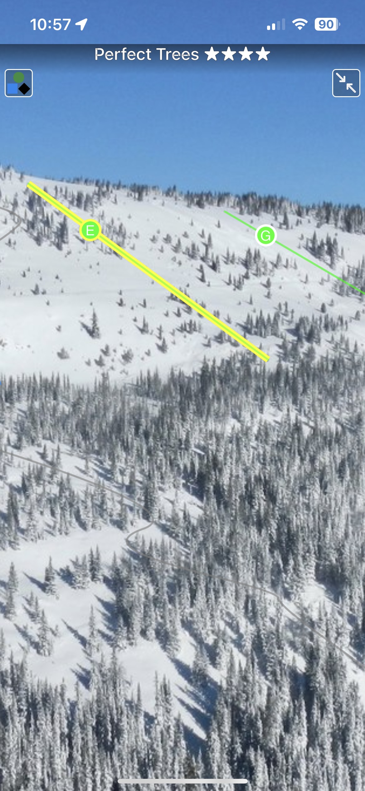
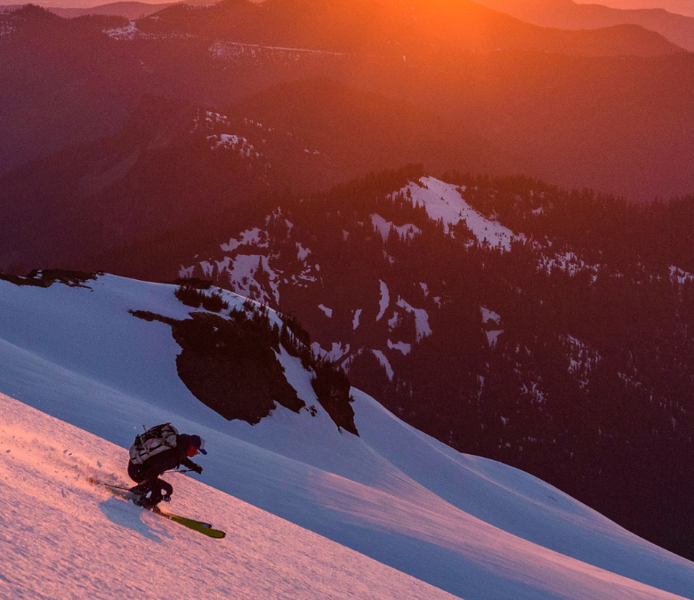
Welcome to the epicenter of backcountry skiing and snowboarding on Colorado’s Front Range. Since the 1930s skiers have been exploring the slopes surrounding US Highway 40 as it climbs and descends Berthoud Pass. This was the former home of one of Colorado’s pioneering ski areas and when it closed, the Pass quickly emerged as the most popular backcountry ski destination on the Front Range. Quick access, a consistent snowpack, and endless discovery continue to draw skiers to Berthoud Pass. The east to west orientation of the Pass, located high above the Fraser River and Clear Creek valleys, attracts a deep snowpack benefiting from both northwest flow and upslope storms. In just over an hour drive from Denver, backcountry skiers have access to numerous trailheads leading into the high basins surrounding the Pass. From pre-work dawn patrols, to car shuttling, to all day epics, Berthoud Pass has an adventure for backcountry riders of all skill levels. The glade skiing, deep powder bowls, and steep couloirs of Berthoud Pass have enough terrain to keep you busy for a lifetime.
Buy digital plus (book and/or map) and the price includes $4.00 for shipping, a screaming deal! When you buy a bundle, you can use your digital rakkup guidebook immediately.
Map view
List view
Full screen photo topos
Backcountry Skiing: Berthoud Pass, Colorado Guidebook was last modified: November 21st, 2023 by todd
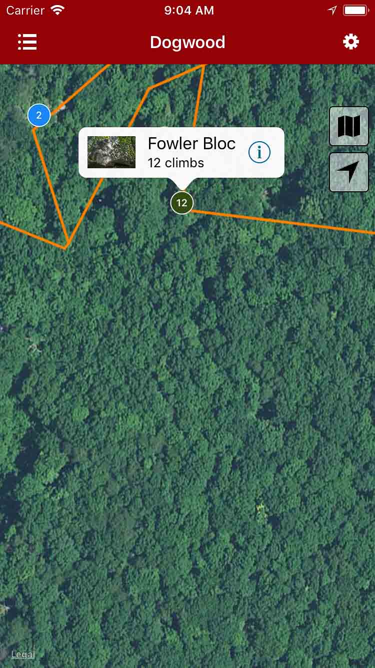
An ongoing effort to document all routes and boulder problems along the Cumberland trail section near Dogwood Lane. Visit dogwoodclimbing.com for registration for this access point.
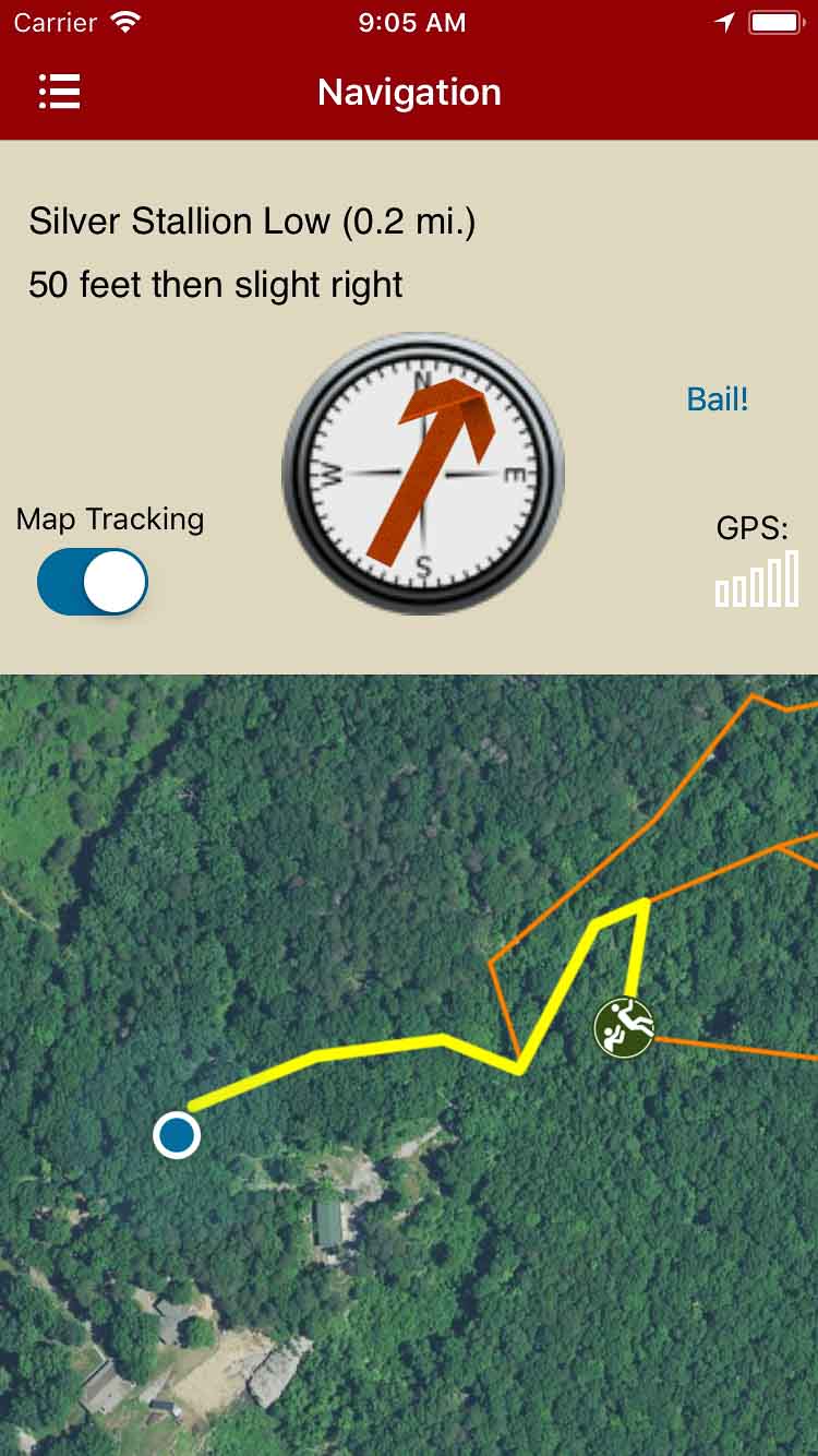
Explore Dogwood bouldering and climbing via our interactive trail map.
rakkup guides you turn by turn to your boulder then shows you a picture when you arrive. Awesome.
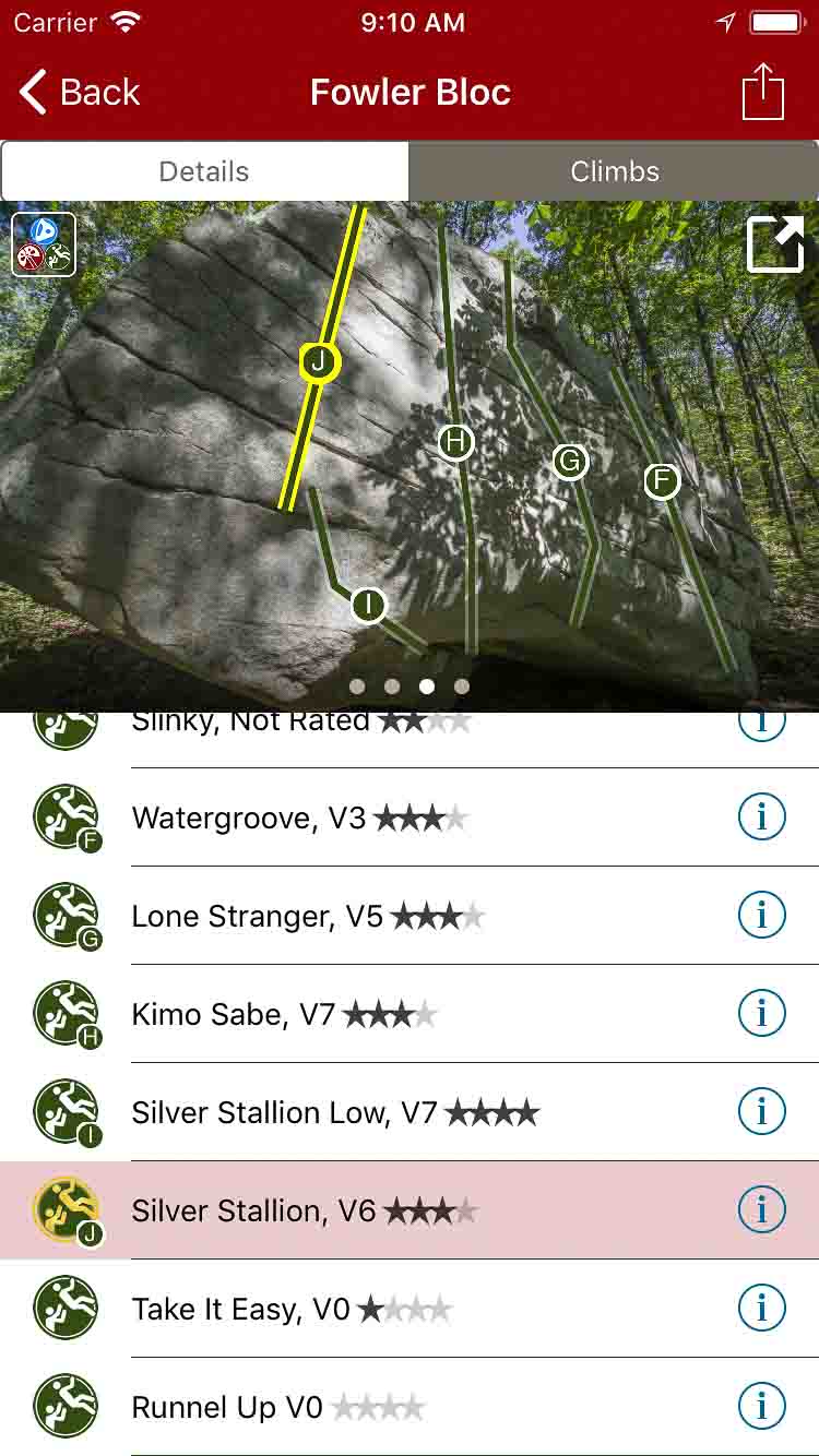
Tap on a problem name, see where it’s located on the image. Tap on a problem badge in the image, discover what problem it is.
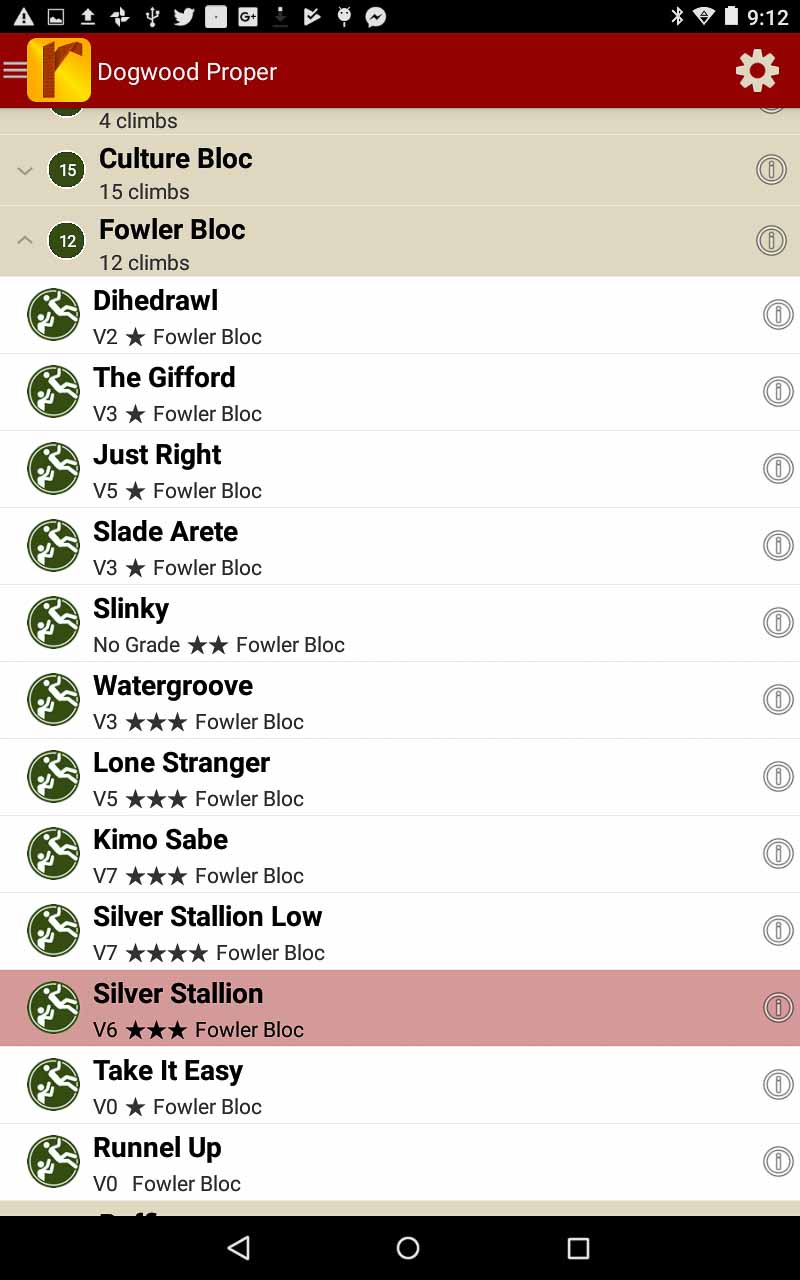
All the Dogwood problems and climbs in a searchable list.
Sort to only the grades you want to see.
Descriptions and photos by local experts.
Dogwood Rock Climbing Guidebook was last modified: June 19th, 2018 by todd
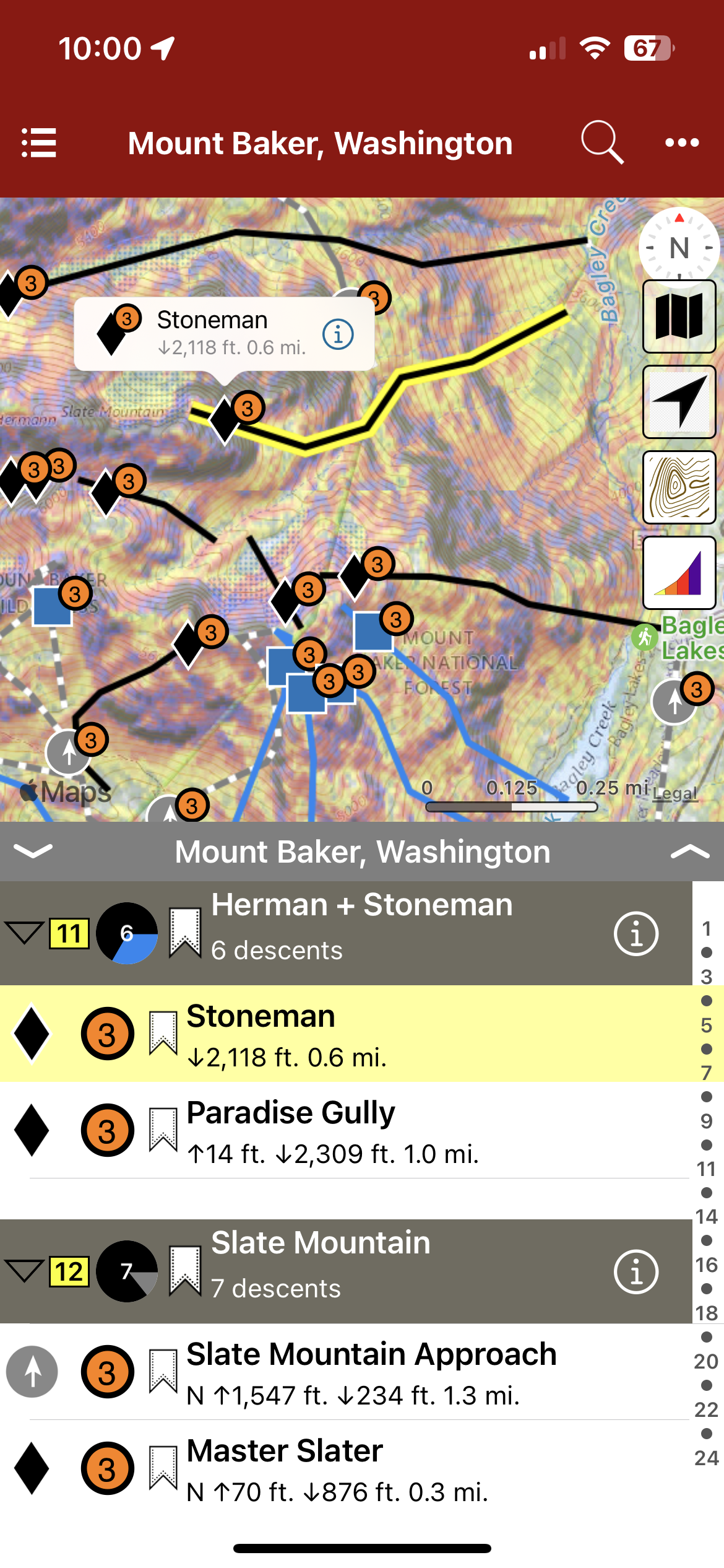
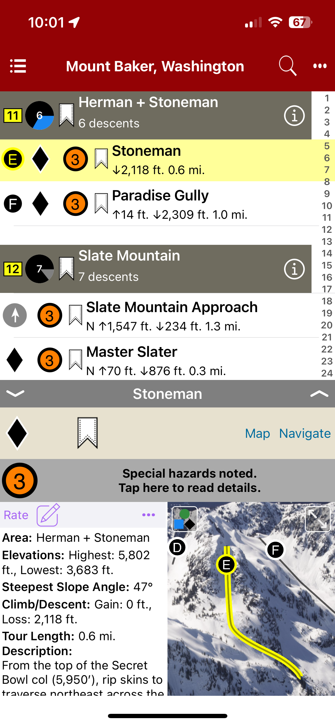
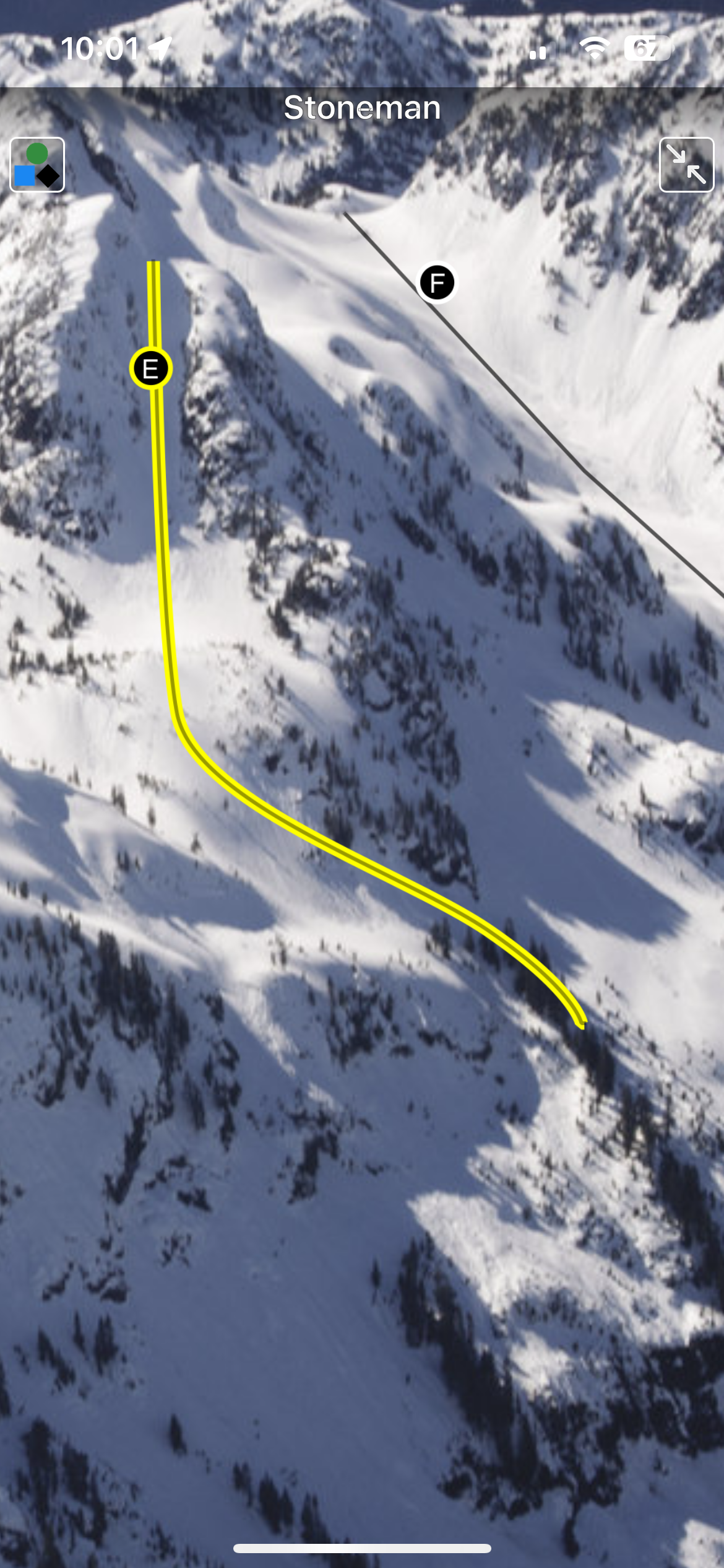
The Mount Baker backcountry extends east to west from Mt. Shuksan to Mt. Baker connecting ridges of Shuksan Arm to Ptarmigan Ridge with expansive glaciers, powder bowls, technical couloirs, powder-filled glades and plenty of lower elevation trees. Many ski routes begin directly from the Mt. Baker Ski Area averaging the deepest snowpack in North America guaranteeing you can find fresh tracks somewhere. In this digital book you will find run descriptions, skintracks, elevation gain and loss, trailhead info, hazards, average slope angles and much more.
Map view
List view
Full screen photos
Backcountry Skiing: Mount Baker, Washington Guidebook was last modified: November 21st, 2023 by todd
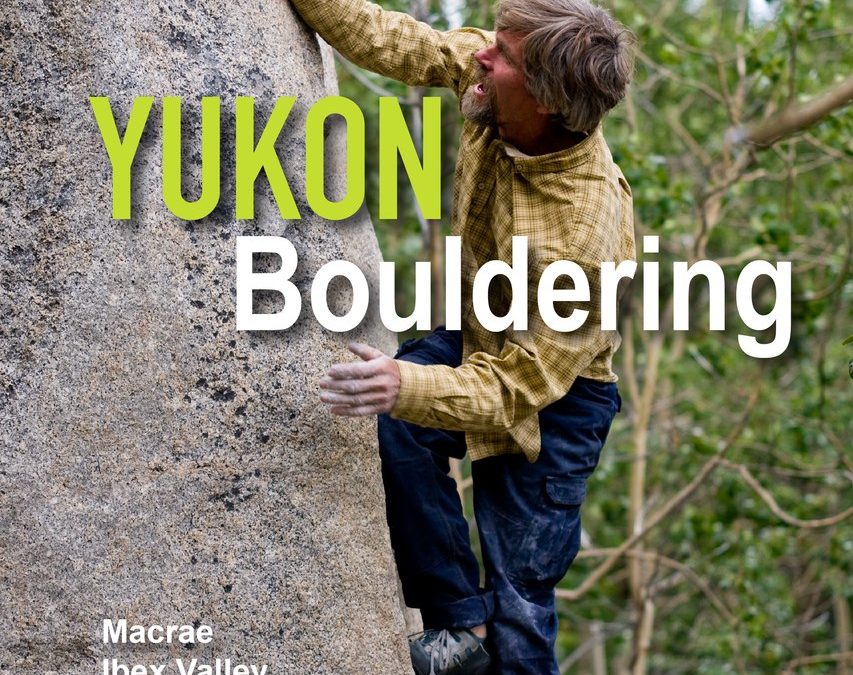
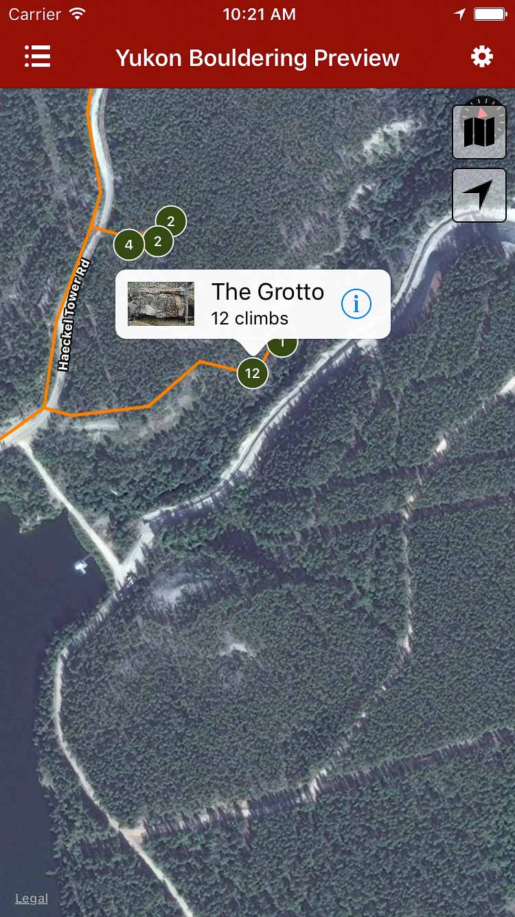
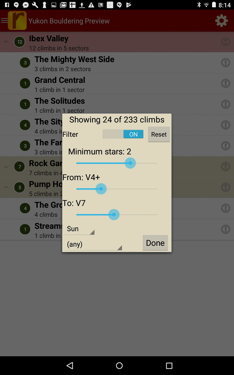
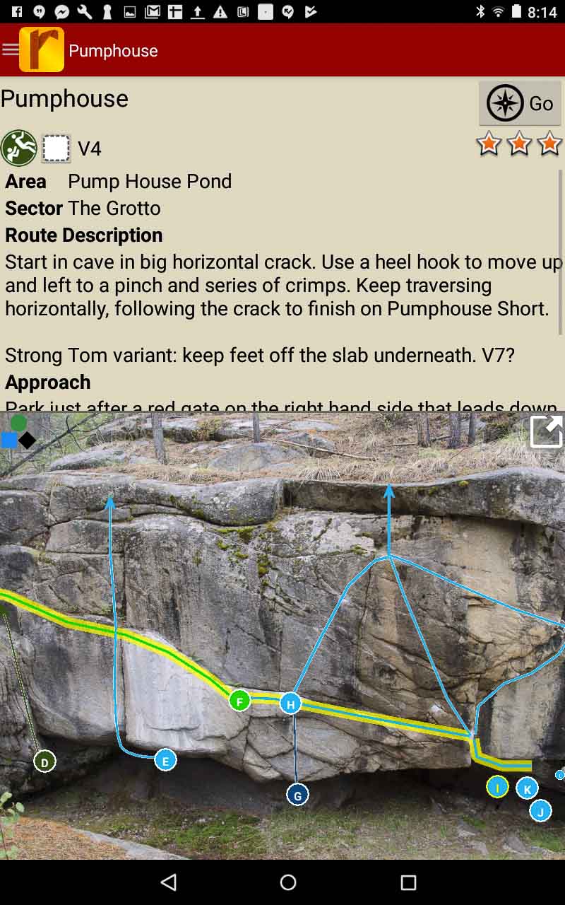
Yukon Bouldering by Sierra Allen in collaboration with Ethan Allen and Eric Allen. The digital guide to bouldering in the Yukon Territory of northwestern Canada. Featuring 6 of the most accessible areas that surround the Yukon’s population hub and capital city, Whitehorse: The Ibex Valley, Rock Gardens, Pump House Pond, Macrae, Carcross Cutoff and Emerald Lake. In this second release, we’ve included Alsek Pass, a gem of central Yukon, located near the town of Haines Junction. This digital guide for Android, iPhone and iPad devices offers detailed descriptions and gps navigation of 20 sectors and nearly 300 boulder problems. Future updates available with no extra charge after purchase will gradually include additions of other sectors and areas still in development.
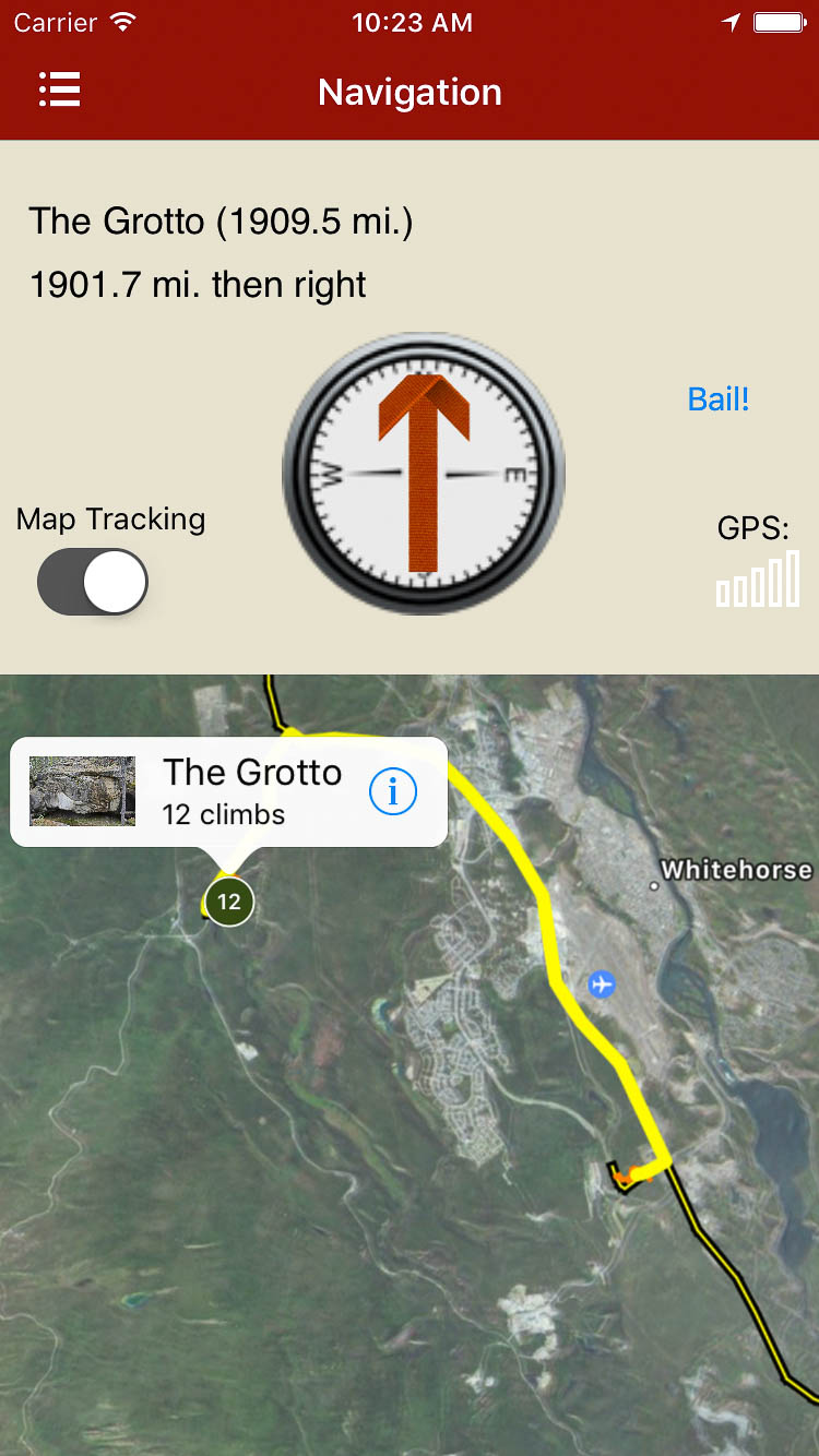
Explore Yukon Bouldering via our interactive trail map.
rakkup guides you car to boulder then displays your destination’s picture when you arrive. Awesome.
Smart topos find your line!
Yukon bouldering problems in a searchable list!
Filter problems to the grades you want.
Detailed route descriptions written by locals.
Yukon Bouldering Guidebook was last modified: August 18th, 2019 by
Staunton State Park opened in the spring of 2013 with 60 established rock climbs. Over the past few years that number has more than tripled! Located a mere 45 minutes west of Denver, Staunton offers great climbing in a beautiful pine forest.
You’ll find everything from 3 pitch moderate trad routes to overhanging sport and trad test pieces, as well as a growing assortment of well protected moderates. Who knows, maybe you’ll even find your own FA! With that being said, all of the proceeds from this guide will be used to develop new routes and maintain existing routes in the park.
In this release you will find comprehensive beta to:
Staunton Rocks
Dines Cliff
The Raven
Death By Wildlife Crag
Chimney Rock
Explore Staunton via our interactive trail map.
rakkup navigates car to crag then displays a picture when arriving
Split screen displays all relevant information on one screen.
Quickly browse or search Staunton’s climb list.
Filter climbs by quality, grade and type.
Beautiful full screen smart topos.
Staunton State Park Rock Climbing Guidebook was last modified: August 20th, 2019 by
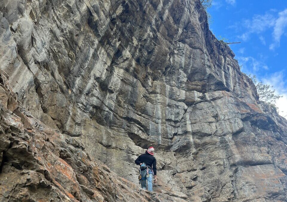
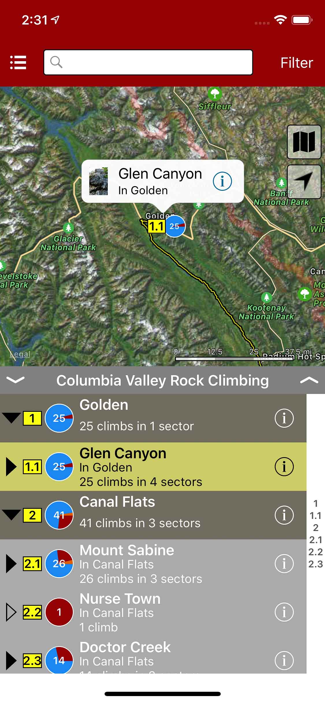
This guidebook is a collection of routes and crags hidden here and there along the Columbia Valley. The purpose of this guidebook is to promote the passion of exploration and discovery to current and future generations through climbing. We want to share the story of climbing in the Valley, talk about the pioneers and route setters through an evolving and comprehensive guide app.
//
Ce guide app est un recueil de voies et de sites cachés à gauche et à droit le long de la Columbia Valley. Le but de ce guide est de promouvoir l’escalade ainsi que de transmettre aux futurs générations la passion de l’exploration et de la découverte. Nous voulons partager l’histoire de l’escalade de la Vallée, parler de ces pionniers et des ouvreurs à travers un guide évolutif et compréhensif.
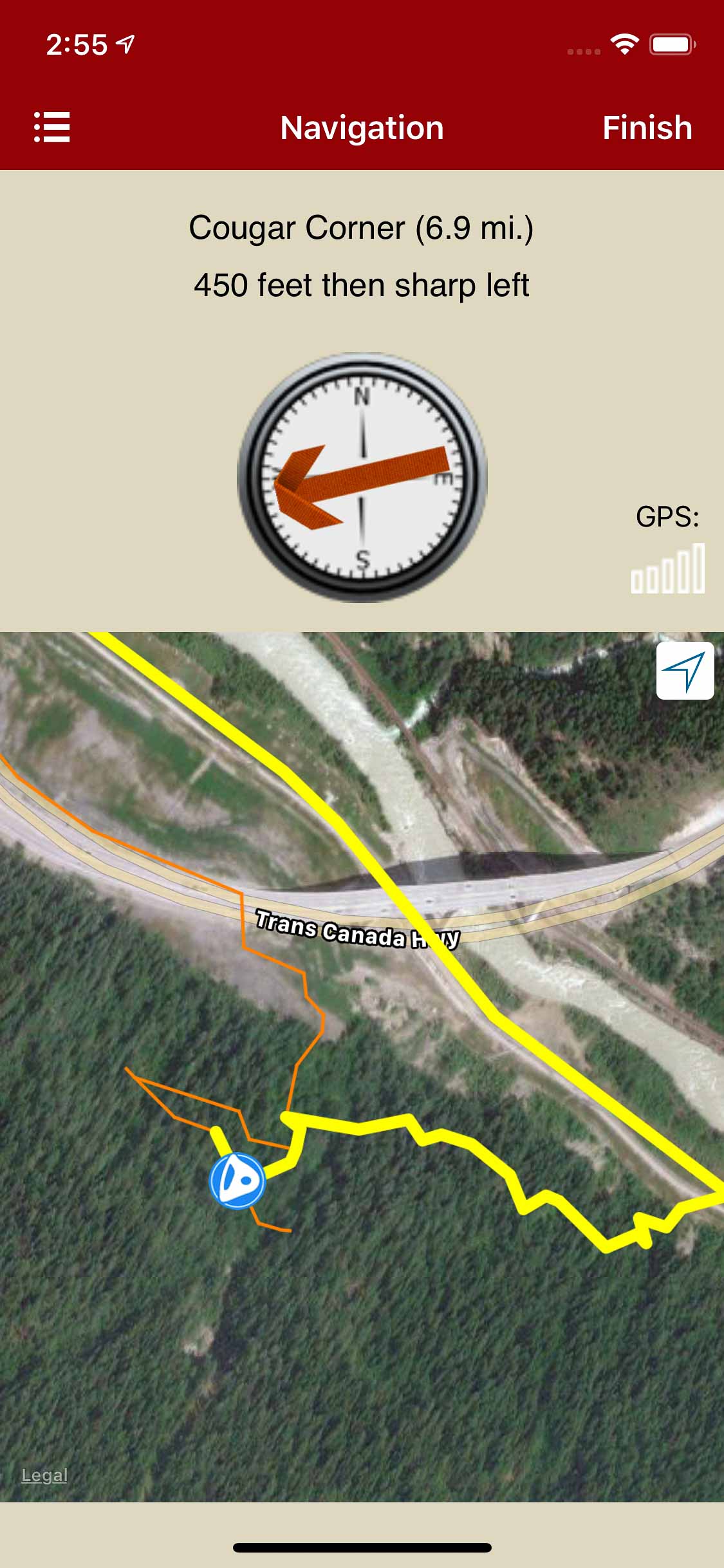
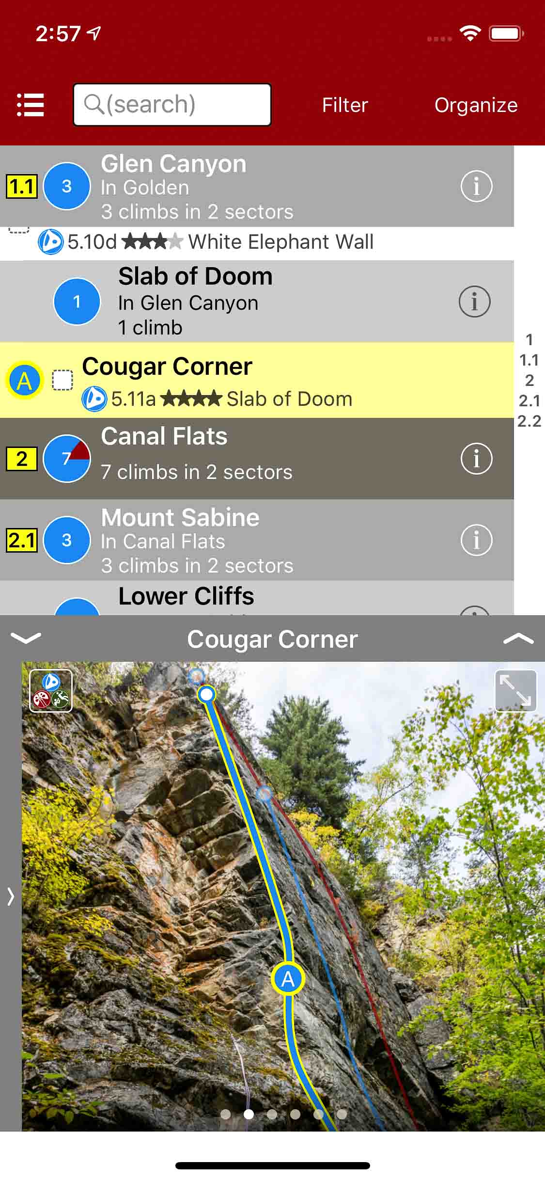
Explore Columbia Valley Rock Climbing via our interactive trail map.
rakkup navigates car to crag then displays a picture when arriving
English and French climb descriptions
Browse climb photographs and topos
Filter climbs by quality, grade and type.
Beautiful full screen smart topos.
British Columbia: Columbia Valley Rock Climbing was last modified: June 14th, 2024 by todd
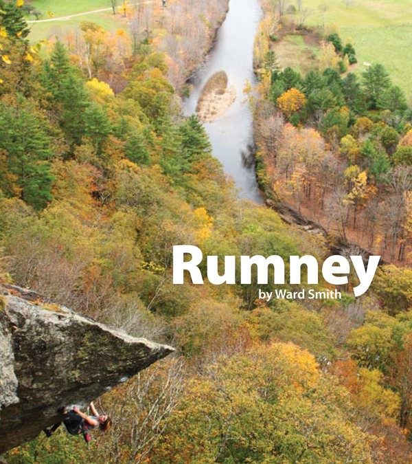
Rumney, by Ward Smith is the definitive guide to the premier sport climbing crag that Rumney has become. Near Plymouth New Hampshire, Rumney is the northeast climbing destination for local and traveling climbers.
Written by Ward Smith, this guide contains topos and written descriptions covering over 700 routes, rated 5.0 to 5.15 (most in the 5.8 to 5.12 range).
Buy both versions of the guidebook (print and digital) for only $50.99! That price includes $7.00 for shipping, meaning that you get the print book for only $30 more! A good deal on a beautiful guidebook!
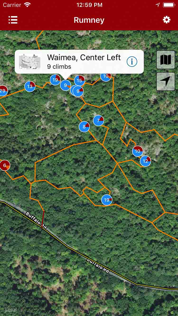
Explore Rumney via our interactive trail map.
rakkup guides you car to crag then displays your destination’s picture when you arrive.
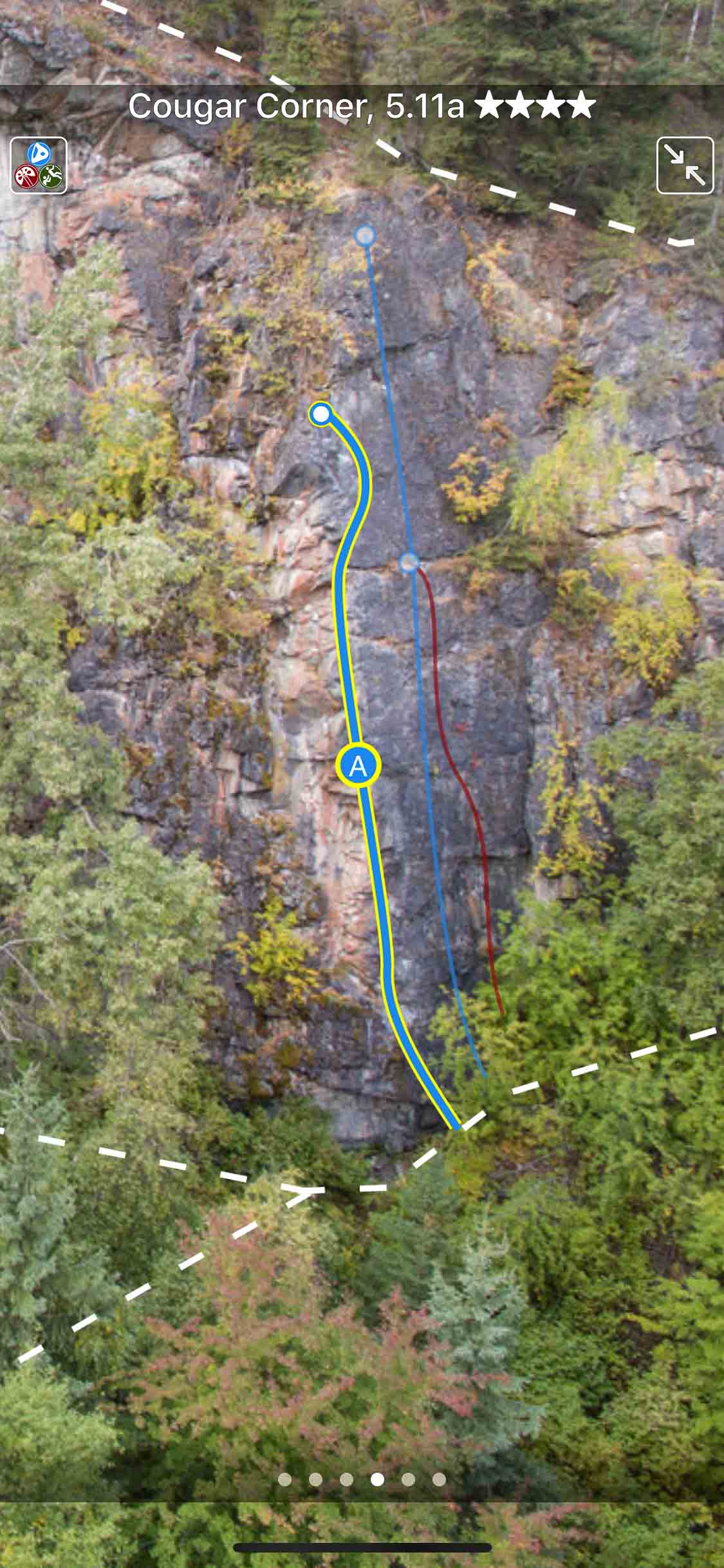
Smart topos find your line!
Rumney climbs in a searchable list!
Filter climbs to the grades you want.
Detailed climb descriptions and hand drawn topo maps.
Rumney Rock Climbing Guidebook was last modified: May 9th, 2024 by todd