by todd | Jul 1, 2019
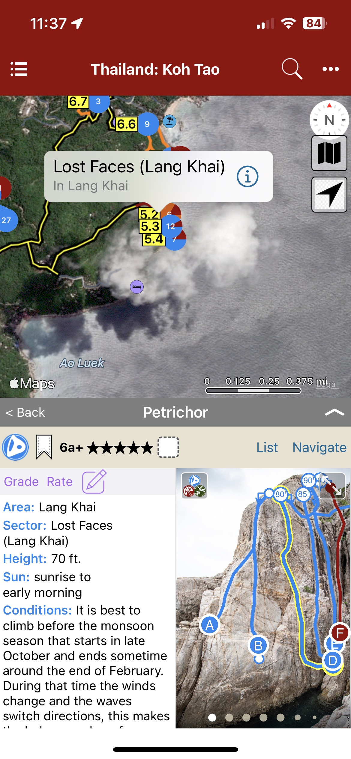
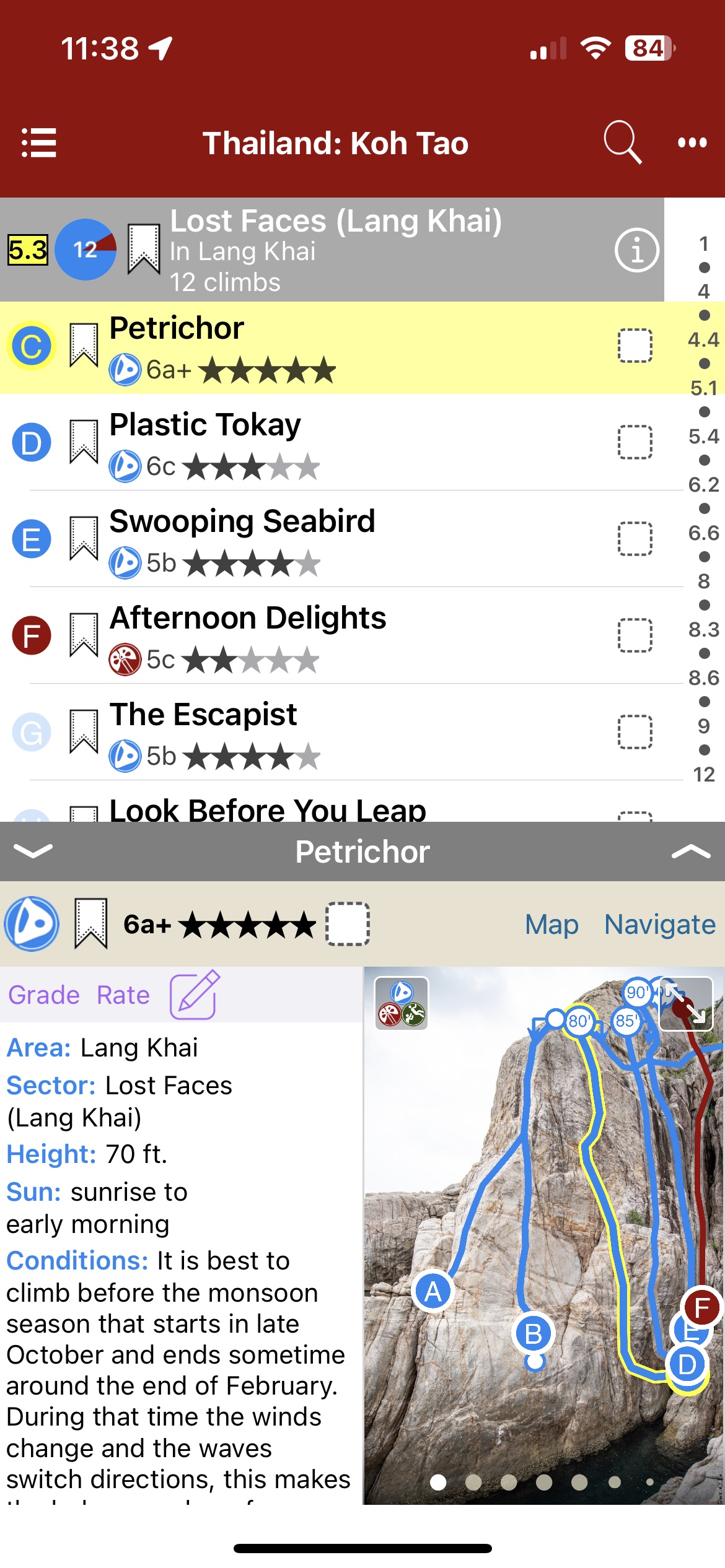
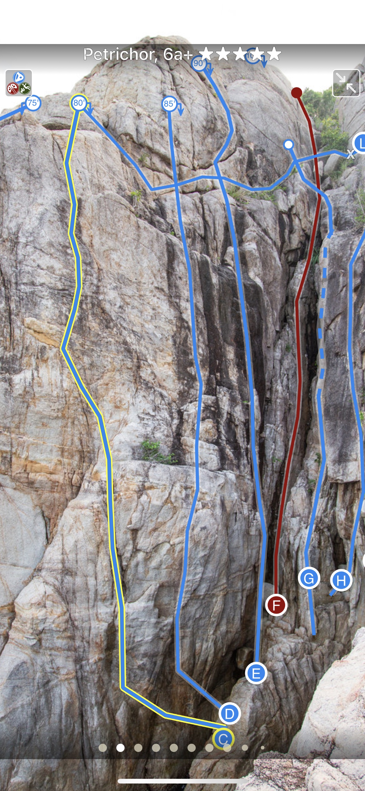
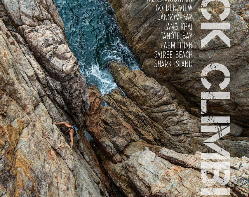
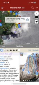
Koh Tao Rock Climbing
by Kelsey Gray
Hatcher Pass Rock Climbing
A guidebook for the small but concentrated island of Koh Tao. The island is known for its diving but is becoming more popular with climbers as they discover its granite cliffs and boulders. This guidebook includes most of the rock climbs on the island with 180 routes.
-
-
Map view
-
-
List view
-

-
Full screen topos
by todd | May 17, 2019
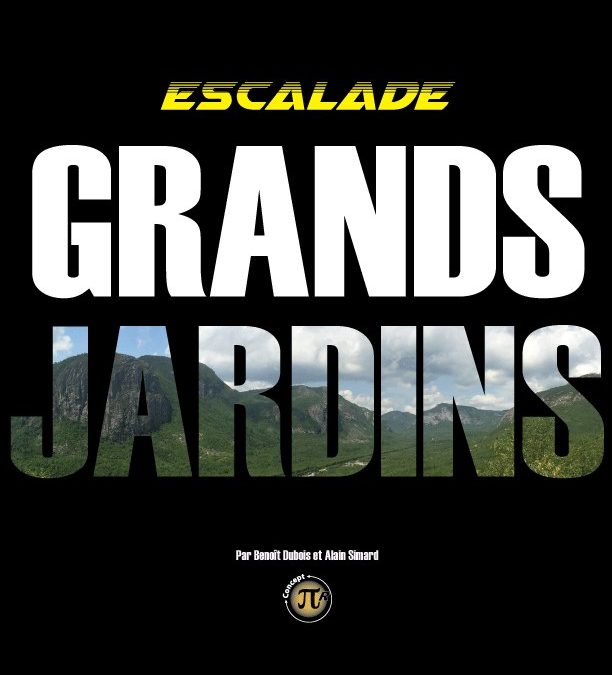
Québec: Escalade Parc des Grands-Jardins
by Benoit Dubois et Alain Simard
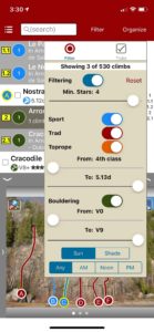
Le Parc des Grands-Jardins et la Zec des Martres est un terrain d’aventure dépaysant à 15 minutes de St-Urbain. Venez grimper des voies mémorables dans un environnement grandiose! La nouvelle version du topo sur rakkup contient 130 voies (+ de 300 longueurs de corde), 160 photos (120 nouvelles) et des informations détaillées sur les différentes voies, dont 23 nouvelles. Cette App nous permettra de faire des mises à jour régulières sans avoir à tout renuméroter et refaire la mise en page du texte et des photos manuellement comme auparavant. D’un simple clic, vous pourrez télécharger une mise-à-jour. Impossible de se perdre grâce aux cartes GPS, vous pourrez accéder sans tarder à vos projets! La quasi-totalité des voies est en escalade traditionnelle en multi-longueurs. On compte 7 voies d’escalade sportive et 3 courtes voies de moulinette pour les enfants/débutants.
-

-
Explore Grands-Jardins via our interactive trail map.
-

-
rakkup navigates car to crag then dispalys a picture when arriving at destination.
-

-
Action photos!
-

-
Filter climbs by grade and type.
-

-
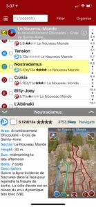
Quickly browse climb details in the climb list.
-

-
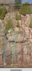
Beautiful full screen smart topos.
by todd | Mar 6, 2019
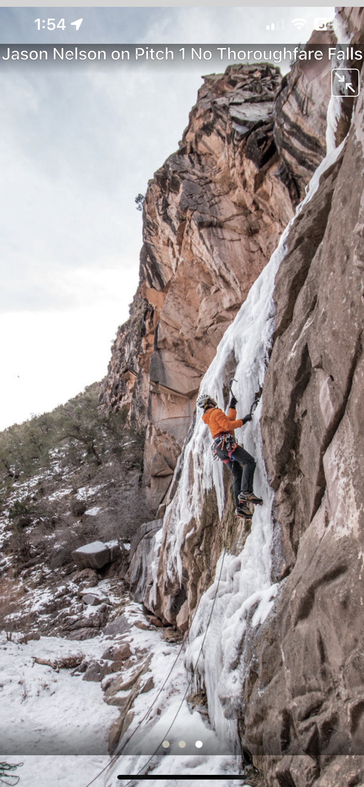
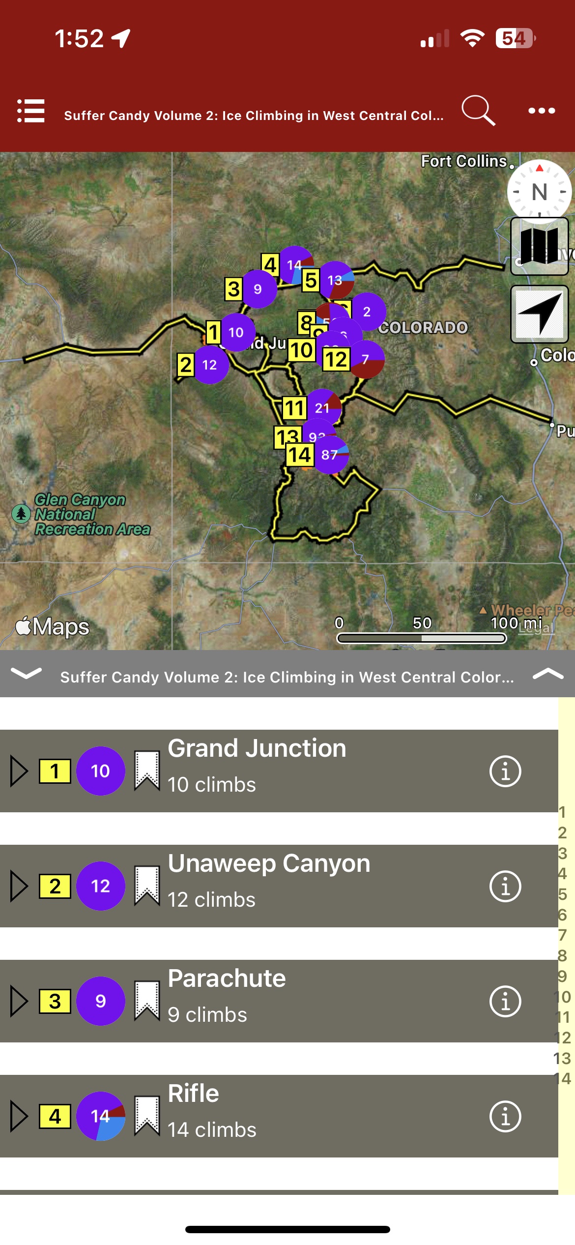
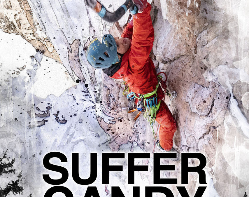
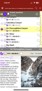
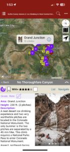
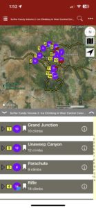
SUFFER CANDY VOLUME 2
by Jason Nelson
Visual Adventures | Suffer Candy Volume 1 | Climbs of the Million Dollar Highway
This guidebook covers ice, mixed and drytooling routes in Western Colorado. Climbs around the following locations are included; Grand Junction, Parachute, Rifle, Glenwood Springs, Aspen, Redstone, Blue Mesa, Crested Butte, Unaweep Canyon, and Lake City.
-
-
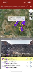
Map over Sector
-
-
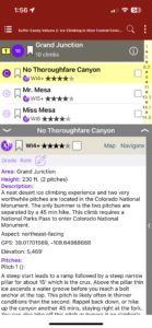
LIst over description
-
-
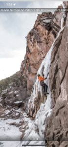
Full screen image
-
-
List, description, image
-
-
Map, Description, Image
-
-
Map Sector
Price includes domestic US shipping for digital plus book bundle.
by todd | Feb 6, 2019
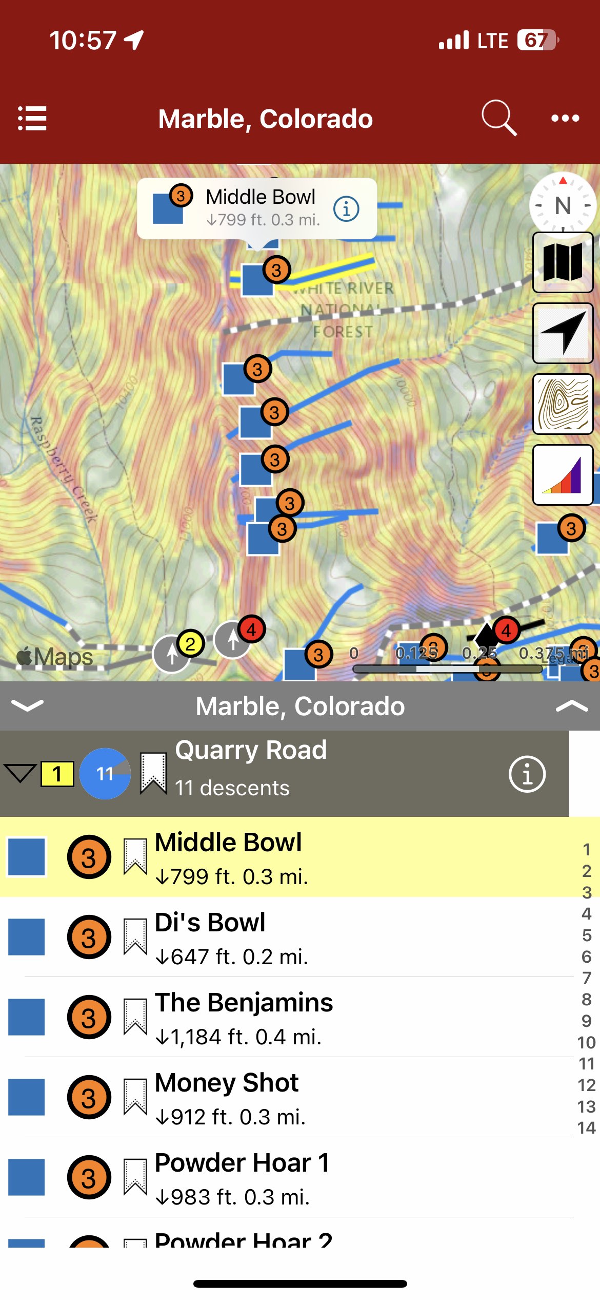
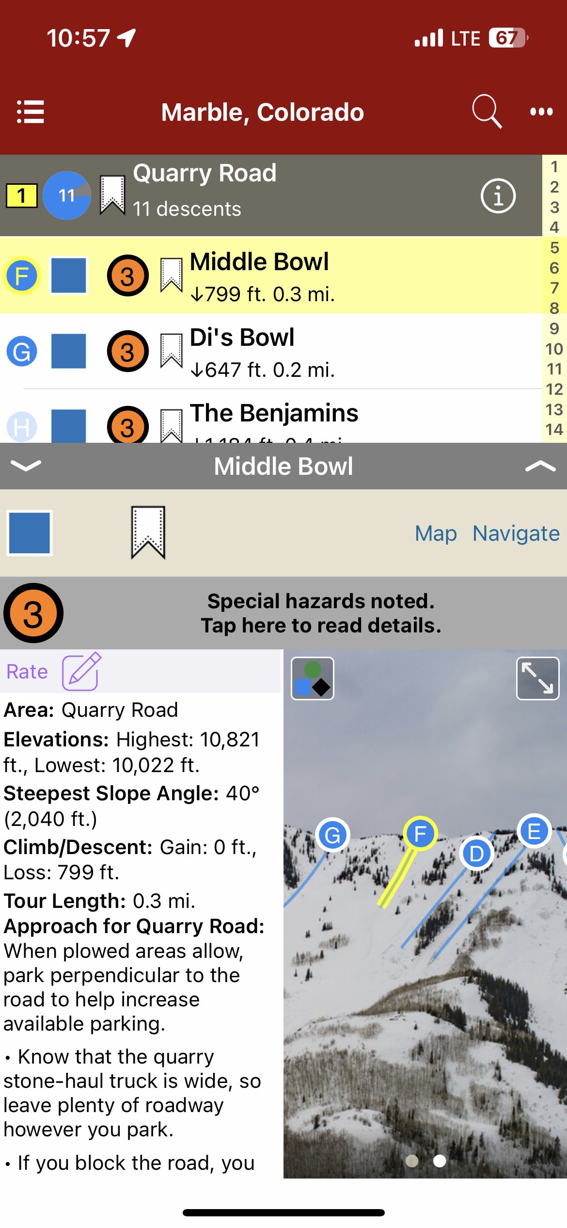
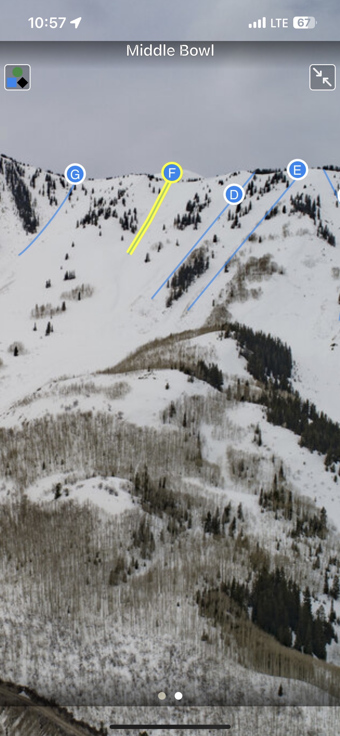
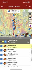
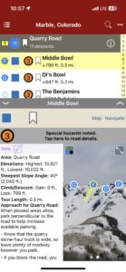
Backcountry Skiing: Marble, Colorado
by Beacon Guidebooks
Colorado Avalanche Information Center
Beacon Guidebooks:
California: Tahoe Light Tours Colorado: Berthoud | Buffalo | Cameron | CO Light Tours | Crested Butte | Loveland | RMNP | Silverton New Mexico: Taos Oregon: Hood Washington: Baker | Crystal | ONP | Snoqualmie | Stevens
Welcome to Marble, Colorado: Out of the way, isolated at a dead-end, and full of snow. In this guide you will find more than just ski lines. You’ll find helpful up-to-date information about road maintenance, snowmobile advice, parking systems and trailhead info. We explain the relationship with the quarry, discuss skin track etiquette, and of course, we provide reliable avalanche terrain information.
-
-
Map view
-
-
List view
-

-
Full screen photos
by todd | Jan 4, 2019
Backcountry Skiing: Loveland Pass, Colorado
by Rob Writz
Colorado Avalanche Information Center
Beacon Guidebooks:
California: Tahoe Light Tours Colorado: Berthoud | Buffalo | Cameron | CO Light Tours | Crested Butte | Marble | RMNP | Silverton New Mexico: Taos Oregon: Hood Washington: Baker | Crystal | ONP | Snoqualmie | Stevens
Join us this winter to unlock new terrain on Loveland Pass. From Watrous Gulch to Porcupine Gulch, we follow US Highway 6 as it climbs dramatically to 11,990 feet; providing trailhead access to glacial valleys holding a lifetime of winter backcountry exploration. Download the Loveland Pass guidebook to get access to 23 zones and 165 named runs. Featuring ascent routes, descent descriptions, max slope angles, a trail map, offline GPS navigation and much more, this app helps your terrain management, tour planning and route finding. Check out the new foldable, waterproof trail map from Beacon Guidebooks too!
Buy digital plus (book and/or map ) and the price includes $4.00 for shipping, a screaming deal! When you buy a bundle, you can use your digital rakkup guidebook immediately.
-
-
Map view
-
-
List view
-
-
Full screen photos
by todd | Nov 28, 2018
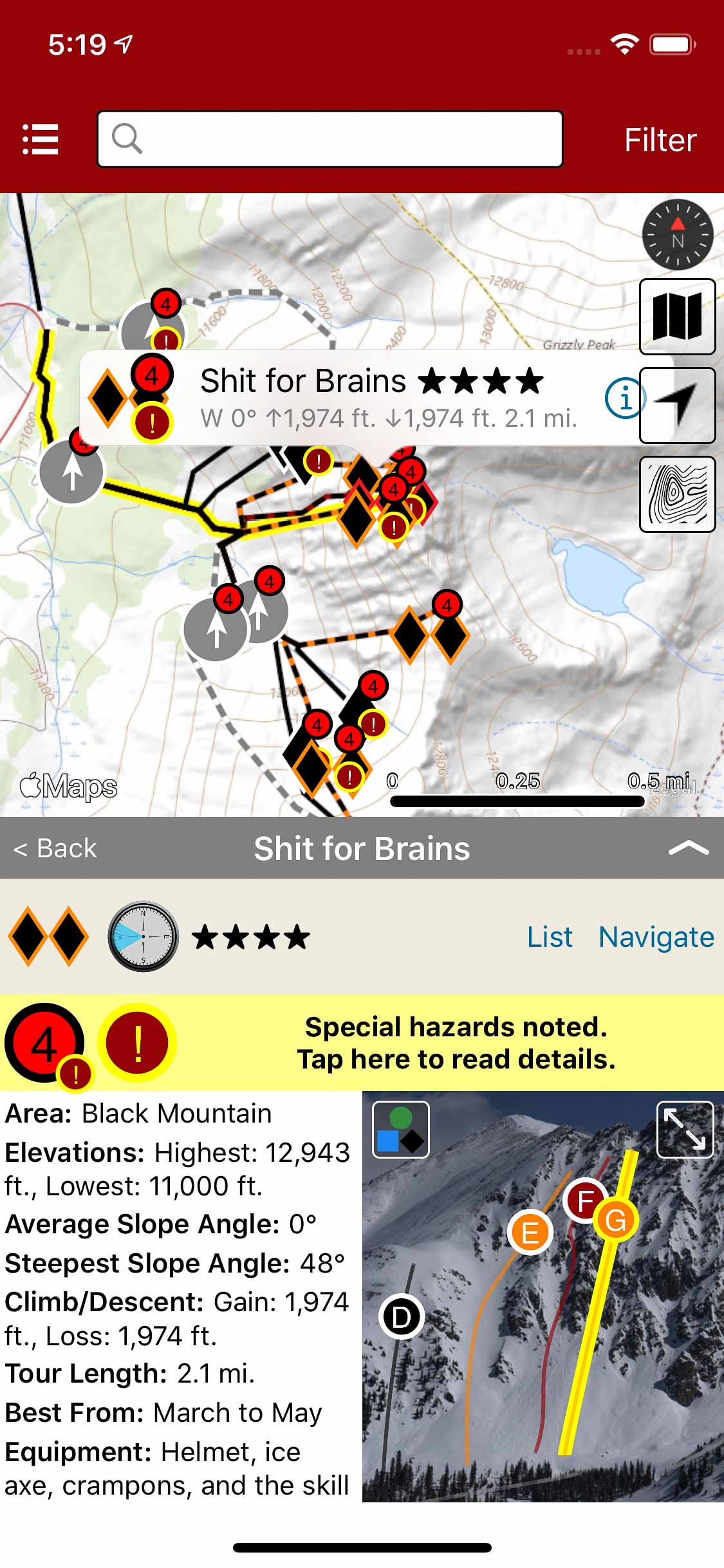
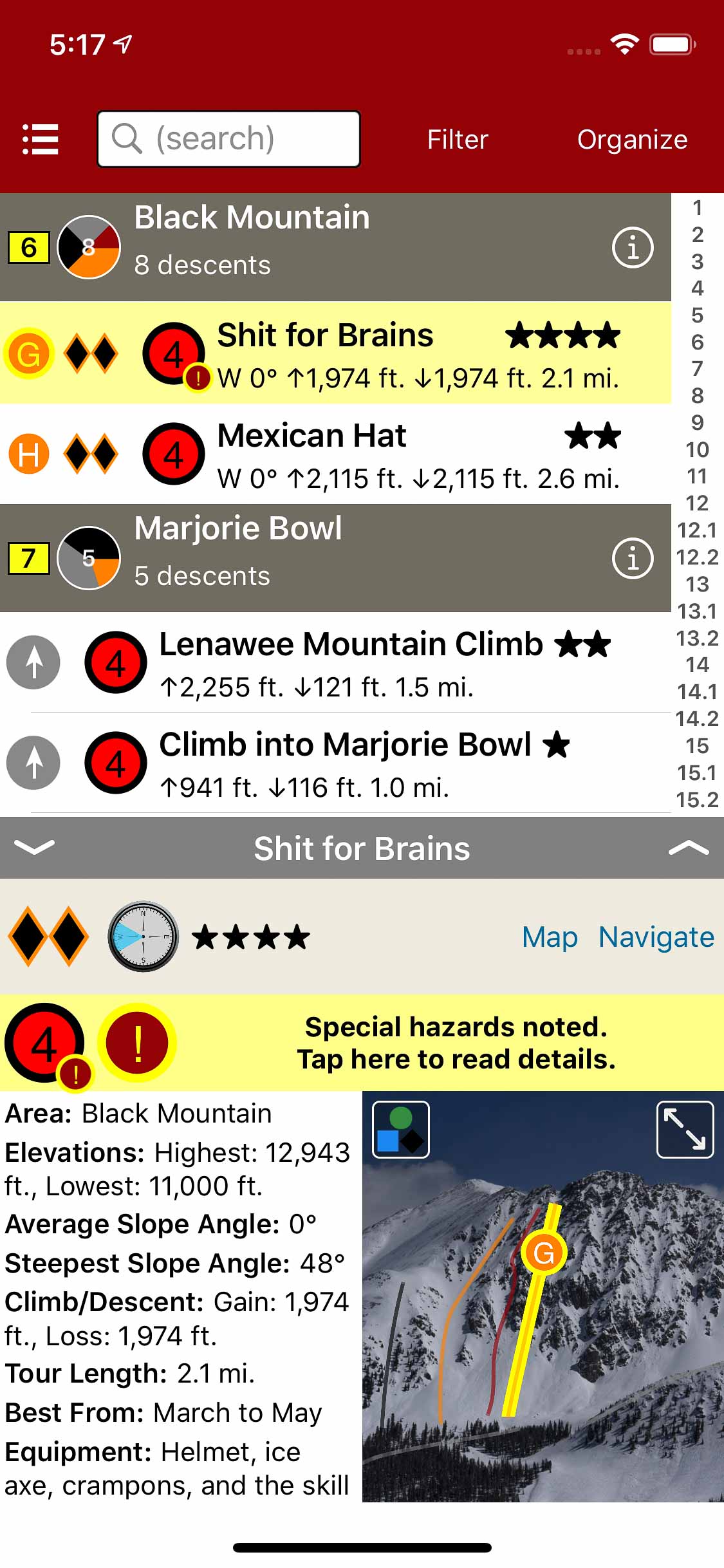
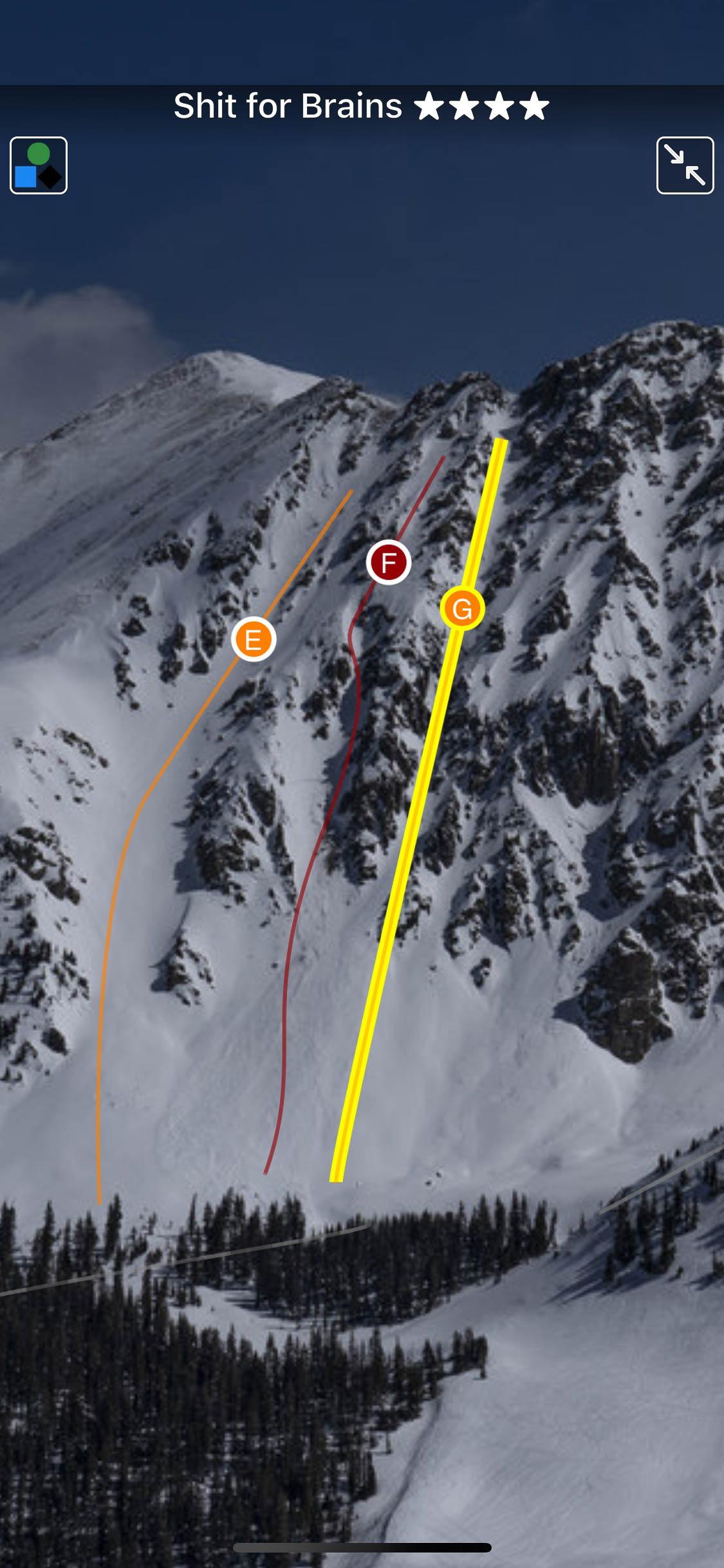
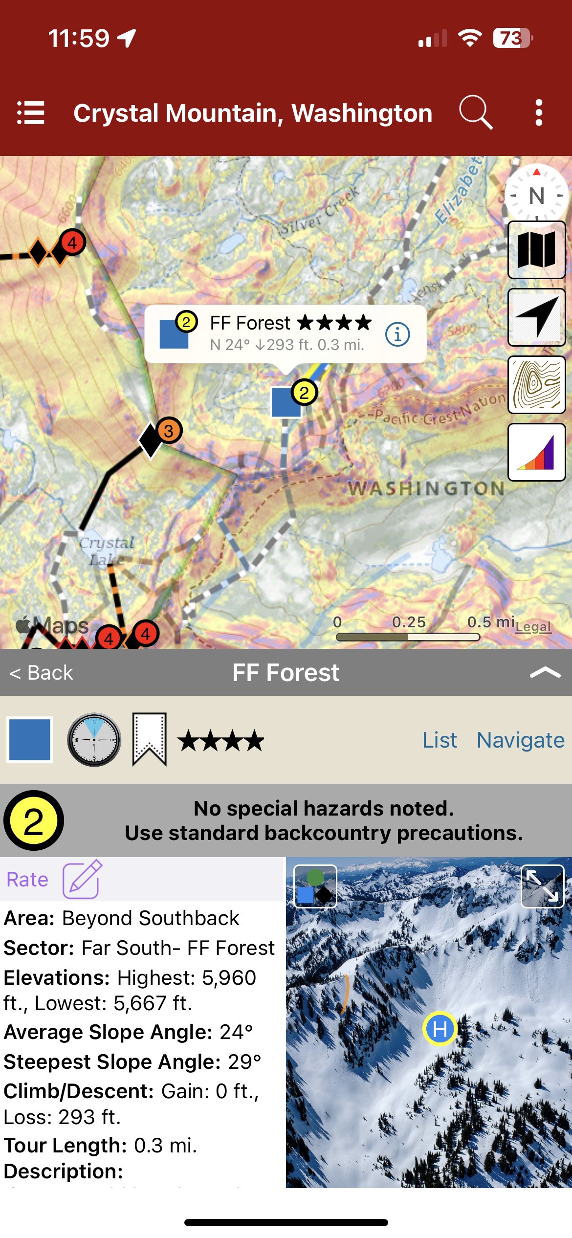
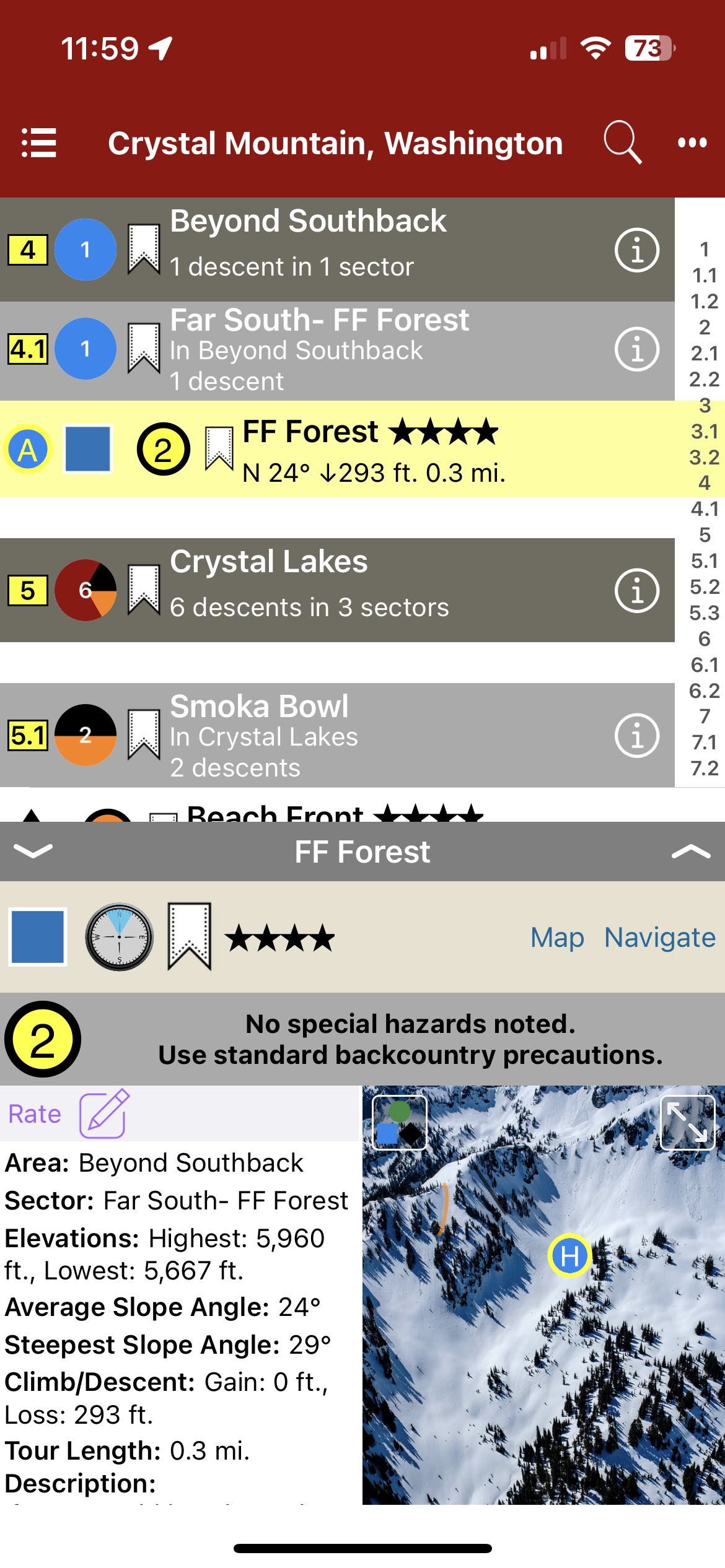
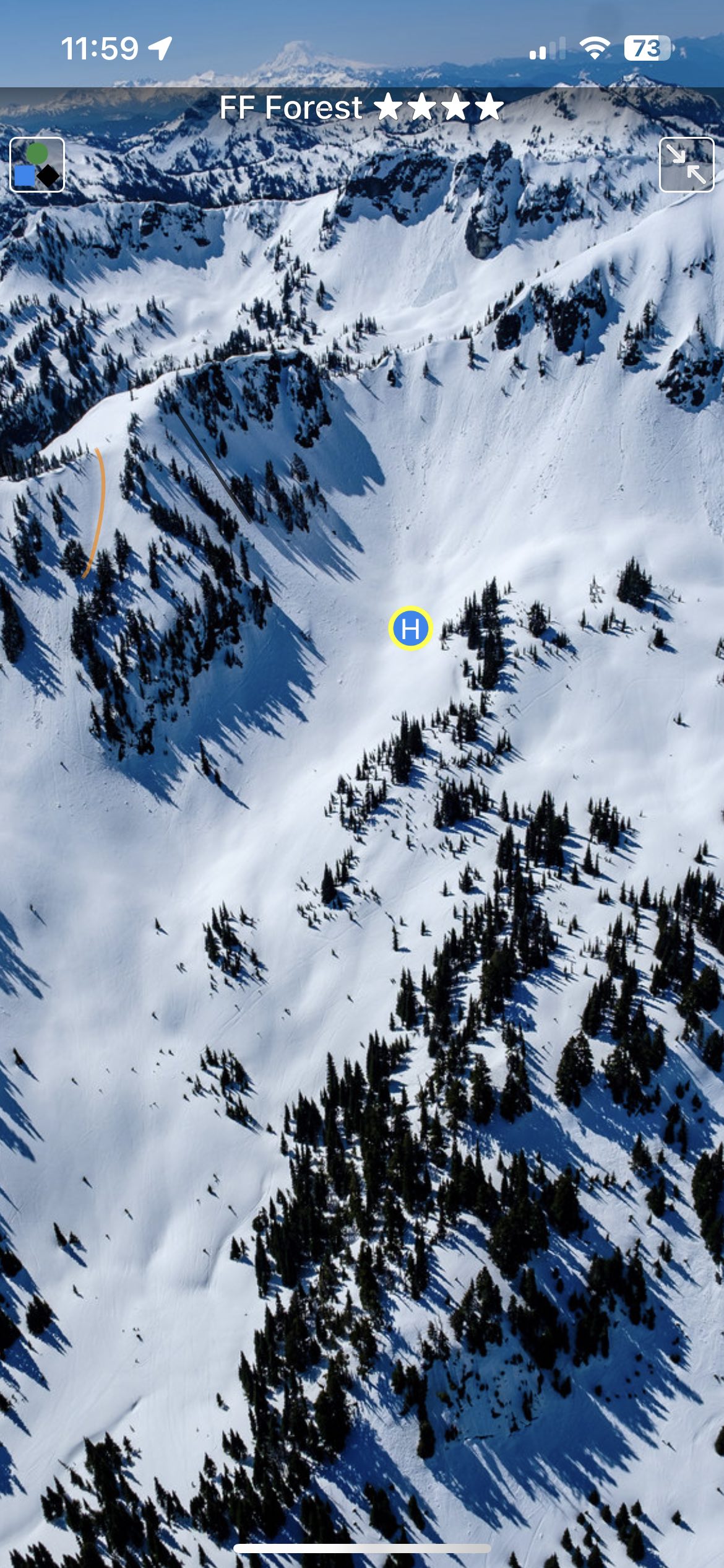
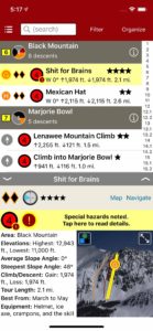
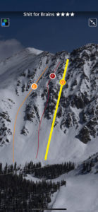
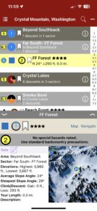
Backcountry Skiing: Crystal Mountain, Washington
by Matt Schonwald
Northwest Avalanche Center
Beacon Guidebooks:
California: Tahoe Light Tours Colorado: Berthoud | Buffalo | Cameron | Crested Butte | Loveland | Marble | RMNP | Silverton New Mexico: Taos Oregon: Hood Washington: Baker | ONP | Snoqualmie | Stevens
Author Matt Schonwald has drawn from his experience to bring this Crystal Mountain backcountry guidebook to you. This guidebook features aerial photos, an offline GPS, max slope angles, run descriptions and a terrain rating system maximizing terrain options and relevant information. Schonwald assesses each zone to provide information that is essential for your tour planning and decision making. Covering everything from mellow glades to steep couloirs, you’re sure to find the right tour for your group.
Buy digital plus book and the price includes $4.00 for shipping, a screaming deal! When you buy a bundle, you can use your digital rakkup guidebook immediately.
-

-
Map view
-
-
List view
-
-
Topo photo
by todd | Sep 10, 2018
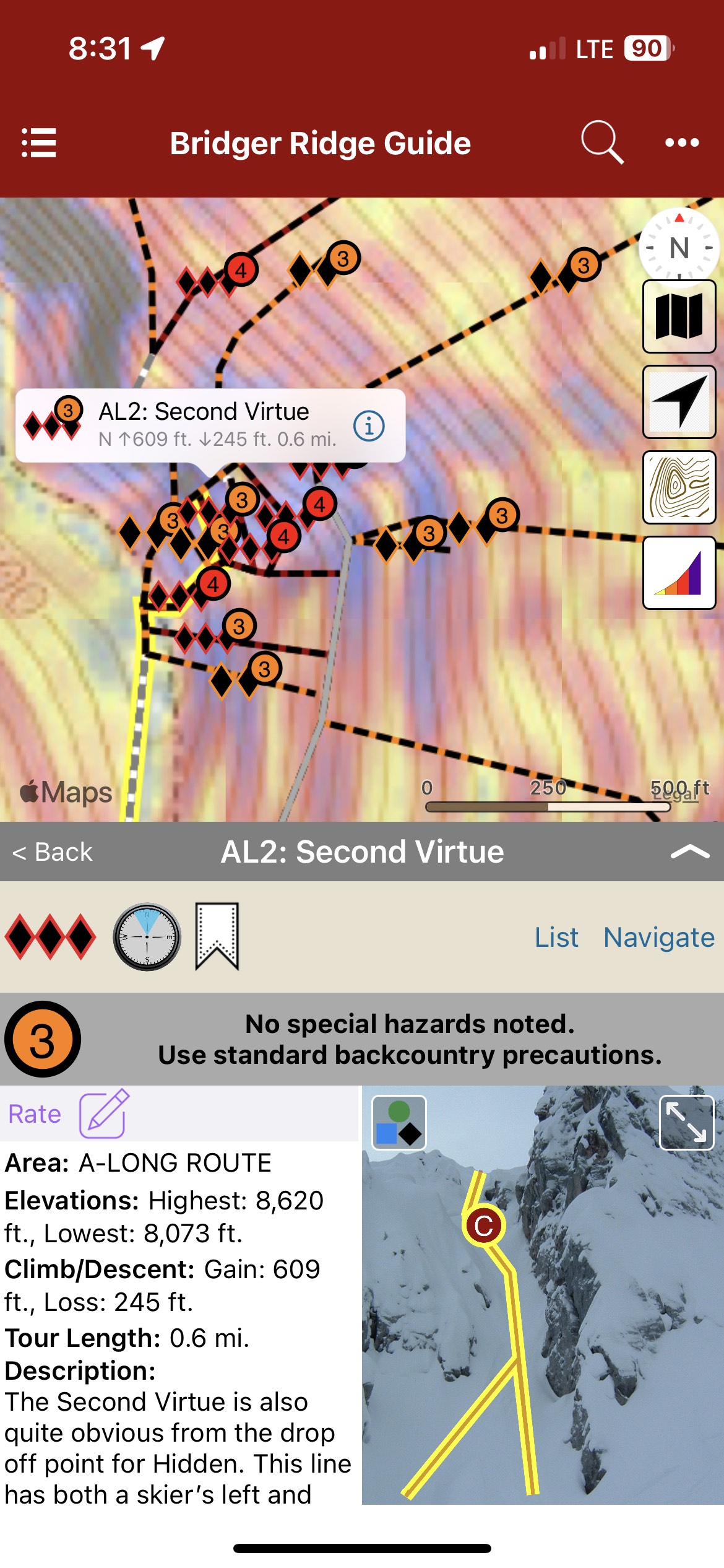
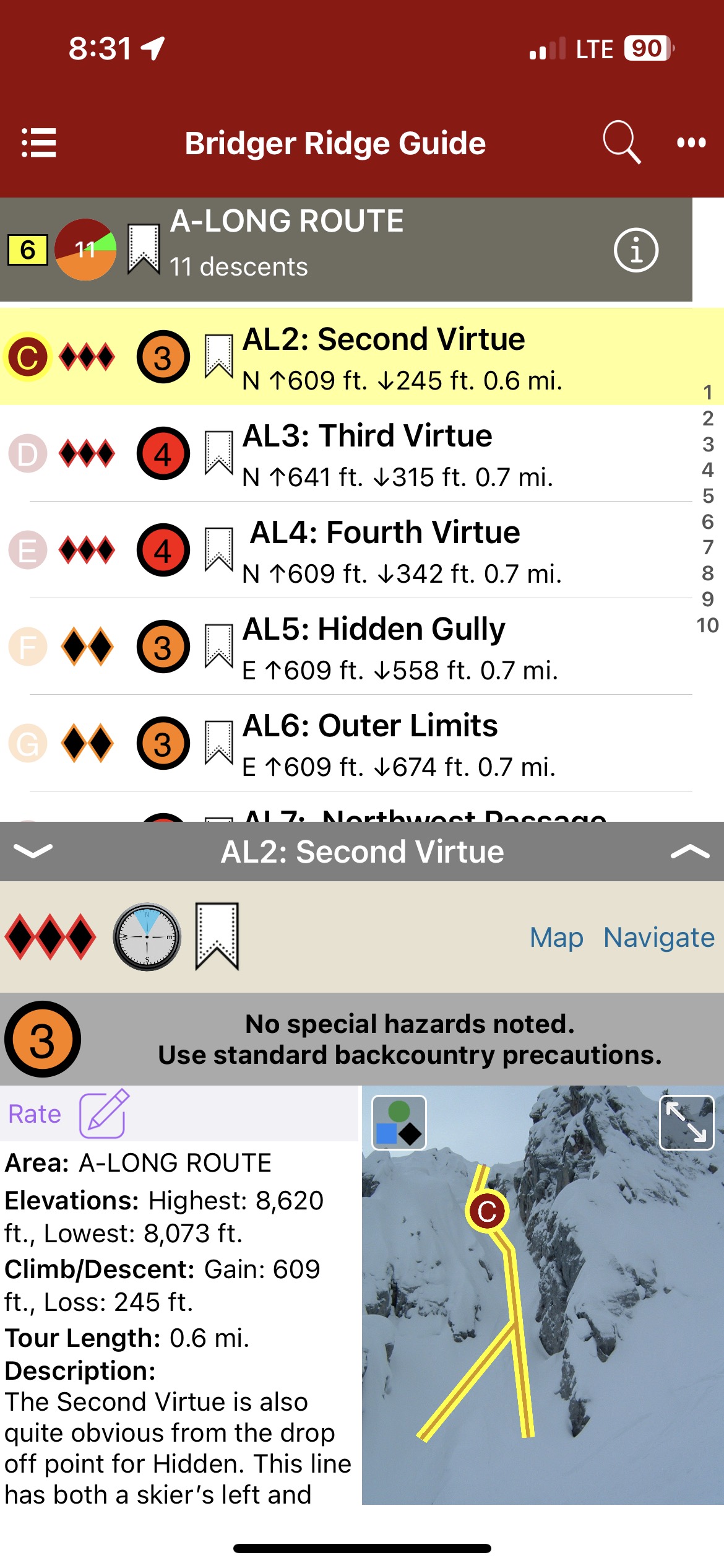
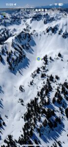
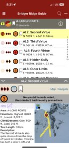
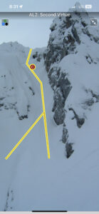
Stepping Up – A Guide to The Ridge at Bridger Bowl
by Tavis Campbell & Sam Cox
Gallatin National Forest Avalanche Center
Stepping Up Website
Bridger Ridge is a detailed account of over 70 prominent descents at Bridger Bowl. It has an abundance of aerial photos, maps, action shots and in-depth line descriptions. Areas of interest include The Ridge, High Traverse and Fingers. This is a must have for Ridge Hippies, novices and anyone passionate about Bridger Bowl.
-

-
Map view
-
-
List view
-
-
Full screen topos
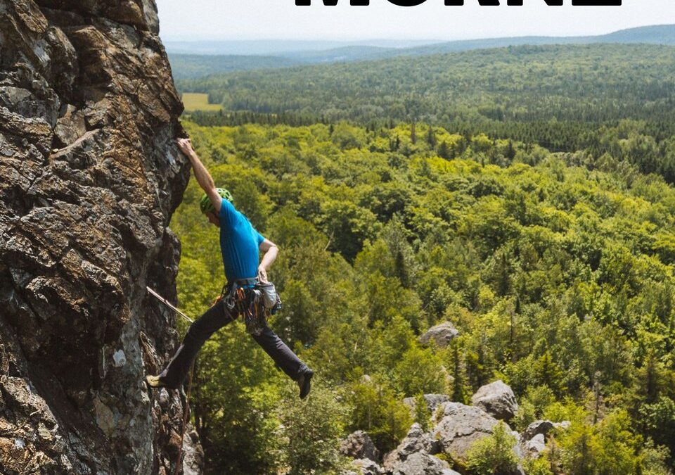
by todd | Aug 1, 2018
Grand Morne
by Nicolas Rodrigue & Club d’escalade et de montagne des Appalaches (CEMA)
Québec: Saint-Léon-de-Standon| Montmagny-L’Islet
Le Grand Morne est la fameuse paroi mystérieuse de la Beauce. Communément appelé le Morne par les locaux, on peut considérer ce site comme le joyau de la région. L’escalade au Morne est unique. C’est une falaise du terroir vertical qu’on ne retrouve nulle part ailleurs. Le Morne c’est un rocher volcanique surprenant avec plein de formes et de prises cachées. Grimper au Morne, c’est accepter de se perdre dans une lecture d’itinéraires déroutantes. On y trouve des voies multi longueurs avec de l’ambiance et une gestuelle variée et complexe. En plus, il vous faudra savoir trouver les placements de protection dans cette escalade majoritairement traditionnelle. Vous voilà avec un grand cru d’escalade bien épicé qui demande temps et patience avant d’en apprécier toute la subtilité. Le Morne est une montagne à approcher avec respect et qui permet de développer le sens de l’itinéraire et de l’engagement. Prenez le temps de découvrir le Morne grâce à ce topo qui contient plus de 250 photos et une description complète des 286 voies (375 longueurs) d’escalade qui sillonnent la paroi. Les bénévoles du CEMA sont toujours au travail, attendez-vous à une mise à jour importante à l’automne prochain et de façon régulière par la suite.
-

-
Area overview map
-

-
Beautiful full screen smart topos
-

-
Climb list
by rob | Jun 14, 2018
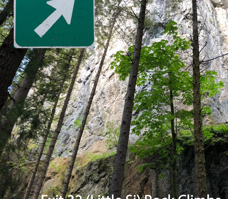
Exit 32 (Little Si) Rock Climbing
by Todd Kutzke and Rob Price
Outdoor Geeks, LLC.
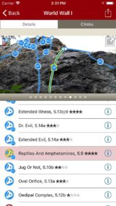
Just outside Seattle at Exit 32 along Interstate 90 lies Little Si, the little sibling to Mt. Si next door. The guidebook features World Wall 1, the crown jewel crag of Washington sport climbing with a storied history of climbing at the highest grades. First pioneered by local climber Brian Burdo in the early 90s, the wall has seen the addition of new testpieces every few years that have pushed well into the 5.14’s at World Wall 1 & 2. World Wall 1’s unique geography, climb density and popularity make photographing this wall particularly challenging. Combining new high-resolution wide angle photographs and rakkup’s smart topo feature, this Little Si guidebook makes it incredibly easy for anyone to find the climb they’re looking for.
Don’t climb 5.12? That’s ok, there’s something here for everyone. World Wall 1 and the smaller crags nearby have many classic moderate lines in an aesthetic setting with great conditions all summer long.
-

-
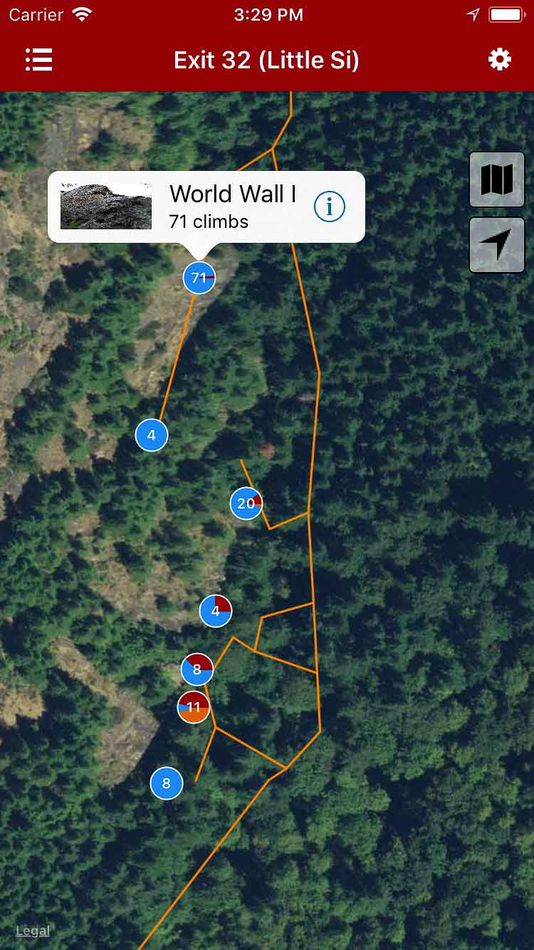
Explore Exit 32 (Little Si) rock climbing via our interactive trail map.
-

-
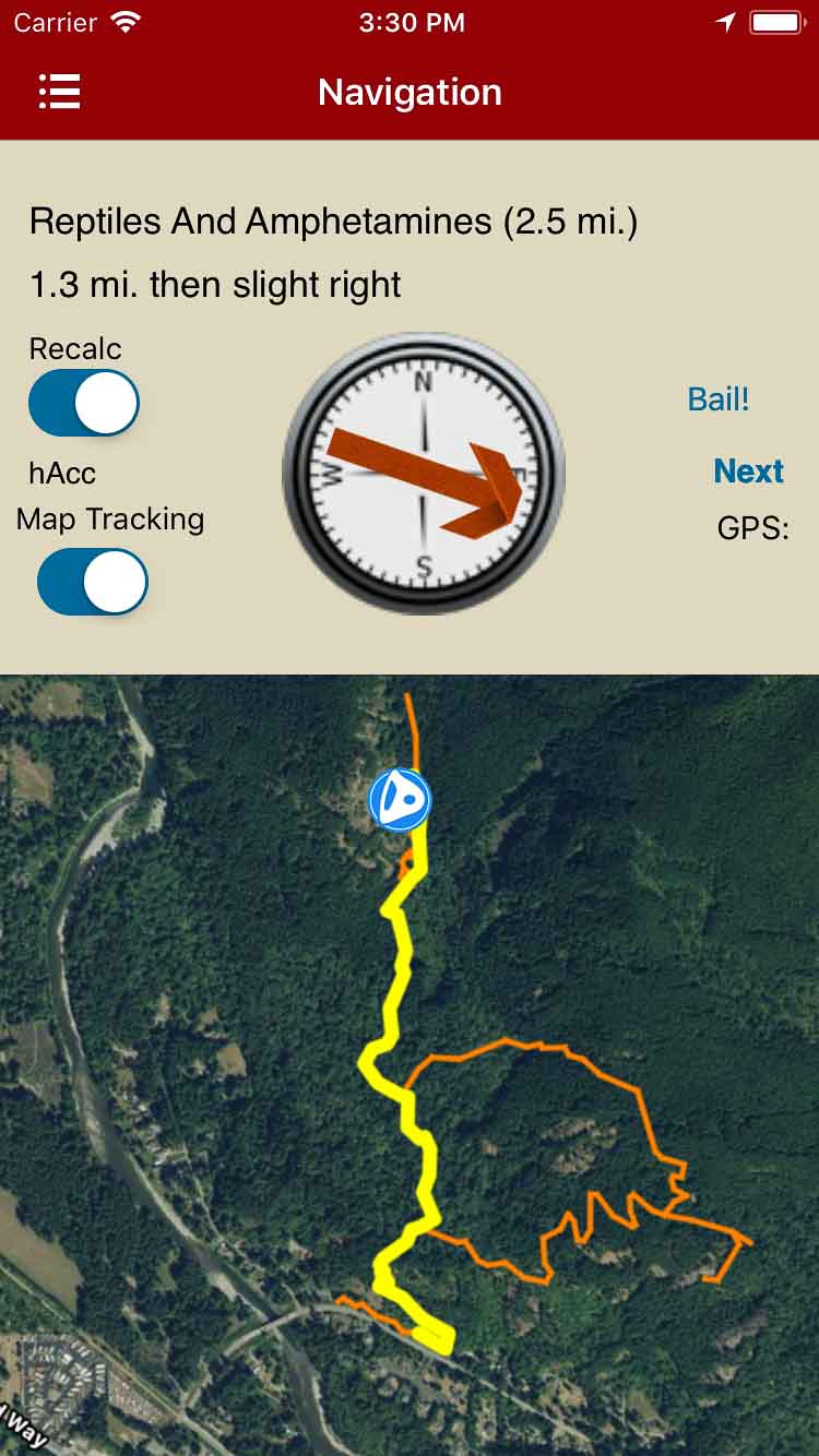
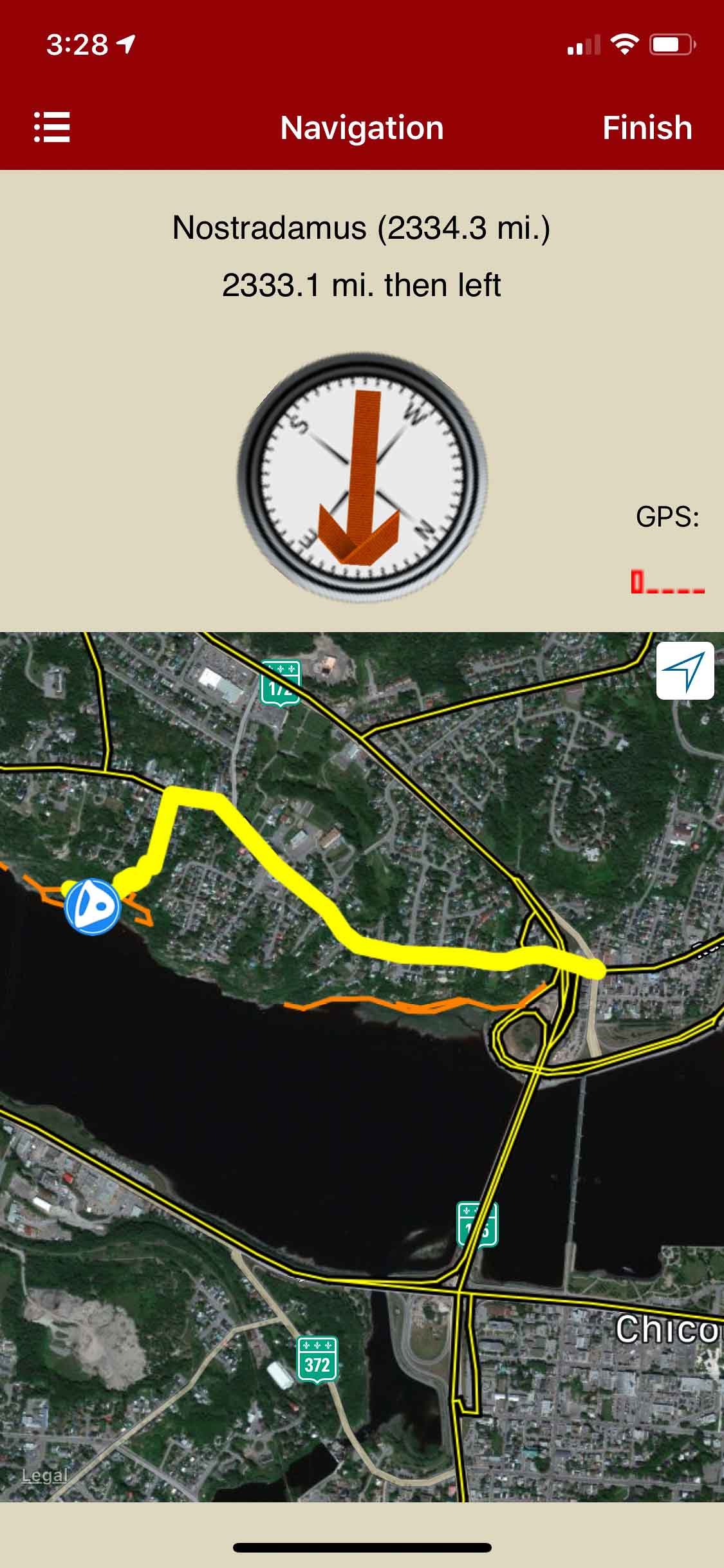
rakkup guides you car to crag then shows you a picture when you arrive.
-
-
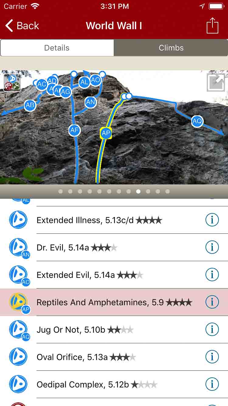
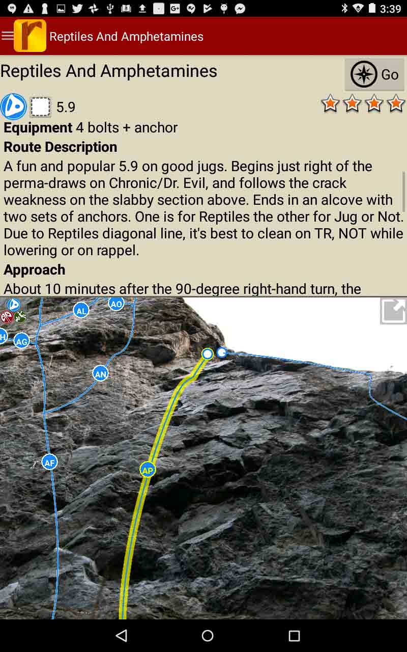
Tap on a climb name, see where it’s located on the image. Tap on a climb bubble in the image, discover what climb it is.
-

-
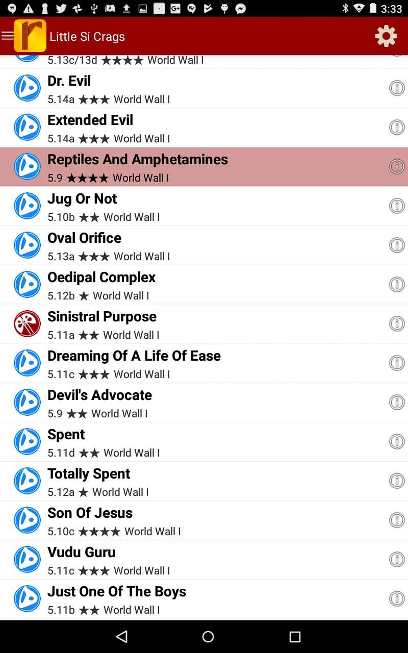
Exit 32 (Little Si) rock climbs in a searchable list.
-
-
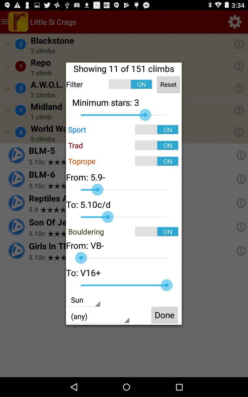
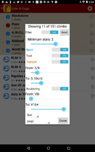
Filter the route list to only the grades and quality you want to see.
-

-
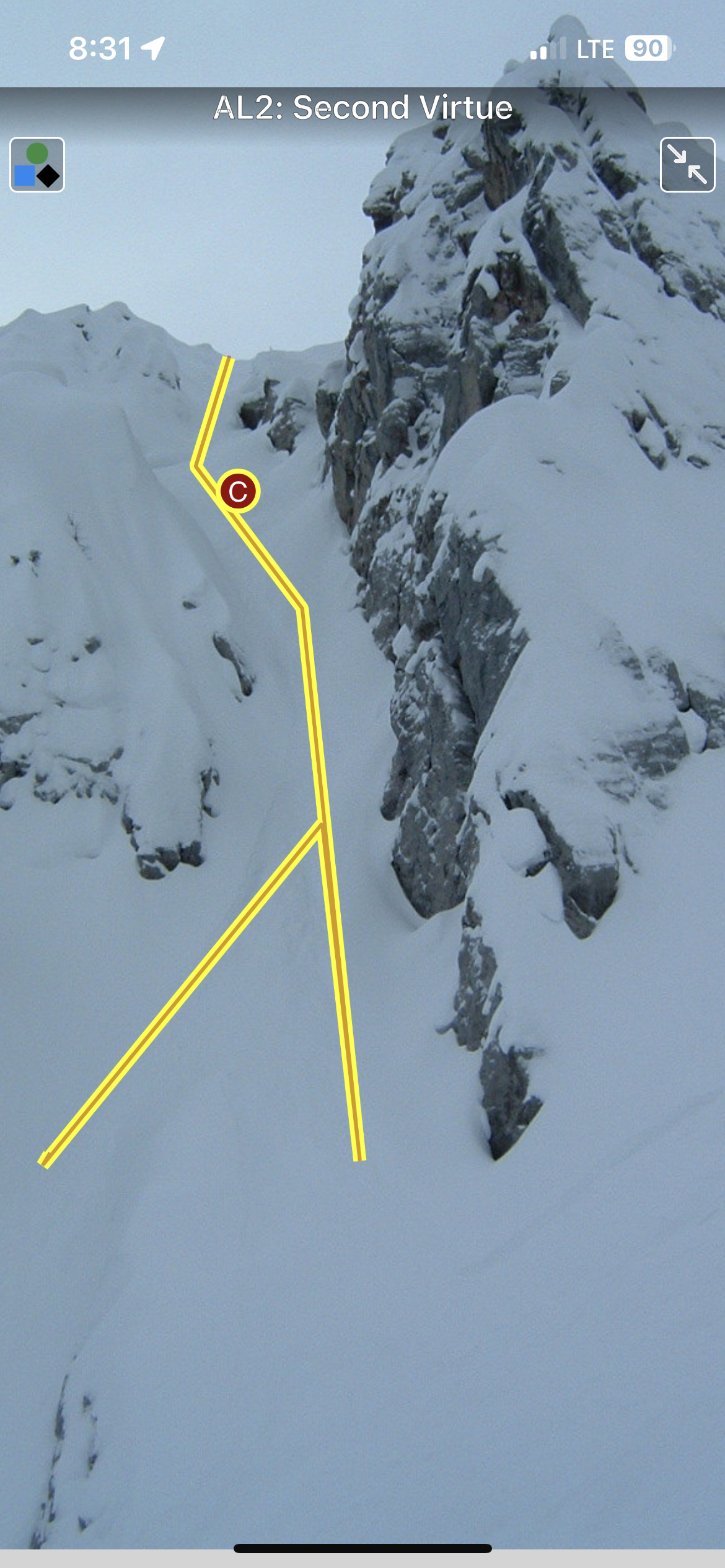
Detailed route descriptions and pictures with topo lines for every route.
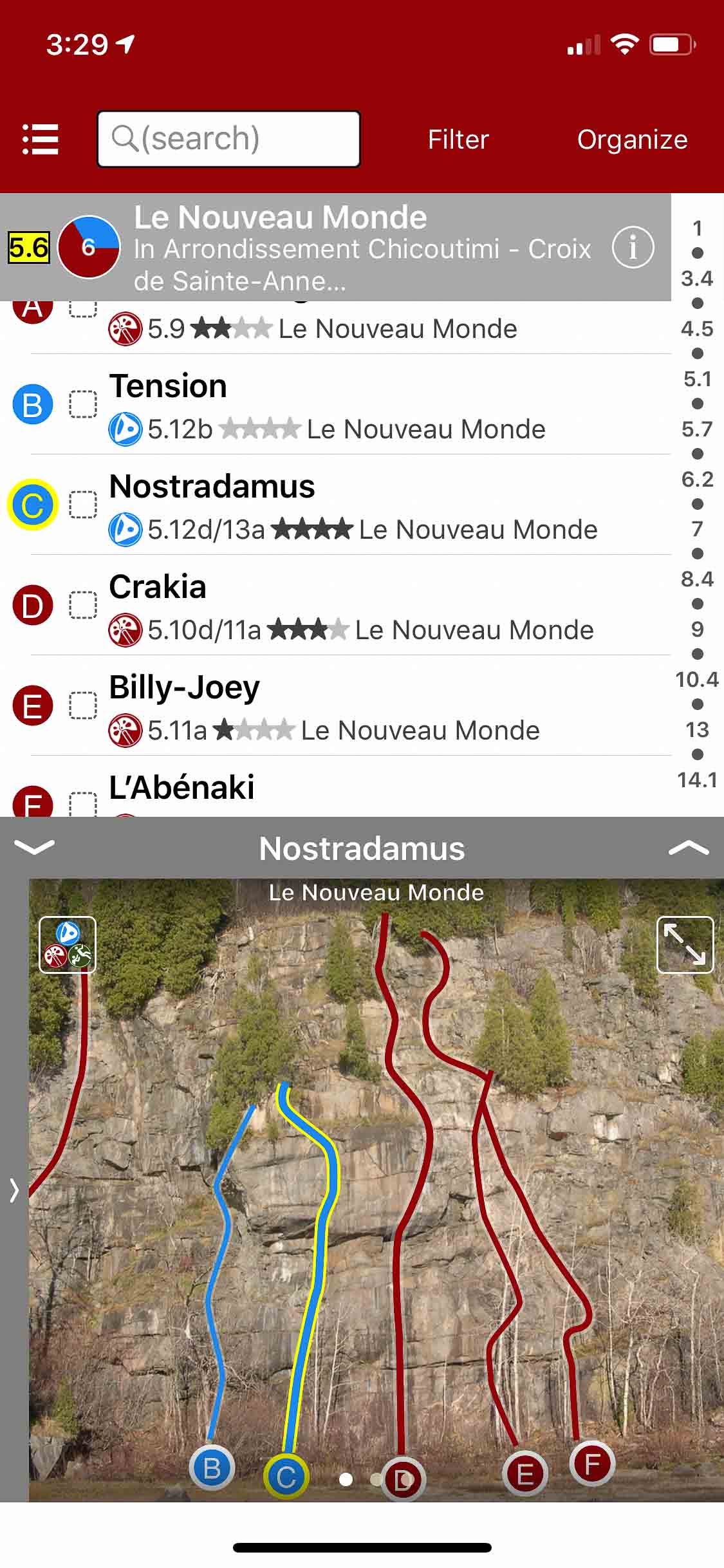
by | Jun 13, 2018
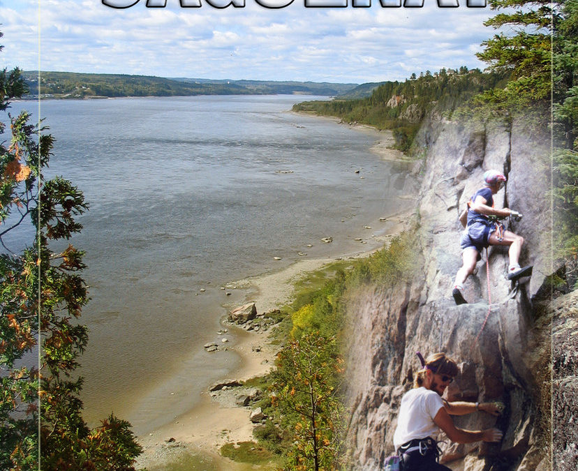
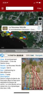
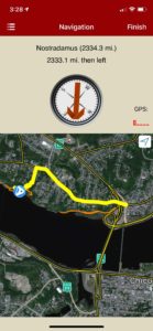
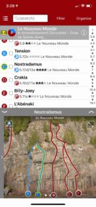
Parois du Saguenay
by Pierre-Y. Plourde & François-Xavier Garneau
Club de Montagne du Saguenay
Saguenay Facebook
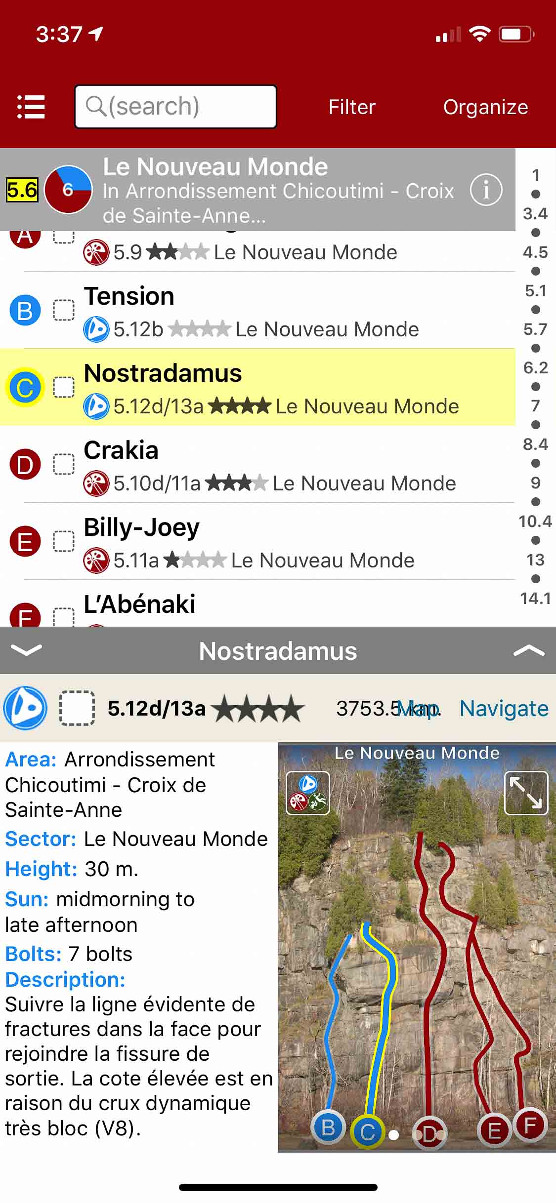
Ce topo-guide est indispensable pour la pratique de l’escalade dans la région du Saguenay. La qualité des photos et le recours aux pictogrammes rendent la navigation facile à comprendre et à utiliser. Le contenu couvre la Ville de Saguenay, Sainte-Rose-du-Nord, Ferland-et-Boilleau, le Parc national du Saguenay, L’Anse-Saint-Jean. Une trentaine de secteurs, plus de 70 blocs et parois d’escalade et plus de 500 itinéraires illustrés.
This guidebook is essential for the practice of climbing in the Saguenay region. The quality of pictures combined with the use of pictograms make navigation easy to understand and use. The content covers the Ville de Saguenay, Sainte-Rose-du-Nord, Ferland et Boilleau, the Parc national du Saguenay, L’Anse-Saint-Jean. Thirty sectors, more than 70 boulders and cliffs and over 500 illustrated climbs.
-
-
Explore Saguenay climbing via our interactive trail map.
-
-
rakkup navigates car to crag then displays a picture when arriving at destination.
-
-
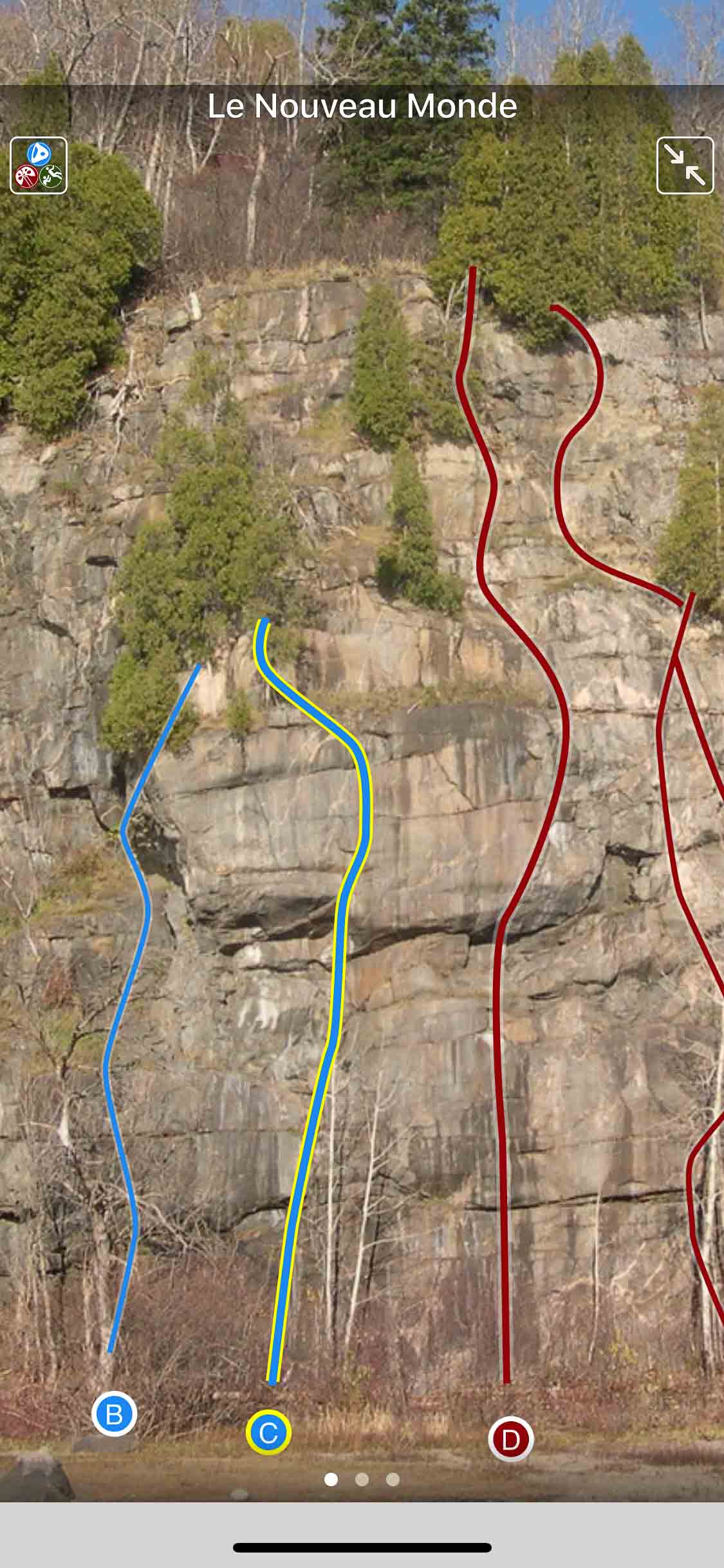
Smart topos help locate the correct route.
-
-
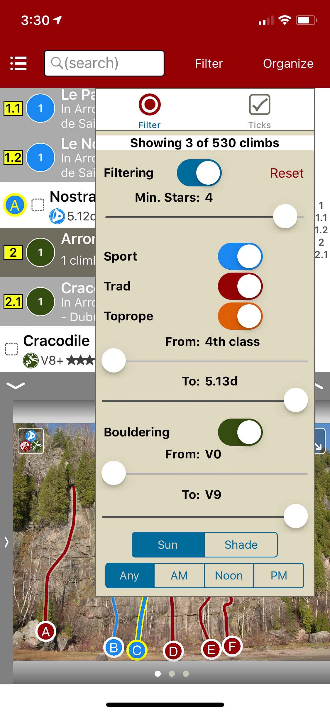
Filter climbs by quality, grade and type.
-
-
Quickly browse climb details in the climb list.
-
-
Beautiful full screen smart topos.