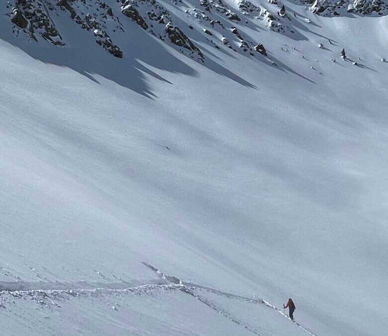
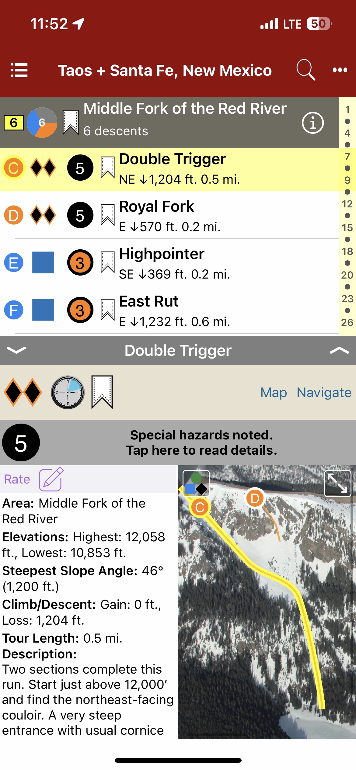
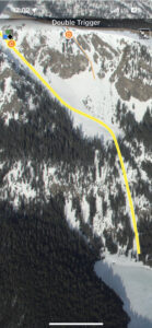
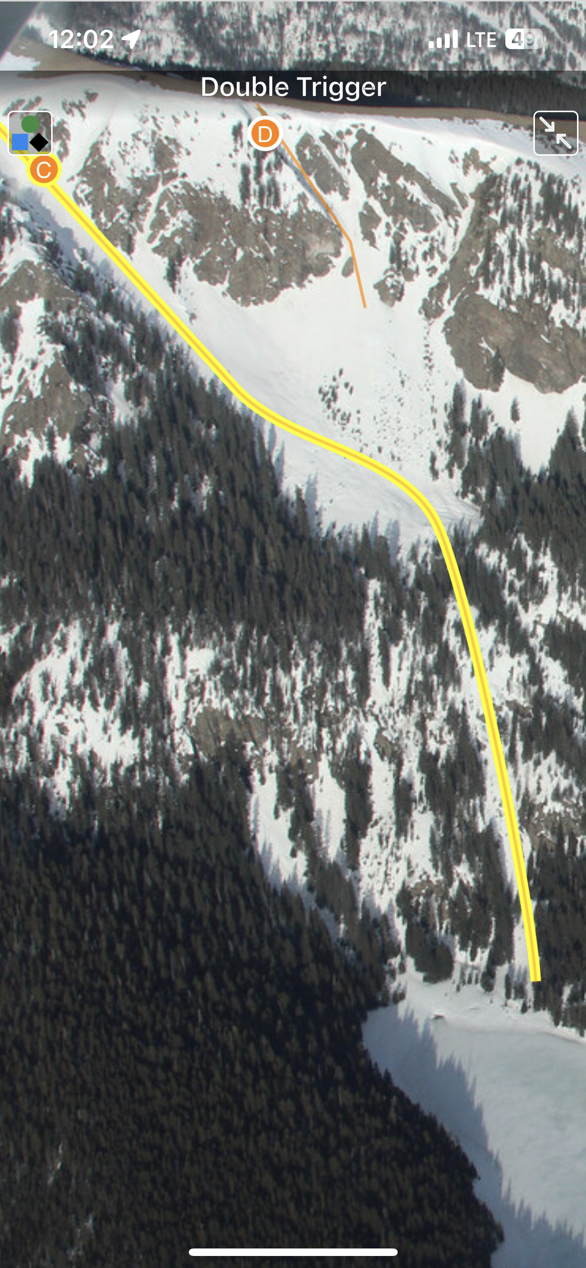
New Mexico has been possessed by many peoples, tribes, countries, and government entities—and without fail, those who visit become possessed by its vastness and beauty. As centuries pass and new abodes are built on top of old, the peaks and valleys forged over geologic time remain. To experience their splendor, open your eyes, take a deep breath of the high desert air, and let the rapture of the place overtake you. At no time is the splendor wasted on those who hike to these summits during the winter and spring months as they are rewarded by the incomparable bliss of sliding down on snow. A truly magical experience. Backcountry touring is a relatively new activity in New Mexico. The early days of the pandemic left many avid skiers and riders without a functioning ski area. For the cost of a lift ticket, backcountry travelers could buy a new pair of skins and open up the world outside the ski area boundaries. I never saw tracks far beyond the ski area boundaries in the 80s; it wasn’t until the early 2000s that I started to see occasional tracks. Today, it’s rare that I don’t see someone else out having fun in the sidecountry—but the wilderness experience is still very much available to those willing to explore. New Mexico offers many adventures in areas less traveled. The snow can be as deep as anywhere in the Rocky Mountains, and the spring skiing can make for quick descents. While the New Mexico snowpack shares commonalities to the snowpack at large within the Rocky Mountains, the lower latitude plus high elevation combine to form a special snowpack different from the surrounding states. The changing snowpack may be very different from the typical continental snowpack folks have come to expect in the San Juan or Elk Mountain ranges just to the north in Colorado. I am fortunate to have had the opportunity to spend the majority of my youth, and to have made a successful guiding career, in these mountains. I share the common thread of the experience with those who have come before and those yet to make the discoveries. —James Marc Beverly
Map view
List view
Full screen photos
Backcountry Skiing: Taos and Santa Fe, New Mexico Guidebook was last modified: January 27th, 2024 by todd
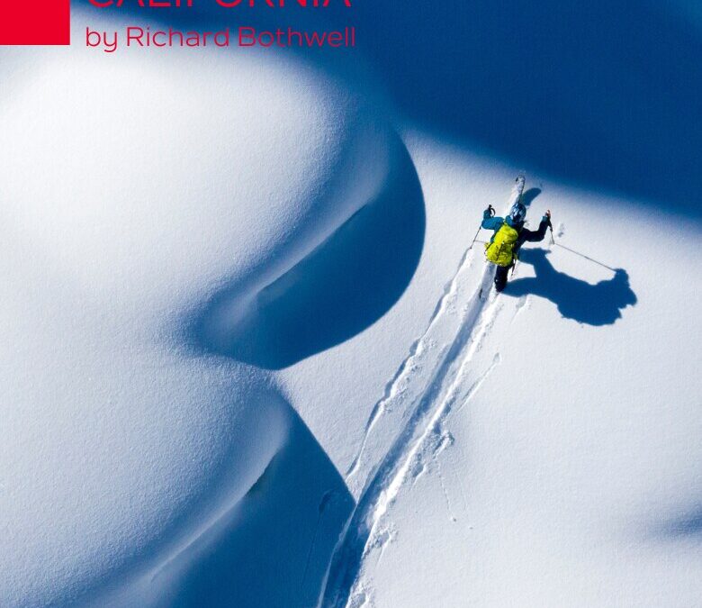
With its combination of playful terrain and plentiful snow, the Tahoe Sierra is reputed as one of the best ski touring regions in North America. While extreme skiing abounds in the Tahoe area, many people have an interest in finding enjoyable terrain for making turns while avoiding high-consequence avalanche slopes. Enter this first edition guidebook focused on the mellow side of ski touring by experienced guide and avalanche educator, Richard Bothwell.
With routes spanning the Lake Tahoe region from Interstate 80/Castle Peak in the north to Carson Pass in the south, there are enough tours to last you many seasons of exploration. Whether these mellower tours serve you as a way to get out on a higher-danger day, or as a way to introduce new friends to backcountry skiing, you’ll find that low-angle routes are a great arrow in your quiver.
Explore with a new ski partner, try something new, concentrate on the exercise and fresh air, and most of all, be proud you’ve chosen a sustainable style of ski touring you can enjoy for decades.
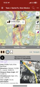
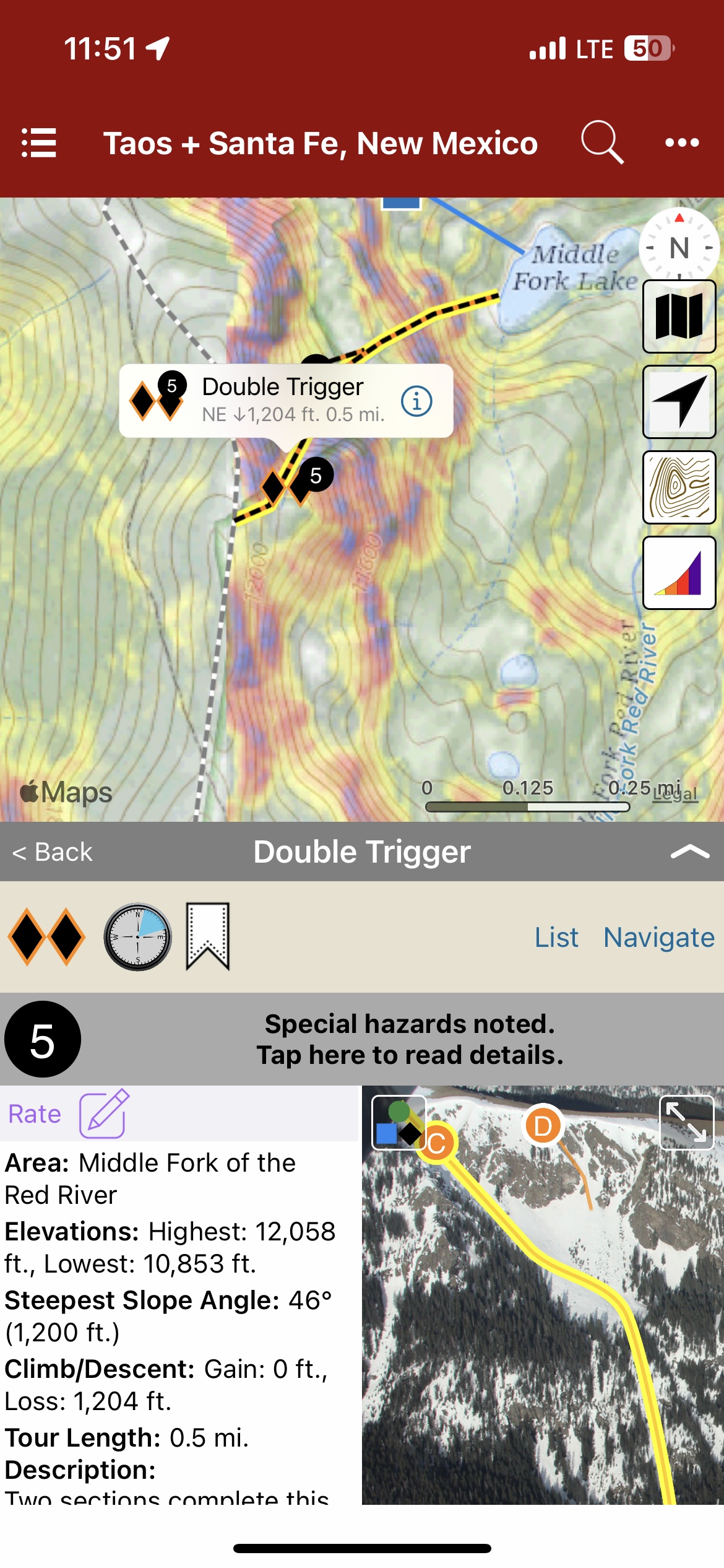
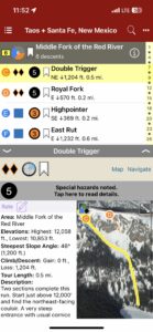
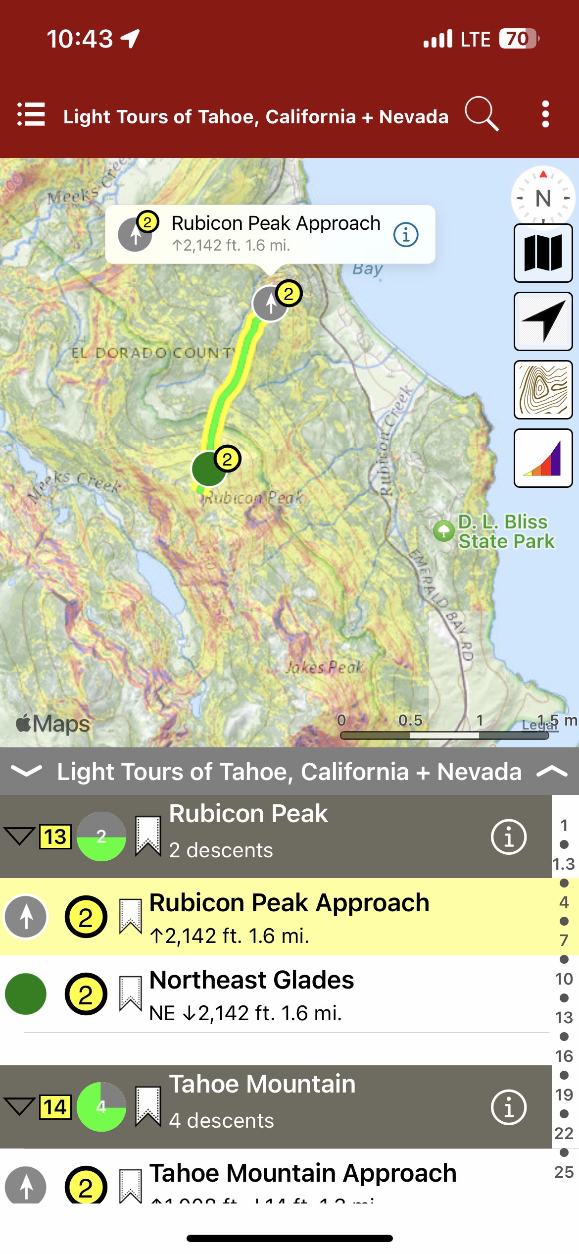
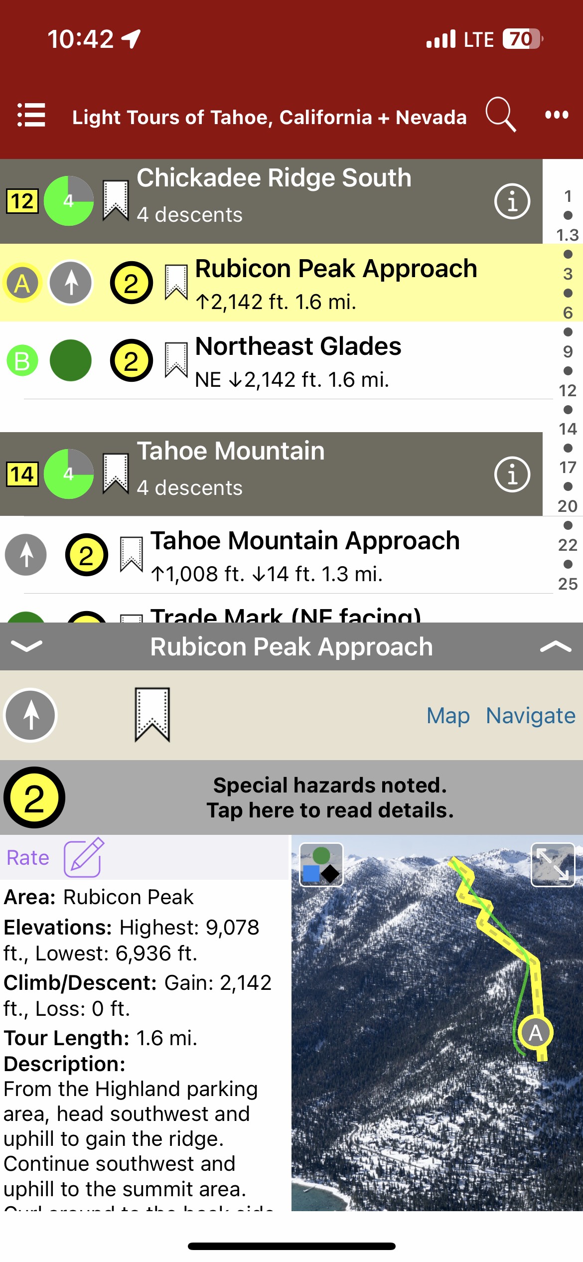
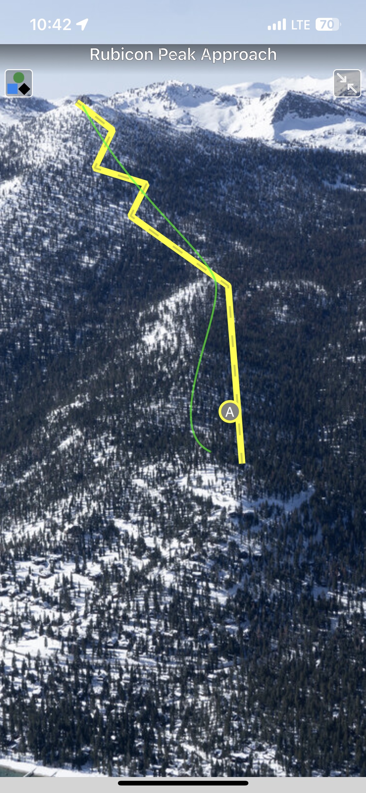
In this digital guidebook, you will find a sophisticated navigational mobile app, complete with aerial photos, marked runs, a zone descent list, ascent and skin track info, run descriptions and tour lengths, hazards, slope angles, elevations, Avalanche Terrain Exposure Scale ratings, and more. Additional app features include: offline GPS navigation, zoomable topo maps, map legends, slope angle shading, a searchable/filterable descent list and bookmarking. Designed to go along with you on your tours and accompany the Light Tours of Tahoe Ski Atlas.This digital book covers the following zones: Castle Peak, Johnson Canyon, Sunrise Bowl, Skislope, Boca Hill, Mount Judah, Bradley Hut, Brockway Summit, Incline Lake Peak, Tamarack Peak, Chickadee Ridge North, Chickadee Ridge South, Rubicon Peak, Tahoe Mountain, Mini Trimmer, Angora Ridge, Echo Lake + Becker, Ralston Peak, Waterhouse North, Waterhouse South, Meiss South, Meiss North, Elephant’s Hump, Round Top, Kirkwood + Caples
Map view
List view
Full screen photos
Backcountry Skiing: Tahoe California Light Tours Guidebook was last modified: March 2nd, 2024 by todd
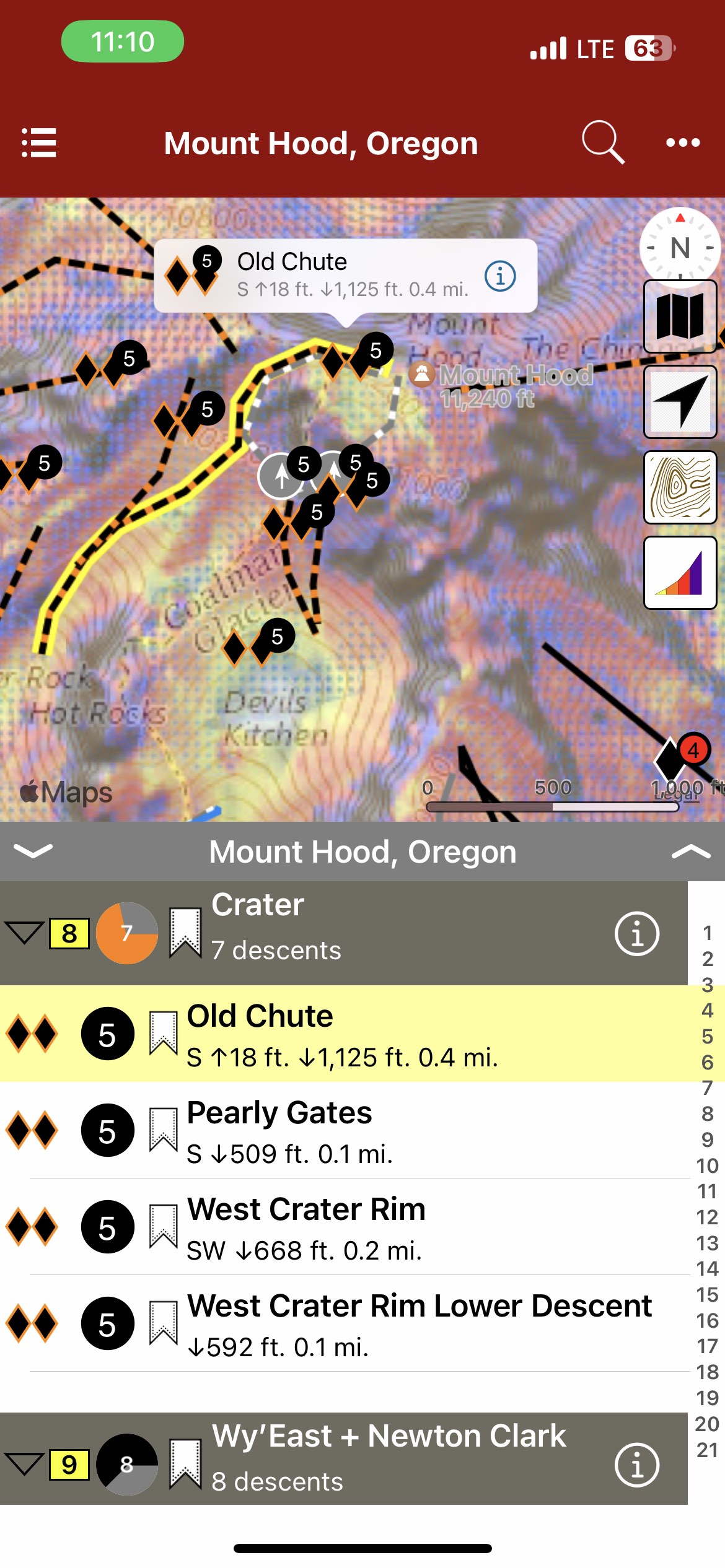
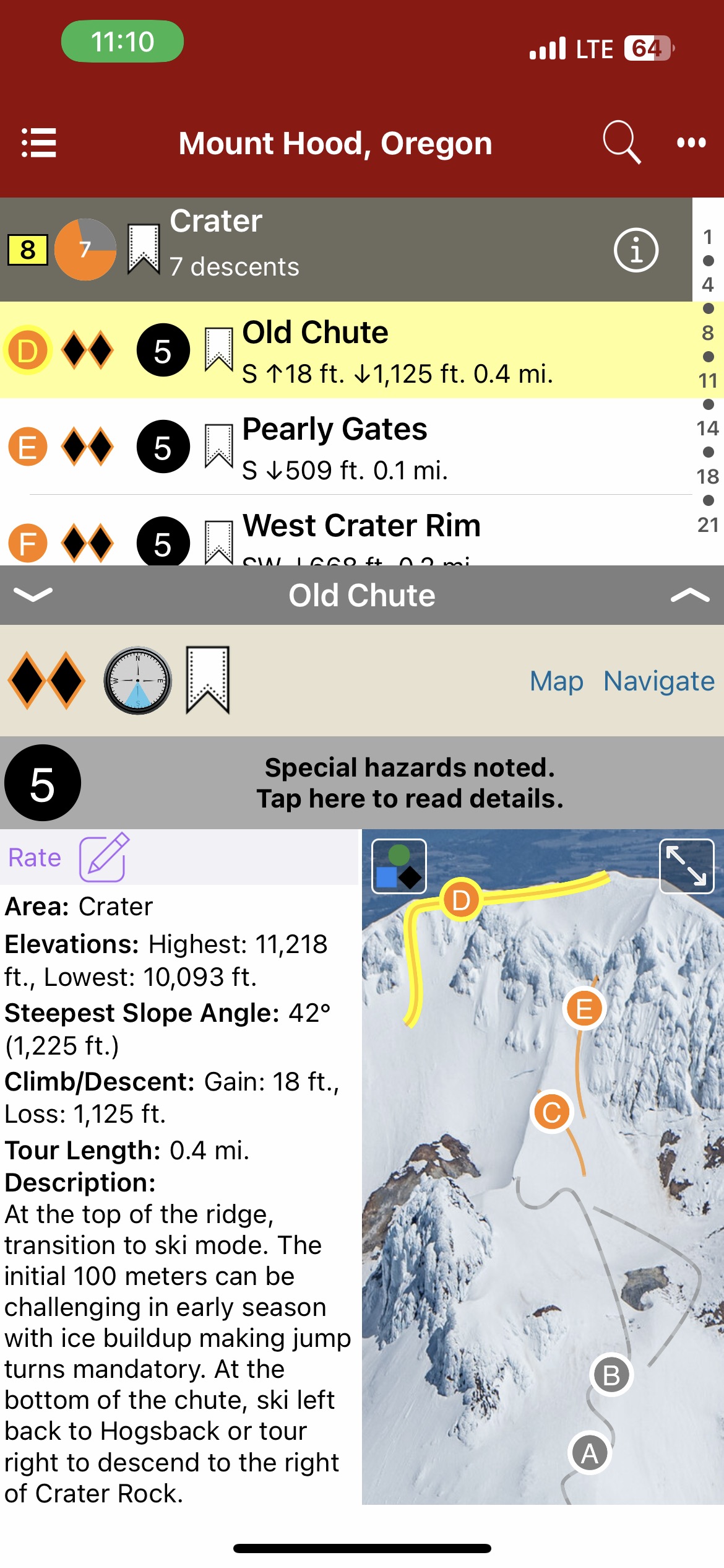
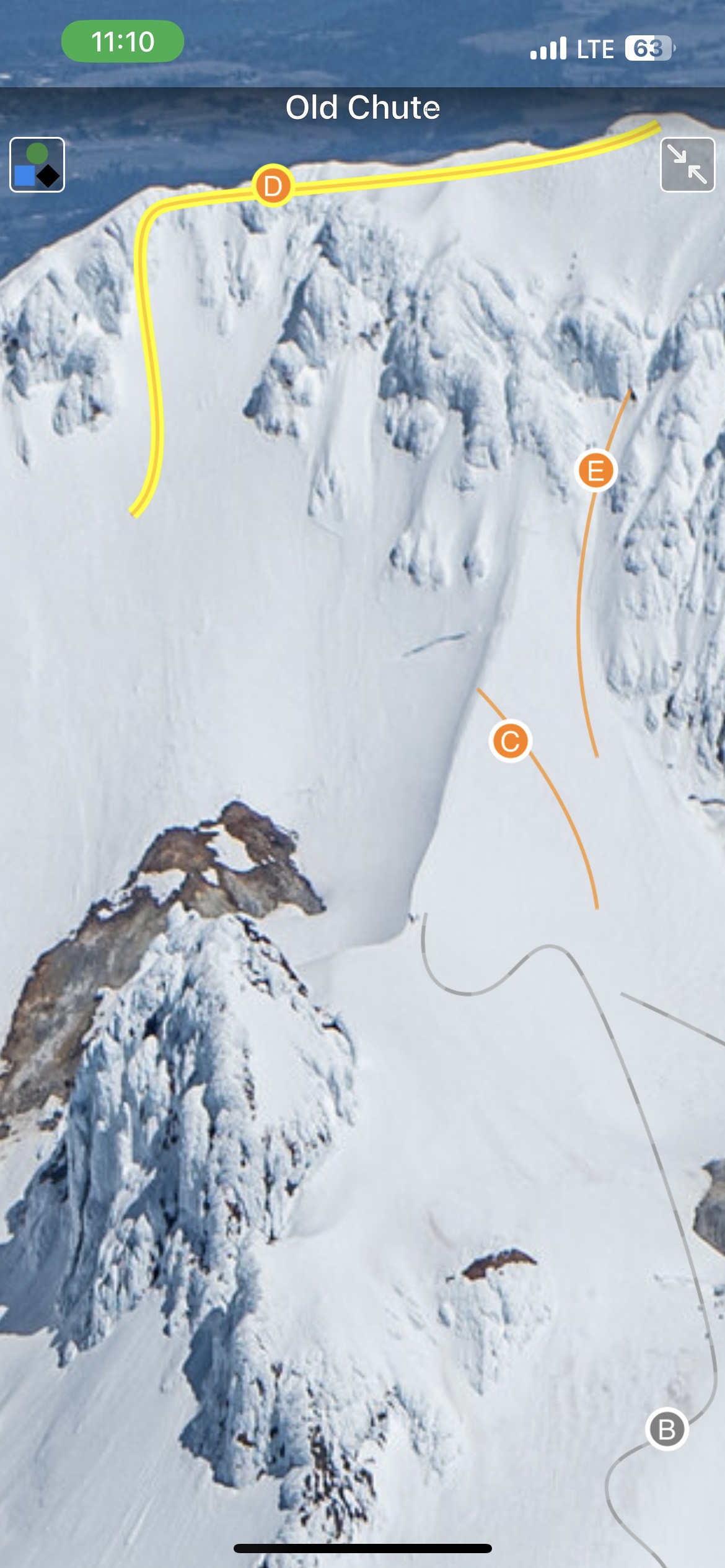
Mount Hood has captivated the imaginations of many in the Pacific Northwest for centuries. Named for a British admiral in the late 1700s, its native name has been lost to history. Lewis and Clark labeled Hood “stupendous” as they returned east on their epic journey, and that assessment rings true today. The first recorded ascent of Mt. Hood occurred in the 1850s, and the history of skiing on the mountain started with people on long wooden skis using them for transportation. The first recorded ski descent of the south side occurred in the 1920s, and skiing and mountaineering on Hood have been intertwined ever since. With the opening of Timberline Lodge in 1937, skiing on the mountain exploded in popularity. Mount Hood became renowned for backcountry skiing when Sylvain Saudan descended Newton-Clark Headwall on the east side of the mountain in 1971, a descent that heralded the arrival of “extreme skiing” in America. Backcountry skiing and riding has always been relatively popular on the mountain, as a stable snowpack and long season entice locals and tourists alike. As backcountry use has grown quickly in the past few years, Mount Hood remains a sought after destination for those looking for ski mountaineering descents, glaciers and hopefully – powder. The author and publisher acknowledge that the land surrounding Mount Hood lies within the ancestral territories of several Native American tribes including the Multnomah, Wasco, Confederated Tribes of Warm Springs, Confederated Tribes of Grand Ronde, and the Confederated Tribes of the Yakama Nation, who have looked upon and lived on this mountain for thousands of years.
Map view
List view
Full screen photos
Backcountry Skiing: Mount Hood, Oregon Guidebook was last modified: December 1st, 2023 by rob
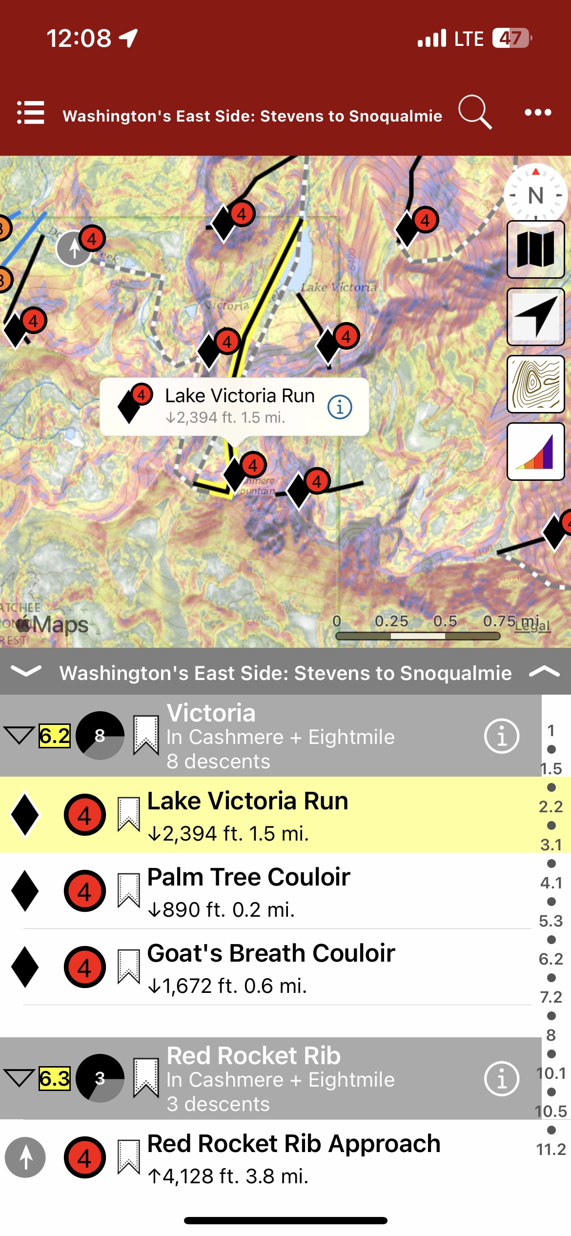
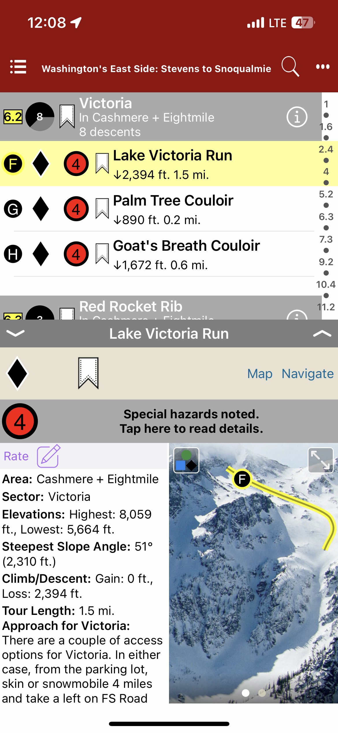
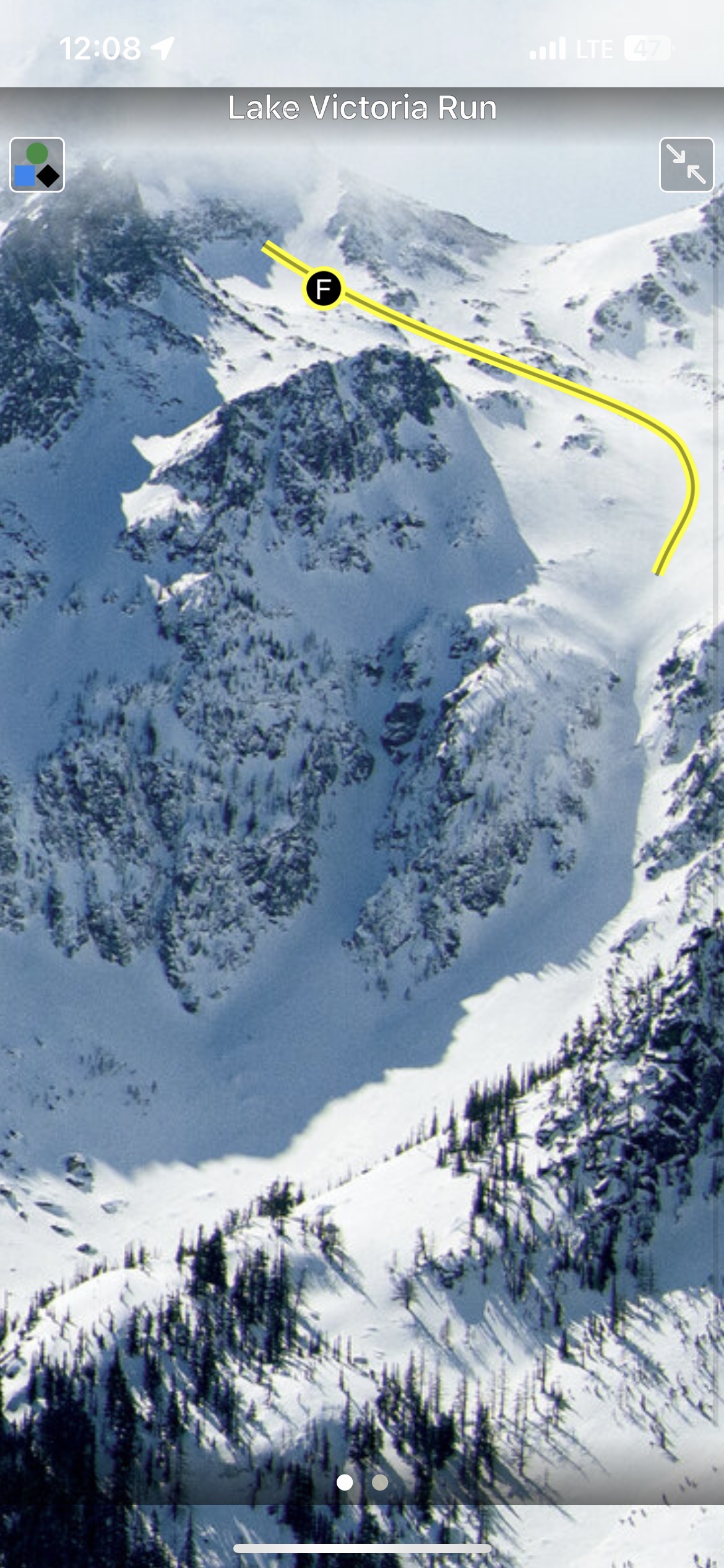
In 1897, John Stevens found the passage for the Great Northern Railroad across a 4,000’ pass in the Cascades. Since then, Stevens Pass place in history is thick with decades of travel, avalanches, ski areas, and so much more. Stevens Pass is one of the essential gateways to the extraordinary backcountry possibilities that exist between I-90, US Highway 97, and US Highway 2. Over 300 tours, accessible via ski areas, roadside pullouts, and long snowmobile approaches make this region’s diverse opportunities seem infinite. The East Side also provides a drier, colder snowpack—bringing blower pow (and persistent slabs) to the Cascades. The author and publisher acknowledge that the lands described in this atlas are the ancestral home of the Pisquouse and Si’apkat, members of the Yakama Nation. The Pisquouse (Yakama name: Winátshapam), or Wenatchi, lived in the area that spans present-day Leavenworth to Wenatchee. Wenatchee is a Sahaptian word for “river water which comes from canyons” or “robe of the rainbow.” The first inhabitants of the Kittitas Valley were the Psch-wan-wap-pams (stony ground people), also known as the Kittitas, Si’apkat, or Upper Yakama. They lived along the upper Yakima River (today called Cle Elum), which was a traditional gathering place for tribes east of the Cascades.
Map view
List view
Full screen photos
Backcountry Skiing: Stevens Pass and Washington’s East Side Guidebook was last modified: November 22nd, 2023 by todd
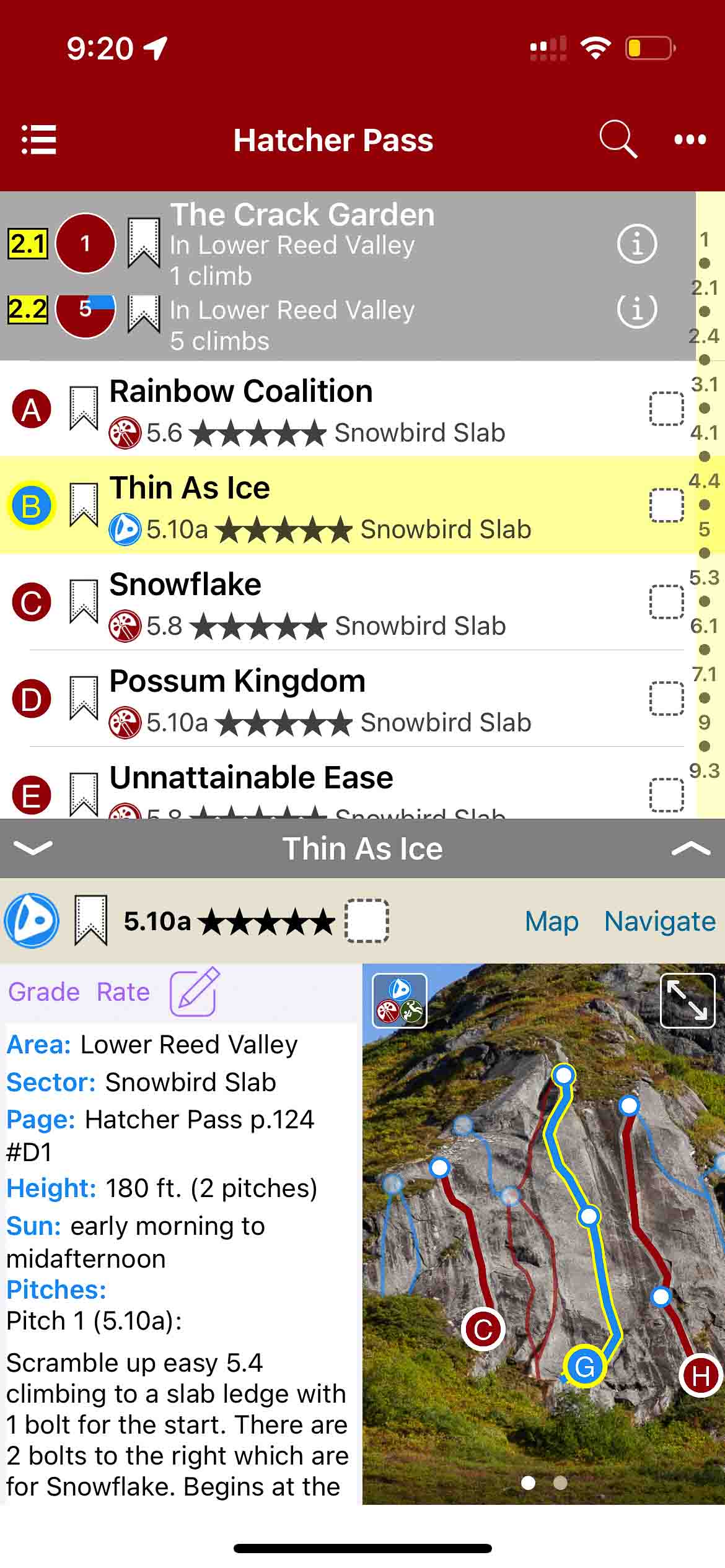
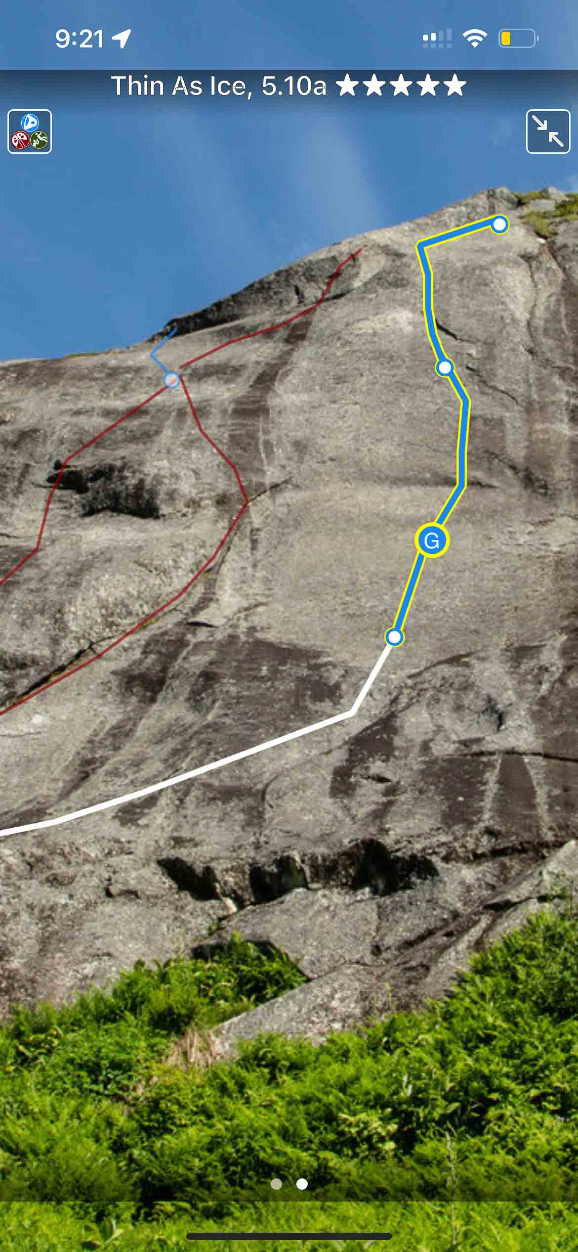
The best (and only) extensive guidebook for Hatcher Pass, Alaska. This new guidebook was published in paperback in 2021. The app includes over 400 climbs within one of the best climbing areas in Alaska.
Buy digital plus book and the price includes $7.00 for shipping, a screaming deal! When you buy a bundle, you can use your digital rakkup guidebook immediately.
Map view
List view
Full screen topos
Hatcher Pass Rock Climbing Guidebook was last modified: August 21st, 2023 by todd
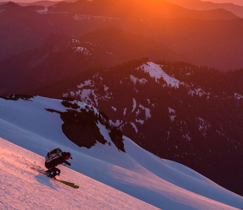
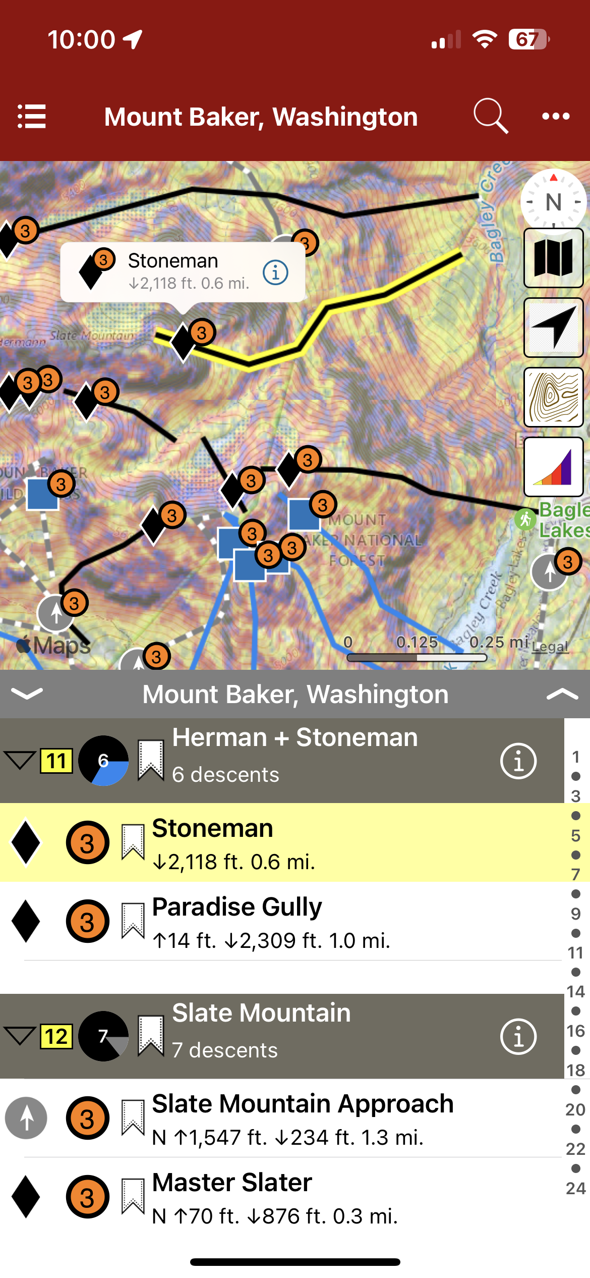
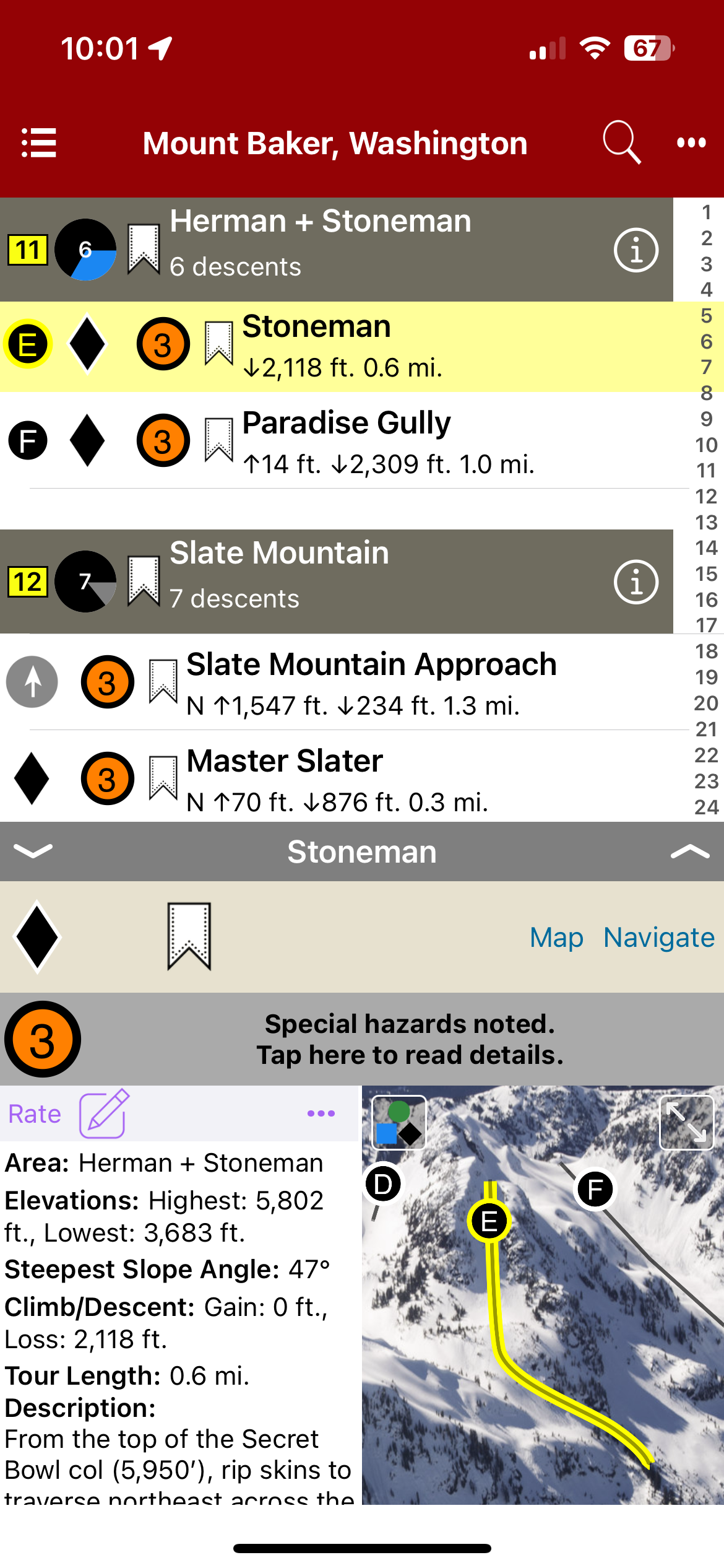
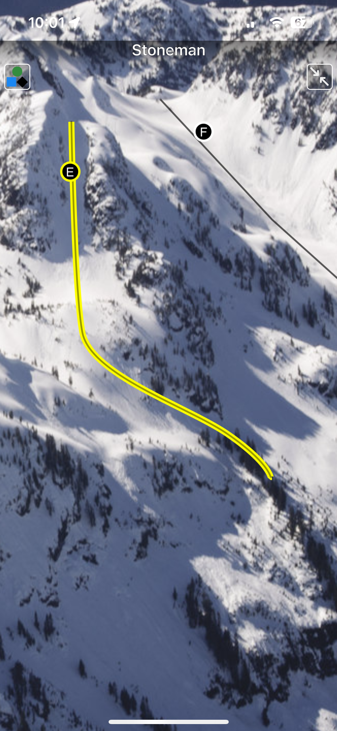
The Mount Baker backcountry extends east to west from Mt. Shuksan to Mt. Baker connecting ridges of Shuksan Arm to Ptarmigan Ridge with expansive glaciers, powder bowls, technical couloirs, powder-filled glades and plenty of lower elevation trees. Many ski routes begin directly from the Mt. Baker Ski Area averaging the deepest snowpack in North America guaranteeing you can find fresh tracks somewhere. In this digital book you will find run descriptions, skintracks, elevation gain and loss, trailhead info, hazards, average slope angles and much more.
Map view
List view
Full screen photos
Backcountry Skiing: Mount Baker, Washington Guidebook was last modified: November 21st, 2023 by todd
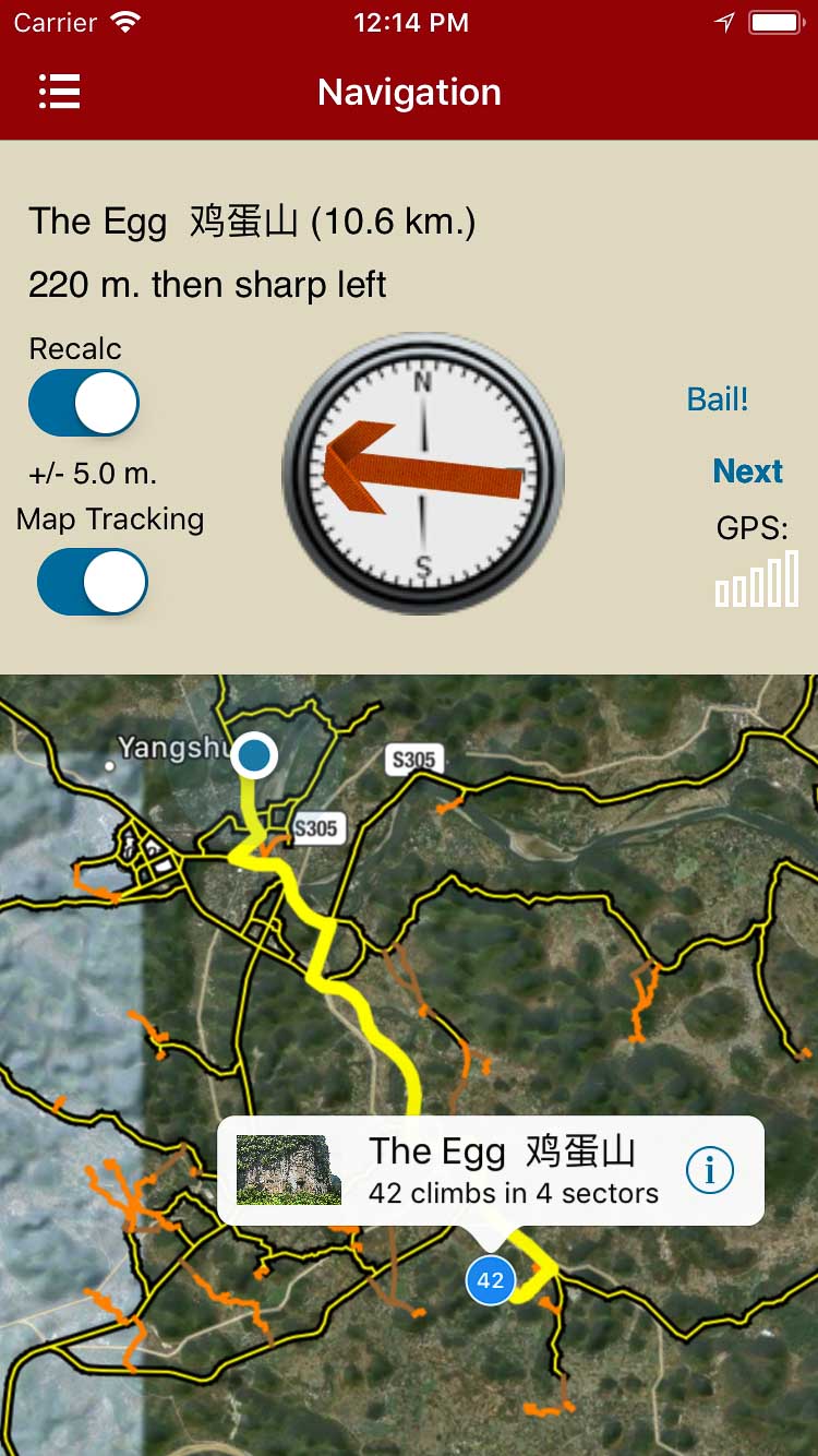
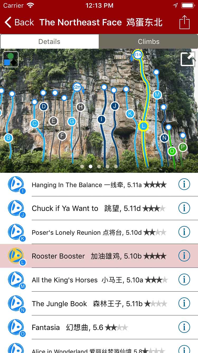
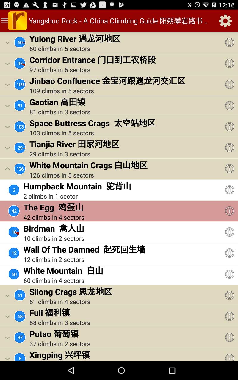
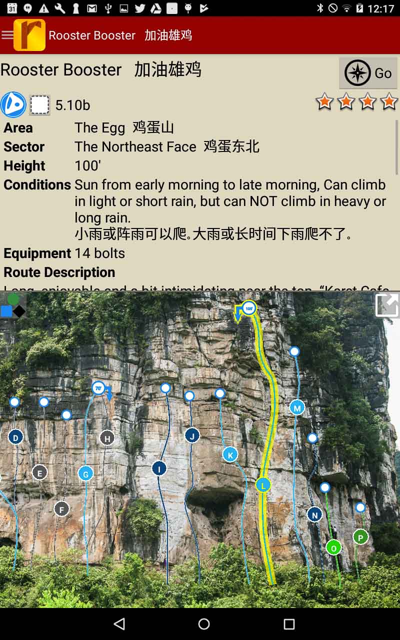
The Yangshuo Rock digital APP produced in conjunction between Andrew Hedesh and Rakkup.com incorporates the best rock climbing within 15km of Yangshuo, China. This APP is an extension of Andrew’s past four years in which he researched the nuances of navigating through the Yangshuo countryside and every detail of 750+ routes included in the recently released paperback book Yangshuo Rock – A China Climbing Guide.
The Yangshuo Rock Digital APP is a wonderful companion or stand-alone product for every climbers’ need while visiting Yangshuo. With exception to travel information and the historical timeline, the Yangshuo Rock Digital APP has everything else including plenty of local flair and personality. You won’t encounter any trouble while navigating the perils of law-breaking traffic, endless rice fields, nor the maze of similarly shaped karst towers to arrive at the climbing crags of your dreams. The Yangshuo Rock Digital APP will be continually updated with lesser known crags, new routes, and current development projects in an effort to create a complete guide totaling more than 60 crags and 1000+ routes. Buy both versions of the guidebook (print and digital) for only $56.99! That price includes $7.00 for U.S. domestic shipping, meaning that you get the print book for only $34 more! A great deal on a beautiful guidebook! Shipping outside the U.S. costs more and we will follow up after your purchase with shipping options and costs.
Please note a VPN is required to download guidebooks behind the Chinese firewall.
Explore Yangshuo’s climbing via our interactive trail map.
rakkup guides you car to crag then shows you a picture when you arrive.
Smart topos find your line.
Searchable Yangshuo climb list.
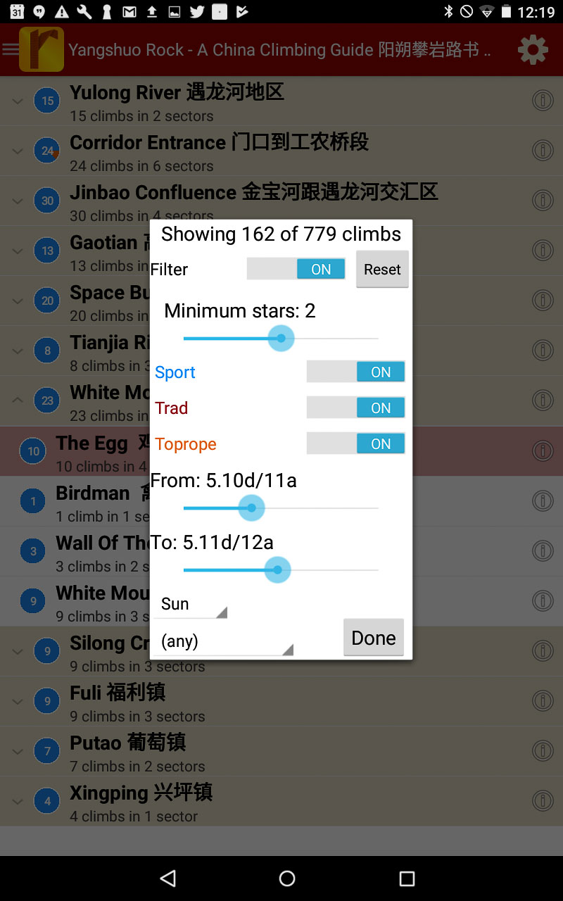
Filter climbs to show only the grades you want to see, or map where the highest quality climbs are located!
Detailed Yangshuo route descriptions.
China: Yangshuo Rock – Climbing Guidebook 阳朔攀岩路书 was last modified: October 6th, 2019 by
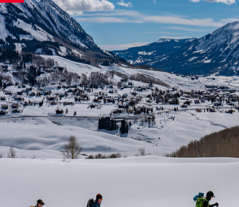
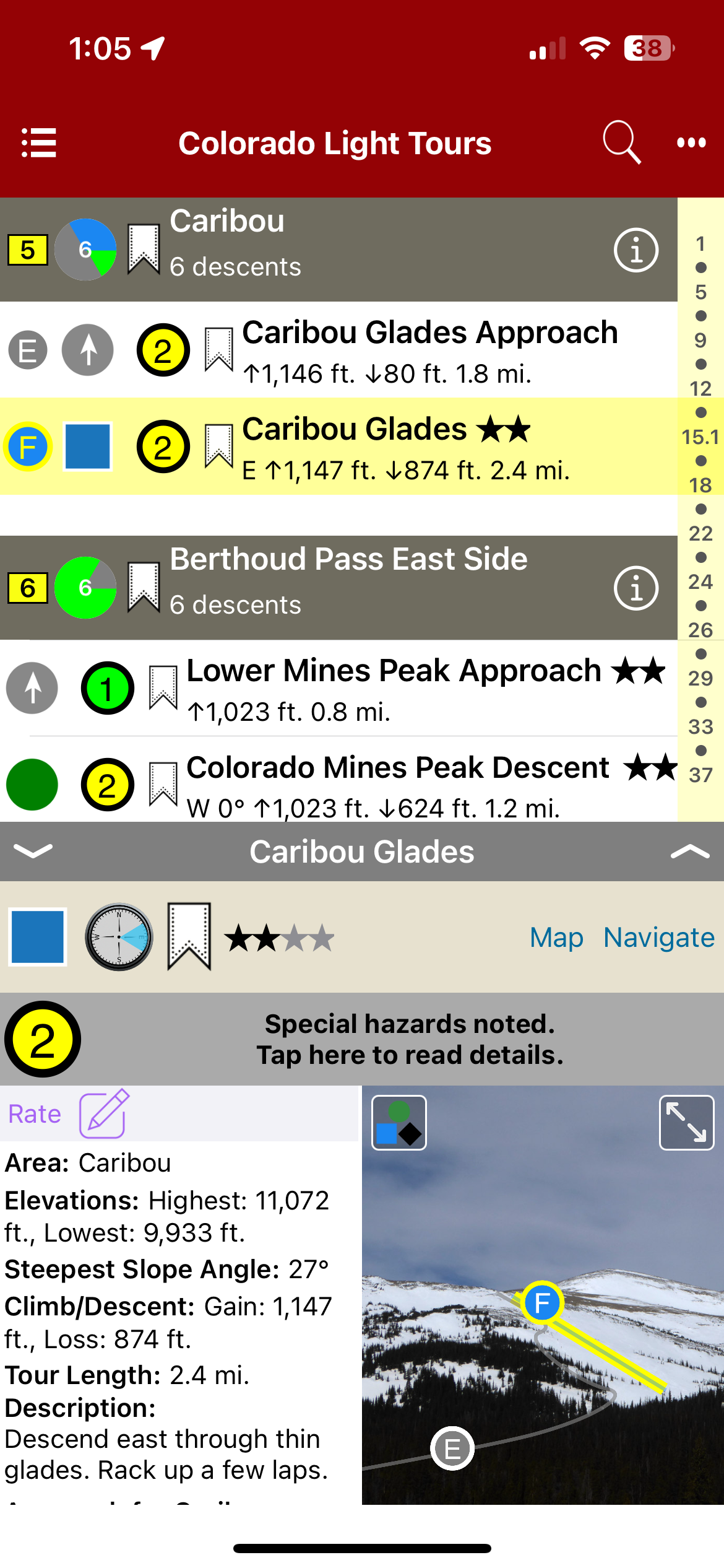
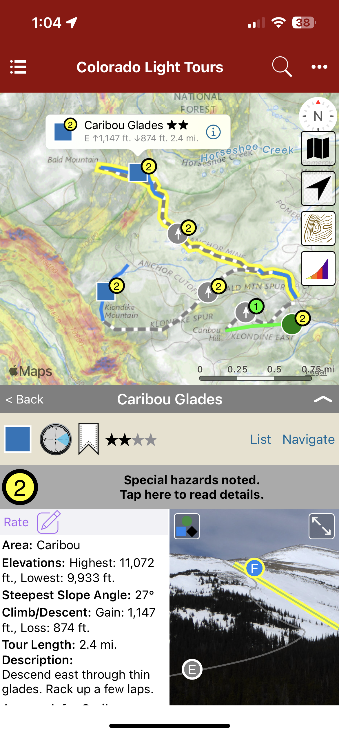
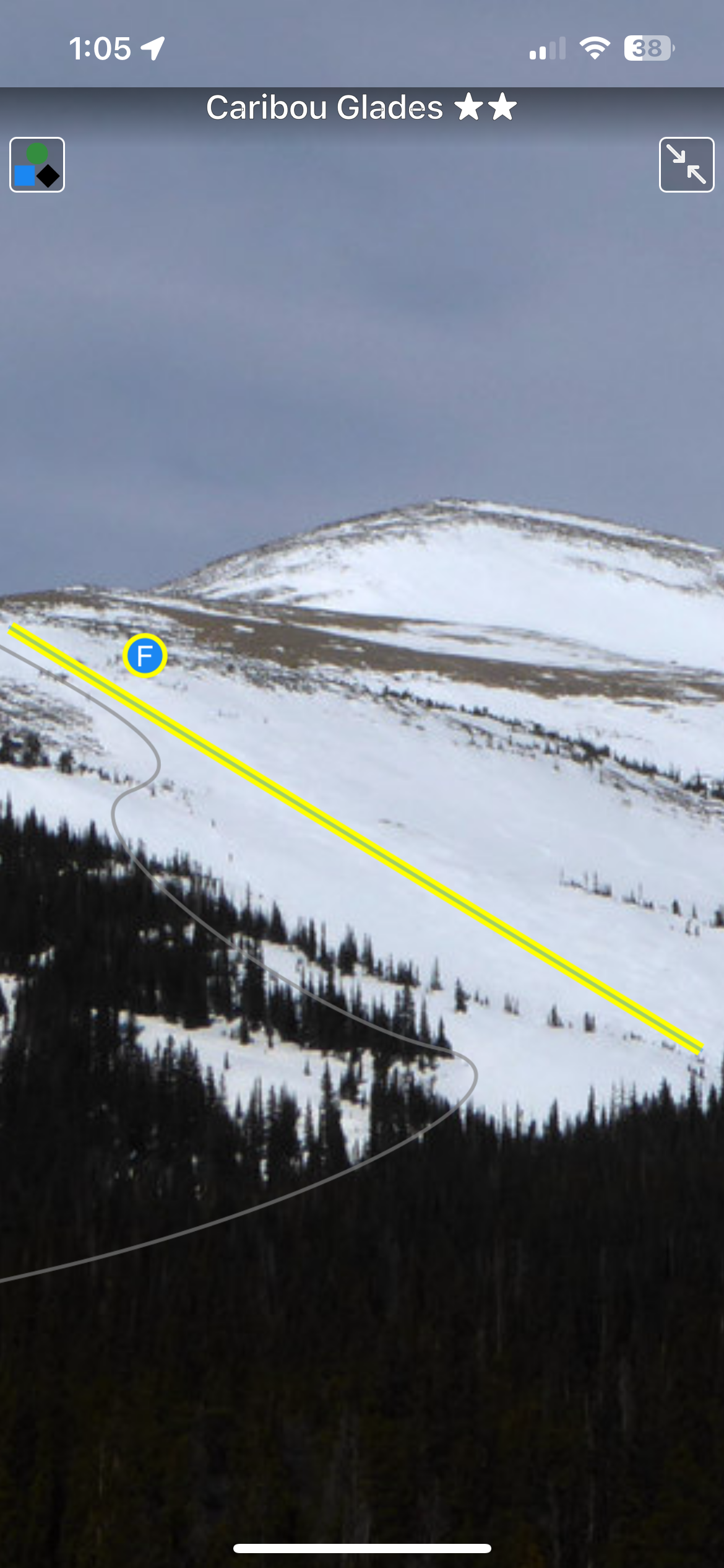
It is said Colorado has 300 sunny days a year. Combine that with several thousand mountains, and a winter climate that’s downright temperate. The result: one of the best places on the planet for ski touring. Of course nothing is perfect. Colorado challenges backcountry skiers with limited public access options, due in part to it being a mostly rural, relatively un-roaded western state. More importantly, due to various climatic factors the state’s mountains can be prone to dangerous avalanches for much of every winter. Yet options exist. Key with backcountry travel is picking routes with lower angle pitches and other avalanche-mitigating factors. While these “light tours” are surprisingly difficult to find, they do exist. We detail a selection of Colorado lends itself to this as well, with most of the state’s more than twenty ski resorts allowing uphill skiing. Thus, we offer a special mix here, combining a variety of “easy” backcountry routes with recommended resort options. Pick one of our many days of Colorado sunshine, get out and enjoy.
Buy digital plus book and the price includes $4.00 for shipping, a screaming deal! When you buy a bundle, you can use your digital rakkup guidebook immediately.
List view
Map view
Full screen photos
Backcountry Skiing: Colorado Light Tours Guidebook was last modified: November 21st, 2023 by todd
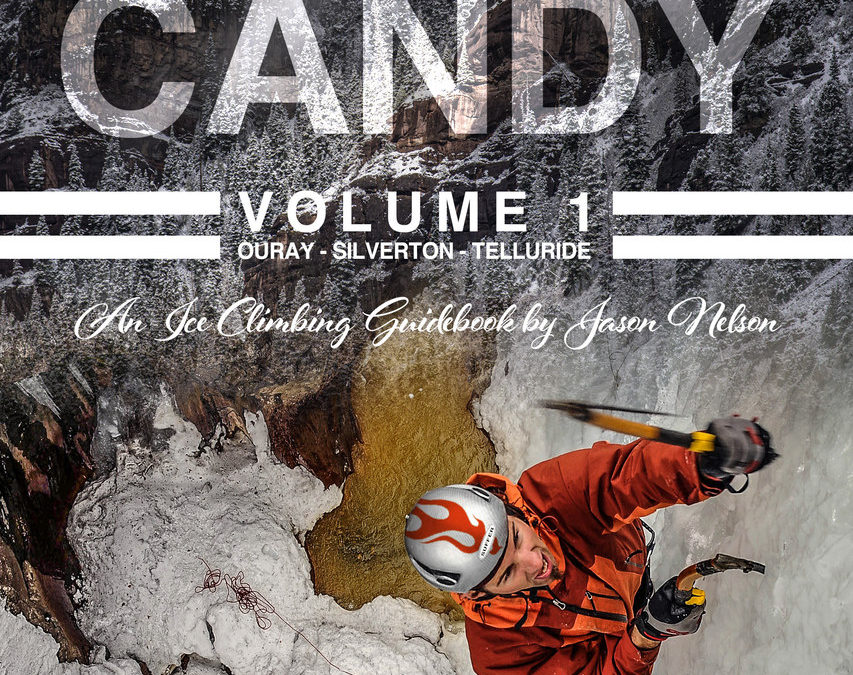
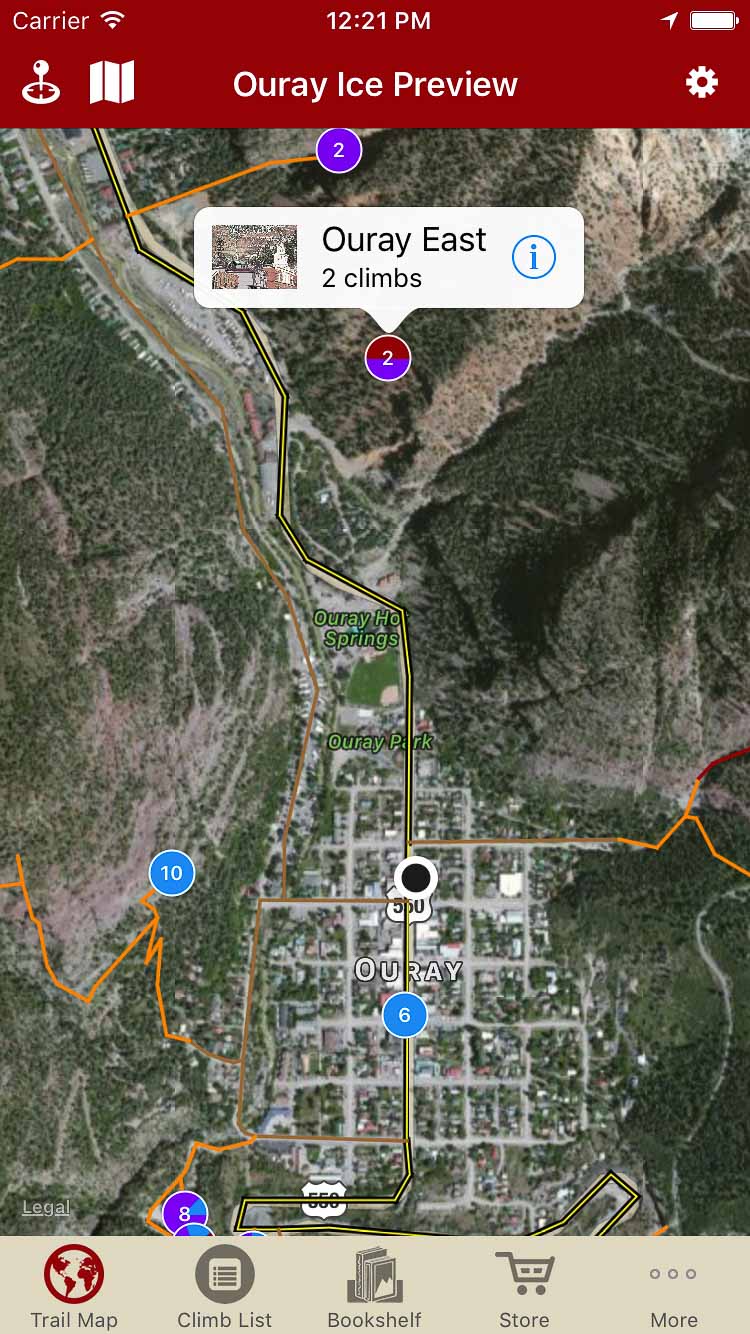
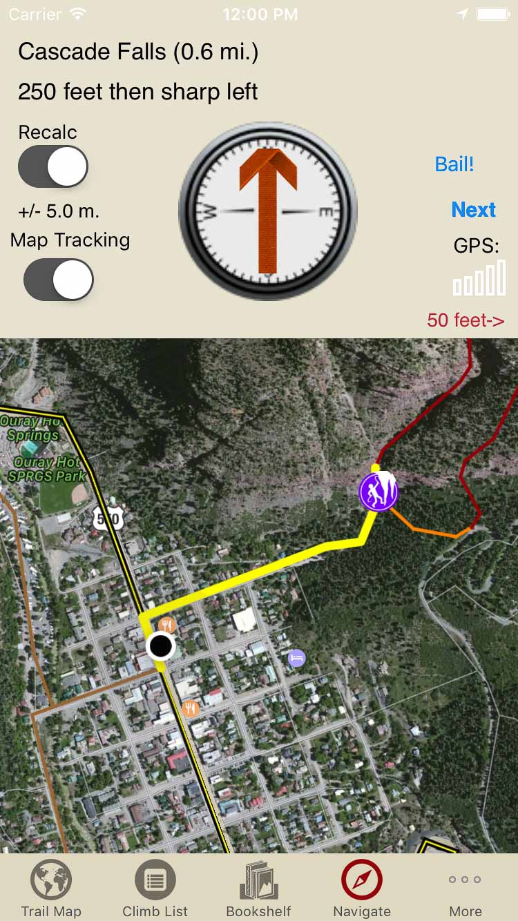
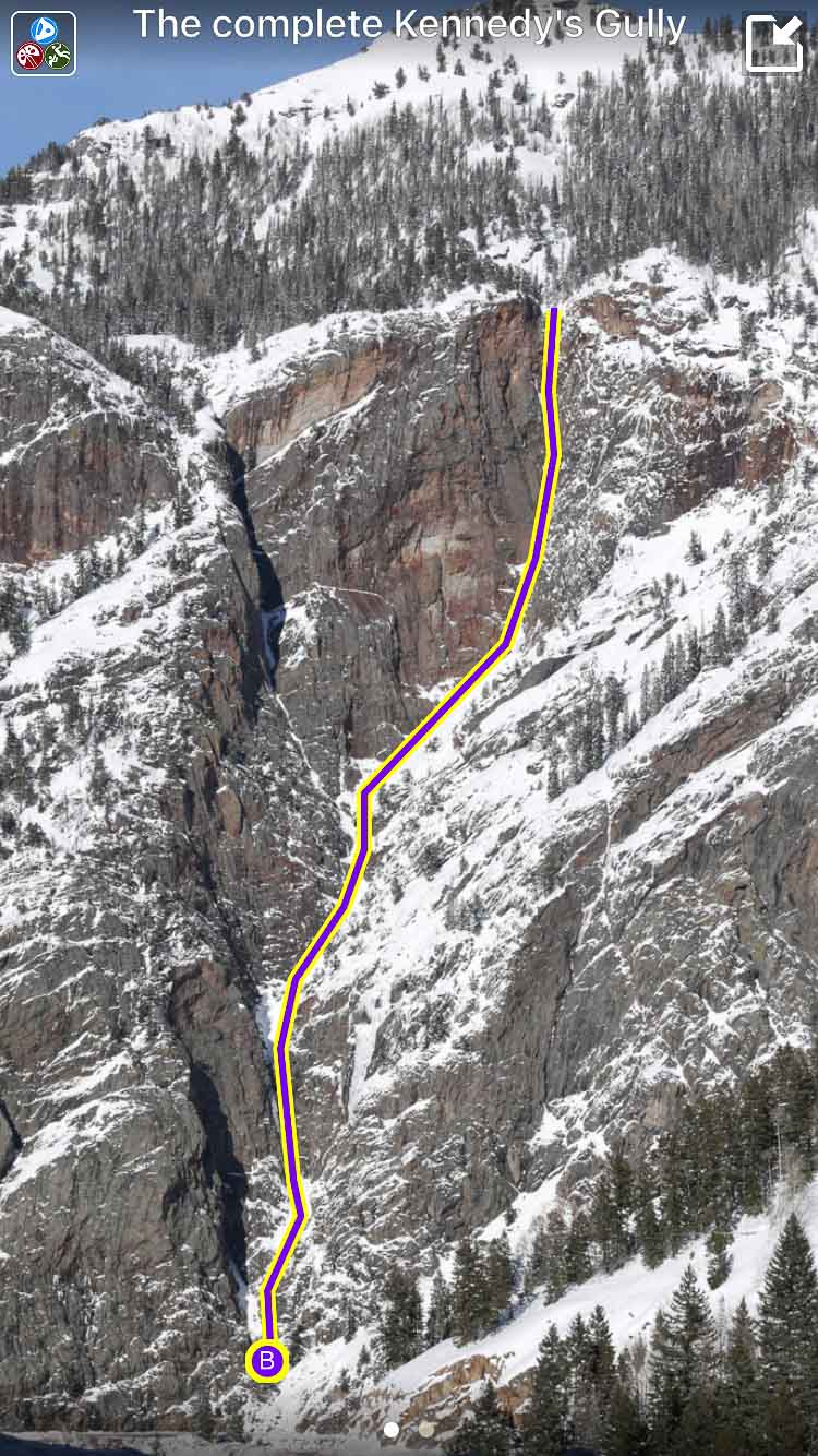
Formerly Ouray Ice, this guidebook covers ice, mixed and drytooling routes in Southwest Colorado. The book’s focus is on Ouray, Telluride, Silverton, West Fork of the Cimarrons, and Dunton.
:
Suffer Candy Volume 1: Ice Climbing in Ouray, Telluride, and Silverton Guidebook was last modified: January 11th, 2023 by todd
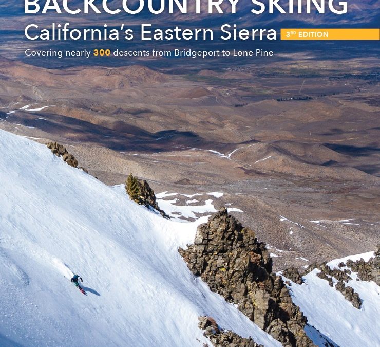
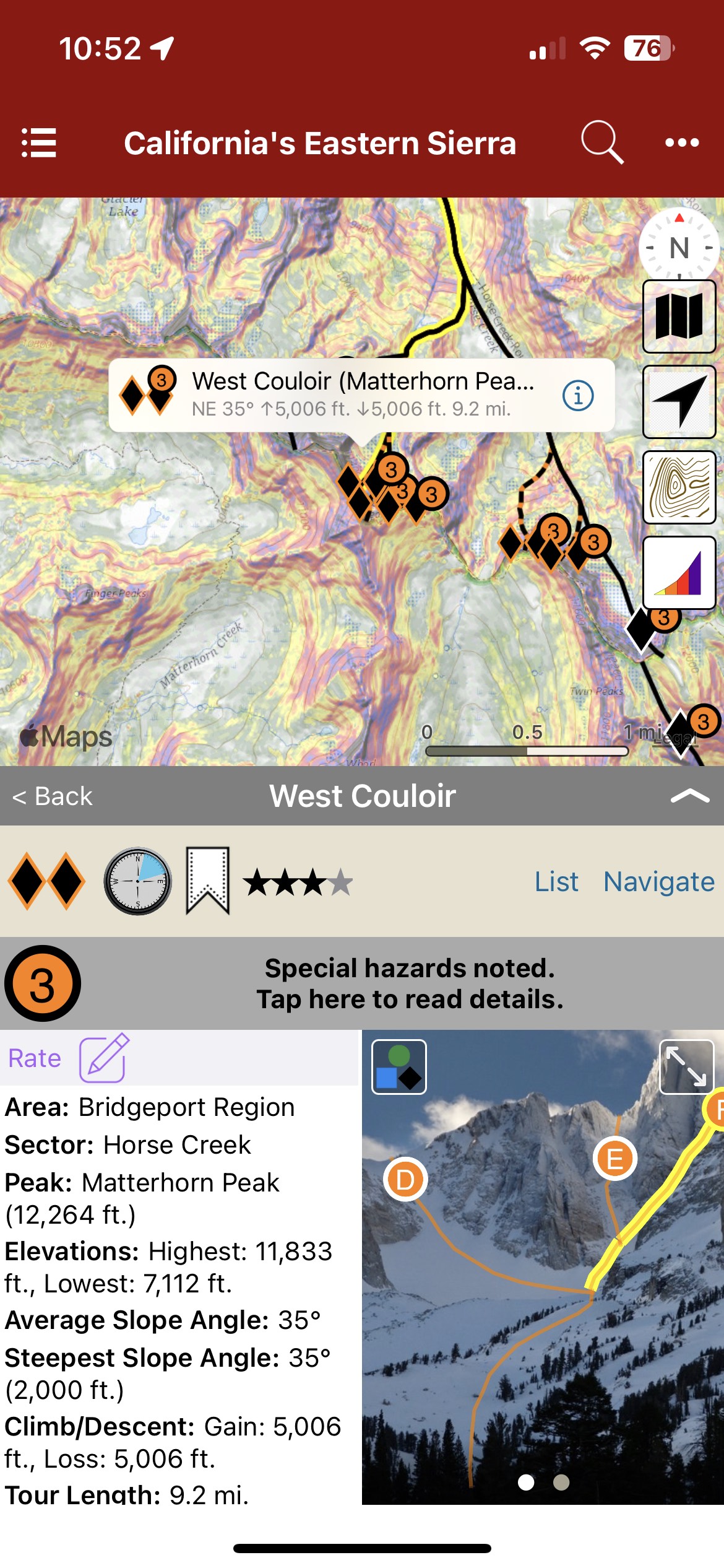
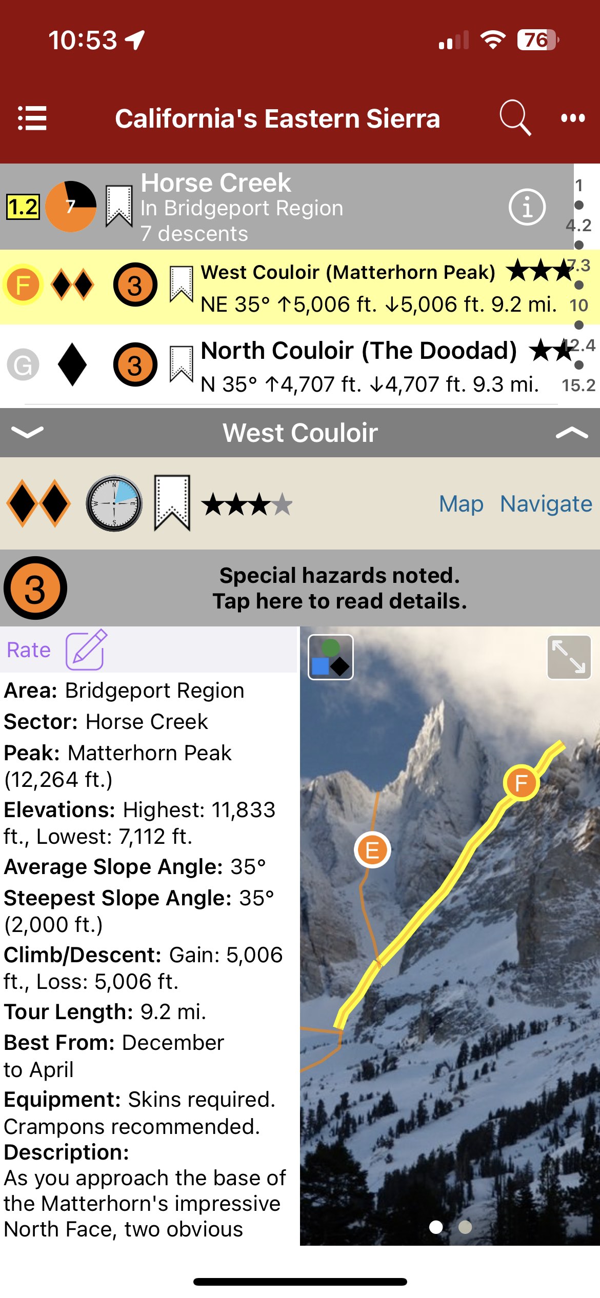
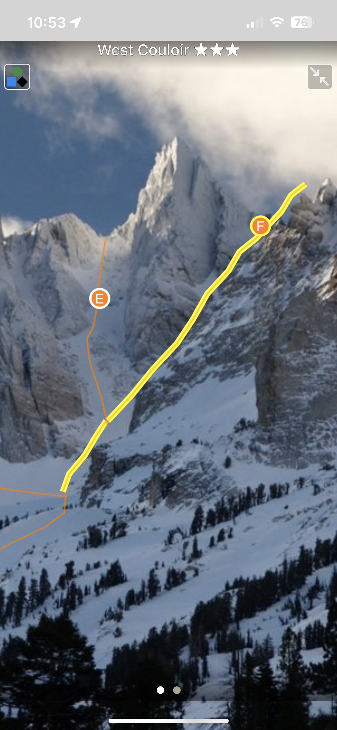
Blessed with a deep snowpack, sunny skies, and high-elevation peaks, the Eastern Sierra has some of the world’s best backcountry skiing and snowboarding. This digital guide covers the area between Bridgeport and Lone Pine, including all information included in the 3rd Edition, plus occasional updates and corrections to content which is not in the print guide. This digital app offers an improved experience for the user, with search and filtering functionality, the ability to quickly visualize and understand terrain, and interactive photos and maps.
Map view
List view
Full screen topo
Buy both versions of the guidebook (print and digital) for only $50.99! That price includes $6.00 for shipping, meaning that you get the bundle for only $10 more! A screaming deal! When you buy the bundle, you can use your digital rakkup guidebook immediately.
Backcountry Skiing: California’s Eastern Sierra Guidebook was last modified: September 13th, 2023 by todd